19
connecting places Seattle’s Open Space Strategy for the Center City The Blue Ring REVISED DRAFT DECEMBER 2002 100-YEAR VISION
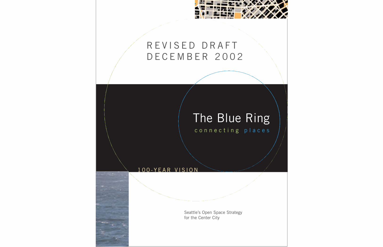
c o n n e c t i n g p l a c e s
Seattle’s Open Space Strategy for the Center City
The Blue Ring
R E V I S E D D R A F TD E C E M B E R 2 0 0 2
1 0 0 - Y E A R V I S I O N

City of SeattleGreg Nickels, Mayor
CityDesign
A 1 0 0 - Y E A R V I S I O N B E C O M I N G A R E A L I T Y N O W
1 0 0 - Y E A R V I S I O N
Seattle’s Open Space Strategy for the Center City
R E V I S E D D R A F TD E C E M B E R 2 0 0 2
c o n n e c t i n g p l a c e s
The Blue Ring

As a reflection of the Seattle’s civic identity, the city’s 100-Year Open SpaceStrategy for Center City neighborhoodssupports urban vitality, eclecticism, sustainability and equality.
This strategy is dedicated to those manymembers of the Seattle community whotoiled for several years to prepare neighborhood plans, and had the foresight to understand the need for thisplan. And to the future citizens ofSeattle, who will be its stewards.
3

4
Creating Open Space Even While Density IncreasesThe commercial, governmental, and cultural coreof Puget Sound, Center City Seattle has becomea densely populated area. It is composed ofdiverse and evolving neighborhoods that accom-modate rising employment and visitor and resi-dential density. The Center City, a small basindefined at the edges by hills and bodies of water,covers only 3.2 square miles, yet today it has apopulation of approximately 40,000 people, and30,000 more are anticipated in less than 20years. Counting projected visitors and com-muters, the number of daily users is anticipatedto reach nearly 500,000 per day in 2020.
Increasing the number of housing units andworkers alone will not make a great city. It mustbe livable and safe, and it must include anaccessible public realm—that part of the citycomposed of open spaces and streets accessibleto all. A vibrant city is defined and enlivened bypublic and private actions and by the buildingsand activities which surround public spaces.People are drawn to cities that have an activepublic life—people attract people. A healthypublic realm that supports social and recreation-al life can be a deciding factor for businessesconsidering where to locate and invest in a com-munity. In addition, land values are often higherin neighborhoods with attractive and accessibleopen spaces. One of the most respected realestate forecasting reports, Emerging Trends inReal Estate 2002 by PriceWaterhouseCoopers,supports this; it recommends that “24-hourcities” are the best places to invest.
Merely increasing the acreage of public openspace, however, is not sufficient. Public spacesmust be lively people places—there must beactivities within the spaces and along theiredges. Fostering this depends to a great extenton how and where spaces are created in relationto the built environment and the life surroundingit. For example, open spaces may be at the cen-ter of neighborhoods or districts, the placeswhere people meet each other or gather for com-munity events. Or they may serve as transitionalspaces between neighborhoods or districts of dif-ferent character. Open spaces shape the life ofthe city as much as buildings do.
Using Existing Open Spaces and Streets
While the need for open space is apparent, thereare many constraints to creating large urbanparks like those from the past. High land valuesand existing building coverage make it difficultto assemble large tracts of land for public openspace. It is important to note, however, thatapproximately 35 to 40 percent of the total landarea in Center City is in public ownership, withthe vast majority of that land in street rights-of-way. Although funding and new land for parksmay be limited, four types of existing assetscould be used as building blocks for a CenterCity open space system:
■ Water■ Public parks, existing and proposed ■ Private plazas■ Street rights-of-way
Two of the Center City’s greatest open spaces arein the form of water: Elliott Bay and Lake Union.They are often seen from the Center City but arenot always directly accessible by land. Both pro-vide scenic views from many vantage points inthe Center City. Although Elliott Bay and LakeUnion are more easily seen than accessed, theydo offer many opportunities for public parks,pedestrian promenades, views and limited beachuse. Pedestrian links between the shorelines andupland areas need to be strengthened, and thephysical form reconfigured to accommodate theemerging mix of uses.
Public parks established and proposed, thoughrelatively small in size, collectively have thepotential to meet the demands of Center City residents, workers and visitors. Coordinated plan-ning and the creation of connections betweenthese parks would increase their usability andtheir viability over time. Also, under bonus provisions in downtown zoning, many publicplazas have been created in individual privateand public developments. These can provideopen space amenities, but must be designed andlocated to be usable and available to the public,and not only for the users of individual projects.Coordination of such developments may yieldmore effective access to and use of private openspaces in the future.
O P E N S P A C E M A K E S C I T I E S L I V A B L E A S G R O W T H O C C U R S
The world’s great cities have memorable public places—the outdoor spacesand promenades that we all can share, such as Central Park or Fifth Avenue orTimes Square in New York, La Rambla in Barcelona and Tiananmen Square inBeijing. Such well-established and recognizable open spaces, whether they arelarge central parks, tree-lined boulevards, beachfront promenades or greatplazas, provide settings for city life. Attractive and accessible open space is desirable in any great city, and is especially important at this time inSeattle’s history.
Public open space is vital to the quality of life we desire in a growing city. Itprovides the shared spaces where we can interact with both neighbors andstrangers. In a high-density urban setting, public streets, parks and plazas pro-vide the outdoor spaces that are often privatized elsewhere. They make roomfor festivals, parades and other special events as well as providing places torelax during a normal day. Safe, well-planned and open spaces can becomethe “outdoor living rooms” of our neighborhoods.
This 100-year vision is the first part of a strategy for the public spaces forCenter City Seattle. This strategy has been drafted to provide a mechanism forcoordinating a large number of plans, private developments and capitalimprovement projects in the Center City, and to shape a coherent system ofplaces into a healthy public realm. The result of years of work by neighborhoodadvocates, City of Seattle staff, elected officials, and others, the “Blue Ring”Open Space Strategy shapes both a common vision for the long term and animplementation plan (see the second part of this document) for a public realmthat is comfortable, beautiful, and teeming with activity.
CityDesign is honored to have prepared this strategy to help shape anothercentury of growth in Center City Seattle. We look forward to continuing as itssteward, and we invite the entire Seattle community to share this opportunitywith us.
John RahaimExecutive DirectorCityDesign
5

76
Connecting PlacesMuch public land exists in the form of city rights-of-way. The dominance of urban transport byautomobiles has led to right-of-way designs thataccommodate vehicular movement, but pedestri-ans, sidewalk vendors and cafés could use theright-of-way as much as vehicles, requiring us toreconsider the use of the street as part of a largerpublic realm. Enhancing the design of thesestreets can eventually lead to reduced reliance onautomobile use, providing pedestrians with apleasant alternative to driving, and providingmore user-friendly connections to the transit sys-tem. Sidewalks on certain Center City streetshave the potential to become outdoor livingrooms through careful programming and design.
An enhanced open space system is integral tothe concept of a sustainable city. A well-designedsystem of gathering places, streets and shore-lines will provide a pedestrian-oriented environ-ment, will reduce emissions and use of fossilfuels, and will increase greenery and permeablesurfaces. Ultimately, with careful attention topublic space, Center City can become a con-tributing element of the regional ecosystem,rather than a distinct “constructed” part of ourlandscape.
Building on the Past for the Future: The Blue RingThe “Blue Ring” strategy outlined here proposesto meet the changing needs of the Center Cityby linking water, existing parks, private plazas,and rights-of-way and by strategically addingnew open spaces to create a more unified publicrealm and a wonderful walking experience.Since 1985, Washington citizens and govern-ment have been working hard to make our townsand cities comfortable and exciting while pre-serving our remaining rural lands and forests.During this process, it became apparent thattwenty years from now the neighborhoods inSeattle’s Center City will accommodate, by far,the largest number of workers and residents inthe region. The crucial next step toward achiev-ing a sustainable and livable core for the PugetSound region, the Blue Ring Strategy buildsupon the past fifteen years of planning effortsby residents and governments.
A timely response to concerns about a variety ofrural and urban issues, the state’s GrowthManagement Act required counties to establishgrowth boundaries, and required municipalitiesto develop Comprehensive Plans, that addressedland use, transportation, housing, utilities andcapital facilities. In response, Seattle’s 1994Comprehensive Plan established the DowntownUrban Center of five neighborhoods as well asthe Uptown Urban Center and four other adja-cent Urban Villages; it also laid the groundworkfor thirty-four citizen committees to engage inSeattle’s Neighborhood Planning Program. Thedevelopment of individual neighborhood planscombined with Seattle’s intense growth in thelate 1990s forced the realization that a larger“Center City” extends beyond the old “down-town” core, and showed the need for a compre-hensive approach to urban design. This resultedin the use of neighborhood plan implementationfunds to help CityDesign develop an UrbanDesign Strategy for Downtown, and for thePlanning and Design Commissions to sponsor theCenter City Urban Design Forum in 2000. Theseactivities, in addition to the Downtown OpenSpace Evaluation of 2001, began to build onand extend neighborhood plans and Seattle’splanning legacy. This history, and many recom-mendations for the future, will be found in thecompanion document to this booklet. Titled TheBlue Ring: Connecting Places, The Next Decade,it contains a 10-year implementation strategyand background analysis, and is a necessarycomponent of this publication for those wishingto fully understand and participate in the BlueRing strategy for the city’s public realm.
Growth will occur whether we plan for it or not.Seattle’s Open Space Strategy for the Center Citypresents an opportunity to prepare for growth inthe best possible way by establishing a publicrealm that can be used by all. The city’s coreevolved as a place of commerce and industry, butcurrently lacks usable open space. The challengewill be to provide a quality, pedestrian-focusedpublic realm and open space amenities within athriving and dense urban center as visitorsincrease and more people come to live and workin Seattle’s Center City.
SPORTSSTADIUMS
5
5
SEATTLECENTER
LAKEUNION
ELLIOTTBAY
99
99
90
4T
H A
VE
S
YESLER WAY
S JACKSON ST
BR
OA
DW
AY
5TH
AVE.
PIKE
WE
ST
LA
KE
AV
E N
DENNY WAY
UptownSouthLakeUnion Capitol
Hill
PioneerSquare
Chinatown/International
District
Pike/Pine
First HillCommercialCore
DennyTriangleBelltown
HOLGATE ST.
Center City Defined
Seattle is at the core ofthe Puget Sound region.Businesses and in-townresidences keep increas-ing in both number anddensity, and are spread-ing out from the originaldowntown. What is nowcalled the “Center City”stretches from Elliott Bay all the way up toBroadway and fromHolgate Street to LakeUnion’s south shore. It encompasses tenneighborhoods.

98
We submit the following report, embodying our suggestionsfor a comprehensive scheme of parks and parkways, a por-tion of which can be executed within the next few yearsand the remainder of which may be kept in mind, to beaccomplished from time to time as circumstances permit.
Seattle possesses extraordinary landscape advantages inhaving a great abundance and variety of water views andviews of wooded hills and distant mountains and snow-capped peaks. It also possesses original evergreen forestswhich covered the whole country, and which, aside from thegrand scale of some of the tress composing them, having avery dense and beautiful undergrowth.
In designing a system of parks and parkways the primaryaim should be to secure and preserve for the use of thepeople as much as possible of these advantages of waterand mountain views and of woodlands, well distributed andconveniently located….
Financial limitations will make the complete carrying out ofsuch an ideal impracticable, yet much can be done if pub-lic sentiment is aroused favorably, and if owner do not tryto obtain every cent possible for the needed land, but arehelpful and co-operative.
Preface from the report by the Olmsted Brothers to theSeattle Parks Commission on “A ComprehensiveSystem of Parks and Parkways”
Adopted by the Seattle City Council in October 1903
Monday, October 19, 1903, was the birthdate of Seattle’s“Green Ring” of wooded parks and parkways. Since year one,that vision has bloomed in the creation and connection ofparks such as Green Lake, Woodland, Volunteer, Lincoln andSeward. The streets that were to link them became elegantparkways, including Lake Washington Boulevard, the Crown ofthe Hill Loop on Queen Anne, Ravenna Boulevard, and theMagnolia Bluffs Parkway. The citizens of Seattle cherish thefruits of having implemented the grand vision of 1903 duringthe past 10 decades.
Without well-defined public open space, the Center City willbecome just another big city with little place for social gath-ering, recreation or enjoyment of an urban, or especially aNorthwest, lifestyle. As growth continues in the Center City,we must be more strategic in providing the open-spaceamenities needed to make our neighborhoods livable.
Over the last 100 years, the long-range plan adopted by theCity of Seattle in 1903 has guided the development of atreasured network of parks and parkways outside of theCenter City. During that time, and thanks to the foresight ofmany civic leaders and community members, a number ofsignificant public open spaces were also created nearer thecore, including Freeway Park, Waterfront Park, MyrtleEdwards Park and Denny Park. New projects such as theCivic Center plazas and South Lake Union Park will add moreopen-space acreage.
Unlike elements in the Olmsted Brothers’ Green Ring, howev-er, at this time most open spaces in the Center City remainscattered and disconnected. The Blue Ring strategy will helpbuild a new open space legacy by establishing concepts andimplementation strategies for connecting the Center City’sassets and amenities. Then the waterfront and urban parks,and some new open spaces, can form a legible and cohesiveBlue Ring system much like Olmsteds’ Green Ring in theouter neighborhoods.
The Blue Ring: Connecting Places is based on years of workby Seattle citizens and government to create a more livablepublic realm in the center of the city. Its implementation willdepend on businesses, developers, residents, planners, andgovernment agencies working together over the next centuryon projects of various scales—some under way now, othersproposed and others yet to be imagined.
The Blue Ring: Connecting Places strategy is an umbrella foropen space plans and policies in the Center City; a livingdocument that will be periodically evaluated and updated, aswell as expanded as funding is made available. More than aline on the map, the Blue Ring is a comprehensive urbandesign framework for all downtown and adjacent neighbor-hoods. It will provide specific design directions to heal gapsand create opportunities for improving the Center City’s phys-ical design fabric.
AboveThe Blue Ring shown as part of the greater system of Seattle’sopen spaces. In the last 50 years, Seattle Center, DiscoveryPark, and Magnusson Park were added to the original GreenRing; Gasworks Park and the Burke-Gilman Trail augmentedpublic open space through conversion; and a lid overInterstate 5 for Freeway Park gave Seattle, and the nation, aradical new way improve the public realm.
The Blue Ring 100-year vision, coming a century after theOlmsted plan, would create a Blue Ring of urban open spacesand connections using water—the bodies of water that geo-graphically define Seattle as well as the rain—as its organizingtheme. The Blue Ring would be linked to the suburban GreenRing using streets revamped as City Corridors.
Above:The lighter greenshows the parks andparkways proposed bythe Olmsted Brothersin 1903. The darkergreen shows additionalparks and greenwaysthat have also beenbuilt since 1960.
Left:The original GreenRing proposal shownon a map of the citywhen the Olmstedswrote their plan.
The Green RingBuilt, 1903–now
The Blue RingProposed, 2003–

11
How Do We Make a Blue Ring?What if you were in Seattle in the year 2020 . . .
Imagine you lived in Center City, and it’s a summer Saturday afternoon—
What would you like to do, where in your neighborhood would you go? Asidewalk café across the street? A pick-up game on the next block, wherethe street is closed to traffic on weekend evenings, and tricycles and basketballs rule?
Imagine you work downtown, and it’s Monday morning commute time—
And you notice the drive on the revamped City Corridor streets is fasterthan it was last year, and you have extra time to plan your lunch hourwith a friend, when you’ll go strolling between the University StreetParklink and the Madison Esplanade, where you spend most of your summer lunches, eating or walking to do errands.
Imagine you and your family have just come to visit Seattle the first time—
Where do you go from your hotel: down the Waterfront Trail throughPioneer Square and the sports complexes before dinner off JacksonStreet in the International District? Or up past the Olympic SculpturePark, across the Bay to Lake Trail, through Seattle Center and over toLake Union for some kayaking before an open-air dinner?
Imagine you and your two top executives are attending a meeting in theConvention Center—
And you’re scouting out places to move your company. What if you findthat a site you might want to redevelop is on the Blue Ring, and there’s abonus to link a pocket park to the Ring? And that your 45 employeeswould have plenty of choices to live within walking distance of work andvital services on The Ramble, or would be able to motor in easily on thefast-flowing regional connectors that the people here call Cityspokes.
Projections show that by the year 2020, nearly twice as many people will be living inthe Center City and that it will be used or visited by almost half a million people a day.If we embrace imagination, build on the hard work of a lot of people and begin now toimplement an overarching vision, this “more crowded” Seattle can be an even betterplace to be than it is now.
What if?
Seattle’s 100-Year OpenSpace Strategy for CenterCity neighborhoods supports a commitment tourban vitality, eclecticism,sustainability and equality inthe urban center communityas a reflection of theSeattle’s civic identity.
10

13
GUIDING PRINCIPLES
Embraceimagination
Capitalize on the opportunitiesexisting inthe publicrealm
Create anawareness of the relationshipbetween thenatural and builtenvironments
HighlightSeattle’sdefiningattributesand naturalfeatures in the pedestrianexperience
Create publicspaces for all
Use a pedestrian-first approachto providedesirable outdoor spacesthat are withinshort walkingdistances for all types of users
Use an integratedapproach thatincorporatesart, science,and landscapein the urbanplace-makingprocess
Make sus-tainability aprime value:use sustain-able methodsand materialsto build forthe seventhgeneration
Provide aframework toguide publicand privateinvestmentopportunities
Developstrategies that implement neighborhoodplan recommend-ations

15
Light and air as open spaceThe sunlight, wind and the sense oforientation that comes from the skyexperienced in the space betweenbuildings provides a continuous con-nection with nature.
Parks and plazas are not the only openspace resources in the city. Althoughthese provide important recreationaland social amenities, we need to thinkabout other ways to create a sense ofopenness in the Center City. There isgreat potential for open spaces in thestreets and public rights of way, in thespaces between buildings, and in bod-ies of water. We can also be innovativein using just such places to accommo-date a variety of uses at different timesof the day and year.
Water as open spaceSeattle’s character is derivedlargely from water, both the rainyclimate and the large bodies ofwater that surround it. Panoramicwater views and the ability to getout on the water are visual andrecreational release valves foreveryone in the city.
Streets as open spaceIn America’s current urbanrevival, the value of the pedestri-an environment is crucial. TheCity of Seattle controls about 40percent of the land in the CenterCity, most of it in the form ofstreet rights-of way, and canshape the way streets could bereorganized and rededicated. Inresponse to changes in our cul-ture, we can help create a societyof pedestrians.
The fourth dimension ofopen space: timeOne way to employ our public resourcesefficiently is to use the public realm fordifferent purposes at different times ofthe day, not only for quickly passing fes-tivals and parades but also for the cycleof daily life for the increasing number ofCenter City residents. A street that car-ries minimal traffic in the evening couldbe closed each day for basketball, hop-scotch, tricycle riding and strolling. Thisvalue can be extended seasonally, assummer light lasts longer. Simple designelements could open up a variety of cre-ative solutions for convertible, multi-functioning streets.
To achieve urban integration means thinking ofurban open space not as an isolated unit – be it astreet, park or a square – but as a vital part of theurban landscape with its own specific set of func-tions. Public space should be conceived of as anoutdoor room within a neighbourhood, somewhereto relax and enjoy the urban experience, a venuefor a range of different activities, from outdooreating to street entertainment; from sport andplay areas to a venue for civic or political func-tions; and most importantly of all as a place forwalking or sitting-out.
—Towards an Urban RenaissanceFinal Report of the Urban Task Force, UK
09:00
20:00
New Paradigms for Urban Open Space

17
EXISTING
Myrtle Edwards ParkSeattle CenterConvention CenterPike Place MarketFreeway ParkKing Street Station
PLANNED South Lake Union ParkBay to Lake TrailTerry AvenueOlympic Sculpture ParkWaterfrontYesler Community Center
FUTURE Harrison Green StreetI-5 LidFirst Hill ConnectorJackson Street SPORTS
STADIUMS
5
5
SEATTLECENTER
LAKEUNION
ELLIOTTBAY
99
99
90
4T
H A
VE
S
YESLER WAY
BR
OA
DW
AY
5TH
AVE.
PIKE
WE
ST
LA
KE
AV
E N
DENNY WAY
Waterfront
Jackson St.
Terr
y Av
e.
Harrison St.
Thomas St.
Bay t
o Lak
e Tra
il
OlympicSculpturePark
MyrtleEdwardsPark
FreewayPark
ConventionCenter
First HillConnector
SeattleCenter
S JACKSON ST
Pike PlaceMarket
HOLGATE ST.
KingStreetStation
South LakeUnion Park
YeslerCommunity
Center
Defining the Blue Ring
The Blue Ring
Connects Center Cityneighborhoods
Links major civicamenities
Coordinates openspace investments
Bridges gaps in theurban fabric
Utilizes water as aplacemaker
Illuminates theurban watersheds
Captures importantpublic views
The Blue Ring consists of public open spaces and civicdestinations—places—of regional significance linked byselected public rights-of-way. These places are diverse inform and purpose; some already exist, while others are inthe planning stages. The connecting public rights-of-waywill be improved to serve as both amenable environmentsfor pedestrians and cyclists and functional streets for vehi-cles. Large portions of the Blue Ring will help bridge thephysical gaps between neighborhoods resulting from I-5 andthe Alaskan Way Viaduct. Shoreline improvements to twoparts of the Blue Ring, the Waterfront and South LakeUnion Park, will provide people with direct access to water.The most challenging improvements will be physicalchanges to the Waterfront and a lid over I-5.
The Blue Ring may be defined in a number of differentways. It may include a series of features that celebratewater in playful and artful ways. It may include a wayfind-ing system to provide joggers and cyclists a recreationalpath encircling Center City. Or it may include special light-ing and wide promenades to encourage strolling, vendorsand gardens along its path. More than a line on the map,the Blue Ring framework will be developed to provide spe-cific design directions to improve physical design ofSeattle’s urban center.
Defining the Blue Ring
Important Public Placeson the Blue Ring

SEATTLECENTER
LAKE UNION
ELLIOTT BAY
19
Seattle Center
South Lake Union Park
I-5 UrbanCorridor
South Jackson Street
The Blue Ring is not only a path, but an organ-izing principle. It is a way of conceiving, design-ing and creating Center City open spaces thatbuild on each other, and on one of the City’smost profound assets—its water. The Blue Ringwill not be one continuous place but rather theaggregation of varied and interconnected placesand spaces that will add up to the equivalent ofa much larger open space. The Blue Ring will beunique to Seattle, our Central Park, our Rambla,our Golden Gate.
Unlike a single contiguous park project, theBlue Ring cannot be built all at once. Its imple-mentation will take time and serious coordina-tion. But neither is it far off in some imaginaryfuture: a number of elements are in place, oth-ers are underway or being planned and some arealready partially funded. The projects namedhere are just examples, and they exemplify thevalue of the Ring as an organizing principle. TheBlue Ring strategy is intended to serve as ameans to coordinate projects conceived long agowith others yet to come. It will connect theseprojects to the city fabric, and make the wholefar greater than sum of the parts.
Blue Ring Elements
T
5
599
90
SEATTLECENTER
LAKEUNION
ELLIOTTBAY
Puget Sound watershed
99
SPORTSSTADIUMS
Continental Divide
Georgia Basin
Watersheds are an important part ofany ecology, even an urban one. ThePuget Sound Watershed is within theGeorgia Basin that empties into thePacific Ocean, as does everything westof the Continental Divide; it encom-passes three watersheds in Seattle’sCenter City. Indicated on the bottommap by the lines over the street grid,these flow to Lake Union, MiddlePuget Sound and Lake Washington.
Watersheds are one of many types ofsystems that the Blue Ring can providea framework for exploring. Awarenessof the urban environment as an inte-gral part of the Puget Sound Watershedis one facet of a comprehensive per-spective that would include economic,social and cultural aspects as well asecological ones. The Blue Ring is atouchstone for this kind of a connect-ed, comprehensive view.

2120
To evolve from freight streetsto great streets, we must re-evaluate the use of streetsthat support the urban core aswell as their grid priorities.The Connections Plan identi-fies a hierarchy of streets withthree new types. Each one willhave consistent physical char-acteristics along its entiretyand embody particularresponses to the adjacentland use, users, scale andneighborhood. In this waystreets can become landmarkswithin the city and reflect thediversity, creativity and char-acter of each neighborhood.
SPORTSSTADIUMS
5
5
SEATTLECENTER
LAKEUNION
ELLIOTTBAY
99
99
90
PINE ST
DENNY WAY
MADISON ST
BR
OA
DW
AY
AV
E E
YESLER WAY
EAGLE ST
TERRY AVE
9TH AVECLAY
STCEDAR S
T
VINE S
T
HARRISON ST
THOMAS ST
BELL S
T
UNIVERSITY ST
HOLGATE ST.
5TH
AVE.
4TH
AVE.A
LAS
KA
N W
AY
4T
H A
VE
S
S JACKSON ST
5T
H A
VE
S
P IKE ST
WE
ST
LA
KE
AV
E N
BLANCH
ARD ST
1S
T AVE.
BAY ST
OC
CID
EN
TA
L S
T
TE
RR
Y A
VE
N
City CorridorsCenter City ConnectorsGreen Streets
Defining a Hierarchy of ConnectionsWhat if you were in Seattle in the year 2020 and . . .
You could stroll Seattle’s front porch, the waterfront along the
rebuilt Alaskan Way, stop to see the porpoises at the Aquarium, play
with your children at the new Pier 62 Park, and then show them a
participatory piece at Olympic Sculpture Park, all without getting in
your car.
You arrived on the train and exited the King Street Station onto a
wonderful civic plaza with a view of the whole city in front of you,
hopped a trolley on Jackson Street to a waterfront park, and then
decided to stroll up the Jackson Street Walkway to the heart of the
Chinatown/International District for a great dinner.
You lived in “home zone” in the Denny Triangle, and could step out
your door to Westlake Promenade, grab a coffee, see water from
yesterday’s rain splashing down to a pool surrounded by trees and
butterflies, and before you knew it, were at the tip of Lake Union,
in a spectacular new park.
What if?
Streets are more than public utilities, more than the equivalent of water lines and sewers and elective cables....more than linear physical spaces that permit people andgoods to get from here to there.... The people of cities under-stand the symbolic, ceremonial, social and political roles ofstreets, not just those of movement and access.
Allan B. Jacobs

23
SPORTSSTADIUMS
5
5
SEATTLECENTER
LAKEUNION
ELLIOTTBAY
99
99
90
5TH
AVE.
4TH
AVE.A
LAS
KA
N W
AY
WE
ST
LA
KE
AV
E N
4T
H A
VE
S
DENNY WAY
BR
OA
DW
AY
AV
E E
1S
T AVE.
YESLER WAY
S JACKSON ST
5T
H A
VE
S
P IKE ST
Selected streets of regional significance, CityCorridors are existing surface streets well knownand used by residents, workers and visitors. Majoropen spaces and civic features are located alongor near City Corridors. With phased improvementsand connections to streets beyond the Center City,they will eventually span the city and join ElliottBay to the lakes, the inner urban Blue Ring to thepastoral Olmsted Green Ring, and the Center Citywith the surrounding urban residential neighbor-hoods. City Corridors are typically primary arterialswith two to four lanes of traffic and parallel park-ing on one or both sides; most are two-way.Sidewalk widths vary. Adjacent land use is pre-dominantly mixed-use commercial.
Design elements include:■ Increased street-level storefronts facing
sidewalks for café/restaurant, retail, sales,service and office uses
■ Where possible, sidewalks 20 to 25 feetwide on the east or north (sunny) side ofthe street to make a “park zone” or activepedestrian space
■ Consistent light standards, paving materialsand sidewalk furnishings to create a unifiedcivic amenity
■ Large street trees
■ Pedestrian-scale street lighting
■ Increased sidewalk vendor activity in parkzones to enhance walking experience
PROPOSED CITY CORRIDORS
Westlake AvenueAlaskan Way (Waterfront)Pike StreetFourth/Fifth Avenue coupletJackson StreetDearborn Street
City Corridors
Existing
Boulevard
Park Zone
Rain Garden
SOLARACCESS
PO
SS
IB
LE
A
LT
ER
NA
TI
VE
S
SOLARACCESS
Fifth Avenue atRainier Square

Center City Connectors have the visual and physi-cal potential to become “main streets” connectingCenter City neighborhoods to each other and con-necting City Corridors. They may also become“outdoor living rooms” with a variety of sidewalkactivities—cafés, storefront retail, vendors and per-formers. With improvements and programming,these streets may also become gathering spacesfor parades, street fairs and other seasonal or peri-odic events. Center City Connectors are typicallyprimary or minor arterials, with two lanes of trafficand parallel parking on one or both sides. Most aretwo-way or part of a one-way couplet. Sidewalkwidths vary.
Design elements may include:■ Flexible design and programming (Fourth
Avenue is the city’s parade route, and couldbe improved to better accommodate thiscivic activity. Denny Way is auto-orientedand could become an identifiable gatewaythrough the use of neon, billboards andhigh-tech visuals.)
■ Widened sidewalks where possible
■ Consistent design vocabulary, but with vary-ing details based on neighborhood characterand adjacent land use
■ Pedestrian-scale lighting
■ Medium to large street trees
■ Increased vendor, café and other retail activ-ity along sidewalks to enhance walking expe-rience
25
PROPOSED CENTER CITYCONNECTORS
Denny WayTerry AvenueFirst AvenuePine StreetMadison StreetBroadwayFourth AvenueYesler WayMercer Street
Center City Connectors
Existing
Event Street
Park Zone: Residential
SOLARACCESS
PO
SS
IB
LE
A
LT
ER
NA
TI
VE
S
SOLARACCESS
Park Zone: Commercial
SPORTSSTADIUMS
5
5
SEATTLECENTER
LAKEUNION
ELLIOTTBAY
99
99
90
5TH
AVE.
4TH
AVE.A
LAS
KA
N W
AY
4T
H A
VE
S
P INE ST
DENNY WAY
MADISON ST
BR
OA
DW
AY
AV
E E
1S
T AVE.
YESLER WAY
5T
H A
VE
S
TE
RR
Y A
VE
N
1S
T A
VE
N
27
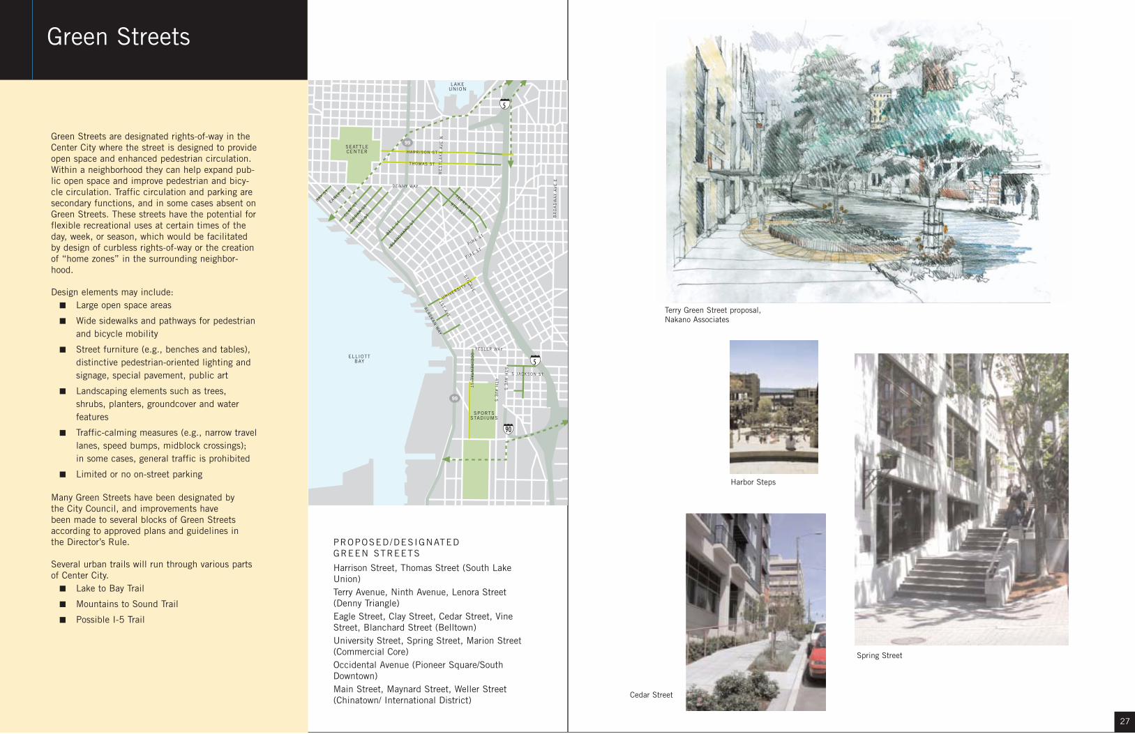
Green Streets are designated rights-of-way in theCenter City where the street is designed to provideopen space and enhanced pedestrian circulation.Within a neighborhood they can help expand pub-lic open space and improve pedestrian and bicy-cle circulation. Traffic circulation and parking aresecondary functions, and in some cases absent onGreen Streets. These streets have the potential forflexible recreational uses at certain times of theday, week, or season, which would be facilitatedby design of curbless rights-of-way or the creationof “home zones” in the surrounding neighbor-hood.
Design elements may include:■ Large open space areas
■ Wide sidewalks and pathways for pedestrianand bicycle mobility
■ Street furniture (e.g., benches and tables),distinctive pedestrian-oriented lighting andsignage, special pavement, public art
■ Landscaping elements such as trees,shrubs, planters, groundcover and waterfeatures
■ Traffic-calming measures (e.g., narrow travellanes, speed bumps, midblock crossings);in some cases, general traffic is prohibited
■ Limited or no on-street parking
Many Green Streets have been designated by the City Council, and improvements have been made to several blocks of Green Streetsaccording to approved plans and guidelines in the Director’s Rule.
Several urban trails will run through various partsof Center City.
■ Lake to Bay Trail
■ Mountains to Sound Trail
■ Possible I-5 Trail
SPORTSSTADIUMS
5
5
SEATTLECENTER
LAKEUNION
ELLIOTTBAY
99
99
90
5TH
AVE.
ALA
SK
AN
WAY
4T
H A
VE
S
P INE ST
DENNY WAY
BR
OA
DW
AY
AV
E E
1S
T AVE.
YESLER WAY
5T
H A
VE
S
TERRY ST9TH AVE
EAGLE ST
CLAY
STCEDAR S
T
VINE S
T
BLANCH
ARD ST
OC
CID
EN
TA
L S
T
P IKE ST
HARRISON ST
THOMAS ST
WE
ST
LA
KE
AV
E N
BAY ST
BELL S
T
UNIVERSITY ST
S JACKSON ST
PROPOSED/DESIGNATED GREEN STREETS
Harrison Street, Thomas Street (South LakeUnion)Terry Avenue, Ninth Avenue, Lenora Street(Denny Triangle)Eagle Street, Clay Street, Cedar Street, VineStreet, Blanchard Street (Belltown)University Street, Spring Street, Marion Street(Commercial Core)Occidental Avenue (Pioneer Square/SouthDowntown)Main Street, Maynard Street, Weller Street(Chinatown/ International District)
Green Streets
Terry Green Street proposal,Nakano Associates
Spring Street
Cedar Street
Harbor Steps

2928
The Blue Ring open space system is alreadytaking shape. Design and planning for SouthLake Union Park, Westlake Avenue and theOccidental Corridor have been initiated withCity of Seattle funding. These projects arereferred to here as catalyst projects since theywill help define the character of the Blue Ringand are a significant first step in realizing the100-year vision. South Lake Union Park is partof the Blue Ring itself, Westlake Avenue is partof a City Corridor and Occidental Way is aGreen Street. Each of the catalyst projectscould be built within the 10-year implementa-tion timeframe proposed in The Blue Ringstrategy provided that funding is available.Coordination among City departments andother stakeholders is essential for completingeach of the catalyst projects described in thefollowing pages.
Catalyst ProjectsWestlake Avenue
SPORTSSTADIUMS
5
TLEER
OTTAY
99
99
4TH
AVE.A
LAS
KA
N W
AY
4T
H A
VE
S
DENNY WAY
1S
T AVE.
YESLER WAY
S JACKSON ST
PIKE ST
5TH
AVE.
WE
ST
LA
KE
AV
E N
5T
H A
VE
S
Building withPromenade Parking Trolley/Car Lanes Community Garden
Building withCistern Fountain
Westlake Avenue
Because Westlake Avenue slices across Seattle’sstreet grid and connects Lake Union directly with thedowntown, its potential as a civic amenity has cap-tured the public’s imagination for many years. The1999 Denny Triangle Neighborhood Plan and neigh-borhood plan implementation funds contributed totwo preliminary design proposals as part of the overallBlue Ring Strategy.
One of the City Connectors identified in the BlueRing Strategy, Westlake Avenue would become theprimary retail street as well as an urban garden forthe Denny Triangle neighborhood. The designs wouldhelp Westlake become a destination in and of itselfas well as a street for circulation. Improvement ofWestlake Avenue will help achieve:
■ Multiple Use of the Right-of-way
■ Improved Pedestrian Environment
■ Improved Pedestrian Connections to SouthLake Union
■ Improved Connections to Downtown
■ Improved Retail Environment
■ Opportunities for Public Art

3130
South Lake Union Park Occidental Corridor
SPORTSSTADIUMS
5TT
99
90
5TH
AVE.
ALA
SK
AN
WAY
4T
H A
VE
S
P INE ST
DENNY WAY
BR
OA
DW
AY
AV
E
1S
T AVE.
YESLER WAY
5T
H A
VE
S
TERRY ST9TH AVE
ST S
T
BLANCH
ARD ST
PIKE ST
BELL S
T
UNIVERSITY ST
S JACKSON ST
OC
CID
EN
TA
L S
T
5
SEATTLECENTER
LAKEUNION
ELLIOTTBAY
99
99
4T
H A
YESLER WAY
5TH
AVE.
WE
ST
LA
KE
AV
E N
DENNY WAY
Waterfront
Jackson St.
Terr
y Av
e.
Harrison St.
Thomas St.
Bay t
o Lak
e Tra
il
OlympicSculpturePark
FreewPark
ConventionCenter
SeattleCenter
S J
Pike PlaceMarket
Project Budget and Proposed ScheduleThe overall budget for the completed park will fall within the range of $28Mand $45M. The Pro Parks Levy will provide $5M in start-up funds between theyears of 2001 and 2008. Full development of the park will occur incrementally,as funding allows.
Schematic Design May 2002 to May 2003Design Development June 2003 to September 2003Construction Documents September 2003 to March 2004Construction Bidding March 2004 to June 2004Construction Beginning June 2004
South Lake Union Park will encompass approxi-mately 12 acres at the south end of Lake Union,with possible expansions to the east and west.The existing Northwest Seaport and Center forWooden Boats will be enlarged and reconfiguredin a Maritime Heritage Center, and changing usesof the former Naval Reserve Armory and adjacentspaces may include moorage for large historic ves-sels and a Native American Canoe Center.
The area west of the Terry Avenue right-of-way willbe designed for use as a recreational public park.The area east of Terry will be used primarily forMaritime Heritage Center facilities and activities.Public access corridors will be designated alongthe entire lake frontage of the park. Several inter-nal public access and view corridors will also bemaintained within the Maritime Heritage Centereast of the Terry Avenue alignment.
The Occidental Corridor is Pioneer Square’s onlyGreen Street. In its neighborhood plan in 1998,the Pioneer Square neighborhood recommendedthat the Occidental Corridor be extended south ofKing Street to Royal Brougham by creating a pub-lic plaza and a southern terminus at the entry tothe baseball field. Improvements below KingStreet will create a central pedestrian connectionbetween Safeco Field, Seahawk Stadium and thePioneer Square neighborhood.
In 2002, a design consultant was commissionedto make a site inventory; recommendations forphysical improvements, maintenance and site pro-gramming; and an implementation plan for theOccidental Corridor.
Conceptual master plan, Hewitt Architects

32
Growth will occur whether we plan for it or not.
Seattle’s Open Space Strategy for the Center City
presents an opportunity to prepare for growth in the
best possible way by establishing a public realm
that can be used by all. The city’s core has evolved
as a place of commerce and industry, but currently
lacks usable open space. The challenge will be to
provide a quality, pedestrian-focused public realm
and open space amenities within a thriving and
dense urban center as more people come to live,
visit and work in Seattle’s Center City.
Greg Nickels, Mayor
Seattle City CouncilPeter Steinbrueck, PresidentJim ComptonRichard ConlinJan DragoNick LicataRichard McIverJudy NicastroMargaret PagelerHeidi Wills
Project FundingDowntown District Council, Catherine Stanford, ChairDowntown Urban Center Planning Group (1995-1999),
Catherine Stanford, ChairDenny Triangle Neighborhood Association, Scott Species,
ChairDepartment of Neighborhoods, Yvonne Sanchez, Director
Participating DepartmentsDepartment of Design, Construction and Land Use, Diane
Sugimura, Acting DirectorDepartment of Neighborhoods, Yvonne Sanchez, DirectorSeattle Arts Commission, Kristine Castleman, Acting
DirectorSeattle Center, Virginia Anderson, DirectorSeattle City Light, Gary Zarker, DirectorSeattle Design Commission, Don Royse, Chair,Seattle Parks and Recreation, Ken Bounds,
SuperintendentSeattle Planning Commission, Chuck Weinstock, ChairSeattle Public Utilities, Chuck Clarke, DirectorSeattle Transportation, Grace Crunican, Director
City Staff Interdepartmental TeamLyle Bicknell, CityDesignLayne Cubell, Seattle Design CommissionMarty Curry, Seattle Planning CommissionShane Dewald, Seattle Department of TransportationJohn Eskelin, Department of NeighborhoodsSusanne Friedman, Seattle Planning CommissionBarbara Goldstein, Seattle Arts CommissionKate Kaehny, Seattle Parks and RecreationPete Lagerway, Seattle Department of TransportationVince Lyons, Department of Design, Construction and
Land Use
Dennis Meier, CityDesignSteve Moddemeyer, Seattle Public UtilitiesMargo Polley, Seattle CenterNoel Shoneman, Seattle Department of TransportationJohn Skelton, Department of Design, Construction and
Land UseFrancisco Tello, Seattle Police DepartmentLish Whitson, Department of Design, Construction andLand Use
Center City NeighborhoodsBelltownCapitol HillChinatown/International DistrictCommercial CoreDenny TriangleFirst HillPike/PinePioneer SquareSouth Lake UnionUptown
Booklet ProductionPhil Kovacevich DesignJoseph N. Newland, Q.E.D.
Consultant TeamMithunBert GregoryDebra GuentherRoger GulaBryon Ziegler
Lorna Jordan StudioLorna Jordan
Coughlin Porter LundeenJim Sprott
HeartlandLaura LohmanJim Reinhardsen
CityDesignJohn Rahaim, Executive DirectorRobert Scully, Urban Designer, Project ManagerLyle Bicknell, Urban Designer
Acknowledgments

34


