The Corps Network Gulf Coast Restoration Initiative Pilot Project The Nature Conservancy’s Coastal Streams and Habitat Restoration and Management Initiative Final Report: Phase I and II Pilot Projects
Transcript
The Corps NetworkGulf Coast Restoration Initiative Pilot Project The Nature Conservancy’s Coastal Streams and Habitat Restoration and Management Initiative
Final Report: Phase I and II Pilot Projects
CONTENTS
1
2 Summary
3 Program Activities
5 Findings
12 Labor Hours / Jobs
14 Corpsmember Knowledge and Experience
16 Project Successes, Lessons Learned and Opportunities
19 Corpsmember / Crew Leader Profile
21 Conclusion Program Partners
22 Appendix
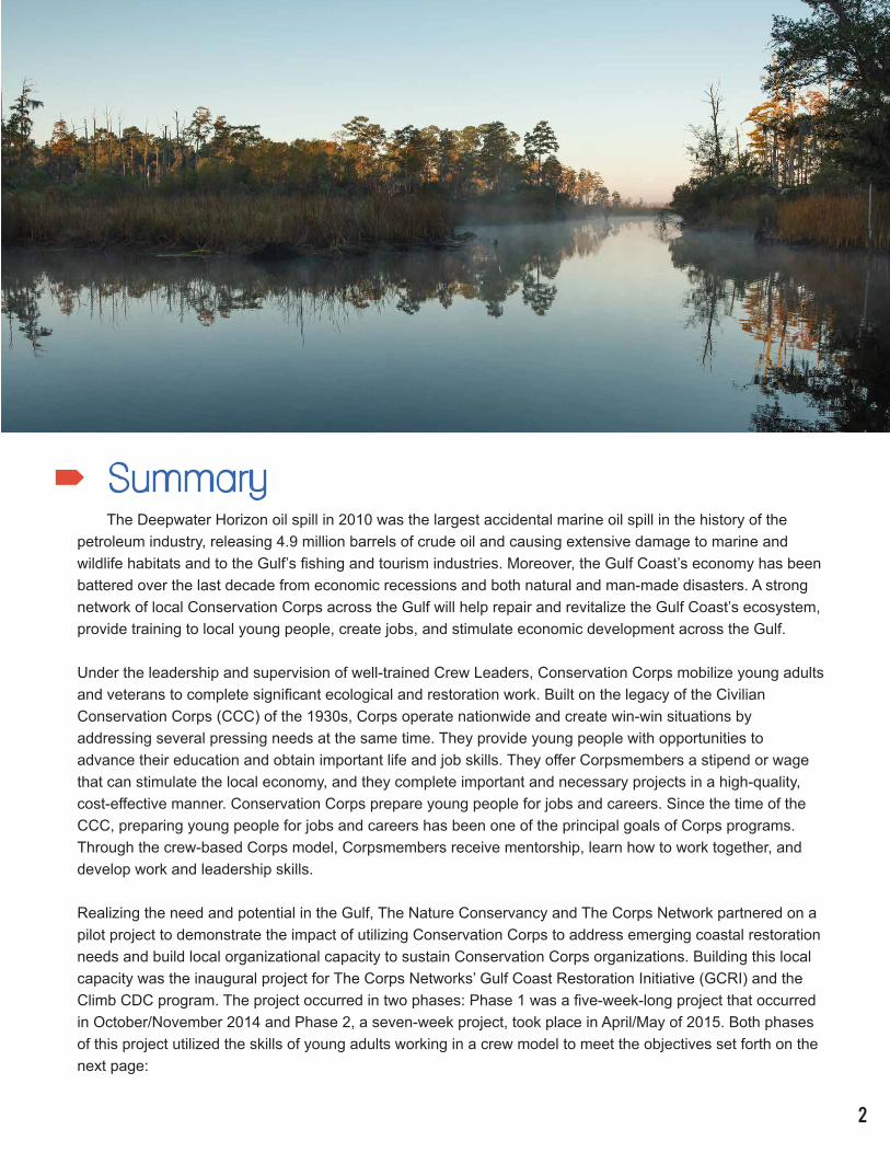
Summary The Deepwater Horizon oil spill in 2010 was the largest accidental marine oil spill in the history of the petroleum industry, releasing 4.9 million barrels of crude oil and causing extensive damage to marine and wildlife habitats and to the Gulf’s fishing and tourism industries. Moreover, the Gulf Coast’s economy has been battered over the last decade from economic recessions and both natural and man-made disasters. A strong network of local Conservation Corps across the Gulf will help repair and revitalize the Gulf Coast’s ecosystem, provide training to local young people, create jobs, and stimulate economic development across the Gulf.
Under the leadership and supervision of well-trained Crew Leaders, Conservation Corps mobilize young adults and veterans to complete significant ecological and restoration work. Built on the legacy of the Civilian Conservation Corps (CCC) of the 1930s, Corps operate nationwide and create win-win situations by addressing several pressing needs at the same time. They provide young people with opportunities to advance their education and obtain important life and job skills. They offer Corpsmembers a stipend or wage that can stimulate the local economy, and they complete important and necessary projects in a high-quality, cost-effective manner. Conservation Corps prepare young people for jobs and careers. Since the time of the CCC, preparing young people for jobs and careers has been one of the principal goals of Corps programs. Through the crew-based Corps model, Corpsmembers receive mentorship, learn how to work together, and develop work and leadership skills.
Realizing the need and potential in the Gulf, The Nature Conservancy and The Corps Network partnered on a pilot project to demonstrate the impact of utilizing Conservation Corps to address emerging coastal restoration needs and build local organizational capacity to sustain Conservation Corps organizations. Building this local capacity was the inaugural project for The Corps Networks’ Gulf Coast Restoration Initiative (GCRI) and the Climb CDC program. The project occurred in two phases: Phase 1 was a five-week-long project that occurred in October/November 2014 and Phase 2, a seven-week project, took place in April/May of 2015. Both phases of this project utilized the skills of young adults working in a crew model to meet the objectives set forth on the next page:
2
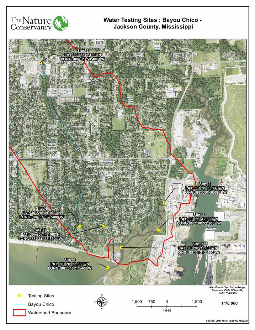
Objectives:1. Collect baseline data from 29 sites across ten coastal streams that all feed into the Mississippi Sound.
2. Promote community resilience and enrich the Gulf Coast economy by training local young adults rather than outsourcing coastal restoration employment opportunities.
3. Assess deteriorating natural spaces in preparation of making steps to restore them.
4. Provide young people in underserved areas a satisfying and productive pathway out of the challenges of their socioeconomic climate.
5. Increase awareness of the Conservation Corps model and its advantages to the natural environment and the community.
6. Build local organizational capacity to launch a Conservation Corps in coastal Mississippi.
7. Build project capacity and experience for Climb CDC to complete Coastal Restoration projects.
GCRI Lead Partnering Organizations: • The Nature Conservancy (TNC)
• The Corps Network (TCN)
• American YouthWorks, Texas Conservation Corps (TxCC)
• Climb CDC Career Development Center – Climb CDC Conservation Corps - Gulfport, MS
• National Fish and Wildlife Foundation (NFWF) Gulf Environmental Benefit Fund (GEBF)
• Mississippi Department of Environmental Quality (MS DEQ)
• Pascagoula River Audubon Center
Program Activities The Coastal Streams and Habitat Initiative is a National Fish and Wildlife Foundation Gulf Environmental Benefit Fund Project that was awarded to the MS Department of Environmental Quality. This initiative is lead by The Nature Conservancy, in partnership with Mississippi Audubon. It is focused on the tidal creeks, bayous and spring-fed streams that flow directly into the Mississippi Sound. In large part, these waterways flow through urban areas. Many of these streams are highly altered systems, yet they retain some level of environmental and historic value and create green corridors across urban landscapes. As such, these waterways and their surroundings have the potential to be restored in such a way that greatly enhances their ecological value and
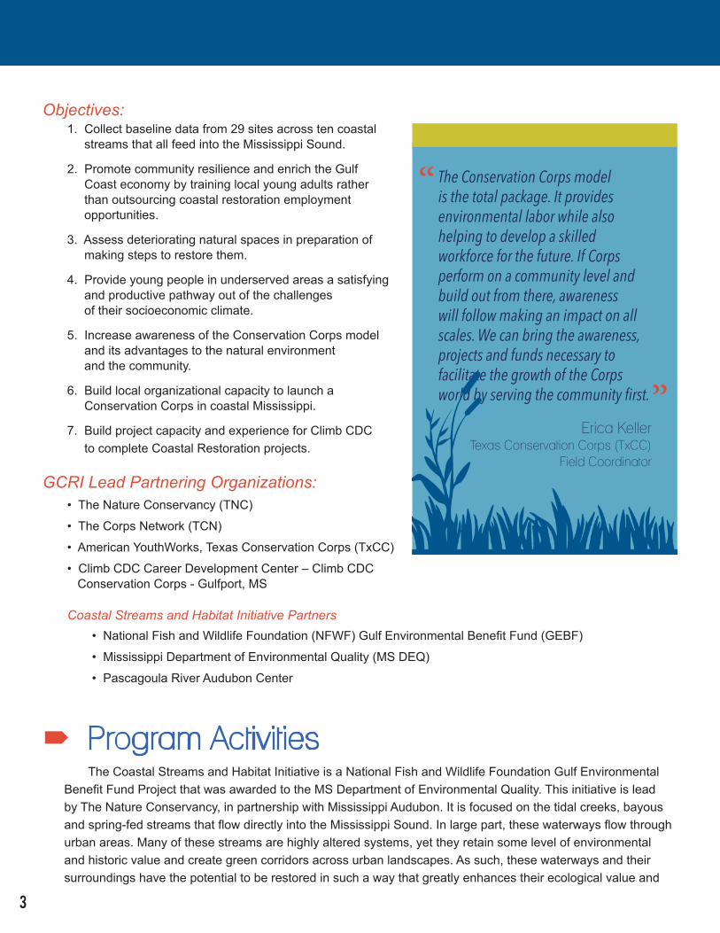
The Conservation Corps model is the total package. It provides environmental labor while also helping to develop a skilled workforce for the future. If Corps perform on a community level and build out from there, awareness will follow making an impact on all scales. We can bring the awareness, projects and funds necessary to facilitate the growth of the Corps world by serving the community first.
Erica KellerTexas Conservation Corps (TxCC)
Field Coordinator
“
”
3
Coastal Streams and Habitat Initiative Partners
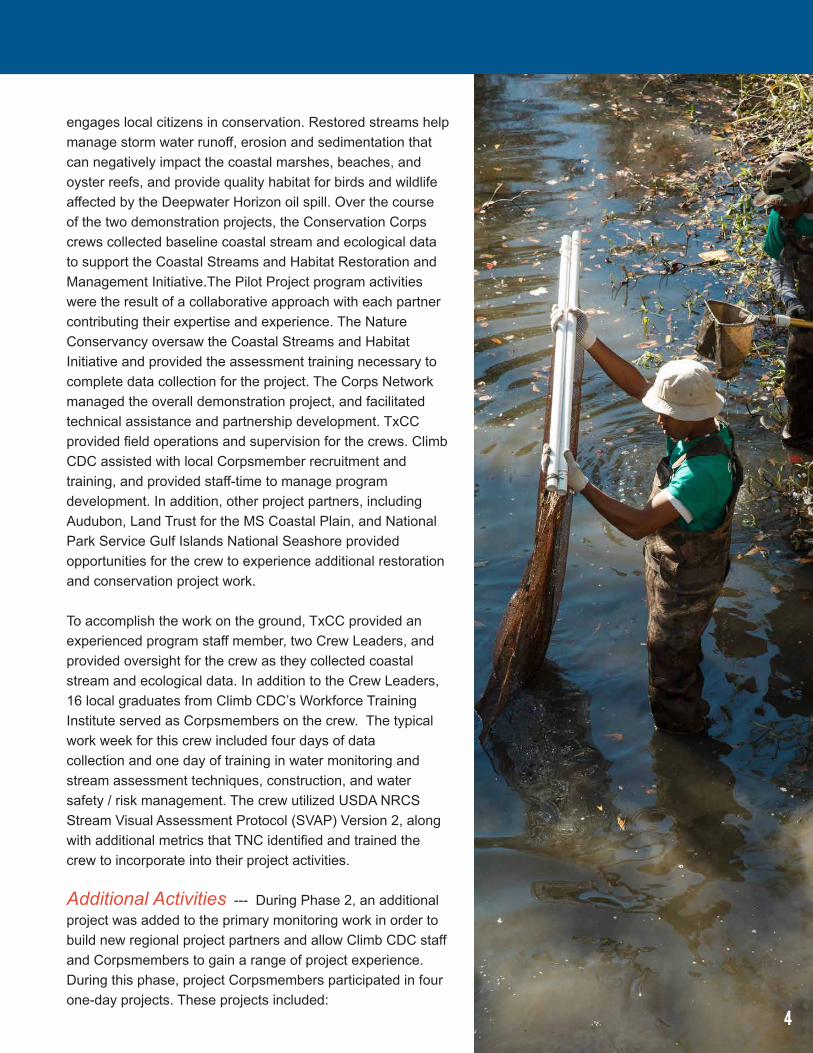
engages local citizens in conservation. Restored streams help manage storm water runoff, erosion and sedimentation that can negatively impact the coastal marshes, beaches, and oyster reefs, and provide quality habitat for birds and wildlife affected by the Deepwater Horizon oil spill. Over the course of the two demonstration projects, the Conservation Corps crews collected baseline coastal stream and ecological data to support the Coastal Streams and Habitat Restoration and Management Initiative.The Pilot Project program activities were the result of a collaborative approach with each partner contributing their expertise and experience. The Nature Conservancy oversaw the Coastal Streams and Habitat Initiative and provided the assessment training necessary to complete data collection for the project. The Corps Network managed the overall demonstration project, and facilitated technical assistance and partnership development. TxCC provided field operations and supervision for the crews. Climb CDC assisted with local Corpsmember recruitment and training, and provided staff-time to manage program development. In addition, other project partners, including Audubon, Land Trust for the MS Coastal Plain, and National Park Service Gulf Islands National Seashore provided opportunities for the crew to experience additional restoration and conservation project work.
To accomplish the work on the ground, TxCC provided an experienced program staff member, two Crew Leaders, and provided oversight for the crew as they collected coastal stream and ecological data. In addition to the Crew Leaders, 16 local graduates from Climb CDC’s Workforce Training Institute served as Corpsmembers on the crew. The typical work week for this crew included four days of data collection and one day of training in water monitoring and stream assessment techniques, construction, and water safety / risk management. The crew utilized USDA NRCS Stream Visual Assessment Protocol (SVAP) Version 2, along with additional metrics that TNC identified and trained the crew to incorporate into their project activities.
Additional Activities --- During Phase 2, an additional project was added to the primary monitoring work in order to build new regional project partners and allow Climb CDC staff and Corpsmembers to gain a range of project experience. During this phase, project Corpsmembers participated in four one-day projects. These projects included:
4
Findings
(1) an invasive species removal project on Ship Island in partnership with the National Park Service;
(2) a bird nesting area barrier installation project at several nesting locations on South Mississippi beaches with Audubon of Mississippi; and
(3) an invasive fuel reduction project near Coffee Creek for The Land Trust for the MS Coastal Plain.
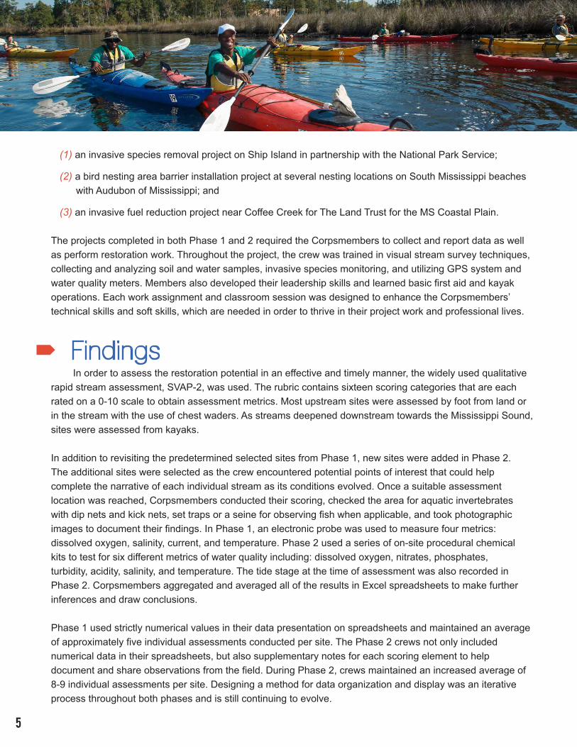
The projects completed in both Phase 1 and 2 required the Corpsmembers to collect and report data as well as perform restoration work. Throughout the project, the crew was trained in visual stream survey techniques, collecting and analyzing soil and water samples, invasive species monitoring, and utilizing GPS system and water quality meters. Members also developed their leadership skills and learned basic first aid and kayak operations. Each work assignment and classroom session was designed to enhance the Corpsmembers’ technical skills and soft skills, which are needed in order to thrive in their project work and professional lives.
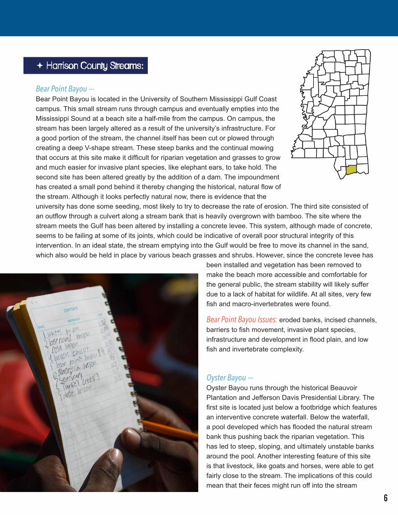
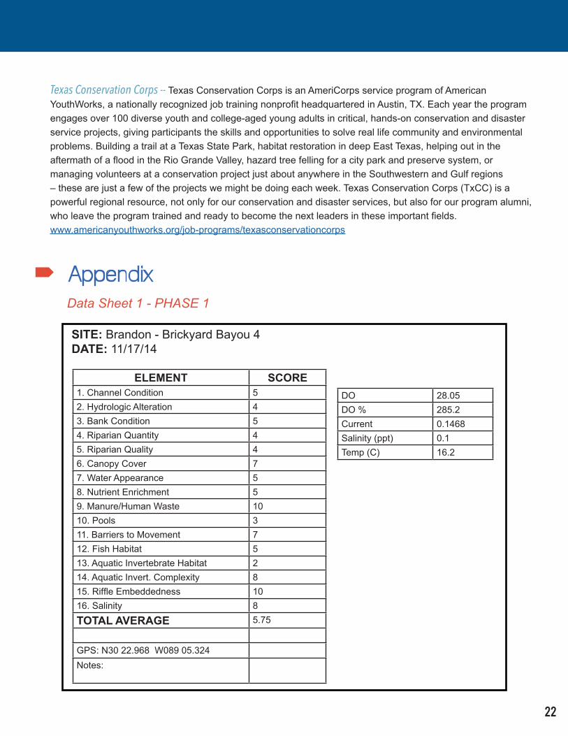
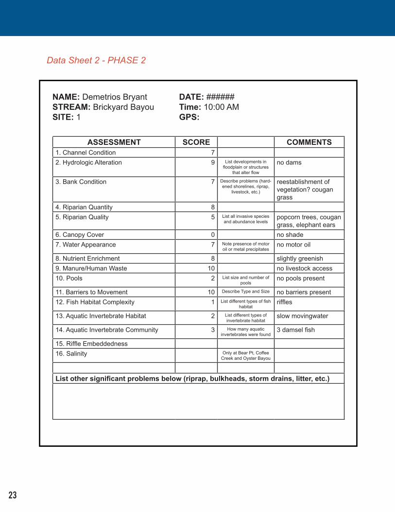
In order to assess the restoration potential in an effective and timely manner, the widely used qualitative rapid stream assessment, SVAP-2, was used. The rubric contains sixteen scoring categories that are each rated on a 0-10 scale to obtain assessment metrics. Most upstream sites were assessed by foot from land or in the stream with the use of chest waders. As streams deepened downstream towards the Mississippi Sound, sites were assessed from kayaks.
In addition to revisiting the predetermined selected sites from Phase 1, new sites were added in Phase 2. The additional sites were selected as the crew encountered potential points of interest that could help complete the narrative of each individual stream as its conditions evolved. Once a suitable assessment location was reached, Corpsmembers conducted their scoring, checked the area for aquatic invertebrates with dip nets and kick nets, set traps or a seine for observing fish when applicable, and took photographic images to document their findings. In Phase 1, an electronic probe was used to measure four metrics: dissolved oxygen, salinity, current, and temperature. Phase 2 used a series of on-site procedural chemical kits to test for six different metrics of water quality including: dissolved oxygen, nitrates, phosphates, turbidity, acidity, salinity, and temperature. The tide stage at the time of assessment was also recorded in Phase 2. Corpsmembers aggregated and averaged all of the results in Excel spreadsheets to make further inferences and draw conclusions.
Phase 1 used strictly numerical values in their data presentation on spreadsheets and maintained an average of approximately five individual assessments conducted per site. The Phase 2 crews not only included numerical data in their spreadsheets, but also supplementary notes for each scoring element to help document and share observations from the field. During Phase 2, crews maintained an increased average of 8-9 individual assessments per site. Designing a method for data organization and display was an iterative process throughout both phases and is still continuing to evolve.
5
Bear Point Bayou --- Bear Point Bayou is located in the University of Southern Mississippi Gulf Coast campus. This small stream runs through campus and eventually empties into the Mississippi Sound at a beach site a half-mile from the campus. On campus, the stream has been largely altered as a result of the university’s infrastructure. For a good portion of the stream, the channel itself has been cut or plowed through creating a deep V-shape stream. These steep banks and the continual mowing that occurs at this site make it difficult for riparian vegetation and grasses to grow and much easier for invasive plant species, like elephant ears, to take hold. The second site has been altered greatly by the addition of a dam. The impoundment has created a small pond behind it thereby changing the historical, natural flow of the stream. Although it looks perfectly natural now, there is evidence that the university has done some seeding, most likely to try to decrease the rate of erosion. The third site consisted of an outflow through a culvert along a stream bank that is heavily overgrown with bamboo. The site where the stream meets the Gulf has been altered by installing a concrete levee. This system, although made of concrete, seems to be failing at some of its joints, which could be indicative of overall poor structural integrity of this intervention. In an ideal state, the stream emptying into the Gulf would be free to move its channel in the sand, which also would be held in place by various beach grasses and shrubs. However, since the concrete levee has
been installed and vegetation has been removed to make the beach more accessible and comfortable for the general public, the stream stability will likely suffer due to a lack of habitat for wildlife. At all sites, very few fish and macro-invertebrates were found.
Bear Point Bayou Issues: eroded banks, incised channels, barriers to fish movement, invasive plant species, infrastructure and development in flood plain, and low fish and invertebrate complexity.
Oyster Bayou ---Oyster Bayou runs through the historical Beauvoir Plantation and Jefferson Davis Presidential Library. The first site is located just below a footbridge which features an interventive concrete waterfall. Below the waterfall, a pool developed which has flooded the natural stream bank thus pushing back the riparian vegetation. This has led to steep, sloping, and ultimately unstable banks around the pool. Another interesting feature of this site is that livestock, like goats and horses, were able to get fairly close to the stream. The implications of this could mean that their feces might run off into the stream
Harrison County Streams:
6
whenever it rains. The upstream assessment site rests in a more undisturbed location. Its banks were in relatively good condition with a fair supply of riparian vegetation. Unfortunately, very few living organisms were found in here. The downstream site was located within a densely packed pine tree stand. The stream had relatively stable banks with little evidence of any major issues, with the exception of having no macro invertebrates or any suitable habitat for fish. A fourth site was added during Phase 2 at the mouth of the stream as it cuts across the beach. Here, the same type of concrete structure as seen at other beach sites provides little habitat for wildlife. The crew reported finding a blue crab, several jellyfish, hermit crabs, litter, and a bird that died from causes that could not be identified.
Oyster Bayou Issues: livestock proximity, hydrologic alteration, low fish and invertebrate complexity, barriers to fish movement, and invasive species.
Coffee Creek ---Coffee creek sites are located in Harrison County with one site at a small local park and the other in a neighborhood with trailer homes along the banks. The site inside the park features very steep banks that are severely eroded. This deep incision has a lot of invasive species, particularly elephant ears, along its banks and riparian area. Unfortunately, this does little to help stabilize it as a whole. However, the second site is much more troublesome. In an attempt to combat erosion issues, concrete has been poured over the entire bank, thereby making an artificial bank. By creating an impermeable surface, water enters the stream system rapidly which will increase the rate of erosion for the entire stream. The artificial embankment does not extend to meet the bed of the stream, and is eroding very heavily where the concrete ends and the natural surface begins. This continued erosion is starting to negatively affect the nearby trailer homes because the ground beneath them is becoming increasingly unstable. Another issue at this site is that the water itself is very polluted with garbage and runoff from the neighborhood. A beach site for this stream was surveyed in Phase 2. Findings were consistent with other beach sites in that the concrete structure contributed to an overall lack of what could be estuarine habitat.
Coffee Creek Issues: Severe erosion, hydrologic alteration, infrastructure in riparian zones, invasive species, consumer waste.
7
Turkey Creek ---The upstream portion of Turkey Creek Flows through historic neighborhoods west of Highway 49. The stream moves east, beneath Highway 49, winding past the Gulfport-Biloxi International Airport, and eventually emptying into Bernard Bayou near the Bayou Vista Golf Course. Turkey Creek is one of the more wild and beloved streams in this community and is valued recreationally by residents. This site will ideally be home to a blueway, sponsored by The Land Trust for the Mississippi Coastal Plain, which will likely increase awareness and enjoyment of this stream. The crew consistently observed invasive species such as Chinese Tallow and Cogon grass. Many of the banks upstream were observed to be channelized and steep with little or no connection to a floodplain. The downstream portion of the creek contains artificial embankments such as rip-rap and corrugated metal bulkheads. There is also severe undercutting of the banks which has caused several trees to fall into the stream because the ground beneath them has degraded due to heavy erosion. Considering that one of the prime recreational uses of this natural area is fishing, the crew expected to identify a variety of species during Phase 1 of the pilot. Not only were there few fish to be found, there were few macro invertebrates as well. The Nature Conservancy obtained a permit to allow for use of passive traps to help the crew collect more information about the fish species in Turkey Creek. Unfortunately, this did not yield fish samples either. Phase 2 brought springtime and macro invertebrates as well as some mosquito fish. There were occasional pools of various sizes and depths as well as macrophyte beds and aquatic vegetation which are expressions of complexity in fish and invertebrate habitat.
Turkey Creek Issues: Erosion of stream banks, improper bank stabilization (riprap), high water flow, low invertebrate and fish communities.
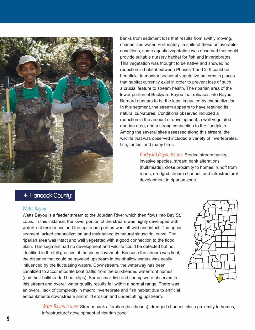
Brickyard Bayou ---Brickyard Bayou is a 4.4-mile stream that carries water eastward to Bayou Bernard. The vast majority of this stream is heavily channelized. The upstream sites were observed to have steep, heavily incised banks with very little riparian vegetation and many artifacts of human consumption (litter). This portion of the stream serves a residential and somewhat industrial area. It receives heavy amounts of runoff from surrounding impervious surfaces, and from storm drains that empty directly into the stream. Stream bank erosion resulting in major undercutting of the bank was observed where storm drains release potentially large volumes of water moving at high velocity directly into the stream. As a way to mitigate this loss of property, hardened artificial stream banks become more prevalent eastward as flowing water gains momentum. The channelization of this stream has completely eliminated any opportunity for the stream to meander and potentially slow quickly moving water. Particularly where there are waterfront residences, bulkheads have been constructed in an attempt to stabilize
“
”
This is a fantastic example of communities connecting with their natural resources and protecting their livelihoods as well as the ecosystems around them. The Corpsmembers are collecting important data that can help inform restoration plans that can make these habitats and communities less vulnerable to coastal hazards.
Tom Mohrman The Nature Conservancy (TNC)
Director of Marine Programs
8
banks from sediment loss that results from swiftly moving, channelized water. Fortunately, in spite of these unfavorable conditions, some aquatic vegetation was observed that could provide suitable nursery habitat for fish and invertebrates. This vegetation was thought to be native and showed no reduction in habitat between Phases 1 and 2. It could be beneficial to monitor seasonal vegetative patterns in places that habitat currently exist in order to prevent loss of such a crucial feature to stream health. The riparian area of the lower portion of Brickyard Bayou that releases into Bayou Bernard appears to be the least impacted by channelization. In this segment, the stream appears to have retained its natural curvatures. Conditions observed included a reduction in the amount of development, a well vegetated riparian area, and a strong connection to the floodplain. Among the several sites assessed along this stream, the wildlife that was observed included a variety of invertebrates, fish, turtles, and many birds.
Brickyard Bayou Issues: Eroded stream banks, invasive species, stream bank alterations (bulkheads), close proximity to homes, runoff from roads, dredged stream channel, and infrastructure/development in riparian zone.
Watts Bayou ---Watts Bayou is a feeder stream to the Jourdan River which then flows into Bay St. Louis. In this instance, the lower portion of the stream was highly developed with waterfront residences and the upstream portion was left wild and intact. The upper segment lacked channelization and maintained its natural sinusoidal curve. The riparian area was intact and well vegetated with a good connection to the flood plain. This segment had no development and wildlife could be detected but not identified in the tall grasses of the piney savannah. Because the stream was tidal, the distance that could be traveled upstream in the shallow waters was easily influenced by the fluctuating waters. Downstream, the waterway has been canalized to accommodate boat traffic from the bulkheaded waterfront homes (and their bulkheaded boat-slips). Some small fish and shrimp were observed in this stream and overall water quality results fell within a normal range. There was an overall lack of complexity in macro invertebrate and fish habitat due to artificial embankments downstream and mild erosion and undercutting upstream.
Watts Bayou Issues: Stream bank alteration (bulkheads), dredged channel, close proximity to homes, infrastructure/ development of riparian zone
Hancock County:
9
Magnolia Bayou ---Magnolia Bayou is a smaller waterway that flows through the Bay of St. Louis residential area and lets out into the bay. The bayou was assessed at three points across a two-mile reach. The water appearance is poor as it collects in the residential area. Runoff drainage and sewage pipes connect directly to the bayou creating an odor and a fair amount of debris. Despite these poor conditions, the crew was able to find a large variety of fish, yet there was very little observed presence of aquatic invertebrates. Due to the nature of residential development, this portion of the waterway retains very little of its natural riparian zone and has several obstructions in its floodplain, which is disconnected by steep and eroded banks. On another leg of the waterway, much of the riparian zone and its connection to the floodplain, though pervasive with invasive plant life, had been preserved. The water appearance and testing result suggested an improved water quality at the adjoining segment of waterway. As the segments of the bayou merge to create a wider and deeper water-flow, the floodplain also increases in width and has only light development. The waterway remains connected to the riparian zone but had a sizeable stand of phragmites that occupied a large portion of the floodplain on the northern bank. On the southern side, the majority of the shoreline is hardened by the placement of riprap at the edge of the yacht club property that is adjacent to an overflow parking lot. As the stream crosses beneath the street through a cylindrical culvert, some barriers to wildlife passage may exist.
Magnolia Bayou Issues: Invasive species, stream bank alteration (riprap), eroded stream banks, low invertebrate and fish community.
Jackson County:
Rhodes Bayou ---Rhodes Bayou is a tidal waterway that flows through several types of development. As it makes its way through the city of Moss Point, the bayou runs through residential neighborhoods. There were few areas with riprap or channel alteration and there did not appear to be any large vegetation gaps from the stream bank to the riparian zone. The riparian zone was larger than expected for the densely developed area, but did contain some invasive plants such as Chinese Tallow and Cogan Grass. The site assessments confirm a high potential for runoff from hardened surfaces within the watershed and frequent developments in the active floodplain. Higher than normal phosphate levels were also found in this area of the bayou, which confirms the assumption of runoff. Some areas had drainage ditches directly from the road to the bayou. Wildlife found also included several indicator species that confirmed poor water quality, however, there was also an abundance of other invertebrates and fish. This may be due to the tidal nature of the bayou, causing the water quality to fluctuate. As the waterway makes its way closer to the Escatawpa River, and ultimately to the Mississippi Sound, the development becomes more sparse and that area becomes more rural. This allows for a floodplain with less development, a sawgrass marsh habitat, and nearby forests. The site assessments indicated some roadways and bridges that partially obstructed the floodplain, but hardened surfaces were far less promionent. Water testing in this area showed that phosphate levels had returned to normal levels and there was an increase in dissolved oxygen. Despite the increase in water quality, the crew was unable to find wildlife in this part of the waterway. Findings in Phase 2 were consistent with findings from Phase 1.
Rhodes Bayou Issues: Stream bank alteration (riprap), hydrologic alteration, infrastructure/ development in riparian zone
10
Bayou Chicot ---Bayou Chicot is a system of tributaries and municipal drainages that slowly form together to a delta that lets out directly into the Gulf, south of Pascagoula. A majority of the bayou has been denaturalized as a result of residential and industrial development. The upstream portions have had large amounts of bank alteration (riprap) and greatly incised banks, creating a complete disconnect from the natural floodplain and riparian zone. In addition to inhibiting any natural habitat, these artificial conditions create a straight water flow with no meandering or obstacles. Eventually, the high current speed will erode the banks even further. Very high levels of phosphate were found near the upstream sites. As the waterway flows south toward the Gulf, it becomes more of a channel with residential docks and bulkheads along the banks. Residential landscaping dominates the riparian zone resulting in nearly zero natural habitats and several invasive plant species. There were many run-off pipes that added pollution and debris, greatly affecting the water quality. The crew found little to no aquatic wildlife in this area. As the delta forms and the water reaches the Gulf, the banks gradually transition to a natural state with connection to the floodplain and riparian zone. Phosphate readings dropped to normal levels, likely because the ratio of runoff to natural water was much lower. A large portion of the delta includes a grassy marsh habitat and brackish water.
Bayou Chicot Issues: Stream bank alteration (riprap), hydrologic alteration, infrastructure/ development in riparian zone
“
”
They are learning to see the land not as independent sections of ‘outdoors’ but as connected concepts flowing in to each other in fantastic and amazing ways. And finally, we are using the funds that we allocated to these areas from disasters to create something dynamic for the people of this region.
Chris Gomon Texas Conservation Corps
Crew Leader
11
Labor Hours / Jobs During the project, TCN was responsible for tracking the number of jobs associated with the project to include the number of hours worked and the duration of the job. These factors were monitored throughout the project in accordance with the contract requirements. The type of scientific monitoring and baseline data collection conducted by the Corpsmembers is typically done by graduate students who are conducting specific research, or by consultants who are already trained in data collection and analysis. Key outcomes of this project are tied to providing valuable work experience for a sample of a population who might not otherwise have the opportunity to be involved in scientific data collection. Not only did the project provide key datapoints that will inform larger and more comprehensive conservation action planning, but it also contributed to the local economy by paying for over 2,000 labor hours over the course of 16 weeks in Phase 1 and 2,600 hours over 12 weeks in Phase 2 for a combined total of 4,600 hours in 28 weeks.
The chart on the following page shows the employee name, number of total hours worked, and the total full-time equivalent (FTE) of their work. The majority of the work for Phase 1 occurred between October 8, 2014 and November 21, 2014. The field work and training for Phase 2 occurred between April 16, 2015 and May 29, 2015. Due to the budget limitations of the project, only one crew member, Brandon McLaurin, was able to continue to work with pay from this grant through January 30, 2015 during Phase 1. Additionally, the staff person provided by the Texas Conservation Corps continued to contribute to the reporting as well as manage the data organization and presentation through the end of the grant period on both phases of the project.
12
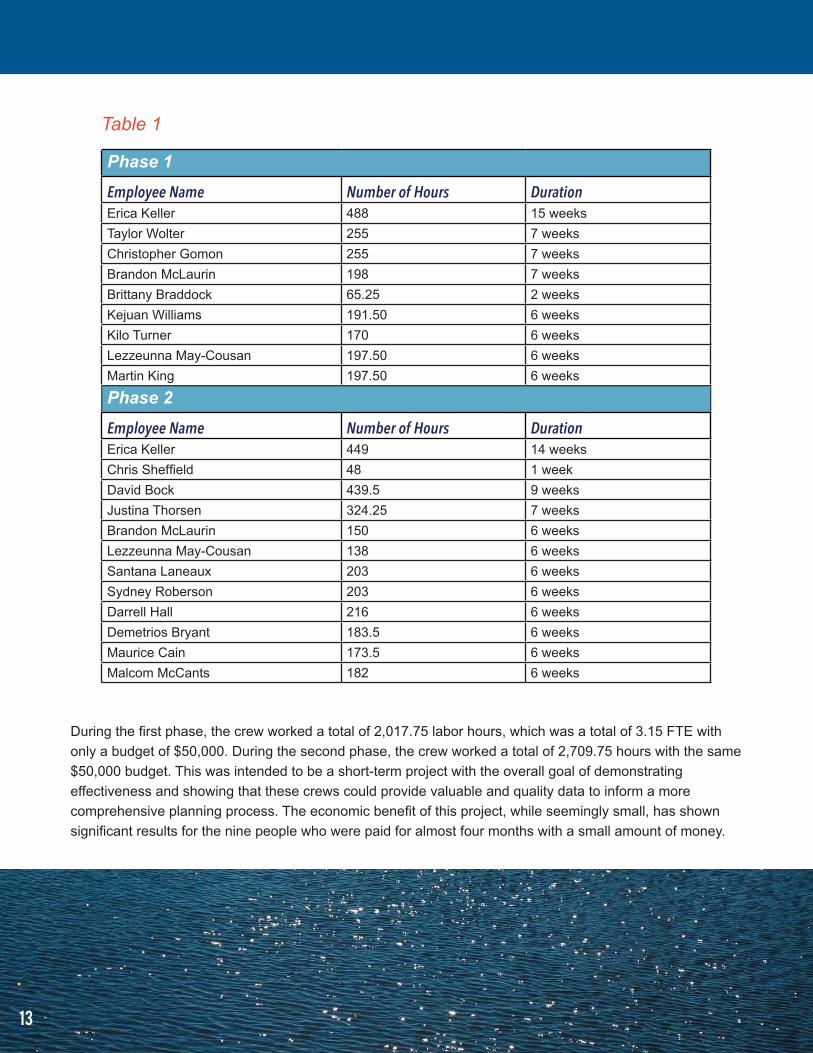
During the first phase, the crew worked a total of 2,017.75 labor hours, which was a total of 3.15 FTE with only a budget of $50,000. During the second phase, the crew worked a total of 2,709.75 hours with the same $50,000 budget. This was intended to be a short-term project with the overall goal of demonstrating effectiveness and showing that these crews could provide valuable and quality data to inform a more comprehensive planning process. The economic benefit of this project, while seemingly small, has shown significant results for the nine people who were paid for almost four months with a small amount of money.
Table 1
Phase 1
Employee Name Number of Hours DurationErica Keller 488 15 weeksTaylor Wolter 255 7 weeksChristopher Gomon 255 7 weeksBrandon McLaurin 198 7 weeksBrittany Braddock 65.25 2 weeksKejuan Williams 191.50 6 weeksKilo Turner 170 6 weeksLezzeunna May-Cousan 197.50 6 weeksMartin King 197.50 6 weeks
In both phases of the pilot program, providing training for the Corpsmembers in order to help build and strengthen a local workforce was a key objective. TNC not only provided the initial training for the stream assessment, but also provided consistent on-the-job training (OJT) throughout the duration of the pilot. Mike Murphy, of The Nature Conservancy, provided the SVAP training in the classroom as well as in the field, and remained on-site as a resource for wildlife and plant species identification. There were a variety of trainings offered to achieve success for both data collection and OJT skills learned. This included kayak training, which was provided to the Corpsmembers by 17 Turtles, an equipment outfitter. Texas Conservation Corps facilitated and lead lessons in water safety and swimming, Leave No Trace principals, safety and situational awareness, and continually fostered leadership and soft-skill development. In addition, TxCC and Trout Headwaters Inc. provided a two day training webinar, “Waders in the Water,” during Phase 1. By Phase 2, TxCC was able to provide chainsaw training both in the classroom and in the field. Through this training, Corpsmembers learned to safely operate and maintain chainsaws at a basic level. In Phase 2, with the addition of service projects beyond stream assessment, Corps-members learned methods of invasive species management, fuel reduction, and habitat restoration techniques. Diversity in service projects provided the crew with a broader skillset and with the highly rewarding and motivating opportunity to look back over a hard day’s work and see an immediate positive impact at the service site.
The Corpsmembers had the opportunity to “learn by doing,” which is generally seen as an experiential approach to education. The members were able to engage in field exercises and reflect on their learning during the Friday classroom sessions. This gave them the opportunity to immediately apply new knowledge and conceptual understanding gained in the classroom and translate that in the field with the direction and guidance of The Nature Conservancy and experienced Crew Leaders from TxCC.
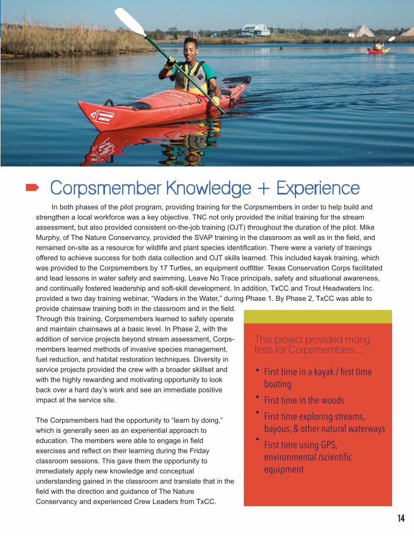
Corpsmember Knowledge + Experience
This project provided many firsts for Corpsmembers...
First time in a kayak / first time boatingFirst time in the woodsFirst time exploring streams, bayous, & other natural waterwaysFirst time using GPS, environmental /scientific equipment
14
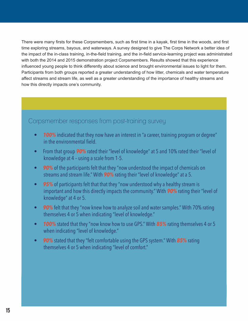
There were many firsts for these Corpsmembers, such as first time in a kayak, first time in the woods, and first time exploring streams, bayous, and waterways. A survey designed to give The Corps Network a better idea of the impact of the in-class training, in-the-field training, and the in-field service-learning project was administrated with both the 2014 and 2015 demonstration project Corpsmembers. Results showed that this experience influenced young people to think differently about science and brought environmental issues to light for them. Participants from both groups reported a greater understanding of how litter, chemicals and water temperature affect streams and stream life, as well as a greater understanding of the importance of healthy streams and how this directly impacts one’s community.
Corpsmember responses from post-training survey
• 100% indicated that they now have an interest in “a career, training program or degree” in the environmental field.• From that group 90% rated their “level of knowledge” at 5 and 10% rated their “level of knowledge at 4 – using a scale from 1-5.• 90% of the participants felt that they “now understood the impact of chemicals on streams and stream life.” With 90% rating their “level of knowledge” at a 5.• 95% of participants felt that that they “now understood why a healthy stream is important and how this directly impacts the community.” With 90% rating their “level of knowledge” at 4 or 5.• 90% felt that they “now knew how to analyze soil and water samples.” With 70% rating themselves 4 or 5 when indicating “level of knowledge.”• 100% stated that they “now know how to use GPS.” With 85% rating themselves 4 or 5 when indicating “level of knowledge.”• 90% stated that they “felt comfortable using the GPS system.” With 85% rating themselves 4 or 5 when indicating “level of comfort.”
15
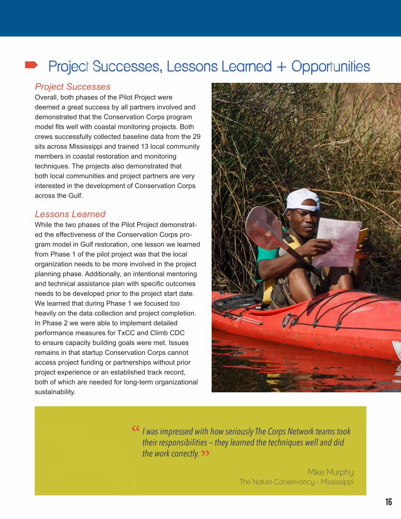
Project Successes, Lessons Learned + OpportunitiesProject SuccessesOverall, both phases of the Pilot Project were deemed a great success by all partners involved and demonstrated that the Conservation Corps program model fits well with coastal monitoring projects. Both crews successfully collected baseline data from the 29 sits across Mississippi and trained 13 local community members in coastal restoration and monitoring techniques. The projects also demonstrated that both local communities and project partners are very interested in the development of Conservation Corps across the Gulf.
Lessons LearnedWhile the two phases of the Pilot Project demonstrat-ed the effectiveness of the Conservation Corps pro-gram model in Gulf restoration, one lesson we learned from Phase 1 of the pilot project was that the local organization needs to be more involved in the project planning phase. Additionally, an intentional mentoring and technical assistance plan with specific outcomes needs to be developed prior to the project start date. We learned that during Phase 1 we focused too heavily on the data collection and project completion. In Phase 2 we were able to implement detailed performance measures for TxCC and Climb CDC to ensure capacity building goals were met. Issues remains in that startup Conservation Corps cannot access project funding or partnerships without prior project experience or an established track record, both of which are needed for long-term organizational sustainability.
I was impressed with how seriously The Corps Network teams took their responsibilities — they learned the techniques well and did the work correctly.
Mike MurphyThe Nature Conservancy - Mississippi
“”
16
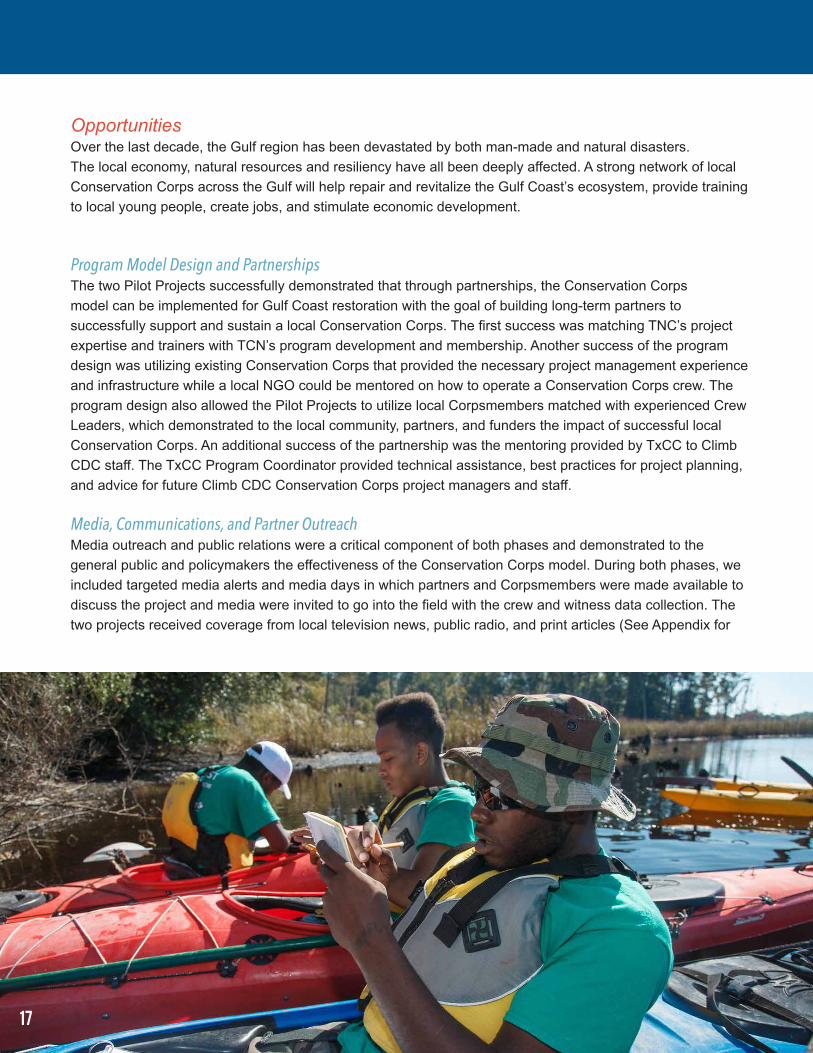
OpportunitiesOver the last decade, the Gulf region has been devastated by both man-made and natural disasters. The local economy, natural resources and resiliency have all been deeply affected. A strong network of local Conservation Corps across the Gulf will help repair and revitalize the Gulf Coast’s ecosystem, provide training to local young people, create jobs, and stimulate economic development.
Program Model Design and Partnerships The two Pilot Projects successfully demonstrated that through partnerships, the Conservation Corps model can be implemented for Gulf Coast restoration with the goal of building long-term partners to successfully support and sustain a local Conservation Corps. The first success was matching TNC’s project expertise and trainers with TCN’s program development and membership. Another success of the program design was utilizing existing Conservation Corps that provided the necessary project management experience and infrastructure while a local NGO could be mentored on how to operate a Conservation Corps crew. The program design also allowed the Pilot Projects to utilize local Corpsmembers matched with experienced Crew Leaders, which demonstrated to the local community, partners, and funders the impact of successful local Conservation Corps. An additional success of the partnership was the mentoring provided by TxCC to Climb CDC staff. The TxCC Program Coordinator provided technical assistance, best practices for project planning, and advice for future Climb CDC Conservation Corps project managers and staff.
Media, Communications, and Partner Outreach Media outreach and public relations were a critical component of both phases and demonstrated to the general public and policymakers the effectiveness of the Conservation Corps model. During both phases, we included targeted media alerts and media days in which partners and Corpsmembers were made available to discuss the project and media were invited to go into the field with the crew and witness data collection. The two projects received coverage from local television news, public radio, and print articles (See Appendix for
17
full listing of media clips). During the 2014 Pilot Project, TNC, TCN, and Oxfam America hosted a workshop on integrating community benefits into restoration planning which brought together federal, state, and local government; science and restoration NGOs; private sector contractors; educational institutions; and workforce and community based organizations. This also allowed the crews to be highlighted in front of important decision makers. For the second phase, we focused on additional partner outreach to include both government land management agencies and NGO conservation organizations to have the crew volunteer on their projects at no cost. This allowed these organizations to see first-hand the quality work that Conservation Corps crews can perform.
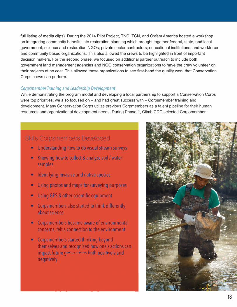
Corpsmember Training and Leadership Development While demonstrating the program model and developing a local partnership to support a Conservation Corps were top priorities, we also focused on – and had great success with – Corpsmember training and development. Many Conservation Corps utilize previous Corpmembers as a talent pipeline for their human resources and organizational development needs. During Phase 1, Climb CDC selected Corpsmember
Skills Corpsmembers Developed • Understanding how to do visual stream surveys
• Knowing how to collect & analyze soil / water samples
• Identifying invasive and native species
• Using photos and maps for surveying purposes
• Using GPS & other scientific equipment
• Corpsmembers also started to think differently about science
• Corpsmembers became aware of environmental concerns, felt a connection to the environment
• Corpsmembers started thinking beyond themselves and recognized how one’s actions can impact future generations both positively and negatively
18
19
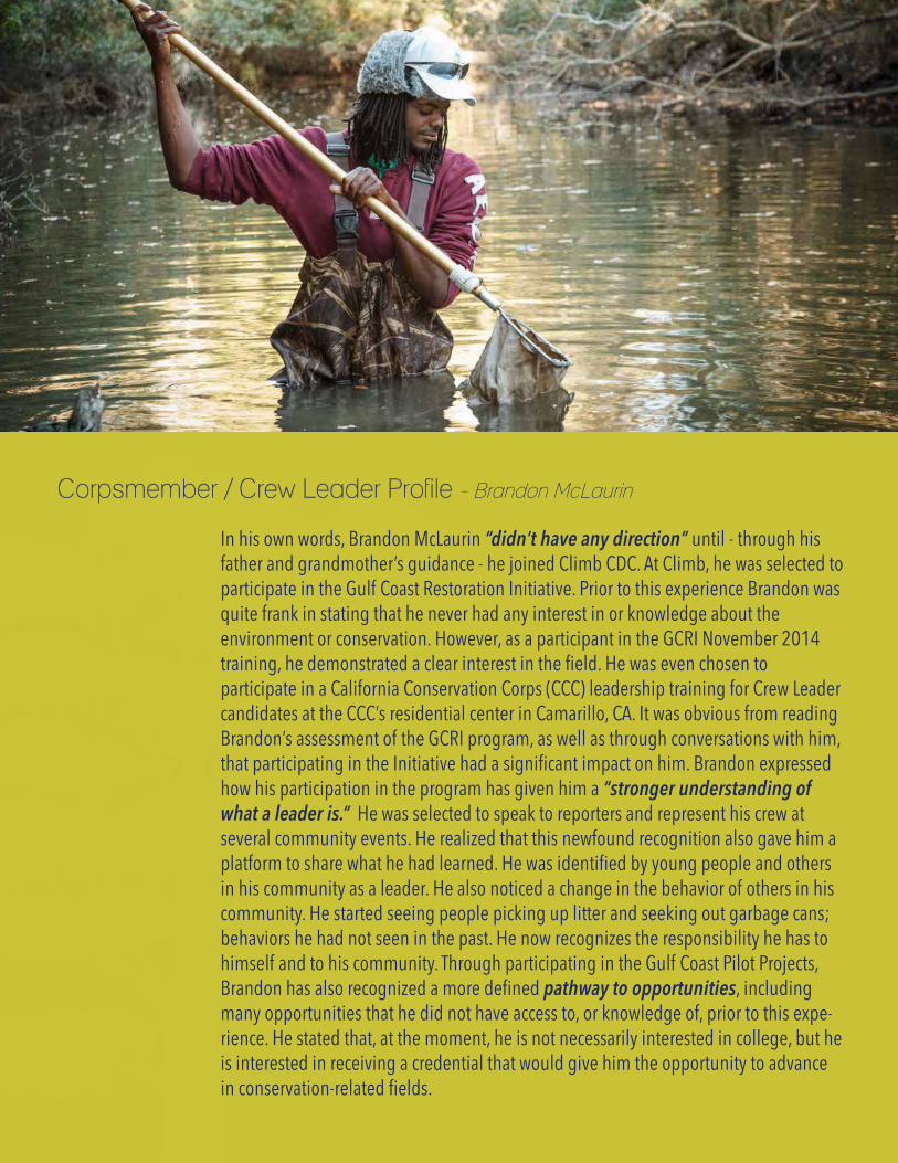
In his own words, Brandon McLaurin “didn’t have any direction” until - through his father and grandmother’s guidance - he joined Climb CDC. At Climb, he was selected to participate in the Gulf Coast Restoration Initiative. Prior to this experience Brandon was quite frank in stating that he never had any interest in or knowledge about the environment or conservation. However, as a participant in the GCRI November 2014 training, he demonstrated a clear interest in the field. He was even chosen to participate in a California Conservation Corps (CCC) leadership training for Crew Leader candidates at the CCC’s residential center in Camarillo, CA. It was obvious from reading Brandon’s assessment of the GCRI program, as well as through conversations with him, that participating in the Initiative had a significant impact on him. Brandon expressed how his participation in the program has given him a “stronger understanding of what a leader is.” He was selected to speak to reporters and represent his crew at several community events. He realized that this newfound recognition also gave him a platform to share what he had learned. He was identified by young people and others in his community as a leader. He also noticed a change in the behavior of others in his community. He started seeing people picking up litter and seeking out garbage cans; behaviors he had not seen in the past. He now recognizes the responsibility he has to himself and to his community. Through participating in the Gulf Coast Pilot Projects, Brandon has also recognized a more defined pathway to opportunities, including many opportunities that he did not have access to, or knowledge of, prior to this expe-rience. He stated that, at the moment, he is not necessarily interested in college, but he is interested in receiving a credential that would give him the opportunity to advance in conservation-related fields.
Brandon McLaurin to be a Crew Leader-In-Training. In an effort to build staff capacity at Climb CDC, Brandon, and a new Climb CDC staff member traveled west to attend trainings with California Conservation Corps. California Conservation Corps’ creation dates back to 1976 and is the single largest state-based Conservation Corps in the nation. Brandon attended an advanced Corpmember leadership training and the Climb staff member attended CCC’s Initial Entry Training for Crew Supervisors. During Phase 2 of the Pilot Project, both Brandon and the Climb staff member increased their leadership and management of the project. Also during Phase 2, Brandon and an additional Corpsmember from the project were able to attend The Corps Network’s Annual Great Outdoors Day of Service in Washington, DC. The event allowed the Climb CDC Corpsmembers to interact with Corpsmembers from across the country and participate in a Community Leaders Briefing at the White House with senior members of the Obama Administration. On August 21, 2015, Brandon received a Partnership Award from the Mississippi Urban Forest Council for his activities with the GCRI. These activities outside of the actual demonstration projects built Climb CDC’s organizational capacity and put them on track to launch the Climb CDC Conservation Corps in the fall of 2015.
Opportunities: A large scale large-scale Gulf-wide Conservation Corps initiative will help repair and revitalize the Gulf Coast’s ecosystem, provide training to local young people, create jobs, and stimulate economic development in response to the Deepwater Horizon oil spill.
The Corps Network embarked on the GCRI with a comprehensive, year-long needs assessment of the region. This outlined the specific needs of key stakeholders, project partners, and community leaders across the Gulf. The results of the needs assessment demonstrated that there are many suitable ecosystem restoration projects for crews to work on, as well as many communities throughout the Gulf that need workforce development programming and have no shortage of workers ready to be trained.
We stand ready and willing to assist the Gulf Coast Ecosystem Restoration Council (Council), NRDA Trustee Council, and the NFWF Gulf Environmental Benefit Fund with the ecosystem and economic restoration of the Gulf Coast while promoting natural resource stewardship of its young people and veterans. In order to take the GCRI to scale, we are focused on the following two projects:
• NFWF Gulf Conservation Corps Restoration Program: The National Fish and Wildlife Foundation, The Nature Conservancy, and The Corps Network will support two new Conservation Corps and a Veterans Conservation Corps pilot demonstration to undertake projects that restore and protect natural resources. The project will improve long-term habitat health for native plants and animals, build organizational strength to continue to use Conservation Corps as a significant strategy for Gulf restoration, and train young people to participate in the expanding Gulf restoration economy. Awarded August 27, 2015.
• Restore Council, NOAA Gulf of Mexico Habitat Restoration via Conservation Corps Partnerships: The Council proposes in their initial Funded Priority List (FPL) to invest in a Gulf Coast Conservation Corps Program (GCCC Program) that would benefit both the environment and coastal communities by equipping local citizens with the knowledge, skills and ability to implement and manage conservation projects. A GCCC Program would build on existing training partnerships among federal, state, academic, and non-profit organizations; recruit and train local workers; and provide paid, hands-on work experience. FPL Announced August 13, 2015.
20
The Corps Network -- The Corps Network provides critical leadership to the Corps movement and our nation’s Service and Conservation Corps as they harness the power of youth and young adults to transform their own lives through tackling some of America’s greatest challenges. Our 100+ members operate in all states and the District of Columbia. Each year they collectively enroll approximately 23,000 Corpsmembers ranging in age from 16-25. Corps are comprehensive youth development programs that provide their participants with job training, academic programming, leadership skills, and additional support through a strategy of service that improves communities and the environment. Learn more at www.corpsnetwork.org
The Nature Conservancy -- The Nature Conservancy is a leading conservation organization working around the world to protect ecologically important lands and waters for nature and people. To date, the Conservancy and its more than one million members have been responsible for the protection of more than 18 million acres in the United States and have helped preserve more than 117 million acres in Latin America, the Caribbean, Asia and the Pacific. Visit The Nature Conservancy on the Web at www.nature.org
CLIMB CDC -- CLIMB CDC is a Mississippi-based nonprofit and community development agency that provides workforce training, housing and financial counseling, housing development and disaster recovery services in the Gulf South Region. In partnership with local and regional organizations and donors, CLIMB CDC builds sustainable, community-based programs for low and moderate income residents that have created over $145 million in community and economic benefits. The agency’s Workforce Training Institute, which has served over 450 individuals, provides employment and business training related to construction, culinary arts, small business start-ups and computer networks and installation. The agency is a 501 (c) (3) nonprofit organization that is governed by a Board of local community and business leaders. www.climbcdc.org
Conclusion
21
Over the last decade, natural and man-made disasters have damaged the Gulf Coast’s ecosystem and economy. A strong network of local Conservation Corps throughout the Gulf would help repair and revitalize coastal habitats as well as the economic health of coastal communities. As The Corps Network and The Nature Conservancy’s two-phase pilot project demonstrated, there is a need for Corps in this region. Over the course of the pilot project, the locally-hired Conservation Corps crews successfully collected baseline coastal stream and ecological data to support the Nature Conservancy’s Coastal Streams and Habitat Restoration and Management Initiative. In the process, these Corpsmembers learned about the environment and gained valuable work experience for potential future employment in the growing Restoration Economy. Supporting the development of local Conservation Corps throughout the Gulf would promote community resilience, enrich the Gulf Coast economy, and protect our fragile coastal ecosystems.
ELEMENT SCORE1. Channel Condition 52. Hydrologic Alteration 43. Bank Condition 54. Riparian Quantity 45. Riparian Quality 46. Canopy Cover 77. Water Appearance 58. Nutrient Enrichment 59. Manure/Human Waste 1010. Pools 311. Barriers to Movement 712. Fish Habitat 513. Aquatic Invertebrate Habitat 214. Aquatic Invert. Complexity 815. Riffle Embeddedness 1016. Salinity 8
TOTAL AVERAGE 5.75
GPS: N30 22.968 W089 05.324Notes:
DO 28.05DO % 285.2Current 0.1468Salinity (ppt) 0.1Temp (C) 16.2
SITE: Brandon - Brickyard Bayou 4 DATE: 11/17/14
Texas Conservation Corps -- Texas Conservation Corps is an AmeriCorps service program of American YouthWorks, a nationally recognized job training nonprofit headquartered in Austin, TX. Each year the program engages over 100 diverse youth and college-aged young adults in critical, hands-on conservation and disaster service projects, giving participants the skills and opportunities to solve real life community and environmental problems. Building a trail at a Texas State Park, habitat restoration in deep East Texas, helping out in the aftermath of a flood in the Rio Grande Valley, hazard tree felling for a city park and preserve system, or managing volunteers at a conservation project just about anywhere in the Southwestern and Gulf regions – these are just a few of the projects we might be doing each week. Texas Conservation Corps (TxCC) is a powerful regional resource, not only for our conservation and disaster services, but also for our program alumni, who leave the program trained and ready to become the next leaders in these important fields. www.americanyouthworks.org/job-programs/texasconservationcorps