FORM-NULL-KSM ™ t r o p e R l a t n e m n o r i v n E d o o h r o b h g i e N R D E e h T 6 Armstrong Road, 4th floor Shelton, CT 06484 Toll Free: 800.352.0050 www.edrnet.com AAD Inspection Corp Provided by September 01, 2020 Inquiry Number: 6176831.1s AAD Inspection Corp
This report found no environmental records within 300 feet of the property located at 1179 NELKRIVER WAY. Additional information is located in Section A.
ENVIRONMENTAL RECORDS BEYOND 300 FEET
The report found no environmental records beyond 300 feet of the property.
About This Report
This report has been compiled by Environmental Data Resources, Inc. (EDR). EDR is the leadingnational provider of environmental risk information to environmental and home inspection professionals.This report compares the property address against selected government databases of known and potentialcontamination sites. This report provides no information on the status of the interior structures on theproperty such as, but not limited to, the existence of mold, asbestos, lead, radon, vapor intrusion orother issues.
For your convenience, this report is organized into the following sections:
Section A provides information about records of known and potential environmental records withina 300 foot radius of the street address provided.
Section B provides information about records of known and potential environmental issues beyond300 feet of the street address provided. The selected databases are searched to distances most commonly usedby environmental professionals.
Section C provides information about records that lack sufficient address information for sites to beaccurately located. Records where EDR can identify the site status as "closed" or "no further action" arenot included in this section.
Section D provides descriptions and explanations of the databases used, and contact informationfor government agencies. If you have concerns about the findings in this report, we recommend that you contactthe relevant government agency that can provide additional information about specific environmental issues.
Report #: 6176831.1s Page 1
AAD INSPECTION CORP
Property Information:
A
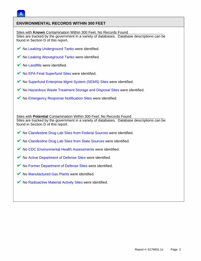
ENVIRONMENTAL RECORDS WITHIN 300 FEET
Sites with Known Contamination Within 300 Feet: No Records FoundSites are tracked by the government in a variety of databases. Database descriptions can befound in Section D of this report.
No Leaking Underground Tanks were identified.
No Leaking Aboveground Tanks were identified.
No Landfills were identified.
No EPA Final Superfund Sites were identified.
No Superfund Enterprise Mgmt System (SEMS) Sites were identified.
No Hazardous Waste Treatment Storage and Disposal Sites were identified.
No Emergency Response Notification Sites were identified.
Sites with Potential Contamination Within 300 Feet: No Records FoundSites are tracked by the government in a variety of databases. Database descriptions can befound in Section D of this report.
No Clandestine Drug Lab Sites from Federal Sources were identified.
No Clandestine Drug Lab Sites from State Sources were identified.
No CDC Environmental Health Assessments were identified.
No Active Department of Defense Sites were identified.
No Former Department of Defense Sites were identified.
No Manufactured Gas Plants were identified.
No Radioactive Material Activity Sites were identified.
Report #: 6176831.1s Page 2
B
ENVIRONMENTAL RECORDS BEYOND 300 FEET
Sites with Known Contamination Beyond 300 Feet: No Records FoundSites are tracked by the government in a variety of databases. Database descriptions can befound in Section D of this report.
No Leaking Underground Tanks were identified beyond 300 feet and within 1/2 mile.
No Leaking Aboveground Tanks were identified beyond 300 feet and within 1/2 mile.
No Landfills were identified beyond 300 feet and within 1/2 mile.
No EPA Final Superfund Sites were identified beyond 300 feet and within 1 mile.
No Superfund Enterprise Mgmt System (SEMS) Sites were identified beyond 300 feetand within 1/2 mile.
No Hazardous Waste Treatment Storage and Disposal Sites were identified beyond 300 feetand within 1/2 mile.
Sites with Potential Contamination Beyond 300 Feet: No Records FoundSites are tracked by the government in a variety of databases. Database descriptions can befound in Section D of this report.
No Clandestine Drug Lab Sites from Federal Sources were identified beyond 300 feetand within 1/8 mile.
No Clandestine Drug Lab Sites from State Sources were identified beyond 300 feetand within 1/8 mile.
No CDC Environmental Health Assessments were identified beyond 300 feetand within 1/4 mile.
No Active Department of Defense Sites were identified beyond 300 feet and within 1/4 mile.
No Former Department of Defense Sites were identified beyond 300 feet and within 1/4 mile.
No Manufactured Gas Plants were identified beyond 300 feet and within 1/4 mile.
No Radioactive Material Activity Sites were identified beyond 300 feetand within 1/4 mile.
Report #: 6176831.1s Page 3
C
UNLOCATED SITES
Government records occasionally lack sufficient address information for some sites to be accuratelyplotted to an exact location. The following site(s) may or may not be in a close proximity to thetarget property. Records where EDR can identify the site status as "closed" or "no further action" are notincluded in the following list.
Location Database(s) EDR ID #
No unlocated sites were found
Report #: 6176831.1s Page 4
D
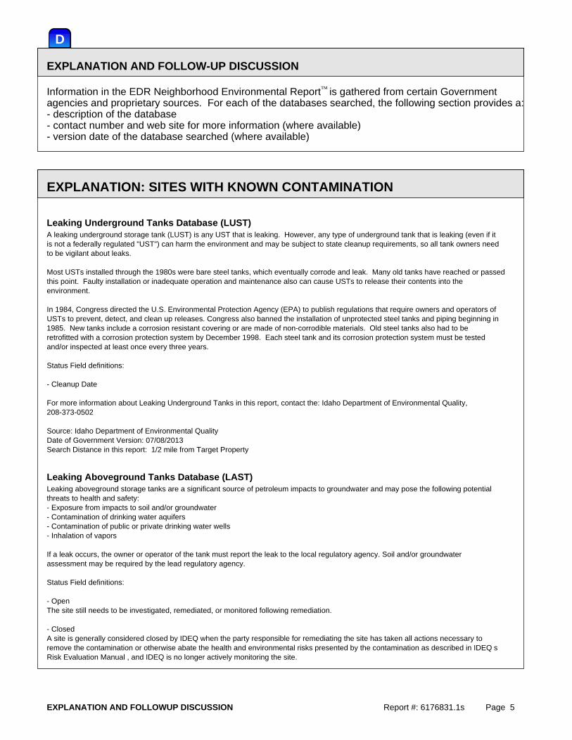
EXPLANATION AND FOLLOW-UP DISCUSSION
™Information in the EDR Neighborhood Environmental Report is gathered from certain Governmentagencies and proprietary sources. For each of the databases searched, the following section provides a:- description of the database- contact number and web site for more information (where available)- version date of the database searched (where available)
EXPLANATION: SITES WITH KNOWN CONTAMINATION
Leaking Underground Tanks Database (LUST)A leaking underground storage tank (LUST) is any UST that is leaking. However, any type of underground tank that is leaking (even if itis not a federally regulated "UST") can harm the environment and may be subject to state cleanup requirements, so all tank owners needto be vigilant about leaks.
Most USTs installed through the 1980s were bare steel tanks, which eventually corrode and leak. Many old tanks have reached or passedthis point. Faulty installation or inadequate operation and maintenance also can cause USTs to release their contents into theenvironment.
In 1984, Congress directed the U.S. Environmental Protection Agency (EPA) to publish regulations that require owners and operators ofUSTs to prevent, detect, and clean up releases. Congress also banned the installation of unprotected steel tanks and piping beginning in1985. New tanks include a corrosion resistant covering or are made of non-corrodible materials. Old steel tanks also had to beretrofitted with a corrosion protection system by December 1998. Each steel tank and its corrosion protection system must be testedand/or inspected at least once every three years.
Status Field definitions:
- Cleanup Date For more information about Leaking Underground Tanks in this report, contact the: Idaho Department of Environmental Quality,208-373-0502
Source: Idaho Department of Environmental QualityDate of Government Version: 07/08/2013Search Distance in this report: 1/2 mile from Target Property
Leaking Aboveground Tanks Database (LAST)Leaking aboveground storage tanks are a significant source of petroleum impacts to groundwater and may pose the following potentialthreats to health and safety:- Exposure from impacts to soil and/or groundwater- Contamination of drinking water aquifers- Contamination of public or private drinking water wells- Inhalation of vapors
If a leak occurs, the owner or operator of the tank must report the leak to the local regulatory agency. Soil and/or groundwaterassessment may be required by the lead regulatory agency.
Status Field definitions:
- OpenThe site still needs to be investigated, remediated, or monitored following remediation.
- ClosedA site is generally considered closed by IDEQ when the party responsible for remediating the site has taken all actions necessary toremove the contamination or otherwise abate the health and environmental risks presented by the contamination as described in IDEQ sRisk Evaluation Manual , and IDEQ is no longer actively monitoring the site.
EXPLANATION AND FOLLOWUP DISCUSSION Report #: 6176831.1s Page 5
For more information about Leaking Aboveground Tanks in this report, contact the: Idaho Department of Environmental Quality,208-373-0502
Source: Idaho Department of Environmental QualityDate of Government Version: 06/20/2011Search Distance in this report: 1/2 mile from Target Property
Landfills Database (SWF/LF)Across the country, many communities, businesses, and individuals have found creative ways to reduce and better manage Municipal SolidWaste (MSW) - more commonly known as trash or garbage - through a coordinated mix of practices that includes source reduction, recycling(including composting), and disposal. The most environmentally sound management of MSW is achieved when these approaches are implemented according to EPA’s preferred order: source reduction first, recycling and composting second, and disposal in landfills orwaste combustors last. Although source reduction, reuse, recycling, and composting can divert large portions of municipal solid waste(MSW) from disposal, some waste still must be placed in landfills. Modern landfills are well-engineered facilities that are located,designed, operated, monitored, closed, cared for after closure, cleaned up when necessary, and financed to insure compliance withfederal regulations. The federal regulations were established to protect human health and the environment. For more information about Landfills in this report, contact the: Idaho Department of Environmental Quality, 208-334-5860 orhttp://www.deq.idaho.gov/waste/assist_business/solid_waste/index.cfm
Source: Idaho Department of Environmental QualityDate of Government Version: 04/17/2013Search Distance in this report: 1/2 mile from Target Property
EPA Final Superfund Sites Database (NPL)EPA Final Superfund Sites Database (NPL) is the list of national priorities among the known releases or threatened releases of hazardoussubstances, pollutants, or contaminants throughout the United States and its territories. The NPL is intended primarily to guide the EPAin determining which sites warrant further investigation.
Superfund is the Federal government’s program to clean up the nation’s uncontrolled hazardous waste sites. Under the Superfund program,abandoned, accidentally spilled, or illegally dumped hazardous waste that pose a current or future threat to human health or theenvironment are cleaned up. To accomplish its mission, EPA works closely with communities, Potentially Responsible Parties (PRPs),scientists, researchers, contractors, and state, local, tribal, and Federal authorities. Together with these groups, EPA identifieshazardous waste sites, tests the conditions of the sites, formulates cleanup plans, and cleans up the sites. For more information about EPA Final Superfund Sites in this report, contact the: Environmental Protection Agency, Superfund Hotline,800-424-9346 or 703-412-9810, http://www.epa.gov/superfund/sites/npl/index.htm.
Source: Environmental Protection AgencyDate of Government Version: 04/26/2013Search Distance in this report: 1 mile from Target Property
EPA Proposed Superfund Sites Database (CERCLIS)The Comprehensive Environmental Response, Compensation, and Liability Act (CERCLA), commonly known as Superfund, was enacted by Congress on December 11, 1980. CERCLA contains information on hazardous waste sites, potential hazardous waste sites, and remedialactivities across the nation, including sites that are on the National Priorities List (NPL) or being considered for the NPL.
Superfund is the Federal government’s program to clean up the nation’s uncontrolled hazardous waste sites. Under the Superfund program,abandoned, accidentally spilled, or illegally dumped hazardous waste that pose a current or future threat to human health or theenvironment are cleaned up. To accomplish its mission, EPA works closely with communities, Potentially Responsible Parties (PRPs),scientists, researchers, contractors, and state, local, tribal, and Federal authorities. Together with these groups, EPA identifieshazardous waste sites, tests the conditions of the sites, formulates cleanup plans, and cleans up the sites. For more information about EPA Proposed Superfund Sites in this report, contact the: Environmental Protection Agency, 703-413-0223 orhttp://www.epa.gov/superfund/action/law/cercla.htm
Source: Environmental Protection AgencyDate of Government Version: 04/26/2013Search Distance in this report: 1/2 mile from Target Property
EXPLANATION AND FOLLOWUP DISCUSSION Report #: 6176831.1s Page 6
Hazardous Waste Treatment Storage and Disposal Sites Database (RCRAInfo)RCRAInfo is EPA’s comprehensive information system, providing access to data supporting the Resource Conservation and Recovery Act(RCRA) of 1976 and the Hazardous and Solid Waste Amendments (HSWA) of 1984. The database includes selective information on sites whichgenerate, transport, store, treat and/or dispose of hazardous waste as defined by the Resource Conservation and Recovery Act (RCRA). Transporters are individuals or entities that move hazardous waste from the generator offsite to a facility that can recycle, treat,store, or dispose of the waste. TSDFs treat, store, or dispose of the waste. For more information about RCRA Treatment, Storage and Disposal sites in this report, contact the: Environmental Protection Agency athttp://www.epa.gov/osw/
Source: Environmental Protection AgencyDate of Government Version: 07/11/2013Search Distance in this report: 1/2 mile from Target Property
Emergency Response Notification System (ERNS)Emergency Response Notification System, also known as The National Response System (NRS), is the government’s mechanism for emergency response to discharges of oil and the release of chemicals into the navigable waters or environment of the United States andits territories. Initially, this system focused on oil spills and selected hazardous polluting substances discharged into theenvironment. It has since been expanded by other legislation to include hazardous substances and wastes released to all types of media. For more information about Emergency Response Notification System in this report, contact the: National Response Center, United StatesCoast Guard, 800-424-8802 or http://www.nrc.uscg.mil/nrsinfo.html
Source: National Response Center, United States Coast GuardDate of Government Version: 12/31/2012Search Distance in this report: 300 feet from Target Property
EXPLANATION: SITES WITH POTENTIAL CONTAMINATION
Clandestine Drug Labs Sites from Federal Sources (US CDL)Clandestine Drug Labs Sites from Federal Sources is a listing of drug lab location from the U.S. Department of Justice ("theDepartment"). It contains addresses of some locations where law enforcement agencies reported they found chemicals or other items thatindicated the presence of either clandestine drug laboratories or dumpsites. In most cases, the source of the entries is not theDepartment, and the Department has not verified the entry and does not guarantee its accuracy. Members of the public must verify theaccuracy of all entries by, for example, contacting local law enforcement and local health departments. For more information about Clandestine Drug Labs from Federal Sources in this report, contact the Drug Enforcement Administration,202-307-1000
Source: Drug Enforcement AdministrationDate of Government Version: 08/06/2013Search Distance in this report: 1/8 mile from Target Property
Clandestine Drug Lab Sites from State Sources (CDL)Clandestine Drug labs are labs in which the Idaho State Police have investigated. The majority of clandestine drug labs manufacturemethamphetamine. These labs are set up in motels, houses, apartments, storage units, and vehicles. Hazardous chemicals are used that cancontaminate structural materials, furnishings, wastewater systems and soils. Local Health Jurisdictions assess properties to determinethe degree and extent of contamination of methamphetamine and chemical residues and biohazards such as hypodermic needles, feces, andblood. Proper decontamination is necessary to reduce the public health risks of injuries and hazardous exposures associated withclandestine drug labs. For more information about Clandestine Drug Lab Sites in this report, contact the: Idaho State Police, 208-884-7000
Source: Idaho State PoliceDate of Government Version: 07/22/2010
EXPLANATION AND FOLLOWUP DISCUSSION Report #: 6176831.1s Page 7
Search Distance in this report: 1/8 mile from Target Property
CDC Environmental Health Assessments DatabaseThe Agency for Toxic Substances and Disease Registry, ATSDR, is an agency of the U.S. Public Health Service. It was established byCongress in 1980 under the Comprehensive Environmental Response, Compensation, and Liability Act, also known as the Superfund law. Thislaw set up a fund to identify and clean up our country’s hazardous waste sites. The Environmental Protection Agency, EPA, and theindividual states regulate the investigation and clean up of the sites.
Since 1986, ATSDR has been required by law to conduct a public health assessment at each of the sites on the EPA National PrioritiesList. The aim of these evaluations is to find out if people are being exposed to hazardous substances and, if so, whether that exposureis harmful and should be stopped or reduced. If appropriate, ATSDR also conducts public health assessments when petitioned by concernedindividuals. Public health assessments are carried out by environmental and health scientists from ATSDR and from the states with whichATSDR has cooperative agreements.
Exposure: As the first step in the evaluation, ATSDR scientists review environmental data to see how much contamination is at a site,where it is, and how people might come into contact with it. Generally, ATSDR does not collect its own environmental sampling data butreviews information provided by EPA, other government agencies, businesses, and the public. When there is not enough environmentalinformation available, the report will indicate what further sampling data is needed.
Health Effects: If the review of the environmental data shows that people have or could come into contact with hazardous substances,ATSDR scientists then evaluate whether or not there will be any harmful effects from these exposures. The report focuses on publichealth, or the health impact on the community as a whole, rather than on individual risks. Again, ATSDR generally makes use of existingscientific information, which can include the results of medical, toxicologic and epidemiologic studies and the data collected indisease registries. The science of environmental health is still developing, and sometimes scientific information on the health effectsof certain substances is not available. When this is so, the report will suggest what further research studies are needed.
Conclusions: The report presents conclusions about the level of health threat, if any, posed by a site and recommends ways to stop orreduce exposure in its public health action plan. ATSDR is primarily an advisory agency, so usually these reports identify what actionsare appropriate to be undertaken by EPA, other responsible parties, or the research or education divisions of ATSDR. However, if thereis an urgent health threat, ATSDR can issue a public health advisory warning people of the danger. ATSDR can also authorize healtheducation or pilot studies of health effects, full-scale epidemiology studies, disease registries, surveillance studies or research onspecific hazardous substances.
For more information about CDC Environmental Health Assessments in this report, contact the: Center for Disease Control, 800-232-4636 orhttp://www.atsdr.cdc.gov/hac/pha/index.asp
Source: Center for Disease ControlDate of Government Version: 11/29/2007Search Distance in this report: 1/4 mile from Target Property
Active Department of Defense Site Database (DOD)Over the last 20 years, the Defense Environmental Restoration Program (DERP) has evolved into a mature program addressing environmentalrestoration activities at its active installation, base realignment and closure (BRAC) installation, and formerly used defense sites(FUDS). Reducing and managing risk is a central element of the DERP. In its earlier years, the DERP forcused heavily on theidentification, investigation, and cleanup of land impacted by decades of defense operations and training activities. As the programexpanded to include historic use of military munitions at its active installations, the program progressed from study to cleanup ofindustrial remediation of past contamination.
The DERP has also included demolition and removing unsafe buildings and structures primarily at former DoD properties that pose healthrisks to personnel and the general public. In all 50 states, the District of Columbia, and 8 U.S. territories, DoD is working to protectcitizens and our natural resources by restoring public lands. DoD has created two distinct programs within the DERP to most effectivelyaddress remediation of its sites. The Installation Restoration Program (IRP) primarily addresses sites impacted by hazardous substances.These sites are similar sites across the country contaminated from past practices at industrial and commercial areas, such as municipallandfills and factories. The IRP is a proven program with successes achieved over the past two decades. Through the newly establishedMilitary Munitions Response Program (MMRP), DoD can most effectively respond to unexploded ordnance and military munitions waste atareas other than operational ranges. In the coming years, DoD will develop the MMRP to mirror the successes of the IRP. For more information about Department of Defense Sites in this report, contact the: Department of Defense Cleanup Office, 800-225-3842or http://www.dtic.mil/envirodod/COffice/COWebL.htm.
Source: Department of Defense
EXPLANATION AND FOLLOWUP DISCUSSION Report #: 6176831.1s Page 8
Date of Government Version: 12/31/2005Search Distance in this report: 1/4 mile from Target Property
Former Department of Defense Sites Database (FUDS)Formerly Used Defense Sites (FUDS) as defined by the Defense Environmental Restoration Program Management Guidance are real properties that were under the jurisdiction of the Secretary of Defense and owned by, leased by, or otherwise possessed by the UnitedStates. Located throughout the United States, these properties are now owned by private individuals, corporations, state and localgovernments, federal agencies, and tribal governments. The OSD Cleanup Office is responsible for programming and budgeting for FUDSrequirements.
The Army is the executive agent for management of FUDS properties, while the U.S. Army Corps of Engineers (USACE) is the day-to-dayexecutor for all aspects of the program. FUDS project categories include, but are not limited to: -Hazardous, toxic and radioactive waste (HTRW);-Management of FUDS properties, while the U.S. Army Corps of Engineers (USACE) is the day- to-day executor for all aspects of the program;-Containerized HTRW;-Building demolition and debris removal;-Potentially responsible party sites;
USACE catalogs all FUDS properties on their site inventory, which details property locations, property number, a nd status ofpotentially hazardous findings. Three phases may be used to determine the restoration process at FUDS properties: Inventory,Investigation, and Cleanup. Once the property is confirmed as being formerly used by a defense agency, it is entered into the FUDSinventory. If contamination resulting from past Defense practices exists, an investigation must be conducted to determine the extent ofthe contamination and the appropriate response. Once these two phases are completed a cleanup process will begin to reduce the risk ofhuman health and the environment, or to improve public safety. Cleanup activities are accomplished based on priority sites posing thegreatest risks are addressed first. For more information about Formerly Used Defense Sites in this report, contact the: US Army Corps of Engineers, 202-528-4285 orhttp://hq.environmental.usace.army.mil/programs/fuds/fuds.html.
Source: U.S. Army Corps of EngineersDate of Government Version: 12/31/2011Search Distance in this report: 1/4 mile from Target Property
EDR Proprietary Manufactured Gas PlantsThe EDR Proprietary Manufactured Gas Plant Database includes records of coal gas plants (manufactured gas plants) compiled by EDR’sresearchers. Manufactured gas sites were used in the United States from the 1800’s to 1950’s to produce a gas that could be distributedand used as fuel. These plants used whale oil, rosin, coal, or a mixture of coal, oil, and water that also produced a significantamount of waste. Many of the byproducts of the gas production, such as coal tar (oily waste containing volatile and non-volatilechemicals), sludges, oils and other compounds are potentially hazardous to human health and the environment. The byproduct from thisprocess was frequently disposed of directly at the plant site and can remain or spread slowly, serving as a continuous source of soiland groundwater contamination.
Source: EDR Inc.Date of Government Version: 08/28/2009Search Distance in this report: 1/4 mile from Target Property
Radioactive Material Activity Sites Database (MLTS)Radioactive Material Activity Sites, also know as the Material Licensing Tracking System (MLTS), is maintained by the Nuclear RegulatoryCommission (NRC) and contains a list of sites which possess or use radioactive materials and which are subject to NRC licensingrequirements. MLTS database lists the NRC’s licenses issued for the operation of nuclear power plants, nuclear waste repositories ormedical, industrial, or research applications. The NRC is responsible for ensuring the public health and safety through licensing,inspection, and environmental reviews for all activities. For more information about Radioactive Material Activity Site in this report, contact the: Nuclear Regulatory Commission, 800-368-5642
Source: Nuclear Regulatory CommissionDate of Government Version: 07/22/2013Search Distance in this report: 1/4 mile from Target Property
EXPLANATION AND FOLLOWUP DISCUSSION Report #: 6176831.1s Page 9
EXPLANATION: FLOOD INFORMATION
Flood Zone Data: This data was obtained from the Federal Emergency Management Agency (FEMA). It depicts100- year and 500-year flood zones as defined by FEMA. It includes the National Flood Hazard Layer(NFHL) which incorporates Flood Insurance Rate Map (FIRM) data and Q3 data from FEMA in areas notcovered by NFHL. Source: FEMA Phone: 877-336-2627 Date of Government Version: 2003, 2015
Federal Contacts for Additional Information
Federal Emergency Management Agency 877-3362-627
State Contacts for Additional Information
Bureau of Disaster Services 208-334-3460
EXPLANATION: WETLANDS INFORMATION
NWI: National Wetlands Inventory. This data, available in select counties across the country, was obtained byEDR in 2004 from the U.S. Fish and Wildlife Service.
Federal Contacts for Additional Information
Fish & Wildlife Service 813-570-5412
State Contacts for Additional Information
Dept. of Fish & Games 208-334-3700
STREET AND ADDRESS INFORMATION(c) 2015 TomTom North America, Inc. All rights reserved. This material is proprietary and the subject ofcopyright protection and other intellectual property rights owned by or licensed to TomTom North America, Inc. The use of this material is subject to the terms of a license agreement. You will be held liable for anyunauthorized copying or disclosure of this material.
EXPLANATION AND FOLLOWUP DISCUSSION Report #: 6176831.1s Page 10
DISCLAIMER, COPYRIGHT AND TRADEMARK NOTICE
Terms, Conditions and Limitations of Liability
This Report contains certain information described herein pertaining solely to the exterior of the target property,which information was obtained from a variety of public and other sources reasonably available to EnvironmentalData Resources, Inc. Environmental Data Resources, Inc. does not produce, maintain or verify the informationcontained in these sources; and assumes, without independent investigation, that the information in such sourcesis accurate and complete. The Beneficiary (defined below) may contact the EDR Partner or Reseller who providedthis Report to obtain a list of the sources used to provide this Report. It cannot be concluded from this Report thatcoverage information for the target and surrounding properties does not exist from other sources.
This Report is intended solely for the individual use of the EDR Partner or Reseller as part of a service that theyprovide to the residential property buyer, seller, listing agent and selling agent ("Beneficiary"), and is notprovided for the benefit of any third parties (other than Beneficiary).
Any analyses, estimates, ratings or risk codes provided in this Report are provided for illustrative purposes only,and are not intended to provide, nor should they be interpreted as providing any facts regarding, or prediction orforecast of, any environmental risk for any property. Only a Phase I Environmental Site Assessment performed byan environmental professional can provide information regarding the environmental risk for any property. ThisReport is not a replacement for a home inspection. This Report does not provide information pertaining to theinterior of the target property such as, but not limited to: mold, asbestos, lead, radon or other issues.Additionally, the information provided in this Report is not to be construed as legal advice.
Environmental Data Resources, Inc. maintains liability insurance including limits of at least one million dollars($1,000,000.00) per occurrence. If an action is brought as a result of an error, inaccuracy or omission in thedisclosures included in this Report, and those errors, inaccuracies or omissions are caused by EnvironmentalData Resources, Inc., then Environmental Data Resources, Inc. shall provide a defense against an action andindemnify the Beneficiary or EDR Partner or Reseller against such claims. Such obligation shall not be effective ifthe Beneficiary or EDR-Certified Partner was aware of the error, inaccuracy or omission, or if the Beneficiary orEDR Partner or Reseller altered this Report and the alteration caused the error, inaccuracy or omission.
Beneficiary hereby indemnifies Environmental Data Resources, Inc. and EDR Partner or Reseller from and againstall third party claims, lawsuits and losses (including claims sounding in contract or tort, including negligence), andany claim brought by or against Beneficiary, against Environmental Data Resources, Inc. or against EDR Partner or Reseller, alleging loss or harm to be caused by information contained in this Report, if such claims are caused byan alteration of this Report by Beneficiary, or if Beneficiary was aware of any errors, inaccuracies or omissions inthis Report. This indemnification includes, but is not limited to prompt payment of all attorney?s fees and costsincurred by Environmental Data Resources, Inc. and EDR Partner or Reseller. Beneficiary hereby agrees that anydispute relating to or arising out of this Report shall be heard exclusively by a single arbitrator under the rules ofthe American Arbitration Association. The exclusive venue for the arbitration shall be in the State of Connecticut,New Haven County. Any arbitration award shall be enforced solely in the Federal or State Courts of the State ofConnecticut.
Beneficiary understands and acknowledges that Environmental Data Resources, Inc.’s service does not includedirect support to the Beneficiary. Beneficiary acknowledges that the EDR Partner or Reseller who provided theservice and this Report to Beneficiary is obligated to provide an explanation of the findings in this Report toBeneficiary. All questions, inquiries, and request for support and/or to requests to perform additional researchmust be directed to the EDR Partner or Reseller who provided the service and the Report. Environmental DataResources, Inc. shall be under no obligation or commitment to discuss this Report with Beneficiary.In the event any one or more covenants, clauses or provisions of this Notice shall be held invalid or illegal, suchinvalidity or unenforceability shall not affect any other provisions of this Notice.
ENVIRONMENTAL DATA RESOURCES, INC., AND EDR PARTNER OR RESELLER SPECIFICALLY DISCLAIMS
Report #: 6176831.1s Page 11
THE MAKING OF ANY EXPRESS OR IMPLIED WARRANTIES IN CONNECTION WITH THIS REPORT,INCLUDING WITHOUT LIMITATION, MERCHANTABILITY OR FITNESS FOR A PARTICULAR USE ORPURPOSE. IN NO EVENT SHALL ENVIRONMENTAL DATA RESOURCES, INC., OR EDR PARTNER ORRESELLER BE LIABLE TO ANYONE FOR SPECIAL, INCIDENTAL, CONSEQUENTIAL, OR EXEMPLARYDAMAGES, EXCEPT AS PROVIDED IN A.R.S. 33-423.
COPYRIGHT NOTICECopyright 2020 by Environmental Data Resources, Inc. All rights reserved. Reproduction in any media or format,in whole or in part, of any report or map of Environmental Data Resources, Inc., or its affiliates, is prohibitedwithout prior written permission.
TRADEMARK NOTICEEnvironmental Data Resources, Inc. and its logos (including EDR, Sanborn and Sanborn Map) are trademarks ofEnvironmental Data Resources, Inc. or its affiliates. All other trademarks used herein are the property of theirrespective owners.