Page 1
Report commissioned by the New
Zealand Geospatial Office and SIBA
NZ (Spatial Industries Business
Association), July 2012.
The
Geospatial
Skills
Shortage in
New Zealand
Mairéad de Róiste School of Geography, Environment and Earth Sciences, Victoria University of Wellington.
Page 2
1
Table of Contents Executive Summary ..................................................................................... 2
International Shortage .............................................................................. 2
A New Zealand Geospatial Skills Shortage ................................................... 2
Filling the Shortage from Within: Capacity Building through Training, Education
and Up-skilling ......................................................................................... 3
Recommendations .................................................................................... 3
1. Introduction ...................................................................................... 4
2. Defining „Geospatial‟ ........................................................................... 4
3. International Shortage ........................................................................ 6
Case study 1: The United States ................................................................ 6
Case study 2: The United Kingdom ............................................................. 8
Case study 3: Australia ............................................................................. 8
4. The New Zealand Case ....................................................................... 9
The Geospatial Sector in New Zealand ...................................................... 10
A Geospatial Shortage? ........................................................................... 11
Exploring the Skills Shortage ................................................................... 12
5. Filling the Shortage from Within: Capacity Building through Training,
Education and Up-skilling ........................................................................... 17
6. Conclusions ..................................................................................... 20
7. Recommendations ............................................................................ 21
8. Bibliography .................................................................................... 23
Appendix A: Development of the Survey and Participation Rates ..................... 26
Appendix B: The Survey ............................................................................. 29
Appendix C: Participating Organisations ....................................................... 40
Appendix D: Acknowledgments ................................................................... 44
Page 3
2
Executive Summary
This report was commissioned by the New Zealand Geospatial Office (NZGO) and
Spatial Industries Business Association, New Zealand (SIBA NZ). The report
addresses three main questions:
1. What evidence is there of a shortage in the workforce for people with
geospatial skills internationally?
2. What is the extent, if any, of a geospatial skills shortage in New Zealand?
3. If a skills shortage exists, what facilities are in place to address this
shortage?
International Shortage
There is broad agreement that the geospatial industry is a growth industry.
Additionally, a current shortage of geospatial professionals has been identified in
the U.S. and Australia. In Australia alone, this figure has been estimated at
between 3,000-4,000 currently unfilled positions. It is also estimated that this
shortage will grow.
A New Zealand Geospatial Skills Shortage
A similar geospatial skills shortage in New Zealand was identified through an
online survey of 157 organisations in the geospatial industry. The number of
current geospatial professionals in the industry was estimated by this report as
1,600 - 2,500. Over the last two years, 97 new positions were created in the
surveyed organisations over and above staff turnover and net of any
disestablished positions.
In addition to difficulties in filling vacant positions, there are various dimensions
to this shortage. Demand is highest for applicants with greater than five years‟
experience, however geospatial qualifications are also highly sought. New
Zealand competes internationally for the retention of geospatial professionals.
Opportunities for graduates to gain initial experience through internships and
apprenticeships are limited and some organisations raised concerns about
graduate employment prospects. Other organisations, however, found difficulties
in recruiting graduates. Shortages across a number of geospatial areas were
identified with the greatest shortages associated with database, programming
and spatial reasoning and problem-solving skills. The geospatial sector is
primarily urban based and rural recruitment difficulties may be amplified. A
subsequent effect of the difficulty in recruiting geospatial professionals is that
Page 4
3
inexperienced and under-skilled staff may be appointed. Related to this is a lack
of awareness outside of geospatial professionals of the potential benefits in using
geospatial techniques within an organisation.
Filling the Shortage from Within: Capacity Building through Training,
Education and Up-skilling
Geospatial qualifications offered by tertiary institutions in New Zealand have
grown over the last five years. Professional certification is also gaining traction.
While most organisations believe that there are sufficient education opportunities,
graduates alone are unlikely to meet current industry demand. Attracting
students into these qualifications is difficult as most postgraduate qualifications
require potential students to have already completed a relevant undergraduate
degree. Education pathways are not obvious for secondary school students
wishing to specialise in this area. Furthermore, few organisations particularly
target positions at geospatial graduates through internships and apprenticeship
streams. Once in a role, most geospatial professionals are supported by their
organisation to pursue a number of different up-skilling options, primarily through
conference and training courses rather than academic qualifications.
Recommendations
This report makes five recommendations.
1. The addition of „Other Spatial Scientist‟ to the New Zealand long term
skills shortage list in order to attract qualified and experienced geospatial
professionals.
The remaining four recommendations are key areas identified for consideration in
the report.
2. The development of clear graduate pathways for new graduates wishing to
gain initial industry experience.
3. Supporting current staff in the attainment of skills, especially recognised
academic qualifications.
4. Raising awareness of geospatial careers with secondary school students.
5. Raising awareness amongst managers and other key stakeholders of the
possible benefits of applying a geospatial approach.
Page 5
4
1. Introduction
The geospatial industry is a growth area in New Zealand but anecdotally, there is
a shortage of geospatial skills. This shortage has been cited as one of the main
barriers to the realization of the economic value of geospatial information and
services in the country (Forne 2010). ACIL Tasman (2009) estimate that the
geospatial industry added $1.2 billion to the New Zealand GDP in 2008. For the
same year, ACIL Tasman estimate that a further $481 million was lost due to the
skills shortage and other barriers. This loss carries associated tax revenue of
$100 million. ACIL Tasman also suggest that the negative economic effects of
these barriers are likely to grow unless notable issues, including the skills
shortage, are addressed.
The three aims of this report are: first, to review the evidence for any shortage in
the workforce for people with geospatial skills internationally, second, to establish
the extent, if any, of a geospatial skills shortage in New Zealand and third, if a
skills shortage exists, to ascertain what facilities are in place to address this
shortage.
We begin this report by describing the geospatial sector and defining key
concepts, such as what constitutes geospatial skills (Section 2). We then review
international literature, including published employment projections, to ascertain
the international demand for geospatial skills (Section 3). We focus our attention
on three case studies; the U.S., the U.K. and Australia. In Section 4, we report
on the findings of a national survey of the geospatial sector in New Zealand. This
survey confirms the anecdotal evidence of a geospatial skills shortage and sheds
light on the dimensions and implications of this shortage. In the following section
(Section 5), we explore the current capacity building efforts to fill the shortage
and particularly examine current educational pathways. We conclude in Section 6
with how New Zealand fits into the global need for augmentation of a skilled
geospatial workforce, and finally offer some recommendations in Section 7.
2. Defining ‘Geospatial’
The geospatial industry in New Zealand revolves around the use, collection,
management, analysis, presentation, and dissemination of data referenced to a
spatial location on the Earth‟s surface. Information with a spatial location, such
as addresses or census areas, can be combined and transformed to work with
Page 6
5
numerous available datasets to better manage current resources or to reveal new
information or patterns, for example, to explore new areas for business expansion.
The geospatial industry spans both the private and public sectors and comprises
both users and producers of geospatial skills, services, data, software and
hardware. As a user, geospatial techniques can be an approach or set of tools
used to support an organisation‟s core business or elements of their business.
For example, industry may use geospatial software and data to streamline
logistics or to analyse their customer base. As a producer, geospatial techniques
or datasets are marketable products and are sold to support geospatial use in
other organisations. While consultancy companies play a large role in this area,
data provision is also a key aspect, e.g. aerial or satellite photography, house
prices or elevation data.
In comparison to other sectors in the economy, government is a key user of
geospatial skills and products as well as a significant stakeholder in the sector
from regulatory and policy viewpoints. Government is also, in some cases, a
supplier of datasets, e.g. census information, topographic maps or aerial
photographs. Government geospatial use extends across all scales of local,
regional and central government.
While geospatial occupations can include surveyors and cartographers, we use a
more constrained definition for this report, except where explicitly stated.
Specifically, we use the ANZSCO (Pink & Bascand 2009) definition for „Other
Spatial Scientist‟ below to refer to geospatial professionals.
Acquires, integrates, analyses, interprets, presents, manages and
distributes information about locations in space and time, and develops
related equipment, software and services.
This definition encompasses varied uses of geospatial technology and the skills
required for these occupations fall under the broader terminology for geographic
information science (GISc). Geospatial professionals utilize numerous geo-
technological approaches, some of which have a long history in science, while
others employ the most current and innovative satellite and computer based
technologies (Estaville 2010). The umbrella term of „geospatial technology‟
incorporates skills in spatial modelling, surveying, global positioning systems
Page 7
6
(GPS), geographic information systems (GIS) and traditional cartography
techniques (Estaville 2010).
3. International Shortage
In 2004, the geospatial workforce was heralded as one of the fastest growing
areas of employment globally (Gerwin 2004). The potential uses of geospatial
technologies are vast and span applied governmental, academic and private
commercial sectors (Gerwin 2004). According to the National Aeronautics and
Space Administration (NASA), advancements in geospatial technologies, such as
satellites for global mapping, will have as profound an impact on daily life as the
computer has during the last half century (Gaudet & Annulis 2008).
TechNavio, a market analysis firm, estimate that the GIS technology market will
grow at an annual growth rate of 9.2% to 2015 (TechNavio 2012a) with growth in
the U.S. and Europe to outstrip this (TechNavio 2012b & 2011). Predicted growth
in the Asia Pacific region is a still strong, but more restrained at 7.8% (Technavio
2012c). Growth in GIS use has also increased in Asia and Africa (Research and
Markets 2010).
These growth figures reflect buoyancy in the sales and development of software
but are also indicative of increasing demand for the software tools to undertake
geospatial processes. However, taking advantage of these technologies across
such a broad spectrum of industries and governmental agencies requires a large
pool of highly trained employees from which to draw.
Case study 1: The United States
Recent advancements in geospatial technologies have had an enormous impact
on the U.S. economy. In 2004, NASA estimated that the geospatial market would
increase from $5 billion to $30 billion by 2005 (Gerwin 2004) and the U.S.
Department of Labour projected that the growth in the geospatial workforce
would continue at a rate of 35% per annum (U.S. DOLETA 2005). Today, the
geospatial industry is still classified as a „high growth industry‟ (U.S. DOLETA
2010). It is clear, therefore, that Gerwin‟s estimates in 2004 of a projected boom
in employment for trained geospatial scientists in the workforce were correct.
Furthermore, Estaville (2010) predicted that employment will grow across all
sectors of the geospatial industry to 2016 with an estimated increase of 14-20%
for geoscientists, mapping technicians, cartographers and photogrammetrists.
Page 8
7
While the growth of the industry and the opportunities for geospatial employment
were met with enthusiasm (Gerwin 2004), there is concern within the industry
that employment needs are not being met (DiBiase et al. 2006; Solem et al.
2008). Indeed, the advancements in GIS and satellite technologies are worryingly
out of step with the level of training in the current workforce, with several studies
highlighting a geospatial skills shortage in both private and governmental sectors
(Estaville 2010). The National Intelligence Agency projected the need for 7,000
new employees in the U.S. trained specifically in remote sensing by 2014. Solem
et al. (2008) identified GIS and cartography as the most sought after geospatial
skills among some 447 U.S. governmental and business organizations. Reports
from the U.S. Department of Labour also highlighted that 87% of geospatial
technology providers stated difficulties in filling positions requiring geospatial
skills (DiBiase et al. 2006). The advancements in global satellite technology
certainly require a highly skilled workforce, however, there is also a shortage of
GIS technicians with base-line proficiencies in using the „off the shelf‟ GIS
programmes (Marble 1998; Marble 2006). Of yet further concern is the imminent
retirement of many of NASA‟s and the Renewable Natural Resources Foundation‟s
senior and most skilled employees (Estaville 2010), which will leave some of the
highest positions in the governmental geospatial workforce vacant.
The solution for filling the growing requirement for geospatial skills in the
workforce is two-fold. First, the next generation of young employees needs to be
trained to the high standards demanded by the industry. Second, to achieve this
standard there is a need to attract new students and trainees into geospatial
programmes. In the past five years, there has been some success across
University campuses in this regard. An analysis of U.S. geography programmes
from 2007-2008 revealed that 188 of the 209 Universities and 8 of the 13 listed
Community Colleges had specialized programmes in GIS (Estaville 2010). GIS
certificate programmes were established across 120 U.S. universities in response
to the growing needs of the geospatial industry (DiBiase et al. 2006), particularly
those jobs identified by Marble (2006) for basic training in GIS. Further, higher
education institutes developed 80 GIS certificate programmes directly in response
to the geospatial industry (AAG, 2008; Estaville, 2010). Other organizations, such
as the Urban and Regional Information Systems Association, developed GIS
certificate programmes that have since become national programmes. These
programmes have graduated some 4,500 spatial scientists and the steps are
clearly positive. However, when viewed in parallel to growing demands of the
Page 9
8
industry, they are likely to only meet some of the demand of the U.S. geospatial
workforce.
Case study 2: The United Kingdom
The UK geospatial industry is well developed and professionalised (Broeders,
2011) with professional associations, such as the Association for Geographic
Information (AGI1). The entrenchment of the industry is reflected in the education
sector, with substantial educational and training options available. The geospatial
website, GoGeo, lists 31 higher education institutions offering GIS programmes of
study; many of which offer several separate GIS programmes at both
undergraduate and postgraduate levels. Additionally, 15 private providers are
listed, plus 7 providers of short courses (GoGeo, 2012).
Given the number of courses and qualifications available and a lack of literature,
it seems that current demand for geospatial professionals is being met. However,
it is predicted that geospatial skills will be increasingly in demand, aiding and
aided by economic revitalisation (Donert, 2012). For the UK, this increased
demand for geospatial skills is likely to be predominantly in non-geospatial
professional roles (Haklay, 2010). These are roles where geospatial skills
complement the main workload of the staff member, e.g. hydrology and planning.
In particular, the UK has seen a surge in free geographic data, but for the value
of that data to be realised, a broad range of professionals need the fundamental
geospatial skills to understand, manipulate and use that data (Donert, 2012).
Case study 3: Australia
High demand for geospatial technologies has also occurred in Australia. The
geospatial industry is currently estimated to contribute $10 billion to the annual
Australian GDP (ACIL Tasman 2008). However, SIBA Australia estimated a
shortage of 3,000-4,000 geospatial professionals to meet the demands of the
geospatial industry (CRCSI 2011)2. Given that the Department of Sustainability
and Environment estimated in 2010 that there were some 51,000 full-time
geospatial professionals in Australia, this deficit is significant (Allen Consulting
Group 2010). SIBA Australia also projected that Queensland alone requires the
re-training of a minimum of 300 mid-career workers due to technological
advancements (CRCSI 2011). As in the U.S., the Australian workforces are aging
and there is a need for young highly trained individuals to move into the
1 http://www.agi.org.uk/ 2 This is a wider definition of geospatial and includes cartographers and surveyors.
Page 10
9
imminent vacant positions. SEAC (2007) raised this concern and cited, based on
data collected in 2001, that one quarter of the male workforce employed in
geospatial positions were aged over 50 years. Only 20% of the total workforce is
between the ages 20-29 whereas 43% are between 60-64 years (SEAC 2007).
There is a growing discrepancy between the demand for geospatial skills and the
number of available trained geospatial workers across sectors in Australia. This
discrepancy may be due, in part, to a lack of university level education
programmes for spatial scientists. Many Australian universities amalgamated their
spatial sciences departments or closed them altogether (SEAC 2007; SSSI 2011).
University programmes from nine institutions in 2007 had 1,400 undergraduate
students enrolled in spatial sciences programmes, with an estimated 220-250
graduates per year (SEAC 2007). This number is not high enough to fill the
internal shortage. It has been suggested that difficulties in attracting students to
geospatial programmes is a large factor in the low enrolment rates (SSSI 2011;
SEAC 2007).
4. The New Zealand Case
In this report, a disparity between the growth in the geospatial industry and the
availability of geospatial employees has been identified in the U.S. and Australia.
Anecdotally, evidence exists for a similar geospatial skills shortage in New
Zealand, however, information on the extent of this shortage and its dimensions
are lacking.
This section of the report provides an overview of the geospatial sector in New
Zealand and explores whether and to what extent a geospatial skills shortage in
New Zealand exists. This section draws upon the results of an online survey
conducted in May-June 2012. The development of the survey, and participation
rates are detailed in Appendix A. The survey itself is included as Appendix B.
The results of this survey were rich and as such, the information presented in this
section is a summary of the information collected. The survey was anonymous
and while an individual participant reflects the view of a particular organisation,
individual‟s names, contact details or organisation identifiers were not captured or
stored with their responses. While voluntary, most organisations who
participated in the survey were willing to supply their organisation name. The
participating organisations are listed in Appendix C. The remainder of this section
is divided into three: a description of the geospatial sector in New Zealand, the
Page 11
10
recruitment experiences of the different organisations and a discussion on the
dimensions and existence of a geospatial shortage for New Zealand.
The Geospatial Sector in New Zealand
Organisations employing geospatial professionals span a multitude of sectors3.
The ACIL Tasman (2009) report on Spatial Information in the New Zealand
Economy explores the current use of geospatial skills and technologies across a
number of different sectors. These are government (e.g. LINZ, local government,
New Zealand Transport Agency and NIWA), services (e.g. consulting and mapping
services), manufacturing, trade and retail services, construction, agriculture, food,
fishing, forestry, transport, communication and utilities, minerals and mining, and
tourism. The value of geospatial techniques and technologies to these
organisations differs. Organisations may provide or consume geospatial skills and
services and the division between the demand for and supply of geospatial skills
and services is not absolute. For example, organisations may create datasets for
internal use but also sell these externally. 45% of the organisations surveyed did
not supply geospatial skills and services. The supply of geospatial skills and
services by the remaining organisation varied across a range; for 12% of
organisations this was a primary role, 10% were major suppliers and 32% were
minor suppliers. Inversely, most organisations were minor geospatial consumers
(53%), yet geospatial techniques were seen as providing significant support for
the core business of the organisation (61%).
On average, organisations had 5 full time geospatial staff working in the 157
organisations, another 1 geospatial position where geospatial was the main but
not the only workload (50-75% of workload), and 0.4 part time geospatial staff.
For the organisations surveyed, these figures total a geospatial workforce of 926.
In addition to these primary geospatial positions, a further 8 staff on average had
geospatial roles which formed a significant but not the main part of their workload.
As geospatial professionals can be employed in a range of sectors and in
supporting an organisation in a range of roles, there are difficulties in estimating
the true numbers of skilled employees within the workforce; a fact consistent with
studies elsewhere (DiBiase et al. 2006; Marble 1998; Estaville 2010). Estimates
of the size of the sector are further complicated by a lack of clear professional
identity which means individuals working in the sector will be assigned to other
professions in a national census. However, from the figures gathered in this
3 See Appendix C for the sectors represented by the participating organisations.
Page 12
11
survey an estimate of the size of the geospatial sector in New Zealand is possible.
These estimates rely on a number of assumptions. First, the responding
participants in the survey are representative of the organisations included in the
mailing list but who did not respond. The survey had a 69% response rate.
Second, since the mailing list compiled is not complete, we must estimate the
total population of geospatial organisations. In particular, the government sector
was well represented as the use of geospatial technologies or otherwise in their
operations is not commercially sensitive information. However, the private sector
is harder to identify and a database of geospatial organisations is not available.
Additionally, there was a focus in the compiled mailing list on ESRI software users
due to ease of access to this data. Consequently, the authors estimate that this
study contacted approximately a third to a half of private geospatial
organisations4. In light of these assumptions, it is estimated that the geospatial
workforce in New Zealand (as defined by ANZSCO) comprises of 1,600 – 2,500
workers. Conservatively, the lower end of this range is less than twice the
number of geospatial professionals captured by this survey reflecting the survey‟s
response rate. In contrast, the 2006 New Zealand census recorded 1,779
surveyors and cartographers which are outside this definition.
A Geospatial Shortage?
The geospatial sector in New Zealand is a strong growth sector, in contrast to
much of the New Zealand economy. Over the last two years, 97 additional roles
were filled in the organisations surveyed over and above the replacement of staff
(94) and the disestablishing of 55 roles. Of the 246 filled positions across 50% of
surveyed organisations, 62% were new roles, 77% were filled by New Zealand
applicants, and 23% were filled by recent New Zealand graduates.
Despite strong growth in the sector, 55.5 positions remain unfilled and are
current vacancies. This equates to 6% of the current workforce and affects 19%
of organisations. Of these, only 40% are currently advertised. In 30 advertised
positions, the vacancies could not be filled as applicants did not have appropriate
experience (57%), suitable qualifications (20%), or were unable to work in New
Zealand (7%). These figures highlight recruitment difficulties for geospatial
organisations.
4 This takes into account that not all ESRI users were contacted as well as users
of other software, e.g. MapInfo, Manifold and open source alternatives.
Page 13
12
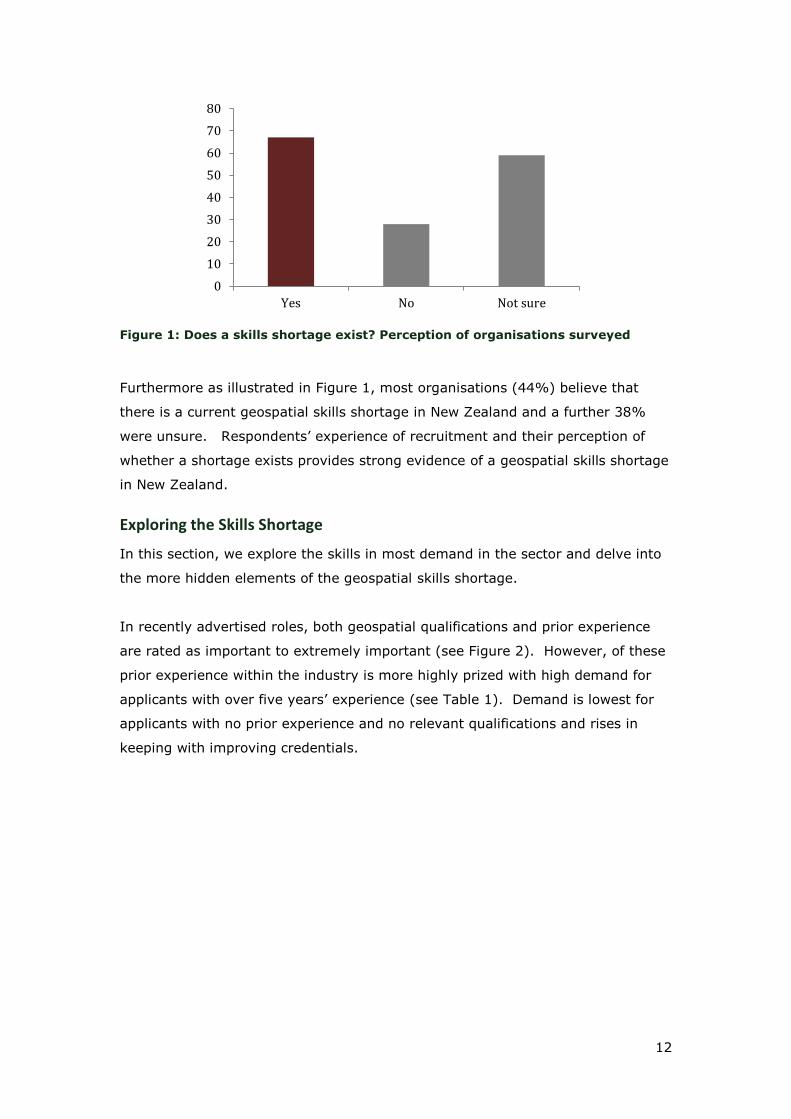
Figure 1: Does a skills shortage exist? Perception of organisations surveyed
Furthermore as illustrated in Figure 1, most organisations (44%) believe that
there is a current geospatial skills shortage in New Zealand and a further 38%
were unsure. Respondents‟ experience of recruitment and their perception of
whether a shortage exists provides strong evidence of a geospatial skills shortage
in New Zealand.
Exploring the Skills Shortage
In this section, we explore the skills in most demand in the sector and delve into
the more hidden elements of the geospatial skills shortage.
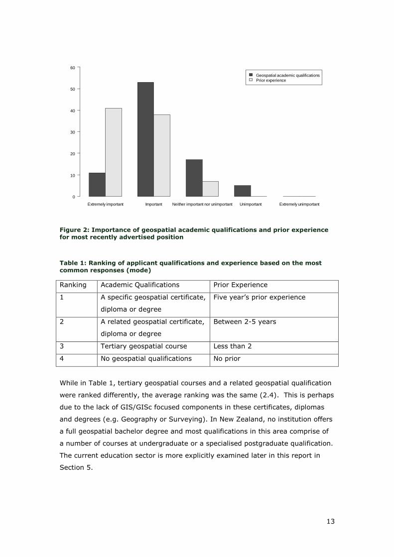
In recently advertised roles, both geospatial qualifications and prior experience
are rated as important to extremely important (see Figure 2). However, of these
prior experience within the industry is more highly prized with high demand for
applicants with over five years‟ experience (see Table 1). Demand is lowest for
applicants with no prior experience and no relevant qualifications and rises in
keeping with improving credentials.
0
10
20
30
40
50
60
70
80
Yes No Not sure
Page 14
13
Figure 2: Importance of geospatial academic qualifications and prior experience for most recently advertised position
Table 1: Ranking of applicant qualifications and experience based on the most common responses (mode)
Ranking Academic Qualifications Prior Experience
1 A specific geospatial certificate,
diploma or degree
Five year‟s prior experience
2 A related geospatial certificate,
diploma or degree
Between 2-5 years
3 Tertiary geospatial course Less than 2
4 No geospatial qualifications No prior
While in Table 1, tertiary geospatial courses and a related geospatial qualification
were ranked differently, the average ranking was the same (2.4). This is perhaps
due to the lack of GIS/GISc focused components in these certificates, diplomas
and degrees (e.g. Geography or Surveying). In New Zealand, no institution offers
a full geospatial bachelor degree and most qualifications in this area comprise of
a number of courses at undergraduate or a specialised postgraduate qualification.
The current education sector is more explicitly examined later in this report in
Section 5.
Extremely important Important Neither important nor unimportant Unimportant Extremely unimportant
Geospatial academic qualifications
Prior experience
0
10
20
30
40
50
60
Page 15
14
As demand is lower for new graduates compared with those with greater work
experience, concerns about the ease of gaining a position as a recent graduate
were raised.
“There seems to be … reduced opportunity for grads to get the important
first two years of experience in "production" environments”
However other respondents felt graduates were also scarce.
“There does not appear to be enough NZ born graduates available. Doing
OE???”
Few organisations (15%) offer a graduate apprenticeship programme or an
internship scheme with internships more commonly offered than apprenticeships.
Expectations surrounding initial geospatial roles may also be a deterrent and
qualified applicants will not expect to take on more traditional entry roles in a
buoyant market.
“I was extremely lucky to get the GIS job straight out of my postgraduate
degree. Others on my course were not so lucky and have had to move on
to a different field of study in order to find work, without having to resort
to data-entry positions.”
Developing local graduates and providing clear entry pathways into industry to
gain hands-on experience through apprenticeships and internships is important
but, as yet, limited in New Zealand.
Respondents were also asked to rank the importance of specified geospatial skills
for their most recent roles. Of the 8 skills, 6 were deemed important (both mean
and median values less than 3) (Table 2) with geospatial software familiarity with
at least one software as extremely important. Both application development
programming and remote sensing were seen as less relevant.
Page 16
15
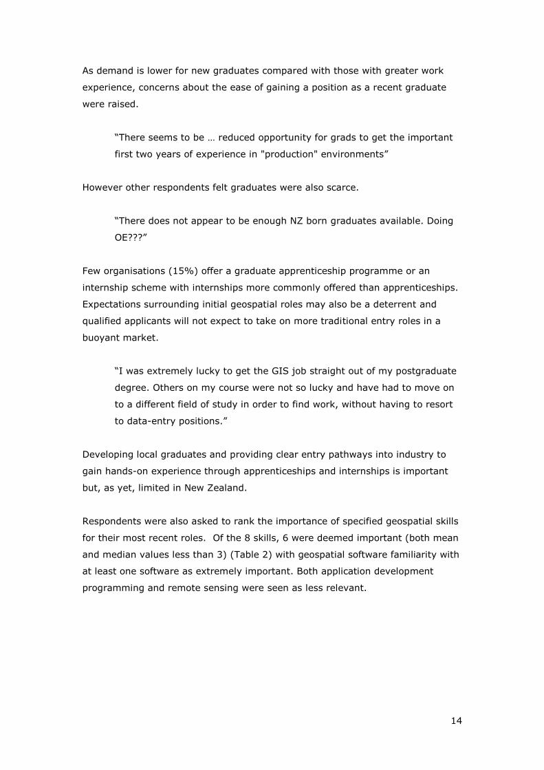
Table 2: Importance of different geospatial skills for the most recent vacancy
Geospatial Skill Median Mean Importance
Geospatial software familiarity with at least one software 1 1.55
Extremely Important
Spatial reasoning and spatial problem solving 2 1.87
Important
Geospatial database familiarity 2 2.05
Cartographic skills 2 2.42
Familiarity with servers 2.5 2.56
End user programming (e.g. coding to automate own work processes) 2.5 2.7
Application development programming 3 2.85 Neither Important nor Unimportant Remote sensing 3 3.27
Shortages across all 8 geospatial skills were identified, with the strongest
shortage acknowledged for geospatial database familiarity, application
development programming, spatial reasoning and problem-solving and end user
programming (Table 3).
Table 3: Skill shortages identified by the number and proportion of organisations
surveyed
Geospatial Skill Frequency %
Application development programming 45 67%
Spatial reasoning and spatial problem solving 45 67%
Geospatial database familiarity 45 67%
End user programming (e.g. coding to automate own work processes)
38 57%
Geospatial software familiarity with at least one software
31 46%
Remote sensing 29 43%
Cartographic skills 29 43%
Familiarity with servers 24 36%
The lack of emphasis on remote sensing and application development skills in
terms of importance for recent roles and their identification as a shortage area is
not as contradictory as it first appears. These are specialised skills and
consequently will not be demanded for each geospatial role. However, remote
sensing in New Zealand is not well developed and there is a lower awareness of
the value of this skill set.
“Photogrammetry and remote sensing training is very specialised and
often not undertaken in New Zealand.”
Page 17
16
Other dimensions of the shortage are also worth noting as they may have policy
implications. Most geospatial positions are located in the three main population
centres and some respondents raised questions over whether the shortage was
prevalent in rural areas.
“There had been little or no response to the job advertisement in that time
[couple of years] - possibly partly to do with location (rural NZ town rather
than city).”
New Zealand is also competing against strong markets internationally and with
Australia in particular for geospatial professionals (e.g. “Our GIS staff are moving
off shore to Australia”). This has resulted in the loss of valued staff to higher
paying opportunities.
A further less visible dimension of the shortage concerns the qualifications, skills
and experience of current staff.
“Very few of our staff have more advanced geospatial skills. Most have
basic knowledge from using webmaps etc. to browse data but very few
have experience using more advanced tools and analysis.”
While there is a high number of unfilled positions and many respondents found it
difficult to hire staff, a further consequence is that inexperienced and under-
skilled staff may be appointed, e.g. “Many small local authorities struggle to
employ graduates in GIS and therefore rely on non-qualified, but experienced GIS
staff”. These under-skilled staff may not be aware of more efficient alternatives
to their current work practices and, as one respondent wrote, “… do not
demonstrate sufficient skills to grow their roles.” Staff who are experienced but
under-qualified may also experience difficulties in gaining employment elsewhere
in the industry if their positions are disestablished.
A related element is a lack of awareness of the potential of a geospatial approach
in an organisation beyond the geospatial staff (e.g. “There is a huge lack of
geospatial capability awareness across government and commercial organisations,
so demand is suppressed”). This issue was identified for New Zealand (ACIL
Tasman 2009) but is also a factor internationally. Following from this, other
barriers identified by ACIL Tasman (2009) for New Zealand, such as data
interoperability, are more difficult to surmount if awareness of the issues and the
Page 18
17
required skills to overcome the obstacles are lacking. However, certain sectors
are recognising the potential of a geospatial approach and in particular, GIS use
within Iwi is growing.
5. Filling the Shortage from Within: Capacity Building through
Training, Education and Up-skilling
Filling the identified geospatial skills shortage in New Zealand requires the
building of national capacity. Geospatial education in New Zealand has grown
over the last five years with a number of institutions offering new qualifications
and courses. Most respondents (55%) believe that there are sufficient geospatial
training, education and up-skilling options currently available in New Zealand,
however 25% are unsure and 21% do not agree. Nonetheless, a number of
issues remain. First, what qualifications are available for potential geospatial
professionals? Second, are these qualifications producing enough graduates to fill
industry demand? Third, are the pathways to work clear and achievable for these
graduates? And finally, given the skills shortage and under-skilling in the
industry, to what extent is industry supporting the up-skilling, further training
and re-skilling of their staff? Each of these questions are dealt with in this section
of the report.
Following is an overview of the different geospatial qualifications currently
available in New Zealand. The overview is primarily based on a review of the
tertiary institution websites and as such, may be out of date. At the tertiary
undergraduate level, degree, certificate and diploma courses in GIS are generally
unavailable to students. Exceptions to this include the Bachelor of Applied
Science majoring in GIS at the University of Otago, a short course certificate in
GIS and GPS at Waiariki Institute of Technology, and certificate of proficiency
options at other tertiary institutes where students can take individual or multiple
GIS courses. GIS courses are generally housed within the Geography
programmes, exceptions include the Surveying and Information Management
programmes at the University of Otago and Forestry in Waiariki IT.
At postgraduate level, the choice of geospatial qualification is wider. Recently,
the University of Canterbury and Victoria University of Wellington launched a joint
Masters and Postgraduate Diplomas in Geographic Information Science
(MGIS/PGDipGIS). Massey University offer a long standing Postgraduate Diploma
in Arts (Geographic Information Systems) and a Master of Philosophy (GIS). The
Page 19
18
University of Auckland offer a Postgraduate Diploma of Science in GIS since 2010.
The University of Waikato offer a graduate specialisation in GIS as part of their
honours, Postgraduate Certificate and Postgraduate Diploma programmes in
Geography. The University of Otago offer Postgraduate Diplomas in Science and
Applied Science in Geographic Information Systems, a Masters of Applied Science
in GIS and a major in GIS for an Applied Science Honours programme. Of these,
Massey University provides a distance option for students while the other courses
are delivered in situ.
Not all GIS courses are delivered in tertiary institutions and vendor courses in
ESRI ArcGIS and MapInfo are also frequently available covering basic to more
advanced applications, such as server installation and content delivery. These
are usually short block courses targeted towards particular software functions and
most expect attendance rather than requiring the students to achieve a particular
standard.
The advantage of academic geospatial courses, where the attainment of skills is
assessed, over vendor specific courses is that the teaching of concepts and
exposure to multiple software products is possible. In practice, however, most
academic institutions use a single software provider for much, if not all, of their
teaching.
A third means of gaining recognition of geospatial skills is a professional
certification. The SSSI provide a number of relevant certifications; GISP-AP for
Spatial Information Professionals, RSP for Remote Sensing Professionals and
General Certification for Spatial Professionals (SSSI n.d.). These certifications
require a “formal tertiary education in a particular spatial science discipline”,
professional experience, and involvement in the wider profession, e.g. mentoring
and conference contributions. They encourage continued professional
development through attendance of conferences and workshops.
To answer the second of our capacity building questions, are these qualifications
producing enough graduates to fill industry demand? Many students enrolled in
postgraduate geospatial programmes are completing the programme part time
and are currently employed in the industry. Additionally, the absolute numbers of
students taking each tertiary qualification is relatively small (approx. 10-15).
Given these restrictions and the attraction of more highly paid overseas markets
Page 20
19
for graduates, the current shortage is unlikely to be filled by current numbers of
graduates.
As in Australia, attracting students onto geospatial education pathways is difficult.
The interdisciplinary and dynamic nature of the sector can make informing
students and their teachers about geospatial pathways challenging. Added to this,
many geospatial qualifications are gained at a postgraduate level and few
undergraduate courses are provided, so interested secondary school students do
not have a clear pathway to employment in this sector. The increasing
professionalization of the industry through named academic qualifications and
professional certification may help define this area more clearly. But current
steps are taken on an ad hoc basis and lessons may be learnt from similar
professionalization journeys in other industries, e.g. architecture and accountancy.
In New Zealand, spatial analysis has been recently added to the secondary
geography curriculum. The curriculum now offers two spatial analysis
achievement standards at levels 1 and 2 (approx. 15 and 16 year old students).
But these standards are not required for all geography students and are studied
at the discretion of their schools. This initiative was supported by the Board of
Geography Teachers and subsequently one of the geospatial software vendors
(Eagle Technology) developed modules to reduce the barriers to the selection of
these standards. The effectiveness of the initiative in attracting students to this
industry will take a number of years to measure and is dependent on awareness-
raising among schools and geography teachers.
The third capacity building question concerns whether current graduates have
established methods to gain initial experience. Of those organisations surveyed,
only 15% offered internships or graduate apprenticeships. These intern and
apprenticeships were provided by larger organisations and with larger number of
geospatial staff. However, not all organisations of this size followed this method
of graduate recruitment and these methods are not standard practice in the
industry.
Given the skills shortage and the capability building issues identified above, are
industry supporting the up-skilling, further training and re-skilling of their staff?
There is recognition of the need for continued professional development in a
dynamic industry with changing skill requirements and a skills shortage. Most
organisations offer at least one type of in-house training (83%) and support
Page 21
20
attendance of vendor courses (74%) and conferences (88%). However, few
organisations provide support to gain tertiary qualifications or attend individual
tertiary courses (39%). Industry focus is on non-assessed methods of up-skilling
which cannot provide a yardstick for current or prospective employers as to the
level of that skill.
6. Conclusions
This report had three aims; to review the evidence of shortages in the workforce
for people with geospatial skills internationally, to ascertain the extent of any
such shortage in New Zealand and, if a national skills shortage exists, establish
what facilities are in place to address this shortage. Each of these three aims was
addressed in turn in Sections 3, 4 and 5 respectively of this report. Here we
summarise the findings of these sections.
The geospatial industry is growing internationally as reflected by the positive
market outlooks for geospatial software and other sources. We focused on three
case studies, the United States, the United Kingdom and Australia to determine
whether a skills shortage exists in these three countries. Strong growth potential
was present in all three case studies and for Australia and the United States, an
acute skills shortage was identified.
Within New Zealand, the geospatial industry is a growth area and a skills
shortage also exists. This shortage was reflected in both the perception of
organisations in the industry and the number of new and unfilled vacancies
reported. In addition to the number of vacancies, a number of dimensions of the
shortage were exposed; the high demand for professionals with qualifications and
experience, potential issues regarding careers paths for recent graduates, the
need to compete against strong international competition for professionals,
greater difficulties in hiring rural geospatial staff, under-skilled current staff and a
lack of awareness in the wider organisation of the potential of geospatial
techniques.
New Zealand is unlikely to fill this shortage internally in the short term. The
number of graduates produced from geospatial qualifications does not meet
current demand. Geospatial courses and qualifications have increased but the
number of students graduating from these is still low. What can be done to
attract students into these courses requires further examination. Few industry
Page 22
21
professionals have certification and while this number will grow, it is still
dependent on a base tertiary qualification. Any initiatives for internal capacity
building will lag behind demand as they will take some time to filter through to
increasing the number of graduates. However, these approaches are long-term
investments and require establishing a framework to build upon.
Thus, a second approach would be to attract skilled immigrants into New Zealand
governmental, academic and industry positions. However, this requires easing
barriers for geospatial professionals in gaining employment in New Zealand and in
particular may necessitate creating a new category for „geospatial professional‟ or
„Other Spatial Scientist‟ in the skills migrant protocol for immigration into New
Zealand. This approach and internal capacity building, if combined in a long-term
strategy, could not only keep New Zealand in line with global requirements for a
trained geospatial workforce but also represent an opportunity to put New
Zealand at the forefront of one of the largest growing global industries.
7. Recommendations
In the short term, more vacancies are being created in New Zealand than the
number of students graduating from geospatial qualifications. Additionally,
demand is greatest for professionals with more than 5 years‟ experience.
1. Easing entry to the New Zealand workforce for skilled overseas geospatial
professionals by adding „Other Spatial Scientist‟ to the long term skills
shortage list will remove some of the potential barriers for geospatial
professionals wishing to relocate to New Zealand.
Other options are also needed to fill the skills gap within New Zealand in the
longer term. This report identifies four further key areas for consideration by
government and industry.
2. Graduate pathways. Experience combined with educational qualifications is
highly sought by the geospatial industry. Currently, few organisations
offer internships and graduate apprenticeships which allow qualified but
inexperienced graduates to gain valuable industry experience. The
potential to expand these opportunities should be investigated.
3. Up-skilling of current staff. Concern about the skills level of current staff
was raised. While many organisations support up-skilling through
Page 23
22
attendance of conferences and vendor courses and internal training, few
provide opportunities to gain academic qualifications which provide
assessment of the skill level attained. In particular, there is a need for the
education sector to provide short introductory block courses as well as
more advanced block courses, e.g. spatial analysis and remote sensing, to
improve the knowledge of more specialised aspects of the industry.
Industry support for up-skilling is also likely to lead to a greater
professionalization of the industry.
4. Awareness of the geospatial industry as a potential career path for
secondary students. Attracting students to the geospatial industry is
difficult. Some work has been done in this area in New Zealand but a
wider framework for targeting potential students is required.
5. Raising awareness of the potential for a geospatial approach to current
business models. Geospatial professionals are often a component of the
organisation‟s core business rather than a primary focus. As such, wider
organisational awareness of the potential of geospatial techniques is
limited. There is a need for awareness-raising programmes, such as a
series of workshops or presentations on introductory geospatial concepts,
data and software as well as the capabilities of spatial analysis targeted
towards managers and other influential individuals within the wider
organisation.
Page 24
23
8. Bibliography
AAG (Association of American Geographers) (2008). Guide to programs in the
United States and Canada, 2007-2008. Washington, DC, Association of
American Geographers.
ACIL Tasman (2008). The Value of Spatial Information: The impact of modern
spatial information technologies on the Australian economy. [pdf] ACIL
Tasman. Available at:
http://www.anzlic.org.au/Publications/Industy/default.aspx [Accessed 20
June 2012].
ACIL Tasman (2009). Spatial information in the New Zealand economy: Realising
productivity gains. [pdf] ACIL Tasman. Available at:
http://www.geospatial.govt.nz/acil-tasman-report [Accessed 20 June
2012].
Allen Consulting Group (2010). Briefing Note: Spatial Market Infrastructure. [pdf]
The Allen Consulting Group. Available at:
http://crcsi.com.au.stage.gs/getattachment/e686d67f-a9b0-438f-b32f-
eae495165d6e/Briefing-Note--Spatial-Market-Infrastructure.aspx
[Accessed 20 June 2012].
Broeders, D. (2011). New technologies and the monitoring and management of
migration flows and population displacement. In: Foresight (2011).
Migration and Global Environmental Change. [pdf] London: Government
Office for Science. Available at:
http://www.bis.gov.uk/assets/foresight/docs/migration/science-
reviews/11-1135-sr16-new-technologies-monitoring-migration-flows.pdf
[Accessed 25 June 2012].
Campbell, H. and Masser, I. (1992). GIS in local government: some findings from
Great Britain. International Journal of Geographical Information Systems
6(6): 529-546.
CRCSI (Cooperative Research Centre for Spatial Information) (2011). Solving the
Spatial Education Problems and Skilled Capacity Shortages in Australia
and New Zealand: a Discussion Paper by the CRCSI. s.l.
DiBiase, D., DeMers, M., Johnson, A., Kemp, K., Luck, A.T., Plewe, B. and Wentz,
E. (2006). Geographic Information Science and Technology Body of
Knowledge. Washington, D.C., Association of American Geographers.
Dillman, D.A., Smyth, J.D., and Christian, L.M. (2008) Internet, Mail and Mixed-
Mode Surveys: The Tailored Design Method. Chicester, Wiley.
Donert, K. (2012). Evolving Industry-Institution Network for Capacity Building. In:
Geospatial World Forum. Amsterdam, The Netherlands 23-27 April 2012.
Available at: http://www.geospatialworldforum.org/2012/acd_abs.htm
[Accessed 25 June 2012].
ESRI. (2012) Who Uses GIS? [online]. Available at: http://www.esri.com/what-is-
gis/who-uses-gis.html#government_panel [Accessed 25 June 2012].
Estaville, L. E. (2010). Geospatial Workforce Trends in the United Sates.
International Journal of Applied Geospatial Research 1(1): 57-66.
Page 25
24
Forne, J. (2010). Developing New Zealand's Skills & Capacity to use Geospatial
Information. [online] (12 February 2010) Available at:
http://www.geospatial.govt.nz/developing-new-zealand-s-skills-and-
capacity-to-use-geospatial-information. [Accessed 12 June 2012].
Gaudet, C. and Annulis, H. (2008). Developing the Geospatial Workforce. [online].
Available at:
http://geospatialworld.net/index.php?option=com_content&view=article
&id=19250&Itemid=381. [Accessed 12 June 2012].
Gerwin, V. (2004). Mapping opportunities. Nature, 427: 376-377.
GoGeo (2012). Training Resources. [online]. Available at:
http://www.gogeo.ac.uk/gogeo-java/resources.htm?cat=4. [Accessed 26
June 2012].
Haklay, M. (2010). Crowd Sourcing, Third Sector, Technology, Usability and
Education. [pdf] AGI. Available at:
http://www.agi.org.uk/storage/foresight/policy/Crowd%20Sourcing%20T
hird%20Sector%20Technology%20Usability%20and%20Education.pdf
[Accessed 25 June 2012].
Longley, P.A., Goodchild, M.F., Maguire, D.J. and Rhind, D.W. (2011) Geographic
Information Systems & Science. 3rd ed. Chichester, John Wiley & Sons.
Marble, D. F. (1998). Rebuilding the top of the pyramid. ArcNews, 20 (1): 28-29.
Marble, D. F. (2006). Who are we? Defining the geospatial workforce. Geospatial
Solutions, [online]. Available at:
http://www.gpsworld.com/gis/management-and-processes/who-are-we-
defining-geospatial-workforce-4686. [Accessed 12 June 2012].
Pink, B. and Bascand, G. (2009). ANZSCO – Australia and New Zealand Standard
Classification of Occupations. Australian Bureau of Statistics and
Statistics New Zealand. First Edition, Revision 1 [pdf]. Available at:
http://www.abs.gov.au/ausstats/subscriber.nsf/log?openagent&12200_fi
rst%20edition%20revision%201.pdf&1220.0&Publication&DF6EC104F973
0D3ECA2575DF001CB71D&&First%20Edition,%20Revision%201&25.06.2
009&Latest [Accessed 25 June 2012].
Research and Markets (2010) Global Geographic Information Systems Market
2010-2014 [online]. Available from:
http://www.researchandmarkets.com/reports/1571235/global_geographi
c_information_systems_market. [Accessed 25 June 2012].
SEAC (Spatial Education Advisory Committee) (2007). Spatial Information
Industry Workforce Plan. s.l.
Solem, M., Cheung, I. and Schlemper, M. B. (2008). Skills in Professional
Geography: An Assessment of Workforce Needs and Expectations. The
Professional Geographer, 60(3): 356–373.
SSSI (Surveying & Spatial Sciences Institute) (2011). National Spatial Education
and Careers Summit Submissions. National Spatial Education and
Careers Summit. s.l. 21 September 2011. SSSI.
Page 26
25
SSSI (Surveying & Spatial Sciences Institute) (n.d.). Certification. [online].
Available from: http://www.sssi.org.au/details/cat/2/sub/6.html.
[Accessed 11 June 2012].
TechNavio (2011). Geographical Information System Market in Europe 2010-2014.
[online] (7 October 2011) Available at:
http://www.technavio.com/content/geographical-information-system-
market-europe-2010-2014. [Accessed 22 June 2012].
TechNavio (2012a). Global Geographical Information Systems Market 2011-2015.
[online] (16 March 2012) Available at:
http://www.technavio.com/content/global-geographical-information-
systems-market-2011-2015. [Accessed 22 June 2012].
TechNavio (2012b). Geographical Information Systems Market in North America
2011-2015. [online] (5 April 2012) Available at:
http://www.technavio.com/content/geographical-information-systems-
market-north-america-2011-2015. [Accessed 22 June 2012].
TechNavio (2012c). Geographical Information Systems Market in the APAC Region
2011-2015. [online] (12 June 2012) Available at:
http://www.technavio.com/content/geographical-information-systems-
market-apac-region-2011-2015. [Accessed 22 June 2012].
U.S. DOLETA (United States Department of Labor, Employment and Training
Administration). (2010). High Growth Industry Profile – Geospatial
Technology. [online] (8 March 2010) Available at:
http://www.doleta.gov/BRG/Indprof/geospatial_profile.cfm. [Accessed 2
July 2012].
U.S. DOLETA (United States Department of Labor, Employment and Training
Administration). (2005). Identifying and Addressing Workforce
Challenges in America’s Geospatial Technology Sector. [pdf] U.S.
DOLETA. Available at:
http://www.doleta.gov/brg/pdf/Geospatial%20Final%20Report_0821200
7.pdf
Page 27
26
Appendix A: Development of the Survey and Participation Rates
Responses to an online survey by 157 geospatial organisations in New Zealand
were collected for this study. An anonymous survey link was sent to 227
organisations giving a response rate of 69%.
The survey mailing list was created from a number of different sources; local
government, central government geospatial users known to the New Zealand
Geospatial office, by soliciting contacts via the ESRI GIS users list, by contacting
a subset of Eagle Technology customers, personal contacts of the author and
through contacting the corporate members of the ESRI GIS user group and SIBA
(Spatial Industries Business Association). For each organisation a single contact
was sought to answer on behalf of the organisation. In most cases, the
appropriate contact was sought by phoning that organisation. This method of
contact serves a key purpose by mimicking Dillman et al.‟s (2008) “Tailored
Design Method” by providing an alternative form of contact alerting potential
participants to the future launch of the survey.
The survey was delivered via Qualtrics, an online survey tool supplied by Victoria
University of Wellington. The survey was tested on a number of students within
the School of Geography, Environment and Earth Sciences and a number of
external staff in the geospatial workforce. Using this feedback, the survey was
amended.
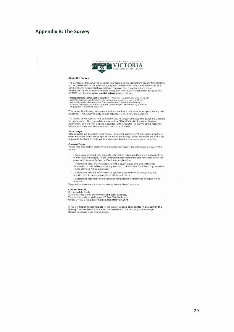
The survey was broken into 5 areas. The first four sections were anonymous to
encourage organisations to participate and share their views. Responses to the
final section were collected in a separate database. The questions in each of the
5 areas are summarised below.
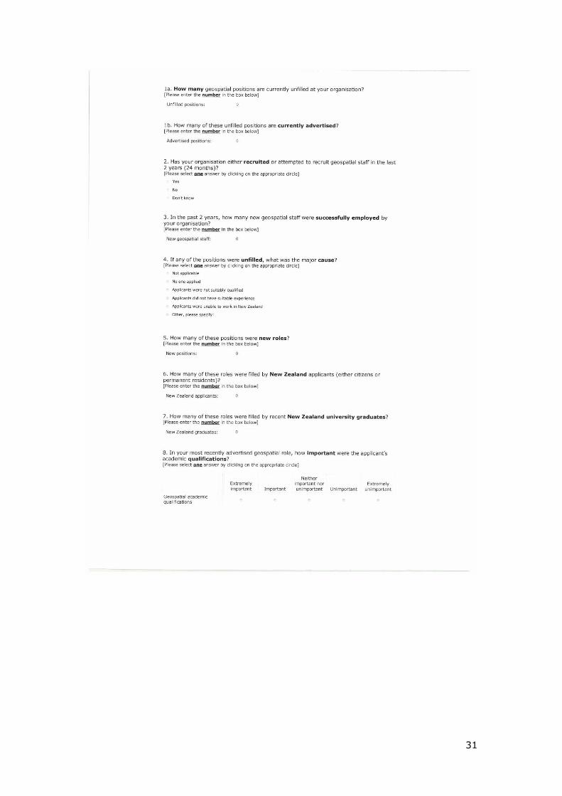
1. Current Staff: the number of staff in the organisation, the number of
geospatial staff, and the location of the geospatial staff.
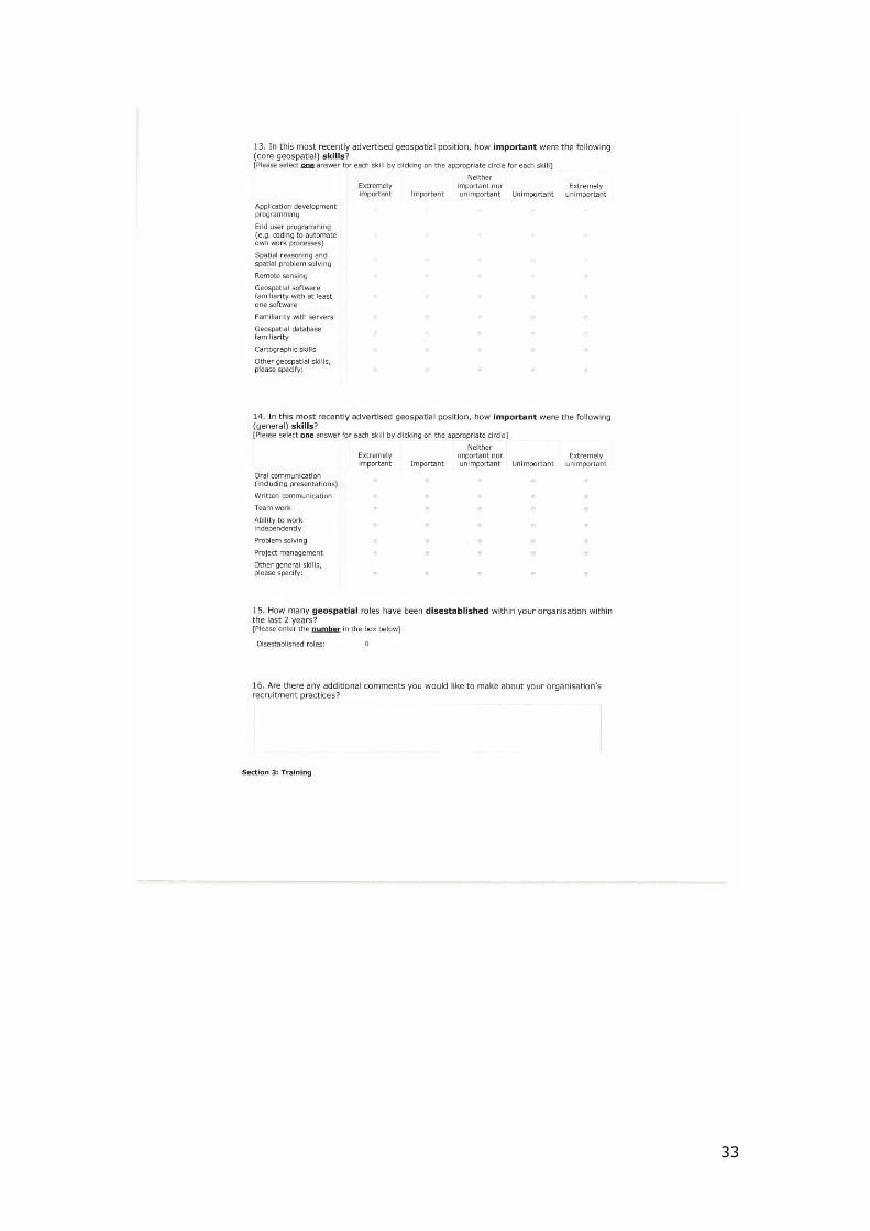
2. Recruitment: the number of unfilled geospatial positions, the number of
currently advertised positions, the number of staff successfully employed over the
last 2 years, the major cause of any unfilled positions, the number of new and
disestablished roles, the number of roles filled by New Zealand applicants and
recent New Zealand graduates, the importance of an applicant‟s academic
qualifications and experience and the important of different geospatial and
general skills.
Page 28
27
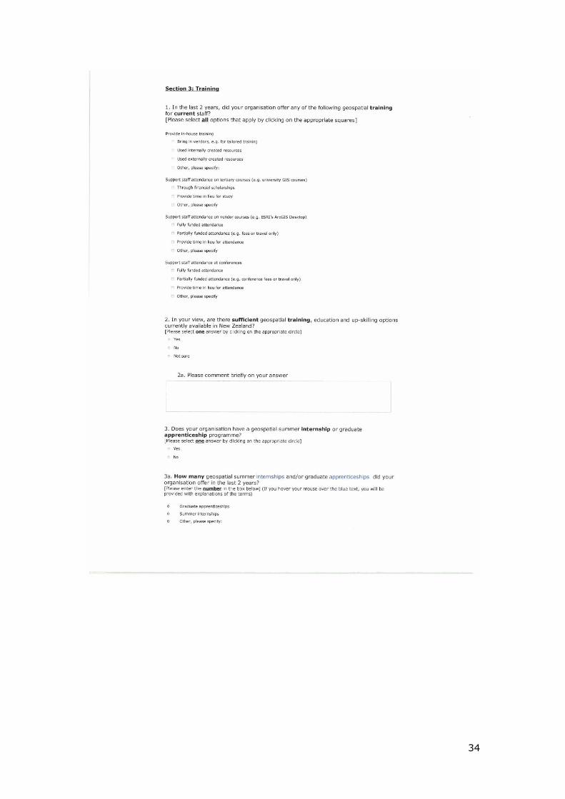
3. Training: the training opportunities offered to current staff, whether adequate
training, education and up-skilling options are currently available in New Zealand,
the number of internship and graduate apprenticeship schemes offered, and
whether there is a geospatial skills shortage in New Zealand.
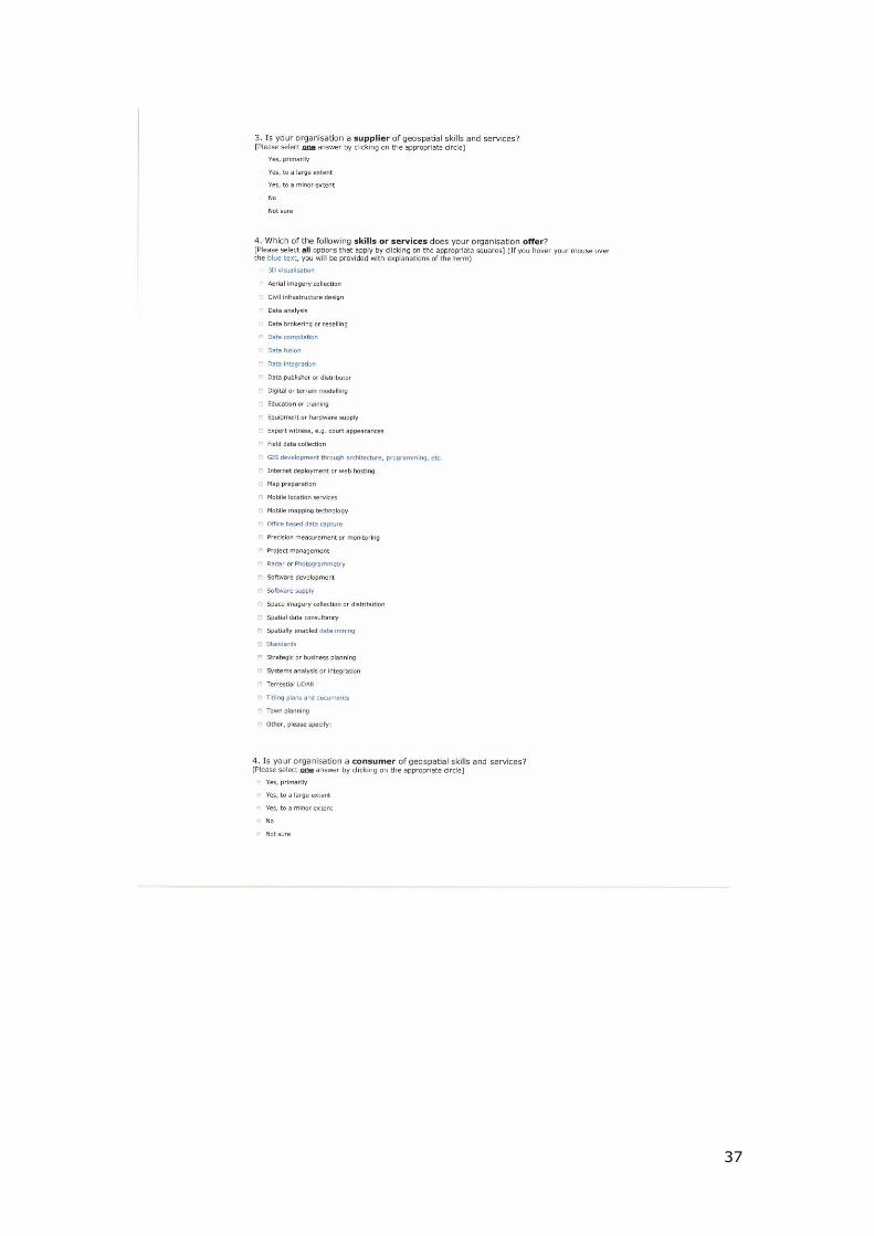
4. Your organisation: the organisation‟s core business, the role geospatial skills
and services play in the organisation, whether the organisation is a supplier or
consumer of these skills and services, and which skills and services were offered.
Participants were also offered the option of commenting on the survey in this
section.
5. More information: email address if the respondent would like to receive the
final report, and the name of the organisation. Responses to this section were
not linked to responses to sections 1-4 and were collected in a separate database.
The survey was launched on May 30th, 2012 and the participants were asked to
provide an alternative contact if they were unable to fill in the survey on behalf of
their organisation. Further emails were sent to updated contacts as needed. A
reminder email was sent on June 13th and a final email reminder was sent on
June 25th. While the survey was anonymous, email addresses and organisation
names were collected in a separate database and participants on these lists were
removed before reminders were sent. This multiple contact method, as
advocated by Dillman et al. (2008), increased response rates.
Mostly incomplete responses were deleted as a second participant from that
organisation may have been asked to fill in the survey and leaving these
responses in the database would bias the results.
This study selected organisations as the entity of interest. While there are
significant advantages to this approach in terms of the collection of data of
interest, it does bring some limitations. Chief amongst these is the requirement
placed on a sole participant from each organisation to represent the geospatial
skills requirements, the open vacancies and any issues encountered in filling
positions for that organisation. This approach favours the collection of data in
smaller geospatial companies as Human Resources (HR), geospatial management
and strategic planning may be the purview of one person or a small number of
people. In larger organisations, such as LINZ, knowledge of the skills needed and
other recruitment requirements across the whole organisation is harder to gather.
However, as this approach favours smaller organisations, it is likely to
Page 29
28
underestimate the needs of larger employers and in this way, is likely to
understate any shortage.
Additionally, the methods used to generate a contact list favoured government
users. Government, and in particular local government, were expressly targeted.
Due to the wider availability of these contact details, it was possible to survey the
majority of the sector. Moreover, these organisations are numerous but many
have a small number of geospatial staff serving the needs of the local authority.
However, local and central government are important components of the
geospatial sector. Geospatial use in government is well documented (e.g.
Campbell & Masser 1992, ESRI 2012, & Gerwin 2004) and indeed, the first GIS
software was developed by and for government (Longley et al. 2011). The
greater capture of government users was also expressly taken into account in the
derivation of sector estimates.
Page 30
29
Appendix B: The Survey
Page 41
40
Appendix C: Participating Organisations
Table 4: List of participating organisations. Not all organisations provided this information.
AECOM
Aerial Surveys Ltd
Airways Corporation of New Zealand
Array Solutions Ltd
Ashburton District Council
Aurecon
AUT University
Ballance Agri-Nutrients
Bay of Plenty Polytechnic
Bay of Plenty Regional Council
BERL
Bill Robertson and Associates
Bruce Churchouse Cartography & CAD Services Ltd
BTW Company
Canterbury University
Capacity Infrastructure Services Ltd
Capital and Coast District Health Board
Central Hawkes Bay District Council
Chorus
Christchurch City Council
Clutha District Council
CODC
Contact Energy Ltd
Critchlow Limited
Department of Conservation
Downer
Eagle Technology
Electoral Commission
Electra Ltd
Environment Canterbury
Environment Southland
Ernslaw One Ltd
e-Spatial Limited
GasNet Limited
Geo & Spatial Information Systems Ltd
Geographic Business Solutions Ltd
Geographx
GeoRamic Ltd
GeoSmart
Gisborne District Council
Golder Associates (NZ) Ltd
Gore District Council
Page 42
41
Greater Wellington Regional Council
Grey District Council
Hastings District Council
Hawkes Bay Regional Council
Hikurangi Forest Farms Limited
Horowhenua District Council
Hurunui District Council
Inland Revenue Department
Institute of Environmental Science and Research
Intergraph Corporation of NZ (Ltd)
Landcorp Farming Ltd
Lat 37 Ltd
Lincoln University
M&P Consulting Limited
Mackenzie District Council
Manawatu District Council
Maori Trustee
Massey University
Meteorological Service of New Zealand
Ministry for the Environment
MPDC (Matamata-Piako District Council)
Napier City Council
National Library of New Zealand
Nelson City Council
New Plymouth District Council
New Zealand Defence Force, Geospatial Intelligence Organisation New Zealand Petroleum and Minerals, a branch of the Ministry of Economic Development
New Zealand Police
NewTopo NZ Ltd
Nextspace Ltd
Ngati Kahungunu Iwi Incorporated
Northland Regional Council
NorthSouth GIS NZ Ltd
NZ Aerial Mapping Ltd
NZ Fire Service
NZ Forest Managers Ltd
NZ Geospatial Office
NZ Transport Agency
Ollivier & Company
Otago Regional Council
Otorohanga District Council
Palmerston North City Council
Porirua City Council
Powerco Ltd
Rangitikei District Council
Page 43
42
Ravensdown Fertiliser Cooperative
Roger Ackers
Rotorua District Council
Scion
Selwyn District Council
Sinclair Knight Merz (SKM)
Solid Energy NZ Ltd
South Taranaki District Council
South Waikato District Council
Southern District Health Board
Splice Group Ltd
Statistics NZ
Taranaki Regional Council
Tararua District Council
Tauranga City Council
Timaru District Council
Timberlands Limited
Tonkin & Taylor Ltd
Transport Accident Investigation Commission
Transpower NZ Ltd
Unitec Institute of Technology
University of Auckland
University of Otago
Upper Hutt City Council
Vicinity Solutions
Victoria University of Wellington
Waikato District Council
Waikato District Health Board
Waikato Regional Council
Waimakariri District Council
Waimate District Council
Waipa District Council
Wairoa District Council
Waitangi Tribunal Unit
Walking Access Commission
Wanganui District Council
Watercare Services Ltd
Waterfront Auckland
Wellington City Council
Wenita Forest Products
West Coast Regional Council
Western Bay of Plenty District Council
Westland District Council
Whakatane District Council
Whangarei District Council
Page 44
43
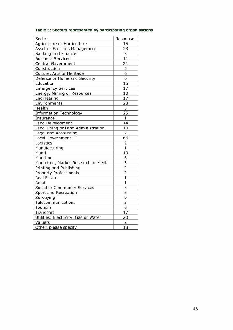
Table 5: Sectors represented by participating organisations
Sector Response
Agriculture or Horticulture 15
Asset or Facilities Management 23
Banking and Finance 3
Business Services 11
Central Government 21
Construction 5
Culture, Arts or Heritage 6
Defence or Homeland Security 6
Education 15
Emergency Services 17
Energy, Mining or Resources 10
Engineering 17
Environmental 28
Health 5
Information Technology 25
Insurance 1
Land Development 14
Land Titling or Land Administration 10
Legal and Accounting 2
Local Government 66
Logistics 2
Manufacturing 1
Maori 10
Maritime 6
Marketing, Market Research or Media 3
Printing and Publishing 2
Property Professionals 2
Real Estate 1
Retail 1
Social or Community Services 8
Sport and Recreation 6
Surveying 9
Telecommunications 3
Tourism 6
Transport 17
Utilities: Electricity, Gas or Water 20
Valuers 2
Other, please specify 18
Page 45
44
Appendix D: Acknowledgments
We would like to acknowledge the financial support of the New Zealand
Geospatial Office and SIBA New Zealand.
We also thank the participating organisations listed above for providing their
views on the geospatial sector in New Zealand and the comments and feedback
from the following people: Scott Campbell, Geoff O‟Malley, Kathryn Salm, Kevin
Sweeney, Rachel Summer, Antoni Moore, Claire Thurlow, Toby Daglish, Andrew
Rae, Peter Woodgate, Ken Lyons and George Havakis.
We greatly appreciate the support of the ESRI user group in supplying a list of
their corporate members and Eagle Technology for contacting a number of their
customers.
Barnaby Dixson, Josef Beautrais and Shaun Eaves provided research assistance
for the project.