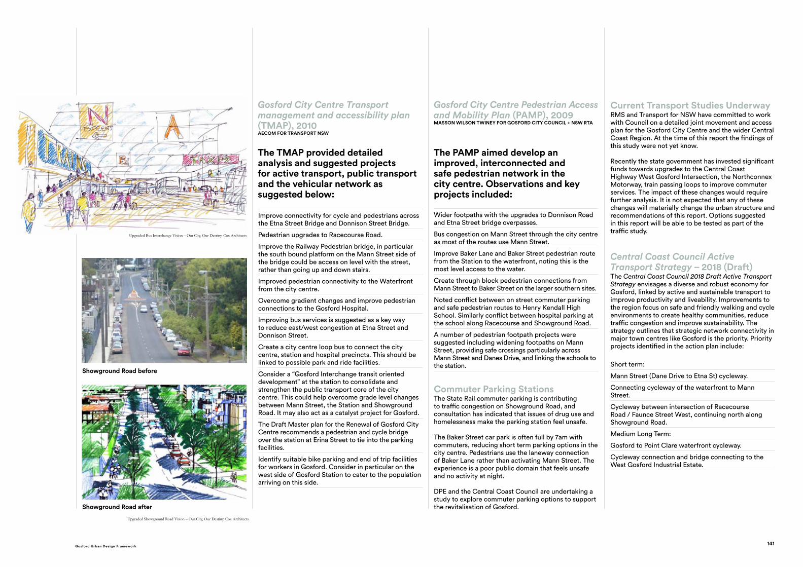
Gosford City Centre Transport management and accessibility plan (TMAP), 2010 AECOM FOR TRANSPORT NSW The TMAP provided detailed analysis and suggested projects for active transport, public transport and the vehicular network as suggested below: Gosford City Centre Pedestrian Access and Mobility Plan (PAMP), 2009 MASSON WILSON TWINEY FOR GOSFORD CITY COUNCIL + NSW RTA The PAMP aimed develop an improved, interconnected and safe pedestrian network in the city centre. Observations and key projects included: Improve connectivity for cycle and pedestrians across the Etna Street Bridge and Donnison Street Bridge. Pedestrian upgrades to Racecourse Road. Improve the Railway Pedestrian bridge, in particular the south bound platform on the Mann Street side of the bridge could be access on level with the street, rather than going up and down stairs. Improved pedestrian connectivity to the Waterfront from the city centre. Overcome gradient changes and improve pedestrian connections to the Gosford Hospital. Improving bus services is suggested as a key way to reduce east/west congestion at Etna Street and Donnison Street. Create a city centre loop bus to connect the city centre, station and hospital precincts. This should be linked to possible park and ride facilities. Consider a “Gosford Interchange transit oriented development” at the station to consolidate and strengthen the public transport core of the city centre. This could help overcome grade level changes between Mann Street, the Station and Showground Road. It may also act as a catalyst project for Gosford. The Draft Master plan for the Renewal of Gosford City Centre recommends a pedestrian and cycle bridge over the station at Erina Street to tie into the parking facilities. Identify suitable bike parking and end of trip facilities for workers in Gosford. Consider in particular on the west side of Gosford Station to cater to the population arriving on this side. Wider footpaths with the upgrades to Donnison Road and Etna Street bridge overpasses. Bus congestion on Mann Street through the city centre as most of the routes use Mann Street. Improve Baker Lane and Baker Street pedestrian route from the Station to the waterfront, noting this is the most level access to the water. Create through block pedestrian connections from Mann Street to Baker Street on the larger southern sites. Noted conflict between on street commuter parking and safe pedestrian routes to Henry Kendall High School. Similarly conflict between hospital parking at the school along Racecourse and Showground Road. A number of pedestrian footpath projects were suggested including widening footpaths on Mann Street, providing safe crossings particularly across Mann Street and Danes Drive, and linking the schools to the station. Central Coast Council Active Transport Strategy – 2018 (Draft) The Central Coast Council 2018 Draft Active Transport Strategy envisages a diverse and robust economy for Gosford, linked by active and sustainable transport to improve productivity and liveability. Improvements to the region focus on safe and friendly walking and cycle environments to create healthy communities, reduce traffic congestion and improve sustainability. The strategy outlines that strategic network connectivity in major town centres like Gosford is the priority. Priority projects identified in the action plan include: Short term: Mann Street (Dane Drive to Etna St) cycleway. Connecting cycleway of the waterfront to Mann Street. Cycleway between intersection of Racecourse Road / Faunce Street West, continuing north along Showground Road. Medium Long Term: Gosford to Point Clare waterfront cycleway. Cycleway connection and bridge connecting to the West Gosford Industrial Estate. Current Transport Studies Underway RMS and Transport for NSW have committed to work with Council on a detailed joint movement and access plan for the Gosford City Centre and the wider Central Coast Region. At the time of this report the findings of this study were not yet know. Recently the state government has invested significant funds towards upgrades to the Central Coast Highway West Gosford Intersection, the Northconnex Motorway, train passing loops to improve commuter services. The impact of these changes would require further analysis. It is not expected that any of these changes will materially change the urban structure and recommendations of this report. Options suggested in this report will be able to be tested as part of the traffic study. Commuter Parking Stations The State Rail commuter parking is contributing to traffic congestion on Showground Road, and consultation has indicated that issues of drug use and homelessness make the parking station feel unsafe. The Baker Street car park is often full by 7am with commuters, reducing short term parking options in the city centre. Pedestrians use the laneway connection of Baker Lane rather than activating Mann Street. The experience is a poor public domain that feels unsafe and no activity at night. DPE and the Central Coast Council are undertaking a study to explore commuter parking options to support the revitalisation of Gosford. Upgraded Showground Road Vision – Our City, Our Destiny, Cox Architects Showground Road before Showground Road after Upgraded Bus Interchange Vision – Our City, Our Destiny, Cox Architects 141 Gosford Urban Design Framework
Transcript
Gosford City Centre Transport management and accessibility plan (TMAP), 2010AECOM FOR TRANSPORT NSW
The TMAP provided detailed analysis and suggested projects for active transport, public transport and the vehicular network as suggested below:
Gosford City Centre Pedestrian Access and Mobility Plan (PAMP), 2009MASSON WILSON TWINEY FOR GOSFORD CITY COUNCIL + NSW RTA
The PAMP aimed develop an improved, interconnected and safe pedestrian network in the city centre. Observations and key projects included:
Improve connectivity for cycle and pedestrians across the Etna Street Bridge and Donnison Street Bridge.
Pedestrian upgrades to Racecourse Road.
Improve the Railway Pedestrian bridge, in particular the south bound platform on the Mann Street side of the bridge could be access on level with the street, rather than going up and down stairs.
Improved pedestrian connectivity to the Waterfront from the city centre.
Overcome gradient changes and improve pedestrian connections to the Gosford Hospital.
Improving bus services is suggested as a key way to reduce east/west congestion at Etna Street and Donnison Street.
Create a city centre loop bus to connect the city centre, station and hospital precincts. This should be linked to possible park and ride facilities.
Consider a “Gosford Interchange transit oriented development” at the station to consolidate and strengthen the public transport core of the city centre. This could help overcome grade level changes between Mann Street, the Station and Showground Road. It may also act as a catalyst project for Gosford.
The Draft Master plan for the Renewal of Gosford City Centre recommends a pedestrian and cycle bridge over the station at Erina Street to tie into the parking facilities.
Identify suitable bike parking and end of trip facilities for workers in Gosford. Consider in particular on the west side of Gosford Station to cater to the population arriving on this side.
Wider footpaths with the upgrades to Donnison Road and Etna Street bridge overpasses.
Bus congestion on Mann Street through the city centre as most of the routes use Mann Street.
Improve Baker Lane and Baker Street pedestrian route from the Station to the waterfront, noting this is the most level access to the water.
Create through block pedestrian connections from Mann Street to Baker Street on the larger southern sites.
Noted conflict between on street commuter parking and safe pedestrian routes to Henry Kendall High School. Similarly conflict between hospital parking at the school along Racecourse and Showground Road.
A number of pedestrian footpath projects were suggested including widening footpaths on Mann Street, providing safe crossings particularly across Mann Street and Danes Drive, and linking the schools to the station.
Central Coast Council Active Transport Strategy – 2018 (Draft)The Central Coast Council 2018 Draft Active Transport Strategy envisages a diverse and robust economy for Gosford, linked by active and sustainable transport to improve productivity and liveability. Improvements to the region focus on safe and friendly walking and cycle environments to create healthy communities, reduce traffic congestion and improve sustainability. The strategy outlines that strategic network connectivity in major town centres like Gosford is the priority. Priority projects identified in the action plan include:
Short term:
Mann Street (Dane Drive to Etna St) cycleway.
Connecting cycleway of the waterfront to Mann Street.
Cycleway between intersection of Racecourse Road / Faunce Street West, continuing north along Showground Road.
Medium Long Term:
Gosford to Point Clare waterfront cycleway.
Cycleway connection and bridge connecting to the West Gosford Industrial Estate.
Current Transport Studies UnderwayRMS and Transport for NSW have committed to work with Council on a detailed joint movement and access plan for the Gosford City Centre and the wider Central Coast Region. At the time of this report the findings of this study were not yet know. Recently the state government has invested significant funds towards upgrades to the Central Coast Highway West Gosford Intersection, the Northconnex Motorway, train passing loops to improve commuter services. The impact of these changes would require further analysis. It is not expected that any of these changes will materially change the urban structure and recommendations of this report. Options suggested in this report will be able to be tested as part of the traffic study.
Commuter Parking StationsThe State Rail commuter parking is contributing to traffic congestion on Showground Road, and consultation has indicated that issues of drug use and homelessness make the parking station feel unsafe.
The Baker Street car park is often full by 7am with commuters, reducing short term parking options in the city centre. Pedestrians use the laneway connection of Baker Lane rather than activating Mann Street. The experience is a poor public domain that feels unsafe and no activity at night.
DPE and the Central Coast Council are undertaking a study to explore commuter parking options to support the revitalisation of Gosford.
HILLS STREET/WATT STREET PEDESTRIAN UPGRADEHills/Watt Streets will form the green spine that links the northern residential precincts back to Kibble Park. While the topography does not make it the preferred north-south pedestrian route, each neighbourhood does have a natural fall towards the street and it is seen as a strong green element in the plan on which new community parks will be located. The provision of mid block linkages in the valleys of Hills Street, leading to Mann Street, will provide a more conducive walking environment.
REMOVAL OF THE GATEWAY CENTRE BRIDGEThe bridge connection to the Gateway Centre is now seldom used and is a visual intrusion. The bridge sits within Council’s airspace and is currently leased to the owners of the Gateway Centre. Council will liaise with the centre owner with the aim of removing the bridge in the future.
UPGRADE OF BURNS PARKBurns Park is a forgotten gem in Gosford’s public domain. The space will be reinvigorated by the removal of the Gateway Centre Bridge and the upgrade of the adjoining Bus Interchange. The redesign will be in the context of a more vibrant and active precinct.
UPGRADED BUS INTERCHANGEA Transport Management and Accessibility Plan (TMAP) will be undertaken, which will include a review of existing and future capacity needs of the bus interchange. Gosford’s bus interchange upgrade will include comfort, safety and convenience measures.
MANN STREET NORTH UPGRADE
The urban environment of Mann Street can be upgraded with better wider footpaths, more shade and improved amenity and safety. The upgrade of sewer and water mains within Mann Street and the installation of the Third Pipe for recycled water offer an opportunity for resource sharing during the street upgrade.
Bus Interchange Concept
CITY,DESTINYOU
R
THE GOSFORD CHALLENGE GOSFORD CITY CENTRE MASTERPLAN
40
GOSFORD BOASTS BOTH MAJOR PUBLIC AND PRIVATE HOSPITALS AND A WIDE RANGE OF SPECIALISTS AND SUPPORT SERVICES THAT CATER FOR A WIDER POPULATION THROUGHOUT THE CENTRAL COAST. THE HOSPITAL PRECINCT IS ONE OF THE BUSIEST ZONES IN GOSFORD TODAY. THE MASTERPLAN SEEKS TO REINFORCE THE HEALTH SERVICES FOR BOTH THE PUBLIC AND PRIVATE HOSPITAL SECTORS WITHIN THIS PRECINCT CLOSE TO THE STATION. THE PRECINCT ALSO INCLUDES THE EDUCATION RESOURCES AT GOSFORD HIGH SCHOOL AND HENRY KENDALL HIGH SCHOOL.
The Hospital Precinct5
Showground Road BeforeRacecourse Road Before
Showground Road AfterRacecourse Road After
CITY,DESTINYOU
R
THE GOSFORD CHALLENGE GOSFORD CITY CENTRE MASTERPLAN
44
Showground Road before
Showground Road after
Upgraded Bus Interchange Vision – Our City, Our Destiny, Cox Architects
141Gosford Urban Design Framework
“There is no better setting to watch a game”
“Potential is the best thing about the waterfront”
“ The stadium is great, but most of the time the area is dead with nothing to do. Gosford City Park is well used for sports a lunch, but is empty the rest of the time. ”
“Tommy’s Cafe is great. We need more like that.”
“It would be great to be able to swim.”
“ The public has been pushed to the edges. The edges of the park, the road and the stadium. Slowly over time the public water edge has been lost.”
“ With strong southerlies, poor water quality and little to do, the city south doesn’t offer much.”
“ It is important to get the city centre right and humming and not be distracted by proposals and planning for the waterfront.”
“ Previous plans have enclosed the waterfront and blocked connections to the city. It will be important to get it right this time.”
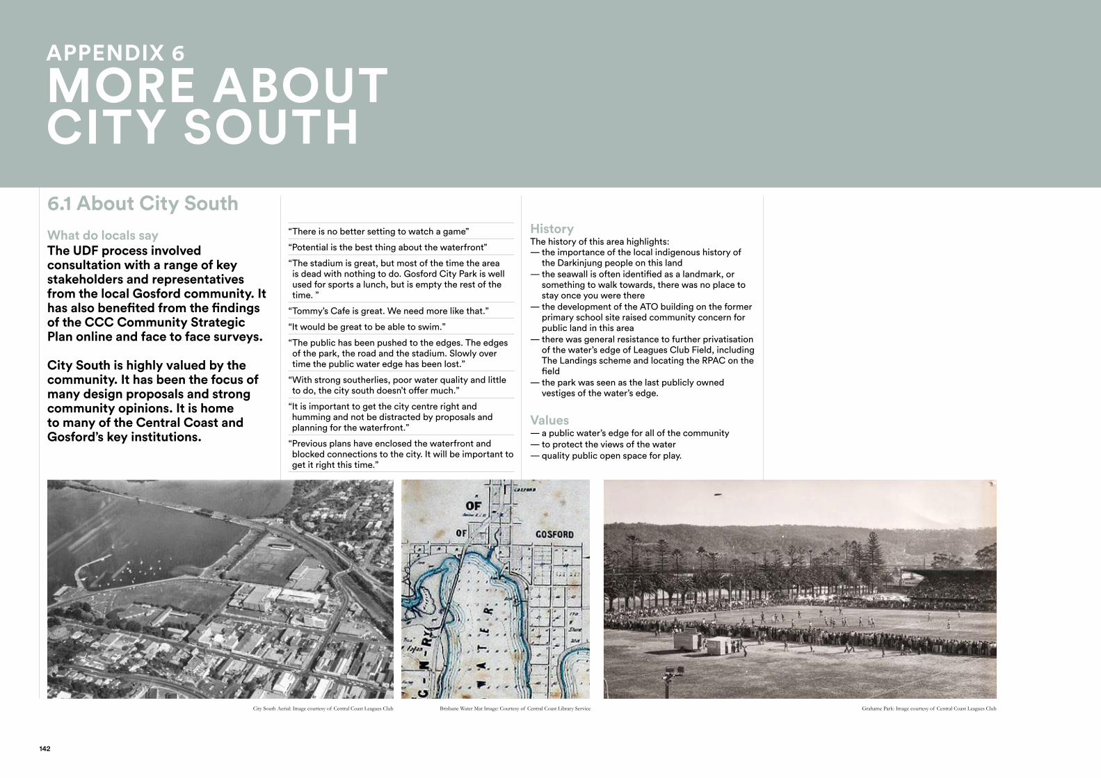
6.1 About City SouthWhat do locals sayThe UDF process involved consultation with a range of key stakeholders and representatives from the local Gosford community. It has also benefited from the findings of the CCC Community Strategic Plan online and face to face surveys.
City South is highly valued by the community. It has been the focus of many design proposals and strong community opinions. It is home to many of the Central Coast and Gosford’s key institutions.
HistoryThe history of this area highlights:
— the importance of the local indigenous history of the Darkinjung people on this land — the seawall is often identified as a landmark, or something to walk towards, there was no place to stay once you were there — the development of the ATO building on the former primary school site raised community concern for public land in this area — there was general resistance to further privatisation of the water’s edge of Leagues Club Field, including The Landings scheme and locating the RPAC on the field — the park was seen as the last publicly owned vestiges of the water’s edge.
Values — a public water’s edge for all of the community — to protect the views of the water — quality public open space for play.
Brisbane Water Mat Image: Courtesy of Central Coast Library Service Grahame Park: Image courtesy of Central Coast Leagues ClubCity South Aerial: Image courtesy of Central Coast Leagues Club
APPENDIX 6
MORE ABOUT CITY SOUTH
142
GREEN LINKS
Link reserves to the city
Trees
More parks and gardens, better quality existing parks, botanical gardens
Promote Gosford’s natural assets and ecology
Greenscape and open space on the Showground in the future
Bay to Bay type run that links recreation and fitness to the environment, treks
Waterplay/ Lagoon
Better connections to Rumbalara Reserve and Presidents Hill
PARKING
Parking at night (noting council car park at Baker Street shuts at 8pm)
More short term parking (currently used by commuters)
Parking (for events on the waterfront)
More commuter parking, parking for workers
TRANSPORT OPTIONS AND ACCESSIBILITY
Better public transport options, other than the car, more direct bus routes
Ferry Service to Woy Woy and Sydney
Better pedestrian access and accessible footpaths for all (will help things feel closer)
Water access is too distant improve the connection
Better signage and way finding
Marina for boats,may require dredging
Better cycle access and paths
Pedestrian access around station, and CC Leagues Club Site
Infrastructure to feed in and be coordinated
SAFETY
Improved safety – particular at night, and for women
Passive surveillance
Lighting
DESIGN
A distinct design style, not cookie cutter
Improved public domain and streetscape, public art, better footpaths, bins,
Integration of arts and design, cultural trail
Quality first, not low budget, which will entice further investment
Wider footpaths
Link people to specific quality of place
SOCIAL
Diversity of users (youth, aging population)
Indigenous history of President’s Hill and other locations respectfully displayed
PROGRAMME AND ATTRACTORS
Active usages at all hours, 7 days
Night life (after 5pm), including small bars
Upgrade the pool with relocated grandstand and connection to the water.
A cultural centre for the region, appropriately funded
Youth place to occupy, youth entertainment
Support Gosford as a cultural capital with diverse arts and music
Space for sports and outdoor recreation
Power to support pop-ups or events on the harbour of Kibble Park
Family playground with BBQs, shelter, preferably near the water
Coordinated activities and events
IDENTITY
A big clear idea, not band-aid solutions
Action, lots of plans that have not come to fruition
Coordinated events to create a cultural destination
Retain and preserve any historic character and fabric
ECONOMY
Options for food + beverage after events, e.g.: a Saturday Game at the stadium
Improve the stadium address event mode pedestrian access, improved members and sponsor area
More high quality shops, culture and arts, high quality office space
HOUSING
More variety and more residents living near and in the city
More affordable housing, social housing and diversity in housing options
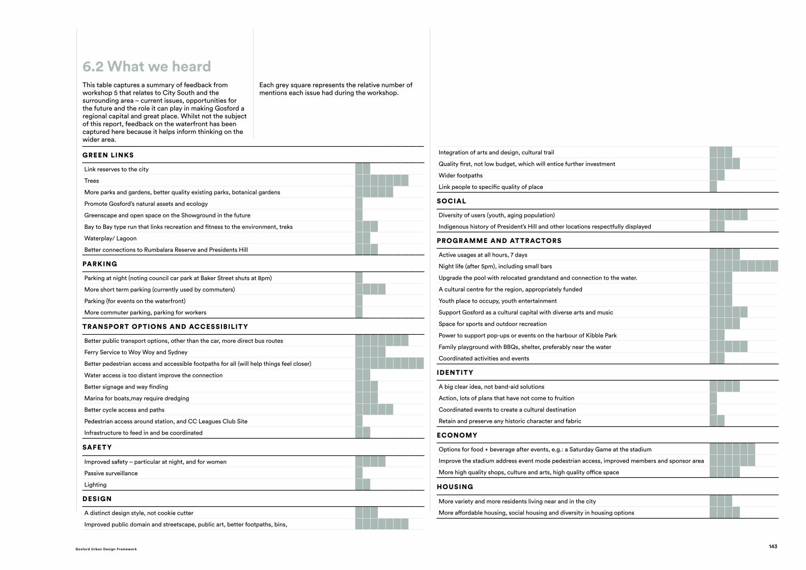
This table captures a summary of feedback from workshop 5 that relates to City South and the surrounding area – current issues, opportunities for the future and the role it can play in making Gosford a regional capital and great place. Whilst not the subject of this report, feedback on the waterfront has been captured here because it helps inform thinking on the wider area.
Each grey square represents the relative number of mentions each issue had during the workshop.
6.2 What we heard
143Gosford Urban Design Framework
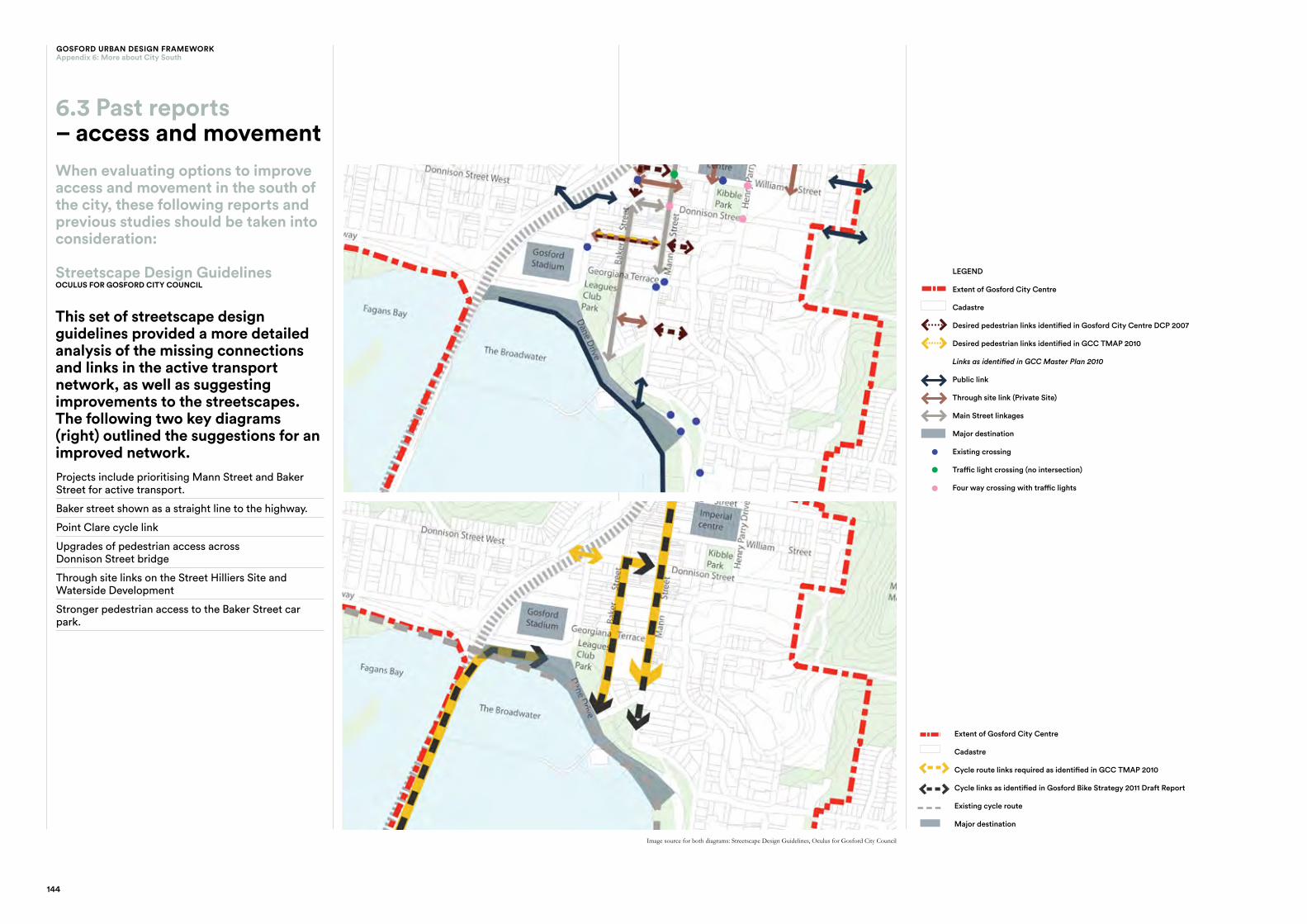
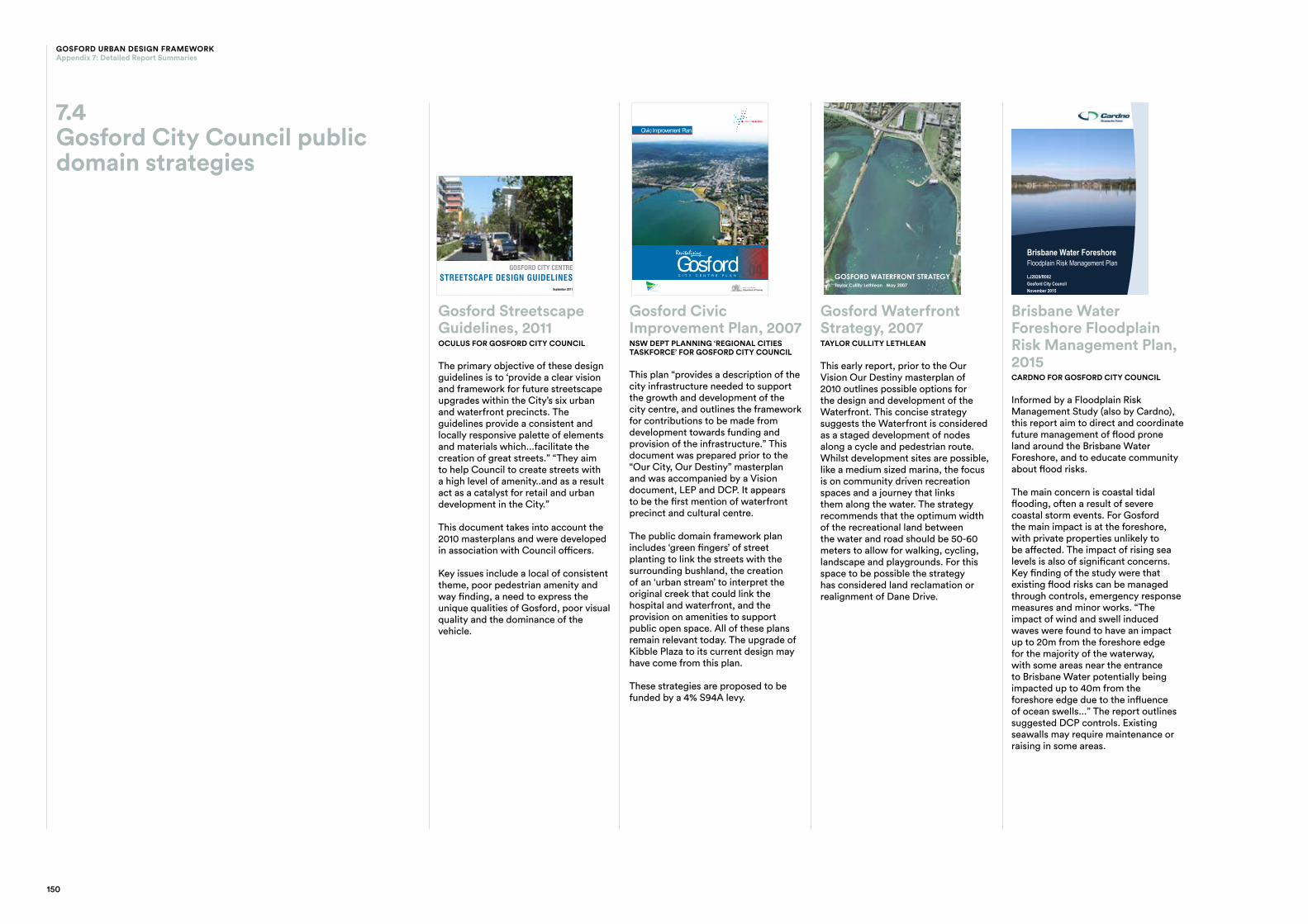
Streetscape Design GuidelinesOCULUS FOR GOSFORD CITY COUNCIL
This set of streetscape design guidelines provided a more detailed analysis of the missing connections and links in the active transport network, as well as suggesting improvements to the streetscapes. The following two key diagrams (right) outlined the suggestions for an improved network.Projects include prioritising Mann Street and Baker Street for active transport.
Baker street shown as a straight line to the highway.
Point Clare cycle link
Upgrades of pedestrian access across Donnison Street bridge
Through site links on the Street Hilliers Site and Waterside Development
Stronger pedestrian access to the Baker Street car park.
22
SECTION THREE
STRATEGIES & DESIGN PRINCIPLESGOSFORD STREETSCAPE GUIDELINES AUGUST 2011
LEGEND
Extent of Gosford City Centre
Cadastre
Desired pedestrian links identified in Gosford City Centre DCP 2007
Desired pedestrian links identified in GCC TMAP 2010
Links as identified in GCC Master Plan 2010
Public link
Through site link (Private Site)
Main Street Linkages
Major Destination
Existing crossing
Traffic light crossing ( no intersection)
Four way crossing with traffic lights
PEDESTRIAN ACCESS DESIGN PRINCIPLES
A pedestrian access strategy has been developed in response to streetscape analysis in the Appendix of this report and Gosford City Council’s strategic planning documents including the Gosford City Centre Master Plan. The pedestrian access strategy seeks to increase and improve key pedestrian links and access between destinations.
SECTION THREE
23
GOSFORD STREETSCAPE GUIDELINES AUGUST 2011 STRATEGIES & DESIGN PRINCIPLES
LEGEND
Extent of Gosford City Centre
Cadastre
Cycle route links required as identified in GCC TMAP 2010
Cycle links as identified in Gosford Bike Strategy 2011 Draft Report.
Existing cycle route
Major Destination
CYCLEWAY DESIGN PRINCIPLES
A cycle strategy has been developed in response to streetscape analysis in the Appendix of this report and Gosford City Council’s strategic planning documents including the Gosford City Centre Transport Management and Accessibility Plan. The cycle strategy seeks to increase and improve key cycle links and access between destinations.
Identified cycle links are to be incorporated into future streetscape designs. A range of treatments are required to realise the cycle strategy. These treatments are illustrated in detail in Section Four of this report.
When evaluating options to improve access and movement in the south of the city, these following reports and previous studies should be taken into consideration:
6.3 Past reports– access and movement
Image source for both diagrams: Streetscape Design Guidelines, Oculus for Gosford City Council
Extent of Gosford City Centre
Cadastre
Cycle route links required as identified in GCC TMAP 2010
Cycle links as identified in Gosford Bike Strategy 2011 Draft Report
Existing cycle route
Major destination
22
SECTION THREE
STRATEGIES & DESIGN PRINCIPLESGOSFORD STREETSCAPE GUIDELINES AUGUST 2011
LEGEND
Extent of Gosford City Centre
Cadastre
Desired pedestrian links identified in Gosford City Centre DCP 2007
Desired pedestrian links identified in GCC TMAP 2010
Links as identified in GCC Master Plan 2010
Public link
Through site link (Private Site)
Main Street Linkages
Major Destination
Existing crossing
Traffic light crossing ( no intersection)
Four way crossing with traffic lights
PEDESTRIAN ACCESS DESIGN PRINCIPLES
A pedestrian access strategy has been developed in response to streetscape analysis in the Appendix of this report and Gosford City Council’s strategic planning documents including the Gosford City Centre Master Plan. The pedestrian access strategy seeks to increase and improve key pedestrian links and access between destinations.
LEGEND
Extent of Gosford City Centre
Cadastre
Desired pedestrian links identified in Gosford City Centre DCP 2007
Desired pedestrian links identified in GCC TMAP 2010
Links as identified in GCC Master Plan 2010
Public link
Through site link (Private Site)
Main Street linkages
Major destination
Existing crossing
Traffic light crossing (no intersection)
Four way crossing with traffic lights
22
SECTION THREE
STRATEGIES & DESIGN PRINCIPLESGOSFORD STREETSCAPE GUIDELINES AUGUST 2011
LEGEND
Extent of Gosford City Centre
Cadastre
Desired pedestrian links identified in Gosford City Centre DCP 2007
Desired pedestrian links identified in GCC TMAP 2010
Links as identified in GCC Master Plan 2010
Public link
Through site link (Private Site)
Main Street Linkages
Major Destination
Existing crossing
Traffic light crossing ( no intersection)
Four way crossing with traffic lights
PEDESTRIAN ACCESS DESIGN PRINCIPLES
A pedestrian access strategy has been developed in response to streetscape analysis in the Appendix of this report and Gosford City Council’s strategic planning documents including the Gosford City Centre Master Plan. The pedestrian access strategy seeks to increase and improve key pedestrian links and access between destinations.
144
GOSFORD URBAN DESIGN FRAMEWORKAppendix 6: More about City South
While the waterfront is not a focus of this report, this strategy is included to focus on the relationship to City South.
This early report, prior to the Our Vision Our Destiny master plan of 2010 suggests the waterfront is considered as a staged development of nodes along a cycle and pedestrian route. Development sites like a medium sized marina are proposed, however the focus is on community driven recreation spaces and a journey that links them along the water.
The strategy recommends that the optimum width of the recreational land between the water and road should be 50-60 meters to allow for walking, cycling, landscape and playgrounds. For this space to be possible the strategy has considered land reclamation or realignment of Dane Drive further north.
Key concepts that remain relevant:create an series of activity nodes or precincts along the waterfront linked by walking or cycle tracks with key nodes easily accessed across Dane Drive.
Experiences, activities and facilities should be authentic, relevant to the amenity of the waterfront location in terms of scale and design, and they must be relevant to the needs primarily of the local community.
“...linkage to the CBD is vital for this important asset to be integrated once more into the city fabric.”
“It is the usual arrival point for people travelling to other Central Coast destinations and, with the turn off from the Pacific Highway passing the waterfront, this highly visible precinct must present as a gateway and arrival point that complements the capital city status of Gosford.”
Suggests including boating activities, childrens playground, picnic facilities, sporting activities, events, cultural activities, restaurants, cafes and bar.
Insufficient crossing points of Dane Drive noted, making the waterfront feel isolated.
Detailed recommendations highlight functional issues like tourist coach access to the waterfront, limited off street parking in this area and access issues with southern end of Mann Street with the escarpment.
It notes that dependence on a single large scale commercial or marina development places the waterfront revitalisation at risk. Rather a number of appropriate sites and uses should be identified with complementary uses that together aid the creation of a visitor destination, but individually can be realised by themselves.
GOSFORD WATERFRONT STRATEGY 33
12.0 CHARACTER PRECINCTS
FIGURE 20
Successful waterfront developments provide for a diverse offering for visitors and the community. This strategy enables multiple and overlapping attractions that cater for a diverse range of needs and expectations. These should be concentrated via precincts that host synergistic uses and reinforce a distinct character. Each should be developed as a holistic experience yet be linked and integrated as a unifi ed waterfront experience.
Gosford’s waterfront has the ‘bones’ of a unique visitor/ community destination based on three key character precincts. Importantly, they can build upon and enhance the existing foundation experience.
City Harbour / Wharf
This precinct will be characterised by its authentic qualities of an active urban waterfront. It will be a place that is host to ferries, hire craft and visiting sailing craft and its maritime character will be reinforced in its design and detailing. It will be an arrival place to the waterfront activated by quality restaurants and cafes, and host to promenading, alfresco dining, over water experiences, memorable views, fi shing and other passive uses.
City Beach
This precinct will be characterised by its use as a fun family recreational space. It will be a place that invites interaction with the water setting, and is enframed by beautiful gardens, promenades and pathways. It will be an inviting space that is host to events, picnics, BBQs, sunbathing and relaxing.
Children’s fun will animate the setting with informal and dedicated play spaces. It will be beautiful and engaging at its quietest yet able to host a diversity of community events.
Marina Precinct
This precinct will be characterised by the visual richness of sail craft, the activity of marina use, complemented by restaurants, cafes, alfresco dining looking out onto a beautiful water setting. A rich array of open and enclosed waterside spaces will be linked by generous pathways offering a diversity of water and landscape experiences. Timber boardwalks, marina moorings, a small beach and picnic spaces will provide an intimate and experiential contrast to the more open and generous city beach precinct.
GOSFORD WATERFRONT STRATEGY 13
CC SupportC CentreResidentialSpecial UsesCC Special UseCC ParksBusiness
15 min walk
FIGURE 6 - LAND USE
There is substantial land along the waterfront that is Crown Reserve, which is zoned as parkland - CC Parks, shaded green in the diagram above - under the care and management of Council. However, roads, lack of attractions and adjacent active frontages and distance from the CBD have reinforced the physical and perceived separation between the waterfront and CBD.
Adjacent uses to the waterfront include residential, primary school and sports fi elds, each not reinforcing the precinct as a major visitor destination.
FIGURE 7 - KEY NODES
The central spine of Gosford’s CBD links the city to the waterfront’s nodes. There is an obvious distribution of key nodes orientated along Mann Street. This orientation is reinforced by the limited features along the Waterfront. The circles representing the CBD and Waterfront’s spatial infl uence overlap at the city wharf precinct indicating this space as a pivotal and connecting location to the CBD and waterfront. It also illustrates the area centred around the existing boat ramp as the key central location of the waterfront.
FIGURE 8 - BARRIERS AND PEDESTRIAN LINKS
Gosford’s Waterfront feels isolated from its city and residential community.
The plan illustrates existing pedestrian desire lines to the waterfront that are impeded by Dane Drive and the lack of formal and informal crossing points.
Although the waterfront is located only fi fteen minutes from the city centre the distance in fact seems far greater due to the lack of activity along the waterfronts edge, the road barriers and lack of clear connectivity between the two.
Barrier
Crossing
Link
10 min walk
5 min walk
15 min walk
10 min walk
5 min walk
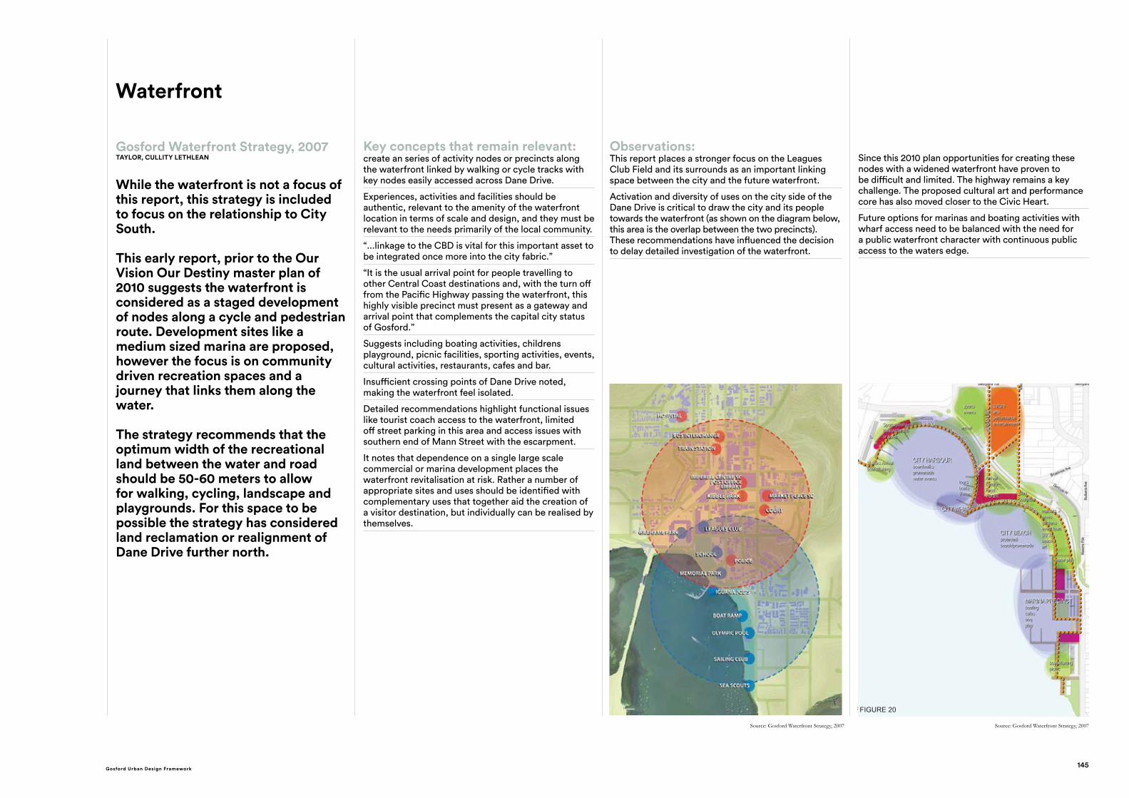
Observations:This report places a stronger focus on the Leagues Club Field and its surrounds as an important linking space between the city and the future waterfront.
Activation and diversity of uses on the city side of the Dane Drive is critical to draw the city and its people towards the waterfront (as shown on the diagram below, this area is the overlap between the two precincts). These recommendations have influenced the decision to delay detailed investigation of the waterfront.
Since this 2010 plan opportunities for creating these nodes with a widened waterfront have proven to be difficult and limited. The highway remains a key challenge. The proposed cultural art and performance core has also moved closer to the Civic Heart.
Future options for marinas and boating activities with wharf access need to be balanced with the need for a public waterfront character with continuous public access to the waters edge.
Our City, Our Destiny 2010COX FOR GOSFORD CITY COUNCIL
The 2010 master plan identified two precincts in the City South with the following projects and principles:
The Waterfront Precinct: New waterfront development with marina, wharfs, retail, entertainment, offices, apartments and hotel.
Continuous public access to the waterfront.
Public square on the waterfront to host events
Minimise view loss from the city
Developments should maintain or enhance the natural environment.
Dane Drive reconceived as a urban street with possible parking on both sides and traffic signals with grade crossings at the bottom of Brian McGowan Bridge and the end of a new Baker Street.
Point Clare cycle link
Regional playground on the waterfront adjacent to the existing pool.
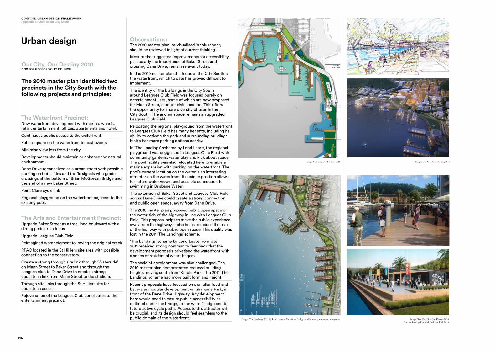
Observations:The 2010 master plan, as visualised in this render, should be reviewed in light of current thinking.
Most of the suggested improvements for accessibility, particularly the importance of Baker Street and crossing Dane Drive, remain relevant today.
In this 2010 master plan the focus of the City South is the waterfront, which to date has proved difficult to implement.
The identity of the buildings in the City South around Leagues Club Field was focused purely on entertainment uses, some of which are now proposed for Mann Street, a better civic location. This offers the opportunity for more diversity of uses in the City South. The anchor space remains an upgraded Leagues Club Field.
Relocating the regional playground from the waterfront to Leagues Club Field has many benefits, including its ability to activate the park and surrounding buildings. It also has more parking options nearby.
In ‘The Landings’ scheme by Lend Lease, the regional playground was suggested in Leagues Club Field with community gardens, water play and kick about space. The pool facility was also relocated here to enable a marina expansion with parking on the waterfront. The pool’s current location on the water is an interesting attractor on the waterfront. Its unique position allows for future water views, and possible connection to swimming in Brisbane Water.
The extension of Baker Street and Leagues Club Field across Dane Drive could create a strong connection and public open space, away from Dane Drive.
The 2010 master plan proposed public open space on the water side of the highway in line with Leagues Club Field. This proposal helps to move the public experience away from the highway. It also helps to reduce the scale of the highway with public open space. This quality was lost in the 2011 ‘The Landings’ scheme.
‘The Landings’ scheme by Lend Lease from late 2011 received strong community feedback that the development proposals privatised the waterfront with a series of residential wharf fingers.
The scale of development was also challenged. The 2010 master plan demonstrated reduced building heights moving south from Kibble Park. The 2011 ‘The Landings’ scheme had more built form and height.
Recent proposals have focused on a smaller food and beverage modular development on Grahame Park, in front of the Dane Drive Highway. Any development here would need to ensure public accessibility as outlined under the bridge, to the water’s edge and to future active cycle paths. Access to this attractor will be crucial, and its design should feel seamless to the public domain of the waterfront.
The Arts and Entertainment Precinct: Upgrade Baker Street as a tree lined boulevard with a strong pedestrian focus
Upgrade Leagues Club Field
Reimagined water element following the original creek
RPAC located in the St Hilliers site area with possible connection to the conservatory.
Create a strong through site link through ‘Waterside’ on Mann Street to Baker Street and through the Leagues club to Dane Drive to create a strong pedestrian link from Mann Street to the stadium.
Through site links through the St Hilliers site for pedestrian access.
Rejuvenation of the Leagues Club contributes to the entertainment precinct.
Urban design
KEY INITIATIVES ARE: - THE WATERFRONT - DANE DRIVE UPGRADE (INCLUDING PARKING) - POINT CLARE CYCLE LINK - CITY PLAYGROUND
The Waterfront Concept Plan
GOSFORD CITY PLAYGROUND
THE WATERFRONT
POINT CLARE CYCLE LINK
DANE DRIVE UPGRADE
CITY,DESTINYOU
R23
CITY,DESTINYOU
R
THE GOSFORD CHALLENGE GOSFORD CITY CENTRE MASTERPLAN
26 CITY,DESTINYOU
R27
In
Nov
embe
r 201
1, C
CR
DC
sub
mitt
ed a
rezo
ning
pro
posa
l to
the
Dep
artm
ent o
f Pl
anni
ng u
nder
the
Stat
e Si
gnifi
cant
Site
(SSS
) pro
cess
. Th
e ‘L
andi
ngs’
mas
terp
lan
(Fig
ure
3) a
nd s
uppo
rting
wor
k de
velo
ped
in c
olla
bora
tion
with
Len
d Le
ase
wer
e ut
ilised
in th
e SS
S st
udy.
The
appl
icat
ion
was
pub
licly
exh
ibite
d be
twee
n 30
Nov
embe
r 201
1 an
d 31
Jan
uary
20
12.
Ref
er w
ebsi
te:
http
://m
ajor
proj
ects
.pla
nnin
g.ns
w.g
ov.a
u/in
dex.
pl?a
ctio
n=vi
ew_j
ob&
job_
id=3
966
Figu
re 3
- Th
e La
ndin
gs M
aste
rpla
n
Th
e La
ndin
gs m
aste
rpla
n id
entif
ied
hote
l and
com
mer
cial
dev
elop
men
t on
the
Gos
ford
Pub
lic S
choo
l site
. Th
e R
egio
nal P
erfo
rmin
g Ar
ts C
entre
was
iden
tifie
d on
th
e ad
jace
nt C
row
n La
nd.
Fo
llow
ing
com
mun
ity fe
edba
ck fr
om th
e ex
hibi
tion
of th
e re
zoni
ng p
ropo
sal,
CC
RD
C
deci
ded
to s
igni
fican
tly a
men
d th
e re
zoni
ng p
ropo
sal t
o fo
cus
on a
muc
h sm
alle
r site
ar
ea (1
0ha)
whi
ch in
clud
ed G
osfo
rd C
ity P
ark,
Gos
ford
Bre
akw
ater
and
Gos
ford
Pu
blic
Sch
ool (
shad
ed o
rang
e on
Fig
ure
2).
Image: Our City, Our Destiny, 2010 Image: Our City, Our Destiny, 2010
Image: ‘The Landings’ 2011 by Lend Lease – Waterfront Background Summary www.ccrdc.nsw.gov.au Image Top: Our City, Our Destiny,2010Bottom: Pop Up Proposal Grahame Park 2018
2.2/The Masterplan
CITY,DESTINYOU
R
THE GOSFORD CHALLENGE GOSFORD CITY CENTRE MASTERPLAN
18
146
GOSFORD URBAN DESIGN FRAMEWORKAppendix 6: More about City South
147Gosford Urban Design Framework
ECONOMIC PROFILE
CENTRAL COAST
Prepared for the Economic Development Strategy for Regional NSW
February 2015
Central Coast Destination Management Plan 2017 - 2021 DRAFT VERSION 2
May 2017
2036Planning &Environment
CentralCoast
PlanRegional
Gosford City CentreTransport Management and Accessibility Plan
December 2010
Economic Profile – Central Coast, 2015 NSW NOW
This document outlines the economic profile of the Central Coast. The Central Coast is “a unique region with an enviable coastal lifestyle, growing business hub, skilled workforce, and strategic access to Sydney and Newcastle.”
“ In 2013 the Central Coast generated $10.8 billion in Gross Regional Product (GRP), representing 8% of Regional NSW’s total GRP.”
Key state investment opportunities include upgrades to the Central Coast Highway West Gosford Intersection, the Northconnex Motorway, train passing loops to improve commuter services, and business investment schemes across the area.
The report includes some useful detailed economic and local population statistics including population, employment rates, and education levels.
Better Placed, 2017GANSW
This state level policy “has been developed by the Government Architect to deliver the strategic approach needed to ensure that as our cities and towns grow bigger they get even better.” It outlines a clear government endorsed design approach to ensure good design that will deliver the architecture, public paces and environments we want to inhabit now and into the future.
The focus on quality places in Gosford, and strategies for an iterative design process has informed the work of this urban design framework. In particular the focus on holistic design thinking has ensured cross government agency collaboration through a series of workshops, and the ability to reconsider the connections and synergies that strengthen the individual precincts and places of Gosford.
The seven design objectives for better places form the basis for evaluating the quality of public spaces proposed by this implementation framework.
Central Coast Destination Management Plan –DRAFT 2, 2017 -2021EARTHCHECK FOR DESTINATION NSW
This document outlines the state level vision for the Central Coast to be the choice for leisure, business and major events. By leveraging the natural assets of the area, the management plan aims to lift the overall visitor experience and use tourism to engage entrepreneurs and the youth in employment opportunities.
It aims to increase the overall market share of regional visitors by providing a clear marketing identity for the Central Coast.
The plan includes strategic priorities for the next scope of work including development and implementing a new Destination Brand and a Regional Signage Strategy for each of the villages in the Central Coast.
Interestingly it is one of the few strategies that outlines key actions for creating a clear, simple identity for the area, improving market confidence, attracting investment and lifting community pride.
Greener Places, 2017GANSW
This draft policy document by the Government Architect, ‘Greener Places’ focuses on the role green infrastructure can play in shaping and improving the liveability of our urban spaces. “It aims to create a healthier, more liveable and sustainable urban environment by improving community access to recreation and exercise, supporting walking and cycling connections, and improving the resilience of urban areas.” Crucial to this policy is the concept that green infrastructure is a network of connected places that form a green grid. This infrastructure has environmental, social and economic benefits for the community.
For Gosford the key places identified by the workshops were all interestingly focused on the green open spaces of the city centre. Enhancing the natural green and water setting of Gosford to its connection to recreational spaces and the public transport network is a vital part of this plan.
Central Coast Regional Plan, 2016-2036NSW DEPARTMENT OF PLANNING AND ENVIRONMENT
This document outlines the NSW Government vision for the central coast, including its broad vision for the region and the role the Gosford City Centre will play in the future of this region. The plan outlines regional level economic, jobs, housing, infrastructure and industry targets for the region. The plan outlines 4 goals for the region, and 23 Directions. Goals 1/Direction 1 specifically relates to the growth of the Gosford City Centre as the region’s capital.
Gosford City Centre Transport management and accessibility plan (TMAP), 2010AECOM FOR TRANSPORT NSW
This document’s primary purpose is to increase the public transport share of work trips into the Gosford City Centre. There is recognition that Gosford needs to address its complex transport challenges such as access across the railway line, illegible and poor quality pedestrian facilities, severance of the waterfront, limited cycle networks and end of trip facilities, managing its parking supply and commuter drain. The comprehensive review includes initiatives to tackle these key challenges and interestingly places the potential measures into short term, medium term and long term actions.
It is unclear how many of the recommendations were adopted and implemented. Many recommendations suggested further studies like a detailed parking strategy, bus review, and public domain upgrades.
7.1 NSW Government policies and goals
APPENDIX 7
DETAILED REPORT SUMMARIES
These following summary pages aim to consolidate federal, state and local plans for the region, with a specific lens of the Gosford City Centre.
Gosford City Centre Floorspace Incentive Contribution Rate Study
Gosford City Council February 2016
Gosford City CentreStatement of Strategic Intent5 December 2014
Prepared by: For:
Operational Plan
2017-2018
central coast.nsw.gov.au
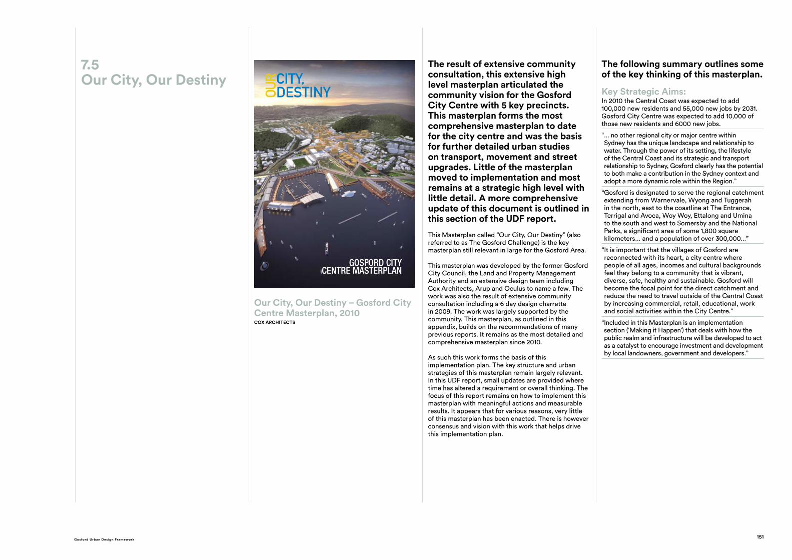
Our City, Our Destiny – Gosford City Centre, 2010COX ARCHITECTS
The result of extensive community consultation, this extensive high level masterplan articulated the community vision for the Gosford City Centre with 5 key precincts. This masterplan forms the most comprehensive masterplan to date for the city centre and was the basis for further detailed urban studies on transport, movement and street upgrades. Little of the masterplan moved to implementation and most remains at a strategic high level with little detail.
The document remains largely applicable. This report aims to provide an update of this 2010 masterplan and its strategic vision.
Gosford City Centre – Floorspace Incentive Contribution Rate Study for Gosford City Council, 2016AECOM
This document provided an economic review of the Gosford LEP Incentive Scheme, and considered the implication of continuing or changing this legislations. Key insights included the impact the incentive scheme has had on land banking in the city centre, and how very few paper DAs resulted in real construction or increased financial contributions to council. Increasing certainty for the development market is crucial. Other key insights include:
“ At present price levels, large scale tower development is unlikely to eventuate”
“ Council could consider a program of public domain works in the CBD. Public domain works are visible and can have a strong positive impact on investment confidence. Together with ongoing development activity, public and private investment activity can help create an environment conducive to further investment into Gosford.”
Gosford City Centre – Statement of Strategic Intent, 2014ROBERTS DAY
This document was created in response to renewed interest in the development in the city centre, and the large number of DAs received by Council as a result of the bonus provisions in the Gosford LEP 2014.
It recognises the increase in FSR and height combined with uncertain economic times have created ‘land banking’. It aims to ‘align council’s strategic direction and current market conditions’, and aims to provide best practice design for appropriate built form massing and heights that would suit the city centre.
Whilst useful the document is again a high level strategic intent document. It contains recommendations for future actions that would allow for implementation and detailed design. The slender tower typology may not align to current demand projections for the city centre.
Operational Plan – Central Coast Council, 2017/ 2018 CENTRAL COAST COUNCIL
This document outlines the Central Coast Council priorities for operational delivery in 2017 and 2018. Key items for the Gosford City Centre include funding for:
— Design and construction of a new regional library and commercial building at the Parkside building by 30.06.20
— Facilitate the establishment of a university presence by 2010
— Stadium upgrades (approx $2M) — City centre sewer and water upgrades
— Design of a regional performing art and conference centre.
7.2Gosford City Council strategic policies and plans
149Gosford Urban Design Framework
Gosford Strategic Parking Study, 2011BROWN SMART CONSULTING FOR GOSFORD CITY COUNCIL
This is a detailed supply and demand study for parking in the Gosford city centre. It reviews opportunities to create a walkable urban city with parking on the periphery and high levels of activity in the core.
In general the issue of commuter parking is addressed by transitioning to other modes of transport, to allow long term parking to transition to short term parking to support retail and commercial development. It suggests developers can give discretionary VAP contributions to offset a 10% reduction in parking provisions. Additional car parks, on the periphery of the city centre are recommended, within suitable walking distance and supported by a shuttle bus. Alternatively partnerships with the shopping centre and Leagues club could be considered.
Stronger restrictions and increased fees are recommended for current parking stations. Parking should be provided at the waterfront, new library and to the north.
A detailed schedule of actions are provided.
Gosford Parking Study, 2010GTA CONSULTING FOR GOSFORD CITY COUNCIL
This is a detailed supply and demand study for parking in the Gosford city centre. It reviews opportunities to create a walkable urban city with parking on the periphery and high levels of activity in the core. The review considers parking provision in new developments, parking in strata titles, parking discounts, the transition of long term parking to short term, contribution methods and future opportunities from large developments.
In general the issue of commuter parking is addressed by transitioning to other modes of transport, to allow long term parking to transition to short term parking to support retail and commercial development. It suggests developers can give discretionary VAP contributions to offset a 10% reduction in parking provisions. Additional car parks, on the periphery of the city centre are recommended, within suitable walking distance and supported by a shuttle bus.
Stronger restrictions and increased fees are recommended for current parking stations. Parking should be provided at the waterfront, new library and to the north.
Gosford Bike Strategy, 2014GOSFORD CITY COUNCIL
Based on community consultation, “ the Gosford Bike Strategy 2014 is Gosford City’s commitment to support initiatives that encourage more people within the local government area to cycle and to promote cycling as an integral part of daily life.”
The strategy aims to increase the mode of bicycle trip in the LGA to 5% by 2016 and 8% by 2031 in line with state policies. It also aim to establish a 244km cycle network which is safe, well maintained and conveniently located.
The strategy outlines key network upgrades to the local road system, key projects like the Point Clare Cycleway, the need for end of trip facilities and bike parking.
The strategy also supports sustainable use of designated mountain bike tracks in the natural bush settings of Kincumba Mountain and Rumbalara and Katandra Reserves.
Funding partners are being pursued.
GOSFORD STRATEGIC PARKING STUDY REPORT
NOVEMBER 2011
REPORT NO. X11170_R01
PREPARED FOR GOSFORD CITY COUNCIL
Gosford Parking Study
Final Report
Gosford Bike Strategy 20147.3Gosford City Council transport and parking strategies
O C U L U Sl a n d s c a p e a r c h i t e c t u r eu r b a n d e s i g n
GOSFORD CITY CENTRE
STREETSCAPE DESIGN GUIDELINESSeptember 2011
Taylor Cullity Lethlean May 2007
GOSFORD WATERFRONT STRATEGY
Brisbane Water Foreshore Floodplain Risk Management Plan
LJ2828/R002 Gosford City Council November 2015
Gosford Streetscape Guidelines, 2011OCULUS FOR GOSFORD CITY COUNCIL
The primary objective of these design guidelines is to ‘provide a clear vision and framework for future streetscape upgrades within the City’s six urban and waterfront precincts. The guidelines provide a consistent and locally responsive palette of elements and materials which...facilitate the creation of great streets.” “They aim to help Council to create streets with a high level of amenity..and as a result act as a catalyst for retail and urban development in the City.”
This document takes into account the 2010 masterplans and were developed in association with Council officers.
Key issues include a local of consistent theme, poor pedestrian amenity and way finding, a need to express the unique qualities of Gosford, poor visual quality and the dominance of the vehicle.
Gosford Waterfront Strategy, 2007 TAYLOR CULLITY LETHLEAN
This early report, prior to the Our Vision Our Destiny masterplan of 2010 outlines possible options for the design and development of the Waterfront. This concise strategy suggests the Waterfront is considered as a staged development of nodes along a cycle and pedestrian route. Whilst development sites are possible, like a medium sized marina, the focus is on community driven recreation spaces and a journey that links them along the water. The strategy recommends that the optimum width of the recreational land between the water and road should be 50-60 meters to allow for walking, cycling, landscape and playgrounds. For this space to be possible the strategy has considered land reclamation or realignment of Dane Drive.
Civic Improvement Plan
GosfordC I T Y C E N T R E P L A N
RevitalisingRevitalising
Gosford Civic Improvement Plan, 2007NSW DEPT PLANNING ‘REGIONAL CITIES TASKFORCE’ FOR GOSFORD CITY COUNCIL
This plan “provides a description of the city infrastructure needed to support the growth and development of the city centre, and outlines the framework for contributions to be made from development towards funding and provision of the infrastructure.” This document was prepared prior to the “Our City, Our Destiny” masterplan and was accompanied by a Vision document, LEP and DCP. It appears to be the first mention of waterfront precinct and cultural centre.
The public domain framework plan includes ‘green fingers’ of street planting to link the streets with the surrounding bushland, the creation of an ‘urban stream’ to interpret the original creek that could link the hospital and waterfront, and the provision on amenities to support public open space. All of these plans remain relevant today. The upgrade of Kibble Plaza to its current design may have come from this plan.
These strategies are proposed to be funded by a 4% S94A levy.
Brisbane Water Foreshore Floodplain Risk Management Plan, 2015CARDNO FOR GOSFORD CITY COUNCIL
Informed by a Floodplain Risk Management Study (also by Cardno), this report aim to direct and coordinate future management of flood prone land around the Brisbane Water Foreshore, and to educate community about flood risks.
The main concern is coastal tidal flooding, often a result of severe coastal storm events. For Gosford the main impact is at the foreshore, with private properties unlikely to be affected. The impact of rising sea levels is also of significant concerns. Key finding of the study were that existing flood risks can be managed through controls, emergency response measures and minor works. “The impact of wind and swell induced waves were found to have an impact up to 20m from the foreshore edge for the majority of the waterway, with some areas near the entrance to Brisbane Water potentially being impacted up to 40m from the foreshore edge due to the influence of ocean swells...” The report outlines suggested DCP controls. Existing seawalls may require maintenance or raising in some areas.
7.4Gosford City Council public domain strategies
151Gosford Urban Design Framework
The result of extensive community consultation, this extensive high level masterplan articulated the community vision for the Gosford City Centre with 5 key precincts. This masterplan forms the most comprehensive masterplan to date for the city centre and was the basis for further detailed urban studies on transport, movement and street upgrades. Little of the masterplan moved to implementation and most remains at a strategic high level with little detail. A more comprehensive update of this document is outlined in this section of the UDF report.
This Masterplan called “Our City, Our Destiny” (also referred to as The Gosford Challenge) is the key masterplan still relevant in large for the Gosford Area.
This masterplan was developed by the former Gosford City Council, the Land and Property Management Authority and an extensive design team including Cox Architects, Arup and Oculus to name a few. The work was also the result of extensive community consultation including a 6 day design charrette in 2009. The work was largely supported by the community. This masterplan, as outlined in this appendix, builds on the recommendations of many previous reports. It remains as the most detailed and comprehensive masterplan since 2010.
As such this work forms the basis of this implementation plan. The key structure and urban strategies of this masterplan remain largely relevant. In this UDF report, small updates are provided where time has altered a requirement or overall thinking. The focus of this report remains on how to implement this masterplan with meaningful actions and measurable results. It appears that for various reasons, very little of this masterplan has been enacted. There is however consensus and vision with this work that helps drive this implementation plan.
The following summary outlines some of the key thinking of this masterplan.
Key Strategic Aims:In 2010 the Central Coast was expected to add 100,000 new residents and 55,000 new jobs by 2031. Gosford City Centre was expected to add 10,000 of those new residents and 6000 new jobs.
“ ... no other regional city or major centre within Sydney has the unique landscape and relationship to water. Through the power of its setting, the lifestyle of the Central Coast and its strategic and transport relationship to Sydney, Gosford clearly has the potential to both make a contribution in the Sydney context and adopt a more dynamic role within the Region.”
“ Gosford is designated to serve the regional catchment extending from Warnervale, Wyong and Tuggerah in the north, east to the coastline at The Entrance, Terrigal and Avoca, Woy Woy, Ettalong and Umina to the south and west to Somersby and the National Parks, a significant area of some 1,800 square kilometers... and a population of over 300,000...”
“ It is important that the villages of Gosford are reconnected with its heart, a city centre where people of all ages, incomes and cultural backgrounds feel they belong to a community that is vibrant, diverse, safe, healthy and sustainable. Gosford will become the focal point for the direct catchment and reduce the need to travel outside of the Central Coast by increasing commercial, retail, educational, work and social activities within the City Centre.”
“ Included in this Masterplan is an implementation section (‘Making it Happen’) that deals with how the public realm and infrastructure will be developed to act as a catalyst to encourage investment and development by local landowners, government and developers.”
7.5Our City, Our Destiny CITY,
DESTINYOUR
GOSFORD CITY CENTRE MASTERPLAN
Our City, Our Destiny – Gosford City Centre Masterplan, 2010COX ARCHITECTS