The hydrogeochemistry of groundwater in fractured bedrock aquifers beneath dryland salinity occurrences at Yass, NSW Jerzy JankowskF & Ian Acworth l
Fresh to brackish groundwaters in the range of 250 to 2250 mglL occur in fractured bedrock aquifers beneath dryland salinity sites at Yass in the Southern Tablelands of New South Wales. The fractured bedrock in these catchments comprises marine, early Paleozoic slates, shales and sandstones in Dicks Creek and Williams Creek catchments, and porphyritic dacite and rhyodacite in Spring Creek catchment. The groundwaters are known to originate from recent meteoric waters . The waters represent various hydrochemical types , generated by chemical processes through water-rock interactions along their flow paths.
Introduction Drilling investigations have been carried out in the early Palaeozoic fractured bedrock aquifers in the Southern Tablelands of New South Wales to investigate the dry land salinity processes which occur in these catchments. The Department of Water Resources have drilled seven deep bores in the Dicks Creek catchment, six in the Spring Creek catchment, and six in the Williams Creek catchment. The initial investigation information from the drilling and sampling in the Spring Creek and Williams Creek Catch•ments are presented by Lawson (1989a, 1989b). The bores are up to 100 m in depth, and water samples taken from these bores represent shallow circulation groundwaters in the Palaeozoic fractured bedrock aquifers.
Many workers have investigated the causes of salinity in the Southern Tablelands. The hydrogeology and hydrogeo•chemistry in fractured bedrock aquifers in the A.C.T. , immediately to the south of this study area have been presented by Jacobson (1982) and Evans (1982, 1987). Van Dijk (1968, 1969) suggested that the salinity was the effect of relict salts stored in the soil profile . Recently published studies from Western Australia (Bettenay, 1978; Ventriss & others, 1982; Engel & others, 1987; Lewis, 1991) reported that dykes can induce saline seeps in the landscape by acting as hydraulic barriers, impeding groundwater flow and forcing saline groundwater to the soil surface. Knight & others (1989) and Please & others (1990) have suggested that the salinity can be geologically induced, whereby major faults or structures act as conduits allowing saline bedrock groundwater to penetrate upwards through the weathered bedrock and overlying silt and clay-rich layers into the soil zone.
Recent investigations in each of the above catchments by the present authors (Acworth & others, 1992; Jankowski & Acworth, 1992) have produced further information con•cerning the water chemistry and hydrogeochemical proc•esses in the fractured bedrock aquifers, and the effect of deep groundwaters discharging through low permeability clay material at the surface. This work has demonstrated that the fractured bedrock groundwaters are not Cl--Na+ type waters and that the general values of total dissolved solids (TDS) are not sufficiently high to directly cause the dry land salinity processes observed without further hydro-
UNSW Groundwater Centre, The University of New South Wales, PO Box 1, Kensington, NSW 2033.
The present chemical composition of major cations and anions in groundwaters from these catchments is derived from the following processes:
water-rock interaction in recharge zones where dissolution of minerals and oxidation processes occur, ion-exchange and reverse ion exchange reactions with clay where it is present in fractures and veins in the bedrock, and microbially mediated reactions with organic matter which produce very low redox potentials.
geochemical interactions involving the overly ing silt and clay-rich layers.
The groundwater at the Dicks Creek site 1 and at Williams Creek has a SOr-_Mg2+ dominance, while at Dicks Creek site 2a HC03' -Na+ dominance is developed. The Spring Creek groundwater is of a Cl-_Mg2+ type.
An appreciatIOn of the hydrogeochemical relationships involved leads to a better understanding of the management issues concerning the development of groundwater in these fractured rock aquifers. The preservation of the clay and poor soil cover on the valley floors is also important to support the rangeland activities in the Southern Uplands.
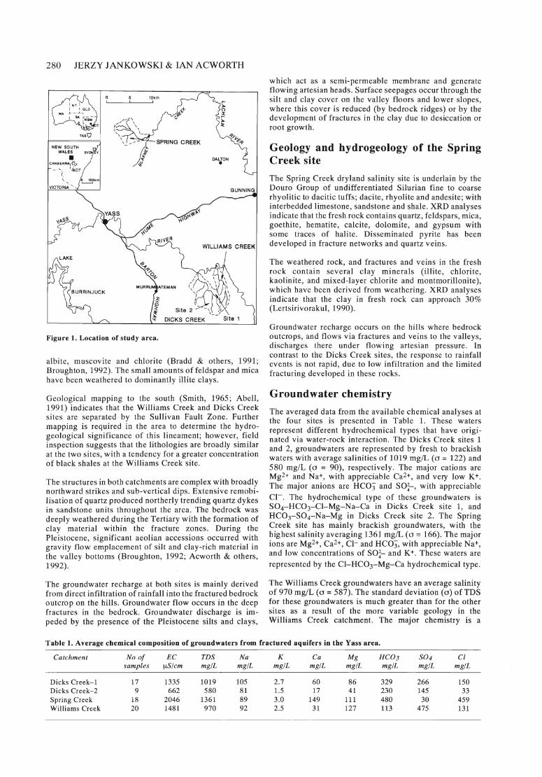
Site description The study areas form part of the Lachlan Fold Belt in New South Wales. The Williams and Dicks Creek catchments are located approximately 30 km southeast of Yass (Fig. 1) in the Southern Tablelands, which lie within the Molong•South Coast Anticlinorial Zone. Both catchments are northwest-flowing tributaries of the Yass River. The Spring Creek (Begalia) catchment is located at Blackburn Lane, approximately 18 km north of Yass (Fig. 1), within the southern region of the Cowra-Yass Sinclinorial Zone. Spring Creek is a minor tributary of the Blakney Creek, which in turn flows into the Lachlan River. The Dicks Creek, Williams Creek and Spring Creek sites are underlain by significantly different bedrock types of early Palaeozoic age.
Geology and hydrogeology of the Dicks Creek and Williams Creek sites The Dicks Creek sites are underlain by bedrock consisting of quartz-rich sandstone, siltstone and shale with minor black shale, chert and impure calcareous sandstone (Abell, 1991). Abell (1991) has assigned these lithologies to the Pittman Formation where they occur in the Cullarin Tablelands immediately south of the present area on the Canberra sheet. Cas (1983) suggested that these sediments were formed in a deep-water environment and Smith (1965) reported that the Pittman Formation reaches a depth of approximately 2650 m in the Nanima area immediately to the southwest of the study catchments.
The XRD analyses indicate that the rocks are mainly composed of quartz, with hematite and pyrite, with minor
280 JERZY JANKOWSKI & IAN ACWORTH
VICTO~'I~ ' '''
10km '----_---'--_~I
Figure 1. Location of study area.
r•~
~ r•~ <:
albite, muscovite and chlorite (Bradd & others, 1991; Broughton, 1992). The small amounts of feldspar and mica have been weathered to dominantly illite clays.
Geological mapping to the south (Smith, 1965; Abell, 1991) indicates that the Williams Creek and Dicks Creek sites are separated by the Sullivan Fault Zone. Further mapping is required in the area to determine the hydro•geological significance of this lineament; however, field inspection suggests that the lithologies are broadly similar at the two sites, with a tendency for a greater concentration of black shales at the Williams Creek site.
The structures in both catchments are complex with broadly northward strikes and sub-vertical dips. Extensive remobi•Iisation of quartz produced northerly trending quartz dykes in sandstone units throughout the area. The bedrock was deeply weathered during the Tertiary with the formation of clay material within the fracture zones. During the Pleistocene, significant aeolian accessions occurred with gravity flow emplacement of silt and clay-rich material in the valley bottoms (Broughton, 1992; Acworth & others, 1992).
The groundwater recharge at both sites is mainly derived from direct infiltration of rainfall into the fractured bedrock outcrop on the hills. Groundwater flow occurs in the deep fractures in the bedrock. Groundwater discharge is im•peded by the presence of the Pleistocene silts and clays,
which act as a semi-permeable membrane and generate flowing artesian heads. Surface seepages occur through the silt and clay cover on the valley floors and lower slopes, where this cover is reduced (by bedrock ridges) or by the development of fractures in the clay due to desiccation or root growth.
Geology and hydrogeology of the Spring Creek site The Spring Creek dry land salinity site is underlain by the Douro Group of undifferentiated Silurian fine to coarse rhyolitic to dacitic tuffs; dacite, rhyolite and andesite; with interbedded limestone, sandstone and shale. XRD analyses indicate that the fresh rock contains quartz, feldspars, mica, goethite, hematite, calcite, dolomite, and gypsum with some traces of halite. Disseminated pyrite has been developed in fracture networks and quartz veins.
The weathered rock, and fractures and veins in the fresh rock contain several clay minerals (illite, chlorite, kaolinite, and mixed-layer chlorite and montmorillonite), which have been derived from weathering. XRD analyses indicate that the clay in fresh rock can approach 30% (Lertsirivorakul, 1990).
Groundwater recharge occurs on the hills where bedrock outcrops, and flows via fractures and veins to the valleys, discharges there under flowing artesian pressure. In contrast to the Dicks Creek sites, the response to rainfall events is not rapid, due to low infiltration and the limited fracturing developed in these rocks.
Groundwater chemistry The averaged data from the available chemical analyses at the four sites is presented in Table 1. These waters represent different hydrochemical types that have origi•nated via water-rock interaction. The Dicks Creek sites 1 and 2, groundwaters are represented by fresh to brackish waters with average salinities of 1019 mg/L (0 = 122) and 580 mglL (0 = 90), respectively. The major cations are Mg2+ and Na+, with appreciable Ca2+, and very low K+. The major anions are RCO}" and SO;-, with appreciable CI-. The hydrochemical type of these groundwaters is SOcRCOrCI-Mg-Na-Ca in Dicks Creek site 1, and RCOr S04-Na-Mg in Dicks Creek site 2. The Spring Creek site has mainly brackish groundwaters, with the highest salinity averaging 1361 mg/L (0 = 166). The major ions are Mg2+, Ca2+, CI- and RCO}", with appreciable Na+, and low concentrations of SO;- and K+. These waters are represented by the CI-RCOrMg-Ca hydrochemical type.
The Williams Creek groundwaters have an average salinity of 970 mglL (0 = 587). The standard deviation (0) of TDS for these groundwaters is much greater than for the other sites as a result of the more variable geology in the Williams Creek catchment. The major chemistry is a
Table 1. Average chemical composition of groundwaters from fractured aquifers in the Yass area.
Catchment No a! EC TDS Na K Ca Mg HC03 S04 Cl samples !J.S/cm mg/L mg/L mg/L mg/L mg/L mg/L mg/L mg/L
Sor -Mg2+ type with Cl- and Na+ also important. The concentrations of HC03 and Ca2+ are low.
The groundwater is slightly acidic at each of the sites, with the exception of Williams Creek where strongly acidic conditions can occur.
The redox potential was measured in the field for 50 of the 64 analyses presented in this paper. Seventeen of the samples had a positive redox potential. These samples were predominantly from recharge zones . The remainder (33) had a negative redox potential with the lowest values of -241 mY, -167 mY, -216 mY, and -93 mY at the Dicks Creek site 1, Dicks Creek site 2, Spring Creek, and Williams Creek sites, respectively.
Representative chemical analy ses from each of the sites are presented in Table 2, and all data is shown plotted in a Piper diagram (Fig. 2) where the chemical analyses are grouped into distinctive fields in both the cation and anion sub-plots.
The rocks at these sites were deposited under marine conditions and therefore it could be expected that Cl- and Na+ would be the dominant ions in groundwater derived from them.
If it is assumed that Cl- is a conservative element derived only from the dissolution of sodium chloride, the concen•tration of Na+ relative to Cl- can be examined to provide evidence of processes other than only simple dissolution . An excess of Na+ will indicate dissolution of sodium feldspar, or exchange with clay. As only small amounts of sodium feldspar were identified in the XRD data, ion
exchange with clay is concluded to be the dominant mechanism providing excess Na+. This process is apparent in the Dicks Creek site 2 data. A Na+ deficiency could be caused by reverse ion exchange processes. This could explain the low Na+ values at Spring Creek.
Discussion and conclusions Several important deductions can be made from the analyses presented above:
• Examination of Na+ versus Cl- results on a molar basis shows that the chemical composition of waters from Dicks Creek site 2 have an excess of Na+ (Fig. 3). However, groundwaters from Dicks Creek site 1 and Williams Creek, with similar geology outcrops, have Na:Cl ratios closer to unity. The Spring Creek ground•waters have a high deficit of Na+, and this deficit increases with increasing Cl- concentration.
• Plots of Ca/Cl versus Na/Cl (Fig. 4) and Mg/Cl versus Na/Cl (Fig. 5) show that in Dicks Creek site 2, the groundwater Na:Cl ratio increases together with in•creases in the Ca/Cl and Mg/Cl ratios. Input of Ca2+ and Mg2+ is explained by dissolution of calcite, dolomite, and chlorite which supply these ions for exchange with Na+.
By contrast, the trend in the Spring Creek catchment shows that the Na:Cl ratio remains constant and is well below 0.5, but the Ca:Cl ratios increase. If Na+ does not react to form sodium-montmorillonite, the decrease of Na+ can be explained by reverse ion exchange and removal of Na+ by reaction with clay.
Table 2. Representative chemical analyses of groundwaters from deep bores in fractured aquifers, Yass area.
Figure 2. Piper diagram showing chemical composition of groundwaters in different catchments, Yass, NSW.
~
cr ~ . z
10
10 15 20 CI meq / L
Figure 3. Sodium versus chloride compositions of Yass ground waters.
o t4
ca/~i • 0 o
o 0
to ~ 0 • o • 00 • • 0 • o
00 .. 0 • • • o 0 • !l 0
0 • 0 0.6-1
• 'b • • o Dicks Creek - Site 1
0.4-1 t • JI • • • • ., o Dicks Creek - Site 2 • Spring Creek • Williams Creek
• • O.2 ~ • • •
5 Na/CI 8
Figure 4. Calcium/sodium versus sodium/chloride ratios for Yass groundwaters.
• • Mg/CI
• • •
• o
o o
o 0
o o 0
• • • • o
• • 0
<$b' • ·00 o Dicks Creek - Site 1 o Dicks Creek - Site 2 • Spring Creek
ril/,~ 00 • Williams Creek • .' •
, Na/CI 8
Figure 5. Magnesium/sodium versus sodium/chloride ratios for Yass groundwaters.
In the Dicks Creek site 2 catchment, ion exchange reactions occur in the groundwater between the clay and the weathered rock which change the cation composition of these waters.
The Spring Creek catchment waters, coming from a different geological environment, indicate that reverse ion exchange reactions have served to decrease the sodium concentration. The Williams Creek groundwater analyses show that, in fresher waters, ion exchange reactions are possible.
• Chemical data plotted on mineral stability diagrams of the Na, Mg, Ca-H-Si02 systems (Fig. 6) show that all waters from these sites are in equilibrium with kaolinite and that Na+ does not react with kaolinite to form sodium-montmorillonite. By contrast, in nearly all of the groundwaters from Dicks Creek and Spring Creek sites, Mg2+ and Ca2+ react with kaolinite and therefore Mg2+ and Ca2+ are in equilibrium with the mixed-layer clays represented by the magnesium-calcium-mont•morillonites. Hence, the Ca2+ and Mg2+ concentrations in these ground waters are controlled by the equilibrium between kaolinite and calcium-magnesium-montmoril•lonite. The majority of Williams Creek groundwaters are in equilibrium with kaolinite, with only a few reacting to form calcium-magnesium-montmorillonite.
• The saturation indices with respect to calcite and dolomite have been calculated, using an ion interaction model (ACTIVITY) based upon Pitzer's equations (Han or, 1987). The saturation indices with respect to calcite and dolomite are shown in Figure 7 and Figure 8, respectively. The Williams Creek and the Dicks Creek site 2 groundwaters are undersaturated with respect to calcite. At Dicks Creek site 1 and Spring Creek, most samples are close to equilibrium, but at Spring Creek the saturation index increases with increasing TDS.
o Dicks Creek - Site 1 o Dicks Creek - Site 2 • Spring Creek • Williams Creek
Figure 6. Activity-activity diagrams showing the stability field for Na, Mg, and Ca minerals.
The Dicks Creek site 1 and Spring Creek site groundwaters are super-saturated with respect to dolomite. All the Dicks Creek site 2 samples and the majority of Williams Creek groundwaters are in equilibrium with dolomite.
' 2
• SUPERSATURATED .. ------<I •
UNDERSATUR ATED •
'] • J -, ••
o Dicks Creek - Site 1 o DIcks Creek - Site 2 -, • Sprlng Creek • • Williams Creek •
-'J • • - 10 , ,
0 500 1(100 1500 2000 ToS mg/l 2500
Figure 7. Saturation indices of Yass groundwaters with respect to calcite.
., 0
0 0 0 0 • • • • dl' • .0" •
0 0 • "O:! Q ODD • "" SUPERSATUR ATED
o 0 g FYf I UNDERSATURATED 0 0
. j • • ~ ~ • 9
",8 _, ·C a Dicks Creek - Site 1 o Dicks Creek - Site 2 • Spring Creek • Wil liams Creek
.j •
• • • - 15 1 , ,
0 '00 100 0 1500 2000 TOS mgll 2500
Figure 8. Saturation indices ofYass groundwaters with respect to dolomite.
The examination of mineralogical data (Bradd & others, 1991; Broughton, 1992) showed that the chlorite com•monly occurs in Williams Creek and the Dicks Creek sites . The weathering of chlorite is a probable source of the high Mg2+ levels identified in the groundwater analyses .
The source of sulphate in the Yass groundwaters can be attributed to dissolution of gypsum or oxidation of pyrite . The XRD-analyses of unweathered rocks (Broughton, 1992) indicate that gypsum is not present in these fractured rocks and its contribution in sulphate concentration would be low. Hence, the main source of sulphate is the oxidation of sulphide minerals present in the rock matrix. The; available geological information indicates that pyrite is a common mineral. Shales often have reduced sulphur which is available for oxidation to produce SO;-, Fe2+ and protons to the groundwater system according to the reaction:
FeS2(6) + ~02 + H20 --+ Fe2+ + 2S0;-, + 2H+
High SO;-, concentrations are evident from both the Dicks Creek sites and the Williams Creek site.
The sediments of marine origin also often have organic matter, which can react with SO;-. and provide a mecha•nism for SO;-, reduction. This reaction is indicated by redox measurements which show that the Eh is often very low (Table 2).
These SO;- reducing reactions provide a mechanism to explain the markedly lower SO;- at the Spring Creek site as well as the high concentration of HC03 according to the reaction:
2CH20 + SO;- --+ H2S + 2HC03"
Oxidation of sulphide to sulphate probably occurs in the recharge zones, where sufficient dissolved oxygen is available in the groundwater. Reduction of the sulphate occurs in the closed system below the discharge zones, where groundwaters are rich in H2S and have no dissolved oxygen present. Our recent studies in Dicks Creek and
284 JERZY JANKOWSKI & IAN ACWORTH Williams Creek catchments showed that oxygen in the discharge zone is completely depleted and that H2S reaches concentrations of 5 mg/L. Even in the recharge zones, when organic matter is present a very low redox potential of -157 mV has been recently measured.
• The chemical reactions of kaolinite with Ca2+ and Mg2+, and the pyrite oxidation reaction, produce protons which should lower the pH (Williams Creek). However, at the Dicks Creek and Spring Creek catchments the field data indicates higher than expected pH values. These high pH values may be explained by fermentation reactions, which can occur under the very low redox conditions observed. The fermentation reactions con•sume protons (hydrogen) and CO2 during the formation of methane and thus increase the pH. This is possible when very low redox potential occurs (Spring Creek, Bore 36756/3, Table 2) and sulphate has already been completely reduced. Field studies are under way to substantiate this process.
If calcareous sediments exist in the bedrock, a reaction between acid groundwaters and sediments can produce higher pH levels, although this has not been detected, probably due to the limited occurrence of these sediments.
Important microbiological processes are involved III
these groundwater systems where organic matter is available. The total number of micro-organisms is 106- 7/100 ml, which are mainly sulphate reducing, iron reducing and nitrate reducing bacteria (Chadwick, 1993).
The above evidence confirms that the groundwater systems in these aquifers are hydrologically, chemically and biologically active . These conclusions are of importance when considering the development of fractured bedrock water supplies in the Yass area.
Acknowledgments The authors thank J. Ferguson, B. Williams and D. Cohen for reviewing an earlier version of the manuscript and for their constructive comments.
Much of this work was carried out under research funds provided by the Land and Water R&D Corporation and The Murray Darling Basin Authority. Their support for the work was instrumental in achieving the results described above.
References Abell, R. S., 1991 - Geology of the Canberra 1 :100000
sheet area New South Wales and Australian Capital Territory. Bureau of Mineral Resources, Australia, Bulletin 233.
Acworth, 1., Jankowski, J. & Broughton, A, 1992 - The occurrence, method of deposition and hydrogeological significance of clay-rich material at dry land salinity sites in the Yass Area of NSW. Third Murray-Darling Basin Groundwater Workshop, 27-29 October 1992 Renmark. Extended Abstracts. 2 pp.
Bettenay, E., 1978 - Deep drainage as a method for treating saltland. Journal of Agriculture of Western Australia, 19, 110-11 I.
Bradd, J. M., Turner, J.V. & Waite, T.D., 1991 - The application of hydrogeological and isotope techniques in relation to dryland salinisation and waterlogging at
Williams Creek, New South Wales. Final Report to The NSW Department of Water Resources, ANSTO/C210.
Broughton, A K., 1992 - The effect of parna-rich debris flow deposits on upland salinity occurrences in the Southern Tablelands New South Wales. Master Applied Science Thesis, Project Report, Department of Applied Geological University of N.S. W. (unpublished).
Cas, R. A F., 1983 - A review of the palaeogeographic and tectonic development of the Palaeozoic Lachlan Fold Belt of Southeastern Australia. Journal ofGeologi•cal Society of Australia. Special Publication, 10.
Chadwick, B. R., 1993 - A microbiological study of a dry land salinity site at Dick's Creek Catchment, Yass, New South Wales. Master Applied Science Thesis, Project Report, Department of Applied Geological University of N.S. W. (unpublished).
Engel, R., McFarlane, D. J. & Street, G., 1987 - The influence of dolerite dykes on saline seeps in Southwest•ern Australia. Australian Journal of Soil Research, 25, 125-136.
Evans, W.R., 1982 - Factors affecting water quality in a regional fractured rock aquifer. In Papers of the Groundwater in Fractured Rock Conference, Canberra, 1982. Australian Water Resources Council, Conference Series 5, 57-69.
Evans, W.R., 1987 - Hydrogeology of the Australian Capital Territory and Environs. Bureau of Mineral Resources, Australia, Report 263.
Hanor, J., 1987 - ACTIVITY - a computer program for calculating activity coefficients and saturation indices. Bureau of Mineral Resources, Geology and Geophysics, Canberra, (unpublished).
Jacobson, G., 1982 - Groundwater in fractured rock aquifers of the Australian Capital Territory - A valuable resource ... or a major problem? Papers of the Groundwater in Fractured Rock Conference, Canberra, 1982. Australian Water Resources Council, Conference Series 5, 109-118.
Jankowski, J. & Acworth, R. 1., 1992 - Process of salinisation: mixing of deep and shallow groundwaters and water-rock interaction, a case study from Southern Tablelands, NSW. Third Murray-Darling Basin Groundwater Workshop, 27-29 October 1992 Renmark. Extended Abstracts, 2 pp.
Knight, M. J., Saunders, B. J., Williams, R. M. & Hillier, J., 1989 - Geologically induced salinity at Yelarbon, Border Rivers area, New South Wales, Queensland. BMR Journal of Australian Geology & Geophysics, 11, 355-36I.
Lawson, S., 1989a - Dryland Salinity Project: Begalia drilling completion report. Department of Water Re•sources, TS 88.018 .
Lawson, S., 1989b - Dryland Salinity Project: Williams Creek drilling completion report. Department of Water Resources, TS 88.017.
Lertsirivorakul, R., 1990 - Hydrogeology and dry land salinity of Begalia Catchment, Yass, New South Wales. Master Applied Science Thesis, Project Report, Depart•ment of Applied Geological University of N.S. W. (unpublished).
Lewis, M. F., 1991 - Lineaments and salinity in Western Australia - Carriers or barriers? International Hydrol•ogy and Water Resources Symposium, Perth 1991. The Institution of Engineers, Australia, National Confer•ence Publication 91/22, 202-209.
Please, P., Knight, M. J. & Corpuz, A, 1990 - Role of large scale geological structures in groundwater driven salinity. Proceedings of Symposium on Management of Soil Salinity in South East Australia, Australian Society
HYDROGEOCHEMISTRY OF GROUNDWATER, YASS 285
of Soil Science, Inc., Riverina Branch, 269-280. Smith, J. W., 1965 - The geology of the Gundaroo•
Nanima area, New South Wales. Master of Science Thesis, Australian National University (unpublished).
van Dijk, D. C., 1968 - Exploratory study of the presence of perchlorate in salty seepages in the Yass Valley . Journal of the Australian Institute of Agricultural Science, 34, 41-43.
van Dijk, D, C., 1969 - Relict salt, a major cause of recent land damage in the Yass Valley, Southern Tablelands, N.S.W. The Australian Geographer, 11, 13-2l.
Ventriss, H. B., Collett, D. B. & Boyd, D. W., 1982 -Relationship between groundwater occurrence and a dolerite dyke in Northampton area of Western Australia. In Papers of the Groundwater in Fractured Rock Conference, Canberra, 1982. Australian Water Re•sources Council, Conference Series 5, 217-227.