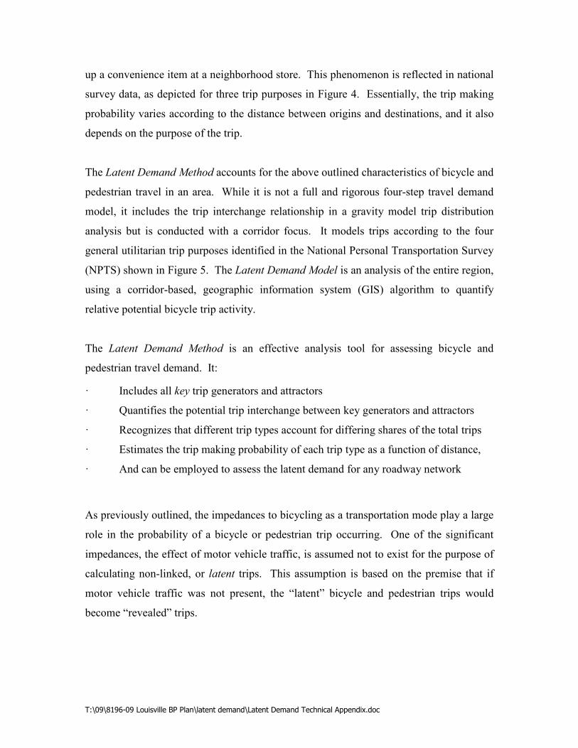
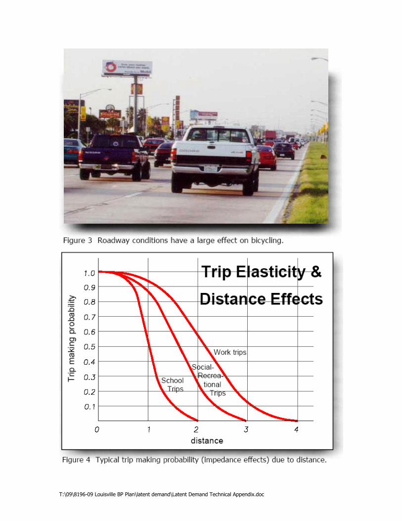
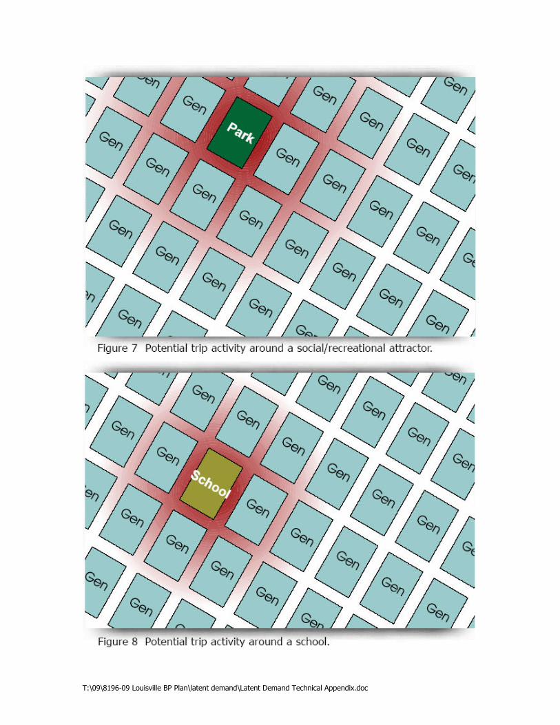
T:\09\8196-09 Louisville BP Plan\latent demand\Latent Demand Technical Appendix.doc The Latent Demand Method The Latent Demand Method predicts relative potential non-motorized trips based on characteristics of trip origins and destinations and their relative proximity and concentration/dispersion. While the way the method predicts potential bicycle and pedestrian travel is the same, in the interest of clarity the following description presents only the bicycle mode. Methods of Assessing on-Motorized Trip Activity There are three primary methods of assessing bicycle and pedestrian trip activity. The first method is documenting revealed demand. This is accomplished by simply counting the existing number of people bicycling and walking on the streets. A second method is to identify, map, and evaluate key bicycle and pedestrian generators or attractors. In practice, this method tends to focus on major bicycle and pedestrian trip attractors. The third method is to assess the latent demand throughout the study area. Assessing latent demand considers both existing and pent-up bicycle and pedestrian activity. It also enables planners and engineers to anticipate and plan for future bicycle and pedestrian travel needs. The following paragraphs briefly describe each of these three methods, their advantages and disadvantages. Revealed demand This method consists of compiling counts of existing bicycles and pedestrians on the roadways. Its usefulness is limited to areas that already have an extensive bicycle and pedestrian network that provides an overall high-quality bicycling and walking environment. This method is not usable for the vast majority of U.S. metro area transportation networks, due to their generally poor bicycle and pedestrian accommodation. Evaluation of Key Bicycle Trip Generators and/or Attractors Until recently, this method has been the most common method of estimating bicycle and pedestrian travel demand. However, it has two major problems: the limited number of
Transcript
T:\09\8196-09 Louisville BP Plan\latent demand\Latent Demand Technical Appendix.doc
The Latent Demand Method
The Latent Demand Method predicts relative potential non-motorized trips based on
characteristics of trip origins and destinations and their relative proximity and
concentration/dispersion. While the way the method predicts potential bicycle and
pedestrian travel is the same, in the interest of clarity the following description presents
only the bicycle mode.
Methods of Assessing �on-Motorized Trip Activity
There are three primary methods of assessing bicycle and pedestrian trip activity. The
first method is documenting revealed demand. This is accomplished by simply counting
the existing number of people bicycling and walking on the streets. A second method is
to identify, map, and evaluate key bicycle and pedestrian generators or attractors. In
practice, this method tends to focus on major bicycle and pedestrian trip attractors. The
third method is to assess the latent demand throughout the study area. Assessing latent
demand considers both existing and pent-up bicycle and pedestrian activity. It also
enables planners and engineers to anticipate and plan for future bicycle and pedestrian
travel needs. The following paragraphs briefly describe each of these three methods,
their advantages and disadvantages.
Revealed demand
This method consists of compiling counts of existing bicycles and pedestrians on the
roadways. Its usefulness is limited to areas that already have an extensive bicycle and
pedestrian network that provides an overall high-quality bicycling and walking
environment. This method is not usable for the vast majority of U.S. metro area
transportation networks, due to their generally poor bicycle and pedestrian
accommodation.
Evaluation of Key Bicycle Trip Generators and/or Attractors
Until recently, this method has been the most common method of estimating bicycle and
pedestrian travel demand. However, it has two major problems: the limited number of
T:\09\8196-09 Louisville BP Plan\latent demand\Latent Demand Technical Appendix.doc
key bicycle and pedestrian attractors it considers, and the fact that it generally focuses
only on attractors – therefore only one end of the trip is considered.
The first problem with this method is that it tends to focus on key bicycle and pedestrian
trip attractors such as schools, parks, and neighborhood retail centers, and thus only a
fraction of the existing and potential trip attractors are represented. In fact, virtually
every residence, every business, and every social and service establishment in a study
area is a key trip generator or attractor. Thus this method, in practice, fails to account for
that fact.
The method’s second shortcoming is directly related to the first. Since the method
focuses on key attractors, only one end of the trip – the destination, is quantified. This is
a problem because the method does not account for the production (or supply) of trips
available to that attractor. For example, a particular park may have many amenities, and
hence exhibit a high trip attraction rate, but if it is in a rather remote area (i.e., the
surrounding population density is very low) the actual bicycle and pedestrian trip activity
(or interchange) between the attractor (park) and generator (population) would be low.
Consequently, the method does not account for the bicycle and pedestrian trip
interchange reality that exists among generators and attractors throughout the Region.
Latent Demand
The method that quantifies both ends of the non-motorized trip as well as considers all
key generators and attractors in a study area for both existing and potential trips is the
Latent Demand Method. The Latent Demand Method is a logical extension of the second
method, and it is rapidly becoming the method of choice for metropolitan areas
throughout the United States. Numerous U.S. metro areas are using this method to
estimate the potential of roadway corridors to serve bicycle and/or pedestrian trip
activity; among them are Baltimore (MD), Birmingham (AL), Philadelphia (PA),