The Mayors’ Institute on City Design The National Endowment for the Arts The United States Conference of Mayors The American Architectural Foundation special funding provided by: The Edward W. Rose III Family Fund of the Dallas Foundation MICD Alumni Technical Assistance Program Final Report Alexandria, Virginia June 29 - 30, 2009
Transcript
The Mayors’ Institute on City Design
The National Endowment for the Arts
The United States Conference of Mayors
The American Architectural Foundation
special funding provided by: The Edward W. Rose III Family Fund of the Dallas Foundation
Alexandria, VirginiaMICD ATA - Alexandria: June 29-30, 2009
Introduction
Since 1986, the Mayors’ Institute on City Design has helped transform communities through design by preparing mayors as the chief urban designers of their cities. The Mayors’ institute achieves it mission by organizing sessions where a select group of mayors engage leading design experts to find solutions to the most critical urban design challenges facing their cities.
Every year, the partner organizations plan and manage six to eight Mayors’ Institute sessions held throughout the country. Each two and one half day session is limited to less than twenty participants, half mayors and half a multi-disciplinary team of outstanding city design and development professionals. Sessions are organized around case-study problems.
Each mayor presents a problem from his or her city for the other mayors and designers to discuss. Mayors present a range of challenges, including waterfront redevelopment, downtown revitalization, transportation planning and the design of new public buildings and facilities. Following each presentation, mayors and designers identify important issues, offer suggestions, and discuss potential solutions. The interchange sparks lively debate, opens new perspectives, and generates creative ideas. Members of the resource team also make presentations on the role of their profession in the process of city design, illustrated by outstanding examples ad best practices.
Mayor Euille was invited to attend Mayors’ Institute 41 in Chicago, IL, where he presented the Braddock Road neighborhood revitalization plan. In 2009, the Mayors’ Institute awarded the City of Alexandria a grant to further study another challenging site, Potomac Yard, through the Mayors’ Institute on City Design Alumni Technical Assistance Program.
The Mayors’ institute on City Design is a partnership program of the American Architectural Foundation, the National Endowment for the Arts and the United State Conference of Mayors. The Alumni Technical Assistance program is made possible by a generous $250,000 gift of the Edward W. Rose III Family Fund of the Dallas Foundation, directed to the National Endowment for the Arts by Mrs. Deedie Potter Rose, a former member of the National Council on the Arts.
Alexandria, VirginiaMICD ATA - Alexandria: June 29-30, 2009
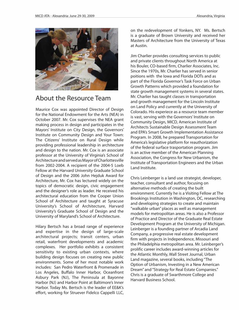
About the Resource TeamMaurice Cox was appointed Director of Design for the National Endowment for the Arts (NEA) in October 2007. Mr. Cox supervises the NEA grant making process in design and participates in the Mayors’ Institute on City Design, the Governors’ Institute on Community Design and Your Town: The Citizens’ Institute on Rural Design while providing professional leadership in architecture and design to the nation. Mr. Cox is an associate professor at the University of Virginia’s School of Architecture and served as Mayor of Charlottesville from 2002-2004. A recipient of the 2004-5 Loeb Fellow at the Harvard University Graduate School of Design and the 2006 John Hejduk Award for Architecture, Mr. Cox has lectured widely on the topics of democratic design, civic engagement and the designer’s role as leader. He received his architectural education from the Cooper Union School of Architecture and taught at Syracuse University’s School of Architecture, Harvard University’s Graduate School of Design and the University of Maryland’s School of Architecture.
Hilary Bertsch has a broad range of experience and expertise in the design of large-scale architectural projects; transit centers, urban retail, waterfront developments and academic complexes. Her portfolio exhibits a consistent sensitivity to existing urban contexts, where building design focuses on creating new public environments. Some of her most notable work includes: San Pedro Waterfront & Promenade in Los Angeles, Buffalo Inner Harbor, Oceanfront Asbury Park (NJ), The Peninsula at Bayonne Harbor (NJ) and Harbor Point at Baltimore’s Inner Harbor. Today Ms. Bertsch is the leader of EE&K’s effort, working for Struever Fidelco Cappelli LLC,
on the redevelopment of Yonkers, NY. Ms. Bertsch is a graduate of Brown University and received her Masters of Architecture from the University of Texas at Austin.
Jim Charlier provides consulting services to public and private clients throughout North America at his Bouler, CO-based firm, Charlier Associates, Inc. Since the 1970s, Mr. Charlier has served in senior poitions with the Iowa and Florida DOTs and as part of the Florida Governor’s Task Force on Urban Growth Patterns which provided a foundation for state growth management systems in several states. Mr. Charlier has taught classes in transportation and growth management for the Lincoln Institute on Land Policy and currently at the University of Colorado. His experiece as a resource team member is vast, serving with the Governors’ Institute on Community Design, MICD, American Institute of Architects Sustainable Design Assessment Team and EPA’s Smart Growth Implementation Assistance Program. In 2008, he prepared Transportation for America’s legislative platform for reauthorization of the federal surface trasportation program. Jim is an active member of the American Planning Association, the Congress for New Urbanism, the Institute of Transportation Engineers and the Urban Land Institute.
Chris Leinberger is a land use strategist, developer, teacher, consultant and author, focusing on alternative methods of creating the built environment. Currently he is a Visiting Fellow at The Brookings Institution in Washington, DC, researching and developing strategies to create and maintain “walkable urban” places as well as management models for metropolitan areas. He is also a Professor of Practice and Director of the Graduate Real Estate Development Program at the University of Michigan. Leinberger is a founding partner of Arcadia Land Company, a progressive real estate development firm with projects in Independence, Missouri and the Philadelphia metropolitan area. Mr. Leinberger’s prolific career includes award-winning articles for the Atlantic Monthly, Wall Street Journal, Urban Land magazine, several books, including “The Option of Urbanism, Investing in a New American Dream” and “Strategy for Real Estate Companies.” Chris is a graduate of Swarthmore College and Harvard Business School.
Alexandria, VirginiaMICD ATA - Alexandria: June 29-30, 2009
City of Alexandria Staff : Rich Baier: Acting Director, Department of Recreation, Parks, and Cultural Activities; Emily Baker: Acting Director, Department of Transportation and Environmental Services; Tom Canfi eld: City Architect; Beth Carton: Park Planner; Mildrilyn Davis: Director, Offi ce of Housing; Jeff Farner: Deputy Director, Department of Planning and Zoning; Claire Gron: Planner II, Department of Planning and Zoning; Faroll Hamer: Director, Department of Planning and Zoning; Yon Lambert: Pedestrian / Bicycle Coordinator; Helen McIlvaine: Deputy Director, Offi ce of Housing; Sandra Marks: Principal Transportation Planner; Karl Moritz: Deputy Director, Department of Planning and Zoning; Valerie Peterson: Principal Planner, Department of Planning and Zoning; and William Skrabak: Director, Offi ce of Environmental Quality.
Alexandria Participants: Joe Antunovich, AIA: Principal, Antunovich Associates, Chicago, Illinois; David Fromm: Del Ray Civic Association; Marguerite Lang: Rosemont Citizens’ Association; Jon Lindgren: Potomac Yard Planning Advisory Group; Dan McCaff ery: President, McCaff ery Interests, Chicago, Illinois; Jennifer Mitchell: Potomac Yard Planning Advisory Group; Eric Wagner: Chair, Potomac Yard Planning Advisory Group and Member, City of Alexandria Planning Commission; Maria Wasowski: Potomac Yard Planning Advisory Group; and Melissa Watson: Lynhaven Civic Association. MICD Design Resource Team: Hilary Bertsch, AIA: Associate Principal, Ehrenkrantz Eckstut & Kuhn Architects, New York, New York; James F. Charlier, AICP: President, Charlier Associates, Inc., Boulder, Colorado; and Chris Leinberger: Visiting Fellow, Brookings Institution, Washington, District of Columbia.
Mayors’ Institute Leadership and Staff : Susan Begley: Design Specialist, National Endowment for the Arts; Story Bellows LEED AP: Director, Mayors’ Institute on City Design; Elizabeth Blazevich: Special Projects Manager, Mayors’ Institute on City Design; Ron Bogle: President & CEO, American Architectural Foundation; Maurice Cox: Director of Design, National Endowment for the Arts; Graham Stroh: Program Manager, American Architectural Foundation; and Philip Zurman: Visiting Fellow, American Architectural Foundation.
Alexandria, VirginiaMICD ATA - Alexandria: June 29-30, 2009
Observations
City of Alexandria Planning and Zoning staff led the MICD Resource Team on a tour to Poto-mac Yard and surrounding Alexandria and Arlington, Virginia neighborhoods. To access the site, the City staff drove along Route 1, a major transportation artery that provides vehicles with a straight-forward thoroughfare to and from the Potomac Yard shopping center. New residential development is located at the historic rail yard’s southern edge, in addition to a new mixed-use municipal fi rehouse. Directly north are several cleared lots, big box retail out-lets and surface parking lots. The east and north borders of Potomac Yard are defi ned by two waterways, the Potomac River and Four Mile Run, respectively.
The MICD Resource Team noted new mid-rise, mixed-use developments north of Four Mile Run in Arlington, Virginia, as well as vibrant residential neighborhoods just west of Potomac Yard. The close proximity of the site to Ronald Regan National Airport, historic neighborhoods and lively commercial corridors like Old Town and Del Ray in Alexandria, George Washington Parkway and trail system and the Potomac River convinced the MICD Resource Team that this location would provide for a great mixed-use development and multi-modal, regional trans-portation hub.
Additionally, after the MICD Resource Team spoke with several community stakeholders and the developer’s representatives, they determined that Potomac Yard is locally, regionally and nationally signifi cant and could provide new development opportunities for community open space and programmed amenities, national retail and residential housing, and multi-modal transportation.
Challenges the MICD Resource Team identifi ed while on tour included the size and scale of Route 1 and the vehicular carrying capacity. The street width and the vehicular speeds pose dangerous for pedestrians walking to the site from neighborhoods west of the site. Addition-ally, the big box retail located at Potomac Yard caters to patrons with cars and not pedestrians.
The City of Alexandria’s Potomac Yard development creates a unique opportunity for a new, regionally signifi cant multi-modal transportation hub that could provide residential, commer-cial and recreational opportunities. Assets and opportunities noted by the team included:
• Rich historic context;
• Parkway access;
• Existing transportation hub for vehicular traffi c with adjacent Metrorail service / opportunity for multi-modal transportation hub – Metrorail, bus / BRT, streetcar / trolley, bike, walk;
• Regional attractions; Del Ray and Old Town commercial districts, Crystal and Pentagon cities, Ronald Regan National Airport, George Washington trail system, Potomac River;
• Route 1 - a major transportation artery with incredible width;
• Local, region and nation interest for the site, from diverse stakeholders (Alexandrians, national retail and residential housing interests, regional transportation interests, etc.);
After the tour, interviews with local stakeholders and City staff revealed the following key challenges and questions, including:
• Width of Route 1 and characteristics (height, age, integrity) of buildings adjacent;
• Current vehicle oriented big box development; from car-centric to people-centric;
Alexandria, VirginiaMICD ATA - Alexandria: June 29-30, 2009
• Demands incurred for current regional retail destination and fi nding the right mix of uses; Can the City garner support for another clustered, destination mixed-use development?
• Engaging developers who understand the need for phased development and can grapple with the city of the question of - how do you build Metro density before Metro?
• Buy-in at all government levels for development of a Metrorail stop and other regional transportation infrastructure; where should the City site the proposed Metro stop? Is Route 1 ready for bus rapid transit?
• Establishing public water frontage, both onthe Potomac River and Four Mile Run;
• Creating a street grid that is compatible with the existing adjacent historic neighborhood fabric;
• Parking – phasing strategies / densities;
• Planning for a tremendous amount of open space;
• Public / Private partnerships for long-term care and maintenance of civic space;
• Building heights that comply with FAA guidelines and restrictions;
• Financing and timing of development;
Conclusions
The MICD Resource Team presented the following recommendations. * Refer to the attached MICD Resource Team Final Presentation slides for corresponding images.
Land Use and Organization
The developer and City should work with other Landbay developers to assemble parcels and reorganize the land uses proposed for the totality of Potomac Yard. While completing this ex-ercise, the City should recognize the site’s edges, specifi cally Crystal City and adjacent neigh-borhoods.
Transportation
Multi-modal transit network must address scale, function, and urban design. Many regional transportation modes use the Route 1 corridor including commercial vehicles, Metrorail buses, cyclists and pedestrians. The City must determine if Route 1 is actually a highway or a street and then determine what the route should become. In addition, a Metrorail station is proposed for the site. With such a wealth of transportation options, the City of Alexandria should capitalize on the opportunity to work with regional transportation networks and es-tablish effi cient and innovative strategies for circulation people to, from and through Poto-mac Yard.
Alexandria, VirginiaMICD ATA - Alexandria: June 29-30, 2009
To promote multi-modal connectivity, plan for and establish a street grid that mimics the pedes-trian-friendly blocks located in adjacent neighborhoods. Planning for development at
this scale avoids poor connectivity seen through massive, congested arterials, increased driving per household, transit voids, inactive living, poor emergency service access and reduced travel safety and convenience for pedestrians.
Building Developments and Urban Designs
With so many regional examples of successful transit oriented development (TOD), design cues should be taken from these destinations – particularly related to height, scale and density of adja-cent buildings. Planning for and implementing a new Metrorail stop is an expensive and complex prospect, but a priority of both the city and the Washington Metropolitan Area Transportation Authority (WMATA). If there is continued local, regional and federal support for this rail stop, the City should plan to phase Potomac Yard’s development, taking into account the location of the stop, its role in a greater multi-modal transportation network intersecting the site and the eco-nomic eff ects that the stop has on development.
The City should strive to plan for mixed-use developments and encourage developers to think of Potomac Yards as a district, realizing that each new building and open space created will have an eff ect on the next. Eff orts should be made to establish connections between adjacent neighbor-hoods to Potomac Yard, not only physical but cultural. By promoting local business development, dense, pedestrian-friendly residential and commercial mixed use environments and adequate open space, the City will create a unique neighborhood that will compliment those that thrive today in Alexandria; Old Town and Del Ray.
Open Space
With incredible natural resources and park systems intersecting and adjacent to Potomac Yard, this development aff ords the opportunity for the City to link the existing network of park trails and river systems through the site. Create an urban park space within the development. This af-fords for programmable space that could be used for commercial, recreational or social activities such as farmers markets and concerts. Care and maintenance of the park should fall under the responsibilities of the business improvement district or property management. Successful urban park models include the Olympic Sculpture Park (Seattle, Washington) and The High Line and Bat-tery Park City (New York, New York).
Communication
Mayor Euille and The City of Alexandria staff have worked hard to educate their constituents about Potomac Yard’s development. Continue to work the community and the developer and explain incentives and opportunities like creating a carbon negative development site or regis-tering the development through the LEED for Neighborhood Development program. The term “sustainability” can carry a variety of meanings, so it is helpful to communicate what the develop-ment goals are, both for the City and developer, and keep accountable to those goals.
Alexandria, VirginiaMICD ATA - Alexandria: June 29-30, 2009
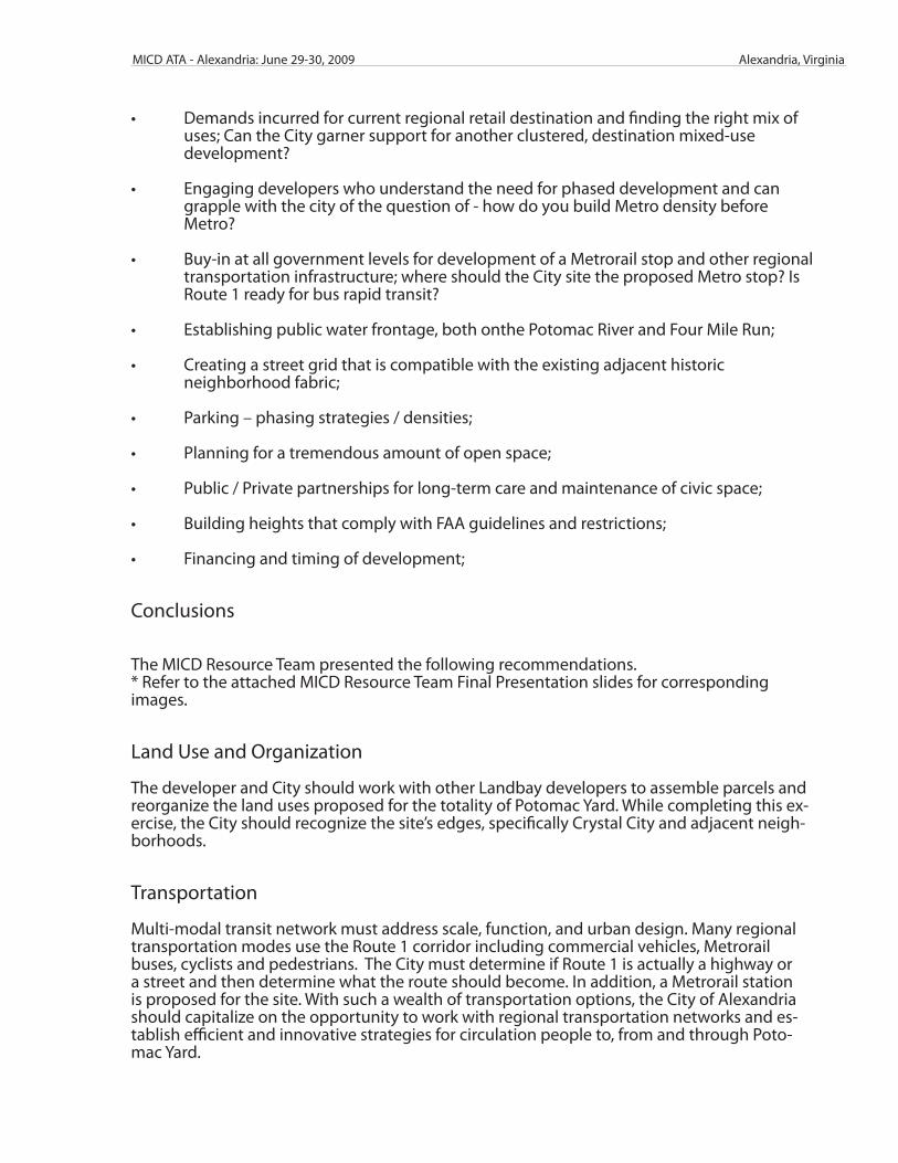
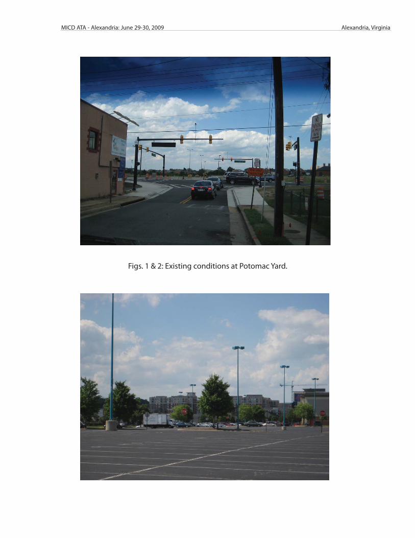
Figs. 1 & 2: Existing conditions at Potomac Yard.
Alexandria, VirginiaMICD ATA - Alexandria: June 29-30, 2009
Figs. 5 & 6: Mayor Euille and City of Alexandria staff work with MICD Resource Team members to further analyze the site lay-out and context.
Figs. 3 & 4: Alexandria stakholders share their observations with the MICD Resource Team.
convenience for pedestriansconvenience for pedestrians
250’
0’25
0
Walk TripshedWalk Tripshed
Pedestrian Walk DistancePedestrian Walk Distance
100% • Conventional Wisdom
50%ensity
50%
Prop
e
1,000 2,000 3,000 4,000 5,000 6,000
DistanceDistance
Pedestrian Walk DistancePedestrian Walk Distance
100% • Access to Transit
50%ensity
50%
Prop
e
1,000 2,000 3,000 4,000 5,000 6,000
DistanceDistance
Pedestrian Walk DistancePedestrian Walk Distance
100% • Great Walk Environment
50%ensity
50%
Prop
e
1,000 2,000 3,000 4,000 5,000 6,000
DistanceDistance
US Route 1US Route 1
Highway or Street?
Pedestrian Survival Rates – Vehicle Speeds
20 h 30 h 40 h100%
20mph
95%
30mph 40mph
50% 55%
% survive
% die 5%
15%
50%
% die45%
100%85%
Aurora
Streets and Urban DesignStreets and Urban Design
Urban Scale
3:2 Height to Width Ratio
Urban Scale
1:1 Height to Width Ratio
Urban Scale
1:4 Height to Width Ratio
URBAN DESIGN & FORMURBAN DESIGN & FORM
TransportationTransportation
O SOpen Space
Development
Crown FarmGaithersburg, Maryland
DEVELOPMENTDEVELOPMENT
• Mixed – UseMixed Use
• Districts
C i i• Connectivity
• Building Heights
FrameworkMIXED‐ USE v. PODSMIXED USE v. PODS
Integrated over the entire district
Insert plan view w uses
Hotel Parks and Residential
RetailOpen Space
Office
DISTRICTS
• EntertainmentEntertainment
• Core
i d• Mixed‐Use
RETAIL & AMENITIESRETAIL & AMENITIES
• RegionalRegional
• Entertainment
l• Local
• Cultural
Rego Park CenterRego Park New YorkRego Park, New York
TRANSIT OPTIONSTRANSIT OPTIONS
• Alternative Option DAlternative Option D
• Alternative Option E
A b th SArverne‐by‐the‐SeaArverne, New York
CONNECTIVITYCONNECTIVITY
HEIGHTSHEIGHTS• Triangle vs. Pyramid
FAA Height RestrictionsFAA Height Restrictions
OPEN SPACEOlympic Sculpture ParkOlympic Sculpture Park
Seattle, Washington
Water, water, water
The High LineNew York, New York
Battery Park City – Rector PlaceBattery Park City Rector PlaceNew York, NY
PHASE 1PARKING:PARKING:Front end loaded (above grade)
Long term (below grade/lower ratios)g ( g / )
PHASE 2PHASE 2
Strategy and Management by a Business Improvement District (BID)S t lik HOA•Set up like an HOA
•Develop solution in Phase I•Transition to non‐profit in Phase II•Could sub‐contract with Downtown DC, Inc. in Phase I and new organization in Phase II
•Phase IIPhase II•Redo Strategy•Clean and safe management•Management of Parking Entertainment/Cultural District•Management of Parking, Entertainment/Cultural District, Transportation
Finance OptionsFinance Options
•Moderate Density (E) of 7M square foot•Moderate Density (E) of 7M square foot•$21.50/FAR foot•$50/foot of land
•High Density (D) of 14M square footg y ( ) q•$21.50/FAR foot•$100/foot of land
•Options:F d l d t t t•Federal and state grants
•TIF (public)•Increase property taxes (private)•Up front cash payment (private)p p y (p )•25‐33% ownership by city/BID of all projects (private)•Some combination of all five