c'ks: k oa :..s " , e,r 5..ti The National Institute for Physical Planning and Construction Research St. Martin's House Waterloo Road Dublin 4 CONSERVATION AND AMENITY ADVISORY SERVICE REPORT OAT AREAS OF SCIENT'iFIC INTEREST IN COUNTY LIMEPJCK R. Young, Research Officer, An Foras Forbartha. October,. 19 71 . -j e N FIDLN F11A ,.
Transcript
c'ks: k oa :..s" ,
e,r5..ti
The NationalInstitutefor PhysicalPlanning andConstructionResearch
St. Martin's HouseWaterloo RoadDublin 4
CONSERVATION AND AMENITYADVISORY SERVICE
REPORT OAT AREAS OF SCIENT'iFICINTEREST IN COUNTY LIMEPJCK
R. Young,Research Officer,An Foras Forbartha.
October,. 19 71 .
-j e
N FIDLN F11A ,.
The following report is based on data in the files of the Conservation Unit,
An Foras Forbartha, and on observations made during a field survey in
October and November 1971.
The report consists of the following parts:-
A. General Introduction.
B. Table summarising details of areas of scientific interest inCounty Limerick.
C. Explanation of the criteria used in rating areas and in decidingupon their priority.
D. Detailed reports on areas marked with an asterisk in thesummary table, B.
Each detailed report is written under the following sub-headings:-Name of area and acreage
Grid reference
Scientific interestRating
PriorityDescription of area (including details of the scientific
Threats to the areaRecommendations
interest)
Table summarising recommendations for protection of the areasof scientific interest.
L
Throughout the report botanical nomenclature follows that of "Flora of the
British Isles" Clapham, Tutin and Warburg. Second Edition. 1962.
In all botanical species lists the abundance of each species recorded is indi-
cated according to the following scale:-
a = abundant
c = common
f = frequent
o = occasional
r = rare
1 = locally
I
SECTION A
INTRODUCTION
As will be seen from the following data, there are very few areas of scientificinterest in County Limerick.
It is important, from the points of view of amenity, education and scientificresearch, that an effort is made to preserve these areas in an unspoilt condi-tion'. The urgency of this task is indicated by the fact that four of the mostimportant areas, Lough Gur and the areas on and near to Aughinish Island, arealready destined to be affected by proposed development.
It can also be said that Limerick is a county almost devoid of deciduous wood-lands and copses. Use of Tree Preservation Orders should be made to preventfurther loss of deciduous trees and the consequent deterioration in the scenicbeauty of the landscape.
I
11
AR
EA
S O
F SC
IEN
TIF
IC I
NT
ER
EST
IN
CO
UN
TY
LIM
ER
ICK
Are
aG
rid
Ref
.R
atin
gPr
iori
tyIn
tere
st
*Lou
gh G
urC
R. 6
4, 4
0I
Nat
iona
lA
Eco
logi
cal.
Orn
ithol
ogic
al.
Prop
osed
as
a N
atio
nal W
ildfo
wl R
efug
e by
the
Iris
h W
ildfo
wl C
omm
ittee
, it i
s im
port
ant a
s a
win
teri
ng a
rea
for
duck
s an
d sw
ans
and
as a
bree
ding
are
a fo
r a
rare
duc
k sp
ecie
s.
*Aug
hini
sh I
slan
dR
. 283
, 545
Nat
iona
lA
%G
eolo
gica
l.N
and
E-R
. 283
, 515
Exp
osur
es o
f un
defo
rmed
Wau
lsor
tian
reef
limes
tone
s.
*Foy
nes
Isla
ndR
. 255
, 527
Nat
iona
lA
'Geo
logi
cal.
lA
n ar
ea o
f gr
eat s
trat
igra
phic
al a
nd p
aleo
ntol
ogic
alim
port
ance
.
Plly
land
ers/
R. 5
87, 1
95N
atio
nal
C.
.G
eom
orph
olog
ical
Kilf
inna
ne M
orai
ne -
R. 7
70, 2
50T
he b
est e
xam
ple
in I
rela
nd o
f th
e en
d-m
orai
ne o
f,
the
Wei
chse
l Gla
ciat
ion.
* L
infi
eld
Qua
rry
.'?
,0P
R. 7
52, 4
65N
atio
nal
CG
eolo
gica
lE
xpos
ures
of
colu
mna
r ba
salt
show
ing
a fe
atur
e th
atis
bel
ieve
d to
be
uniq
ue in
Ire
land
.
I
jI
'i.
i t_j
iI I
j
I
G
i
j
I
4
;i
) 1
,
,
j
t I;
II
'
N
Are
aG
rid
Ref
.R
atin
gPr
iori
tyIn
tere
st
*Aug
hini
sh I
slan
dR
. 276
, 531
Reg
iona
lA
Orn
ithol
ogic
al.
Wes
tA
sm
all w
etla
nd o
f im
port
ance
to w
inte
ring
and
mig
rato
ry w
ildfo
wl.
*Ask
eato
n E
stua
ryR
.31
,53
Reg
iona
lA
Orn
ithol
ogic
al. E
colo
gica
l. B
otan
ical
.Z
Li
I
A w
inte
ring
are
a fo
r G
reyl
ag a
nd G
reen
land
.W
hite
fron
ted
Gee
se. T
here
are
exa
mpl
es o
fm
arsh
suc
cess
ion
and
on th
e lim
esto
ne g
rass
land
and
by P
oula
wea
la C
reek
gro
w s
ever
al p
lant
sth
at a
re e
xtre
mel
y lo
cal i
n Ir
elan
d.
*Gle
n B
ogR
. 657
, 378
Reg
iona
lB
Eco
logi
cal.
A w
ell d
evel
oped
car
r do
min
ated
by
alde
r, A
lnus
glut
inos
a an
d co
mm
on s
allo
w, S
alix
cin
erea
.W
ithin
the
carr
are
sev
eral
sm
all,
wet
ter,
open
area
s do
min
ated
by.
reed
, Phr
agm
ites
aust
ralis
.
WlI
'
f
,
Are
aG
rid
Ref
.R
atin
gPr
iori
tyIn
tere
st
*Gle
nast
ar W
ood
R. 2
35, 3
83R
egio
nal
BE
colo
gica
l.A
mat
ure
oak
woo
dlan
d in
a s
mal
l wet
, ste
ep-s
ided
valle
y.
*Lou
ghm
ore
R. 5
43, 5
30R
egio
nal
BO
rnith
olog
ical
. Bot
anic
al.
An
area
whe
re b
lack
-tai
led
God
wits
and
a la
rge
vari
ety
of w
ater
bir
ds c
an b
e se
en. S
ever
al p
lant
s oc
cur
that
are
loca
l in
Irel
and.
Cur
ragh
Cha
seR
.40
,49
Reg
iona
lB
Orn
ithol
ogic
al. B
otan
ical
.A
n is
olat
ed w
este
rn b
reed
ing
area
of
the
Bla
ckca
p an
d_
ith
e G
arde
n W
arbl
er. S
ever
al r
are
Iris
h pl
ants
hav
ebe
en r
ecor
ded
here
.
Ask
eato
ri Q
uarr
y.,
R. 3
40,'5
00R
egio
nal
BG
eolo
gica
l.A
larg
e qu
arry
in th
e C
arbo
nife
rous
Lim
esto
ne s
how
ing
;\:`
ja
low
er s
ectio
n in
the
Wau
lsor
tian
seri
es th
an th
eex
posu
res
on A
ughi
nish
Isl
and.
*Car
rigo
gunn
el1
'R
. 498
, 552
Reg
iona
lC
Geo
logi
cal.
The
roc
ky k
noll,
topp
ed b
y th
e ru
ined
cas
tle, i
s of
cons
ider
able
geo
logi
cal i
nter
est.
(
i(
`
1
i
I-
Are
aG
rid
Ref
.R
atin
gPr
iori
tyIn
tere
st
* C
aher
conl
ish
Qua
rry
R. 6
82, 5
Q1
Reg
iona
lC
Geo
logi
cal.
Exp
osur
es o
f co
lum
nar
trac
hyte
.
Kno
ckde
rc H
illR
. 657
, 738
5R
egio
nal
CG
eolo
gica
l.A
n ar
ea o
f re
d sy
enite
, an
unco
mm
on r
ock
in I
rela
nd.
Kno
ckse
efin
Hill
R. 7
545
Reg
iona
lC
Geo
logi
cal.
The
vol
cani
c ro
cks
of th
e hi
ll ar
e of
gen
eral
geo
logi
cal
interest.
Der
k H
illR
. 764
2R
egio
nal
CG
eolo
gica
l.T
he v
olca
nic
rock
s of
the
hill
are
of g
ener
al g
eolo
gica
linterest.
Kilt
eely
Hill
R. 7
30, 4
10R
egio
nal
CG
eolo
gica
l.T
he v
olca
nic
rock
s of
the
hill
are
of g
ener
al g
eolo
gica
linterest.
Cro
mw
ell H
illR
. 733
9R
egio
nal
CG
eolo
gica
l.T
he v
olca
nic
rock
s of
the
hill
are
of g
ener
al g
eolo
gica
linterest.
Cur
ragh
turk
Ove
rflo
w C
hann
elR
. 275
, 237
Reg
iona
lC
Geo
mor
phol
ogic
al.
Thi
s sm
all o
verf
low
cha
nnel
is th
e hi
ghes
t of
thos
efo
rmed
by
the
glac
ial l
ake
that
onc
e fi
lled
the
Gle
nof
{
Ahe
rlow
.
+ i i f I
s
`
I/ L-X
Are
aG
rid
Ref
.R
atin
gPr
iori
tyIn
tere
st
*Hea
thfi
eld
Woo
d/1
()R
. 402
, 246
Loc
alB
Eco
logi
cal.
An
alm
ost p
ure
stan
d of
you
ng b
eech
tree
s.
*Bal
linvi
rick
Mar
shR
. 391
, 479
Loc
alC
Bot
anic
al.
A w
ell d
evel
oped
mar
sh v
eget
atio
n,. i
n w
hich
mar
shhe
llebo
rine
, Epi
pact
is p
alus
tris
, is
wel
l est
ablis
hed.
*Cap
pagh
Fen
R.
377,
460
Loc
alC
}
Eco
logi
cal.
An
area
of
mar
sh a
nd f
en w
ith a
n in
tere
stin
g va
riet
yof
pla
nt c
omm
uniti
es.
*Bal
lyvo
gue
Fen
R. 3
85, 5
15L
ocal
CE
colo
gica
l.'1
UA
sm
all a
rea
of m
arsh
and
fen
with
an
inte
rest
ing
vari
ety
of p
lant
com
mun
ities
.E
1!
*Bal
lym
orri
shee
n Fe
nR
. 365
, 465
Loc
al}
CE
colo
gica
l.A
n ar
ea o
f fe
n an
d sm
all l
ough
s w
ith a
n in
tere
stin
gva
riet
y of
pla
nt c
omm
uniti
es.
*Gor
teen
nam
rock
Fen
R. 3
80, 4
80L
ocal
CE
colo
gica
l.A
n ar
ea o
f m
arsh
and
fen
with
an
inte
rest
ing
vari
ety
!' f
fof
pla
nt c
omm
uniti
es.
*Bar
gone
R. 3
00, 5
06L
ocal
CE
colo
gica
l. B
otan
ical
.JU
An
area
of
gras
slan
d an
d ba
re li
mes
tone
with
isol
ated
shru
bs.
Seve
ral p
lant
s oc
cur
that
are
loca
l in
Irel
and.
rn
l-
i
'i
j
I
I, j 3
r _
i
SECTION C
RATING OF ARMS OF SCIENTIFIC IMPORTANCE
This is a measure of the relative importance of areas of scientificimportance.
The importance of each area is indicated in terms of the followingcategories:
International Importance
1 . Only area of its type in Europe.2. One of a few such localities in Europe.3. One of a natural series in Europe.4. Recognised international. importance.
5. Specialised educational importance.
National Imnortance
1. Only area of its type in Ireland.2. One of a few such localities in Ireland.3. One of a natural series in Ireland.4. Recognised national importance.
5. General or specialised educational importance.
Regional Importance
1 Only area of its type in province.2. One of a few localities in Ireland.3. One of a natural series in region.4. Fine example of its kind.5. General or specialised educational importance.
7.
1
.
Local Importance
1 . Only area of its type in county.
2. One of a few localities in province.
3. Fine example of its kind.
4. General educational importance.
PRIORITY OF AREAS OF SCIENTIFIC INTEREST
This is a measure of the relative urgency necessary for protection of the
areas of scientific importance.
Each site is given a priority rating of A, B or C.
The rating of any area is based on a combination of the following criteria:-
a) the importance of the area
b) the vulnerability of the area
c) the nature and imminence of any threats to the area.
SECTION D
Name of Area LOUGH GUR (280 acres)
Grid reference R. 640 405
Scientific interest Ornithology. Ecology.Rating National importancePriority
Description of the Area
The area of scientific interest is shown on Map I.
The area was visited on 7 October, 1971 and the main habitats described.
Lough Gur
The lough was viewed from the top of Knockadoon and from the S shore ofthe NE arm of the lough.
The lough appears to be highly eutrophic and at the time of the visit wasaffected by an algal bloom. The wind had concentrated surface algae intoa thick, dull green scum in the W-- facing bay.
In places a short grassland vegetation extends right to the water's edge withonly a narrow marginal band of:-
Juncus articulatus (jointed rush) c
Eleocharis palustris (common spike-rush) c
Rorippa microphylla (water cress) f
Mentha aquatica (water mint) f
Myosotis scorpioides (water forget-me-not) f
Menyanthes trifoliata (bog bean) f
s.
A
At these points it can be seen that there is little rooted vegetation in the
shallow'water, although there are isolated clumps of Myriophyllum spicatum
(spiked water-milfoil). The substrate is stony and 'stone-turning' revealed
a rich invertebrate fauna:-
UTurbellaria
Hirudinea
Gastropoda
Amphipoda
Trichoptera(case-building type)
(flatworms)
(leeches)
(spire snails)
c
c
c
(freshwater shrimps) c
(caddis larvae) c
Much of the lough, however, is fringed with emergent vegetation and access
to the open water hence prevented:-
Typha latifolia
-Schoenplectus lacustris
Carex rostrata
(great reedmace or'bulrush')
(bulrush)
(bottle sedge)
These species do not usually occur mixed together, each, where it occurs,
forming an almost pure stand.
Behind the marginal reedbeds SE of Bolin Island a wet, extremely spongy
patch of ground was noted:-
Agro sti s stolonifera (fiorin) a
Galium palustre (marsh bedstraw) c
Apium nodiflorum (fool's watercress) f
Bidens cernua (nodding bur-marigold) f
Carex ? rostrata (bottle sedge) f
Equisetum fluviatile (water horsetail) f
Hippuris vulgaris (mare's tail) f
Mentha aquatica (water mint) f
Menyanthes trifoliata (bog bean) f
Carex panicea (carnation sedge) o
Senicio aquaticus (marsh ragwort)
Typha latifolia (great reedmace or'bulrush') o
Lycopus europaeus (gypsy-wort) r10.
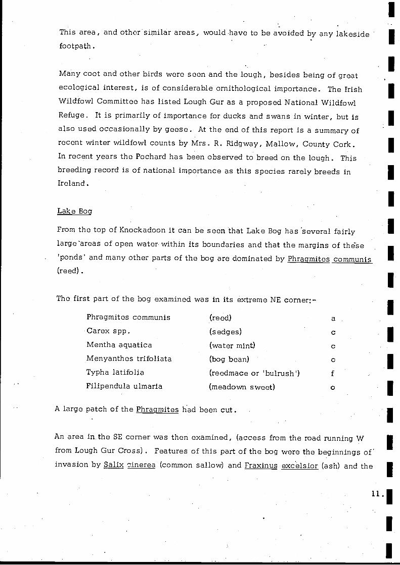
This area, and other similar areas, would have to be avoided by any lakesidefootpath.
Many coot and other birds were seen and the lough, besides being of greatecological interest, is of considerable ornithological importance. The IrishWildfowl Committee has listed Lough Gur as a proposed National WildfowlRefuge. It is primarily of importance for ducks and swans in winter, but isalso used occasionally by geese. At the end of this report is a summary ofrecent winter wildfowl counts by Mrs. R. Ridgway, Mallow, County Cork.In recent years the Pochard has been observed to breed on the lough. Thisbreeding record is of national importance as this species rarely breeds inIreland.
Lake Bog
From the top of Knockadoon it can be seen that Lake Bog has 'several fairlylarge-areas of open water, within its boundaries and that the margins of these'ponds' and many other parts of the bog are dominated by Phragmites communis(reed) .
The first part of the bog examined was in its extreme NE corner:-
Phragmites communis (reed)
Carex s pp. (sedges) c
Mentha aquatica (water mint) c
Menyanthes trifoliata (bog bean) c
Typha latifolia (reedmace or 'bulrush') f
Filipendula ulmaria (meadown sweet)
A large patch of the Phragmites had been cut.
An area in the SE corner was then examined, (access from the road running Wfrom Lough Gur Cross) . Features of this part of the bog were the beginnings ofinvasion by Salix cinerea (common sallow) and Fraxinus excelsior (ash) and the
11.'
IE
i
lE
r
large hummocks of Carex paniculata (panicled sedge) separated'by verychannels containing Equisetum fluviatile (water horsetail):-
The bog is obviously shot; a man was seen walking along the edge with ashotgun and dog.
Threats to the Area
In the Report and Plan of the Lough Gur Amenity and Tourism Survey the objec-
tives of the County Council are stated as follows:-
a) to provide a local recreation centre for the residents of thecity and county of Limerick.
b) to protect the objects of antiquarian interest in the vicinity.c) to attract tourists from outside the county, andd) to provide an additional source of income for the local economy.
It is unfortunate that no mention is made of the scientific interest of the areaand the desirability of preserving this.
l
1
13.1
Threats to the scientific interest that might occur as a result of developmentfor amenity and tourism are:-
a) the disturbance of migrant and breeding birds and physical damageto the marginal reedswamps in which they shelter and breed.the possible influx into the lough of nutrients resulting from thebreakdown of sewage.
That the lough already has fairly high nutrient levels is indicated by the algalbloom observed in October 1971. Influx of nutrients from sewage may result
in rapid eutrophication of the waters of the lough and massive algal growth,
resulting in dense 'blooms' of planktonic algae every summer. Such 'blooms'
would discolour the water and result in the formation of algal 'scum' in theareas in which the wind concentrates the floating algae, usually in the easternparts of the lough. Thick blankets of filamentous algae may also develop over
the bed of the lough. _
Influx of sewage nutrients into the lough is therefore undesirable, not only in
that it would alter the ecological balance of the lough, but also from the amen-ity point of view.
The Report and Plan of the Lough Gur Amenity and Tourism Survey rejects thepossibility of discharging treated sewage directly into the lough but suggestsdischarge into either, or both, Lake Bog and/or Red Bog. As both bogs drain
into the lough,such a practice might eventually result in the influx of nutrientsinto the lough and is therefore not acceptable from an ecological viewpoint.
Rapid eutrophication of the lough could also occur as a result of intensive farm-
ing development within the catchment. Such sources of nutrients are fertilisers
.and animal sewage from, for example, intensive pig or poultry farming.
14.
I.
Recommendations
Chapter III of the Report and Plan of the Lough Gur Amenity and Tourism Survey
lists the attractions of Lough Gur as follows:-
a) "isolated gem of scenery and the site of a precious historical record" .
b) "a water area in an area where lakes are few".
c) the quiet and emptiness which is found there" .
Development for amenity should aim at utilising and preserving these naturalassets without destroying the scientific interest of the area.
In view of the importance of Lough Gur, it is recommended that a Special
Amenity Area Order be prepared for the area, under Section 42, Local Government
(Planning and Development) Act, 1963. This could be prepared in draft form by
An Foras Forbartha.
Regarding amenity and tourism development the following recommendations are
also made:-
a) All building and other development within the Lough Gur catchment shouldbe strictly controlled to prevent or minimise:-
1) spoiling of the scenic beauty of the area. (use'of tree planting forscreening purposes should be considered).
2) discharge of sewage effluent into the catchment.b) Bearing in mind the above, the County Council should provide, on the
shore of the lough and in areas immediately adjacent, for:-1) a museum and/or information centre for the area.
2) . access to sites of historical interest.3) picnic sites.4) paddling and swimming facilities.
5) changing rooms.
6) public toilets.7) a restaurant.8) a lakeshore footpath and easy access to the surrounding hills.
15.
E
E
'
boating facilities. Boating on the lough should be limited toa small number of rowing boats for fishing -and general pleasureuse. This would minimise disturbance of bird populations andpreserve the peace and quiet of the area. Landing from theboats onto the islands or the shores of the lough, except poss-ibly for within designated landing areas, should be prohibitedso as to reduce disturbance of nesting birds and prevent damageto reedbeds in which they nest.
10) car parks necessary for visitors .
c) The County Council should provide for these developments:-
1) Easy access.2) An adequate water supply.
3) An adequate sewage disposal and refuse collection system.As indicated above it is not desirable that sewage effluentshould be discharged into the catchment.
Bourchier's Castle and the surrounding area should be the developmentsite for the provision of the museum/information centre, with associatedcar park and toilets and access to sites of historical interest. Develop-ment has already begun in this area - there is a new restaurant/baramongst the trees N of Lake Bog.
e) The eastern arms of the lough are the parts most likely to be adverselyaffected by algal 'blooms' and are therefore not suitable as a site for allthe proposed amenity development. Swimming is not attractive if thewater is covered with a thick green algal 'scum'.Therefore, the remainder of the proposed development should be situated atthe 'Stone Circle' site recommended in the Report and Plan of the Lough GurAmenity and Tourism survey.Developments other than those mentioned in b) above, e.g. dance halls,etc. should only be allowed in areas outside the Lough Gur catchment.
g) Shooting within the Lough Gur catchment should be prevented.
h) Intensive farming development within the Lough Gur catchment should alsobe prevented. .
16..
SUM
MA
RY
OF
RE
CE
NT
WIN
TE
R W
ILD
FOW
L C
OU
NT
S FO
R L
OU
GH
GU
R
By.
Mrs
. R. R
idgw
ay, R
ossm
ore,
Mal
low
, Cou
nty
Cor
k
Dat
e:7.12.66
14.1.67
2.2.67
3.3.67
12.1.68
16.3.68
21.12.68
8.2.69
13.12.69
28.1.70
Mal
lard
6+10
0+14
56
2252
728
5
Teal
-65
38+
442
22
110+
417
.17
87
Gad
wal
l4
Wig
eon
300
204
334
90
10
22
4286
148+
165
Pintail
12
--
2-
--
-
Shov
eler
3024
46+
2019
1740
+56
5562
Pochard
19
27
23
13
28
17
11
42
11
18
Tuf
ted
Duc
k300
241
228
125
71
80
47
90
30
195
Shel
duck
--
-3
--
1-
Gol
dene
ye2
--
--
-M
ute
Swan
135
150
174
141
47
71
52
71
118+
93+
Who
oper
Sw
an49
--
-26
-15
--
Bew
ick
Swan
-
-10
-_
NO
T C
OU
NT
ED
Coo
t33
545
630
00+
330+
661
Cor
mor
ant
NO
T C
OU
NT
ED
2515
7-
1
NO
T C
OU
NT
ED
Great crested Grebe
24-
1-
1
_
MAP SI- OVJI NNS AREA OF SCIE1JTIFIC INTEREST-1
Scale : 6 to 1 rliia
aa
Fir.ocken nell
rtY - -- 3) a 6u -'i c r` a }- F " t 400113 f- a . _ _: X - f; 1 '- ..C:m t
.^/ t - . { - j y :tea.. 7 7 _a i HfSGC::T'.QfE 1
f
` K dY,r it oa 1Back Hi:1
f, f
feSrfu cl :Gz.. t7Q .a.
a''
- - _ais t 2I4. ; 300-.._II;
I 4 _V-A 13.11. Ii- , - i . - < < 1
<ja a4 I a
/.111./.1
r a cf:..,.). :,;r:rtfore ?..'.'...up' ".` ;, 3f
. yx ` ry, rI :- f .'fit J Y' \I' ' l \-
p0UaV,gvr Far -; .L ;1
vves!a --. - ice. a
- if - - _ It9w rl C2L a ; . ` `TM, af <.. ) -_
400, 1 -
F; =rtet`.A_.. .1! .. -' -' _ E fir:: ._ 1.= _' d ^ - Phi
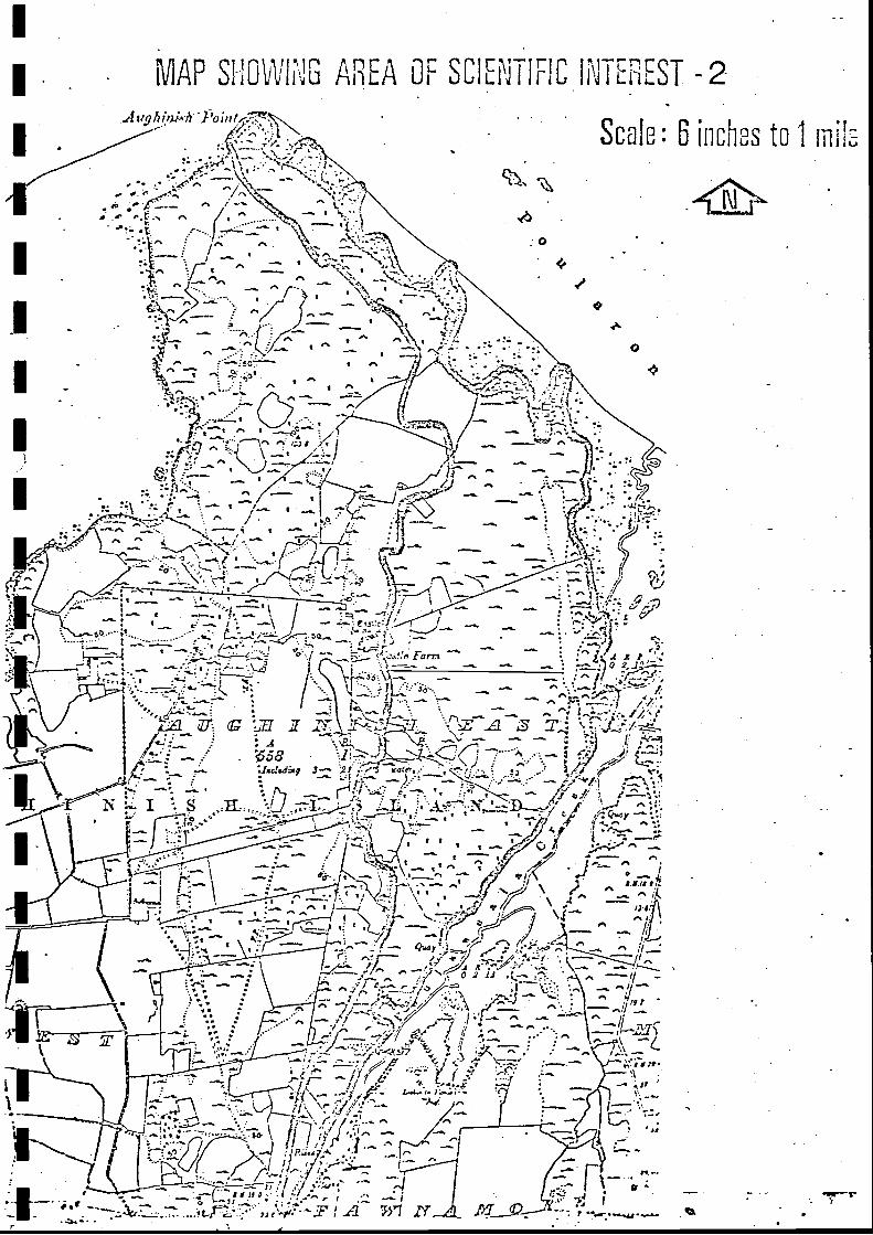
Name of Area AUGHINISH ISLAND, NORTH AND EAST (190 acres)Grid Reference R 283 545 - R 283 515
Scientific interest GeologicalRating National importancePriority A
Description of Area
The area of scientific interest is shown on Map 2.
Waulsortian reef limestones occur throughout the area indicated. They lieat a low dip and are not deformed. Knoll forms can be studied in approxi-mately their original position with well preserved transitions from knoll tooff-bank facies .
There has been no special survey to date though the area is referred to in:-Lees, A. , 1959. The Waulsortian Reef Complex of Eire and the rocks ofits associated facies . Ph.D. Thesis, Reading University.
Lees, A. , 19 61 . The Waulsortian 'reefs' of Eire, a carbonate mudbankcomplex of Lower Carboniferous age. Journal of Geology. 69. p. 101 - 109.
The area is visited by geological parties.
Threats to the Area
The area is threatened by the proposed ALCAN development.
Recommendations .
a) If possible, development within this area should be prevented.b) As far as possible, access to the area should not be restricted by
development elsewhere on the island. On the contrary, access tothe area should be made easier than it is at present.
I
I
I-CO
Ou--1rD
=LJJ
L
Ecm
4
9',{ 1.1.
y11 , .'
fI
L/-'\..
;1
1':
cc
II( I
.19L
tV
.S
` ( .f(f!
f1
fi+
i, w
.,, 1,. S
r=:,
r{
`f
{;. 1
V-
f. ..r; f
C f
-(
fS
c
Alb
`<
-{.),
1f
:i .: rn
f'I %
,Jy . I
tl
f( (
I--
<ft (
1`S
"f
fti,,C
.. f-
f(
1`
;,j'
..5.S
f9;
:v:,t_ :J
i
cc
c j_".:. -
(S
f (j '1'.:yr'
S S
1{'{
s:S
j'i
!{
{r.
a`'
isf
Ss
c
,-
SS
.. j'j
......
`.i,
f' ,.'; ;;,, (.
j/
/f,
w;
:..(..t.::,
r' Cap
tc.
((fS;,
S-:,;
CIO
t---
C
ss
!4\4
.
t, '.-,.
_ !II "a '
't
!I't a
( ( v'
`_
.-:.
.! A1
ri
t_
..r
-
`S'/
I.r-
!S
ao a
Ij
.<
c,
i c ii
c<'
,clS
.r.. S
, , _,.
Name of Area FOYNES ISLAND (40 acres)
Grid reference R 255 527
Scientific interest GeologicalRatin National importancePriority B
Description of Area
The area of interest is shown on Map 3 (Fossil localities indicated +) .
Within the area can be seen the lower strata of the Clare Shales, whichsucceed the Carboniferous limestone. These strata, the E2 , H and R1
zones are much thicker here than at other localities in the region.
Also here are the type localities for two goniatite species, Reticulocerassubreticulatum and Homoceratoides divaricatus.
Further details can be found in:-Hodson. 1954. The Carboniferous rocks of Foynes Island, County Limerick.Geological Magazine. Vol., 91, p. 153 -160.
Hodson and Lewarne. 1961. A mid-Carboniferous (Namurian) basin in partsof the counties of Limerick and Clare. Quarterly Journal of the GeologicalSociety. Vol., 117, p. 307-333.
Threats to the area
Building or other development within the area would destroy its scientificvalue..
The quarry is of note for its columnar basalt, exposed in a vertical rock-facec. 70' high. At the western end of the quarry the basalt columns are 2 or 3'in diameter and run vertically up the whole height of the rock-face. At the -eastern end of the rock-face, however, the basalt columns are much thinnerand radiate out from a central point, forming a circular structure, c. 40' indiameter. This 'sunburst' structure may well. be unique in Ireland.
Threats to the Area
Further quarrying would destroy the 'sunburst' structure and the area would
then be of little scientific interest.
Recommendation
Further quarrying should be prevented.
.11
MAP AREA OF FT
Scale: 6 iral,as to
/J
it Il
1r R : Pa J.3.J IJ
_jan Z4 f l:?rrakr
"I EEE^
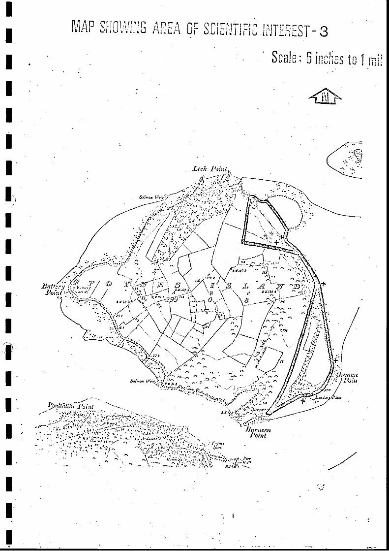
Name of Area AUGHINISH ISLAND, WEST (3 acres)
Grid reference R 276 531
Scientific interest Ornithological
Rating Regional importance
Priority A .
Description of Area
(Taken from 'Report on Aughinish Island' by Dr. D. Cabot, An Foras Forbartha.
March 1971. Commissioned by the Industrial Development Authority.)
The soil of Aughinish West has been classified by An Foras Taluntais (Soilsof County Limerick, 1966) as a Shannon gley, which has been derived from
estuarine alluvium (fine texture, base rich). Shannon gleys comprise 2.10%
of the Limerick soils. The soil is very poorly drained, has a slow permeabi-lity and a very high water table. From an agricultural point of view of thesoil of Aughinish West has a limited use range. The current land utilizationis wet pasture grazing.
The vegetation of the area is characteristic of a wet grassland with Agrostis
stolonifera, Glyceria fluitans, Juncus effusus and -uncus inflexus being the
dominant species.
The sea embankment was extensively repaired.by the Office of Public Works
in 1965/6 and a series of drains, streams and small canals drain into the N.E.corner where there is a sluice outfall.
In the north east corner there is an important open water wetland, fed bybase-rich fresh water arising from the limestone outcrop to the east. This
wetland is an important feeding and watering area for waders and wildfowl
from the Shannon estuary area. On 11 March (high tide) the following
1
species were recorded:-
Mallard 10
Teal 80 - 100
Wigeon 120
Pintail 20
Redshank 5
Dunlin 20
Curlew 15
Greenshank 1
The importance of this area to wildfowl was clearly shown by the extremely
large number of spent shotgun cartridges. A total of 400 cartridges was
counted with a further 100 estimated. The freshness of the cartridges indi-cated that they had been used in the 1970/71 shooting season.
Although substantial numbers of waders and wildfowl were not counted in thisarea on 11 March, it is clear that this freshwater/brackish habitat is impor-tant to the wintering and migratory waterfowl populations of the Shannon estuary
based on the evidence of (a) the abundance of bird droppings; (b) frequency of
footprints of birds; (c) extremely high density of shotgun cartridges. The
occurrence of this type of habitat in the Shannon estuary area is difficult todetermine because of insufficient survey data. However, it is known from
casual observation that this kind of freshwater/brackish habitat in closeproximity of the tidal mud flats is not numerous.
Threats to the Area
The area is within the 26' high wall proposed by ALCAN to impound the 'red
mud' lake necessary for the aluminium plant.
22.
Recommendations
(Taken from 'Report on Aughinish Island. Dr. D. Cabot. March 1971).
a) Ideally the proposed 26' impounding wall for the 'red mud' lakeshould be located in such a way as to isolate the zone indicatedby the black line on Map 5 from the impounding area. However,it is appreciated that this may eliminate too much of the potential'red mud' area and be technically too costly and difficult.
If it was only possible on financial and economic grounds to iso-late the heartland of the wetland (within the red line on Map 5 -about 10 acres) from the impounding area, this would still allowa considerable amount of research information to be gathered aboutthe impact of industry on this kind of ecosystem. The informationcould be of use in making large industry more compatible with thepreservation of our natural heritage.
If the area ceased to be important to wildfowl populations it couldalways be incorporated into the lagoon area.
b) Thereb) There is insufficient research information on the distribution and
abundance of waterfowl populations in relation to their food supply,roosting areas and freshwater habitats in the Shannon estuary area.In view of the development potential of the whole area basic surveysare urgently required. If it is not possible to isolate this smallimportant wetland area from the 'red mud' deposit area further surveysof the waterfowl populations of the Shannon estuary should be under-taken during the winter of 1971/'72. ALCAN might like to considerthe possibility of sponsoring such a survey.
23. 1
LO
v J
LL1
r LJ
CyC/D
L1_,OOTC/D
mv
Name of Area ASKEATON ESTUARY (c. 1, 600 acres)
Grid Reference R 31 53Scientific interest Ornithological, Ecological, Botanical
Rating Regional importance
Priority A
Description of Area
The area of scientific interest is shown on Map 6.
The area is of great importance to the resident wildfowl populations of the
Shannon estuary and as a wintering area for Greylag and Greenland White-
fronted Geese.
Large areas of inter-tidal mud flats provide feeding areas for birds and the
islands and headlands are used for roosting at high tide.
The area around the mouth of Poulaweala Creek was briefly examined on
5 October, 1971.were all noted:-
A full species list was not made but the following species
Artemisia maritima (sea wormwood) 1 c
Rosa spinosissima (burnet rose) f
Gentianella campestris (field gentian) o
Viola hirta (hairy violet) o
I was told that the following species have also been recorded in the area:-
The proposed ALCAN development on Aughinish Island could have effects in
several ways. It may cause:- .
a) disturbance of bird populations
b) development, e.g. housing, within the areac) pollution by
i) domestic type sewageii) atmospheric emission of alumina dustiii) spreading of bauxite dust during unloading, etc.iv) emission of SO,
Whilst the general impact of these factors is difficult to assess it is almostcertain that there will be adverse effects on the bird populations.
Land reclamation work could destroy the area.
Recommendations
a) Development or reclamation works within the area should-be prevented.
b) In the event of the proposed ALCAN development on Aughinish Islandbecoming reality, ecological studies should be started, aimed atassessing the impact of the developments on the ornithology andgeneral ecology of this area. Such research would be of great scien-tific and practical importance.
25.
Name of Area GLEN BOG
Grid reference R 657 378
Scientific interest Ecological
Ratin Regional
Priority B
E
r
Description of Area
The area of interest is shown on Map 7.
Probably once the site of a shallow lake, the area is now covered with dense
alder/willow scrub or carr. Within the boundaries of the carr are still small,open patches with standing water and dominated by Phragmites communis (reed) .
The carr was briefly examined on Oct. 7th 1971.
The following species were recorded:-Phragmites communis (reed)
Drainage would destroy the ecological value of the area.
No information is available as to whether such drainage is proposed.
Recommendation
This area of great ecological interest should be protected by a ConservationOrder under Section 46, Local Government (Planning and Development) Act, 1963 .'
27.
MAP 'Ll1NG AREA OF SCIENTIFIC INTEREST-7
Scale: 6 inches to i mile
RC.ChurehLnnur I
I 1 4
Lia lets Floods
1<00 n lt. ot1
1
r
d tn
rH
Ie Bogs
1.
f
79 2 / 1
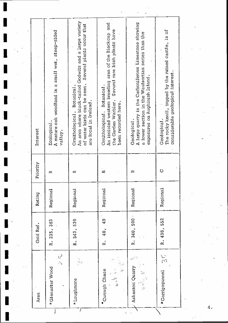
Name of Area GLENASTAR WOOD (38 acres)
Grid reference R 235 383
Scientific interest Ecological
Rating Regional importance
Priority B
Description of Area
The area of interest is shown on Map
This is an area of dense, deciduous woodland in a deep, wet, v-shaped valley.'
The N-facing slope was examined on Oct. 6th, 1971. It is extremely dampwith small streams running down the slope in several places to join theR. Daar in the valley bottom.Trees and Shrubs
Praeger in Botanist in Ireland' reports Chamaenerion angustifolium (rosebay
willow-herb) by the waterfall.
The general view obtained of the S-facing slope of the valley indicated thatthe woodland at the western end has a high canopy almost exclusively formed
by oak, whilst birch becomes more important at the eastern end, where thevalley is wider. This increase in abundance of birch towards the wider
eastern end of the valley was also noted on the N-facing slope.
Threats to the areaClearance of the woods for replanting or other. development would appear to
be the only danger.No information is available as to whether this is proposed.
Recommendation
This area of woodland should be protected by a Tree Preservation Order, underSection 45, Local Government (Planning and Development) Act, 1963.
MAP SHOti'J NG AREA OF SCIENTIFIC INTEREST-8
Scale : 6 irchos to 1 rlii;o
7
\ > ' mo ? r '''_ ; t i ..{, -r
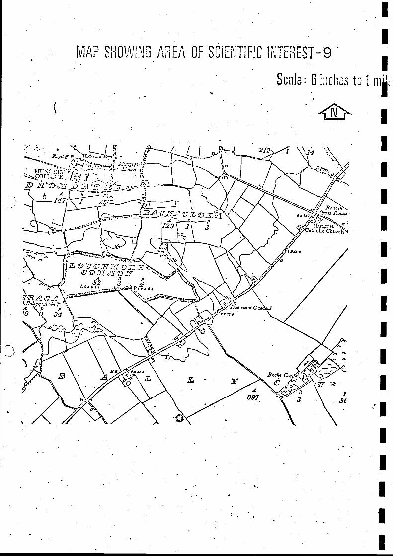
Name of area LOUGHMORE (32 acres)
Grid reference R 543 530
Scientific interest Ornithological. Botanical
Ratin Regional importance
Priority B
Description of Area
The area of interest, is shown on Map 9.
When visited, on Oct. 7th, 1971, this area was dry except for several pools,c 20 cms deep, in the eastern part of the area. Extensive flooding is reportedto occur in the winter months.
Polygonum ? lapathifolium (pale persicaria) oPotentilla reptans (creeping cinquefoil) o
Eleocharis palustris (common spiketrush) r
Equisetum palustre (marsh horsetail) r
Rorippa ? microphylla (watercress) r
7
The area is important ornithologically because of its proximity to Limerick
city, its variety of species, and the comparative ease with which the birds
can be seen and identified. The following data is based on records from
the area by L. Stapleton, between 1966 and 1969.
32.
Mallard: Seen annually in small numbers. Attempted to breed in 1969. 'Max. number seen at one time: 30
Teal:
Widgeon:
Pintail:
Shoveller:
,, It Is it Is
50
Tufted duck:
Pochard:
Shelduck:
Mute Swan:
,,
Whooper Swan:
: 63
II 11 itIt 11 it to : 27
It 11 11 11 II
Present in some years, from December to May. The averageflock is about 40; the maximum number seen at any one time: 60
Small numbers seen in most years. Maximum number seen atone time: 30.Their behaviour suggested breeding in 1966.
One seen on January 1st, 1969 after heavy fog.
Present whenever there is a sufficient depth of water, butmakes no serious attempt to breed.
Flocks of up to 30 birds appear irregularly.
Bewick's Swan: Occurs irregularly.
Lapwing:
Golden Plover:
Snipe:
Black-tailedGodwit:
Dunlin:
Dabchick:
Great *crestedGrebe:
Seen regularly. Up to 1500 present in the winter of 1967.
Occur irregularly in January in fields around the area.
Often seen 'drumming' over the area in Spring and early Summer.
Seen annually in small numbers; 24 seen in 1966, 9 seen in 196713 seen in 1969.
1Seen occassionally.
Seen occassionally.
Seen occassionally.
N.P. The Spoonbill, Little Gull and Garganey are also reported to have beenseen here.
,,
1
II
'
Threats to the Area
Drainage of the area, or building development in or around it, would destroyits interest.
The area is used as grazing land for most of the year, i.e. when it is notflooded. Drainage would not appear to be wise from the farmer's point of
view because, although it would extend the grazing period by several months,
it would result in the disappearance of the small ponds that are used aswatering-places by stock during the summer and autumn.
No information is available as to whether such developments are proposed.
Recommendations
a) Building in the area, or in adjacent areas,- should be prevented.
b) If the farmer does propose to drain the area, it is recommended that
he be advised against it on the above grounds, and because any
advantages to be gained are small in comparison with the loss from
the ornithological and educational viewpoints .
34.
MAP G AREA OF SC1Ei'1TIFIC li`ITE EST-9
Scale: 6 incres to 1IV .
C,
t
Name of Area CARRIGOGUNNEL (3 acres)
Grid reference R 498 552
Scientific interest Geological
Ratin Regional importance
Priority C
Description of Area
The area of interest is shown on Map 10.
The area was visited on November 9th, 1971.
The rocky knoll, on which the old castle was built, is composed of several
different rock types. A basalt lava flow sits on top of the Carboniferous
limestone and is itself overlaid by pyroclastic ashes.
Threats to the Area
In view of the limited size and historical value of the site any development
appears unlikely.
Recommendation
Any development around the castle should be compatible with the geological
value of the site as well as with its historical interest.
35.
L
' n Q I ( 1 r t f, r- r n rU : 4 I L 11Lr O1 vU L1 r i b L 10
1
scale: 6 irci s to 1 ,
-17
f̀or ff rtii - +
ata
^i 'J r
r- t - r._l
Name of Area CAHERCONLISH QUARRY (c -3 acres)
Grid reference R 682 501
Scientific interest Geological
Ratin Regional importance
Priority C
Description of Area
The area of interest is shown on Map 11 .
The area was visited on November 9th, 1971.
E
EI
i
Here can be seen fine exposures of columnar trachyte. The columns are
best seen at the southern end of the quarry where they are 3 or 4' in diameter
and c 30' high.
Threats to the site
As the quarry is on the side of an extremely small rocky knoll, further
quarrying would quickly destroy the site.
Recommendation
Further quarrying should be prevented.
36.
'1
S1"iv(1 f'-
"-utic I
nrrd
-{{LUIL1
t^!1IC I1 I L11L
Scale: 6 irci,cs
1
Lt d! i I -11t !1
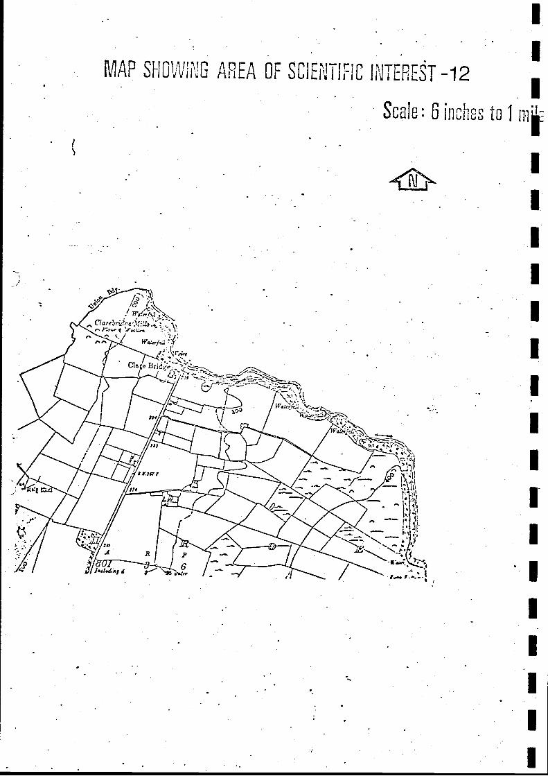
Name of area CLARE GLEN (c. 3 acres)
Grid reference R 735 598
Scientific interest Ecological
Ratin Local importance
Priority C
I
Description of area
The area of interest is shown on Map 12. Only the N-facingslope of the valley is in County Limerick, the Clare River forming the
County boundary at this point.
The area was visited on October 8, 1971.
Most of the valley has been cleared of its original deciduous woodland and
replanted with conifers. There is still, however, a narrow strip of deciduouswoodland bordering the river, which flows over a series of flat, low rockysteps - weathered out bedding-planes of the Old Red Sandstone bedrock.
This small remnant of the former woodlands is of scientific and educationalimportance. It does, in fact, form an essential part of the Nature Trail on
the Tipperary side of the Clare River.
The following species were recorded in the woodland:!--
On the riverside rocks, which were often covered with a dense growth of
the moss Thamnion alopecurum the following additional herbs were noted:-
I Bellis perennis (daisy) c
Cardamine flexuosa (wood bitter-cress)
Galium saxatile (heath bedstraw) f
Prunella vulgaris (self-heal) f
Taraxacum sp. (dandelion) o
Agrostis stolonifera (fiorin)
Blechnum spicant (hard fern) o
Crepis paludusa (marsh hawk '. s -beard) o
Festuca gigantea (tall brome) o
Hypericum androsaemum (tutsan) o
Juncus articulatus (jointed rush) o
Juncus bulbosus (bulbous rush) o
Lotus pedunculatus (large birds foot -trefoil) 0
Senicio jacobea (ragwort) o
Stellaria holostea (great stitchwort) o
Epilobium montanum (broad-leaved willow herb) r
Polygonum hydropiper (water-pepper) r
Threats to the AreaClearance might be carried out in connection with the forestry work.
Recommendation
Removal of trees should be prevented by a Tree Preservation Order, under
Section 45, Local Government (Planning and Development) Act, 1963.
39.
r
MAP SHRVI G AREA 0 SCIEN' T IF IC T EFEST -12
Scale: 6 ircu, o
Name of area
Grid reference
Scientific interestRatin
Priority
5
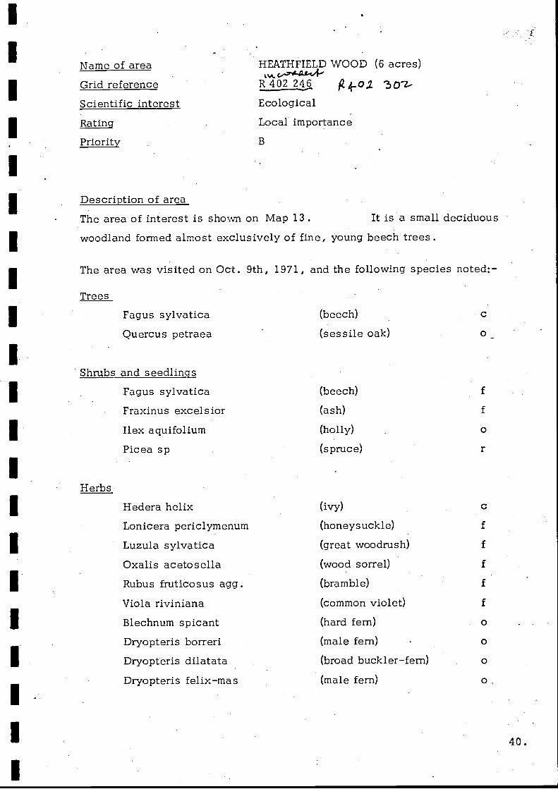
HEATHFIELD WOOD (6 acres)
R 402 246 30'ZEcological
Local importance
B
Description of areaThe area of interest is shown on Map 13. It is a small deciduous
woodland formed almost exclusively of fine, young beech trees.
The area was visited on Oct. 9th, 1971, and the following species noted:-
Trees
Fagus sylvaticaQuercus petraea
Shrubs and seedlingsFagus sylvaticaFraxinus excelsior
Ilex aquifolium
Picea sp
Herbs
Hedera helixLonicera periclymenum
Luzula sylvatica
Oxalis acetosellaRubus fruticosus agg.
Viola riviniana
Blechnum spicant
Dryopteris borreri
Dryopteris dilatata
Dryopteris felix-mas
(beech)
(sessile oak)
(beech)
(ash)
(holly)
(spruce)
(ivy)
(honeysuckle)
(great woodrush)
(wood sorrel)
(bramble)
(common violet)
(hard fern)
(male fern)
(broad buckler-fern)
(male fern)
c
f
c
f
f
f
f
f
0
0
0
o,
1 40.
K C
Geranium robertianum (herb robert) o
Pteridium aquilinum (bracken) o
Sanicula europaea (wood sanicleVaccinium myrtillus (bilberry) o
Carex sylvatica (wood sedge) r
Hypericum androsaemum (tutsan) r
Succisa pratensis (devil's-bit scabious) r
Generally, the cover of field layer and ground zone vascular plants is low andthere are large areas of bare ground and other areas covered only by the mossRhytidiadelphus triguetrus.
Threats to the Area
The wood is protected at the moment by Mrs. Aliott, Odelville, Ballingarry,who is Trustee under a Marriage Settlement.
Control of the estate passes to Mrs. Allott's nephews in two years, however,and it is possible that the threat of clearance may arise after this time.
Recommendation
The area should be protected by a Tree Preservation Order, under Section 45,Local Government (Planning and Development) Act, 1963.
41. I
MAP SHOWii'!G AREA OF SC1E JTiEIC IUiTErREST-13
Scale: 6 inches to 1;
o
I I
Name of area
Grid reference
Scientific interestRatin
Priority
BALLINVIRICK MARSH (2.5 acres)
R 391 479
Botanical
Local importance
C
Description of areaThe area of interest is shown on Map 14.
The area was visited on Oct. Sth, 1971, and the following species noted, in
Pinguicula vulgaris (butterwort) rRhinanthus minor (hayrattle)
11
1-
I
The interest of the area lies in the presence of Epipactis palustris (marshhelleborine), a species of extremely local occurence in Ireland. Thereare a large number of plants of this orchid in this area and in a small partof the adjoining field, which is mown for hay.
Threats to the Area
The only likely threat is drainage, which would probably cause the Epipactispalustris to die out.
No information is available as to whether such drainage is proposed.
Recommendations
a) Building in the area (an unlikely possibility) should be prevented.
b) In view of the limited importance of this site, opposition to anydrainage scheme aimed at improving the agricultural quality ofthe land is not recommended.
43.
MAP S11-10VVING AREA OF SC1Ei,]TIE1C INTEREST-14
Scale: 6 inches to 1 ipI
i
_AREA
I
13rt lrrrrrrrrk"I:JIii frr-
1
Name of Area CAPPAGH FEN (26 acres)
Grid reference R 377 460
Scientific interest Ecological
Ratin Local importance
Priority
Description of Area
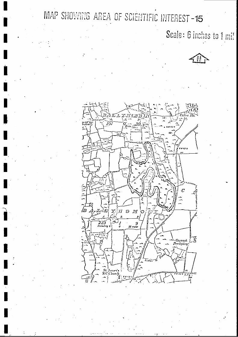
The area of interest is shown on Map 15.
The area was visited on 5th October, 1971 and the SE part, nearest to theroad, was the first to be examined. Here are several small, shallowbase-rich pools, in which a Chara sp (stonewort) was abundant, surrounded
by a tall herb vegetation, in which there are interesting variations incommunity structure from place to place.
The following species were noted:-
In the pools
Chara sp .
Menyanthes trifoliata
Fen and marsh areas
7
Cladium marsicus
Juncus acutiflorusPhragmites communis
Schoenus nigricans
Carex lepidocarpaCarex panicea
Filipendula ulmaria
Hydrocotyle vulgaris
Irish pseudacorus
Equisetum palustre
Mentha aquatica
(stonewort) c
(bog bean) f
(sedge) 1 a
(sharp-flowered rush) 1 a
(reed) 1 a
(bog rush) 1 a
(yellow sedge)
(carnation-grass) c
(meadow-sweet) c
(marsh pennywort) c
(yellow flag) 1 c
(marsh horsetail) f
(water mint) f
44.
C
Parnassia palustris (grass of parnassus) f
Potentilla anserina (marsh cinquefoil) f
Anagallis tenella (bog pimpernel) o
Carex rostrata (bottle sedge) o
Equisetum fluviatile (water horsetail) o
Eriophorum angustifolium (cotton sedge) o
Moninia caerulea (purple moor-grass) 0
Succisa pratensis (devil's-bit scabious)Eupatroium canabinum (hemp agrimony) r
The remainder of the fen is dominated by either Cladium mariscus (sedge)
or Phragmites communis (reed) .
Threats to the Area
Drainage appears to be the only likely threat.
Recommendation
The scientific importance of this area is affected by the availability ofsimilar habitats within the region e.g. Gorteennamrock Fen. It is,therefore, recommended that, should drainage be proposed at any time
in the future, a reassessment of the scientific importance of this areashould be carried out. The advisability of drainage should then be
considered in the light of this reassessment.
E
1
45. 1
o
.
n Lr Q Ii'J i LnCST -15
1 n 1, r-%Scale: G 1[1 61 i J
i`H1
;Za. 1 GJ
s I /'_ i _ _) / ai
22Y 1lnci.d,ny !6 r (er
r
F-11.1 f-
I j.Ct..Iarnrs'e i
H.U.('hurrh
r 1:.; !,!+MI-1111"d Sri
u
;-
tRia:+ - . . LYJS! 4
Name of Area BALLYVOGUE FEN (14 acres)
Grid reference R 385 515
Scientific interest Ecological
Ratin Local importance
Priority C
Description of Area
The area of interest is shown on Map 16.
The area was visited on October 8th, 1971, and seen to be very similar toCappagh Fen, previously described. Here, however, Cladium mariscus wasnot as abundant, and waterlilies (only a few small leaves seen) were noted
in a shallow pool.
Threats to the Area
Drainage appears to be the only likely threat.
Recommendation
The scientific importance of this area is affected by the availability ofsimilar habitats in the region, e.g. Cappagh Fen. It is, therefore, recommended 'that, should drainage be proposed at any time in the future, a reassessmentof the scientific importance of this area should be carried out. The advisabilityof drainage should then be considered in the light of this reassessment.
46.'
'
'
0 cl)
"T i
c)
CIA
OcD
rri
m=
Aco
C1.3
H--
CyJ
C-3
.
cm
m =
mm
= m
m
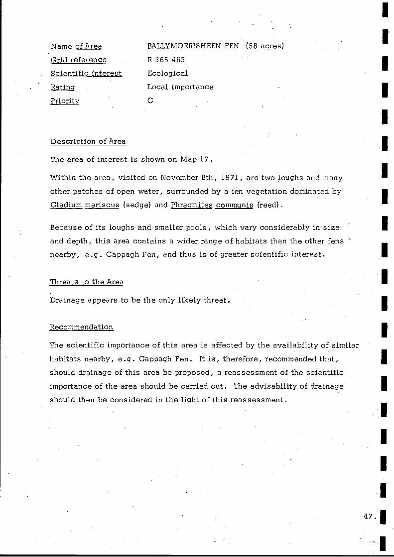
Name of Area BALLYMORRISHEEN FEN (58 acres)
Grid reference R 365 465
Scientific interest Ecological
Ratin Local importance
Priority C
Description of Area
The area of interest is shown on Map 17.
Within the area, visited on November 8th, 1971, are two toughs and many
other patches of open water, surrounded by a fen vegetation dominated by
Cladium mariscus (sedge) and Phragmites communis (reed) .
Because of its loughs and smaller pools, which vary considerably in sizeand depth, this area contains a wider range of habitats than the other fensnearby, e.g. Cappagh Fen, and thus is of greater scientific interest.
Threats to the Area
Drainage appears to be the only likely threat.
Recommendation
The scientific importance of this area is affected by the availability of similarhabitats nearby, e.g. Cappagh Fen. It is, therefore, recommended that,should drainage of this area be-proposed, a reassessment of the scientificimportance of the area should be carried out. The advisability of drainage
should then be considered in the light of this reassessment.
ot lk rn r -. rl rJ! -MAP JitoL J lLii Or uL lLl.ii i, IL li,iT Li1L
Scale : 6 lc
..`11 1L _L a-1 721H .7 , :iZ11 ,
141
1 JI YcjH-r
- ! I
1 i
4d1 27 , ,
. Inrhe,ug 1v.
A
rq
4i
v` s. ., .....`.' . T- `ma`y _9 .. .t+e..'
. \.... 13!L.
0 21
D
\
115 `01 9 r1rr 1ea.' .
t .1 r .. ;mar
. t. 1 - ~ {.. ;4_ I : -+' 1
.r1-N tel./ ,..( 1 .1 a`. i. 1
i
k_ 1
'- 'l nuglr i
t: 44.,.* i y t y It
h "<a y tI4
tea.
-ti
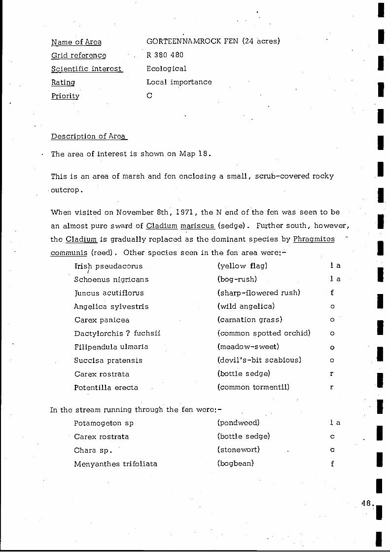
Name of Area GORTEENNAMROCK FEN (24 acres)
Grid reference R 380 480
Scientific interest Ecological
Ratin Local importance
Priority C
Description of Area
The area of interest is shown on Map 18.
This is an area of marsh and fen enclosing a small, scrub-covered rockyoutcrop.
When visited on November 8th, 1971, the N end of the fen was seen to bean almost pure sward of Cladium mariscus (sedge) . Further south, however,
the Cladium is gradually replaced as the dominant species by Phragmites
communis (reed) . Other species seen inIrish pseudacorusSchoenus nigricans
Juncus acutiflorus
Angelica sylvestrisCarex panicea
Dactylorchis ? fuchsiiFilipendula ulmaria
Succisa pratensisCarex rostrataPotentilla erecta
the fen area were:-(yellow flag)
(bog-rush)
(sharp-flowered rush)
(wild angelica)
(carnation grass)
(common spotted orchid)
(meadow-sweet)
(devil's-bit scabious)(bottle sedge)
(common tormentil)
In the stream running through the fen were:-Potamogeton sp (pondweed)
Carex rostrata (bottle sedge)
Chara sp. (stonewort)
Menyanthes trifoliate (bogbean)
o
o
o
r
r
la
c
c
1
Threats to the Area
Drainage appears to be the only likely threat.
Recommendation
The scientific importance of this area is affected by the availability of
similar habitats nearby, e.g. Cappagh Fen. It is,. therefore, recommended
that, should drainage be proposed, a reassessment of the scientific importance
of the area should be carried out. The advisability of drainage should then
be considered in the light of this reassessment.
49.
C
r--;
CD
00
L, .
C_:
.{ J
C/3
CID
co T Lc:
C C
3LJ
C.D
.--. s
L1J
C,3
Cam
']
C.
LJ C1" s- C-7
C7
11
Name of area
Grid reference
Scientific interest
Ratin
Priority
BARIGONE (10 acres)
R 300 506
Ecological, Botanical
Local
C
Description of areaThe area of interest is shown on Map 19.
It is an area of grassland and exposed limestone with a few isolated shrubs.
There is no 'pavement' development.
There is a rich and interesting flora and the following species were noted