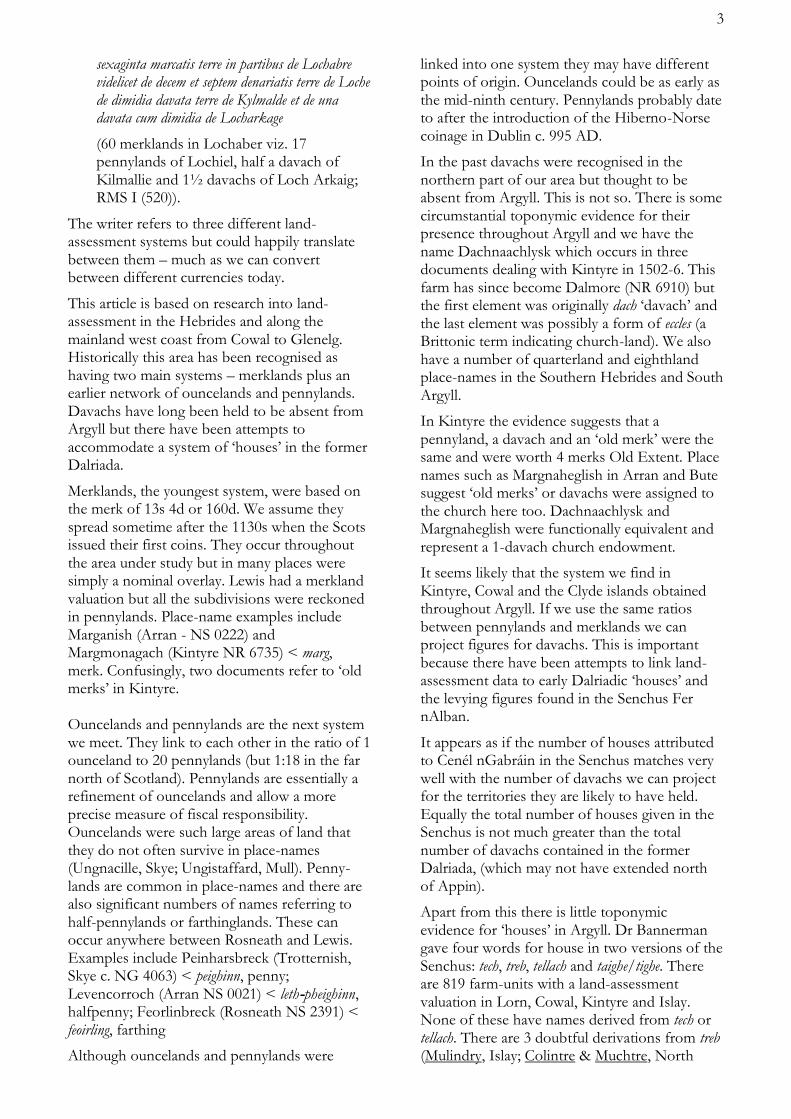
No. 33 Autumn 2012 SCOTTISH PLACE-NAME SOCIETY COMANN AINMEAN-ÀITE NA H-ALBA Just after dawn: north-eastward view from a balloon flight over the outskirts of Biggar, South Lanarkshire. After a very still, cool summer night, cold moist air had flowed down the hillsides and formed mist in the hollows and valleys. This well known meteorological phenomenon of hilly districts was invoked by W J Watson in his classic ‘The Celtic Place-Names of Scotland’, to explain the Naver of Sutherland, Nabar- in Roman times, Nabhair in Gaelic, as probably named for the fogs rising from the river. He saw the name as from an Indo-European root shared with Greek néphos, ‘cloud’, and Sanskrit nábhas, ‘wet cloud’. Beyond Broomy Law, with its group of telecom masts on the horizon, drainage converges on the Tarth Water, with its flat floodplain confined by hills. As a prime candidate for convection fogs, it is intriguing that its name, in Welsh, means ‘mist’; but Gordon’s 17th century map has ‘Terf’ . As for the small town in the foreground, “Glasgow is big but Biggar is Biggar”, and more of a challenge to toponymists than the ‘Green Hollow’.
Transcript
No. 33
Autumn 2012
The Newsletter of the SCOTTISH PLACE-NAME SOCIETY
COMANN AINMEAN-ÀITE NA H-ALBA
Just after dawn: north-eastward view from a balloon flight over the outskirts of Biggar, South Lanarkshire. After a very still, cool summer night, cold moist air had flowed down the hillsides and formed mist in the hollows and valleys. This well known meteorological phenomenon of hilly districts was invoked by W J Watson in his classic ‘The Celtic Place-Names of Scotland’, to explain the Naver of Sutherland, Nabar- in Roman times, Nabhair in Gaelic, as probably named for the fogs rising from the river. He saw the name as from an Indo-European root shared with Greek néphos, ‘cloud’, and Sanskrit nábhas, ‘wet cloud’. Beyond Broomy Law, with its group of telecom masts on the horizon, drainage converges on the Tarth Water, with its flat floodplain confined by hills. As a prime candidate for convection fogs, it is intriguing that its name, in Welsh, means ‘mist’; but Gordon’s 17th century map has ‘Terf’. As for the small town in the foreground, “Glasgow is big but Biggar is Biggar”, and more of a challenge to toponymists than the ‘Green Hollow’.
2
The postal address of the Scottish Place-Name Society is:
c/o Celtic and Scottish Studies, University of Edinburgh, 27 George Square, Edinburgh EH8 9LD
Membership Details: Annual membership £6 (£7 for overseas members because of higher postage costs), to be sent to Peter Drummond, Apt 8 Gartsherrie Academy, Academy Place, Coatbridge ML5 3AX.
Scottish Place-Name Society web site: http://www.spns.org.uk/
FROM THE AGM For those who were not able to be at the AGM in Oban, the Committee thought it would be useful to mention in print a few of the previous year’s more significant achievements.
There is a rolling programme of publications, largely managed by Jake King. Early this year we issued in book form a collection of articles written over several decades by our Honorary President Prof Bill Nicolaisen: In the Beginning was the Name. Thanks to successful fund-raising by Doreen Waugh, who has now retired from the Committee, not only has the cost of this substantial book been kept down to £10, but a student essay prize has been inaugurated in Prof Nicolaisen’s honour.
In March to November 2011 the Society partnered Scottish Language Dictionaries, in the Scots Words and Place-Names project based at Glasgow University. This was aimed at finding out how modern social media could be used to broaden public interest in language and place-names. It included a very successful competition for schools, and used Facebook and Twitter to engage with the public. An important result is the electronic Glossary of Scottish Place-Name Elements compiled by Alison Grant, online at http://www.gla.ac.uk/swap. Three members represented the Society in a public event at the Riverside Museum in Glasgow on 9 June, in connection with Michael Wood’s series of programmes on British history for the BBC.
The previous Convener, Simon Taylor, has been made an Honorary Fellow of the Royal Scottish Geographical Society, and our committee
member Ellen Bramwell has gained her PhD for research on naming in Scottish communities.
The Society continues to be grateful to Leslie and Elizabeth Fraser for running the conference bookstalls, which support the Society both intellectually and financially.
Our Treasurer, Peter Drummond, writes: “Readers not able to come to AGMs may like to know something about our finances. We have about 340 members, which generates some £1750 p.a., which approximately equals the cost of printing and posting the Newsletter. The conferences, whose accommodation and catering costs are usually around £1000 each, are paid for by conference fees. Our other sources of income include donations, Gift Aid on the subscriptions, our bookstall sales and sales of the Society’s own publications. This is used for such things as new publications, and supporting students’ attendance at conferences. If any member would like a copy of the 2011-12 accounts (held in an Excel file), contact the Treasurer at [email protected].”
MERKLANDS, PENNYLANDS AND DAVACHS IN ARGYLL
The land-assessment systems of Scotland can be confusing. In documents and place-names we find a variety of terms such as merklands, pennylands, davachs, carucates, arachors, cowlands and mail-lands. How did each system articulate with the others – over space and time?
Our approach shares much with the toponymist. We also derive evidence from documents and place-names. But the type of evidence we are working with gives us one crucial advantage. The systems we are studying were bound together by arithmetic. The relationships between their different parts were precisely defined – as were the relationships between different systems. We do not struggle with those nuances of meaning which can so trouble the textual or linguistic historian. If we can work out the various ratios within each system as well as the ratios between the various systems then we can reconstruct patterns even for those areas where the evidence is weak.
In practice such matters are seldom crystal-clear. Why did the relationships between merklands and ouncelands vary? We have lost the understanding shown by this mid-fourteenth century scribe:
sexaginta marcatis terre in partibus de Lochabre videlicet de decem et septem denariatis terre de Loche de dimidia davata terre de Kylmalde et de una davata cum dimidia de Locharkage
(60 merklands in Lochaber viz. 17 pennylands of Lochiel, half a davach of Kilmallie and 1½ davachs of Loch Arkaig; RMS I (520)).
The writer refers to three different land-assessment systems but could happily translate between them – much as we can convert between different currencies today.
This article is based on research into land-assessment in the Hebrides and along the mainland west coast from Cowal to Glenelg. Historically this area has been recognised as having two main systems – merklands plus an earlier network of ouncelands and pennylands. Davachs have long been held to be absent from Argyll but there have been attempts to accommodate a system of ‘houses’ in the former Dalriada.
Merklands, the youngest system, were based on the merk of 13s 4d or 160d. We assume they spread sometime after the 1130s when the Scots issued their first coins. They occur throughout the area under study but in many places were simply a nominal overlay. Lewis had a merkland valuation but all the subdivisions were reckoned in pennylands. Place-name examples include Marganish (Arran - NS 0222) and Margmonagach (Kintyre NR 6735) < marg, merk. Confusingly, two documents refer to ‘old merks’ in Kintyre. Ouncelands and pennylands are the next system we meet. They link to each other in the ratio of 1 ounceland to 20 pennylands (but 1:18 in the far north of Scotland). Pennylands are essentially a refinement of ouncelands and allow a more precise measure of fiscal responsibility. Ouncelands were such large areas of land that they do not often survive in place-names (Ungnacille, Skye; Ungistaffard, Mull). Penny-lands are common in place-names and there are also significant numbers of names referring to half-pennylands or farthinglands. These can occur anywhere between Rosneath and Lewis. Examples include Peinharsbreck (Trotternish, Skye c. NG 4063) < peighinn, penny; Levencorroch (Arran NS 0021) < leth-pheighinn, halfpenny; Feorlinbreck (Rosneath NS 2391) < feoirling, farthing
Although ouncelands and pennylands were
linked into one system they may have different points of origin. Ouncelands could be as early as the mid-ninth century. Pennylands probably date to after the introduction of the Hiberno-Norse coinage in Dublin c. 995 AD.
In the past davachs were recognised in the northern part of our area but thought to be absent from Argyll. This is not so. There is some circumstantial toponymic evidence for their presence throughout Argyll and we have the name Dachnaachlysk which occurs in three documents dealing with Kintyre in 1502-6. This farm has since become Dalmore (NR 6910) but the first element was originally dach ‘davach’ and the last element was possibly a form of eccles (a Brittonic term indicating church-land). We also have a number of quarterland and eighthland place-names in the Southern Hebrides and South Argyll.
In Kintyre the evidence suggests that a pennyland, a davach and an ‘old merk’ were the same and were worth 4 merks Old Extent. Place names such as Margnaheglish in Arran and Bute suggest ‘old merks’ or davachs were assigned to the church here too. Dachnaachlysk and Margnaheglish were functionally equivalent and represent a 1-davach church endowment.
It seems likely that the system we find in Kintyre, Cowal and the Clyde islands obtained throughout Argyll. If we use the same ratios between pennylands and merklands we can project figures for davachs. This is important because there have been attempts to link land-assessment data to early Dalriadic ‘houses’ and the levying figures found in the Senchus Fer nAlban.
It appears as if the number of houses attributed to Cenél nGabráin in the Senchus matches very well with the number of davachs we can project for the territories they are likely to have held. Equally the total number of houses given in the Senchus is not much greater than the total number of davachs contained in the former Dalriada, (which may not have extended north of Appin).
Apart from this there is little toponymic evidence for ‘houses’ in Argyll. Dr Bannerman gave four words for house in two versions of the Senchus: tech, treb, tellach and taighe/tighe. There are 819 farm-units with a land-assessment valuation in Lorn, Cowal, Kintyre and Islay. None of these have names derived from tech or tellach. There are 3 doubtful derivations from treb (Mulindry, Islay; Colintre & Muchtre, North
4
Kintyre) but each is questionable and treb need not necessarily be a marker for Dalriadic Scots since we find it in other parts of Scotland associated with the Britons. We have only two early tigh names - Tydrum and Tycarmakan (Islay). It does not appear that Dalriadic ‘houses’ were embedded deeply in Argyll but the survival of the equivalent native unit - the davach - may explain this.
Denis Rixson (summarising his talk at the spring conference in Oban)
ALEXANDER CARMICHAEL AND
THE REV. NIEL CAMPBELL: TRACING TWO FOLKLORISTS’
ENGAGEMENT WITH THE
HIGHLAND ENVIRONMENT
In my paper I investigated two major folklore collectors who laboured in the districts between Oban and Loch Awe – Glen Lonan, Muckairn, and Kilchrenan and Dalavich – at the end of the nineteenth century. One of them, Alexander Carmichael (1832–1912) is still recognised today thanks to his six-volume magnum opus full of songs, stories, charms, blessings, prayers, and all manner of traditionary lore, Carmina Gadelica. Carmichael’s name, however, tends to be associated with the Outer Hebridean islands of Uist and Barra where he worked as an exciseman for nearly two decades between 1864 and 1882. Much less well-known are Carmichael’s connections with Oban, where he passed two rather unsatisfactory years at the end of the 1870s, and with Taynuilt, where he and his family spent their summer holidays after taking up residence in Edinburgh. Indeed, after finally completing the first two volumes of Carmina Gadelica in 1899, Carmichael and his wife Mary Frances left Edinburgh for Taynuilt, supposedly for good. They would spend only a few months there, however, before a falling out with the local factor meant that the couple had to return to the capital.
The other collector is a much less familiar figure. Over a period of five years at the end of the nineteenth century the established minister of Kilchrenan and Dalavich, the Rev Niel Campbell (1850–1904), would record hundreds of items from the people of his own and neighbouring parishes. He did so on behalf of the Edinburgh surgeon Robert Craig Maclagan (1839–1919), then supervising a major collecting project embracing the whole Highlands on behalf of the Folklore Society in London.
The papers of both these collectors are preserved in the archives of the University of Edinburgh. Carmichael’s form the kernel of the great Carmichael Watson Collection at the Centre for Research Collections at the University Library, while Campbell’s are to be found among thousands of other items in the Maclagan Manuscripts in the School of Scottish Studies Archives. Both are the subject of ongoing cataloguing projects, making research considerably easier.
Carmichael’s hasty scribbles in his personal field notebooks contrast nicely with Campbell’s beautifully written, highly idiosyncratic and playful letters to Maclagan. Both collectors devoted much of their labours to the stories local people told about conspicuous landmarks and antiquarian sites in their neighbourhood – or rather what they thought might be of interest to outsiders, and suitable to tell them. What we have, then, is generally what people regarded as traditional lore rather than modern anecdotes: fascinating in-depth insights into indigenous perceptions of the local historical landscape on the brink of the catastrophic cultural collapse of the twentieth century. We have much historical information, such as from the ferryman at ‘New York’:-
The ferry was originally between Inverinan and Fernoch. The cattle passed that way to the south. They tied one head by a rope to the boat. The rest of the herd were surrounded and easily got to follow. The cattle in this way swum the loch. The ferry was named ‘boidheach’ ‘beautiful’. [Maclagan MS 2739(3)]
Rabscallions Chillechreanain: Rapscallions of Kilchrenan. These were regarded as the worst boys at the school, and these are school nicknames… [Maclagan MSS 906(8)]
Carmichael records that the people of Muckairn were known as Bearraich Mhuc Càrna, ‘the gibers of Muckairn’ because of ‘a bad reputation among their neighbours for their rude interference and impertinent remarks.’ [CW217 fos.72–4]
Much material is devoted to landmarks connected with death: green swards, supposedly scenes of murder past, or prominent trees (rarer then than now) as sites of hangings. Elaborate
5
stories are recorded concerning hauntings and other supernatural phenomena, often connected with prominent buildings such as Lochnell Castle, Inverawe House, or Barbreck Farm. A whole complex of place-names in Glen Lonan – ‘farms, streams, rocks, and wells’ – illustrated the Fenian lay of the death of the hero Diarmid, mythical ancestor of the Campbells. Such stories must have been considerably embellished for the Ossian-obsessed tourists who thronged Oban from the end of the eighteenth century. Other topographical items concern buried treasure with their associated markers, historical clan legends, and some anecdotes of more recent provenance, including reminiscences of ‘beating the bounds’.
Far from being set in a timeless landscape, many items relate to recent changes and transformations. Landmarks such as Bonawe Furnace, and its associated industry, are said to have been foretold by local prophets. Some English names have replaced Gaelic:-
Opposite Port innisherrich on Loch Awe is ‘New York’ and between Taynuilt and Achnacloich is Australia. Then we have ‘Nelson’s Monument’ at Taynuilt all evidently the fancies of the Smelting English Company or of Southern tourists who could not find it convenient to call them by their Gaelic names or as in the case of the Monument wished to attach a worthier tradition. [Maclagan MS 1772(1)]
Some landmarks have even been recreated for tourists, such as a fake cairn illustrating a historical legend:-
I fancy it has been built for the benefit of tourists or rather of those who profit by their coming here. I cannot say whether it is the same as the funeral cairn I think not. One is not sorry that it is used for road ‘metal’.
… In any case a visit to the real cairn a scene of the tragedy takes the pedestrian 10 minutes of[f] the road: keeps him i.e. 10 minutes behind or adds ¾ of a mile to his journey. [Maclagan MS 1089]
The topographical collections of Alexander Carmichael and the Rev. Niel Campbell are not just absorbing in themselves, but bear witness to the complexity, creativity, flexibility, disruptiveness, and mutability of naming practices and of engagement with places even in one relatively small district of the Gàidhealtachd. It may be too easy to draw a contrast between the first ‘pure’ namers of a place, and ensuing
generations who mispronounce and misinterpret at will. One tentative conclusion here might be that the distinction does not always hold, that people’s relations with their environment, especially with the conspicuous, the curious, and the unusual within it, are often far from straightforward.
My thanks to Kirsty M Stewart and Guinevere Barlow, my colleagues at the Carmichael Watson Project, funded by a generous grant from the Leverhulme Trust. Thanks also to Caroline Milligan and Cathlin Macaulay for access to the draft catalogue for the Maclagan MSS.
Domhnall Uilleam Stiùbhart, Carmichael Watson Project, University of Edinburgh
SCOTTISH TOPONYMY IN
TRANSITION: PROGRESSING
COUNTY SURVEYS OF THE
PLACE-NAMES OF SCOTLAND
Scottish Toponymy in Transition (STIT) is an AHRC-funded research project at the University of Glasgow, running from May 2011 to June 2014. The aim is to advance the long-term goal of surveying all of Scotland’s place-names, by publishing survey volumes for three historical counties and initiating research on two others. STIT continues the momentum of Simon Taylor’s The Place-Names of Fife, produced during the course of a previous AHRC-funded project (Gaelic in Medieval Scotland: The Onomastic Evidence, 2006–2010), and aims to establish a firm foundation for future surveys. The team comprises Thomas Clancy (Principal Investigator), Carole Hough (Co-Investigator), Simon Taylor (Chief Researcher), Peter McNiven (Research Associate) and Eila Williamson (Research Associate). There is also a PhD student, Leonie Dunlop, whose role is vital not only in contributing to the research itself, but in ensuring that the project does indeed lay a foundation for the future by bringing new young scholars into the discipline.
The project will produce two full county surveys, for the historical counties of Clackmannanshire and Kinross-shire. Both are small in terms of geographical area, but have complex administrative and parish histories. These surveys will include a full toponymic analysis of all place-names on the Ordnance Survey 1:25,000 (Explorer) maps, and of all obsolete settlement names recorded before 1560. The research methods are those developed for The Place-Names of Fife, and the volumes will be produced to the same high standard.
6
During the first year of the project, work on Kinross-shire has reached an advanced stage, with name collection and analysis completed for four of the five parishes (Cleish, Kinross, Orwell and Portmoak). Fossoway too is in draft, but remains to be finished. Alongside this, preliminary work has been carried out on Clackmannanshire, including the laying out of head-names and grid references, collection of data from early printed sources, and transcription of Ordnance Survey Name Book entries. The Name Books are among our key sources, and we are working with the National Records of Scotland to make them available for both toponymic and genealogical research.
The other three counties will not be fully surveyed during the course of the project, but will be progressed to different stages. Building on his PhD thesis on the Gaelic settlement-names of Menteith (now under Stirling Council, but historically part of Perthshire), Peter McNiven will complete a survey of Menteith, intended as the first step towards a survey of the whole of Perthshire. Research on Cunninghame initiated by Thomas Clancy will similarly point ahead to a future survey of Ayrshire. Leonie Dunlop has begun work on north-east Berwickshire, focusing particularly on the charters of Coldingham preserved in Durham cathedral. Her PhD thesis has the working title “Breaking old and new ground: an analysis of Anglo-Saxon lexis in the assertion and redistribution of land in four Berwickshire parishes”. The parishes in question are Abbey St Bathans, Bunkle and Preston, Cockburnspath and Coldingham, providing a mix of coastal and inland names. In another part of the same county, Carole Hough and Eila Williamson are undertaking a pilot study of four parishes along the border with England: Coldstream, Hutton, Ladykirk and Mordington.
So much for the toponymy; what about the transition? Each of the study areas presents a different mix of linguistic strata, alongside transition of various kinds. In Clackmannanshire and Kinross-shire, the early Brittonic language is generally taken to move from British to Pictish (a view that may be challenged by the current research), and there is also transition between areas where Gaelic survived as a living language later than in others. In Menteith, Peter McNiven has identified the late fifteenth century as the transitional period when Gaelic began to be superseded by Scots for naming purposes. The toponymy of Cunninghame is predominantly
Scots, but here too there is a Gaelic core, as well as names from British, Old English and Old Norse.
Berwickshire reflects yet another type of transition. Bordering on northern England and historically forming part of Anglo-Saxon Northumbria, its place-names have more in common linguistically with those of England than with those of other parts of Scotland. However, since the English Place-Name Survey (EPNS) stops short at the present-day border with Scotland, traditional scholarship has treated the border counties with the Scottish rather than the English onomasticon. Recent years have seen a paradigm shift towards treating the toponymicon of southern Scotland and northern England as a continuum (see e.g. Hough 2003, 2009; Scott 2004, 2008), and now that the survey for County Durham is in progress, and Diana Whaley has been appointed as EPNS editor for Northumberland, there is a real opportunity for comparative analysis and collaboration. With names from Old English as well as from Cumbrian and Gaelic, Berwickshire raises questions not only about the diachronic transition from Old English to Older Scots, but also about the synchronic transition from Middle English to Middle Scots, and from Modern English to Modern Scots.
It will be clear from the above that STIT is an exciting and challenging project requiring a wide range of expertise. We are most grateful for the active involvement and support of our Academic Advisory Board, comprising Dauvit Broun (University of Glasgow), Peder Gammeltoft (University of Copenhagen), Kay Muhr (Ulster Place-Name Society, Belfast), Kevin Murray (University College, Cork) and David Parsons (Centre for Advanced Welsh and Celtic Studies, Aberystwyth). We are also fortunate to be able to draw on our Knowledge Exchange Liaison Group (KELG), comprising two members of the Academic Advisory Board (Dauvit Broun and Kay Muhr) alongside others based within the study areas themselves. They are Janet Carolan (Dollar Museum), Rob Close (Ayrshire Federation of Historical Societies), Mark Hall (Perth Museums and Art Gallery), Susan Mills (Clackmannanshire Council Museums and Heritage Service), David Munro (Kinross Museum) and David Strachan (Perth & Kinross Heritage Trust).
Knowledge Exchange is, indeed, a key aspect of the project. In order to progress the academic research, it is crucial to have input from local
7
informants. And in order to disseminate that research, it is equally crucial to establish and to maintain links with local history societies, museums and other interested parties. We have a strong commitment to activities such as exhibitions, seminars and talks to local organisations, and we are in contact with – amongst others – Education Scotland, the Living Lomonds Landscape Partnership and the Ochils Landscape Partnership. Events that SPNS members were invited to attend included the BBC’s Great British Story roadshow in Glasgow on Saturday 9 June, where both STIT and SPNS were represented, and a place-name walk from Tillicoultry to Alva on Tuesday 19 June and Saturday 23 June organised by STIT as part of the Ochils Festival.
Further information on the project is available at: http://www.gla.ac.uk/departments/celtic/projects/stit.
(Based on the talk given by Carole Hough, University of Glasgow, at the Oban Conference)
References
Hough, Carole (2003), ‘Larkhall in Lanarkshire and related place-names’, Notes and Queries 50, 1–3.
Hough, Carole (2009), ‘“Find the lady”: the term lady in English and Scottish place-names’, in Names in Multi-Lingual, Multi-Cultural and Multi-Ethnic Contact: Proceedings of the 23rd International Congress of Onomastic Sciences, August 17–22, 2008, York University, Toronto, Canada, ed. Wolfgang Ahrens, Sheila Embleton and André Lapierre with the assistance of Grant Smith and Maria Figueredo (Toronto: York University), 511–18.
McNiven, Peter Edward (2011), Gaelic Place-Names and the Social History of Gaelic Speakers in Medieval Menteith. PhD thesis, University of Glasgow.
Scott, Margaret (2004), ‘Uses of Scottish place-names as evidence in historical dictionaries’, in New Perspectives on English Historical Linguistics: Selected Papers from 12 ICEHL, Glasgow, 21–26 August 2002 Vol. 2: Lexis and Transmission, ed. Christian J. Kay, Carole Hough and Irené Wotherspoon (Amsterdam and Philadelphia: John Benjamins), 213–24.
Scott, Maggie (2008), ‘Unsung etymologies: lexical and onomastic evidence for the influence of Scots on English’, in Yesterday’s Words: Contemporary, Current and Future Lexicography, ed. Marijke Mooijaart and Marijke van der Wal (Newcastle: Cambridge Scholars), 187–98.
Taylor, Simon, with Gilbert Márkus (2006– ), The Place-Names of Fife, 4 vols of 5 so far published (Donington: Shaun Tyas).
Watts, Victor (2007), The Place-Names of County Durham Part One. Stockton Ward, EPNS 83 (Nottingham: English Place-Name Society).
SCOTS PLACE NAMES
The recent appearance in many parts of Scotland of Gaelic place-names at places like railway stations has given rise to questions about the extent to which the multi-lingual nature of the country should be represented in the linguistic landscape.
Last year signs appeared at Linlithgow railway station in West Lothian informing travellers that the Gaelic name for the town is Gleann Iucha. Any decision to provide multi-lingual signage is informed by a number of linguistic, political and social arguments. What is such a sign for? Is its purpose to achieve some (specific or non-specific) linguistic outcome, for example, more people using Gaelic names. Or is it political – the intention perhaps to underscore the linguistically diverse nature of the community and therefore to encourage respect for difference. One of the issues with the policy of providing Gaelic place names in areas where few people speak or use the languages is that at present there have been few if any attempts to explain what they’re for.
But there are other questions which are rarely if ever addressed. These are connected to the other names a place may have and the manner in which these names are or are not recognised. In the case of Linlithgow there is a well-established and widely used name for the town, Lithgae, which is not recognised in the new signage but which is much more prevalent in the local community than the Gaelic name. And which it might be argued has far greater linguistic, cultural and historical significance to the people living locally. Lithgae is the name used by Scots speakers not only in Linlithgow itself but in the surrounding county and furth of it forbye so what is it of the three names for the town which makes it uniquely unacceptable for use in public space? (Actually, it can be seen in the town but only on the sign for the Lithgae Arms, a pub on the High Street.)
The introduction of Gaelic signage requires us to ask questions about the status and visibility of Scots place names. When we start to ask these questions we find ourselves considering the
processes by which names have changed and in particular how Scots names have become not so much Anglicised as ‘primped’. Not so far from Linlithgow you can see a sign for Paddockhall cattery. As you drive past you can see the haugh and I guess if you were walking you might catch a glimpse of a puddock. But how should we respond to these historic changes, indicative as they are, after all, of a process by which language was deliberately changed, where the impact was not only on the name itself but the vocabulary, the breadth and depth of the lexical items available to speakers?
In a series of articles and essays the Scots Language Centre has asked academics and commentators to consider some of these issues. You can read them and, if you like, join in the debate by visiting the Centre’s web site at www.scotslanguage.com. You’ll find the place name feature on our home page. Folk with an interest in Scots in the linguistic landscape might also want to visit our collection of images on flickr. Gathered over five years the collection is a unique record of Scots in public space, some official but mostly ‘community generated’.
I’m hopeful that this fascinating subject continues to be a matter for discussion by SPNS. Is action needed, how should we respond to contemporary and historical place name questions? It would be interesting to have members’ views.
Michael Hance, Director, Scots Language Centre
A BERWICKSHIRE PUZZLE
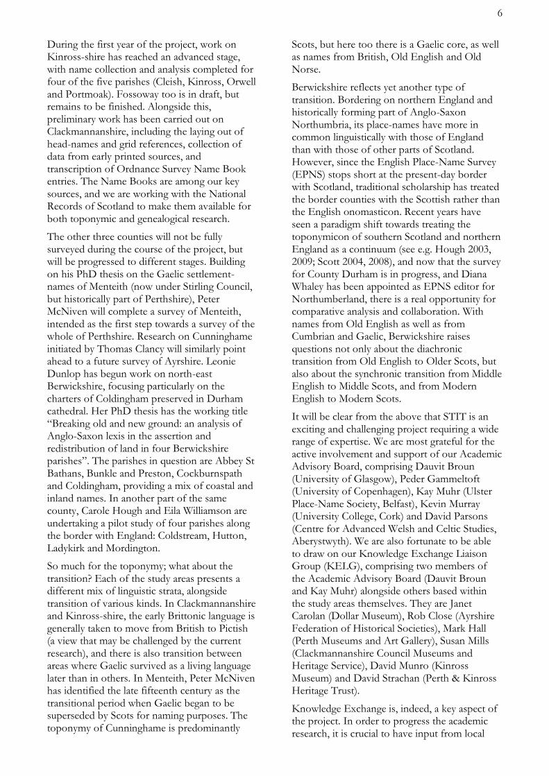
Though English of widely separated periods and, in between those, Scots, have had by far the greatest influence on the naming of places in the most easterly Border county, there are also contributions from Gaelic and Northern Brittonic. Even Norse has a tiny look-in. So it should not be imagined that everything is simple in the study of Berwickshire place-names. Just
over the Border from the Liberties of Berwick, on a lane parallel to the main road through Foulden, is an attractive small group of buildings.
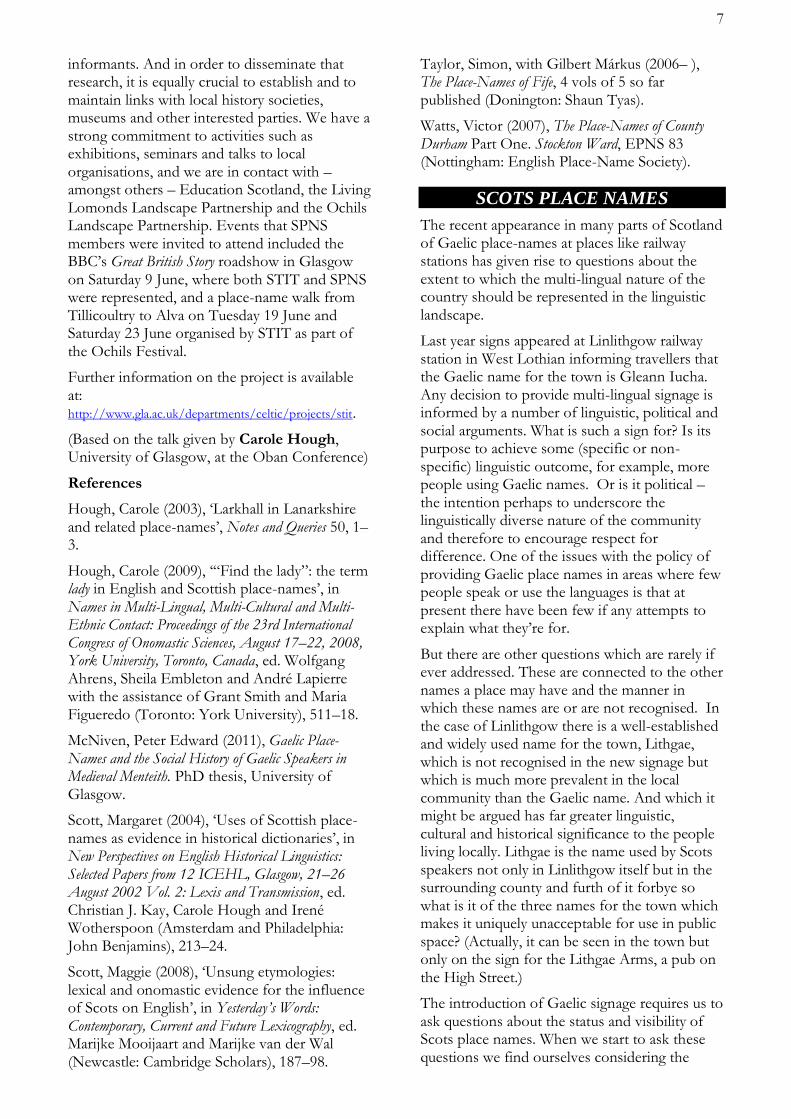
It is now signed and officially known as Kirkbanny Farm, though in a recent Ordnance Survey map it has also appeared, in apparently more Gaelic guise, as Kilbanny. This happens to be the name of a small place in Co Waterford, Ireland, but whether that coincidence or antiquarianism has had some influence on the Kil- form can only be guessed at. On many editions and scales of OS maps the present Kirkbanny Farm was called ‘New Farm’ for over a century, but right at the beginning of the Ordnance Survey it appears on the 25 inches and 6 inches to 1 mile maps, surveyed in 1857, as Kirkbannock.
First Edition 25 inches to 1 mile map, surveyed 1857. (Thanks to NLS online map library.)
So there is no helpful pattern or continuity, even less when we consider that on the Greenwood/ Fowler/ Sharp map of Berwickshire, published in 1826 well before Kirkbannock appeared, it is ‘New Farm’ just as it was later.
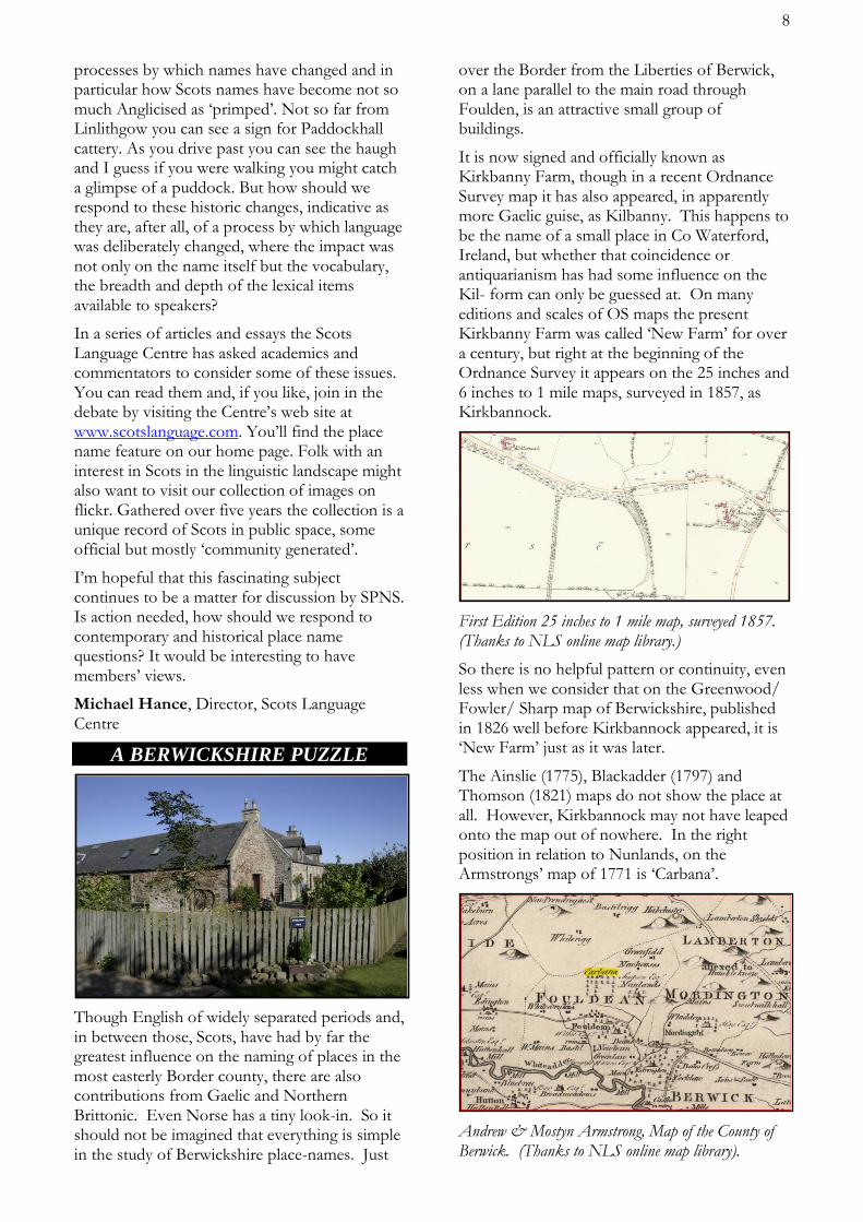
The Ainslie (1775), Blackadder (1797) and Thomson (1821) maps do not show the place at all. However, Kirkbannock may not have leaped onto the map out of nowhere. In the right position in relation to Nunlands, on the Armstrongs’ map of 1771 is ‘Carbana’.
Andrew & Mostyn Armstrong, Map of the County of Berwick. (Thanks to NLS online map library).
This can scarcely not be another guise of the name now in use. Its neighbour to the east is Nunlands, invariably so on maps since Gordon’s manuscript map of the Merche, drawn about 1636-52, and the Blaeu map of 1654 likewise based on Pont’s work at the end of the 16th century, so an ecclesiastical association would not be too surprising. That is enough to prompt the thought that, given such local associations, the earlier and half-forgotten Carbana might have been reinterpreted as a kirk name, as happened with Kirkbuddo in Angus (Kirbuddo 1533). But unlike at Kirkbuddo, there is no hint of a local *cair, a fortification or an enclosed homestead.
Kirkbanny appears in James B Johnston’s The Place-Names of Berwickshire (1940), now more highly regarded for its listing of sources than for its etymologies. It is easy to understand why that might be, from his comment about Kirkbanny: “… other name for Foulden New Mains. Who Banny was is very uncertain. Baine was a daughter of the King of Alban in The Four Masters, and Béinne is an old British name.”; odd that he thinks of ancient personal names but not of Old Gaelic bennacht, now beannachd (from Latin benedictio) ‘blessing’, known to occur in many place-names elsewhere. However, this is enough to show that a resemblance to the name was not in his mind when he offered a possible location for “BANNACHARVIK, ? Foulden: sic 1637 Ret[ours]. Gael. beannach ‘horned place’, one where waters divide, cf. Loch Vennachar; and prob. airbheach, ‘ribbed, furrowed’”, a description which would plainly not match anywhere in Foulden parish; though anyone looking for a ‘horn’ of land not far from Foulden would find a splendid one between the Tweed and the Whiteadder at their confluence just above Berwick1.
We might now divide the name as Old Gaelic bennchar plus a suffix, rather than as Johnston did. If the reflexes of bennchar, ‘horn-cast’2 usually refer to topography (pointed hills in Ireland, pointed bits of land or water in Scotland), the picture is complicated by the saintly-named Banchory Devenick and Banchory Ternan in Kincardineshire, and Beannchar (Bangor) over the Sheugh in County Down where St Comgall founded a monastery in the mid 6th century. It stretches coincidence somewhat if there is no etymological connection of the places in the former Pictland with the Welsh and Breton Bangors, where early monasteries were named for their bangor,3 a
wattle enclosure around the precinct.
It hardly needs to be said that to get from Bannacharvik in 1633 to Carbana in 1771 to Kirkbannock in 1857 would involve radical modifications: so radical in the first stage that it might be more credible to think of a repertoire of alternative vernacular forms (as for nearby Auchencraw/ Edencraw – representing achadh and alltan? – which have coexisted for centuries), only intermittently and erratically making it into written record. Although the probability that Kirkbanny began as an ecclesiastical settlement must be slight indeed, there is always the hope that research in obscure medieval documents, or field names, might cast some light. (WP)
1 Horncliffe (Hornecliff 1210) is upstream of the confluence, on the Northumberland bank of the Tweed, but it is more likely to refer to some more local feature. 2 See W J Watson The Celtic Place-Names of Scotland, 480-481, on bennchar/ beannchar as a topographical term. 3 See discussion of Bangor names in Dictionary of the
Place-Names of Wales, H Wyn Owen and R Morgan; they note that Old English burg was suffixed to the name of Bangor[-is-Coed], e.g. Bonkerbury 1278-81.
SKIVO ~ SKYFOG
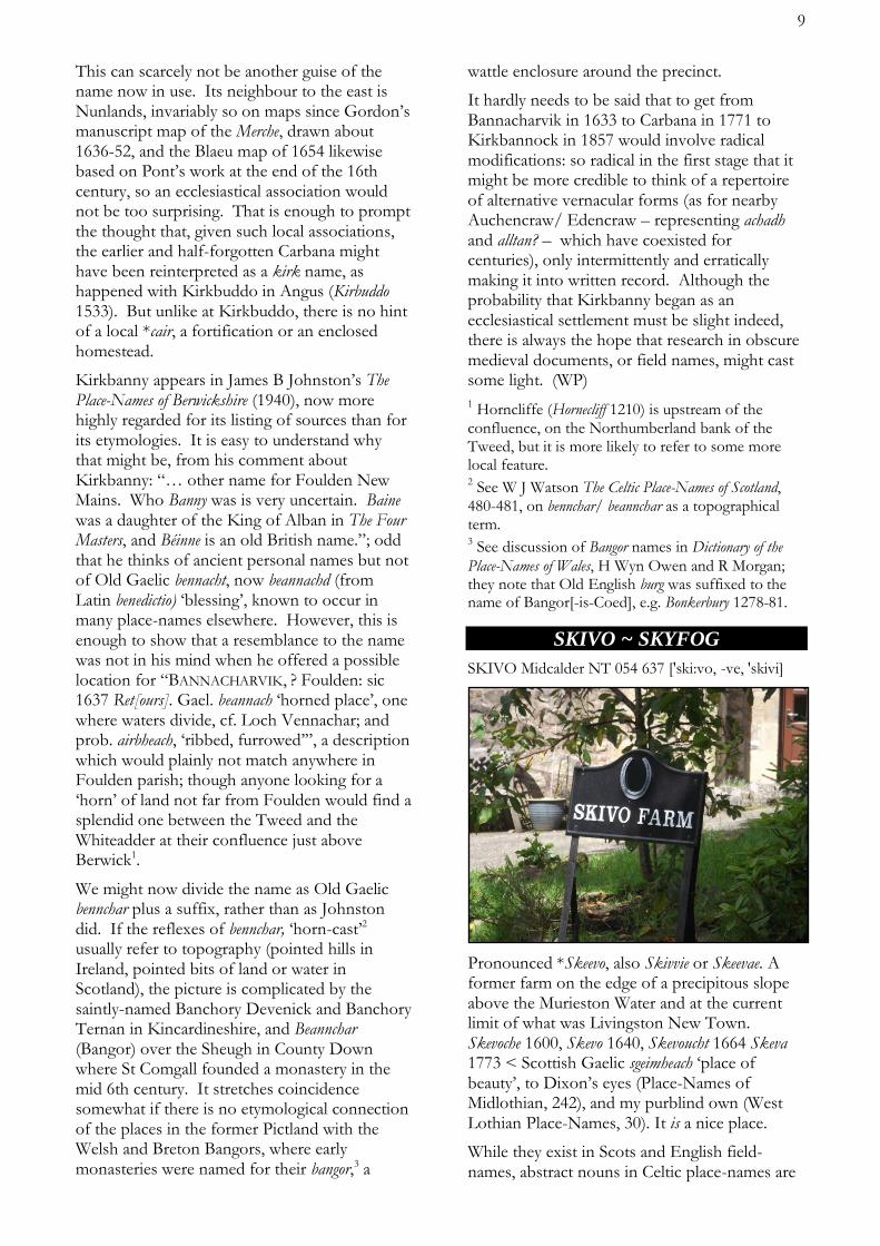
SKIVO Midcalder NT 054 637 ['ski:vo, -ve, 'skivi]
Pronounced *Skeevo, also Skivvie or Skeevae. A former farm on the edge of a precipitous slope above the Murieston Water and at the current limit of what was Livingston New Town. Skevoche 1600, Skevo 1640, Skevoucht 1664 Skeva 1773 < Scottish Gaelic sgeimheach ‘place of beauty’, to Dixon’s eyes (Place-Names of Midlothian, 242), and my purblind own (West Lothian Place-Names, 30). It is a nice place.
While they exist in Scots and English field-names, abstract nouns in Celtic place-names are
10
prone to becoming virtual sanctuaries around which the ghosts of shattered clans might foregather, as at Dollar Glen and Castle Campbell, Clackmannanshire. They should be proscribed by toponymists, unless there is a local tale, more particularly a myth, to explain them, as more usual in Ireland. Even then, the tale may have come from the name, as spectacularly in Turniemoon, West Lothian (West Lothian Place-Names, 7), but the two will have fused together to become part of that place’s unique story: what might be termed its toponymeme.1
Tall tales apart, Skivo is more likely < Brythonic *(i)scev(i)oc ‘sloping’, Welsh Ysgeif(i)og, found in several locations in Wales. Cf. Ekwall’s entry for Sheviock Cornwall (Savioch Domesday Book, Sevioc 1229 Sheviok 1306): ‘No doubt identical with Ysceifiog in Flint, (Llanfihangel) Esgeifiog in Anglesea [Eskeyuyok 1352...] and with isceuiauc c.1150 [Book of Llandaf]. Tref ir isceiauc [Book of Llandaf] is translated into Latin as ‘villa proclivii’. Isceviauc (Sheviock) would then mean “slope” or “sloping”.’ (Dictionary of English Place-Names, 417) Tref iriscei(v)auc, apparently later recorded as Skeio, is either referent to a river (as implied by imblain isceivioc ‘in the upper reaches of Ysgeifiog’, also in the Book of Llandaf) or a slope.1
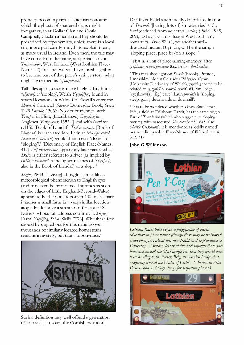
Skyfog PMB ['skә:vog], though it looks like a meteorological phenomenon to English eyes (and may even be pronounced at times as such on the edges of Little England-Beyond-Wales) appears to be the same toponym 400 miles apart: it names a small farm in a very similar location atop a bank above a stream not far east of St Davids, whose full address confirms it: Skyfog Farm, Ysgeifiog, Solva [SM807273]. Why these few should be singled out for this naming over thousands of similarly located homesteads remains a mystery, but that’s toponymics.2
Such a definition may well offend a generation of tourists, as it sours the Cornish cream on
Dr Oliver Padel’s admittedly doubtful definition of Sheviock ‘[having lots of] strawberries’ < Co *sevi (deduced from adjectival saviec) (Padel 1985, 209), just as it will disillusion West Lothian’s romantics. Skivo WLO, yet another well-disguised mutant Brython, will be the simple ‘sloping place, place by/on a slope’.3
1 That is, a unit of place-naming-memory, after
grapheme, meme, phoneme &c.: British dindsenchas.
2 This may shed light on Savick (Brook), Preston, Lancashire. Not in Geiriadur Prifysgol Cymru (University Dictionary of Welsh), ysgeifiog seems to be related to (y)sgafell < scamell ‘shelf, sill, rim, ledge, (eye)brow(s); (fig.) cave’. Latin proclivis is ‘sloping, steep, going downwards or downhill’.
3 It is to be wondered whether Skeavy-Brae Cupar, Fife, a field at Tailabout, Tarvit, has the same origin. Part of Temple-hill (which also suggests its sloping nature), with associated Skaviecroheard (1645, also Skeivie Crokheard), it is mentioned as ‘oddly named’ but not discussed in Place-Names of Fife volume 4, 312, 317.
John G Wilkinson
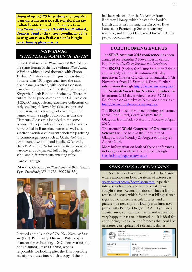
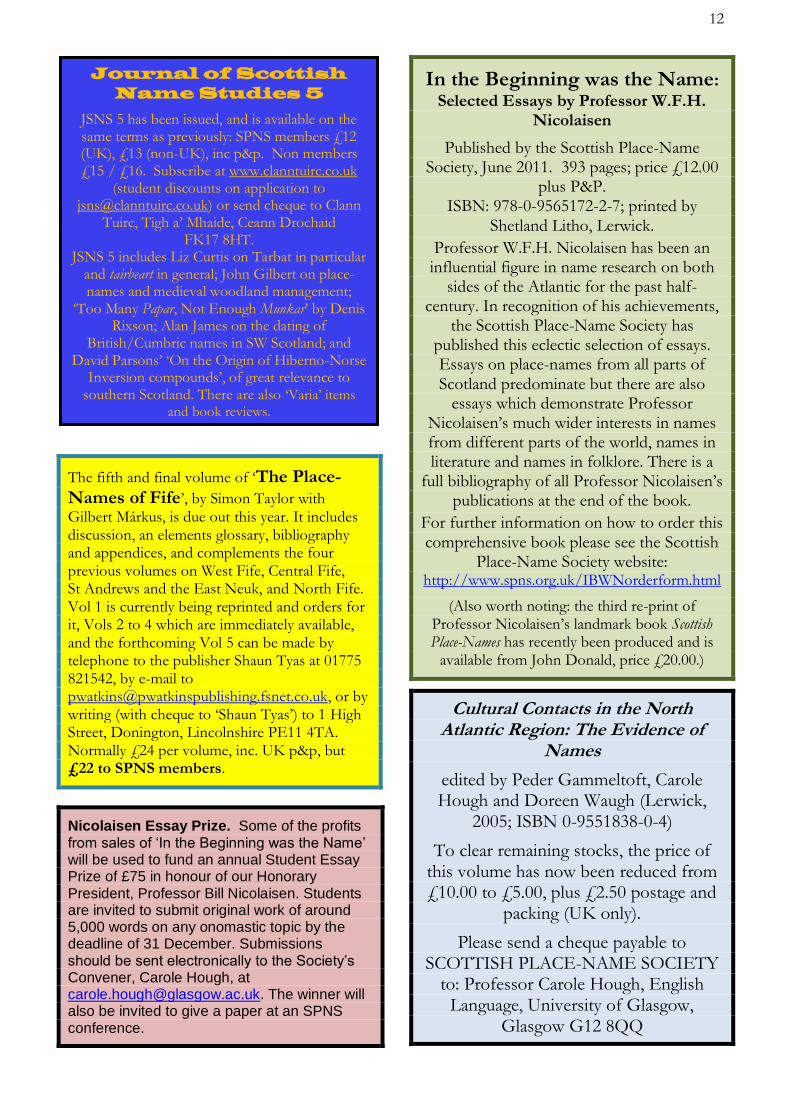
Lothian Buses have begun a programme of public education in place-names (though there may be revisionist views emerging, about this now traditional explanation of Penicuik). Another, less readable text informs those who have just missed the Stockbridge bus that they would have been heading to the ‘Stock Brig, the wooden bridge that originally crossed the Water of Leith’. (Thanks to Peter Drummond and Guy Puzey for respective photos.)
11
NEW BOOK: ‘THE PLACE-NAMES OF BUTE’
Gilbert Márkus’s The Place-Names of Bute follows the same format as the five-volume Place-Names of Fife on which he collaborated with Simon Taylor. A historical and linguistic introduction of more than 100 pages leads into the main place-name gazetteer, with sections on non-parochial features and on the three parishes of Kingarth, North Bute and Rothesay. There are entries for all place-names on the OS Explorer (1:25,000) map, offering extensive collections of early spellings followed by close analysis and discussion. An advantage of covering all the names within a single publication is that the Elements Glossary is included in the same volume. This provides an index to all elements represented in Bute place-names as well as a succinct overview of current scholarship relating to common generics such as Gaelic baile ‘farm, ferm-toun, township’ and Gaelic cill ‘church, chapel’. At only £24 for an attractively presented hardcover book packed full of high-quality scholarship, it represents amazing value.
Carole Hough
(Márkus, Gilbert, The Place-Names of Bute. Shaun Tyas, Stamford; ISBN 978-1907730153.)
Pictured at the launch of The Place-Names of Bute are (L-R): Paul Duffy, Discover Bute project manager for archaeology; Dr Gilbert Markus, the book’s author; Jessica Herriot, who is responsible for looking after the Discover Bute learning resource into which a copy of the book
has been placed; Patricia McArthur from Rothesay Library, which hosted the book’s launch and is also hosting the Discover Bute Landscape Partnership Scheme learning resource; and Bridget Paterson, Discover Bute’s project co-ordinator.
FORTHCOMING EVENTS
The SPNS Autumn 2012 conference has been arranged for Saturday 3 November in central Edinburgh. Details on flier with this Newsletter.
The SNSBI (Society for Name Studies in Britain and Ireland) will hold its autumn 2012 day meeting in Chester City Centre on Saturday 17th November from 10.30am to 4.30pm. Further information through http://www.snsbi.org.uk/.
The Scottish Society for Northern Studies has its autumn 2012 day conference and AGM in Edinburgh on Saturday 24 November: details at http://www.northernstudies.org.uk/.
The SNSBI meets for its next spring conference at the Pond Hotel, Great Western Road, Glasgow, from Friday 5 April to Monday 8 April 2013.
The triennial World Congress of Onomastic Sciences will be held at the University of Glasgow from Monday 25 August to Friday 29 August 2014.
More information on both of these conferences in Glasgow is available from Carole Hough: [email protected]
SPNS GOES A-TWITTERING
The Society now has a Twitter feed. The ‘name’, where anyone can look for items of interest, is www.twitter/com/Scotplacenames; type this into a search engine and it should take you straight there. Recent additions include a link to results of a study which found that bilingual road signs do not increase accident rates; and a picture of a new sign for Dull (Perthshire) now paired with Boring, Oregon, USA. If you are a Twitter user, you can tweet at us and we will be very happy to pass on information. It is ideal for announcing things like conferences that could be of interest, or updates of relevant websites.
The fifth and final volume of ‘The Place-Names of Fife’, by Simon Taylor with
Gilbert Márkus, is due out this year. It includes discussion, an elements glossary, bibliography and appendices, and complements the four previous volumes on West Fife, Central Fife, St Andrews and the East Neuk, and North Fife. Vol 1 is currently being reprinted and orders for it, Vols 2 to 4 which are immediately available, and the forthcoming Vol 5 can be made by telephone to the publisher Shaun Tyas at 01775 821542, by e-mail to [email protected], or by writing (with cheque to ‘Shaun Tyas’) to 1 High Street, Donington, Lincolnshire PE11 4TA. Normally £24 per volume, inc. UK p&p, but £22 to SPNS members.
Nicolaisen Essay Prize. Some of the profits from sales of ‘In the Beginning was the Name’ will be used to fund an annual Student Essay Prize of £75 in honour of our Honorary President, Professor Bill Nicolaisen. Students are invited to submit original work of around 5,000 words on any onomastic topic by the deadline of 31 December. Submissions should be sent electronically to the Society’s Convener, Carole Hough, at [email protected]. The winner will also be invited to give a paper at an SPNS conference.
In the Beginning was the Name: Selected Essays by Professor W.F.H.
Nicolaisen
Published by the Scottish Place-Name Society, June 2011. 393 pages; price £12.00
plus P&P. ISBN: 978-0-9565172-2-7; printed by
Shetland Litho, Lerwick.
Professor W.F.H. Nicolaisen has been an influential figure in name research on both
sides of the Atlantic for the past half-century. In recognition of his achievements,
the Scottish Place-Name Society has published this eclectic selection of essays. Essays on place-names from all parts of Scotland predominate but there are also
essays which demonstrate Professor Nicolaisen’s much wider interests in names from different parts of the world, names in literature and names in folklore. There is a
full bibliography of all Professor Nicolaisen’s publications at the end of the book.
For further information on how to order this comprehensive book please see the Scottish
Place-Name Society website: http://www.spns.org.uk/IBWNorderform.html
(Also worth noting: the third re-print of Professor Nicolaisen’s landmark book Scottish Place-Names has recently been produced and is
available from John Donald, price £20.00.)
Cultural Contacts in the North Atlantic Region: The Evidence of
Names
edited by Peder Gammeltoft, Carole Hough and Doreen Waugh (Lerwick,
2005; ISBN 0-9551838-0-4)
To clear remaining stocks, the price of this volume has now been reduced from £10.00 to £5.00, plus £2.50 postage and
packing (UK only).
Please send a cheque payable to SCOTTISH PLACE-NAME SOCIETY
to: Professor Carole Hough, English Language, University of Glasgow,
Glasgow G12 8QQ
Journal of Scottish
Name Studies 5
JSNS 5 has been issued, and is available on the same terms as previously: SPNS members £12 (UK), £13 (non-UK), inc p&p. Non members £15 / £16. Subscribe at www.clanntuirc.co.uk
(student discounts on application to [email protected]) or send cheque to Clann
Tuirc, Tigh a’ Mhaide, Ceann Drochaid FK17 8HT.
JSNS 5 includes Liz Curtis on Tarbat in particular and tairbeart in general; John Gilbert on place-names and medieval woodland management;
‘Too Many Papar, Not Enough Munkar’ by Denis Rixson; Alan James on the dating of
British/Cumbric names in SW Scotland; and David Parsons’ ‘On the Origin of Hiberno-Norse
Inversion compounds’, of great relevance to southern Scotland. There are also ‘Varia’ items