THE ROLE OF UNIVERSITIES IN THE BRAZILIAN NSDI CAPACITY BUILDING PLAN – THE CASE OF THE OPEN GEOSPATIAL LABORATORY AT UFPR Silvana Philippi Camboim, Maria Cecília Bonato Brandalize Universidade Federal do Paraná Setor de Ciências da Terra Departamento de Geomática Silvana Philippi Camboim ‐ [email protected]
Transcript
THE ROLE OF UNIVERSITIES IN THE BRAZILIAN NSDI CAPACITY BUILDING PLAN – THE CASE OF THE OPEN GEOSPATIAL LABORATORY AT UFPR
Silvana Philippi Camboim, Maria Cecília Bonato Brandalize
Universidade Federal do ParanáSetor de Ciências da Terra Departamento de Geomática
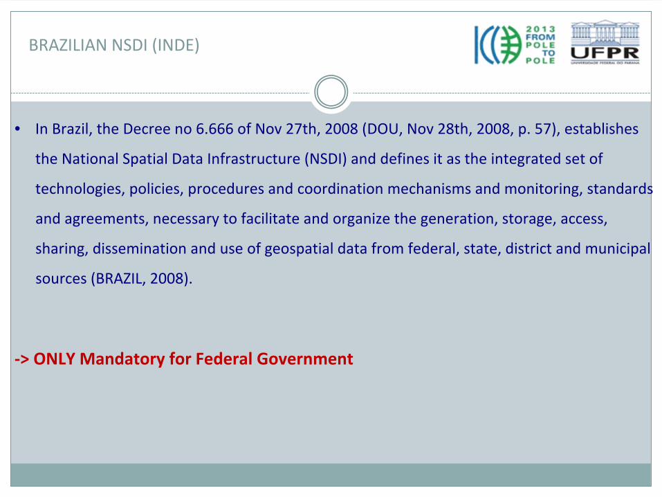
• In Brazil, the Decree no 6.666 of Nov 27th, 2008 (DOU, Nov 28th,
2008, p. 57), establishes the National Spatial Data Infrastructure (NSDI) and defines it as the integrated set of
technologies, policies, procedures and coordination mechanisms and monitoring, standards and agreements, necessary to facilitate and organize the generation, storage, access,
sharing, dissemination and use of geospatial data from federal, state, district and municipal sources (BRAZIL, 2008).
‐> ONLY Mandatory for Federal Government
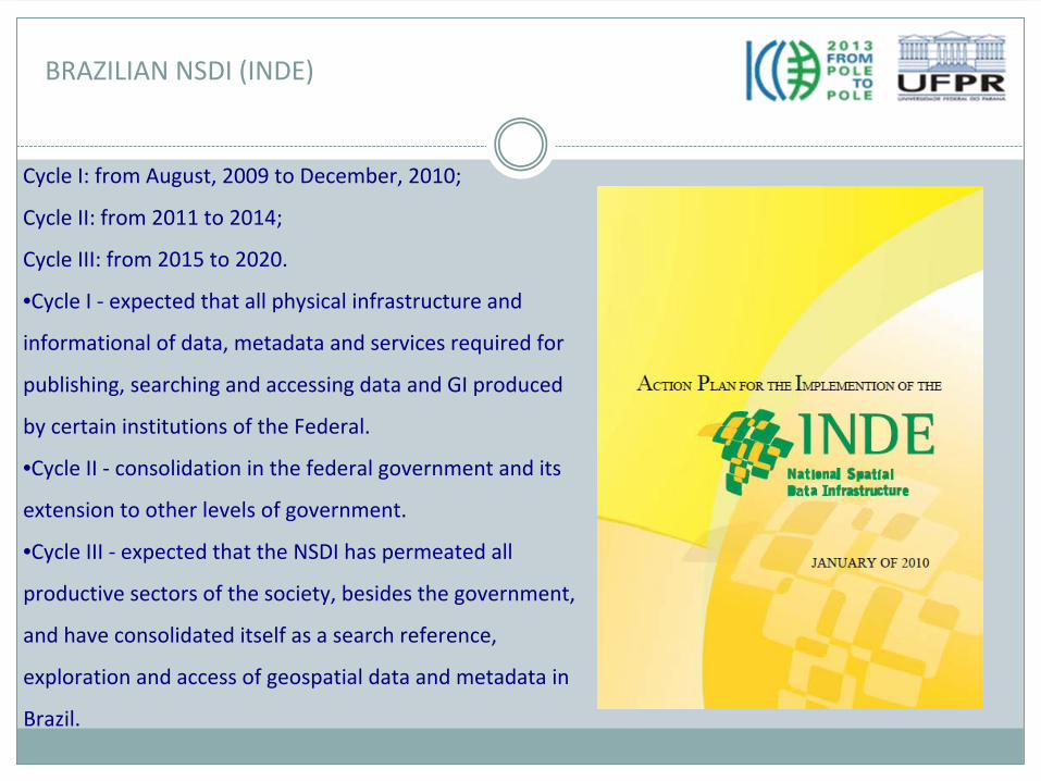
BRAZILIAN NSDI (INDE)
Cycle I: from August, 2009 to December, 2010;
Cycle II: from 2011 to 2014;
Cycle III: from 2015 to 2020.
•Cycle I ‐
expected that all physical infrastructure and
informational of data, metadata and services required for
publishing, searching and accessing data and GI produced
by certain institutions of the Federal.
•Cycle II ‐
consolidation in the federal government and its
extension to other levels of government.
•Cycle III ‐
expected that the NSDI has permeated all
productive sectors of the society, besides the government,
and have consolidated itself as a search reference,
exploration and access of geospatial data and metadata in
Brazil.
BRAZILIAN NSDI (INDE)
Source: INDE Action Plan
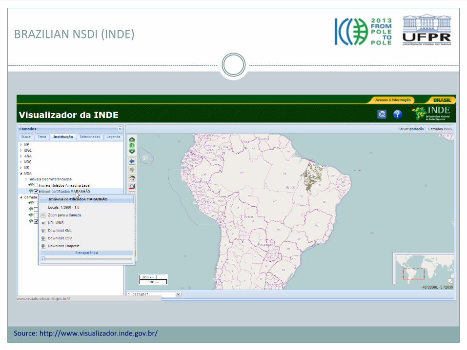
BRAZILIAN NSDI (INDE)
Source: http://www.visualizador.inde.gov.br/
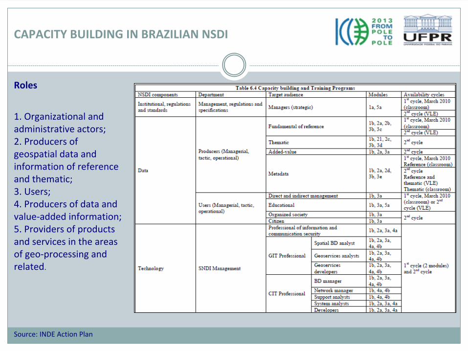
CAPACITY BUILDING IN BRAZILIAN NSDI
Roles
1. Organizational and
administrative actors;2. Producers of
geospatial data and
information of reference
and thematic;3. Users;4. Producers of data and
value‐added information;5. Providers of products
and services in the areas
of geo‐processing and
related.
Source: INDE Action Plan
PROPOSED SOLUTION
• To use the network of universities to spread NSDI capacity building program.
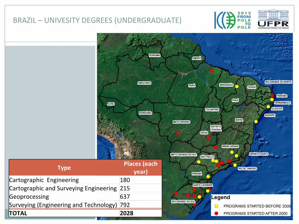
BRAZIL – UNIVESITY DEGREES (UNDERGRADUATE)
Type Places (each
year)Cartographic Engineering 180Cartographic and Surveying Engineering 215Geoprocessing 637Surveying (Engineering and Technology) 792TOTAL 2028
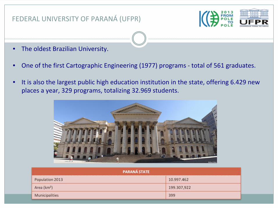
FEDERAL UNIVERSITY OF PARANÁ
(UFPR)
• The oldest Brazilian University.
• One of the first Cartographic Engineering (1977) programs ‐
total of 561 graduates.
• It is also the largest public high education institution in the state, offering 6.429 new places a year, 329 programs, totalizing 32.969 students.
ICA‐OSGeo Lab UFPR
UFPR
TEACHING COMMUNITY RESEARCH
• Integrating NSDI topics and
open source in GIS courses• NSDI capacity building • Research Lines
• Geodesy
• Photogrammetry and
Remote Sensing
• Cartography and GIS
• PhD and MSc Geodetic Science (1972)• Surveying and Cartographic Engineering (1977)• Diploma in Geotechonolgies (2002)
ACESSING DEMAND – LOCAL AUTHORITIES
Population Class Municipalities (Paraná
State) Estimated number of
professionals
Total
More than 1,000,000 inhabitants 1 10 10Between 100,000 and 1,000.000 inhabitants 18 5 90Between 20,000 and 100,000 inhabitants 42 2 84
Less than 20,000 inhabitants 338 1 338399 522
Source: IPARDES
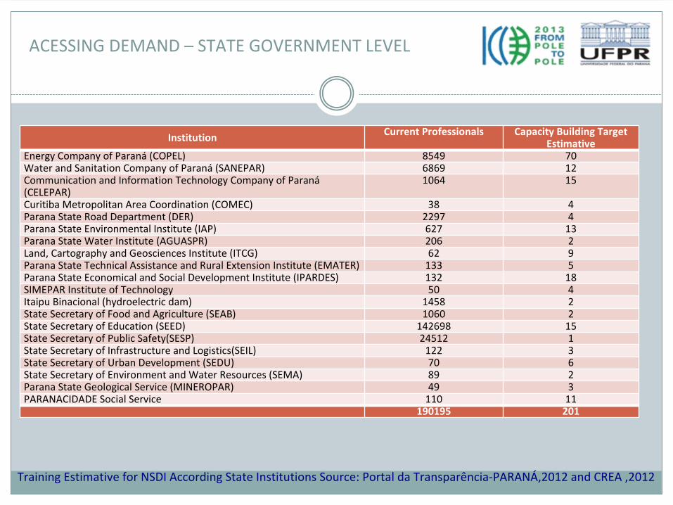
Institution Current Professionals Capacity Building Target
Estimative
Energy Company of Paraná
(COPEL) 8549 70Water and Sanitation Company of Paraná
(SANEPAR) 6869 12Communication and Information Technology Company of Paraná
(CELEPAR)
1064 15
Curitiba Metropolitan Area Coordination (COMEC) 38 4Parana State Road Department (DER) 2297 4Parana State Environmental Institute (IAP) 627 13Parana State Water Institute (AGUASPR) 206 2Land, Cartography and Geosciences Institute (ITCG) 62 9Parana State Technical Assistance and Rural Extension Institute (EMATER) 133 5Parana State Economical and Social Development Institute (IPARDES) 132 18SIMEPAR Institute of Technology 50 4Itaipu Binacional (hydroelectric dam) 1458 2State Secretary of Food and Agriculture (SEAB) 1060 2State Secretary of Education (SEED) 142698 15State Secretary of Public Safety(SESP) 24512 1State Secretary of Infrastructure and Logistics(SEIL) 122 3State Secretary of Urban Development (SEDU) 70 6State Secretary of Environment and Water Resources (SEMA) 89 2Parana State Geological Service (MINEROPAR) 49 3PARANACIDADE Social Service 110 11
190195 201
Training Estimative for NSDI According State Institutions Source: Portal da Transparência‐PARANÁ,2012 and CREA ,2012
ACESSING DEMAND –
STATE GOVERNMENT LEVEL
ACESSING DEMAND – PRIVATE SECTOR
• 53 private companies ‐
are members of Aerosurveying National Companies Association (ANEA). Among then, 12 are located in Paraná
State, the second largest state in this sector.
There are an estimated number of 800 technicians working on these companies.
• In other companies, we considered professionals registered in the Regional Architecture and Engi‐neering Council (CREA‐PR) in related fields: Cartographic Engineers, Surveying
Engineers, Environmental Engineers, Geographers and technicians in Surveying, which adds more 1178 professionals.
• Total estimated: 2000 technicians in private sector.
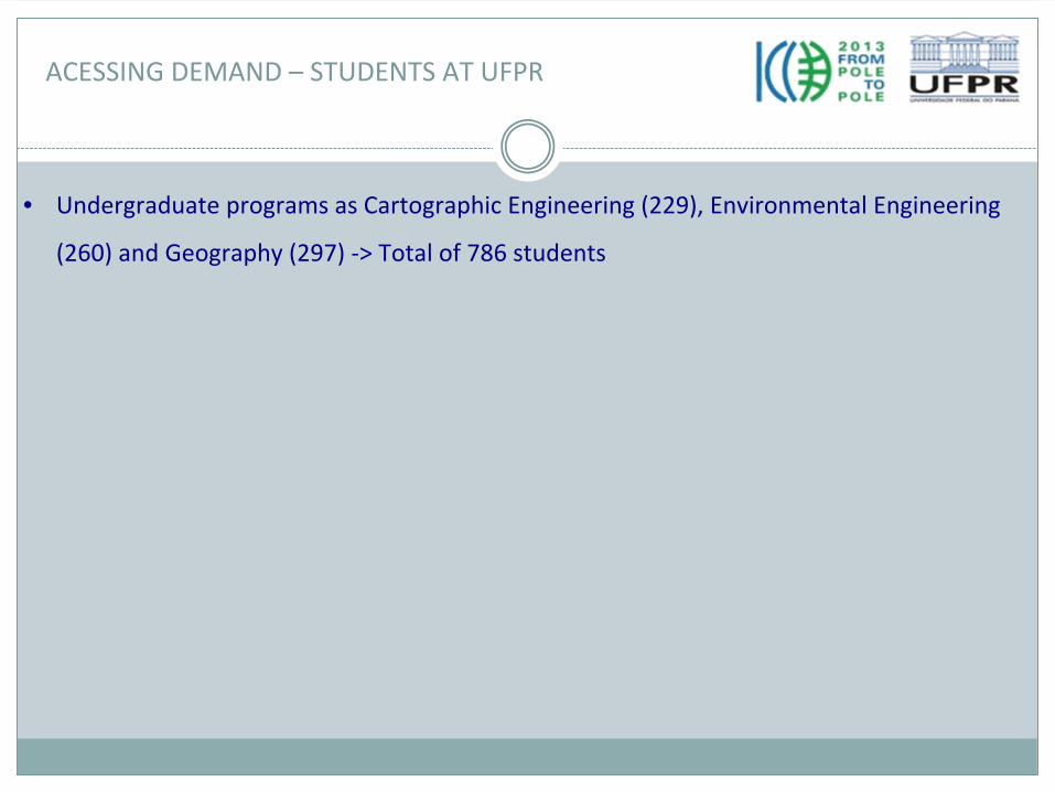
ACESSING DEMAND – STUDENTS AT UFPR
• Undergraduate programs as Cartographic Engineering (229), Environmental Engineering (260) and Geography (297) ‐> Total of 786 students
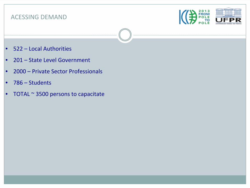
ACESSING DEMAND
• 522 – Local Authorities
• 201 –
State Level Government
• 2000 – Private Sector Professionals
• 786 – Students
• TOTAL ~ 3500 persons to capacitate
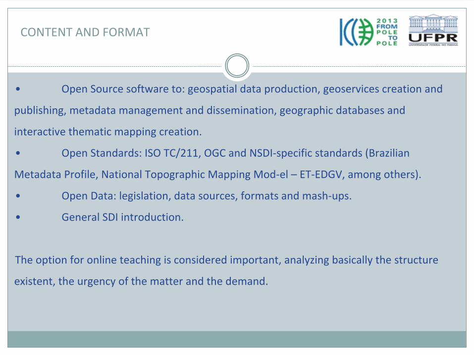
• Open Source software to: geospatial data production, geoservices
creation and publishing, metadata management and dissemination, geographic databases and
interactive thematic mapping creation.
• Open Standards: ISO TC/211, OGC and NSDI‐specific standards (Brazilian Metadata Profile, National Topographic Mapping Mod‐el – ET‐EDGV, among others).
• Open Data: legislation, data sources, formats and mash‐ups.
• General SDI introduction.
The option for online teaching is considered important, analyzing basically the structure existent, the urgency of the matter and the demand.
CONTENT AND FORMAT
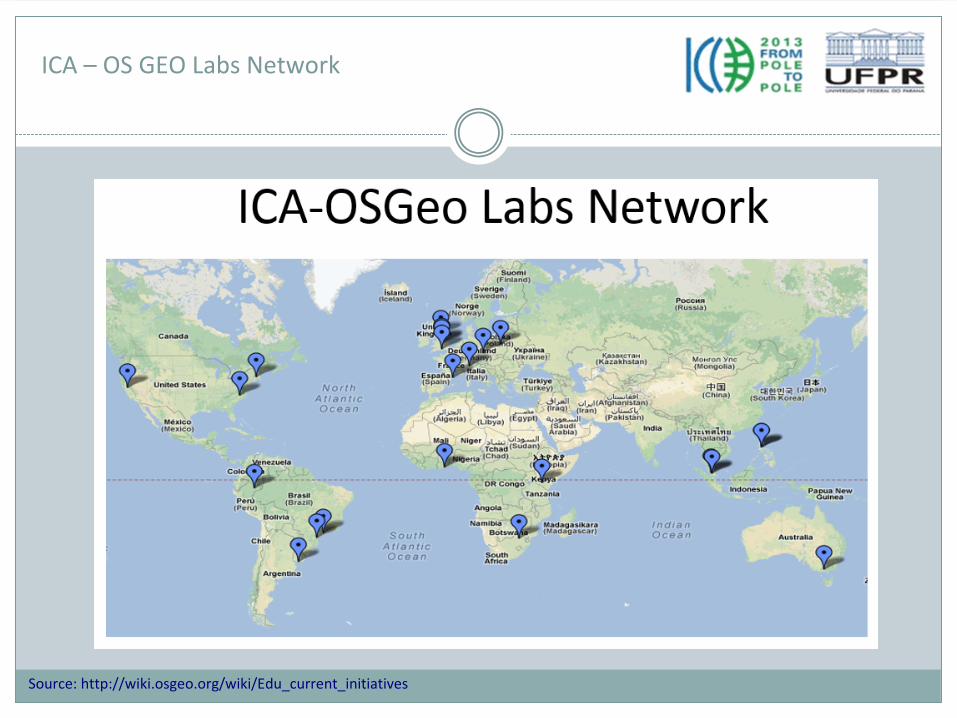
ICA – OS GEO Labs Network
In September 2011, the Open Source Geospatial Foundation (OSGeo)
and the International Cartographic
Association (ICA) signed a Memorandum of Understanding with the aim of developing on a global basis
collaboration opportunities for academia, industry and government organizations in open source GIS
software and data.
AIMS:
• to provide expertise and support for the establishment of Open Source Geospatial Laboratories and
Research Centres across the world for supporting development of open‐source geospatial software
technologies, training and expertise;
• to provide support for building‐up and supporting development of open source GIS teaching and
training materials;
• To joint organization of open source GIS events, workshops through the ICA network for wider
Translate and adapt existent materials.3 – Create a platform for e‐learning . 4 – Use of Open Source in the Department Courses.. 5 – Create a local version of the Open Source DVD suite.6 – Focus on instructors training.7 –
Develop the website for the Brazilian OSGeo Lab network
2013 –
University funding – Room and equipment
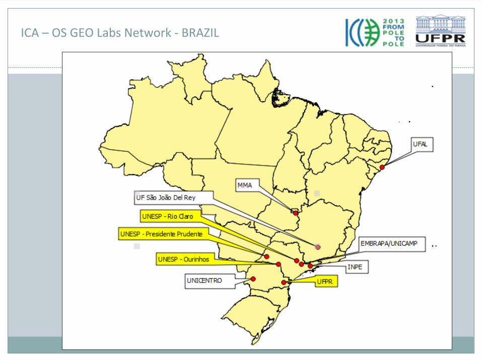
ICA – OS GEO Labs Network ‐
BRAZIL
•The NSDI is now perceived as essential to Brazilian government and society. One important obstacle achieving the goals established in the Action Plan is to have a well‐prepared
workforce in order to produce, publish and use the geospatial information accordingly to SDI principles.
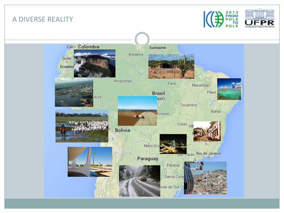
•Since much of the data is created and handled at local and regional level, and Brazil has a great regional diversity, the network of high education institutes is one suitable option to act in the different states bringing NSDI national outlined contents to each local reality and
examples.
•The distance learning techniques can support this development to
be even more distributed and in the speed needed to have the initiative operational in a near future.
•ICA‐OS Geo Open Geospatial Labs network can be a great opportunity to help Brazilian universities to prepare for this challenge and contributing to the nodes not feel that are starting from scratch but learning with each other experiences.