35
The Seven Landform The Seven Landform Regions of Canada Regions of Canada
| Date post: | 24-Dec-2015 |
| Category: |
Documents |
| Upload: | logan-mccarthy |
| View: | 222 times |
| Download: | 1 times |

The Seven Landform The Seven Landform Regions of CanadaRegions of Canada

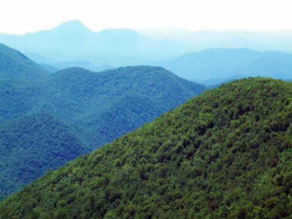
1. The Pacific Coast - The Cordillera

The Canadian ShieldThe Canadian Shield
• This is the largest region that covers almost half of Canada
• Canada's largest geographical feature, it stretches east to Labrador, south to Kingston on Lake Ontario and northwest as far as the Arctic Ocean.
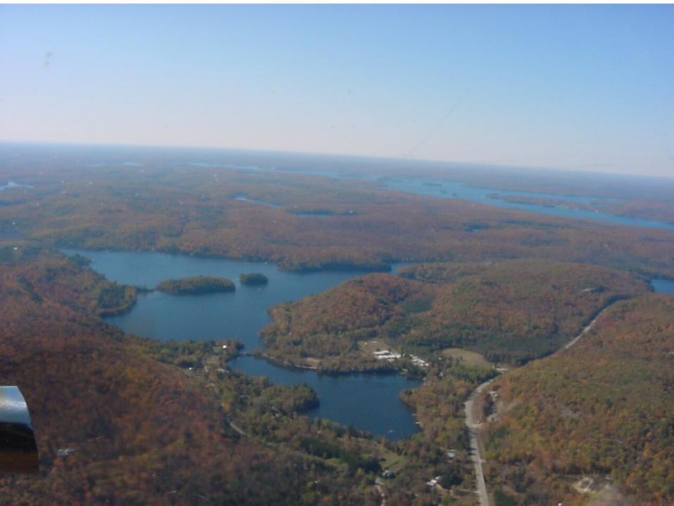
The Canadian ShieldThe Canadian Shield
• Scraped by glaciers, the Shield has only a thin layer of soil that supports a boreal forest of spruce, fir, tamarack and pine.
• The region is a storehouse of minerals, including gold, silver, zinc, copper and uranium, and Canada's great mining towns are located there: Sudbury and Timmins in Ontario, Val d'Or in Quebec, and Flin Flon and Thompson in Manitoba.

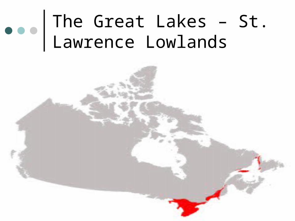
The Great Lakes – St. Lawrence Lowlands

The Great Lakes – St. Lawrence The Great Lakes – St. Lawrence LowlandsLowlands
Southern Quebec and Ontario, the Southern Quebec and Ontario, the industrial heartland of Canada, contain industrial heartland of Canada, contain Canada's two largest cities, Montreal and Canada's two largest cities, Montreal and Toronto. Toronto.
In this small region, 50 percent of In this small region, 50 percent of Canadians live and 70 percent of Canada's Canadians live and 70 percent of Canada's manufactured goods are produced. manufactured goods are produced.
The Great Lakes – St. Lawrence The Great Lakes – St. Lawrence LowlandsLowlands
The region also has prime The region also has prime agricultural land, permitting the agricultural land, permitting the cultivation of grapes, peaches, pears cultivation of grapes, peaches, pears and other fruits. and other fruits.
The Great Lakes and St. Lawrence The Great Lakes and St. Lawrence region is sugar maple country. The region is sugar maple country. The sap is collected in spring and sap is collected in spring and evaporated to make maple syrup and evaporated to make maple syrup and sugarsugar


The Appalachians

The Appalachians Includes New Brunswick, Nova Scotia,
Prince Edward Island and Newfoundland – The Maritime Provinces
This is one of the richest fishing grounds in the world. Once thought to contain a virtually inexhaustible supply of fish, the Banks are now considered a vulnerable resource that must be wisely managed.

The AppalachiansMuch of the region has low,
rugged hills and plateaus, and a deeply indented coastline. Agriculture flourishes in the fertile valleys


The Interior Plains
The Interior PlainsThe Interior Plains
Also known as “The Praries” Also known as “The Praries” To drive across the Prairies is to see endless To drive across the Prairies is to see endless
fields of wheat and canola ripening under a fields of wheat and canola ripening under a sky that seems to go on forever. sky that seems to go on forever.
The plains of Alberta, Saskatchewan and The plains of Alberta, Saskatchewan and Manitoba are among the richest grain-Manitoba are among the richest grain-producing regions in the world. producing regions in the world.

The Interior PlainsThe Interior Plains
Alberta is Canada's leading producer of petroleum. Alberta is Canada's leading producer of petroleum. The sedimentary rocks underlying the Prairies have The sedimentary rocks underlying the Prairies have important deposits of oil, natural gas and potash. important deposits of oil, natural gas and potash.
If you leave the road at Brooks, Alberta, and drive If you leave the road at Brooks, Alberta, and drive north, you descend into the Red Deer River valley. north, you descend into the Red Deer River valley. Here, in desert-like conditions, water and wind have Here, in desert-like conditions, water and wind have created strange shapes in the sandstone called created strange shapes in the sandstone called "hoodoos." The same forces of erosion have "hoodoos." The same forces of erosion have uncovered some of the largest concentrations of uncovered some of the largest concentrations of dinosaur fossils in the world. dinosaur fossils in the world.


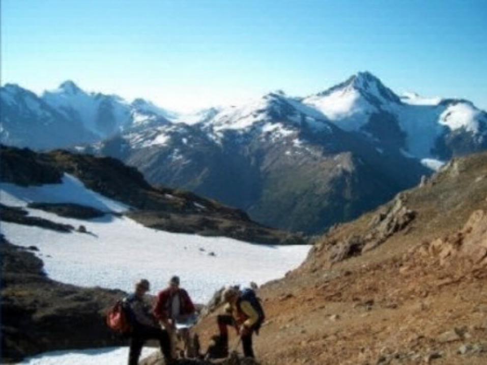
The Western Cordillera

The Western CordilleraThe Western Cordillera
Bathed by warm, moist Pacific air currents, the Bathed by warm, moist Pacific air currents, the British Columbia coast, indented by deep fiords and British Columbia coast, indented by deep fiords and shielded from the Pacific storms by Vancouver Island, shielded from the Pacific storms by Vancouver Island, has the most moderate climate of Canada's regions.has the most moderate climate of Canada's regions.
From British Columbia to just east of the Alberta From British Columbia to just east of the Alberta border the land is young, with rugged mountains and border the land is young, with rugged mountains and high plateaus. Signs of geologically recent volcanic high plateaus. Signs of geologically recent volcanic activity can be seen activity can be seen


The Innuitians

The InnuitiansThe Innuitians
During the short summer, when daylight is nearly During the short summer, when daylight is nearly continuous and a profusion of flowers blooms on continuous and a profusion of flowers blooms on the tundra, the temperature can reach 30°C. the tundra, the temperature can reach 30°C.
Winters are long, bitterly cold and dark.Winters are long, bitterly cold and dark. The Arctic is no longer an inaccessible frontier. The Arctic is no longer an inaccessible frontier.
inuvik, in the Mackenzie delta, can be reached by inuvik, in the Mackenzie delta, can be reached by road, and every community is served by air. Most road, and every community is served by air. Most have electricity, stores and health services. have electricity, stores and health services.


The Arctic

The Arctic
Many explorers died in blizzards studying the Arctic region
Largely made up of islands formed from sedimentary rock
Surface is very stony and has very little vegetation
Oil and natural-gas deposits have been found
Both the Arctic region and Innuition are part of Nunavut


