2
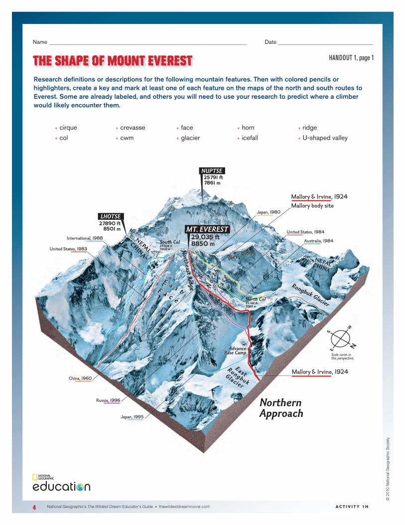
4 National Geographic’s The Wildest Dream Educator’s Guide • thewildestdreammovie.com © 2010 National Geographic Society Name°° ° ° ° ° ° ° ° ° °°°°°°°°°°°Date°° ° ° ° °°°° THE SHAPE OF MOUNT EVEREST HANDOUT 1, page 1 + N E P A L C H I N A N E P A L C H I N A G l a c i e r R o n g b u k E a s t E a s t F a c e N o r t h F a c e E a s t F a c e N o r t h F a c e Japan, 1980 Australia, 1984 International, 1988 United States, 1983 United States, 1984 Japan, 1995 China, 1960 Russia, 1996 Scale varies in this perspective. S W N E Advance Base Camp Advance Base Camp Mallory & Irvine, 1924 Mallory body site Mallory & Irvine, 1924 29,035 ft 8850 m 27890 ft 8501 m 25791 ft 7861 m MT. EVEREST LHOTSE NUPTSE North Col 23,182 ft 7066 m South Col 25,938 ft 7906 m Northern Approach N o r t h R i d g e W e s t R i d g e N o r t h e ast Ridge Rongbuk Glacier ACTIVITY 1H Research definitions or descriptions for the following mountain features. Then with colored pencils or highlighters, create a key and mark at least one of each feature on the maps of the north and south routes to Everest. Some are already labeled, and others you will need to use your research to predict where a climber would likely encounter them. °° ° cirque °° ° col °° ° crevasse °° ° cwm °° ° face °° ° glacier °° ° horn °° ° icefall °° ° ridge °° ° U-shaped°valley°