The U.S.A.’s Next Generation Geostationary Weather Satellites TRAINING GOES-R Amanda M. Terborg - Satellite Meteorologist NOAA/Aviation Weather Center Leroy Spayd and Tony Mostek – NOAA Office of the Chief Learning Officer Wendy Shreiber-Abshire – UCAR’s COMET program Scott Lindstrom – University of Wisconsin/CIMSS Bernie Connell – Colorado State University/CIRA
Transcript
The U.S.A.’s Next Generation Geostationary Weather Satellites
TRAINING GOES-R Amanda M. Terborg - Satellite Meteorologist NOAA/Aviation Weather Center Leroy Spayd and Tony Mostek – NOAA Office of the Chief Learning Officer Wendy Shreiber-Abshire – UCAR’s COMET program Scott Lindstrom – University of Wisconsin/CIMSS Bernie Connell – Colorado State University/CIRA
OVERVIEW • What is the GOES-R training plan for forecasters in the United States?
• Foundational Applications Continuous learning
• Satellite Training Advisory Team (STAT)
• What training resources are widely available?
• COMET domestic and international
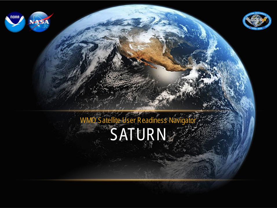
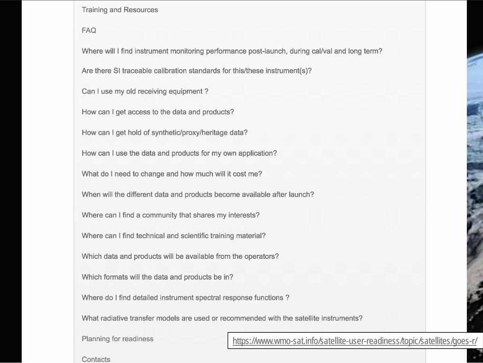
• SATURN WMO training portal
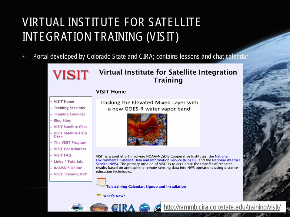
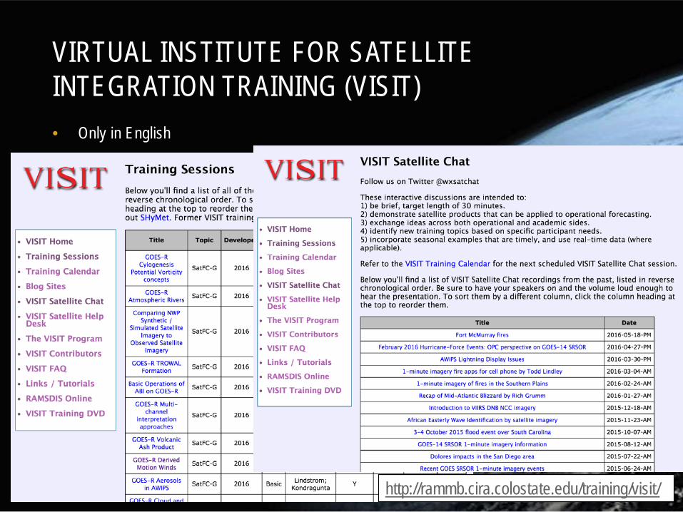
• VISIT modules and chats
• Data visualization tools
• Useful links
National plan Satellite Training Advisory Team (STAT)
The U.S.A.’s GOES-R training plan
4
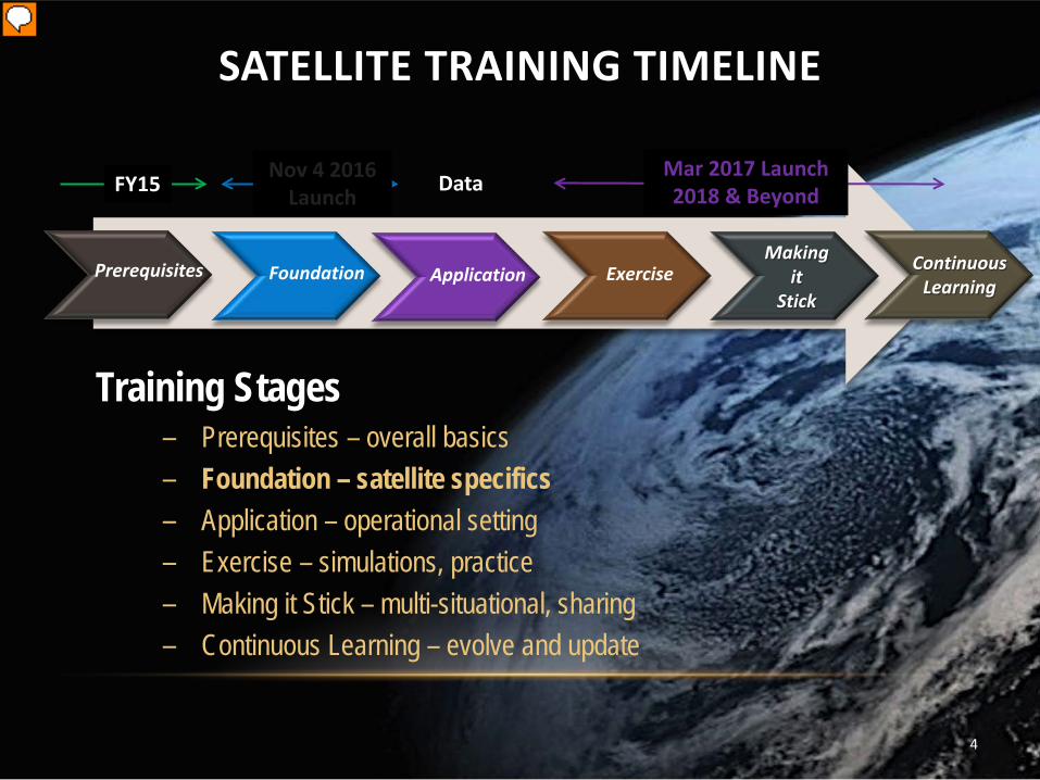
SATELLITE TRAINING TIMELINE
FY15 Mar 2017 Launch 2018 & Beyond
Nov 4 2016 Launch
Application Prerequisites Making
it Stick
Data
Foundation Exercise Continuous Learning
Training Stages ‒ Prerequisites – overall basics ‒ Foundation – satellite specifics ‒ Application – operational setting ‒ Exercise – simulations, practice ‒ Making it Stick – multi-situational, sharing ‒ Continuous Learning – evolve and update
Presenter
Presentation Notes
Nov 4, 2016 is GOES_R Launch Date and soon after that have JPSS in March 2017!
5
Presenter
Presentation Notes
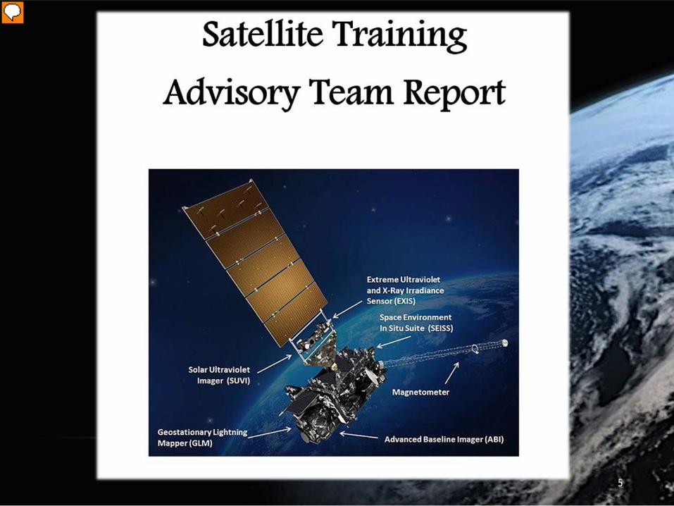
Here is the cover of the STAT Plan/Report that you will hear about next!
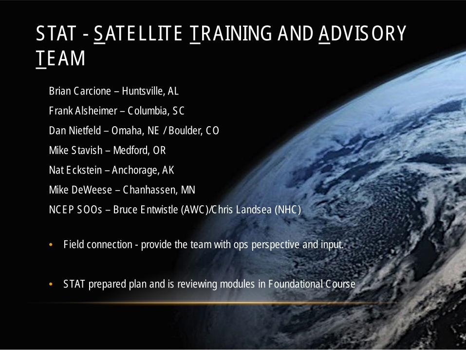
STAT - SATELLITE TRAINING AND ADVISORY TEAM
Brian Carcione – Huntsville, AL
Frank Alsheimer – Columbia, SC
Dan Nietfeld – Omaha, NE / Boulder, CO
Mike Stavish – Medford, OR
Nat Eckstein – Anchorage, AK
Mike DeWeese – Chanhassen, MN
NCEP SOOs – Bruce Entwistle (AWC)/Chris Landsea (NHC)
• Field connection - provide the team with ops perspective and input.
• STAT prepared plan and is reviewing modules in Foundational Course
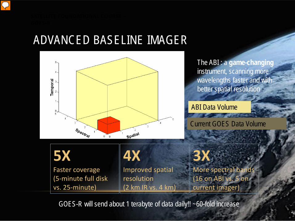
Current GOES Data Volume
ABI Data Volume
7
5X Faster coverage (5-minute full disk vs. 25-minute)
4X Improved spatial resolution (2 km IR vs. 4 km)
3X More spectral bands (16 on ABI vs. 5 on current imager)
ADVANCED BASELINE IMAGER The ABI : a game-changing instrument, scanning more wavelengths faster and with better spatial resolution
GOES-R will send about 1 terabyte of data daily!! ~60-fold increase
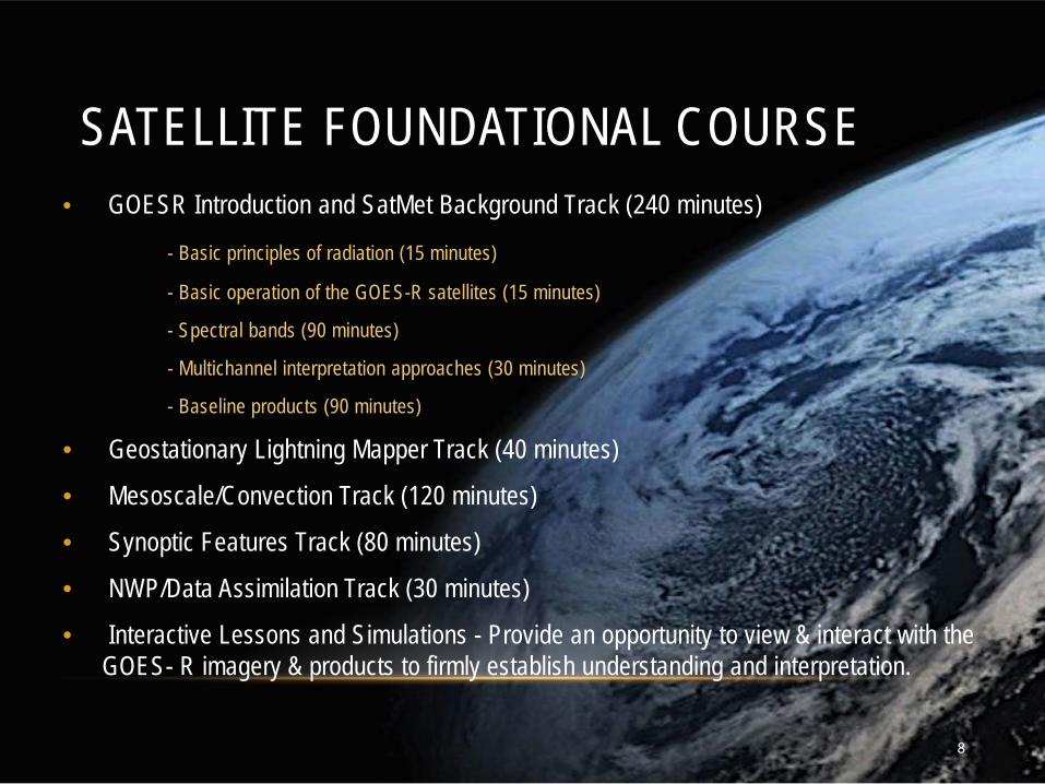
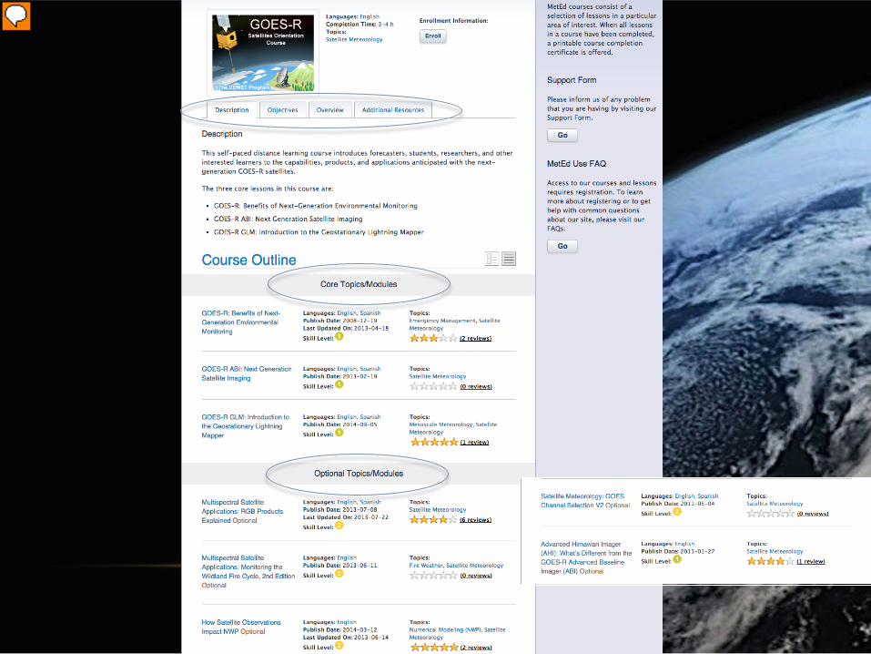
SATELLITE FOUNDATIONAL COURSE - GOES-R
Presenter
Presentation Notes
Slide from one of the first modules units - J. Gerth, CIMSS. There will be a 60-fold increase in the amount of data sent by the ABI compared to GOES-13 through -15. The ABI on GOES-R acquires a full-disk image 5 times faster than the imager on GOES-13 through GOES-15. Spatial resolution on the ABI compared to present GOES increases by a factor of 2 in both horizontal directions. There are about 3x more spectral bands on GOES-R. The cubes represent the data volumes from present GOES, in dark orange, and GOES-R, in beige. The combination of increased resolutions means a 60-fold increase in data; more than a terrabyte of data will flow daily from GOES-R!
• Interactive Lessons and Simulations - Provide an opportunity to view & interact with the GOES- R imagery & products to firmly establish understanding and interpretation.
8
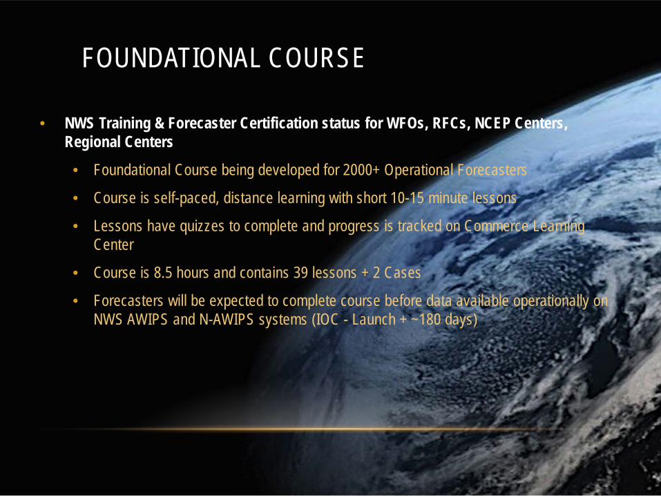
FOUNDATIONAL COURSE
• NWS Training & Forecaster Certification status for WFOs, RFCs, NCEP Centers, Regional Centers
• Foundational Course being developed for 2000+ Operational Forecasters
• Course is self-paced, distance learning with short 10-15 minute lessons
• Lessons have quizzes to complete and progress is tracked on Commerce Learning Center
• Course is 8.5 hours and contains 39 lessons + 2 Cases
• Forecasters will be expected to complete course before data available operationally on NWS AWIPS and N-AWIPS systems (IOC - Launch + ~180 days)
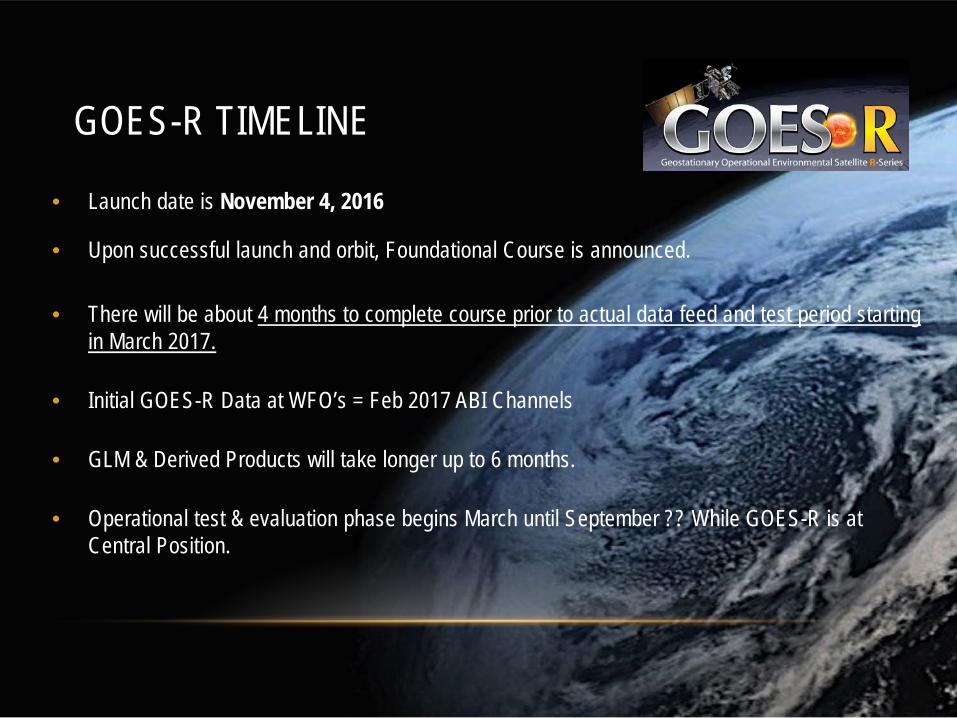
GOES-R TIMELINE
• Launch date is November 4, 2016
• Upon successful launch and orbit, Foundational Course is announced.
• There will be about 4 months to complete course prior to actual data feed and test period starting in March 2017.
• Initial GOES-R Data at WFO’s = Feb 2017 ABI Channels
• GLM & Derived Products will take longer up to 6 months.
• Operational test & evaluation phase begins March until September ?? While GOES-R is at Central Position.
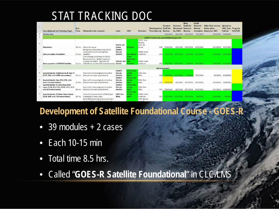
STAT TRACKING DOC
Development of Satellite Foundational Course - GOES-R
• 39 modules + 2 cases
• Each 10-15 min
• Total time 8.5 hrs.
• Called “GOES-R Satellite Foundational” in CLC/LMS
11F-11
CONCERNS AND FOCUSING LOCAL… • Forecaster time concerns
• One plan doesn’t exactly fit all • 128 Weather Forecast Offices
• Half a dozen River Forecast Centers
• 12 Central Weather Service Units (aviation)
• ~9 National Centers
• Multiple types of training • Modules
• One on one training
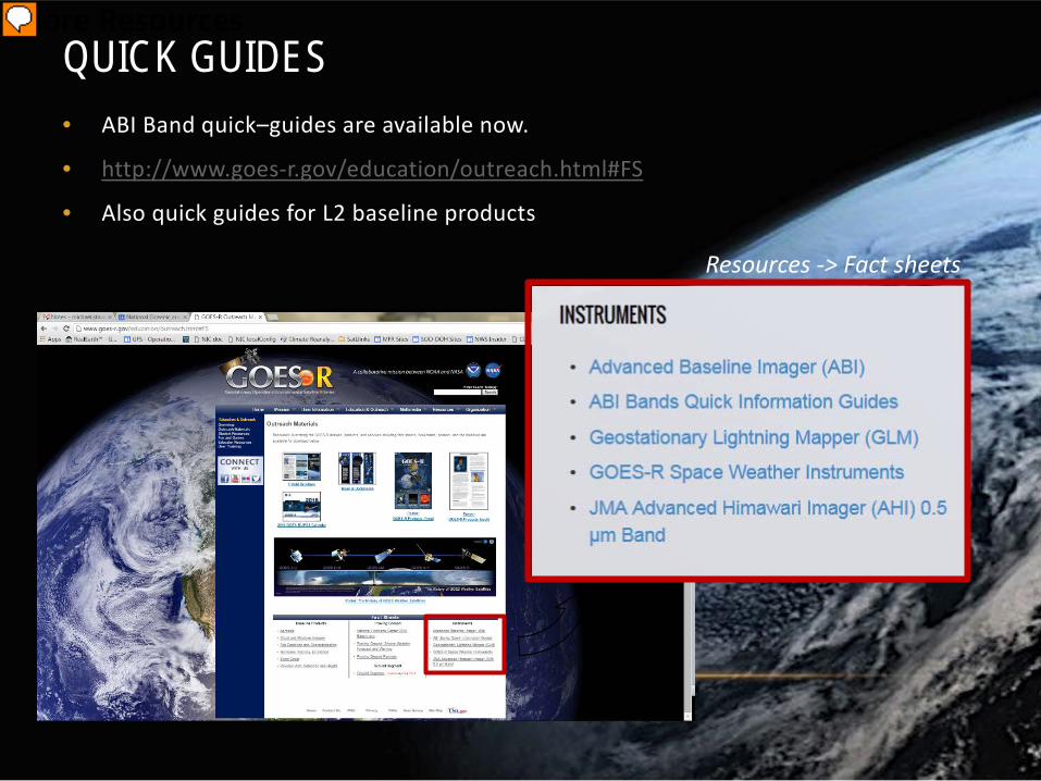
• Quick guides
• Mini case studies
• Train the trainer one forecaster to another
12
Training material availability for international users
Where can training resources be found?
Course and lessons
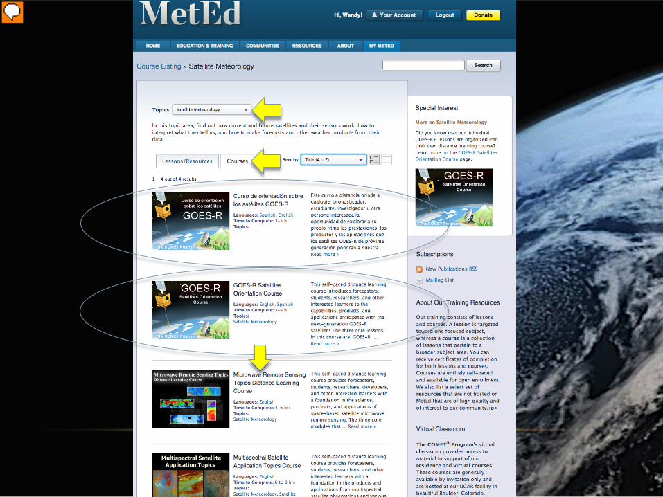
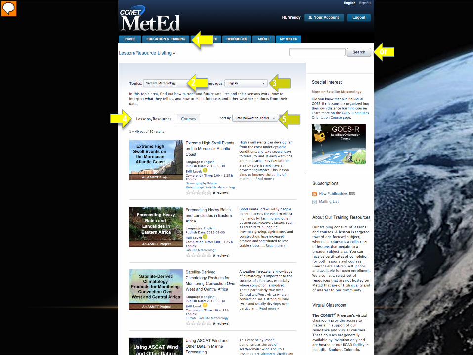
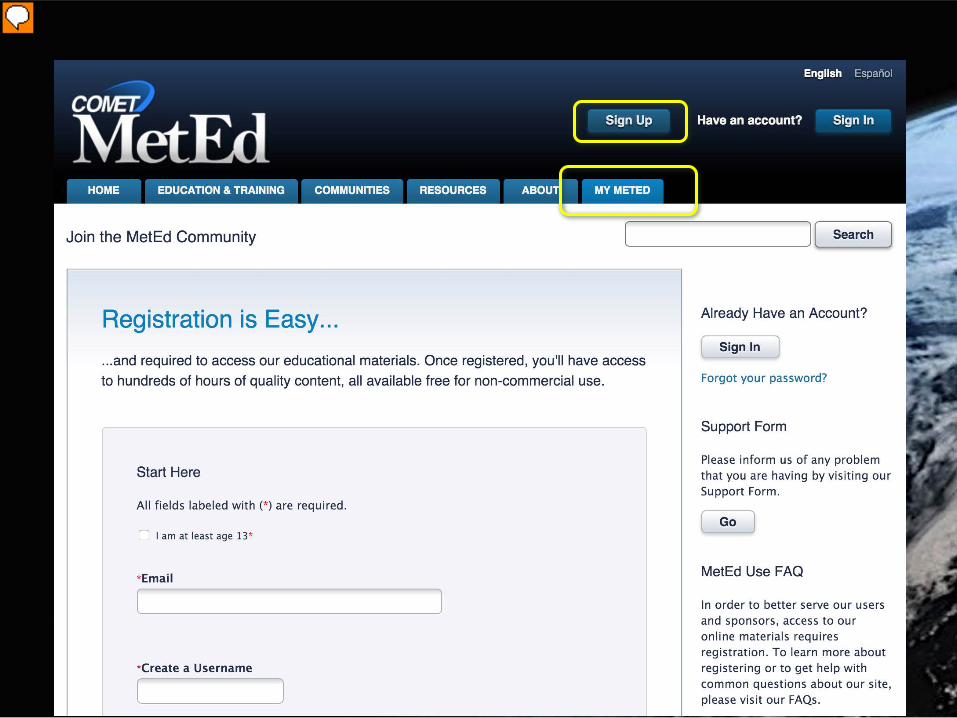
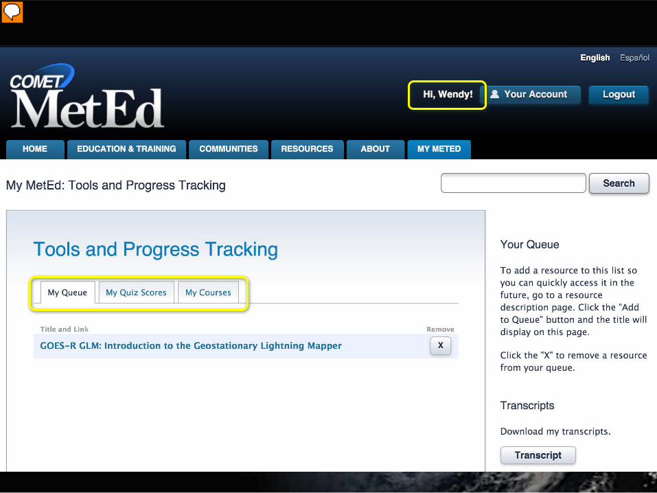
COMET and METED
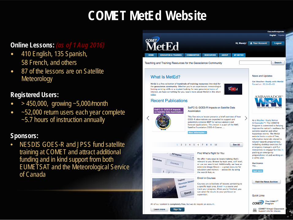
COMET MetEd Website
www.meted.ucar.edu
Online Lessons: (as of 1 Aug 2016) • 410 English, 135 Spanish, 58 French, and others • 87 of the lessons are on Satellite
Meteorology Registered Users: • > 450,000, growing ~5,000/month • ~52,000 return users each year complete
~5.7 hours of instruction annually Sponsors: • NESDIS GOES-R and JPSS fund satellite
training at COMET and attract additional funding and in kind support from both EUMETSAT and the Meteorological Service of Canada
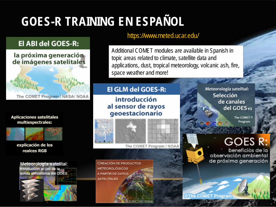
Additional COMET modules are available in Spanish in topic areas related to climate, satellite data and applications, dust, tropical meteorology, volcanic ash, fire, space weather and more!
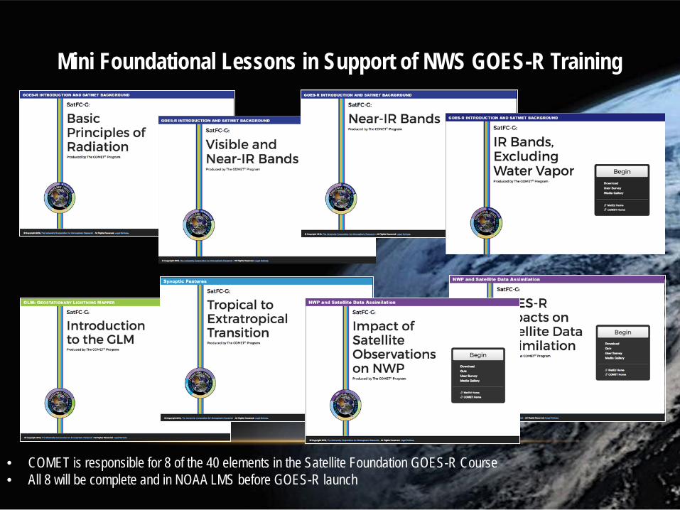
Mini Foundational Lessons in Support of NWS GOES-R Training
• COMET is responsible for 8 of the 40 elements in the Satellite Foundation GOES-R Course • All 8 will be complete and in NOAA LMS before GOES-R launch
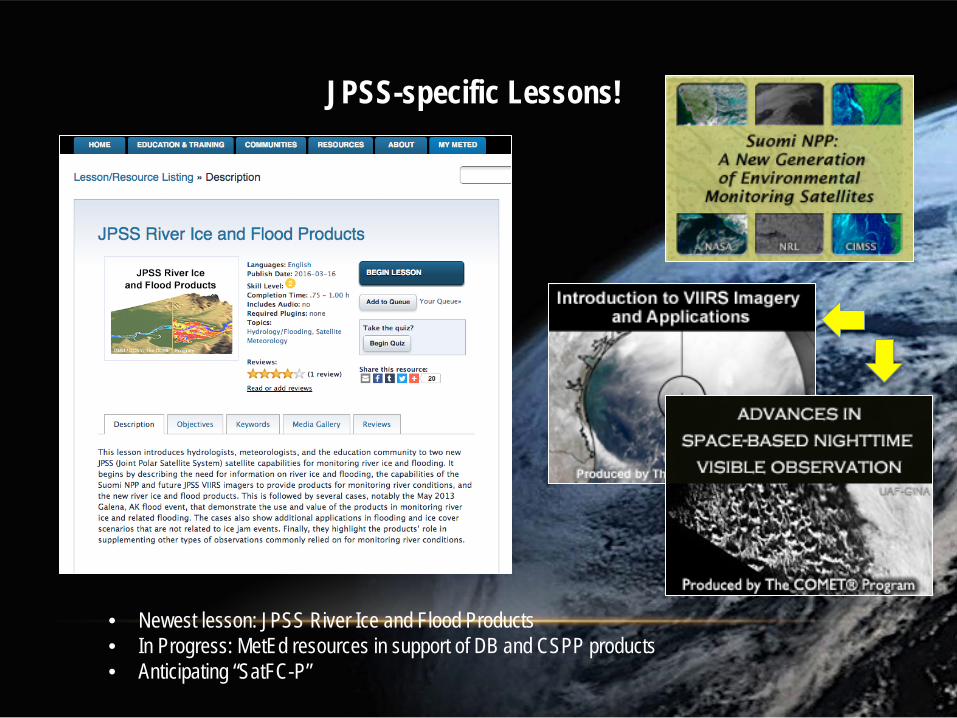
JPSS-specific Lessons!
• Newest lesson: JPSS River Ice and Flood Products • In Progress: MetEd resources in support of DB and CSPP products • Anticipating “SatFC-P”
20
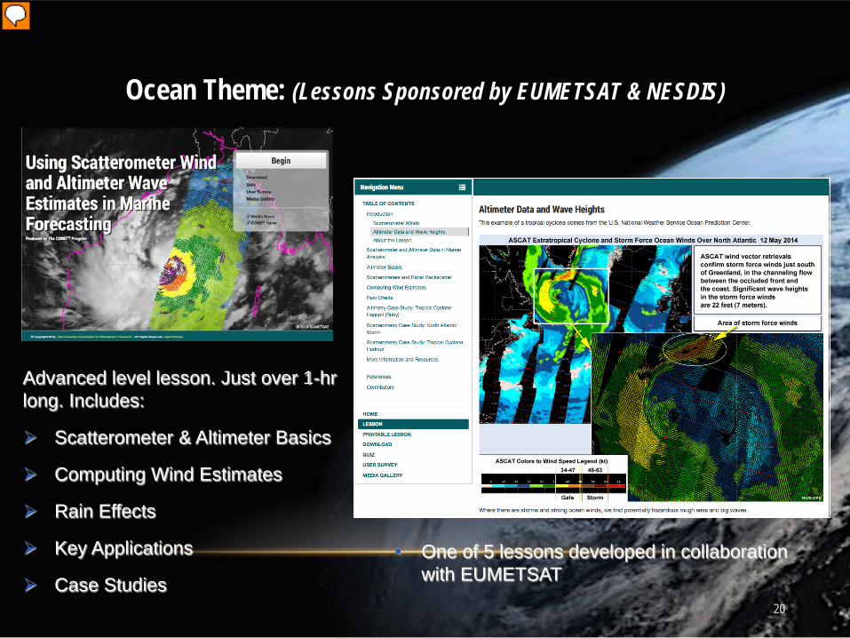
Ocean Theme: (Lessons Sponsored by EUMETSAT & NESDIS)
Advanced level lesson. Just over 1-hr long. Includes:
Scatterometer & Altimeter Basics
Computing Wind Estimates
Rain Effects
Key Applications
Case Studies
• One of 5 lessons developed in collaboration with EUMETSAT
Presenter
Presentation Notes
Of particular interest to forecasters with Marine Forecast warning areas or those that wish to learn more about scatterometry
21
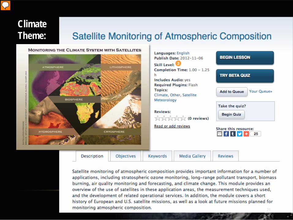
Climate Theme:
Presenter
Presentation Notes
Published 2009, just over 1 hour long, Available in English, French, and Spanish
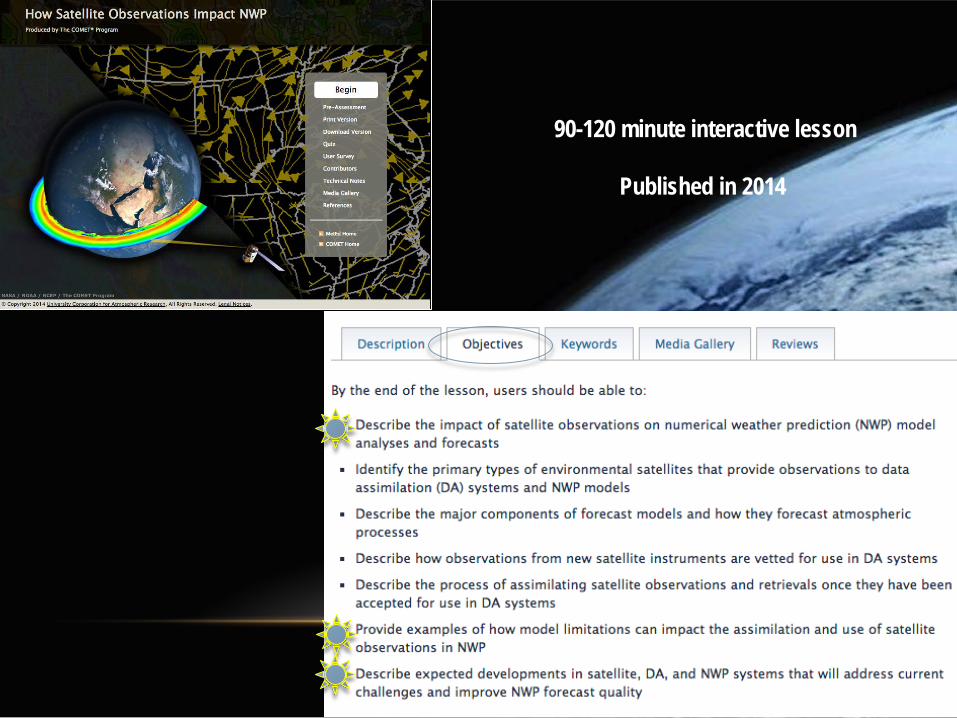
90-120 minute interactive lesson
Published in 2014
Presenter
Presentation Notes
Highlight that our GOES-R training is grouped into a multilesson course, and available in both English and Spanish.
Presenter
Presentation Notes
Has two more optional lesson on GOES Channel Selection and AHI on Himawari.
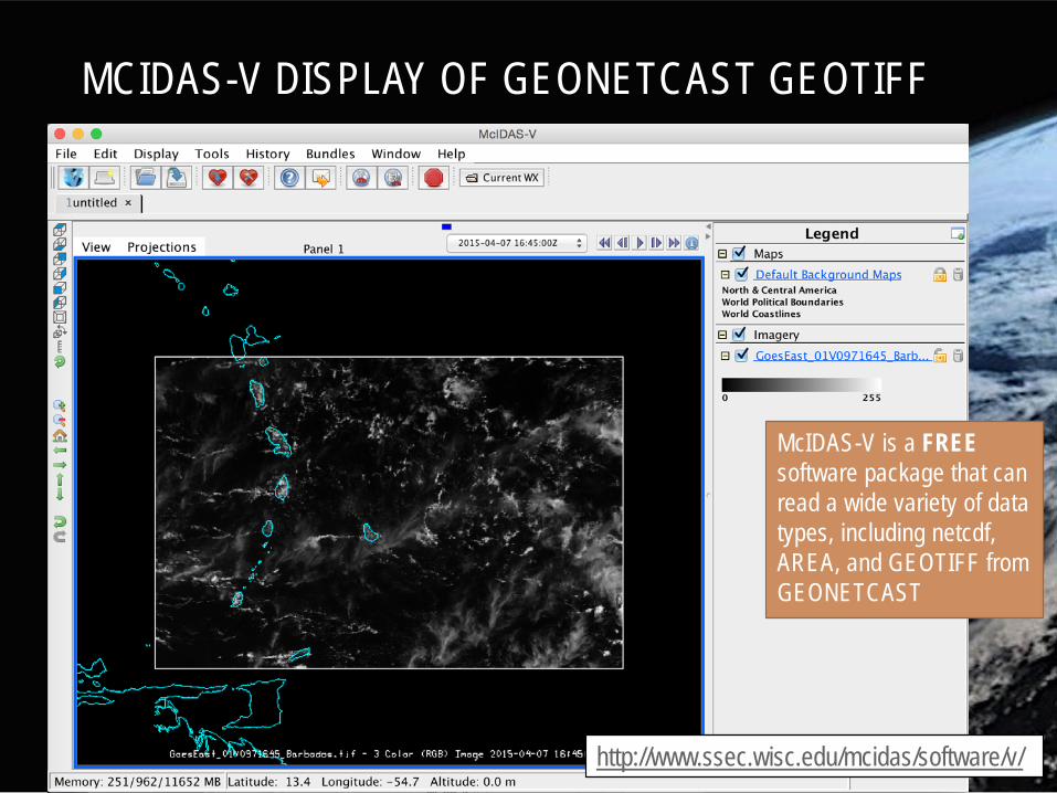
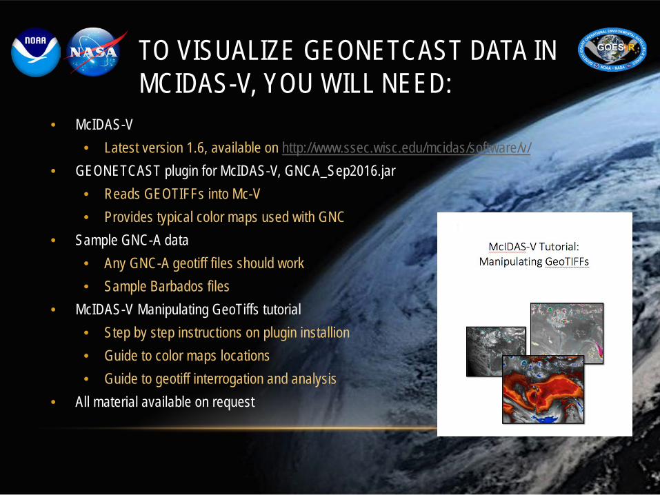
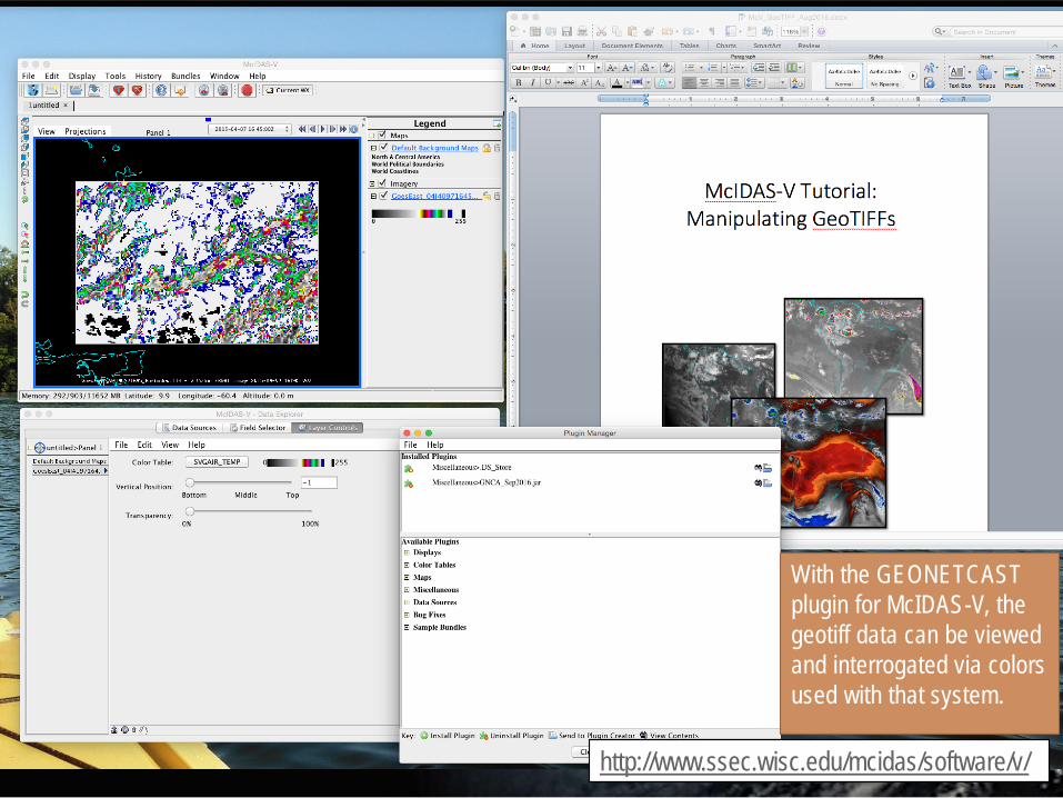
TO VISUALIZE GEONETCAST DATA IN MCIDAS-V, YOU WILL NEED:
• McIDAS-V • Latest version 1.6, available on http://www.ssec.wisc.edu/mcidas/software/v/
• GEONETCAST plugin for McIDAS-V, GNCA_Sep2016.jar • Reads GEOTIFFs into Mc-V • Provides typical color maps used with GNC
• Sample GNC-A data • Any GNC-A geotiff files should work • Sample Barbados files
• McIDAS-V Manipulating GeoTiffs tutorial • Step by step instructions on plugin installion • Guide to color maps locations • Guide to geotiff interrogation and analysis
NASA MSFC- http://lightning.nsstc.nasa.gov/ http://lightning.nsstc.nasa.gov/data/data_lis-otd-climatology.html http://thunder.msfc.nasa.gov/data/data_lis-otd-climatology.html