The influence of training on position and attribute accuracy in volunteered geographic information GEORGE MASON UNIVERSITY , DEPARTMENT OF GEOGRAPHIC AND CARTOGRAPHIC SCIENCES, C OLLEGE OF SCIENCE Patricia Pease, MS Candidate, GECA /GISESP Dr. Matthew Rice, Thesis Director Dr. Arie Croitoru, Committee Member Dr. Kevin Curtin, Committee Member Dr. Michele Campagna, Committee Member (Italy)
Transcript
The influence of training on position and attribute accuracy in volunteered geographic information
GEORGE MASON UNIVERSITY, DEPARTMENT OF GEOGRAPHIC AND
CARTOGRAPHIC SCIENCES, COLLEGE OF SCIENCE
Patricia Pease, MS Candidate, GECA /GISESPDr. Matthew Rice, Thesis DirectorDr. Arie Croitoru, Committee MemberDr. Kevin Curtin, Committee MemberDr. Michele Campagna, Committee Member (Italy)
• Geo-crowdsourcing is emerging geospatial data collection technique in fieldwork
• Citizen science benefits – savings/expertise
• Offering of specific and targeted training
• Experiment set up with trained and untrained participants to assess effectiveness of training
• Both treatment groups then reported obstacles found in field
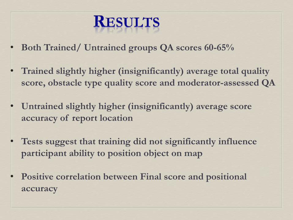
• Statistical analysis of QA data found no significant difference
• VGI – although traced much earlier term named by Goodchild in
2007 (GIS in the hands of citizens)
• Christmas Bird Count well established long-running examples
• Citizen science taps into advantages of funding, expertise, and
interest of people in an area
• Value of VGI declines based on errors, low accuracy or malicious
data
• Open sources such as OpenStreetMap and many cell phone apps
have made more VGI possible
• Democratization of GIS (Brown) (‘earned rather than learned’)
• Use and speed of GIS changes
• Much CGD deals with changing, non-static data
• Applications continue to be added and change usability
of GIS
• Goodchild’s concept of ‘platial’ relationaship with
volunteer activity in geography
• Summarization of the American Scientist citizen science
sites – approximately 50 (18 selected)
Continued . . .
• FrogWatch
• Wisconsin Bat Monitoring
• Ushahidi
• Secchi
• Marine Debris Tracker
• Astro Drone (European Space Agency)
• Invaders of Texas
• The Quake Catcher Center
• Project Noah
• Meteor Counter
• PING (precipitation)
• Globe at Night
• eBird
• Dark Sky
• NOVA Energy Lab
• Safecast
• Galloway study of training of school age students to identify White
oaks indicated need for sampling methodology training
• Fowler’s study of fleeting weather and atmosphere conditions
required spatial, temporal and altitudinal elements to be included
• Powell also looked into GeoExposures (2011, UK web launch)
where participants can increase geoscience knowledge base with
their data
• Marine Debris Initiative funded project (Martin, 2013) began in
Georgia makes use of VGI to aid environment
• McClendon and Robinson (2013) social media for input of CGD no
training but potential for disaster information
• Began in London in 2004 requires internet accessibility
• Haklay (2009) compares OSM to Ordinance Survey (UK’s)
• High quality product from skilled core contributors + large
core participants lack formal training
• Positional accuracy, attribute accuracy and completeness
• Provide good base map data for other open-source projects
• Key issue was completeness – coverage influenced by
participant choices – errors not randomly distributed
• Citizens organize mapping parties to give hands-on experience
• Foody (2013) considered land cover identification as important
component of geo-spatial data
• RS generated data followed by analysis = $ costly $
• Unreliability, inconsistencies in accuracy of VGI result in
hesitancy to accept
• Comparisons between volunteer land cover and reference data
• Characterizing performance of ea. volunteer for accuracy can
ID those who could benefit best from training
• Variation in accuracy attributed to background education, skills
and experience of volunteers
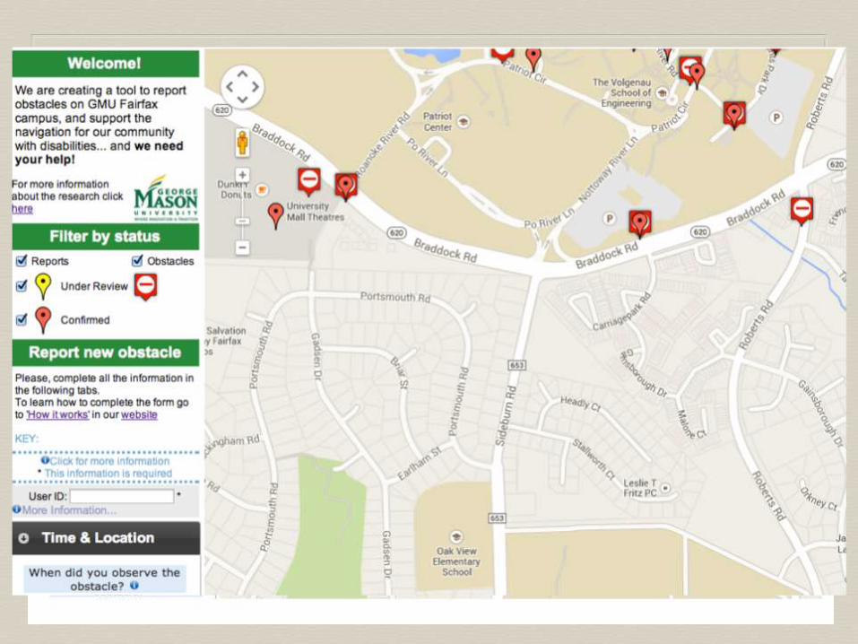
• Rice et al (2013) began in 2010 to develop interactive website &
tools to use geo-crowdsourcing on GMU campus
• Path access for disabled members of community considered
(vision and mobility impaired)
• Webmap (geo.gmu.edu/vgi/) modeled after OSM to allow
reports of various types of obstructions
• Gazzetteer all named places, geoparsed to location on campus
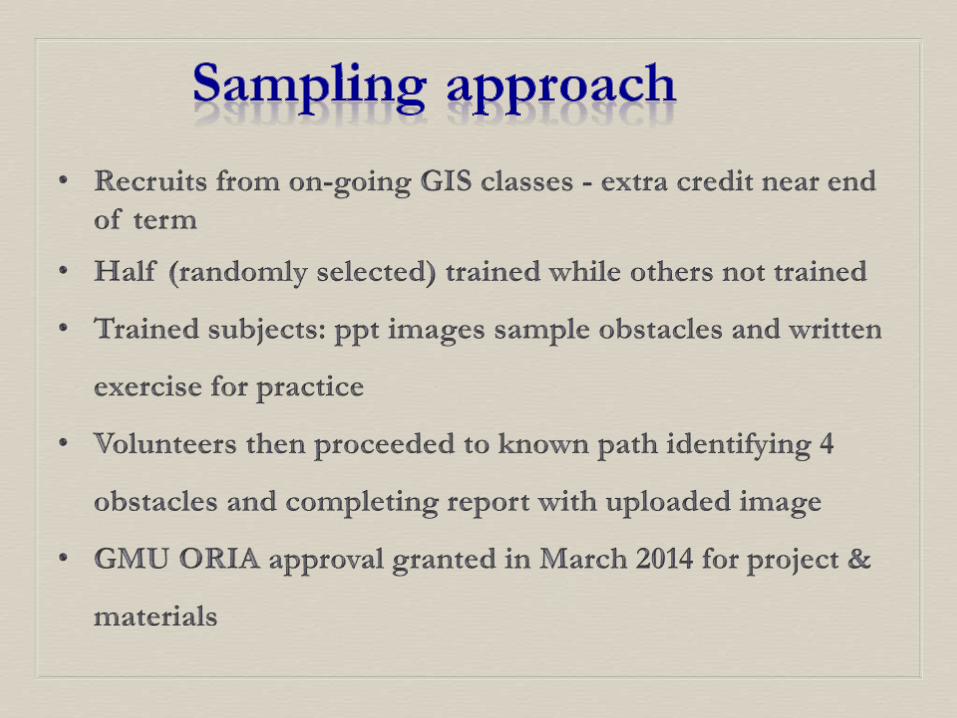
• Participants recruited on campus to execute reports of obstacles
using the web interface
• Several updates and revisions to accommodate needs
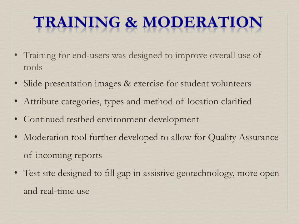
• Training for end-users was designed to improve overall use of
tools
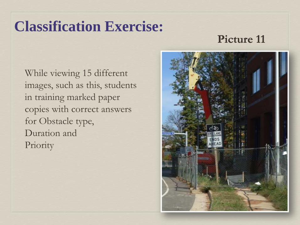
• Slide presentation images & exercise for student volunteers
• Attribute categories, types and method of location clarified
• Continued testbed environment development
• Moderation tool further developed to allow for Quality Assurance
of incoming reports
• Test site designed to fill gap in assistive geotechnology, more open
and real-time use
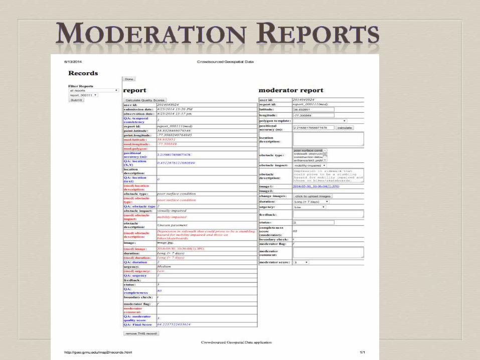
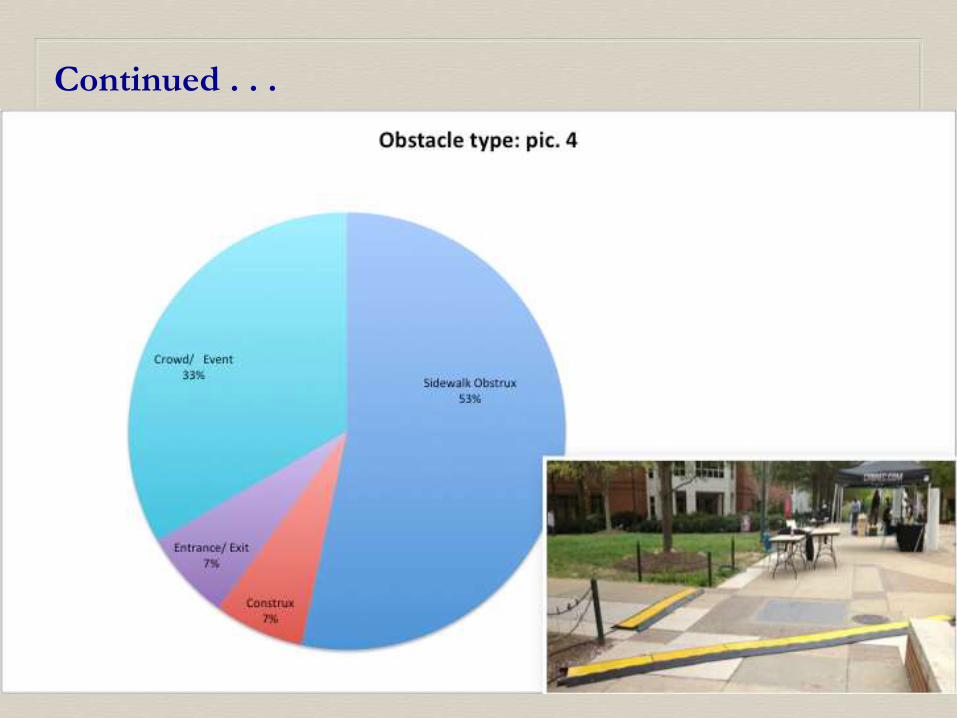
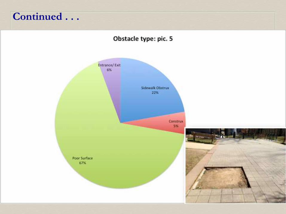
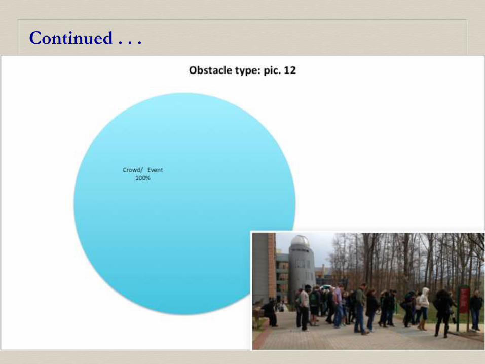
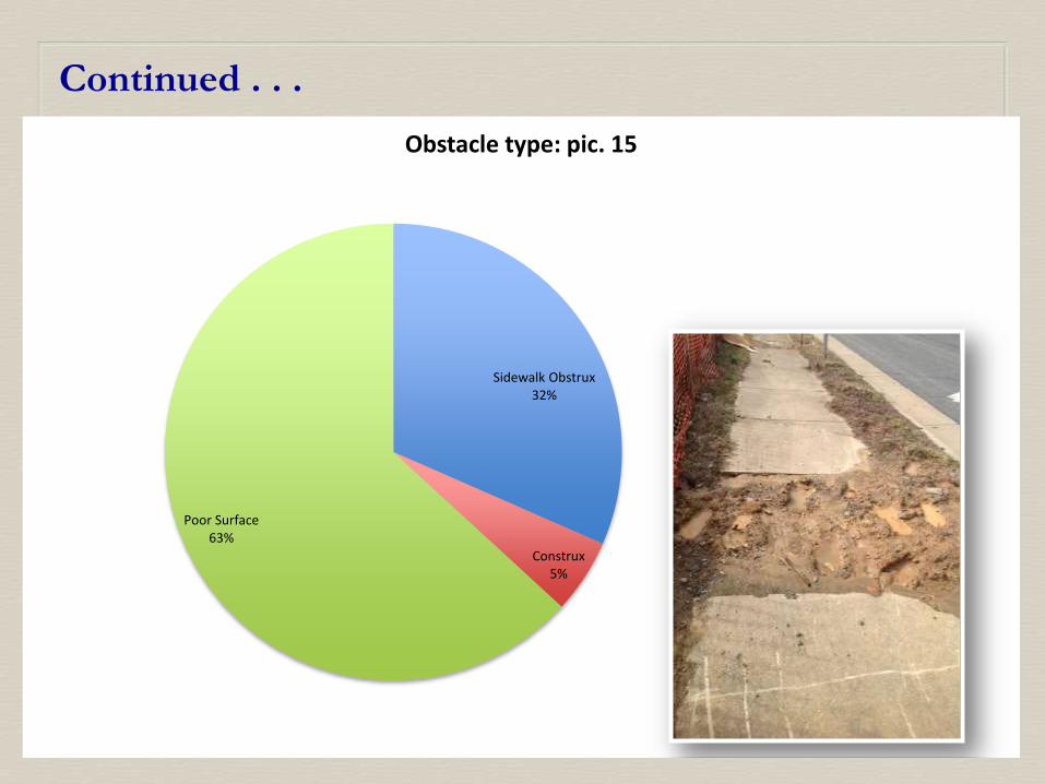
• Position of obstacle based on x, y coordinate
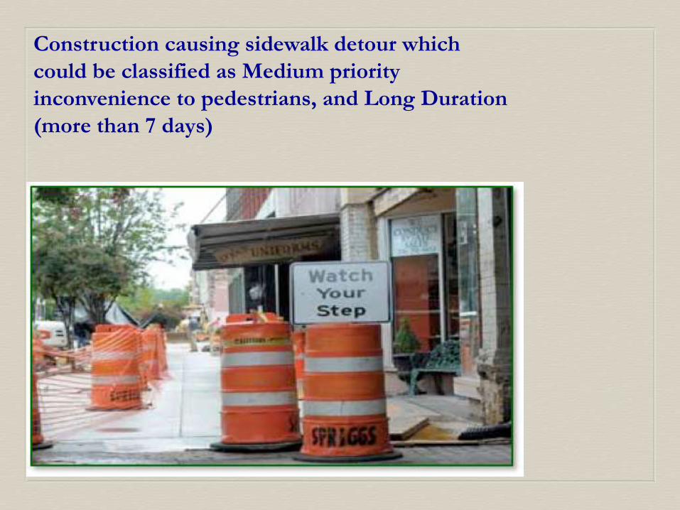
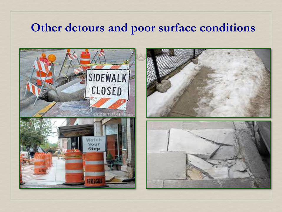
• Type of obstacle: obstruction, poor surface, exit/entrance,
crowd/event, construction detour
• Duration: short, medium, long
• Priority: (low, medium, high) based on impact
• Image of obstacle and text description help in moderation of final
report
• All part of final scores developed for Quality Assurance
• Each participant required no more than one hour of time
commitment (including in-class time for training)
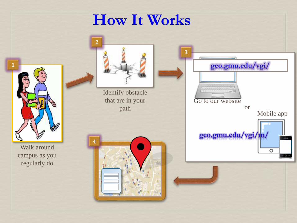
How It Works
Identify obstacle
that are in your
path
Go to our websiteor
Mobile app
2
1
Walk around
campus as you
regularly do
3
4
Reporting Obstacles
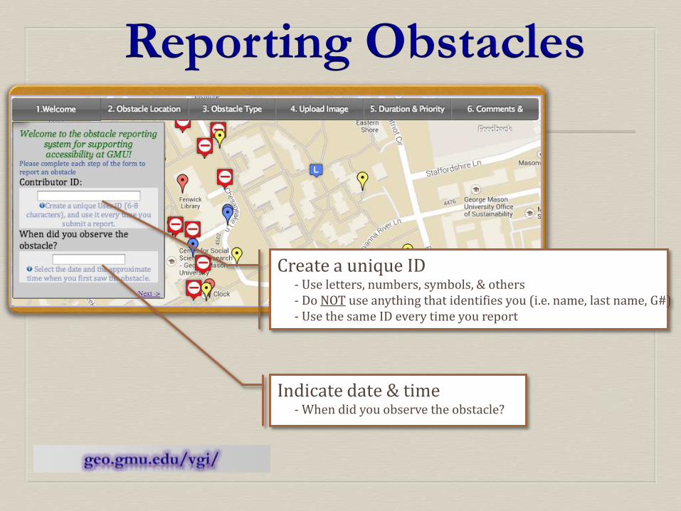
Create a unique ID - Use letters, numbers, symbols, & others- Do NOT use anything that identifies you (i.e. name, last name, G#)- Use the same ID every time you report
Indicate date & time - When did you observe the obstacle?
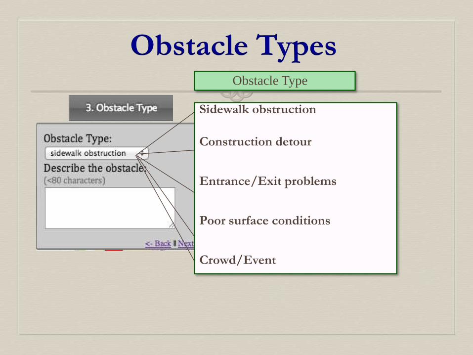
Obstacle TypesObstacle Type
Sidewalk obstruction
Construction detour
Entrance/Exit problems
Poor surface conditions
Crowd/Event
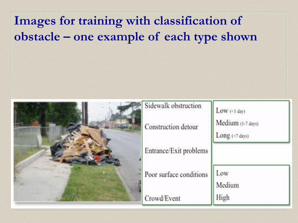
Duration & Priority
Duration
Priority
Low (<1 day)
Medium (1-7 days)
Long (>7 days)
Low
Medium
High
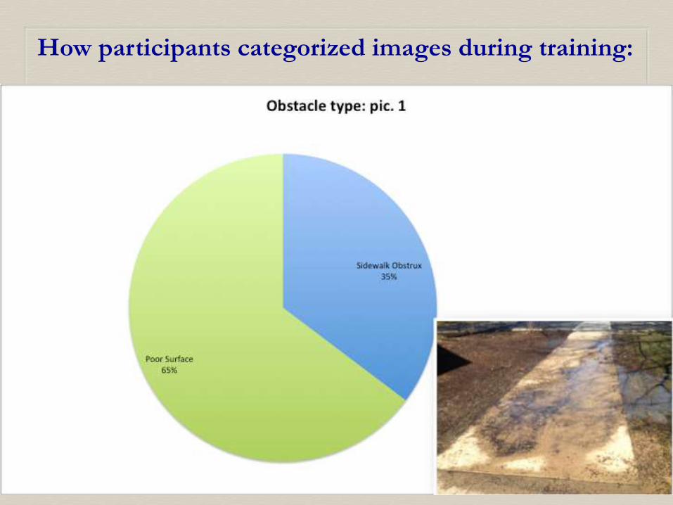
Images for training with classification of
obstacle – one example of each type shown
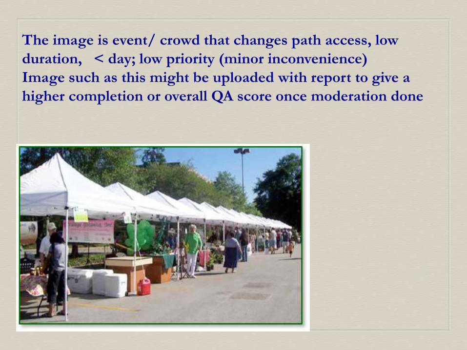
The image is event/ crowd that changes path access, low
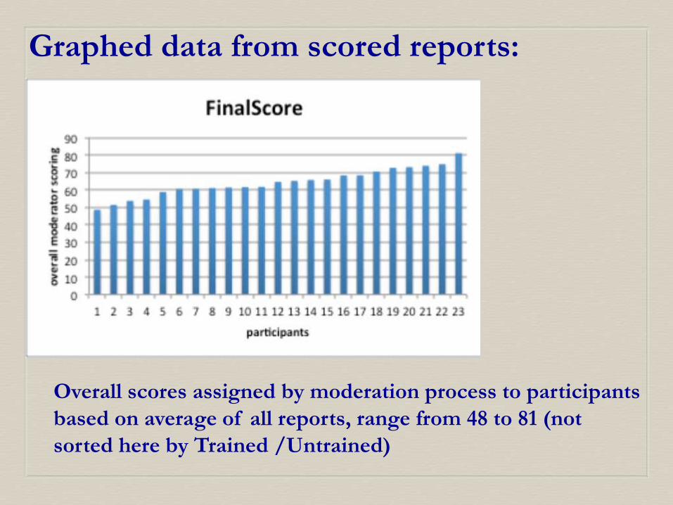
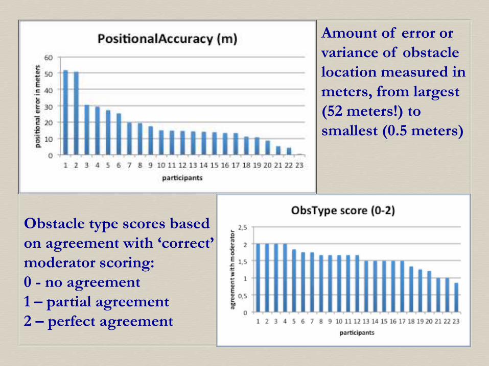
• n = 23, with uneven distribution of test subjects
• Larger test groups, better planning for reliability of participants and increased incentives – social setting (?)
• Possibly link training to internet sites
• Develop improvements to site for suitability on campus
• Continued student studies to increase usability
• Possible training developed to be included in GIS classes
• Export best training ideas to use for invasive species, bird counts, marine debris, seismic hazards, and many other citizen science applications in crowd-sourcing of geographic data
Abdulmonem, Alabri, and Jane Hunter. "Enhancing the Quality and Trust of Citizen Science Data." 2010 Sixth IEEE International Conference on e-Science.Brisbane: IEEE Computer Society, 2010. 81-88.
Brown, Greg. "An empirical evaluation of the spatial accuracy of public participation GIS (PPGIS) data." Applied Geography 34 (2012a): 289-294.
Brown, Greg. "Public Participation GIS (PPGIS) for Regional and Environmental Planning: Reflections on a Decade of Empirical Research." URISA Journal 24, no. 2 (2012b): 7-18.
Creative Commons. CC Wiki. December 12, 2013. http://www.wiki.creativecommons.org/License_versions (accessed December 14, 2013).
Dunn, Erica H., et al. "Enhancing the Scientific Value of The Christmas Bird Count." The Auk 122, no. 1 (2005): 338-346.
Foody, G. M., et al. "Assessing the Accuracy of Volunteered Geographic Information arising from Multiple Contributors to an Internet Based Collaborative Project." Transactions in GIS (John Wiley & Sons Ltd) 1111 (2013): 1-14.
Fowler, Amy, J. Duncan Whyatt, Gemma Davies, and Rebecca Ellis. "How Reliable are Citizen-Derived Scientific Data? Assessing th Quality of Contrail Observations Made by the General Public." Transactions in GIS 17, no. 4 (2013): 488-506.
Galloway, Aaron W. E., Margaret T. Tudor, and W. Matthew Vander Haegen. "The Reliability of Citizen Sceince: A Case Study of Oregon White Oak Stand Surveys." Wildlife Society Bulletin 34, no. 5 (Dec 2006): 1425-1429.
Goodchild, Michael. "Citizens as Sensors: The World of Volunteered Geography." GeoJournal (National Center for Geographic Information and Analysis) 69, no. 4 (2007): 211-221.
Greenemeier, Larry. "Welcome to Scientific American's Citizen Science Initiative." Scientific American, May 2, 2011.
Haklay, Mordechai. "How good is volunteered geographical information? A comparative study of OpenStreetMap and Ordance Survey datasets." Environment and Planning B: Planning and Design, Sept 13, 2009: 682-703.
Henrich, Joseph Heine, Steven J. and Norenzayan, Ara. "Most people are not WEIRD." Nature, July 1, 2010: 29.
Howe, Jeff. 2006. http://www.wired.com/wiread/archive/14.06/crowds.html(accessed December 8, 2013).
Jackson, Steven P., William Mullen, Peggy Agouris, Andrew Crooks, Arie Croitoru,
and Anthony Stefanidis. "Assessing Completeness and Spatial Error of Features in
Volunteered Geographic Information ." ISPRS Internation Jouinral of Geo-Information 2
(2013): 507-530.
Martin, Jeannie Miller. "Marine debris removal: One year of effort by the Georgia