9
Tom Clemo Deputy Chief of Operations Santa Monica Fire Dept.

Tom Clemo Deputy Chief of Operations
Santa Monica Fire Dept.

Representing the Cities in CAL OES Region I
Culver City Santa Monica Beverly Hills
Mission Statement:
“To get the right resource, to the right place at the right
time – regardless of the patch on the sleeve or sticker on the door.”

Region I Counties Los Angeles San Luis Santa Barbara Ventura Orange

C u l v e r C i t y G I S P r o g r a m

We all rely on GIS data to dispatch Technology is moving rapidly towards GIS Data
and point based dispatching All Area A cities have ESRI Platforms, just
different data schemas 2 of the 3 of us have the same Computer Aided
Dispatch (CAD) systems LA City borders all of our cities and is replacing
their CAD system Mutual and automatic Aid agreements allow the
sharing of resources We have significant border issues and
discrepancies This is a technical problem we can fix!


C u l v e r C i t y G I S P r o g r a m
C u l v e r C i t y G I S P r o g r a m

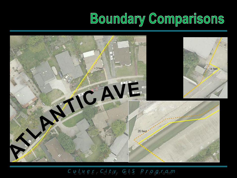
Analyze the borders and define the discrepancies between LA, BH, CC and SM – DONE
Go city by city and assure the addresses on the borders
are routed to the correct dispatch center – DONE in BH and partially in CC
Develop strategies to meet the mission – In Progress
Participate in the LA City CAD project Develop common CAD interop standards Share GIS data and have a common schema Work towards a CAD interop solution (NCR CAD Project) Realign the borders


