Towards practical Guidance for Sustainable Sediment Management using the Sava River as a showcase Damir Bekić, Ph.D., M.Sc., Dipl.Ing., Civ.Eng. University of Zagreb, Faculty of Civil Engineering, Croatia UNIVERSITY OF ZAGREB FACULTY OF CIVIL ENGINEERING WATER RESEARCH DEPARTMENT 8th International SedNet Conference 6-9 November 2013 Lisbon, Portugal Innovative Sediment Management: How to do more with less
Transcript
Towards practical Guidance for Sustainable Sediment Management using the Sava River
as a showcase
Damir Bekić, Ph.D., M.Sc., Dipl.Ing., Civ.Eng. University of Zagreb, Faculty of Civil Engineering, Croatia
UNIVERSITY OF ZAGREB FACULTY OF CIVIL ENGINEERING
WATER RESEARCH DEPARTMENT
8th International SedNet Conference 6-9 November 2013 Lisbon, Portugal Innovative Sediment Management: How to do more with less
Contents
1. Introduction 2. Project – Towards practical Guidance for SSM 3. Project results 4. Future steps
2
1. INTRODUCTION
The River Sava
3rd longest in the Danube Basin = 944 km (source-mouth) largest by discharge tributary of the Danube River
(Qm=1.564 m3/s, contributing by 25% to QDanube)
3
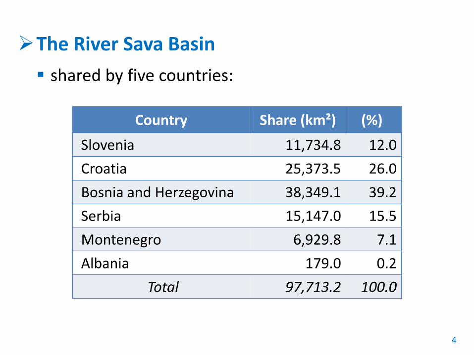
The River Sava Basin shared by five countries:
4
Country Share (km²) (%) Slovenia 11,734.8 12.0 Croatia 25,373.5 26.0 Bosnia and Herzegovina 38,349.1 39.2 Serbia 15,147.0 15.5 Montenegro 6,929.8 7.1 Albania 179.0 0.2
Total 97,713.2 100.0
Background No examples yet to integrate SSM into RBMP The key driver for UNESCO IHP, ISI and SedNet to promote
SSM Legal background in the Sava River Basin Framework Agreement on Sava River Basin (FASRB) =
framework for transboundary cooperation in WM, navigation, etc. Protocol on Sediment Management to FASRB (not yet
harmonized)
5
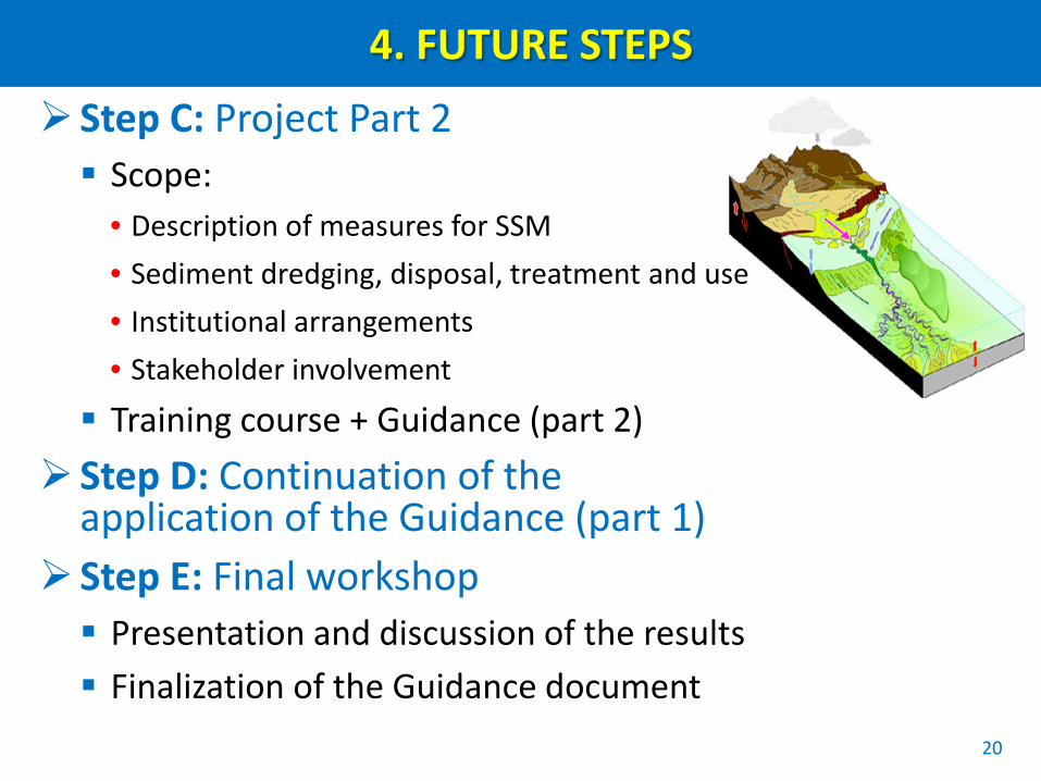
2. PROJECT: Towards practical Guidance for SSM
General facts Main objective = to develop and validate practical
guidance to achieve SSM plan on the river basin scale
Project partners = experts appointed by UNESCO, ISI, SedNet and ISRBC
Estimated duration = 26 months
6
Project schedule
Main steps
A. Project Part 1 = SSM course 1 + Guidance part 1
B. Application of Guidance Part 1 in the Sava River
C. Project Part 2 = SSM course 2 + Guidance part 2
D. Continuation of Guidance Part 1 application in the Sava River practice
E. Final workshop
7
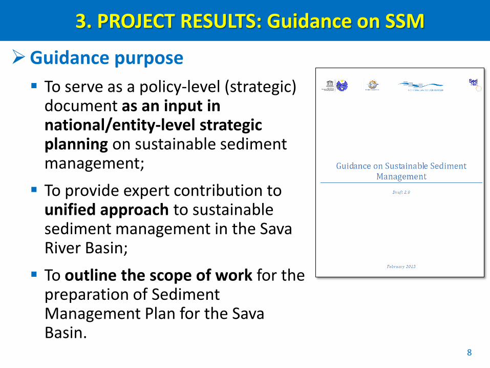
3. PROJECT RESULTS: Guidance on SSM
Guidance purpose To serve as a policy-level (strategic)
document as an input in national/entity-level strategic planning on sustainable sediment management; To provide expert contribution to
unified approach to sustainable sediment management in the Sava River Basin; To outline the scope of work for the
preparation of Sediment Management Plan for the Sava Basin.
8
Guidance contents Introduction
• background, definitions, main objectives, purpose and scope
Legislative Framework for sustainable sediment management • linkage with EU directives and policies, Policy Framework for SSM
Sediment as an integral part of the river basins • sediment quantity (budget), sediment quality, aquatic ecosystems:
ecology and biodiversity, anthropogenic pressures
Status on sediment management in the Sava River Basin • Overview of hydro-morphology, sed. balance, monitoring, sed. quality
Description of measures for SSM Institutional arrangements Means of stakeholder involvement Development of SMP
9
3. PROJECT RESULTS: Guidance Part 1
Scope of Part 1 Sediment balance Sediment monitoring Evaluation of sediment quality and
quantity
Implementation of Part 1 Step A: Execution of the training course
• course held in October 2012 in Zagreb
Step B: Application of the Guidance • Subproject: Estimation of Sediment Balance for
the Sava River (BALSES)
10
Step B: Application of Guidance Part 1 Subproject: Estimation of Sediment Balance for the Sava
River (BALSES) - Outcomes Overview on the actual monitoring system, monitored
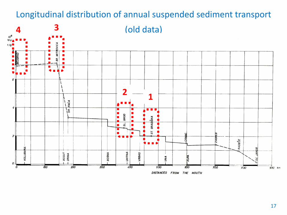
variables, frequency of data sampling and operation period Identification of monitoring gaps and data uncertainties Map of sediment monitoring network Estimation of sediment yield from the main tributaries Longitudinal profile of the Sava River with presentation of
riverbed changes Estimation of a basin-wide sediment balance Proposal of joint activities towards the establishment of an
effective sediment monitoring system Proposal for the sediment database composition
11
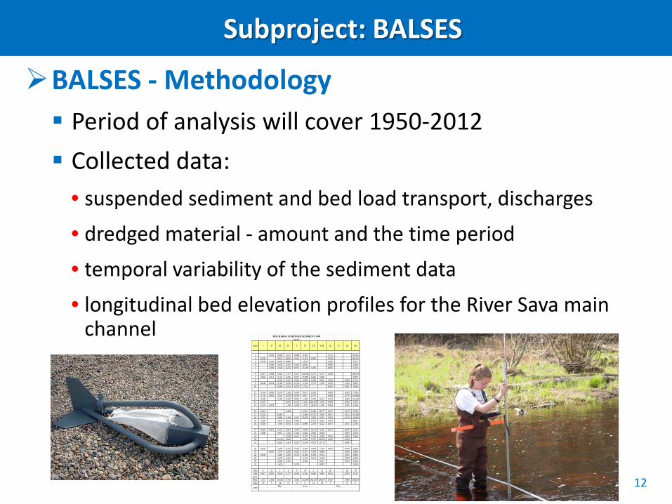
Subproject: BALSES
BALSES - Methodology Period of analysis will cover 1950-2012 Collected data:
• suspended sediment and bed load transport, discharges
• dredged material - amount and the time period • temporal variability of the sediment data
• longitudinal bed elevation profiles for the River Sava main channel