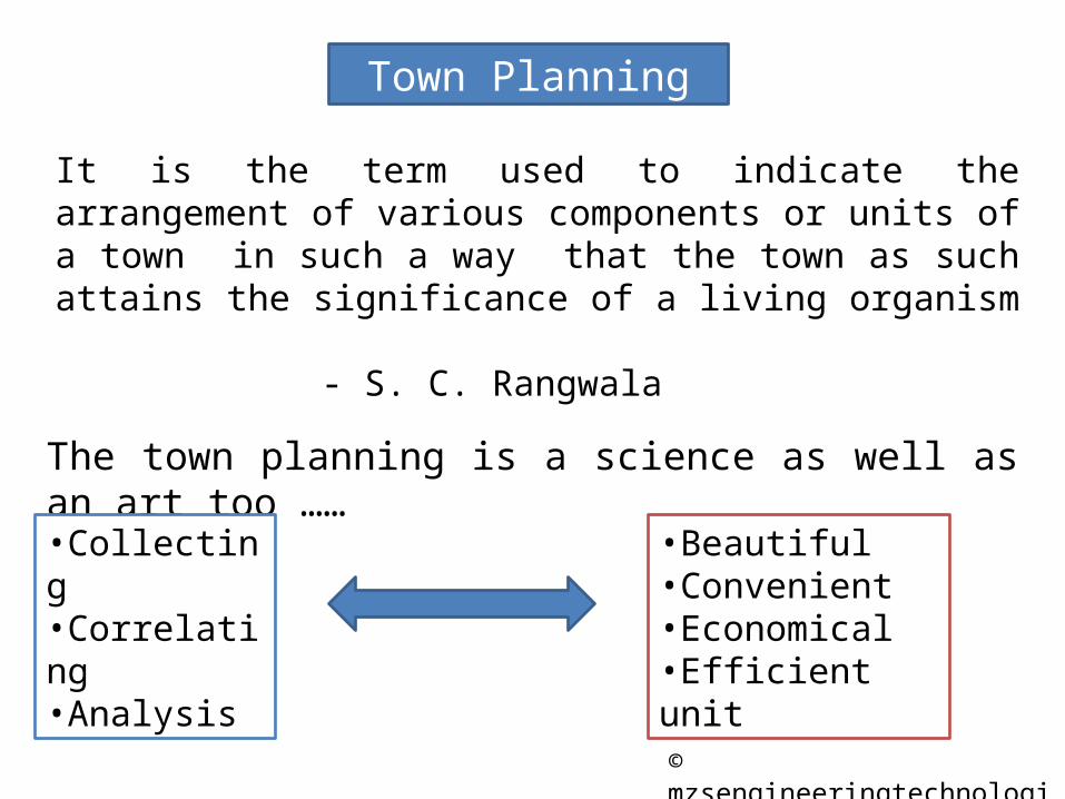
It is the term used to indicate the arrangement of various components or units of a town in such a way that the town as such attains the significance of a living organism
- S. C. Rangwala
The town planning is a science as well as an art too ……•Collecting•Correlating•Analysis
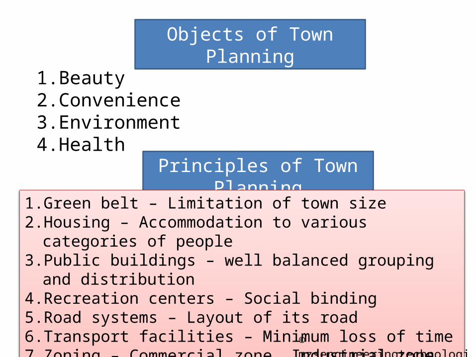
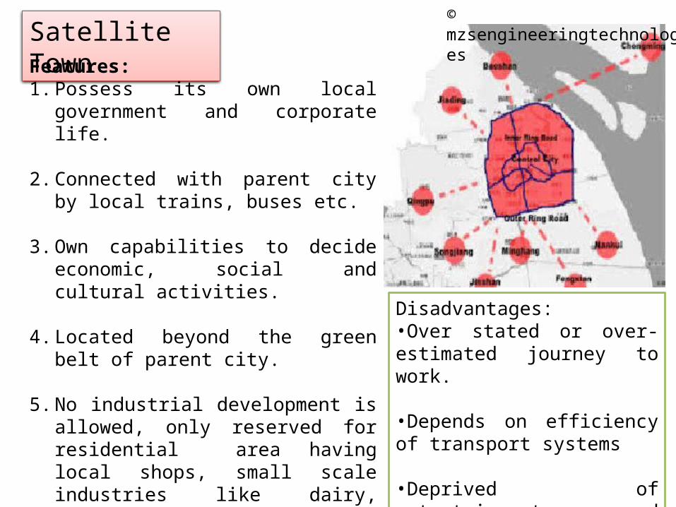
1. Green belt – Limitation of town size2. Housing – Accommodation to various categories of people3. Public buildings – well balanced grouping and distribution4. Recreation centers – Social binding5. Road systems – Layout of its road6. Transport facilities – Minimum loss of time 7. Zoning – Commercial zone, Industrial zone, residential zone,etc.
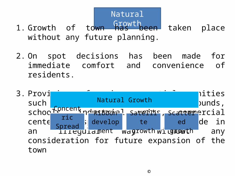
1. Growth of town has been taken place without any future planning.
2. On spot decisions has been made for immediate comfort and convenience of residents.
3. Provisions of various essential amenities such as road system, parks, play grounds, schools, industrial units, commercial centers, hospitals, cinemas are made in an irregular way without any consideration for future expansion of the town
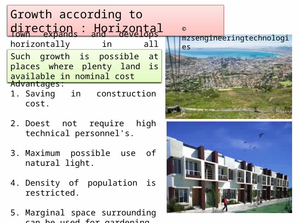
This type of development takes place due to tendency of people to near to town centre. Town develops in the form of concentric rings with nucleus as a town.
The idea of concentric spread is based on the fact that similar or functionally related activities will be located at the same distance from centre of an urban area.First zone embodies the central business district and focal point of commercial, social and civic life of town area.
Disadvantages:•Improper housing•Concentration of people•More transportation time and charges•Congestion of the traffic and accidents•Inner zone extends its area by invading the adjoining zone
Ribbon development is building houses along the routes of communications radiating from a human settlement.
Such development results long fingers or ribbons of houses, factories, shops, etc as shown in image
The development involves usage of land along the frontage of highway or service roads, the interior is left undeveloped causing of wastage of valuable land
Disadvantages of Ribbon Development1. As a result of linear expansion of housing along the length of highway or
service roads, there is increase in cost of basic utility services like water supply, electricity, telephone, etc resulting in wastage of available resources.
2. Future improvements becomes costlier, difficult and some times not possible.
3. The housing face heavy traffic associated with noise and polluted air.
4. Traffic congestions and traffic delays becomes common feature of town.
5. Loss of traffic capacity and efficiency due to local traffic, pedestrians, minor and major accidents, advertisement and obstruction to view.
6. There is lack of social life.
7. Needs creation of a competent authority to enforce the various legislative measures.
8. Removal of encroachments from the road right-of-way, etc.
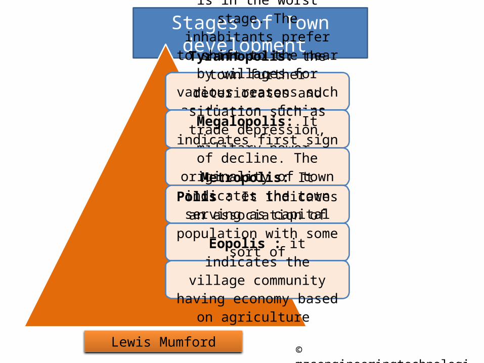
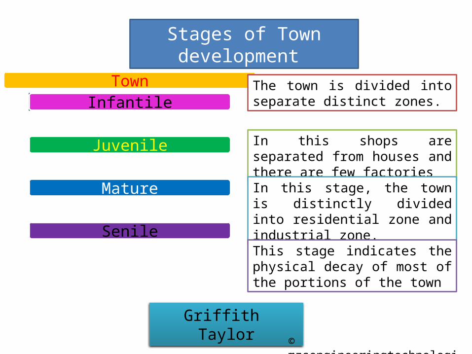
Necropolis: The town is in the worst stage. The inhabitants prefer to shift to the near by villages for various reasons
such as disease, famine, war, economic breakdown, etc. the
town may recover or re-establish after an interval of
time
Tyrannopolis: the town further deteriorates and situation such as trade
depression, military power, exploration of colonies , etc
occur.Megalopolis: It indicates first sign of decline. The originality of town shows sign of declineMetropolis: It indicates the town serving as capital of state
or regionPolis : It indicates an association of population with some sort of specialization and
mechanizationEopolis : it indicates the village community having
Population 400 -500 soulsPrimary occupationAgricultureStabilityPrimary school, open well, Murom roads, mobile dispensary, etc.
Population 2000-3000 soulsPrimary occupationCultural, commercial and administrativeStabilitySecondary school, tube well, Murom roads, mobile dispensary, community hall, etc.Groups 10-15 basic villages
Population 5000-7000 soulsPrimary occupationSmall scale industries over and above the agricultural employmentStabilitycolleges, pipe water supply, Macadam roads, health center, community hall, etc.Groups 25-30 basic villages
Last level of settlementPopulationCity50,000 – 1,00,000Great – City1,00,000 – overSuper – CityMore than 3 Lacs.Metropolis 1 cr and aboveMegalopolis5 cr and above
Planning is based on creation of healthful living and working environment for the majority of the inhabitants of the town with due consideration to the physical background, economic limitations, public administration, finance and change in technology, etc.
The development plan for city or town aims at proper distribution of population densities, regulation of green belts, suitable division of the area in various zone of the area in various zone, etc.
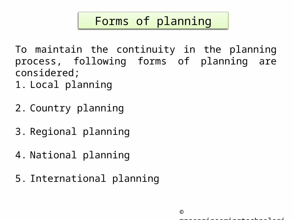
Regional planning helps in controlling and reshaping major towns in the region.
Term region is used to define as an area separated not merely or exclusively by natural boundaries but equally by political or administrative boundaries.
Four methods of determining a region is advocated;1. Geographic boundaries,2. Economic considerations,3. Administrative convenience, and4. Metropolitan influence.
Country planning cannot be divorced from town and regional planning, because the town and country are not two separate entities but are complementary to each other
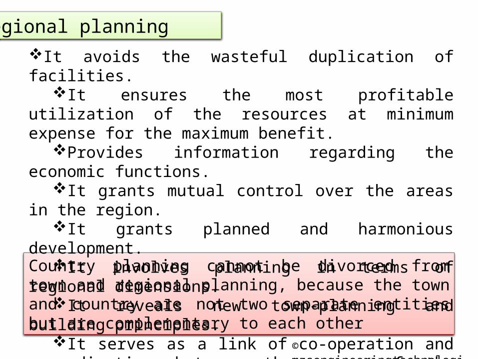
Regional planningIt avoids the wasteful duplication of facilities.
It ensures the most profitable utilization of the resources at minimum expense for the maximum benefit.
Provides information regarding the economic functions.It grants mutual control over the areas in the region.It grants planned and harmonious development.It involves planning in terms of regional dimensions.It reveals new town-planning and building principles.It serves as a link of co-operation and co-ordination
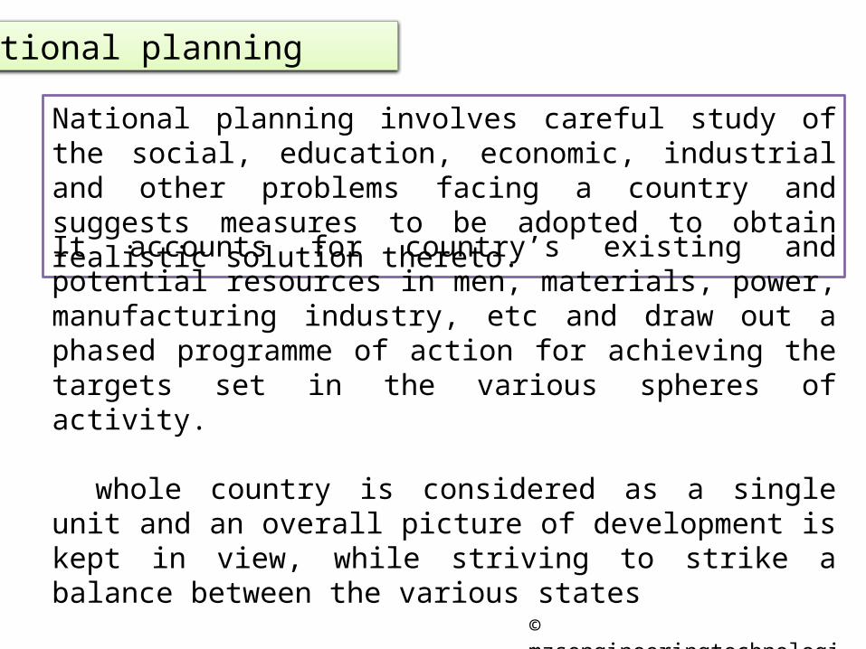
National planning involves careful study of the social, education, economic, industrial and other problems facing a country and suggests measures to be adopted to obtain realistic solution thereto.
It accounts for country’s existing and potential resources in men, materials, power, manufacturing industry, etc and draw out a phased programme of action for achieving the targets set in the various spheres of activity.
whole country is considered as a single unit and an overall picture of development is kept in view, while striving to strike a balance between the various states
In India, the various five year plans are an example of National Planning.
First Sanitary And Public Health Act of Great Britain (1840)
This was an first attempt to control the quality of construction from private housing.
The act controls only the construction of individual building by laying down standards for structural stability, their fire-proof construction, provision of sanitary appliances, water supply, adequate ventilation, pedestrian and vehicular traffic
Disadvantages:The act did not contain any provision in regard to the relationship of the individual building with neighbouring buildings and amenities such as primary and secondary schools, shopping facilities, open spaces or other essential needs, by earmarking land for these purpose.
The major change in present act was made with an amendment in the act to enable local authorities to acquire and clear insanitary dwelling and to construct new houses on the sites occupied by them, the Act was renamed as;
Housing Act (1980)
First Sanitary And Public Health Act of Great Britain (1840)
First Sanitary And Public Health Act of Great Britain (1840)
To provide remedy to first to deal with town planning and housing was passed in Great Britain in 1909.
Its main objective was to achieve the basic concept of town planning viz. ensuring the use of land in the best interests of the nation as a whole and preventing further mischief.
As some of the suburban developments of cities were sterilizing the country's most valuable resources
Garden City The concept of garden city was put forth by a shorthand writer in the house of common, Ebenezer Howard in 1898.
In his book titled “ To-morrow” later published under title “garden cities of To-morrow”.
The idea of city called by him a garden city, to reconcile country life and town life and to grant various other advantages to population of this city.
This concept find his way in formulation by Garden Cities and Town planning Association, 1919
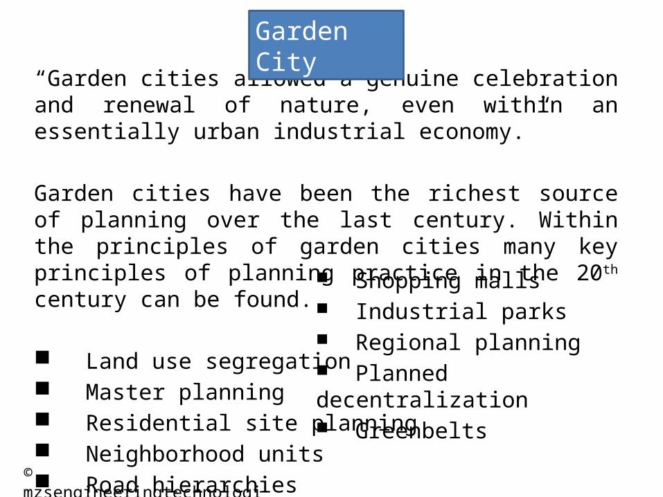
“Garden cities allowed a genuine celebration and renewal of nature, even within an essentially urban industrial economy.”
Garden cities have been the richest source of planning over the last century. Within the principles of garden cities many key principles of planning practice in the 20th century can be found.
Land use segregation Master planning Residential site planning Neighborhood units Road hierarchies
Garden City
Shopping malls Industrial parks Regional planning Planned decentralization Greenbelts
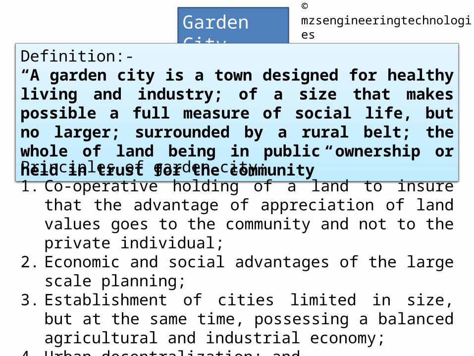
Definition:-“A garden city is a town designed for healthy living and industry; of a size that makes possible a full measure of social life, but no larger; surrounded by a rural belt; the whole of land being in public ownership or held in trust for the community”
Principles of garden city;1. Co-operative holding of a land to insure that the advantage of
appreciation of land values goes to the community and not to the private individual;
2. Economic and social advantages of the large scale planning;3. Establishment of cities limited in size, but at the same time,
possessing a balanced agricultural and industrial economy;4. Urban decentralization; and5. Use of a surrounding green belt to serve as an agricultural,
recreational area and to assist the extension of limit.
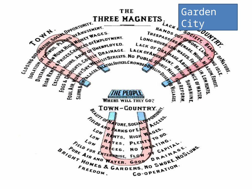
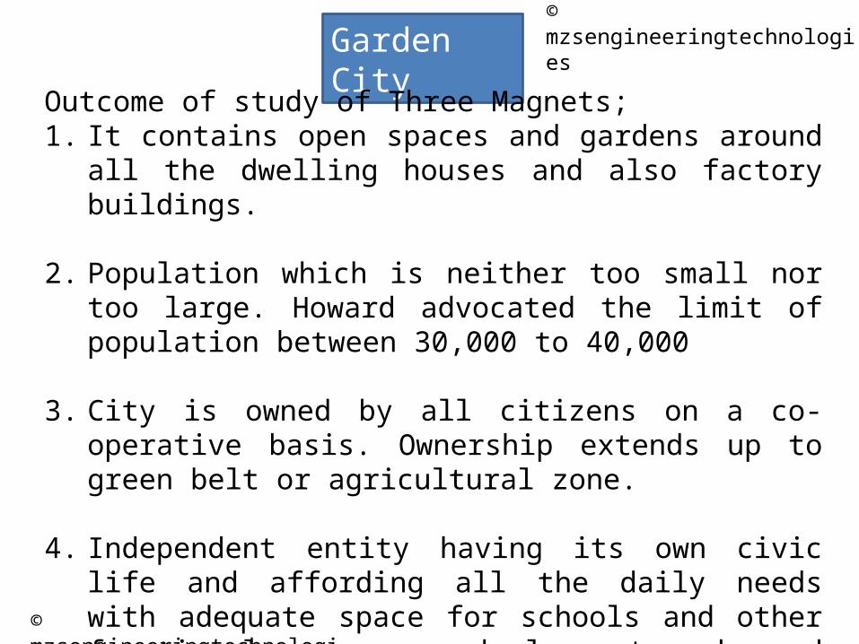
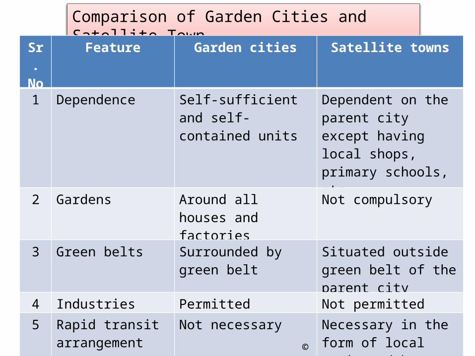
Outcome of study of Three Magnets;1. It contains open spaces and gardens around all the dwelling
houses and also factory buildings.
2. Population which is neither too small nor too large. Howard advocated the limit of population between 30,000 to 40,000
3. City is owned by all citizens on a co-operative basis. Ownership extends up to green belt or agricultural zone.
4. Independent entity having its own civic life and affording all the daily needs with adequate space for schools and other functional purposes and pleasant parks and parkways
6. Town area is surrounded on its periphery by a green belt i.e. a larger area is reserved permanently for agriculture ensuring the country’s benefits.
7. No need to have rapid transit arrangements
8. Principle of zoning is followed
9. Surplus fund is utilized for the development of the community itself.
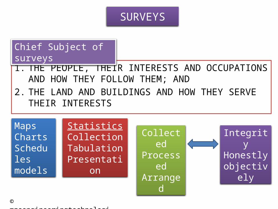
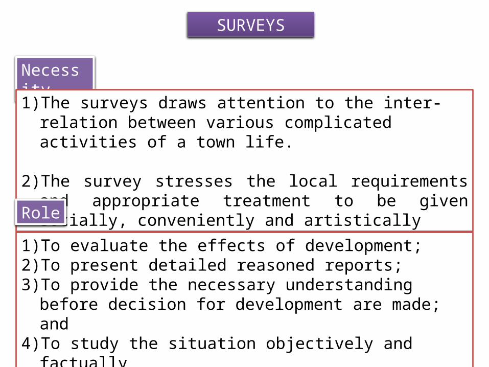
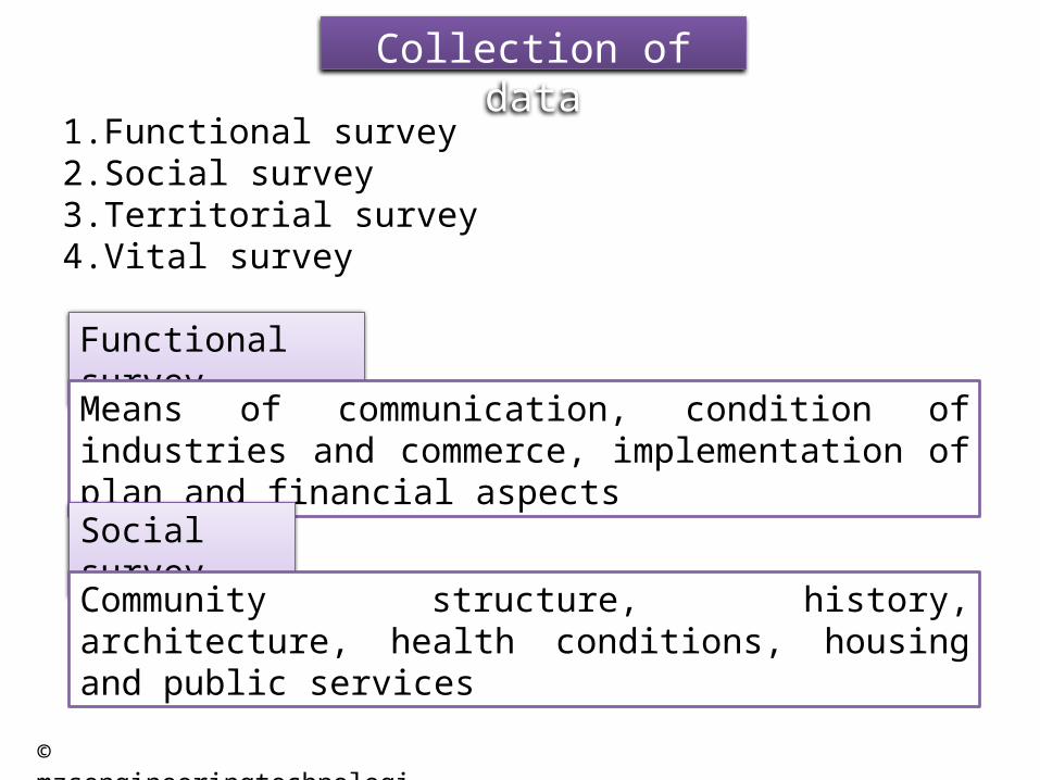
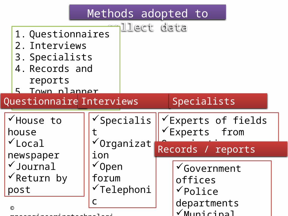
Civic surveyCommunication amenitiesContourExisting land uses and land valuesHistorical backgroundHousingPopulationPreservation of natural resourcesPublic buildingsPublic healthPublic services topography
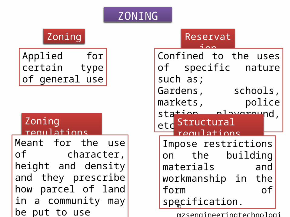
Term zoning in planning Sense include two aspects;
1. Allocation of land for specific purpose, and2. Control of use, height and construction of buildings
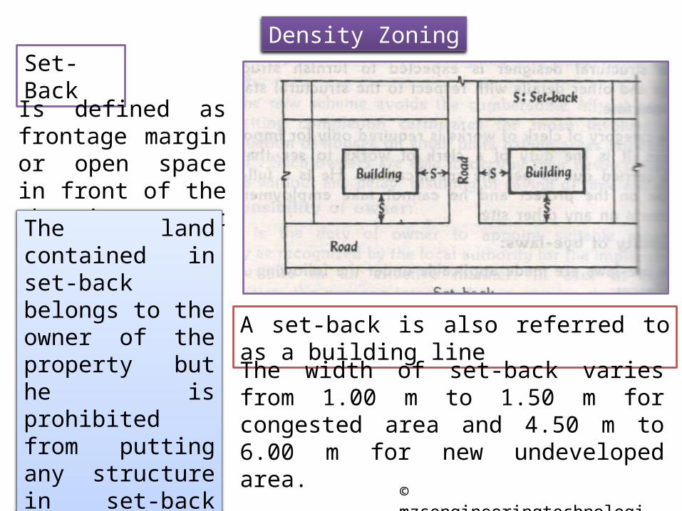
It is defined as the regulation by law of the use of land and (or) buildings and of the height and density of buildings in specific areas for the purpose of securing convenience, health, safety and general welfare of the community.
1. The front, side and rear margins from the boundaries are specified.
2. The maximum height of the building is specified.3. The minimum size of allotment for each house is specified.4. The number of houses per unit area is specified.5. The ration of total site area to the total built-up floor area is
specified
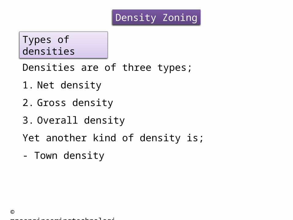
Gross density
The average density of population per unit area of the whole residential zone
Net density
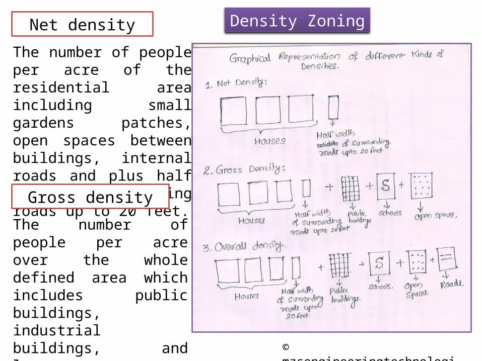
The average density of population per unit of housing area including local roads and excluding open spaces
The number of people per acre of the residential area including small gardens patches, open spaces between buildings, internal roads and plus half width of surrounding roads up to 20 feet.
Gross density
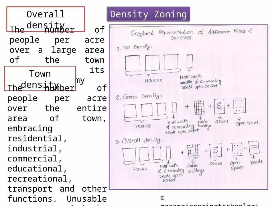
The number of people per acre over the whole defined area which includes public buildings, industrial buildings, and large open areas plus half width of surrounding roads up to 20 feet.
The number of people per acre over a large area of the town affecting its general economy
Town densityThe number of people per acre over the entire area of town, embracing residential, industrial, commercial, educational, recreational, transport and other functions. Unusable areas occupied by large quarry pits, river beds, streams, lakes, airfield, military area within town limits is also accounted
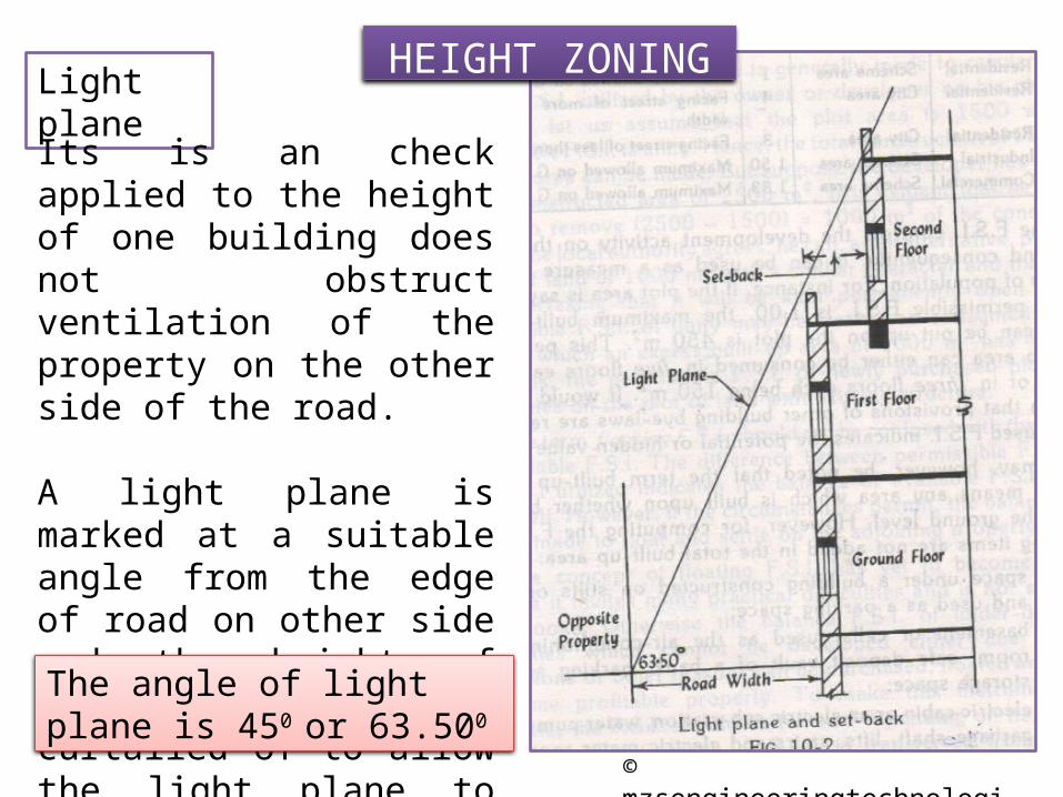
Its is an check applied to the height of one building does not obstruct ventilation of the property on the other side of the road.
A light plane is marked at a suitable angle from the edge of road on other side and the height of building is suitably curtailed of to allow the light plane to pass.
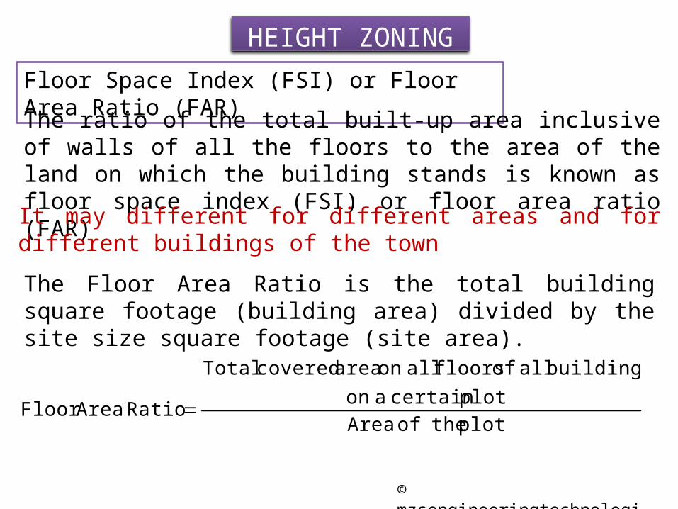
HEIGHT ZONINGFloor Space Index (FSI) or Floor Area Ratio (FAR)
The ratio of the total built-up area inclusive of walls of all the floors to the area of the land on which the building stands is known as floor space index (FSI) or floor area ratio (FAR)
It may different for different areas and for different buildings of the townThe Floor Area Ratio is the total building square footage (building area) divided by the site size square footage (site area).
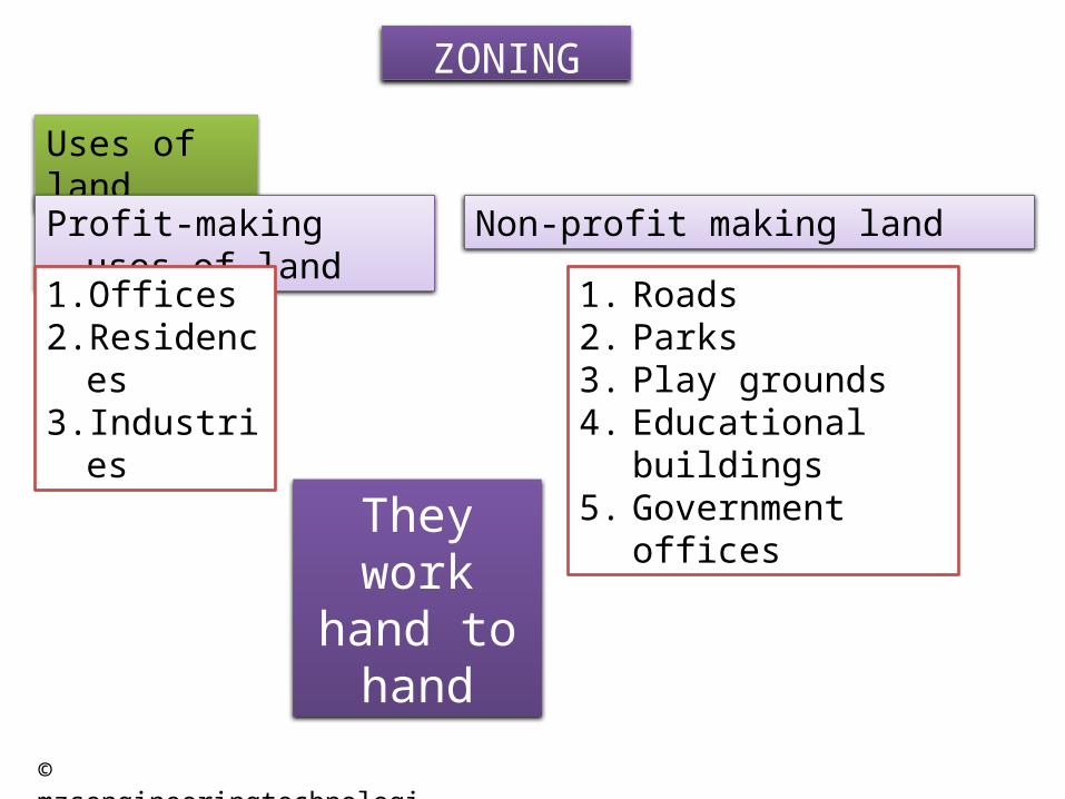
The zones are usually classified into following four categories;1. Residential zone ………………40% to 50%2. Commercial zone ……………..2% to 5%3. Industrial zone………………… 2% to 25%4. Recreational zone …………….. remaining
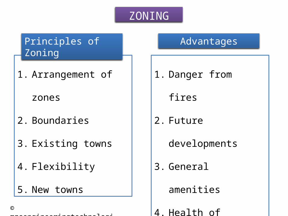
Advantages:
Best use of land for which it is reserved.
Stabilization of land values.
Unnecessary intrusion of factories and industries in residential
area is avoided.
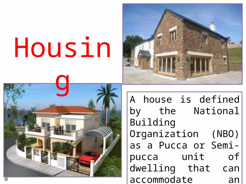
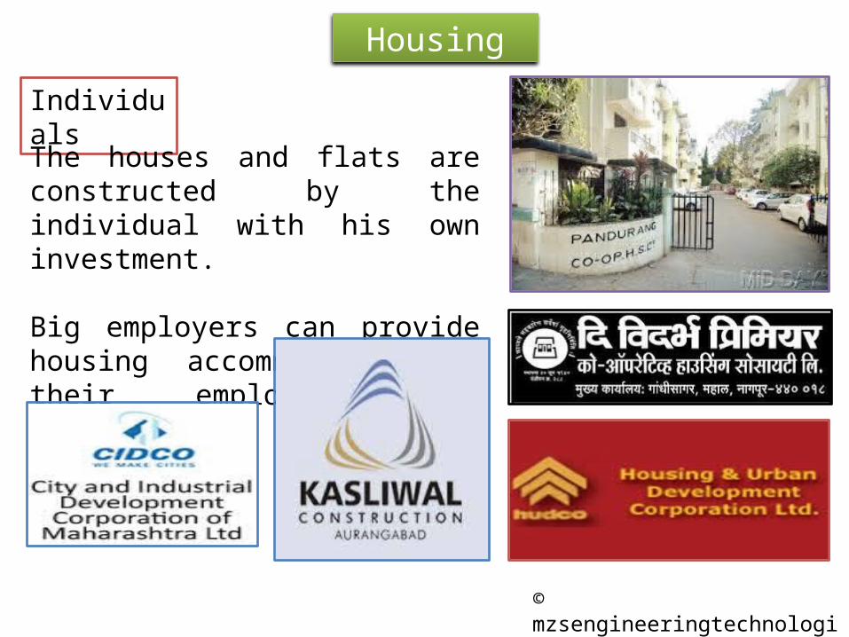
Housing
A house is defined by the National Building Organization (NBO) as a Pucca or Semi-pucca unit of dwelling that can accommodate an average household.
A house in a general sense represents the smallest unit from where the town planning scheme emerges
The success or failure of all the town planning scheme rest on effective provision of housing for the population to be served by the town planning schemes
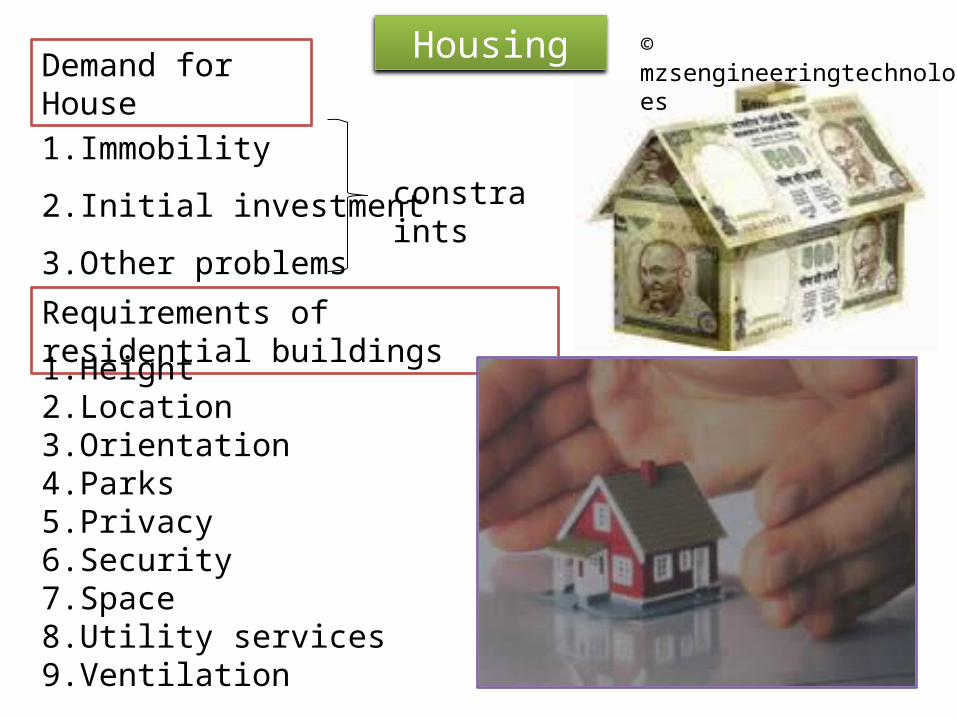
Demand for House
1. Immobility
2. Initial investment
3. Other problemsRequirements of residential buildings
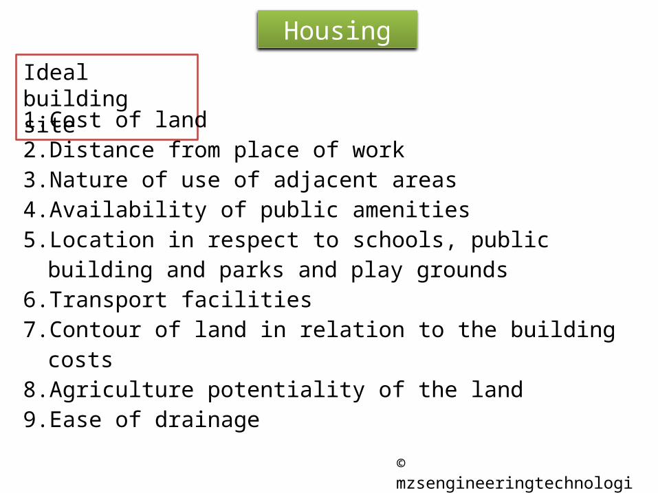
1. Cost of land2. Distance from place of work3. Nature of use of adjacent areas4. Availability of public amenities5. Location in respect to schools, public building and parks and
play grounds6. Transport facilities7. Contour of land in relation to the building costs8. Agriculture potentiality of the land9. Ease of drainage
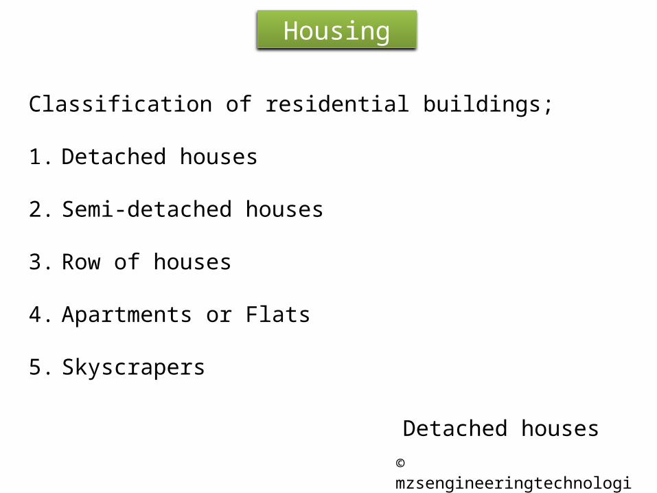
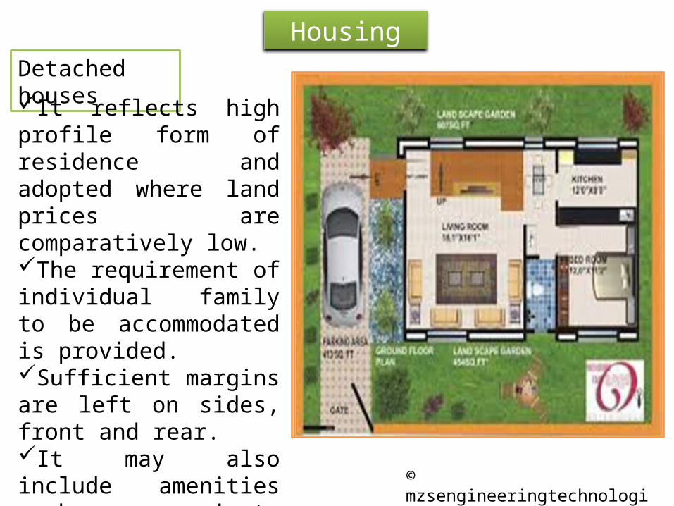
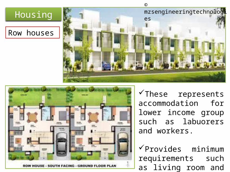
HousingDetached housesIt reflects high profile form of residence and adopted where land prices are comparatively low.The requirement of individual family to be accommodated is provided.Sufficient margins are left on sides, front and rear.It may also include amenities such as private garden, swimming pool, etc.
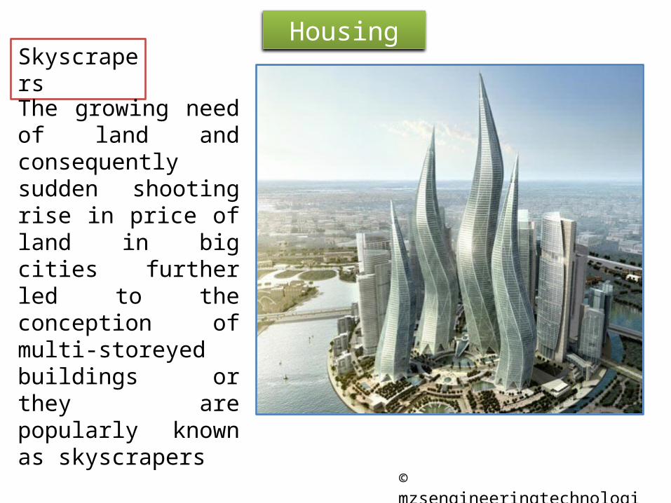
The growing need of land and consequently sudden shooting rise in price of land in big cities further led to the conception of multi-storeyed buildings or they are popularly known as skyscrapers
1. Decentralization2. Economic conditions3. Education4. Improper used of land5. Industrialization6. Lack of zoning7. Migrants8. Powers of local authority9. Repair and maintenance
1. Absence of amenities2. Health3. Surrounding locality4. Undesirable spots5. Working conditions
Slum Clearance
1. Complete removal method2. Improvement method
Prevention of slum formation
1. Cheap housing2. Compulsion to employers3. Construction of buildings4. Maintenance and repairs5. Rent restrictions6. Social education7. Unauthorized construction
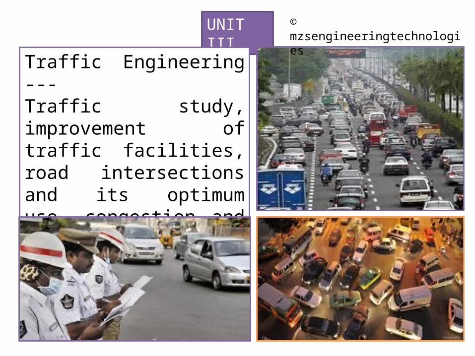
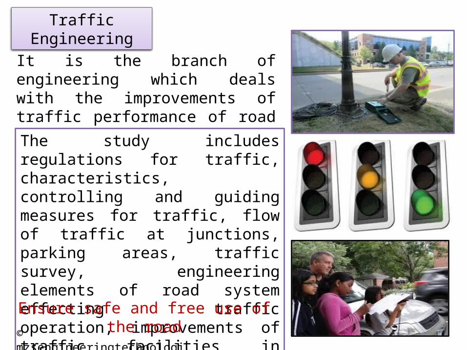
Traffic Engineering ---Traffic study, improvement of traffic facilities, road intersections and its optimum use, congestion and parking traffic control device, refuge islands, raped transit systems
It is the branch of engineering which deals with the improvements of traffic performance of road networks and terminals.The study includes regulations for traffic, characteristics, controlling and guiding measures for traffic, flow of traffic at junctions, parking areas, traffic survey, engineering elements of road system effecting traffic operation, improvements of traffic facilities in existing towns and cities etc.
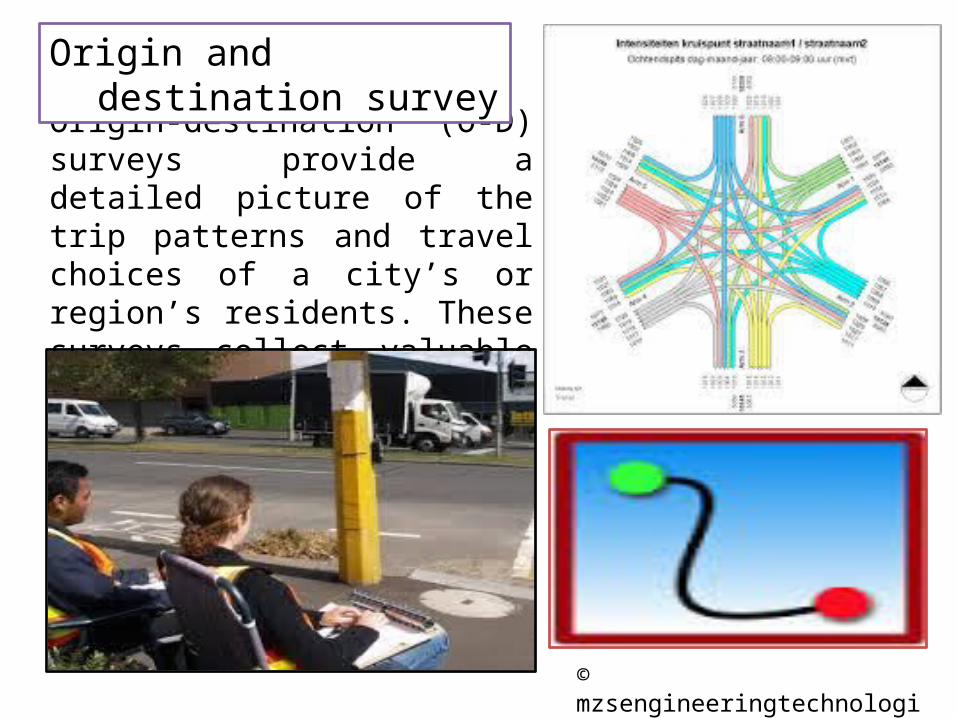
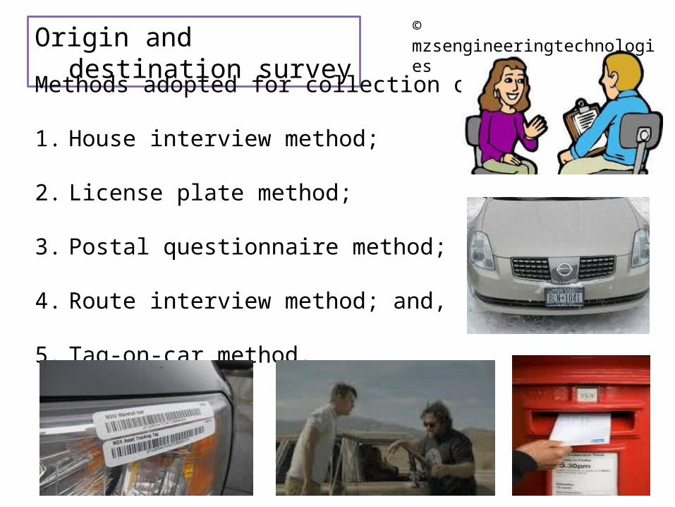
Origin‐destination (O‐D) surveys provide a detailed picture of the trip patterns and travel choices of a city’s or region’s residents. These surveys collect valuable data related to households, individuals and trips.
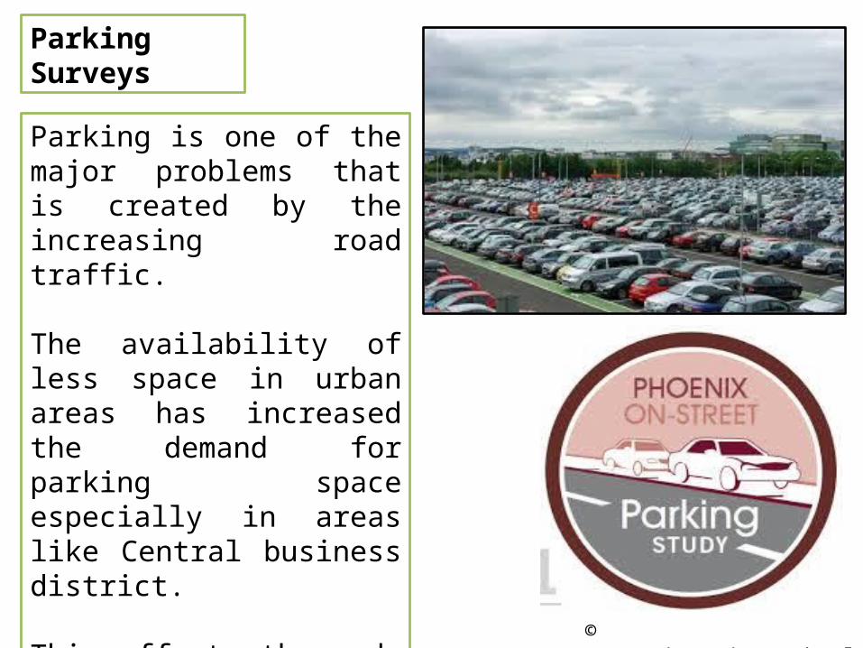
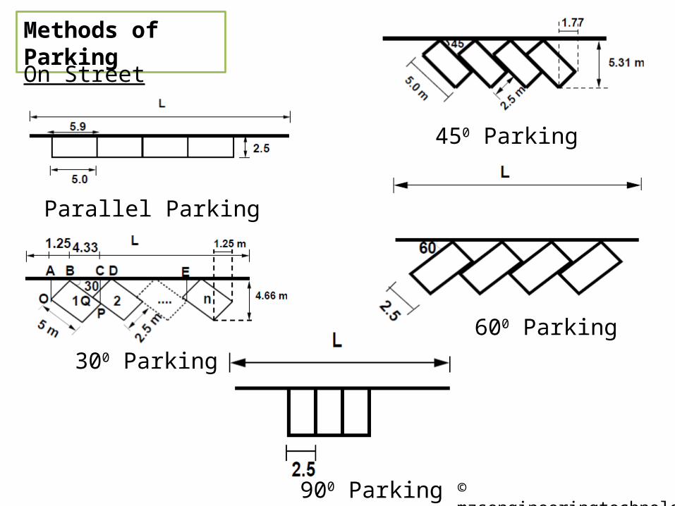
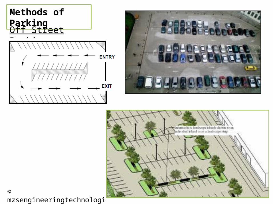
Parking is one of the major problems that is created by the increasing road traffic.
The availability of less space in urban areas has increased the demand for parking space especially in areas like Central business district.
This affects the mode choice also. This has a great economical impact.
Parking Surveys
Parking accumulationIt is defined as the number of vehicles parked at a given instant of time. Normally this is expressed by accumulation curve. Accumulation curve is the graph obtained by plotting the number of bays occupied with respect to time.
Parking volume is the total number of vehicles parked at a given duration of time. This does not account for repetition of vehicles.
Parking volume
Parking loadParking load gives the area under the accumulation curve. It can also be obtained by simply multiplying the number of vehicles occupying the parking area at each time interval with the time interval. It is expressed as vehicle hours
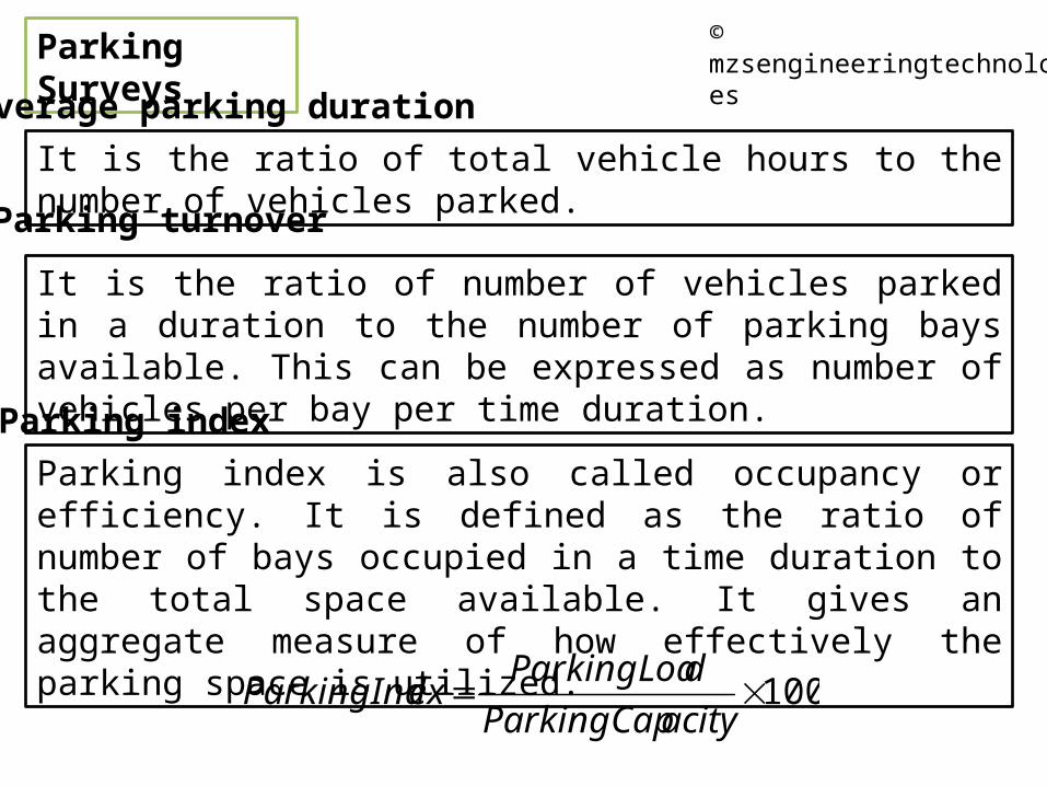
Average parking durationIt is the ratio of total vehicle hours to the number of vehicles parked.
Parking turnover
It is the ratio of number of vehicles parked in a duration to the number of parking bays available. This can be expressed as number of vehicles per bay per time duration.Parking indexParking index is also called occupancy or efficiency. It is defined as the ratio of number of bays occupied in a time duration to the total space available. It gives an aggregate measure of how effectively the parking space is utilized.
Speed is an important transportation consideration because it relates to safety, time, comfort, convenience, and economics.
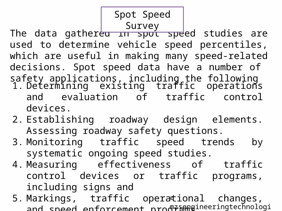
Spot speed studies are used to determine the speed distribution of a traffic stream at a specific location
The data gathered in spot speed studies are used to determine vehicle speed percentiles, which are useful in making many speed-related decisions. Spot speed data have a number of safety applications, including the following
Spot Speed Survey
1. Determining existing traffic operations and evaluation of traffic control devices.
Spot speed data are gathered using one of three methods: (1) Stopwatch method,(2) Radar meter method, or(3) Pneumatic road tube method.
Spot Speed Survey
The stopwatch method can be used to successfully complete a spot speed study using a small sample size taken over a relatively short period of time. The stopwatch method is a quick and inexpensive method for collecting speed data.
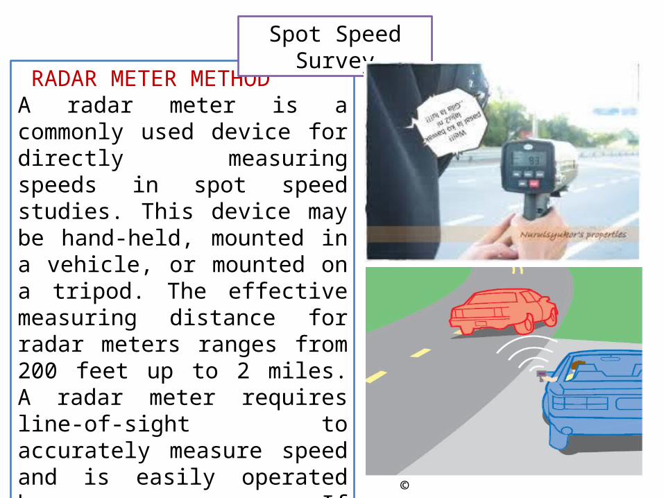
RADAR METER METHODA radar meter is a commonly used device for directly measuring speeds in spot speed studies. This device may be hand-held, mounted in a vehicle, or mounted on a tripod. The effective measuring distance for radar meters ranges from 200 feet up to 2 miles. A radar meter requires line-of-sight to accurately measure speed and is easily operated by one person. If traffic is heavy or the sampling strategy is complex, two radar units may be needed.
PNEUMATIC ROAD TUBE METHODThe pneumatic road tube method is normally used for longer data collection time periods than those of either the stopwatch or radar meter method. Using this method, pneumatic tubes are placed in the travel lanes and are connected to recorders located at the side of the Road . The automatic recorders are capable of storing large amounts of individual vehicle data or even larger amounts of vehicle classification data. The collected data are downloaded from the recorder to a laptop computer or portable floppy disk drive in the field, or via telephone modem to a centrally located computer
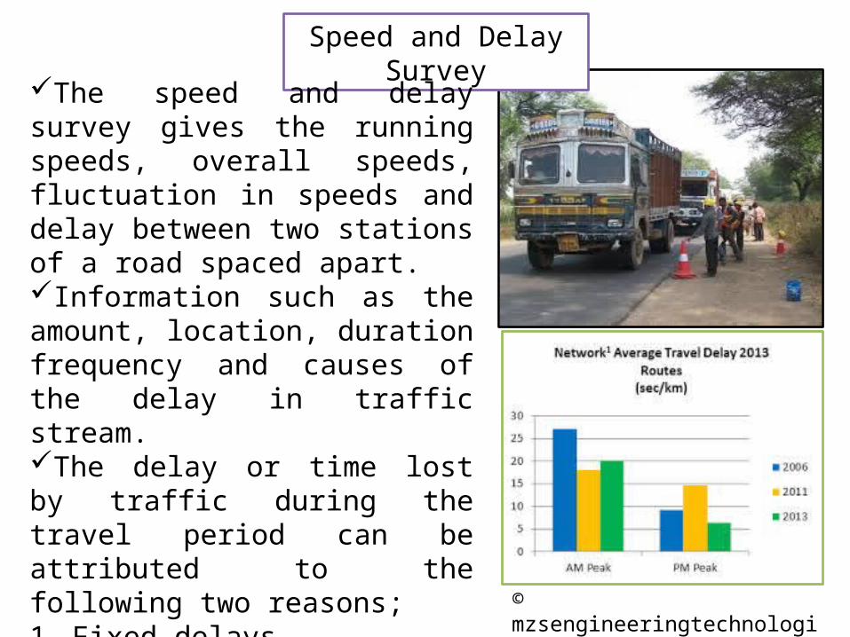
The speed and delay survey gives the running speeds, overall speeds, fluctuation in speeds and delay between two stations of a road spaced apart.Information such as the amount, location, duration frequency and causes of the delay in traffic stream.The delay or time lost by traffic during the travel period can be attributed to the following two reasons;1. Fixed delays2. Operation delays
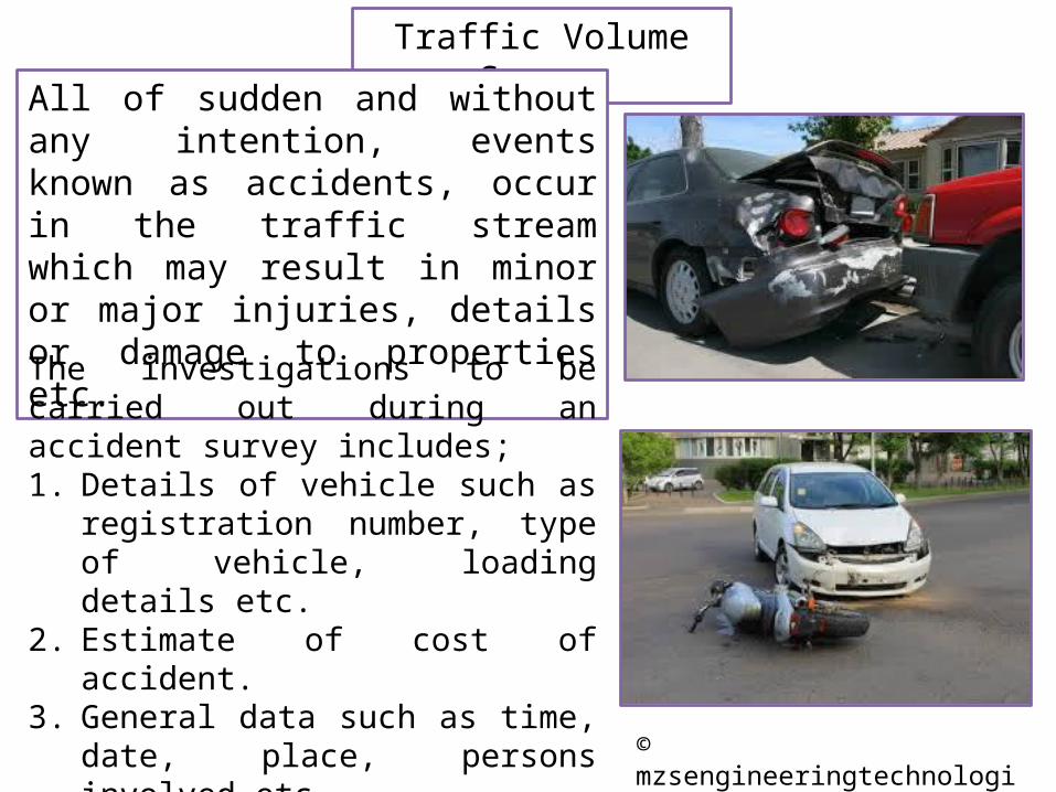
All of sudden and without any intention, events known as accidents, occur in the traffic stream which may result in minor or major injuries, details or damage to properties etc.
The investigations to be carried out during an accident survey includes;1. Details of vehicle such as registration
number, type of vehicle, loading details etc.
2. Estimate of cost of accident.3. General data such as time, date, place,
persons involved etc.4. Primary causes of accident.5. Road and traffic conditions at site of
accident.
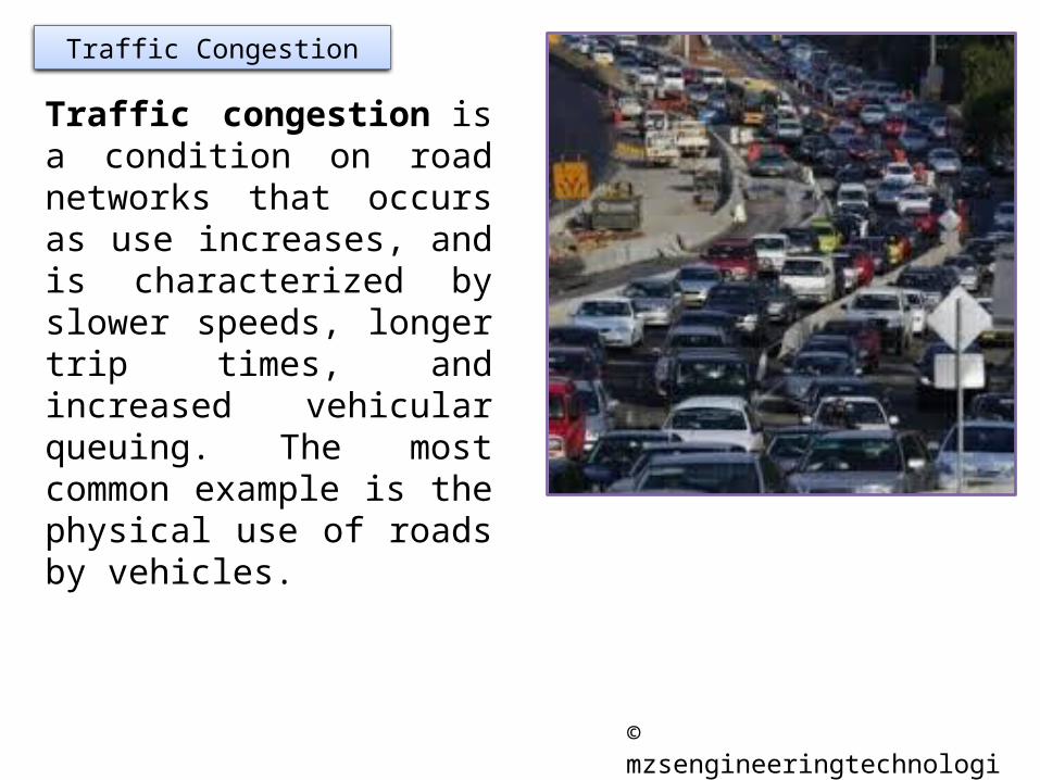
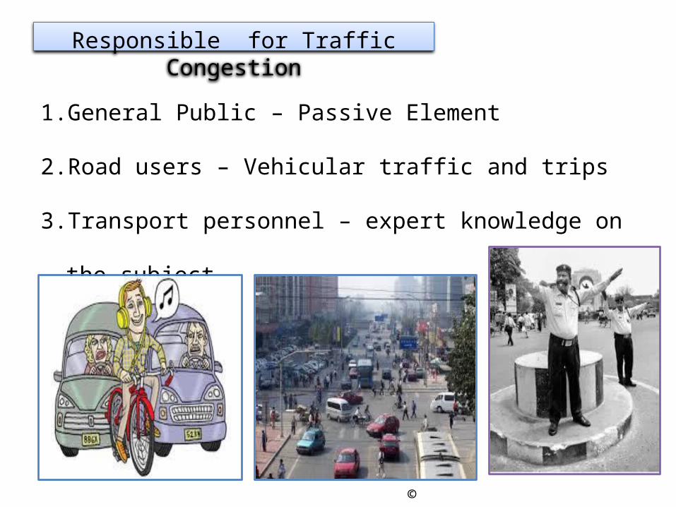
Traffic Congestion
Traffic congestion is a condition on road networks that occurs as use increases, and is characterized by slower speeds, longer trip times, and increased vehicular queuing. The most common example is the physical use of roads by vehicles.
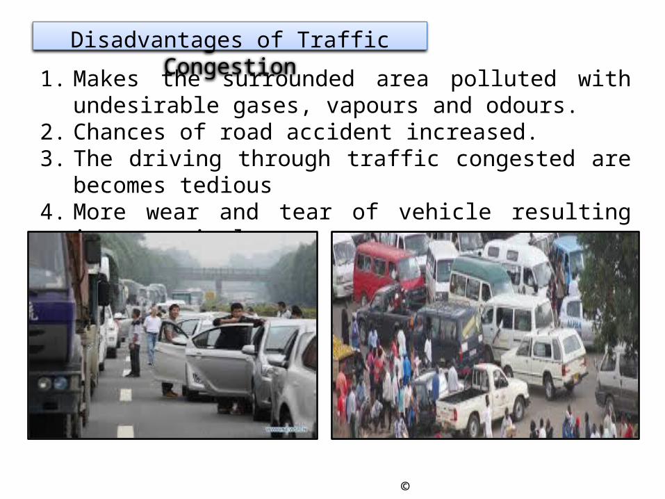
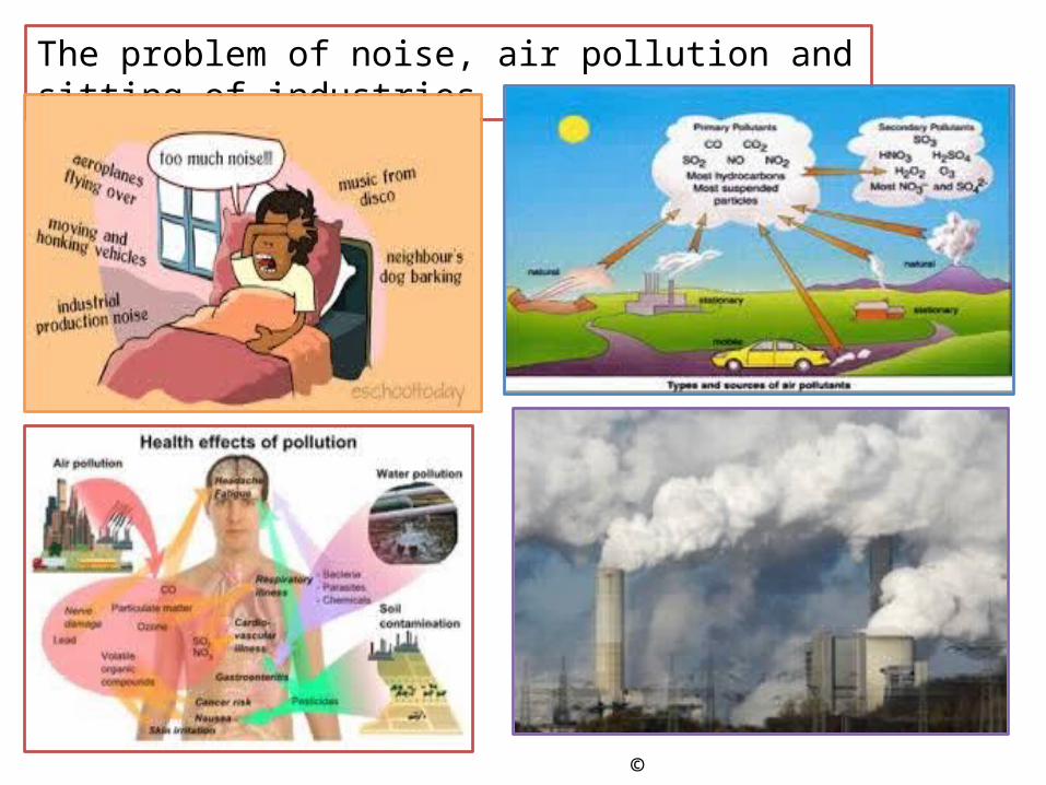
1. Makes the surrounded area polluted with undesirable gases, vapours and odours.
2. Chances of road accident increased.3. The driving through traffic congested are becomes tedious 4. More wear and tear of vehicle resulting in economic loss.5. Wastage of fuel.
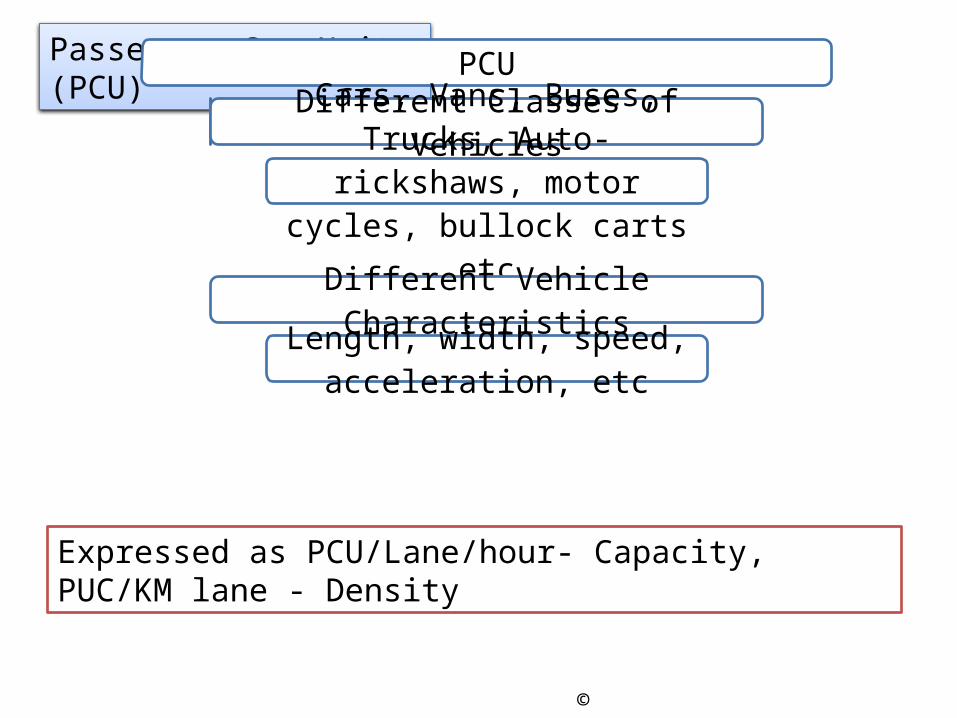
Traffic Volume:It is the number of vehicles moving in a specified direction on a given lane and roadway that pass a given point or cross-section during specified unit of time. Expressed as vehicle per hour, etc
Traffic Density:It is the number of vehicles occupying a unit length of lane of roadway at a given instant. Expressed as vehicle per kilometers.
Traffic Capacity:It is the ability of a roadway to accommodate traffic volume. Expressed as the maximum number of vehicle in a lane or road that can pass a given point in unit time.
Practical CapacityIt is the maximum number of vehicle that can pass a given point on a lane or roadway during one hour, without traffic density being so great as to cause unreasonable delay, hazard or restriction to the drivers freedom to manoeurve under the prevailing roadway and traffic conditions.
Determination of theoretical maximum capacity
SVC 1000
C = Capacity of a single lane vehicle per hourV= Speed, kmphS = Average centre to centre spacing of vehicles, when they follow one behind the other as the queue or space headway, m
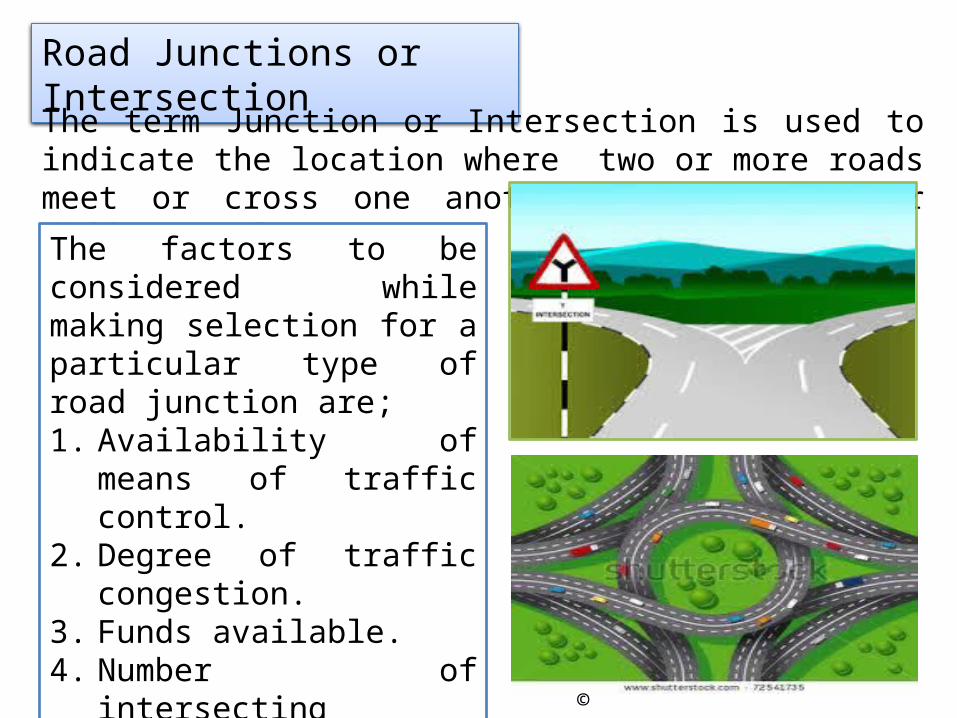
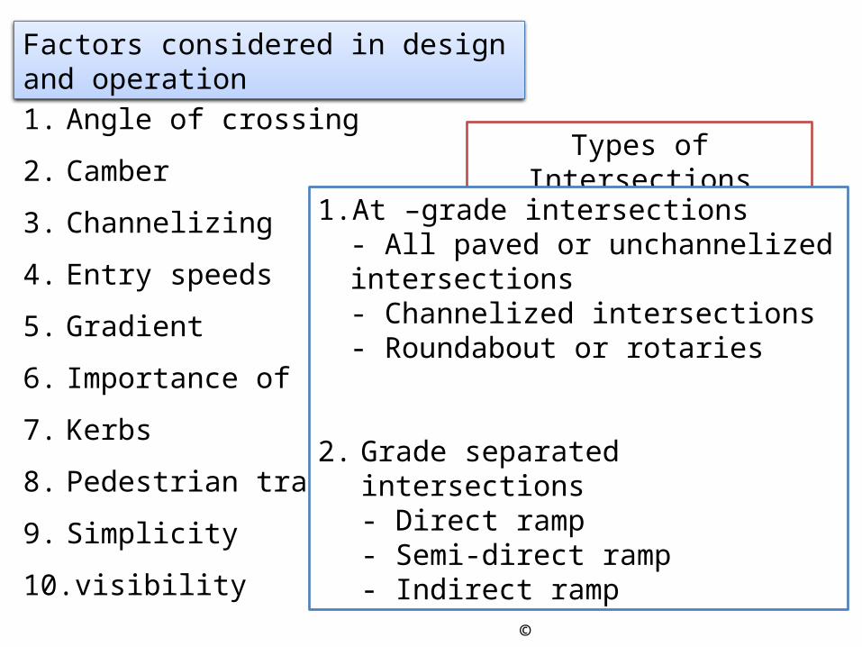
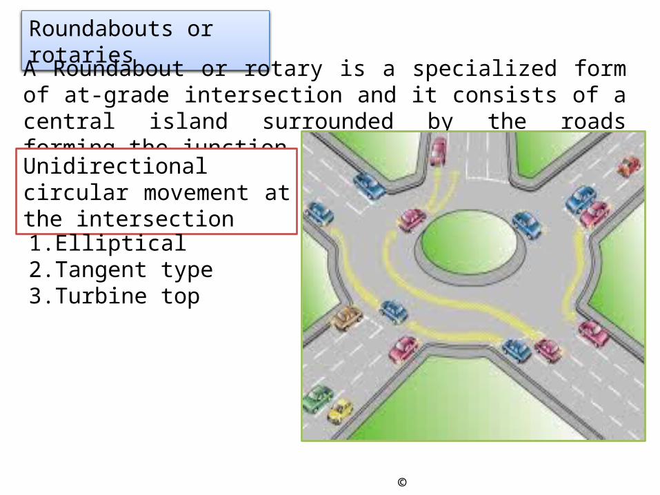
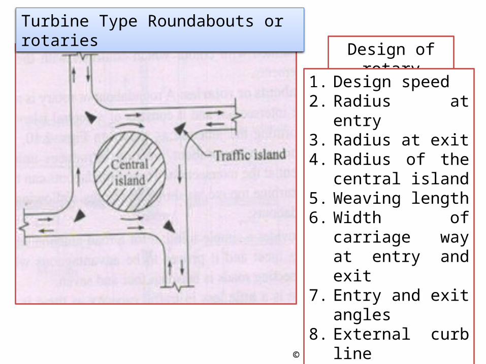
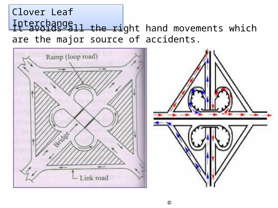
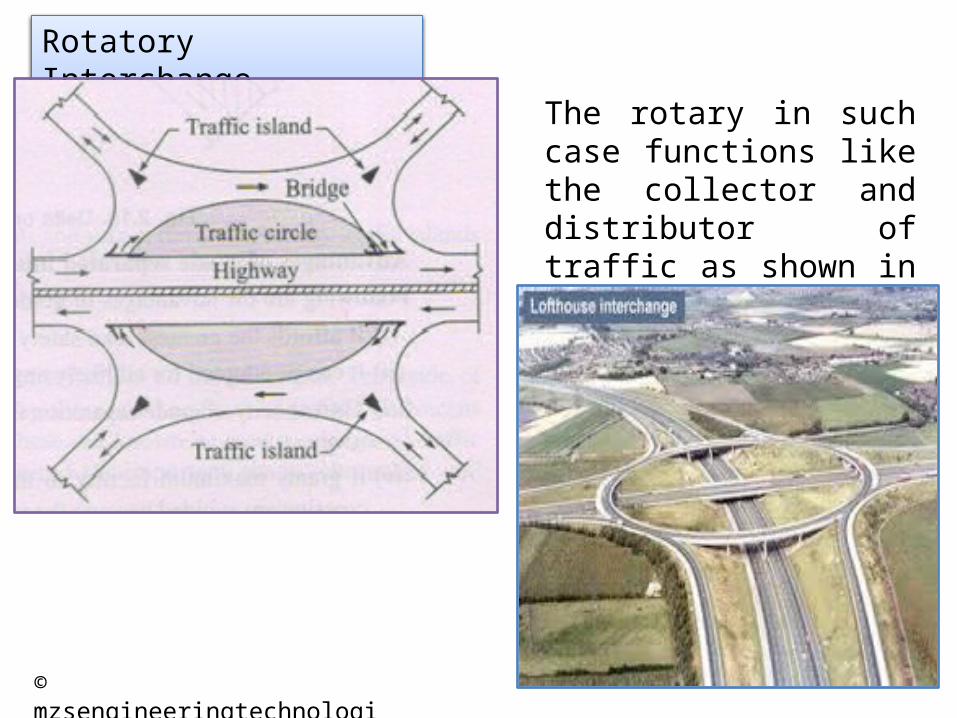
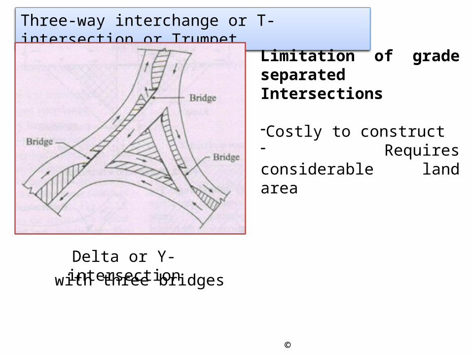
The term Junction or Intersection is used to indicate the location where two or more roads meet or cross one another at the same or different elevation.The factors to be considered while making selection for a particular type of road junction are;1. Availability of means of
traffic control.2. Degree of traffic congestion.3. Funds available.4. Number of intersecting
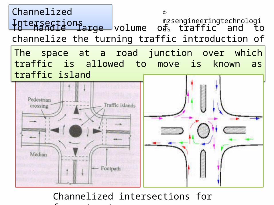
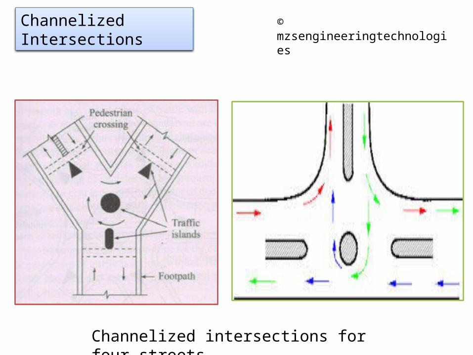
To handle large volume of traffic and to channelize the turning traffic introduction of traffic island is done.The space at a road junction over which traffic is allowed to move is known as traffic island
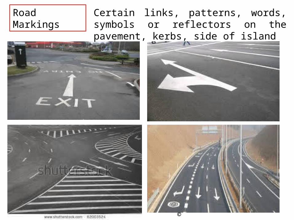
In order to control, regulate, and guide traffic it is necessary to have suitable traffic aids or devices known as traffic control devices
Following are the basic requirements for use of traffic control device;1. It must convey clear and simple meaning.2. It must command attention.3. It must command respect of road users.4. It must give adequate time for response.5. It must justify necessity.
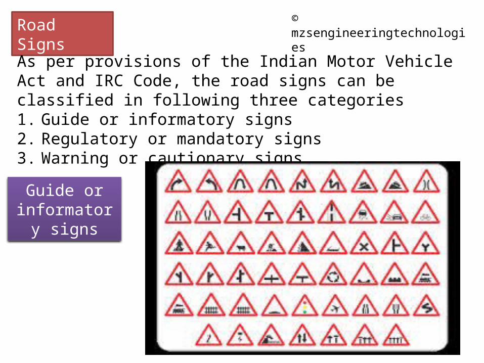
As per provisions of the Indian Motor Vehicle Act and IRC Code, the road signs can be classified in following three categories1. Guide or informatory signs2. Regulatory or mandatory signs3. Warning or cautionary signs
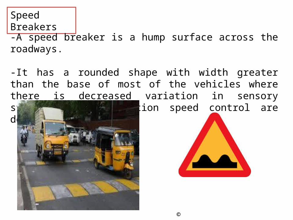
-A speed breaker is a hump surface across the roadways.
-It has a rounded shape with width greater than the base of most of the vehicles where there is decreased variation in sensory stimuli and at location speed control are desired
According to nature of dependence on circumstances;1. Fixed industries2. Linked industries3. Foot-loose industries
According to nature of industry;4. Manufacturing industries – heavy, intermediate, light and minor5. Miscellaneous industries6. Special industries – primary, secondary, tertiary and quaternary
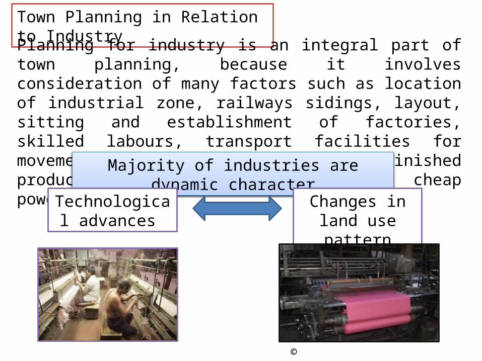
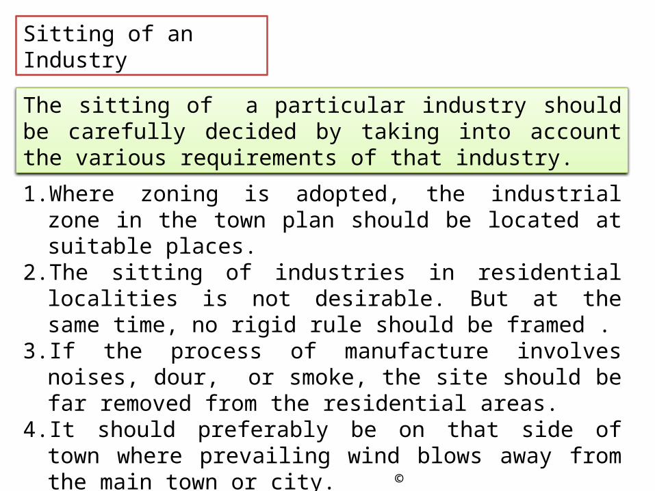
Planning for industry is an integral part of town planning, because it involves consideration of many factors such as location of industrial zone, railways sidings, layout, sitting and establishment of factories, skilled labours, transport facilities for movements of raw materials and finished product, plentiful supply of water, cheap power, etc.
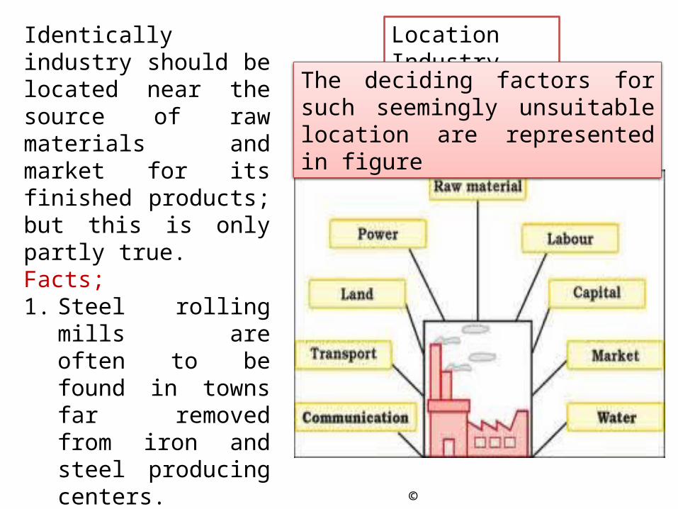
Identically industry should be located near the source of raw materials and market for its finished products; but this is only partly true.Facts;1. Steel rolling mills are
often to be found in towns far removed from iron and steel producing centers.
2. Many cotton spinning and weaving mills are located in the regions they do not produce cotton at all.
The deciding factors for such seemingly unsuitable location are represented in figure
Conurbations and Industry
In general heavy industries are established near the source of raw materials and occasionally have towns of their own. For example: Jamshedpur, Bhilai and Rourkela.In contrast other industries prefer to remain in or near existing towns where suitable sites, power, water and good communications are available.
This creates conurbation which have to be kept within a reasonable size to prevent heavy concentration of industry and employment in one place at the expense of employment in other places
MythsBig conurbation were not considered desirable on the strategic ground, because large concentration of industry and population were vulnerable to enemy air attacks in the event of wars
But this argument is no longer valid in view of development of the hydrogen bomb and guided missile employing atomic warheads
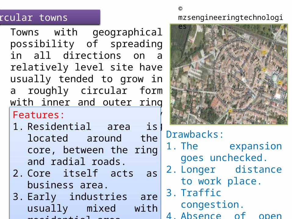
Circular townsTowns with geographical possibility of spreading in all directions on a relatively level site have usually tended to grow in a roughly circular form with inner and outer ring roads, linked together by radiating roads emanating from center.Features:1. Residential area is located
around the core, between the ring and radial roads.
2. Core itself acts as business area.3. Early industries are usually
mixed with residential area4. Towns represent peripheral
growth.
Drawbacks:1. The expansion goes
unchecked.2. Longer distance to work
place.3. Traffic congestion.4. Absence of open spaces.
Based on principle of superblock, which consists of number of blocks, or sectors.Each block or sector tracts of land, approximately three-forth of a mile long and half a mile.Each block or sector accommodate populations ranging from 15000 to 25000 souls.There are usually three to four neighbourhood units in each blocks.Example: Chandigarh
Two important factors contributing to population increase are;1. Natural growth2. Tendency of villagers ( Migration for various
reasons, such as education, employment, glamour, etc)
Results in over crowding and serious problems such as;Residential areas well planned and spacious get converted into slums.Parks and playgrounds becomes inadequate.Industries have invaded into residential area.Communication system has been completely failed.The road system has become obsolete.Recreation and amusement centers are haphazardly located.
Pulling down of detoriated structures, carrying out extensive renovation of building to be retained, redesigning of road system, changing the pattern of land use.
ConservationCooperationDevelopment planFinanceLegislationPeriod of projectRedevelopmentrehabilitation
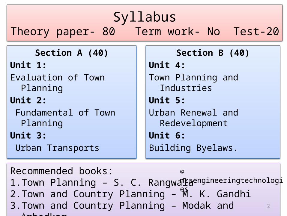
1. What is town planning? Explain its purpose and scope.
2. Write down the significance of the subject town planning.
3. What is the role of a civil engineer and a town planner in a city?
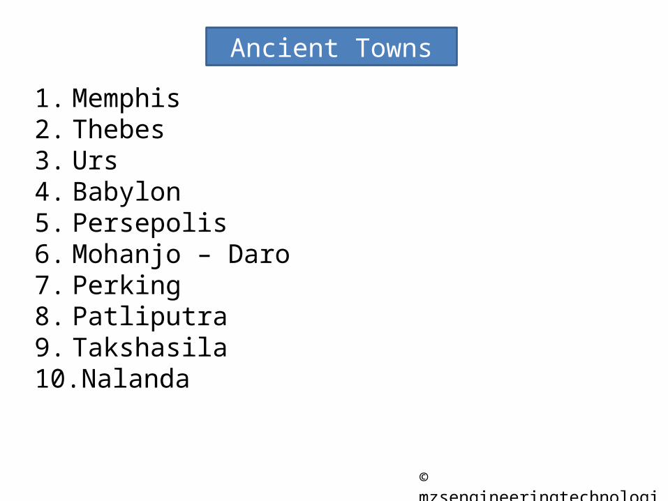
The European-American city of Memphis was founded on May 22, 1819. They named it after the ancient capital of Egypton the Nile River. Memphis developed as a transportation center in the 19th century because of its flood-free location high above the Mississippi River. Located in the low-lying delta region along the river, its outlying areas were developed as cotton plantations, and the city became a major cotton market and brokerage center.
Memphis
•What are the objects of town planning?
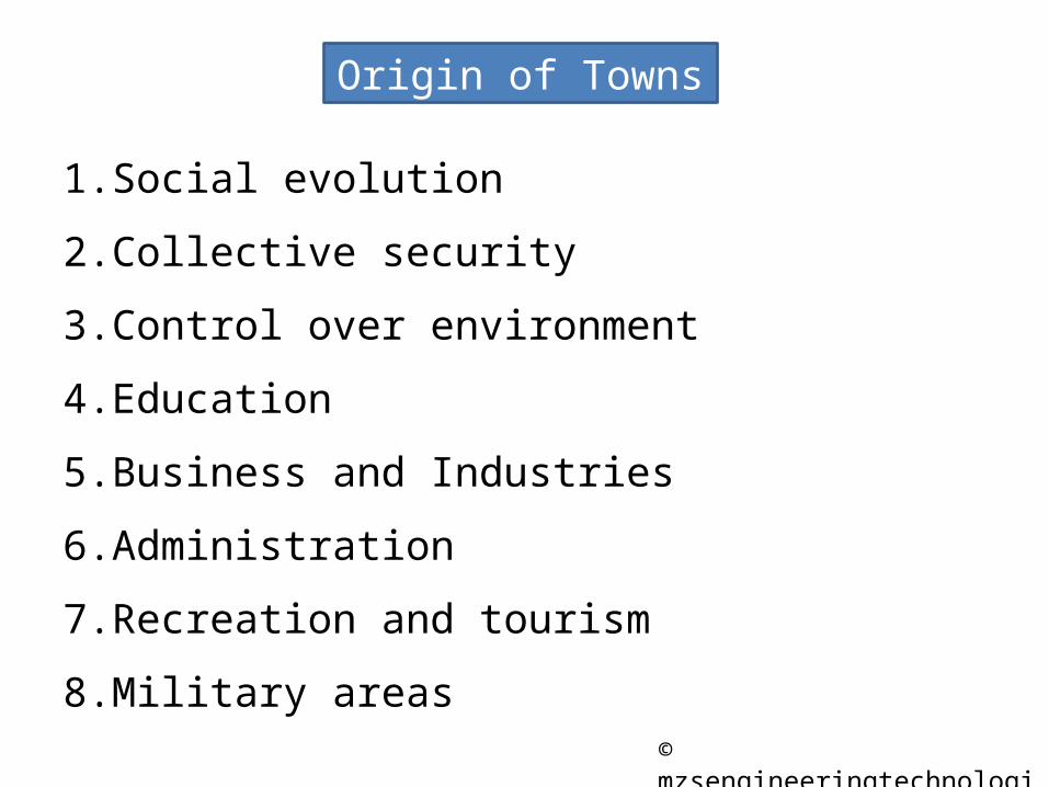
•Discuss the growth of towns according to origin?
•Discuss the stages in town development as suggested by;