TRACT 43202 - Terrebonne Parish, Louisiana All of the lands now or formerly constituting the beds and bottoms of all water bodies of every nature and description as to which title is vested in the State of Louisiana, together with all islands arising therein and other lands formed by accretion or by reliction, where allowed by law, excepting tax adjudicated lands, and not presently under mineral lease on May 8, 2013, situated in Terrebonne Parish, Louisiana, and more particularly described as follows: Beginning at a point having Coordinates of X = 2,179,733.52 and Y = 227,478.14; thence East 18,479.09 feet to a point having Coordinates of X = 2,198,212.61 and Y = 227,478.14; thence South 9,965.38 feet to a point having Coordinates of X = 2,198,212.61 and Y = 217,512.75; thence West 11,480.45 feet to a point on the East boundary of State Lease No. 724, as amended having Coordinates of X = 2,186,732.16 and Y = 217,512.75; thence along the boundary of said State Lease No. 724 the following courses: North 00 degrees 16 minutes 35 seconds West 2,706.09 feet to a point having Coordinates of X = 2,186,719.11 and Y = 220,218.81 and South 89 degrees 43 minutes 25 seconds West 6,985.67 feet to a point having Coordinates of X = 2,179,733.52 and Y = 220,185.12; thence North 7,293.01 feet to the point of beginning, (This lease includes only waterbottoms claimed and owned by the state and specifically excludes any land which the state may claim or own and to which the mineral rights are vested in the state), containing approximately 400 acres , all as more particularly outlined on a plat on file in the Office of Mineral Resources, Department of Natural Resources. All bearings, distances and coordinates are based on Louisiana Coordinate System of 1927, (North or South Zone), where applicable. NOTE: The above description of the Tract nominated for lease has been provided and corrected, where required, exclusively by the nomination party. Any mineral lease selected from this Tract and awarded by the Louisiana State Mineral and Energy Board shall be without warranty of any kind, either express, implied, or statutory, including, but not limited to, the implied warranties of merchantability and fitness for a particular purpose. Should the mineral lease awarded by the Louisiana State Mineral and Energy Board be subsequently modified, cancelled or abrogated due to the existence of conflicting leases, operating agreements, private claims or other future obligations or conditions which may affect all or any portion of the leased Tract, it shall not relieve the Lessee of the obligation to pay any bonus due thereon to the Louisiana State Mineral and Energy Board, nor shall the Louisiana State Mineral and Energy Board be obligated to refund any consideration paid by the Lessor prior to such modification, cancellation, or abrogation, including, but not limited to, bonuses, rentals and royalties. NOTE: The State of Louisiana does hereby reserve, and this lease shall be subject to, the imprescriptible right of surface use in the nature of a servitude in favor of the Department of Natural Resources, including its Offices and Commissions, for the sole purpose of implementing, constructing, servicing and maintaining approved coastal zone management and/or restoration projects. Utilization of any and all rights derived
Transcript
TRACT 43202 - Terrebonne Parish, Louisiana All of the lands now or formerly constituting the beds and bottoms of all water bodies of every nature and description as to which title is vested in the State of Louisiana, together with all islands arising therein and other lands formed by accretion or by reliction, where allowed by law, excepting tax adjudicated lands, and not presently under mineral lease on May 8, 2013, situated in Terrebonne Parish, Louisiana, and more particularly described as follows: Beginning at a point having Coordinates of X = 2,179,733.52 and Y = 227,478.14; thence East 18,479.09 feet to a point having Coordinates of X = 2,198,212.61 and Y = 227,478.14; thence South 9,965.38 feet to a point having Coordinates of X = 2,198,212.61 and Y = 217,512.75; thence West 11,480.45 feet to a point on the East boundary of State Lease No. 724, as amended having Coordinates of X = 2,186,732.16 and Y = 217,512.75; thence along the boundary of said State Lease No. 724 the following courses: North 00 degrees 16 minutes 35 seconds West 2,706.09 feet to a point having Coordinates of X = 2,186,719.11 and Y = 220,218.81 and South 89 degrees 43 minutes 25 seconds West 6,985.67 feet to a point having Coordinates of X = 2,179,733.52 and Y = 220,185.12; thence North 7,293.01 feet to the point of beginning, (This lease includes only waterbottoms claimed and owned by the state and specifically excludes any land which the state may claim or own and to which the mineral rights are vested in the state), containing approximately 400 acres, all as more particularly outlined on a plat on file in the Office of Mineral Resources, Department of Natural Resources. All bearings, distances and coordinates are based on Louisiana Coordinate System of 1927, (North or South Zone), where applicable. NOTE: The above description of the Tract nominated for lease has been provided and corrected, where required, exclusively by the nomination party. Any mineral lease selected from this Tract and awarded by the Louisiana State Mineral and Energy Board shall be without warranty of any kind, either express, implied, or statutory, including, but not limited to, the implied warranties of merchantability and fitness for a particular purpose. Should the mineral lease awarded by the Louisiana State Mineral and Energy Board be subsequently modified, cancelled or abrogated due to the existence of conflicting leases, operating agreements, private claims or other future obligations or conditions which may affect all or any portion of the leased Tract, it shall not relieve the Lessee of the obligation to pay any bonus due thereon to the Louisiana State Mineral and Energy Board, nor shall the Louisiana State Mineral and Energy Board be obligated to refund any consideration paid by the Lessor prior to such modification, cancellation, or abrogation, including, but not limited to, bonuses, rentals and royalties. NOTE: The State of Louisiana does hereby reserve, and this lease shall be subject to, the imprescriptible right of surface use in the nature of a servitude in favor of the Department of Natural Resources, including its Offices and Commissions, for the sole purpose of implementing, constructing, servicing and maintaining approved coastal zone management and/or restoration projects. Utilization of any and all rights derived
2
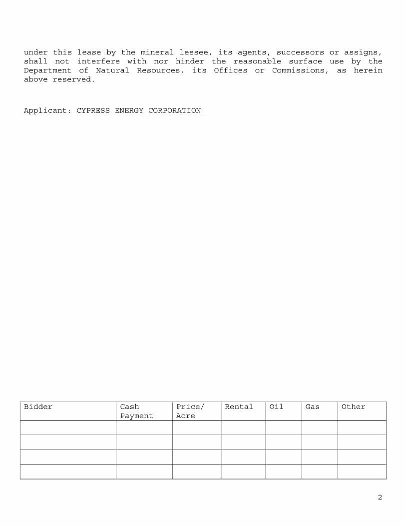
under this lease by the mineral lessee, its agents, successors or assigns, shall not interfere with nor hinder the reasonable surface use by the Department of Natural Resources, its Offices or Commissions, as herein above reserved.
Applicant: CYPRESS ENERGY CORPORATION
Bidder Cash Payment
Price/ Acre
Rental Oil Gas Other
3
Office of Mineral Resources, Acres: 400 Tract Number: 43202
4
TRACT 43203 - Plaquemines Parish, Louisiana All of the lands now or formerly constituting the beds and bottoms of all water bodies of every nature and description as to which title is vested in the State of Louisiana, together with all islands arising therein and other lands formed by accretion or by reliction, where allowed by law, excepting tax adjudicated lands, and not presently under mineral lease on May 8, 2013, situated in Plaquemines Parish, Louisiana, and more particularly described as follows: Beginning at a point having Coordinates of X = 2,641,212.25 and Y = 213,058.00; thence East 11,293.75 feet to a point having Coordinates of X = 2,652,506.00 and Y = 213,058.00; thence South 15,297.00 feet to a point having Coordinates of X = 2,652,506.00 and Y = 197,761.00; thence West 11,013.11 feet to a point having Coordinates of X = 2,641,492.89 and Y = 197,761.00; thence North 4,740.37 feet to the Southernmost Southwest corner of State Lease No. 20944 having Coordinates of X = 2,641,492.89 and Y = 202,501.37; thence along the boundary of said State Lease No. 20944 the following courses and distances: North 88 degrees 22 minutes 11 seconds East 2,585.50 feet, North 01 degrees 40 minutes 39 seconds West 5,234.38 feet, South 88 degrees 35 minutes 22 seconds West 2,608.01 feet and North 02 degrees 16 minutes 51 seconds West 2,628.92 feet to it Northernmost Northeast corner having Coordinates of X = 2,641,212.25 and Y = 210,369.71; thence North 2,688.29 feet to the point of beginning, containing approximately 2,456 acres, all as more particularly outlined on a plat on file in the Office of Mineral Resources, Department of Natural Resources. All bearings, distances and coordinates are based on Louisiana Coordinate System of 1927, (North or South Zone), where applicable. NOTE: The above description of the Tract nominated for lease has been provided and corrected, where required, exclusively by the nomination party. Any mineral lease selected from this Tract and awarded by the Louisiana State Mineral and Energy Board shall be without warranty of any kind, either express, implied, or statutory, including, but not limited to, the implied warranties of merchantability and fitness for a particular purpose. Should the mineral lease awarded by the Louisiana State Mineral and Energy Board be subsequently modified, cancelled or abrogated due to the existence of conflicting leases, operating agreements, private claims or other future obligations or conditions which may affect all or any portion of the leased Tract, it shall not relieve the Lessee of the obligation to pay any bonus due thereon to the Louisiana State Mineral and Energy Board, nor shall the Louisiana State Mineral and Energy Board be obligated to refund any consideration paid by the Lessor prior to such modification, cancellation, or abrogation, including, but not limited to, bonuses, rentals and royalties. NOTE: The State of Louisiana does hereby reserve, and this lease shall be subject to, the imprescriptible right of surface use in the nature of a servitude in favor of the Department of Natural Resources, including its Offices and Commissions, for the sole purpose of implementing, constructing, servicing and maintaining approved coastal zone management
5
and/or restoration projects. Utilization of any and all rights derived under this lease by the mineral lessee, its agents, successors or assigns, shall not interfere with nor hinder the reasonable surface use by the Department of Natural Resources, its Offices or Commissions, as herein above reserved.
Applicant: HAROLD J. ANDERSON, INC.
Bidder Cash Payment
Price/ Acre
Rental Oil Gas Other
6
Office of Mineral Resources, Acres: 2456 Tract Number: 43203
7
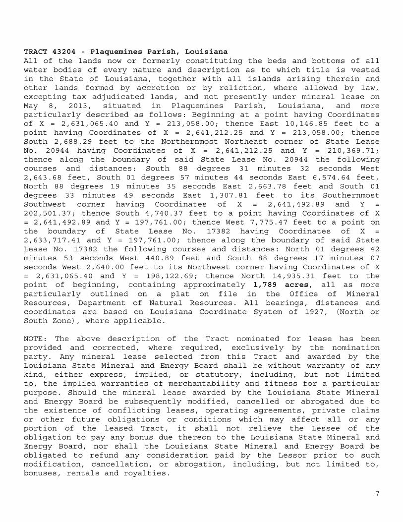
TRACT 43204 - Plaquemines Parish, Louisiana All of the lands now or formerly constituting the beds and bottoms of all water bodies of every nature and description as to which title is vested in the State of Louisiana, together with all islands arising therein and other lands formed by accretion or by reliction, where allowed by law, excepting tax adjudicated lands, and not presently under mineral lease on May 8, 2013, situated in Plaquemines Parish, Louisiana, and more particularly described as follows: Beginning at a point having Coordinates of X = 2,631,065.40 and Y = 213,058.00; thence East 10,146.85 feet to a point having Coordinates of X = 2,641,212.25 and Y = 213,058.00; thence South 2,688.29 feet to the Northernmost Northeast corner of State Lease No. 20944 having Coordinates of X = 2,641,212.25 and Y = 210,369.71; thence along the boundary of said State Lease No. 20944 the following courses and distances: South 88 degrees 31 minutes 32 seconds West 2,643.68 feet, South 01 degrees 57 minutes 44 seconds East 6,574.64 feet, North 88 degrees 19 minutes 35 seconds East 2,663.78 feet and South 01 degrees 33 minutes 49 seconds East 1,307.81 feet to its Southernmost Southwest corner having Coordinates of X = 2,641,492.89 and Y = 202,501.37; thence South 4,740.37 feet to a point having Coordinates of X = 2,641,492.89 and Y = 197,761.00; thence West 7,775.47 feet to a point on the boundary of State Lease No. 17382 having Coordinates of X = 2,633,717.41 and Y = 197,761.00; thence along the boundary of said State Lease No. 17382 the following courses and distances: North 01 degrees 42 minutes 53 seconds West 440.89 feet and South 88 degrees 17 minutes 07 seconds West 2,640.00 feet to its Northwest corner having Coordinates of X = 2,631,065.40 and Y = 198,122.69; thence North 14,935.31 feet to the point of beginning, containing approximately 1,789 acres, all as more particularly outlined on a plat on file in the Office of Mineral Resources, Department of Natural Resources. All bearings, distances and coordinates are based on Louisiana Coordinate System of 1927, (North or South Zone), where applicable. NOTE: The above description of the Tract nominated for lease has been provided and corrected, where required, exclusively by the nomination party. Any mineral lease selected from this Tract and awarded by the Louisiana State Mineral and Energy Board shall be without warranty of any kind, either express, implied, or statutory, including, but not limited to, the implied warranties of merchantability and fitness for a particular purpose. Should the mineral lease awarded by the Louisiana State Mineral and Energy Board be subsequently modified, cancelled or abrogated due to the existence of conflicting leases, operating agreements, private claims or other future obligations or conditions which may affect all or any portion of the leased Tract, it shall not relieve the Lessee of the obligation to pay any bonus due thereon to the Louisiana State Mineral and Energy Board, nor shall the Louisiana State Mineral and Energy Board be obligated to refund any consideration paid by the Lessor prior to such modification, cancellation, or abrogation, including, but not limited to, bonuses, rentals and royalties.
8
NOTE: The State of Louisiana does hereby reserve, and this lease shall be subject to, the imprescriptible right of surface use in the nature of a servitude in favor of the Department of Natural Resources, including its Offices and Commissions, for the sole purpose of implementing, constructing, servicing and maintaining approved coastal zone management and/or restoration projects. Utilization of any and all rights derived under this lease by the mineral lessee, its agents, successors or assigns, shall not interfere with nor hinder the reasonable surface use by the Department of Natural Resources, its Offices or Commissions, as herein above reserved.
Applicant: HAROLD J. ANDERSON, INC.
Bidder Cash Payment
Price/ Acre
Rental Oil Gas Other
9
Office of Mineral Resources, Acres: 1789 Tract Number: 43204
10
TRACT 43205 - Terrebonne Parish, Louisiana All of the lands now or formerly constituting the beds and bottoms of all water bodies of every nature and description as to which title is vested in the State of Louisiana, together with all islands arising therein and other lands formed by accretion or by reliction, where allowed by law, excepting tax adjudicated lands, and not presently under mineral lease on May 8, 2013, situated in Terrebonne Parish, Louisiana, and more particularly described as follows: Beginning at a point having Coordinates of X = 2,186,732.16 and Y = 217,512.75; thence East 11,480.45 feet to a point having Coordinates of X = 2,198,212.61 and Y = 217,512.75; thence South 18,380.41 feet to the Northeast corner of State Lease No. 21086 having Coordinates of X = 2,198,212.61 and Y = 199,132.35; thence West 7,700.00 feet along the North boundary of said State Lease No. 21086 to its Northwest corner having Coordinates of X = 2,190,512.61 and Y = 199,132.35; thence continue West 3,691.78 feet to a point on the East boundary of State Lease No. 724, as amended having Coordinates of X = 2,186,820.83 and Y = 199,132.35; thence North 00 degrees 16 minutes 35 seconds West 18,380.62 feet along the East boundary of said State Lease No. 724 to the point of beginning, LESS AND EXCEPT any right, title, and interest in lands owned by and not under lease from the State of Louisiana, on behalf of the Terrebonne Parish School Board, situated in Section 16, Township 21 South, Range 17 East, Terrebonne Parish, Louisiana, contained within the above described tract, containing approximately 267 acres, all as more particularly outlined on a plat on file in the Office of Mineral Resources, Department of Natural Resources. All bearings, distances and coordinates are based on Louisiana Coordinate System of 1927, (North or South Zone), where applicable. NOTE: The above description of the Tract nominated for lease has been provided and corrected, where required, exclusively by the nomination party. Any mineral lease selected from this Tract and awarded by the Louisiana State Mineral and Energy Board shall be without warranty of any kind, either express, implied, or statutory, including, but not limited to, the implied warranties of merchantability and fitness for a particular purpose. Should the mineral lease awarded by the Louisiana State Mineral and Energy Board be subsequently modified, cancelled or abrogated due to the existence of conflicting leases, operating agreements, private claims or other future obligations or conditions which may affect all or any portion of the leased Tract, it shall not relieve the Lessee of the obligation to pay any bonus due thereon to the Louisiana State Mineral and Energy Board, nor shall the Louisiana State Mineral and Energy Board be obligated to refund any consideration paid by the Lessor prior to such modification, cancellation, or abrogation, including, but not limited to, bonuses, rentals and royalties. NOTE: The State of Louisiana does hereby reserve, and this lease shall be subject to, the imprescriptible right of surface use in the nature of a servitude in favor of the Department of Natural Resources, including its Offices and Commissions, for the sole purpose of implementing,
11
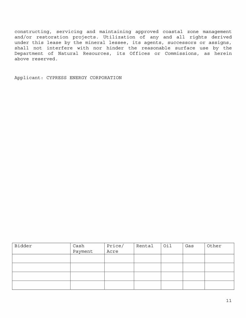
constructing, servicing and maintaining approved coastal zone management and/or restoration projects. Utilization of any and all rights derived under this lease by the mineral lessee, its agents, successors or assigns, shall not interfere with nor hinder the reasonable surface use by the Department of Natural Resources, its Offices or Commissions, as herein above reserved.
Applicant: CYPRESS ENERGY CORPORATION
Bidder Cash Payment
Price/ Acre
Rental Oil Gas Other
12
Office of Mineral Resources, Acres: 267 Tract Number: 43205
13
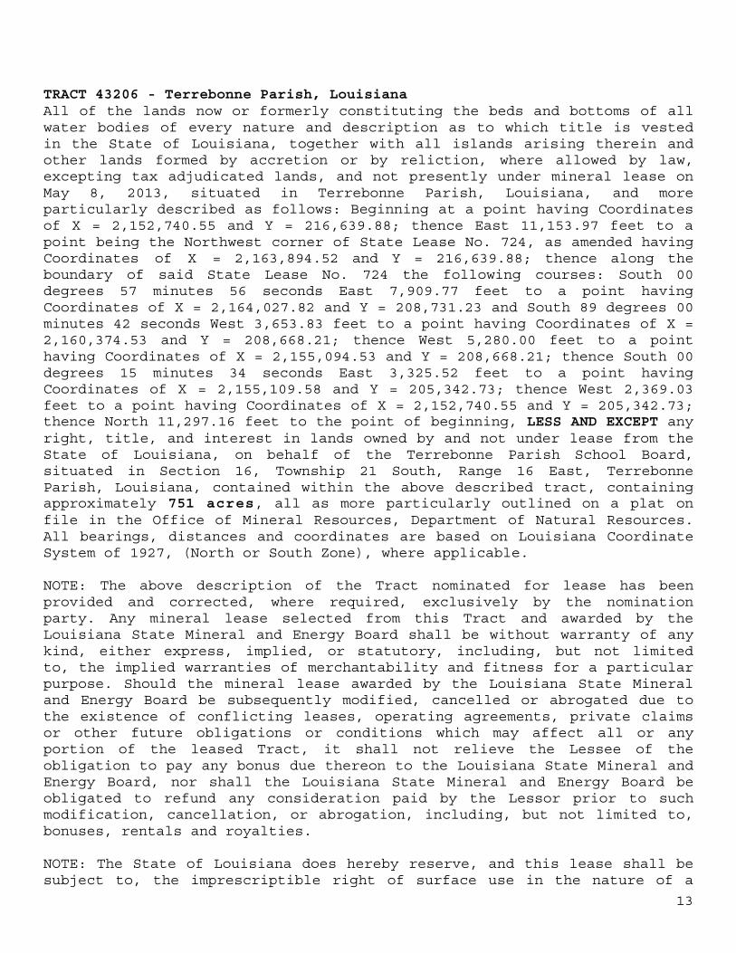
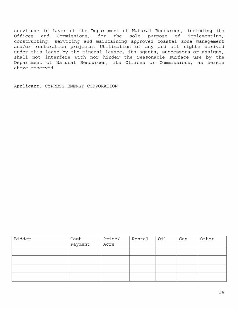
TRACT 43206 - Terrebonne Parish, Louisiana All of the lands now or formerly constituting the beds and bottoms of all water bodies of every nature and description as to which title is vested in the State of Louisiana, together with all islands arising therein and other lands formed by accretion or by reliction, where allowed by law, excepting tax adjudicated lands, and not presently under mineral lease on May 8, 2013, situated in Terrebonne Parish, Louisiana, and more particularly described as follows: Beginning at a point having Coordinates of X = 2,152,740.55 and Y = 216,639.88; thence East 11,153.97 feet to a point being the Northwest corner of State Lease No. 724, as amended having Coordinates of X = 2,163,894.52 and Y = 216,639.88; thence along the boundary of said State Lease No. 724 the following courses: South 00 degrees 57 minutes 56 seconds East 7,909.77 feet to a point having Coordinates of X = 2,164,027.82 and Y = 208,731.23 and South 89 degrees 00 minutes 42 seconds West 3,653.83 feet to a point having Coordinates of X = 2,160,374.53 and Y = 208,668.21; thence West 5,280.00 feet to a point having Coordinates of X = 2,155,094.53 and Y = 208,668.21; thence South 00 degrees 15 minutes 34 seconds East 3,325.52 feet to a point having Coordinates of X = 2,155,109.58 and Y = 205,342.73; thence West 2,369.03 feet to a point having Coordinates of X = 2,152,740.55 and Y = 205,342.73; thence North 11,297.16 feet to the point of beginning, LESS AND EXCEPT any right, title, and interest in lands owned by and not under lease from the State of Louisiana, on behalf of the Terrebonne Parish School Board, situated in Section 16, Township 21 South, Range 16 East, Terrebonne Parish, Louisiana, contained within the above described tract, containing approximately 751 acres, all as more particularly outlined on a plat on file in the Office of Mineral Resources, Department of Natural Resources. All bearings, distances and coordinates are based on Louisiana Coordinate System of 1927, (North or South Zone), where applicable. NOTE: The above description of the Tract nominated for lease has been provided and corrected, where required, exclusively by the nomination party. Any mineral lease selected from this Tract and awarded by the Louisiana State Mineral and Energy Board shall be without warranty of any kind, either express, implied, or statutory, including, but not limited to, the implied warranties of merchantability and fitness for a particular purpose. Should the mineral lease awarded by the Louisiana State Mineral and Energy Board be subsequently modified, cancelled or abrogated due to the existence of conflicting leases, operating agreements, private claims or other future obligations or conditions which may affect all or any portion of the leased Tract, it shall not relieve the Lessee of the obligation to pay any bonus due thereon to the Louisiana State Mineral and Energy Board, nor shall the Louisiana State Mineral and Energy Board be obligated to refund any consideration paid by the Lessor prior to such modification, cancellation, or abrogation, including, but not limited to, bonuses, rentals and royalties. NOTE: The State of Louisiana does hereby reserve, and this lease shall be subject to, the imprescriptible right of surface use in the nature of a
14
servitude in favor of the Department of Natural Resources, including its Offices and Commissions, for the sole purpose of implementing, constructing, servicing and maintaining approved coastal zone management and/or restoration projects. Utilization of any and all rights derived under this lease by the mineral lessee, its agents, successors or assigns, shall not interfere with nor hinder the reasonable surface use by the Department of Natural Resources, its Offices or Commissions, as herein above reserved.
Applicant: CYPRESS ENERGY CORPORATION
Bidder Cash Payment
Price/ Acre
Rental Oil Gas Other
15
Office of Mineral Resources, Acres: 751 Tract Number: 43206
16
TRACT 43207 - Terrebonne Parish, Louisiana All of the lands now or formerly constituting the beds and bottoms of all water bodies of every nature and description as to which title is vested in the State of Louisiana, together with all islands arising therein and other lands formed by accretion or by reliction, where allowed by law, excepting tax adjudicated lands, and not presently under mineral lease on May 8, 2013, situated in Terrebonne Parish, Louisiana, and more particularly described as follows: Beginning at a point having Coordinates of X = 2,141,530.30 and Y = 216,639.88; thence East 11,210.25 feet to a point having Coordinates of X = 2,152,740.55 and Y = 216,639.88; thence South 11,297.16 feet to a point having Coordinates of X = 2,152,740.55 and Y = 205,342.73; thence West 11,210.25 feet to a point having Coordinates of X = 2,141,530.30 and Y = 205,342.73; thence North 11,297.16 feet to the point of beginning, containing approximately 2,427 acres, all as more particularly outlined on a plat on file in the Office of Mineral Resources, Department of Natural Resources. All bearings, distances and coordinates are based on Louisiana Coordinate System of 1927, (North or South Zone), where applicable. NOTE: The above description of the Tract nominated for lease has been provided and corrected, where required, exclusively by the nomination party. Any mineral lease selected from this Tract and awarded by the Louisiana State Mineral and Energy Board shall be without warranty of any kind, either express, implied, or statutory, including, but not limited to, the implied warranties of merchantability and fitness for a particular purpose. Should the mineral lease awarded by the Louisiana State Mineral and Energy Board be subsequently modified, cancelled or abrogated due to the existence of conflicting leases, operating agreements, private claims or other future obligations or conditions which may affect all or any portion of the leased Tract, it shall not relieve the Lessee of the obligation to pay any bonus due thereon to the Louisiana State Mineral and Energy Board, nor shall the Louisiana State Mineral and Energy Board be obligated to refund any consideration paid by the Lessor prior to such modification, cancellation, or abrogation, including, but not limited to, bonuses, rentals and royalties. NOTE: The State of Louisiana does hereby reserve, and this lease shall be subject to, the imprescriptible right of surface use in the nature of a servitude in favor of the Department of Natural Resources, including its Offices and Commissions, for the sole purpose of implementing, constructing, servicing and maintaining approved coastal zone management and/or restoration projects. Utilization of any and all rights derived under this lease by the mineral lessee, its agents, successors or assigns, shall not interfere with nor hinder the reasonable surface use by the Department of Natural Resources, its Offices or Commissions, as herein above reserved. NOTE: This tract is located in an area designated by the Louisiana Legislature or the Wildlife and Fisheries Commission as a Public Oyster
17
Seed Ground or Reservation. Surface activity within the boundaries of these designated Public Oyster Seed Grounds or Reservations is prohibited.
Applicant: CYPRESS ENERGY CORPORATION
Bidder Cash Payment
Price/ Acre
Rental Oil Gas Other
18
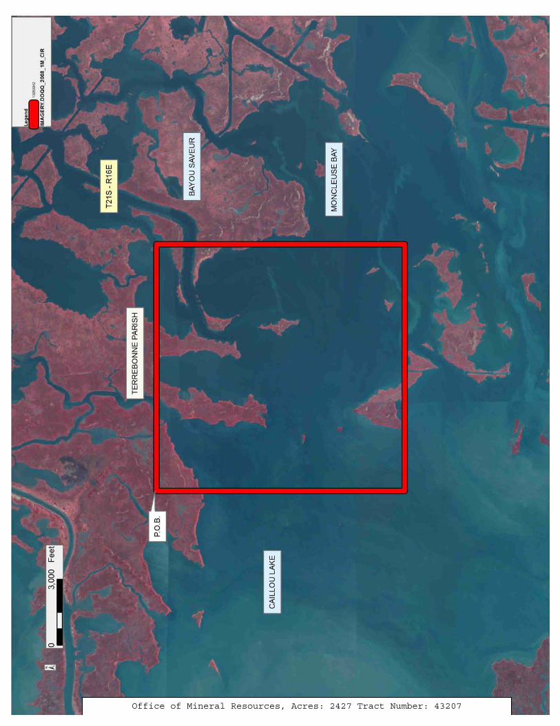
Office of Mineral Resources, Acres: 2427 Tract Number: 43207
19
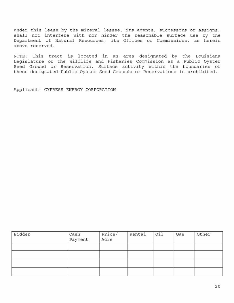
TRACT 43208 - Terrebonne Parish, Louisiana All of the lands now or formerly constituting the beds and bottoms of all water bodies of every nature and description as to which title is vested in the State of Louisiana, together with all islands arising therein and other lands formed by accretion or by reliction, where allowed by law, excepting tax adjudicated lands, and not presently under mineral lease on May 8, 2013, situated in Terrebonne Parish, Louisiana, and more particularly described as follows: Beginning at a point having Coordinates of X = 2,129,131.78 and Y = 214,167.27; thence East 12,398.51 feet to a point having Coordinates of X = 2,141,530.30 and Y = 214,167.27; thence South 8,824.54 fee to a point having Coordinates of X = 2,141,530.30 and Y = 205,342.73; thence West 12,398.51 feet to a point having Coordinates of X = 2,129,131.78 and Y = 205,342.73; thence North 8,824.54 feet to the point of beginning, LESS AND EXCEPT any right, title, and interest in lands owned by and not under lease from the State of Louisiana, on behalf of the Terrebonne Parish School Board, situated in Section 16, Township 21 South, Range 15 East, Terrebonne Parish, Louisiana, contained within the above described tract, (This lease includes only waterbottoms claimed and owned by the state and specifically excludes any land which the state may claim or own and to which the mineral rights are vested in the state), containing approximately 2,500 acres, all as more particularly outlined on a plat on file in the Office of Mineral Resources, Department of Natural Resources. All bearings, distances and coordinates are based on Louisiana Coordinate System of 1927, (North or South Zone), where applicable. NOTE: The above description of the Tract nominated for lease has been provided and corrected, where required, exclusively by the nomination party. Any mineral lease selected from this Tract and awarded by the Louisiana State Mineral and Energy Board shall be without warranty of any kind, either express, implied, or statutory, including, but not limited to, the implied warranties of merchantability and fitness for a particular purpose. Should the mineral lease awarded by the Louisiana State Mineral and Energy Board be subsequently modified, cancelled or abrogated due to the existence of conflicting leases, operating agreements, private claims or other future obligations or conditions which may affect all or any portion of the leased Tract, it shall not relieve the Lessee of the obligation to pay any bonus due thereon to the Louisiana State Mineral and Energy Board, nor shall the Louisiana State Mineral and Energy Board be obligated to refund any consideration paid by the Lessor prior to such modification, cancellation, or abrogation, including, but not limited to, bonuses, rentals and royalties. NOTE: The State of Louisiana does hereby reserve, and this lease shall be subject to, the imprescriptible right of surface use in the nature of a servitude in favor of the Department of Natural Resources, including its Offices and Commissions, for the sole purpose of implementing, constructing, servicing and maintaining approved coastal zone management and/or restoration projects. Utilization of any and all rights derived
20
under this lease by the mineral lessee, its agents, successors or assigns, shall not interfere with nor hinder the reasonable surface use by the Department of Natural Resources, its Offices or Commissions, as herein above reserved. NOTE: This tract is located in an area designated by the Louisiana Legislature or the Wildlife and Fisheries Commission as a Public Oyster Seed Ground or Reservation. Surface activity within the boundaries of these designated Public Oyster Seed Grounds or Reservations is prohibited.
Applicant: CYPRESS ENERGY CORPORATION
Bidder Cash Payment
Price/ Acre
Rental Oil Gas Other
21
Office of Mineral Resources, Acres: 2500 Tract Number: 43208
22
TRACT 43209 - Terrebonne Parish, Louisiana All of the lands now or formerly constituting the beds and bottoms of all water bodies of every nature and description as to which title is vested in the State of Louisiana, together with all islands arising therein and other lands formed by accretion or by reliction, where allowed by law, excepting tax adjudicated lands, and not presently under mineral lease on May 8, 2013, situated in Terrebonne Parish, Louisiana, and more particularly described as follows: Beginning at a point having Coordinates of X = 2,141,530.30 and Y = 205,342.73; thence East 13,579.29 feet to a point having Coordinates of X = 2,155,109.58 and Y = 205,342.73; thence South 00 degrees 15 minutes 34 seconds East 7,916.67 feet to a point having Coordinates of X = 2,155,145.41 and Y = 197,426.04; thence West 13,615.12 feet to a point having Coordinates of X = 2,141,530.30 and Y = 197,426.04; thence North 7,916.68 feet to the point of beginning, containing approximately 2,140 acres, all as more particularly outlined on a plat on file in the Office of Mineral Resources, Department of Natural Resources. All bearings, distances and coordinates are based on Louisiana Coordinate System of 1927, (North or South Zone), where applicable. NOTE: The above description of the Tract nominated for lease has been provided and corrected, where required, exclusively by the nomination party. Any mineral lease selected from this Tract and awarded by the Louisiana State Mineral and Energy Board shall be without warranty of any kind, either express, implied, or statutory, including, but not limited to, the implied warranties of merchantability and fitness for a particular purpose. Should the mineral lease awarded by the Louisiana State Mineral and Energy Board be subsequently modified, cancelled or abrogated due to the existence of conflicting leases, operating agreements, private claims or other future obligations or conditions which may affect all or any portion of the leased Tract, it shall not relieve the Lessee of the obligation to pay any bonus due thereon to the Louisiana State Mineral and Energy Board, nor shall the Louisiana State Mineral and Energy Board be obligated to refund any consideration paid by the Lessor prior to such modification, cancellation, or abrogation, including, but not limited to, bonuses, rentals and royalties. NOTE: The State of Louisiana does hereby reserve, and this lease shall be subject to, the imprescriptible right of surface use in the nature of a servitude in favor of the Department of Natural Resources, including its Offices and Commissions, for the sole purpose of implementing, constructing, servicing and maintaining approved coastal zone management and/or restoration projects. Utilization of any and all rights derived under this lease by the mineral lessee, its agents, successors or assigns, shall not interfere with nor hinder the reasonable surface use by the Department of Natural Resources, its Offices or Commissions, as herein above reserved. NOTE: This tract is located in an area designated by the Louisiana Legislature or the Wildlife and Fisheries Commission as a Public Oyster
23
Seed Ground or Reservation. Surface activity within the boundaries of these designated Public Oyster Seed Grounds or Reservations is prohibited.
Applicant: CYPRESS ENERGY CORPORATION
Bidder Cash Payment
Price/ Acre
Rental Oil Gas Other
24
Office of Mineral Resources, Acres: 2140 Tract Number: 43209
25
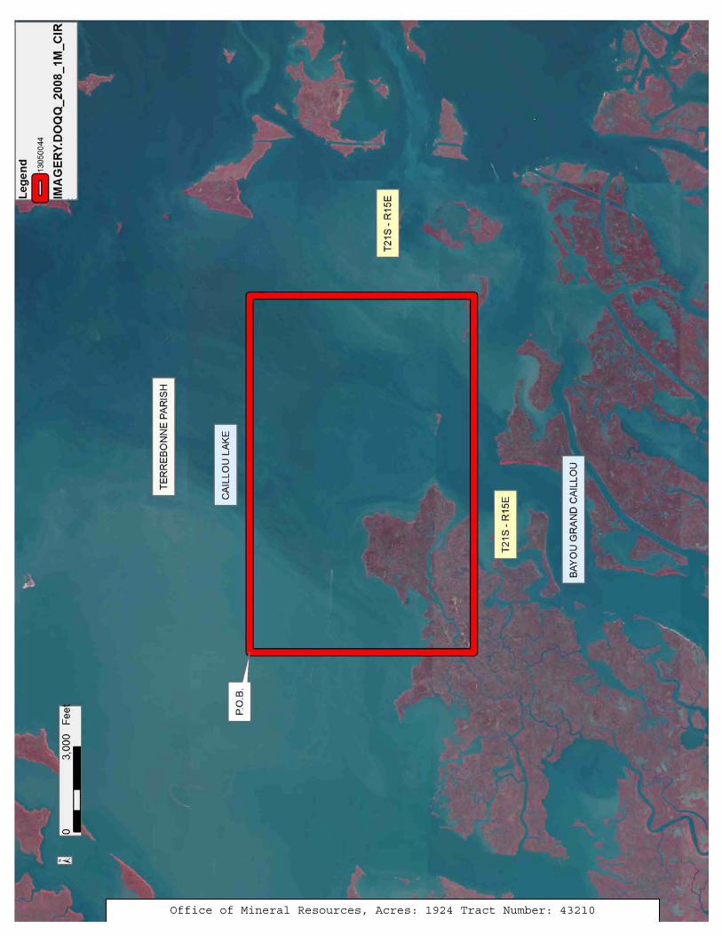
TRACT 43210 - Terrebonne Parish, Louisiana All of the lands now or formerly constituting the beds and bottoms of all water bodies of every nature and description as to which title is vested in the State of Louisiana, together with all islands arising therein and other lands formed by accretion or by reliction, where allowed by law, excepting tax adjudicated lands, and not presently under mineral lease on May 8, 2013, situated in Terrebonne Parish, Louisiana, and more particularly described as follows: Beginning at a point having Coordinates of X = 2,128,941.78 and Y = 205,342.73; thence East 12,588.51 feet to a point having Coordinates of X = 2,141,530.30 and Y = 205,342.73; thence South 7,916.68 feet to a point having Coordinates of X = 2,141,530.30 and Y = 197,426.04; thence West 12,588.51 feet to a point having Coordinates of X = 2,128,941.78 and Y = 197,426.04; thence North 7,916.68 feet to the point of beginning, containing approximately 1924 acres, all as more particularly outlined on a plat on file in the Office of Mineral Resources, Department of Natural Resources. All bearings, distances and coordinates are based on Louisiana Coordinate System of 1927, (North or South Zone), where applicable. NOTE: The above description of the Tract nominated for lease has been provided and corrected, where required, exclusively by the nomination party. Any mineral lease selected from this Tract and awarded by the Louisiana State Mineral and Energy Board shall be without warranty of any kind, either express, implied, or statutory, including, but not limited to, the implied warranties of merchantability and fitness for a particular purpose. Should the mineral lease awarded by the Louisiana State Mineral and Energy Board be subsequently modified, cancelled or abrogated due to the existence of conflicting leases, operating agreements, private claims or other future obligations or conditions which may affect all or any portion of the leased Tract, it shall not relieve the Lessee of the obligation to pay any bonus due thereon to the Louisiana State Mineral and Energy Board, nor shall the Louisiana State Mineral and Energy Board be obligated to refund any consideration paid by the Lessor prior to such modification, cancellation, or abrogation, including, but not limited to, bonuses, rentals and royalties. NOTE: The State of Louisiana does hereby reserve, and this lease shall be subject to, the imprescriptible right of surface use in the nature of a servitude in favor of the Department of Natural Resources, including its Offices and Commissions, for the sole purpose of implementing, constructing, servicing and maintaining approved coastal zone management and/or restoration projects. Utilization of any and all rights derived under this lease by the mineral lessee, its agents, successors or assigns, shall not interfere with nor hinder the reasonable surface use by the Department of Natural Resources, its Offices or Commissions, as herein above reserved. NOTE: This tract is located in an area designated by the Louisiana Legislature or the Wildlife and Fisheries Commission as a Public Oyster
26
Seed Ground or Reservation. Surface activity within the boundaries of these designated Public Oyster Seed Grounds or Reservations is prohibited.
Applicant: CYPRESS ENERGY CORPORATION
Bidder Cash Payment
Price/ Acre
Rental Oil Gas Other
27
Office of Mineral Resources, Acres: 1924 Tract Number: 43210
28
TRACT 43211 - Plaquemines Parish, Louisiana All of the lands now or formerly constituting the beds and bottoms of all water bodies of every nature and description as to which title is vested in the State of Louisiana, together with all islands arising therein and other lands formed by accretion or by reliction, where allowed by law, excepting tax adjudicated lands, and not presently under mineral lease on May 8, 2013, situated in Plaquemines Parish, Louisiana, and more particularly described as follows: Beginning at a point having Coordinates of X = 2,641,492.89 and Y = 197,761.00; thence East 11,013.11 feet to a point having Coordinates of X = 2,652,506.00 and Y = 197,761.00; thence South 9,236.00 feet to a point having Coordinates of X = 2,652,506.00 and Y = 188,525.00; thence West 11,013.11 feet to a point having Coordinates of X = 2,641,492.89 and Y = 188,525.00; thence North 9,236.00 feet to the point of beginning, LESS AND EXCEPT any right, title, and interest in lands owned by and not under lease from the State of Louisiana, on behalf of the Plaquemines Parish School Board, situated in Section 16, Township 22 South, Range 31 East, Plaquemines Parish, Louisiana, contained within the above described tract, containing approximately 2,335.10 acres, all as more particularly outlined on a plat on file in the Office of Mineral Resources, Department of Natural Resources. All bearings, distances and coordinates are based on Louisiana Coordinate System of 1927, (North or South Zone), where applicable. NOTE: The above description of the Tract nominated for lease has been provided and corrected, where required, exclusively by the nomination party. Any mineral lease selected from this Tract and awarded by the Louisiana State Mineral and Energy Board shall be without warranty of any kind, either express, implied, or statutory, including, but not limited to, the implied warranties of merchantability and fitness for a particular purpose. Should the mineral lease awarded by the Louisiana State Mineral and Energy Board be subsequently modified, cancelled or abrogated due to the existence of conflicting leases, operating agreements, private claims or other future obligations or conditions which may affect all or any portion of the leased Tract, it shall not relieve the Lessee of the obligation to pay any bonus due thereon to the Louisiana State Mineral and Energy Board, nor shall the Louisiana State Mineral and Energy Board be obligated to refund any consideration paid by the Lessor prior to such modification, cancellation, or abrogation, including, but not limited to, bonuses, rentals and royalties.
29
Applicant: HAROLD J. ANDERSON, INC.
Bidder Cash Payment
Price/ Acre
Rental Oil Gas Other
30
Office of Mineral Resources, Acres: 2335.1 Tract Number: 43211