Transforming the Way the World Works Sanjeev Trehan Director of Business Development & Sales & Distribution, Govt. & Defence “Advancing Role of Geospatial Knowledge in Digital Economy” Vijayawada, 06.09.2019
Transcript
Transforming the Way the World Works
Sanjeev Trehan
Director of Business Development & Sales & Distribution, Govt. & Defence
“Advancing Role of Geospatial Knowledge in Digital Economy” Vijayawada, 06.09.2019
Transforming the
Way the World Works
Trimble Inc.
At Trimble, we have been in the
business of crafting confidence for
customers for over 35 years.
Founded on the core principles of
triangulation, we stand for: Position,
Information and Communication.
Where all points unite, you’ll find
Trimble -with innovation and
technology for the future.
Position
Information
Communication
Trimble Snapshot
InnovationCompany
NASDAQ:
TRMB
$3.13B
Revenue (2018 year end)
34%+
Building & Infrastructure
1,200+
Unique Patents
360 Construction Workflow
& Technology Patents
14%
R&D re-invested
People
11,000+ Employees
in 35 Countries
800+ Construction
Professionals
Global Customers
in 150 countries
Trimble - 1200+ People Strong in India
Core Business Franchises
Transportationand Logistics
GeospatialBuildings Civil Engineering
and ConstructionAgriculture
4
Our core industries are global trillion $ industries which operate in demanding
environments, with technology adoption in the early phases
Emerging Businesses
Rail Environmental & Waste Water Utilities Electric Utilities
Mining Forestry Field Service Oil, Gas, & Chemical
5
The Digital Drive Calls for World Class Infrastructure using State of the Art tech. & Collaboration
This in turn is leading to evolution and rapid adoption of newer technologies….........
Environmental
Infra. – Disaster,
Waste, Climate
Physical Infra. – Road Rail, Energy, Water
Social Infra. –
Health, Food,
Educ., Safety,
Citizen Services
●Consistent Coordinate Frame
When planning for a National / State GIS - Problems that may occur if not working with a VRS networking solution...
VRS - Virtual Reference Station
Trimble first launched Trimble VRS® in 1999
CORS stations within an network send observables to server
Server creates a model of network
Each rover connects to server, and a “virtual” base station is created
Strengths (+) Weaknesses (-)
No need for a local base
stationRelies on IP/cellular connectivity
Consistent Cm level
accuracy, anywhere in the
coverage
Eliminate RTK dilution of
precision
Consistent reference
frame
Position integrity
Low initial cost
Communications(cellular/radio/satellite)
Network Control(Data Processing)
The Benefits of a Common Reference Frame
Parcel Survey & Mapping
Administrative Boundary Management
Land Use Planning
Infrastructure Planning
Natural Resource Management
Digital Elevation Modeling
Digital Terrain Modeling
Aerial Scanning & Photogrammetry
Utilities Management
Road/Railway Design & Management
Irrigation & Disaster Mitigation
Building Design & Management
Geodetic Infrastructure, GNSS, and Innovative technologies will revolutionize geospatial data gathering & decision making
This change will happen within government and the private sector, followed by huge innovation and creativity in application and value-generation
The biggest transformation in the transition away from traditional methods is MORE information, FASTER work, EARLIER societal benefit, BETTER living!
Points to be Noted
Thank You
Transforming the Way the World Works
Sanjeev Trehan
Director of Business Development & Sales & Distribution, Govt. & Defence
“New Age Solutions Addressing Digital Age Challanges” Vijayawada, 06.09.2019
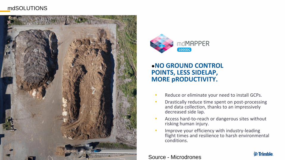
Market leading, highly accurate solutions for the measurement and digitization of our 3D world.An ecosystem tailored to the needs of our global, multi-disciplined customer base.
Geospatial
Geodetic Framework Infrastructure
●Infrastructure for Positioning
Trimble Positioning Infrastructure = 10th Utility
▪ Infrastructure Examples:– Cellular Towers
– Interstate Highways
– Utilities, water, power….
– Gas and Oil
– Communication
Infrastructure is an enabling technology!
●Consistent Coordinate Frame
▪ When planning for a National / State GIS - Problems that may occur if not working with a VRS networking solution...
Sporadic SDI Development
Administrative
Land Use (urban/rural)
Individual Parcels
Geology/Seismology
Monitoring/Deformation
Boundary/Zoning
Boundary/Zoning
Construction/Utilities
Natural Resources
Natural Resources
SDI Development with a Common Reference Frame
●The Benefits of a Common Reference Frame
●VRS - Virtual Reference Station
▪ Trimble first launched Trimble VRS® in 1999
▪ CORS stations within an network send observables to server
▪ Server creates a model of network
▪ Each rover connects to server, and a “virtual” base station is created
Strengths (+) Weaknesses (-)
No need for a local base
stationRelies on IP/cellular connectivity
Consistent Cm level
accuracy, anywhere in the
coverage
Eliminate RTK dilution of
precision
Consistent reference
frame
Position integrity
Low initial cost
●DBO Project Turkey– 150 CORS
Trimble Infrastructure VRS Networks: >200 Networks >3,000 CORS >40 Countries
out
USA
China
Denmark
Switzerland
Finland
Germany
Sweden
Norway
Italy
Austria
Belgium
United
Kingdom
Slovenia
Serbia and
Montenegro
Canada
Japan
Portugal
Slovakia
New
Caledonia
Partial View
USACE
UNAVCO
Lithuania
Saudi Arabia
KSA
Thailand
Brunei
Rep. South Africa France Poland Czech Republic
South Korea
Croatia
Turkey
Greece
Poland
RussiaIreland
Benin
Estonia
Brasil
Iceland
Albania
Singapore
JamaicaCorsica
Costa Rica
Puerto Rico
Ecuador
Burkina Faso
Chile
Australia
New Zealand
Taiwan
Malaysia
Spain
Hong Kong
Bangladesh
In a National Network, Reference
Stations stream Data back to the Control
Center 24 Hours a Day
How Does a National Network Operate?
●VRS Data Flow
Roving receiver sends its
position back to the server
NMEA
VRS position is
established
VRS
●VRS Data Flow
VRS
NMEA
Server uses VRS position
to create „corrected“
RTCM real-time data
RTCM
Rover
surveys as in
„normal“
RTK – but
getting VRS
data as if
from a
nearby
reference
station
●and Applications
Government• Land and Revenue• Town & Country Planning• Public Works Dept.• Municipal Corporations• Transportation• Forestry• Defense and Internal
Security• Utilities• Natural Resources• Mining• Fleet Management and
Vehicle Tracking• Assets Inventory• Agriculture
Construction• Roads / Highways• Power Grids• Oil and Gas• Dams/ Harbour/ Ports• Metro Rail• Railways• Airports• Bridges• Industry• Utilities• Telecom• Tunnels• Water Supply and Sewage
● Information delivered in a way that is ○ Easy to understand
○ Easy to use
Connected and Integrated Workflows - Field
Trimble Access 2018
▪ TA 2018 and TSC7– Familiar wofklows– More map-centric– Gesture control– Working with 3D models– Support scan data operations– Improved survey workflows– Full Windows 10
Inspect objects and stakeout directly from IFC - traditional
Inspect objects and stakeout directly from IFC – in 3D
Inspect and Analyze Point Clouds inside Trimble Access
Roads
●Technology Evolution – Snapshot of Today
Connected and Integrated Workflows - Office
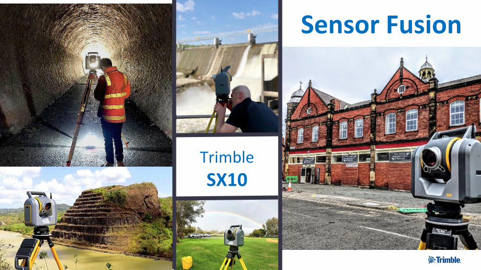
Trimble Business Center Software “TBC”
Complete Survey and Construction Office Software Enabling Field to Finish Workflows with Confidence