70
Transportation Engineering Part-I
| Date post: | 15-Jul-2015 |
| Category: |
Engineering |
| Upload: | gaurav-h-tandon |
| View: | 485 times |
| Download: | 5 times |
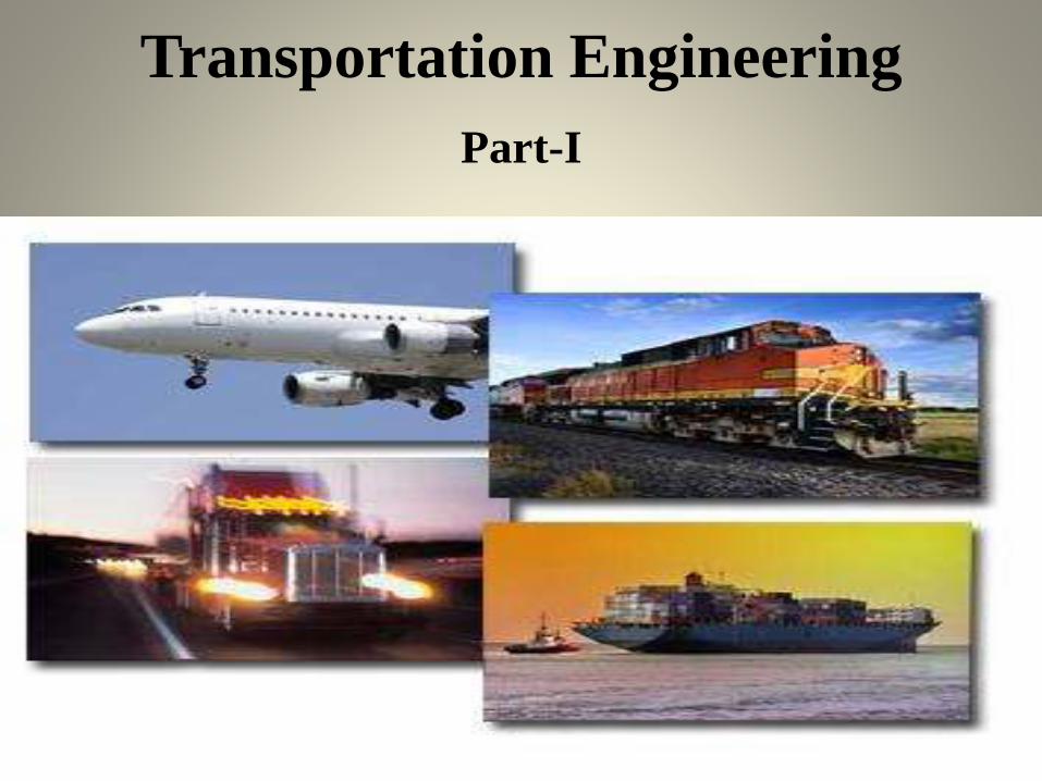
Transportation Engineering
Part-I

Syllabus
• Elements of Traffic Engineering and Traffic control.

Elements of Traffic Engineering and
Traffic ControlDef: Traffic Engineering
• Traffic engineering is that branch of engineering which deals withplanning and geometric design of streets, highway, abutting lands, andoperating traffic systems to achieve safe, economical, convenient andefficient movement of persons and goods.
• Object of Traffic Engineering:
• To achieve free and rapid flow of traffic with least number of trafficaccident.
• Factors affecting Traffic:
• The Roaduser
• The Vehicle
• The Roadway
• The environment
Drivers of various types of vehicles and pedestrians are known as road user.They are human being, hence affected by so many factors.
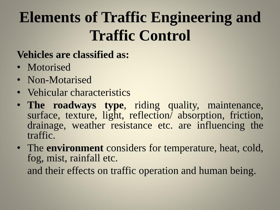
Elements of Traffic Engineering and
Traffic Control
Vehicles are classified as:
• Motorised
• Non-Motarised
• Vehicular characteristics
• The roadways type, riding quality, maintenance,surface, texture, light, reflection/ absorption, friction,drainage, weather resistance etc. are influencing thetraffic.
• The environment considers for temperature, heat, cold,fog, mist, rainfall etc.
and their effects on traffic operation and human being.
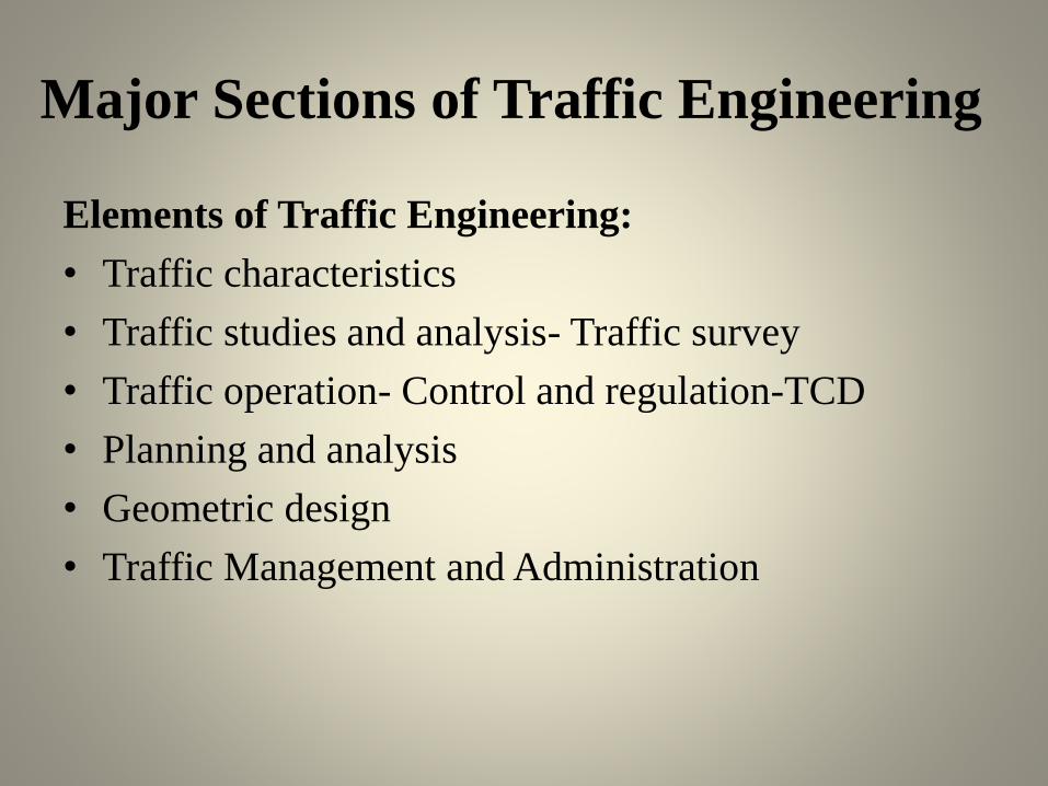
Major Sections of Traffic Engineering
Elements of Traffic Engineering:
• Traffic characteristics
• Traffic studies and analysis- Traffic survey
• Traffic operation- Control and regulation-TCD
• Planning and analysis
• Geometric design
• Traffic Management and Administration
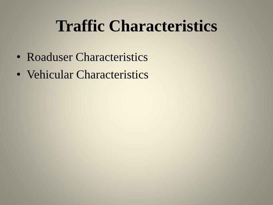
Traffic Characteristics
• Roaduser Characteristics
• Vehicular Characteristics
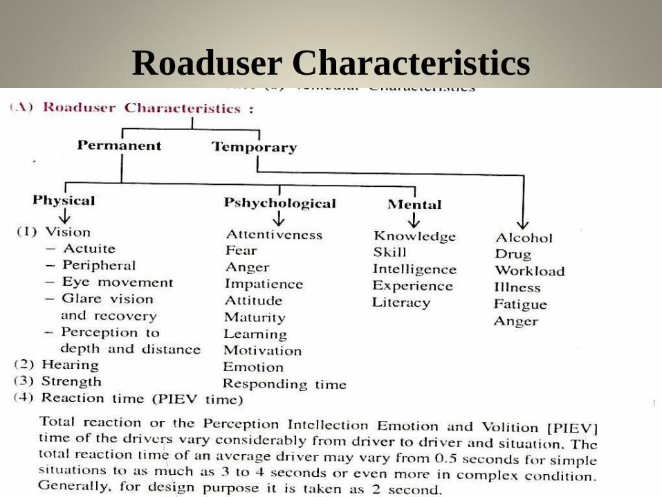
Roaduser Characteristics

Vehicular Characteristics
Traffic Survey
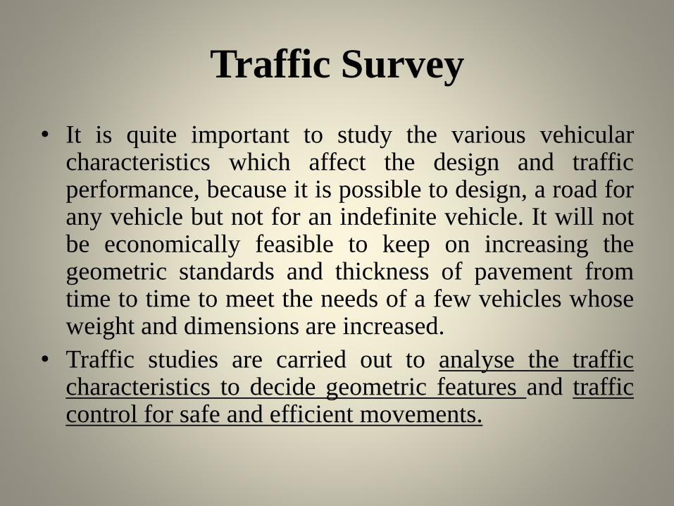
• It is quite important to study the various vehicularcharacteristics which affect the design and trafficperformance, because it is possible to design, a road forany vehicle but not for an indefinite vehicle. It will notbe economically feasible to keep on increasing thegeometric standards and thickness of pavement fromtime to time to meet the needs of a few vehicles whoseweight and dimensions are increased.
• Traffic studies are carried out to analyse the trafficcharacteristics to decide geometric features and trafficcontrol for safe and efficient movements.
Major types of survey are as below:
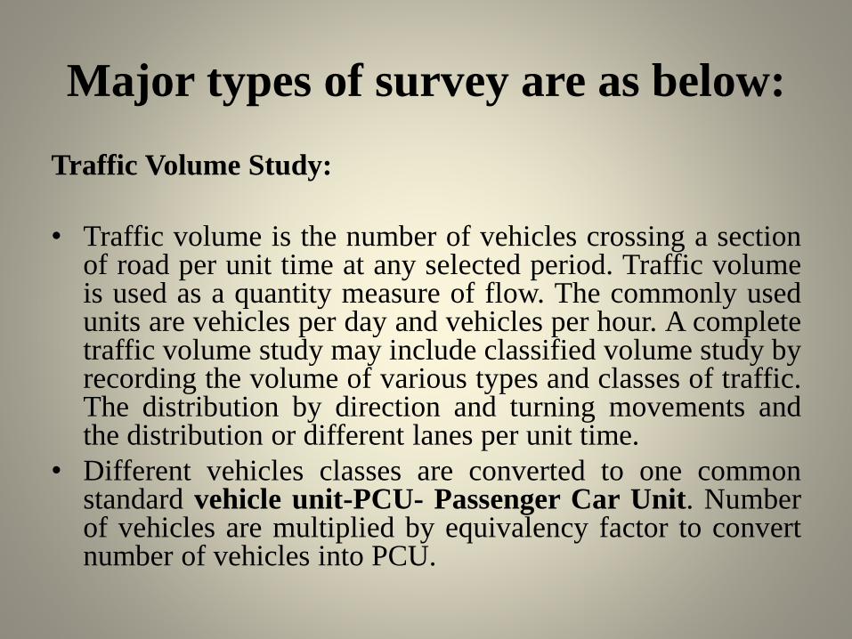
Traffic Volume Study:
• Traffic volume is the number of vehicles crossing a sectionof road per unit time at any selected period. Traffic volumeis used as a quantity measure of flow. The commonly usedunits are vehicles per day and vehicles per hour. A completetraffic volume study may include classified volume study byrecording the volume of various types and classes of traffic.The distribution by direction and turning movements andthe distribution or different lanes per unit time.
• Different vehicles classes are converted to one commonstandard vehicle unit-PCU- Passenger Car Unit. Numberof vehicles are multiplied by equivalency factor to convertnumber of vehicles into PCU.
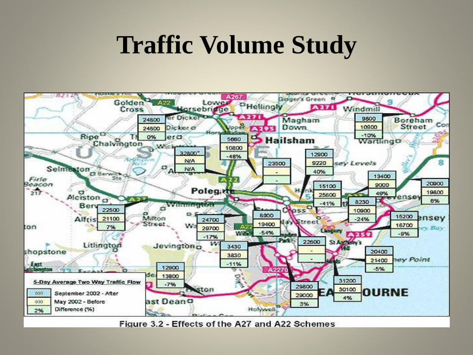
Traffic Volume Study

Spot Speed Survey
• Spot speed survey is the instantaneous speed of avehicle at a specified section or location.Enoscope is the name of equipment use for thissurvey. Manually it is possible to measure the spotspeed by entering the data into the record book.The collected data are analysed and S-Curve isplotted. We can obtain medium speed, geometricdesign speed 85 th percentile speed (Upper speedlimit for regulation), 15th percentile speed, modalspeed, space mean speed, time mean speed etc.from collected data.

Spot Speed Survey
Speed and Delay Study
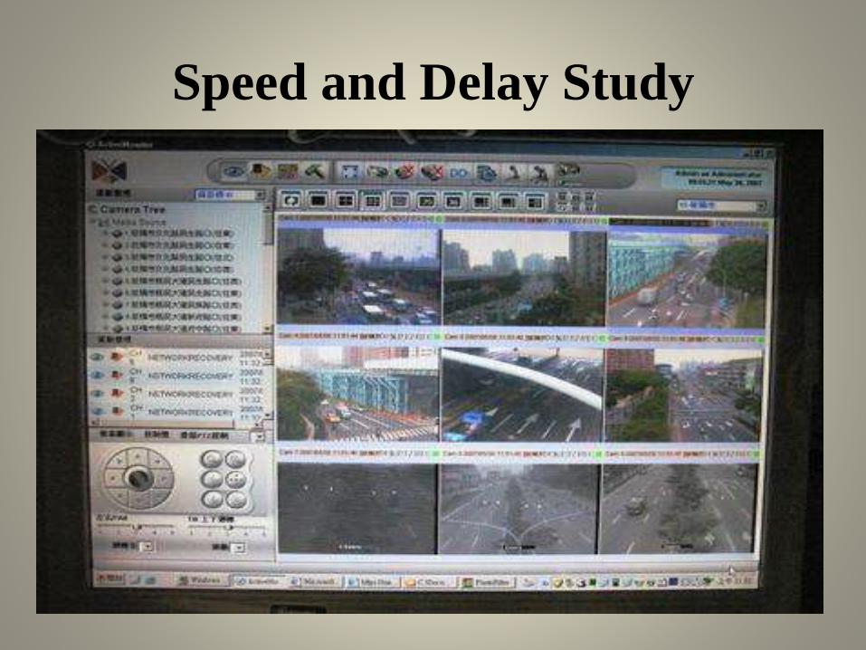
• Speed and delay studies give running speeds,overall speeds, fluctuations in speed and delaybetween two stations of a road spaced far apart.They also give the information such as amount,location, duration, frequency and causes of thedelay in the traffic stream. Various methods tocarry out speed and delay survey are:
• Floating Car method
• Licence Plate record method
• By Interview
• By Photography and videography
Speed and Delay Study
Origin and Destination Survey
• The O and D studies of vehicular traffic determines theirnumber, their origin and destination in each zone understudy. The data of number of passengers in each vehicles,purpose of trip, intermediate stops made and reasons, actualdirection of travel, selection of routes and length of trip etc.also collected.
• Methods of O and D survey are:
• Road side interview method
• Licence plate method
• Return post card method
• Tag on car method
• Home interview method

Origin and Destination Survey

Traffic Flow Characteristics and Studies
• The measure of traffic flow are volume, density, and speed. The
data for traffic volume, traffic density, space headway, time
headway, features of road, traffic manoeuvres etc. are
observed here. The basic traffic manoeuvres are diverging,
merging, and crossing.
• Density is the number of vehicles occupying a unit length of lane
of roadway at a given instant. It is expressed as vehicles per hour.
• The time interval between the passage of successive vehicles
moving in the same lane and measured from head to head as they
pass on the road is known as time headway.
• The distance between successive vehicles moving in the same
line measured from head at any instance is known as space
headway.

Traffic Flow Characteristics and
Studies

Traffic flow study is useful as
following• This is useful in geometric design features such as volume, number of
lanes, width of carriageway etc.
• To decide traffic regulatory measures like one way movement.
• It is used in design of traffic control measures and devices.
• It is used for accident rate analysis and to determine measures to reduce and avoid accident.
• To decide speed trends and traffic patterns.
• To decide the priority for improvement and expansion.
• It is used for planning and control of existing facilities and routes.
• It is used for planning and designing the new facilities, To suggest improvement and expansion.
• It is used for planning of pedestrian facilities like sidewalks, crosswalks, subways and pedestrian signals.
• It is used for planning signal timing.
• It is used for structural design of pavement.
• To compute roadway capacity.
• To plan mass transit facilities.
Traffic Capacity Studies:
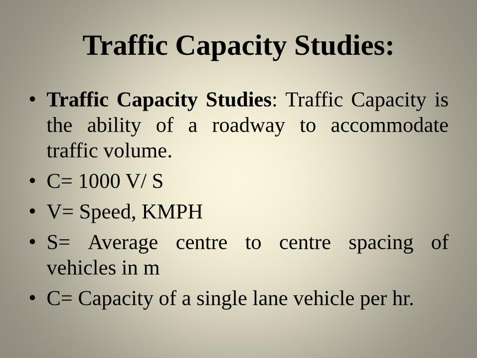
• Traffic Capacity Studies: Traffic Capacity is
the ability of a roadway to accommodate
traffic volume.
• C= 1000 V/ S
• V= Speed, KMPH
• S= Average centre to centre spacing of
vehicles in m
• C= Capacity of a single lane vehicle per hr.
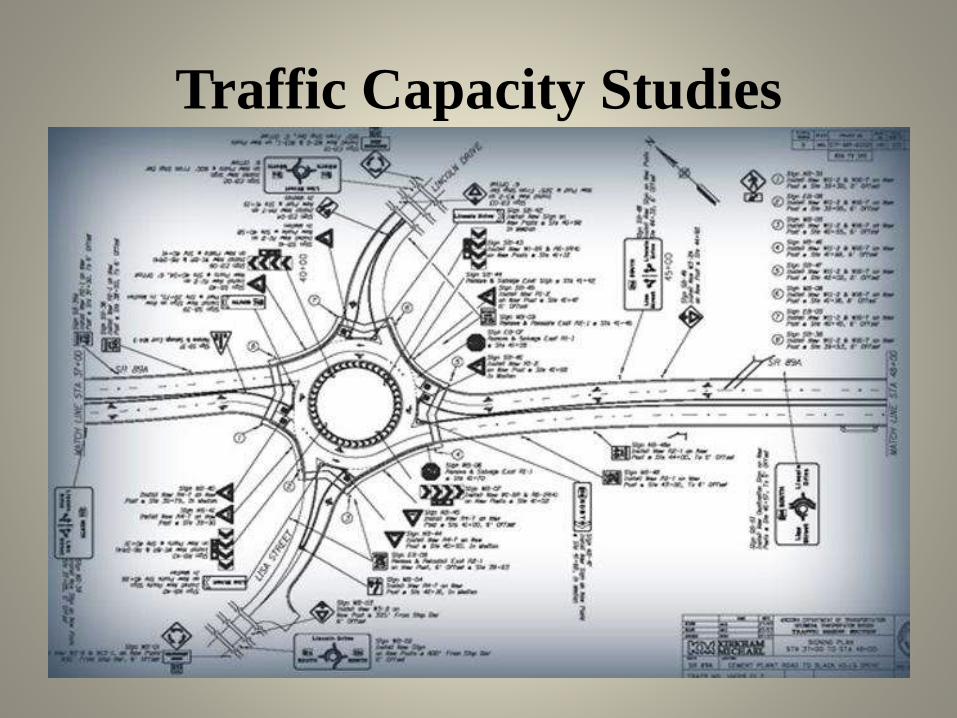
Traffic Capacity Studies

Parking Survey• Parking survey is the work of data collection related to space available for parking of vehicles and number and
type of vehicles demand for parking.
• Types of Parking
• Kerb parking
• Off street
• Kerb parking: vehicles are parked on the kerb or on the side of street or road.
• Types of Kerb Parking:
• Parallel Parking
• 30 0 angle parking
• 60 0 angle parking
• 45 0 angle parking
• 90 0 angle parking
• Angle parking is more convenient for the motorists than the parallel parking.
• Out of various angle parking, 45 0 angle parking is the best and most convenient.
• Off street parking:
• When parking facility is provided at a separate place away from the kerb it is known as off-street parking.
• Types of offstreet parking:
• Surface parking lots
• Multi floor parking garages

Parking Survey
Accident Study
• Types of accident
• Minor injury
• Major injury
• Fatal
• Damage to property
• Accident reports are prepared in police station and town planning offices as
• Collision diagram
• Condition Diagram
• Preventive measures of accident are 3 E’s
• Engineering
• Enforcement
• Education

Accident Study
Traffic operations
• It is essential to impose adequate traffic
regulations and traffic control devices for safe
traffic operations.
• Traffic regulations should cover all aspects of
vehicles, drivers, pedestrians, flow, accidents etc.
The traffic laws implemented by legislative laws
are obligatory on all road users.
• (a) Traffic Regulation
• (b) Traffic Control Devices (TCD)

Traffic Regulation
• Various Traffic regulatory measures are:
• Issue driving licence- by checking age and conducting test drive
• Registration of Vehicles
• Transfer of Ownership
• Distinction between private and public vehicles
• Transport authorities
• Speed limit
• Limits of Weight
• Parking and halting Places
• Insurance fees
• Punishment of Violation and offences
• Provision of Control Devices
Traffic Control Devices• The various aids and devices used to control, regulate and guide traffic is called TCD
• Signs• Regulatory
• Warning
• Informatory
• Signals• Fixed Time
• Manually Operated
• Traffic actuated
• Pedestrian
• Special Traffic
• Marking• Pavement
• Kerb
• Object
• Reflector unit
• Delineators
• Islands• Divisional
• Channelizing
• Pedestrian loading
• Rotary
• Lights
Traffic Signs
(A) Regulatory Signs:
• Regulatory Signs are meant to inform the road user ofcertain laws, regulations and prohibitions. The violationof these signs is a legal offence.
• Eg.
• Stop and give way sign
• Prohibitory signs
• No Parking signs
• Speed limit and vehicle control signs
• Restriction end sign
• Compulsory direction control and other signs
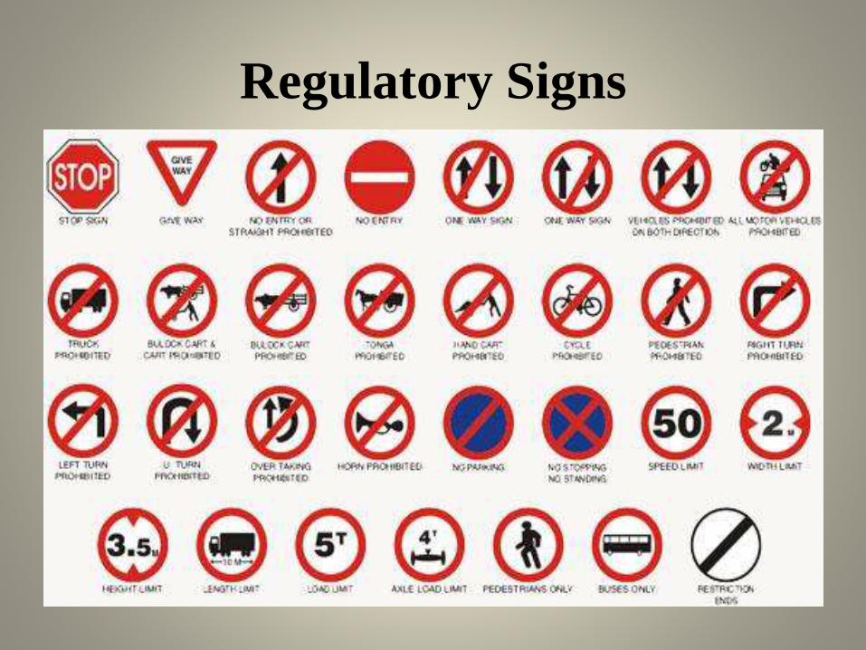
Regulatory Signs

Traffic Signs
(B) Warning Signs: warning or cautionary signs areused to warn the road user of certain hazardousconditions that exists on or adjacent to theroadway. The warning signs are in the shape of aequilateral triangle with its apex pointingupwards. The warning signs are to be located atsufficient distance in advance of the hazardwarned against; these distances are 120, 90, 60,and 40 m respectively on NH/ SH , MDR, ODR,and VR. On urban road the distance is 50 m
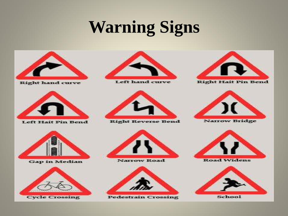
Warning Signs

Traffic Signs
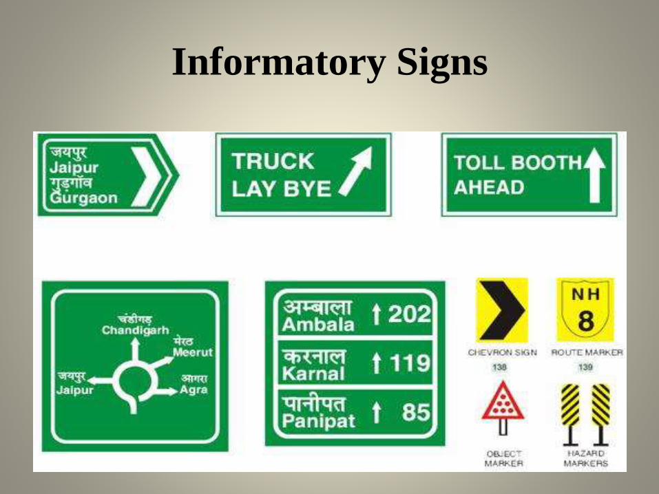
Informatory Signs:
• These signs are used to guide the road user alongroutes, inform them of destination and provide with theinformation to make travel easier, safe and pleasant.
• Eg.
• Direction and place identification Sign
• Facilities Information Signs
• Other Useful information Signs
• Parking Signs
• Flood gauge

Informatory Signs
Informatory Signs

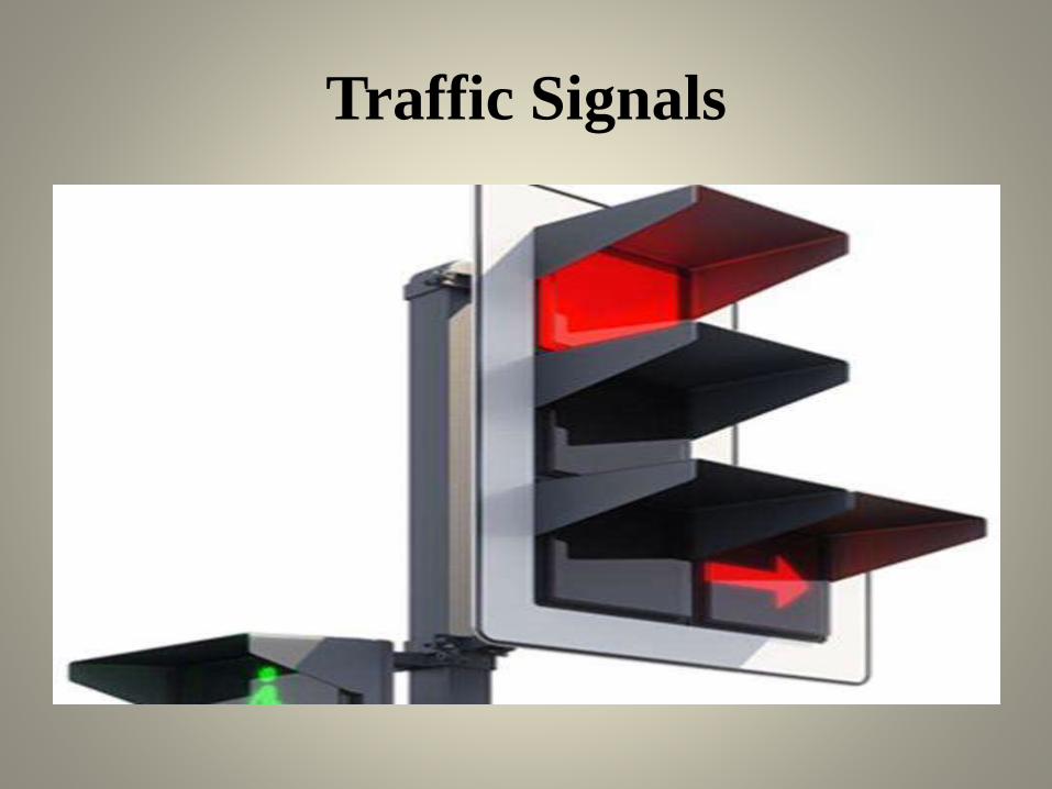
Traffic Signals
• At Intersection where a large number of crossing and
right turn traffic, there is possibility of collision and
accident. To provide orderly movement with safety
and speed, signals are provided at intersection. The
crossing streams of traffic flow are seperated by time
segeration
Traffic Signals
• Definition: Traffic Signals are control devices which could
alternately direct the traffic to stop and proceed at intersections
using red and green traffic light signals automatically.
• Advantages of Signals:
• Signal is provided at intersection to manage the traffic flow.
• Signals provide safety to vehicular traffic and pedestrian. They
reduce and avoid the accidents.
• Signals are easy to understand compare to traffic police
management at intersection.
Traffic Signals
Traffic Signals• Disadvantages of Signals:
• Fast moving vehicles may cause rear end collision at signalised
intersection
• Improper design of signal cycle length can cause fixed delay.
• Duration off-peak hour unnecessary delay occur at signalised
intersection.
Traffic Signals
• Fixed Time Signals: are set to repeat regularly a cycle ofred, amber and green lights. The timing demand to clear offthe intersection with the help of detectors which areinstalled at the approaches. These are very costly.
• Pedestrian Signals: are meant to give the right of way topedestrians to cross a road. The vehicular traffic should bestopped by red or stop signal on the traffic signal of theroad.
• Traffic actuated Signals: are those in which the timings ofthe phase and cycle are changed according to traffic demandto clear off the intersection with the help of detectors whichare installed at the approaches. They are very costly.
Road Marking
• Road marking are made of lines, patterns, words,symbols or reflectors on the pavement, kerb, sides ofislands or on fixed object wiithin or near the roadway tocontrol, warn, guide, or regulate the traffic. The markingare made by using white, black, yellow, colour paints.Longitudinal lines are 10 cm thick and traverse linesshould be made in such a way that they are visible atsufficient distance in advance. Yellow color marking areused to indicate parking restrictions, continious centreline and barrier line markings. Longitudinal solid linesare used as guiding and regulating lines and are notmeant to be crossed by the driver. White color stop linesare meant for vehicles to stop near the signalised sectionand pedestrian crossing.

Road Markings
Center Lines
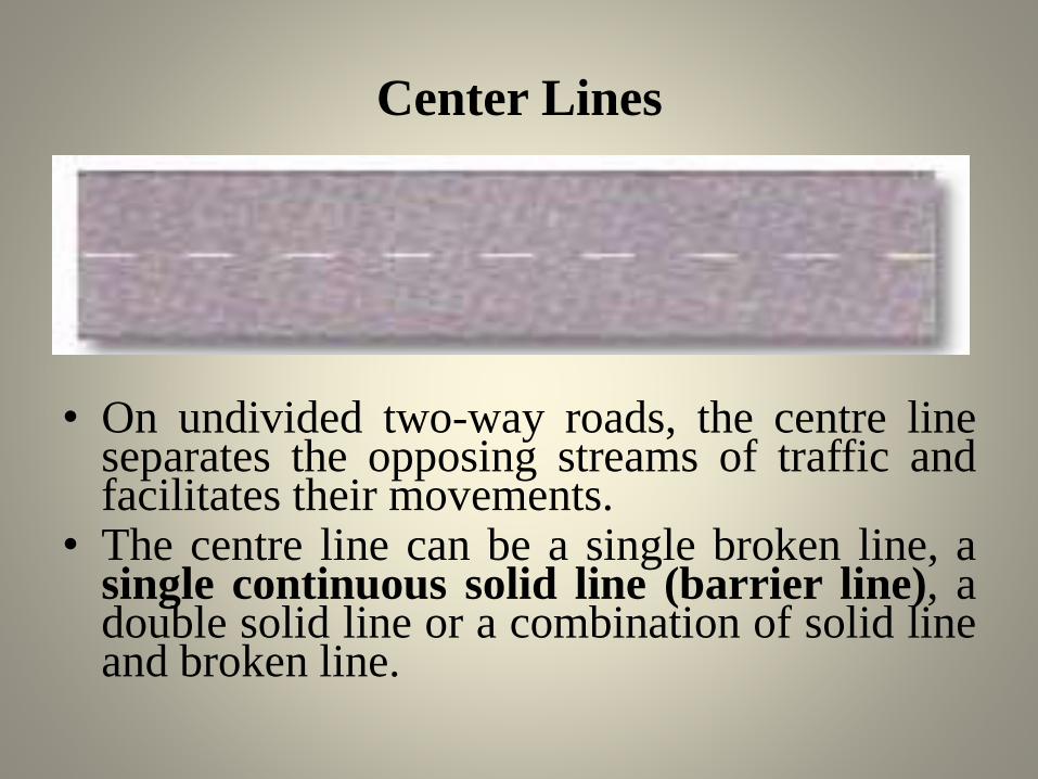
• On undivided two-way roads, the centre lineseparates the opposing streams of traffic andfacilitates their movements.
• The centre line can be a single broken line, asingle continuous solid line (barrier line), adouble solid line or a combination of solid lineand broken line.
Types of lines used to mark lanes.
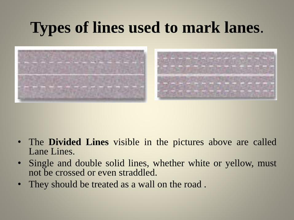
• The Divided Lines visible in the pictures above are calledLane Lines.
• Single and double solid lines, whether white or yellow, mustnot be crossed or even straddled.
• They should be treated as a wall on the road .
Double Lines.
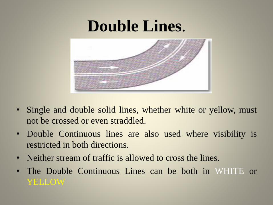
• Single and double solid lines, whether white or yellow, must
not be crossed or even straddled.
• Double Continuous lines are also used where visibility is
restricted in both directions.
• Neither stream of traffic is allowed to cross the lines.
• The Double Continuous Lines can be both in WHITE or
YELLOW
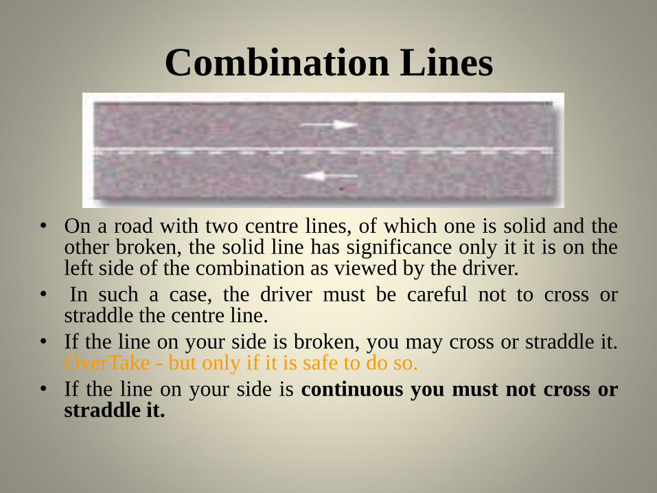
Combination Lines
• On a road with two centre lines, of which one is solid and theother broken, the solid line has significance only it it is on theleft side of the combination as viewed by the driver.
• In such a case, the driver must be careful not to cross orstraddle the centre line.
• If the line on your side is broken, you may cross or straddle it.OverTake - but only if it is safe to do so.
• If the line on your side is continuous you must not cross orstraddle it.
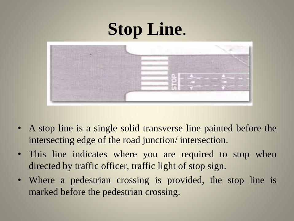
Stop Line.
• A stop line is a single solid transverse line painted before the
intersecting edge of the road junction/ intersection.
• This line indicates where you are required to stop when
directed by traffic officer, traffic light of stop sign.
• Where a pedestrian crossing is provided, the stop line is
marked before the pedestrian crossing.
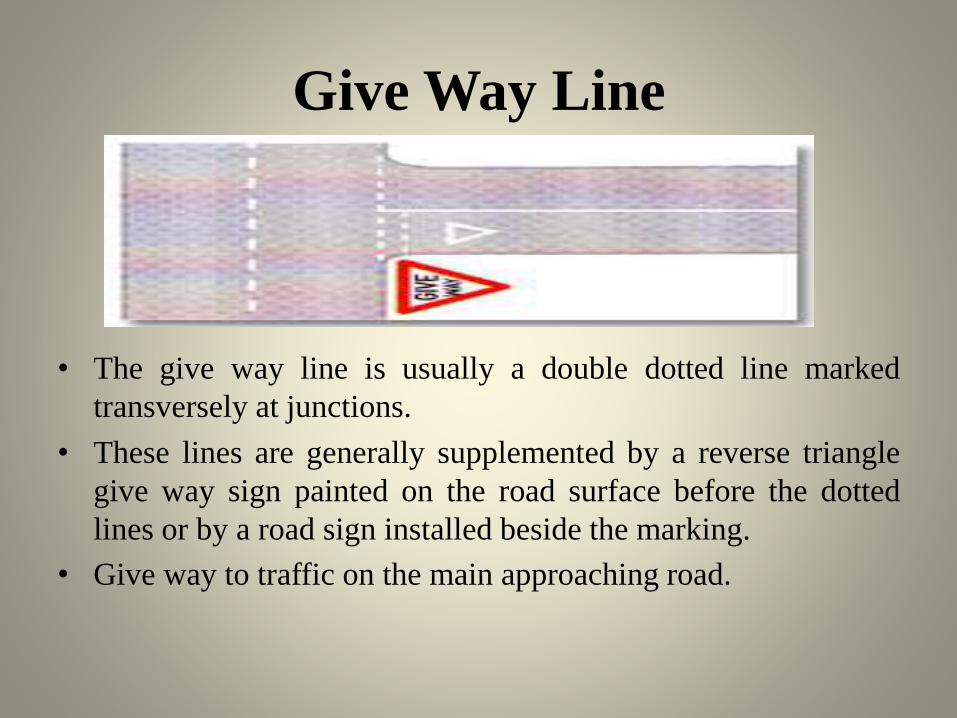
Give Way Line
• The give way line is usually a double dotted line marked
transversely at junctions.
• These lines are generally supplemented by a reverse triangle
give way sign painted on the road surface before the dotted
lines or by a road sign installed beside the marking.
• Give way to traffic on the main approaching road.

Border Edge Line
• These are continuous lines at the edge of the
carriageway and mark the limits of the main
carriageway upto which a driver can safely venture.
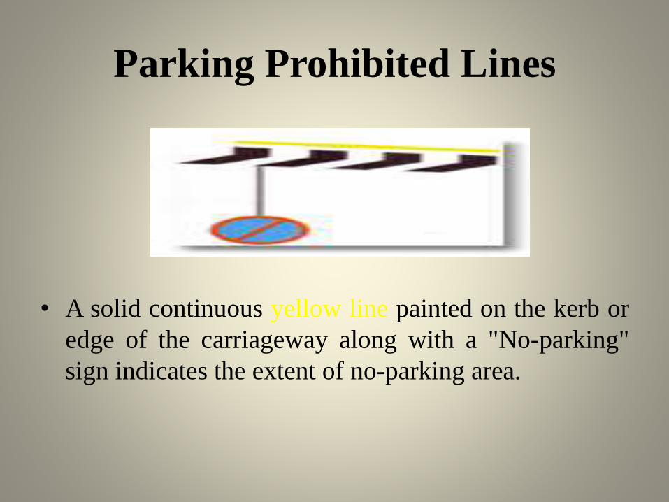
Parking Prohibited Lines
• A solid continuous yellow line painted on the kerb or
edge of the carriageway along with a "No-parking"
sign indicates the extent of no-parking area.
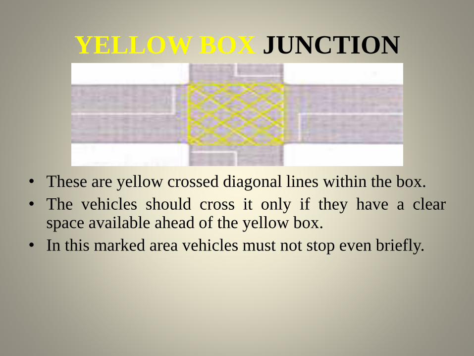
YELLOW BOX JUNCTION
• These are yellow crossed diagonal lines within the box.
• The vehicles should cross it only if they have a clearspace available ahead of the yellow box.
• In this marked area vehicles must not stop even briefly.

Pedestrian Crossing
• These are alternate black and white stripes painted parallel to
the road generally known as zebra crossing.
• Pedestrians must cross only at the point where these lines are
provided and when the signal is in their favour at controlled
crossings.
• You must stop and give way to pedestrians at these crossings.
• Pedestrian crossings are marked to facilitate and give the right
of way to pedestrians.
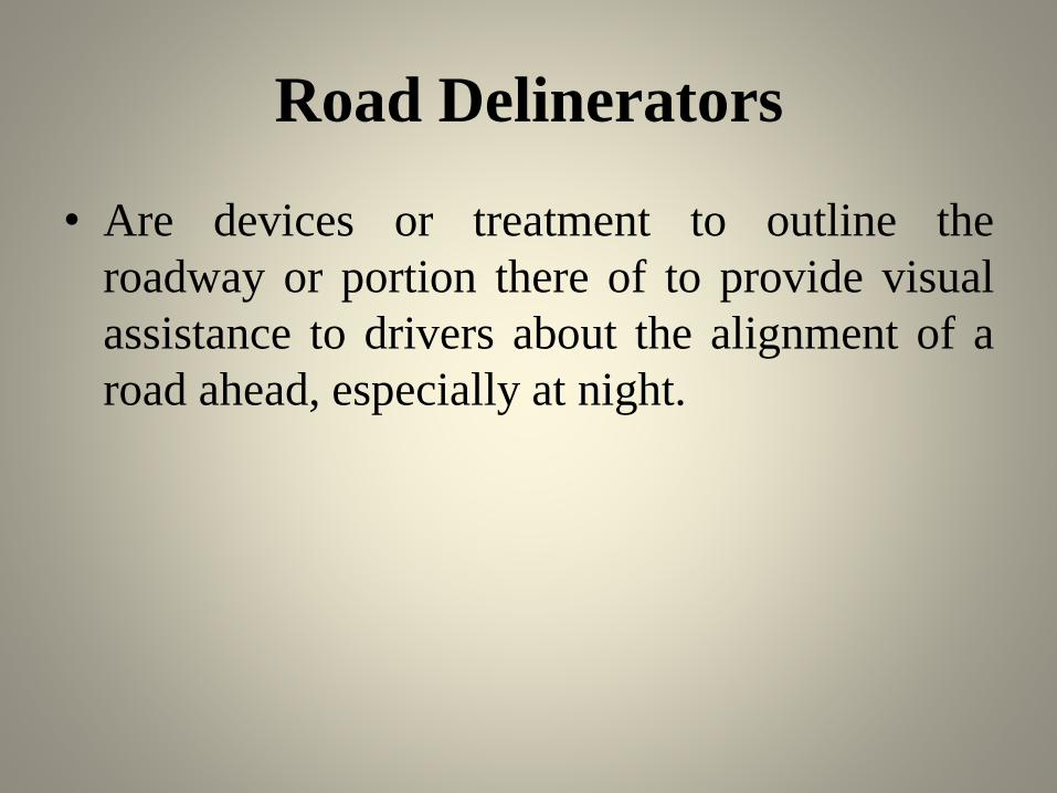
Road Delinerators
• Are devices or treatment to outline the
roadway or portion there of to provide visual
assistance to drivers about the alignment of a
road ahead, especially at night.
Types of delineators are:
• Roadway indicators
• Hazard markers
• Object markers

Road Delinerators
Traffic Islands
• Are raised areas constructed within the roadway to establishphysical channels through which the vehicular traffic maybe guided.
• Types of Islands are:
• Divisional Islands: Divisional islands are dividing thehighway in two one way roadways so that head on collisionare eliminated and accidents are reduced.
• Channelizing Islands: Channelizing islands guide thetraffic into proper channel through the intersection area.
• Pedestrian loading Islands: Pedestrian loading islands areprovided at regular bus stops and similar places for theprotection of passengers.
• Rotary Islands : Rotary islands is the large central island ofa rotary intersection.

Needs of Islands
• Islands provide self controlled traffic. No need
of traffic police to manage the traffic.
• Islands reduce conflicts points hence chances
of collision and accident also reduce.
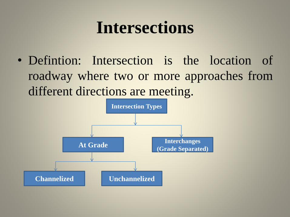
Intersections
• Defintion: Intersection is the location of
roadway where two or more approaches from
different directions are meeting.Intersection Types
At GradeInterchanges
(Grade Separated)
Channelized Unchannelized
Intersections
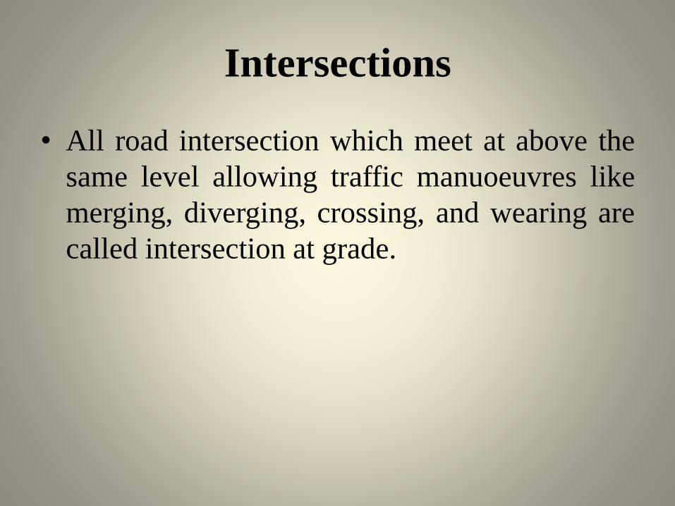
• All road intersection which meet at above the
same level allowing traffic manuoeuvres like
merging, diverging, crossing, and wearing are
called intersection at grade.

Intersections

Channelized Intersection
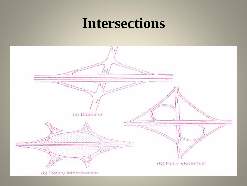
• Is acheved by introducing islands into theintersection area to reduce conflicts. Theintersection area is paved and there is absolutelyno restriction to vehicles to use any part of intersection area.
• When there is intolerable congestion andaccidents at the intersection of two highwayscarrying very heavy traffic grade seperatedintersection are provided which are known asinterchange.
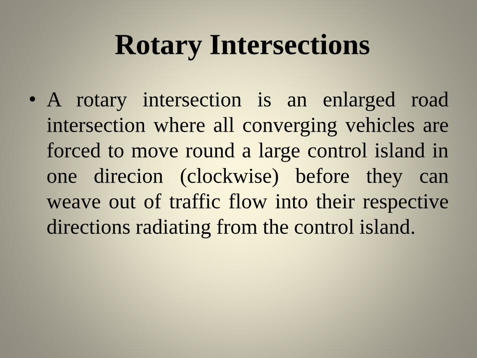
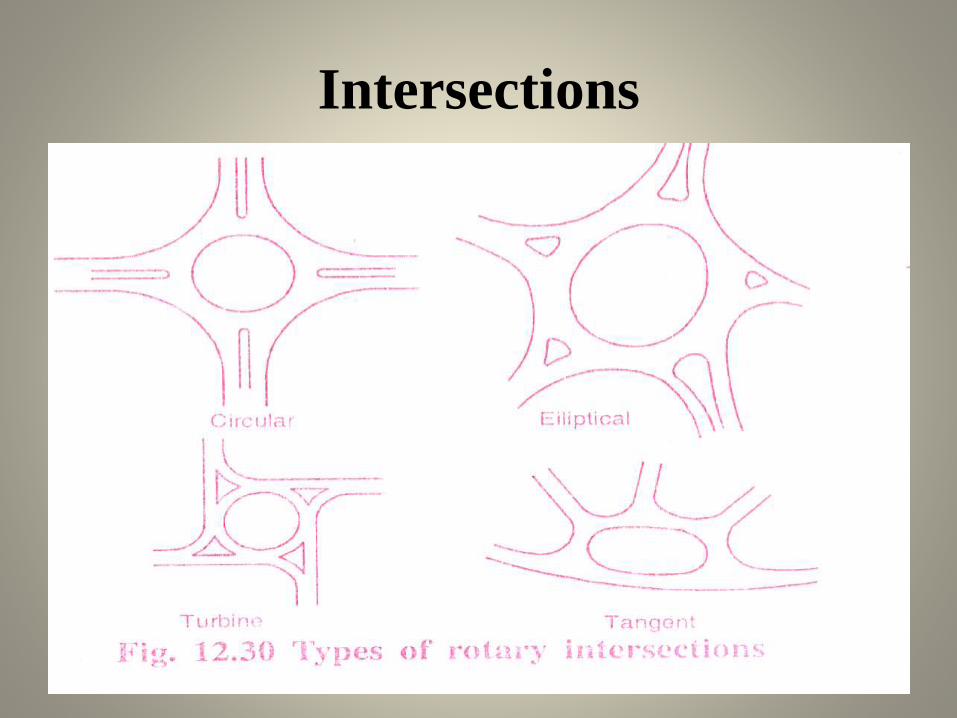
Rotary Intersections
• A rotary intersection is an enlarged road
intersection where all converging vehicles are
forced to move round a large control island in
one direcion (clockwise) before they can
weave out of traffic flow into their respective
directions radiating from the control island.

Intersections
Intersections
Intersections

Planning and Analysis
• Planning of traffic on major highways, mass transitfacilities, parking and terminal faciities are carried outas per existing data collection and need of people. Theinformation collected are analysed with respect to pasttrends and future expectations.
• Planning and Analysis is carried out in 4 stages:
• Trip Generation
• Trip Distribution
• Model Split
• Traffic Assignment
Geometric Design
• All the elements such as pavements cross
section, riding surface details, sight distance
reqirement, horizontal and vertical alignment,
manoevre areas and intersections and parking
facilities are to be suitable designed for better
performance.

Administrating and Managment
• Traffic department is administrating and
managing the traffic. Traffic police are guiding
and enforcing traffic discipline. Traffic laws
and regulations are enforced for traffic
management. Traffic engineering division
deals with improvement of road geometrics,
providing additional road facilities and
installation of suitably designed traffic control
devices.
Thanks


![Transportation Engineering - I - · PDF fileenough to Transportation Engineering - I nissan 3 URL: [1] INTRODUCTION TO TRANSPORTATION ENGINEERING Transportation](https://static.documents.pub/doc/80x56/5a8958357f8b9a4a268b45eb/transportation-engineering-i-to-transportation-engineering-i-nissan-3-url.jpg)


