Orange County’s Transportation Planning and Multimodal Corridor Plan Presentation to UCF LIFE November 11, 2014 Alissa Barber Torres, Ph.D., AICP, PLS Orange County Transportation Planning Division
Transcript
Orange County’s
Transportation Planning and Multimodal Corridor Plan
Presentation to UCF LIFE
November 11, 2014
Alissa Barber Torres, Ph.D., AICP, PLS
Orange County Transportation Planning Division
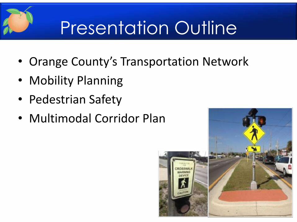
Presentation Outline
• Orange County’s Transportation Network
• Mobility Planning
• Pedestrian Safety
• Multimodal Corridor Plan
Transportation Network
Orange County’s network includes:
• 2,835 miles of roadways
• 1,671 retention ponds
• 2,800 miles of sidewalks – Build 10 to 16 miles of new sidewalk annually
– Repair 15 to 30 miles of sidewalk annually
Transportation Network
Orange County’s network includes:
• 104,650 traffic signs
• 569 traffic signals
• 220 miles of fiber optic cable for signals
• 290 school beacons and 85 flashing beacons
• 50 midblock crossings
• New speed feedback signs
Transportation Network
Transportation projects in Orange County have several sources:
• Orange County Capital Improvements Program
- Funded by impact fees, gas taxes, state/federal grants
• Florida Department of Transportation Work Program - Regional prioritization through MetroPlan Orlando
• Public-private partnerships
Transportation Network
http://www.ocfl.net/?tabid=369
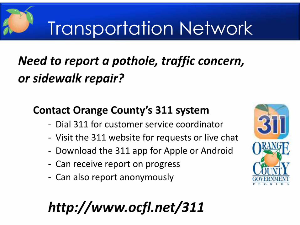
Transportation Network
Need to report a pothole, traffic concern,
or sidewalk repair?
Contact Orange County’s 311 system - Dial 311 for customer service coordinator
- Visit the 311 website for requests or live chat
- Download the 311 app for Apple or Android
- Can receive report on progress
- Can also report anonymously
http://www.ocfl.net/311
Mobility Planning
Planning for both current and future needs • Comprehensive Plan
- Goals, objectives, and policies for transportation/land use
- Long Range Transportation Plan identifies needs
• Orange County Code - Subdivision regulations
- Impact fees
• Concurrency Management System - Database ensures roadway capacity available
- Code requires “concurrent” with new development
Mobility Planning
•Public-Private Partnership Agreements − Sand Lake Road
− John Young Pkwy Interchange
− SR 50/SR 436 Interchange
− SR 417/Valencia College Lane
− SR 528/Innovation Way
Mobility Planning
• Public/Private Partnership Agreements − Enable private sector land donations and/or construction of
roadways for impact fee credits
− Over $250M in approved agreements
Calendar Year # Approved by RAC
# Approved by BCC
Value of BCC Approved
2009 23 19 $4,936,824.84
2010 16 11 $4,020,025.00
2011 18 12 $8,506,285.00
2012 21 17 $3,404,690.00
2013 15 $74,095,823.95*
Mobility Planning
• Roadway Conceptual Analysis for Corridors − New roadways/roadway changes
− Community input
− Preliminary design
− Rights of way/Retention areas
− Social/environmental analysis
− Land use
Mobility Planning
• Agency Coordination/Plan Review − Central Florida Expressway Authority: Wekiva
Parkway, BeachLine, SR 417
− Osceola County Expressway Authority: Osceola Parkway Extension, North Ranch
− Florida Department of Transportation: I-4 Ultimate Improvements, SR 50, Sand Lake Road
Mobility Planning
• GIS − Roadway mapping
− Sidewalk inventory
− Trails
• State/Local Agency Partnerships − Intersections
− Review major road improvements
− Federal grants/State grants
− Trails
Mobility Planning
Mobility Planning
• Goal to have transportation better reflect land use
• Transportation plan historically roadway-focused
• 2011 legislation removed state mandates
• Develop and implement a different approach – More urban, multimodal, safer for pedestrians/bicyclists
Mobility Planning
• Orange County Transportation Element of Comprehensive Plan
– Multimodal roadways, connectivity
– Concurrency
– Alternative Mobility Area (Concurrency Exception)
– Projects that Promote Public Transportation (Concurrency Exception)
• Recent Zoning Code updates – Pedestrian connectivity standards for development
– Enhanced bicycle parking
• Mobility Reviews of Proposed Development
−Determine availability of transit service
using LYNX data
−Assess availability of bus shelters, sidewalks, bicycle routes and other facilities, such as park and ride lots
− Identify gaps in multimodal network
Mobility Planning
Jan. 1, 2006-April 14, 2014
Pedestrian Safety
“Metro Orlando tops the list of most dangerous areas to walk this year”