Alternative Transportation in the Parks and Public Lands Program Project Proposal for Fiscal Year 2008 Funds – Planning Project Project Name (Please provide a 1-2 sentence description of the project): Mt. Baker-Snoqualmie National Forest Alternative Transportation Feasibility Study. The study will develop a range of transportation alternatives for the Mt. Baker-Snoqualmie NF (MBS) on four east – west highway corridors. The study will include: Traffic Study, Visitor Capacity Analysis, Natural Resource Condition Survey, Marketing Assessment, Transportation Alternatives, and Economic Analysis of Alternatives. The data and alternatives will be used to develop sustainable visitor and resource capacity and initiate further NEPA analysis through the subsequent development of a Transportation Plan. Proposed Funding Recipient: USDA Forest Service, Mt. Baker-Snoqualmie National Forest Public land unit(s) involved: Location of Project Mt. Baker-Snoqualmie National Forest City: Seattle, Everett, Tacoma, Enumclaw, North Bend, Snoqualmie, Monroe, Sultan, Skykomish, Bellingham, Glacier County: Pierce, King, Snohomish, Skagit, Whatcom State: Washington Congressional District: 2 and 8 Federal Land Management Agency managing Type of Planning Project: the above unit(s): (Implementation projects, please use the alternate Bureau of Land Management form) Bureau of Reclamation Planning Fish and Wildlife Service Forest Service National Park Service Proposal is to plan for a possible new alternative transportation system where none currently exists. Proposal is to plan for a possible expansion or enhancement of an existing alternative transportation system. ATPPL Funding Requested during FY 2008 Total Cost of Planning Project at Completion (All $500,000 – Approximation based on sources) comparable feasibility studies completed for $515,000 Albion Basin – Wasatch Catche National Forest and Mt. Rainier National Park Were you awarded FY 2006 of FY 2007 ATPPL funds? Yes No If answer “Yes,” please provide amount awarded: $ Do you plan to request additional ATPPL funds in future years? Yes No (Note: If you wish to compete for future ATPPL fiscal year funds you must reapply). If answer “Yes,” please specify ATPPL proposed funding levels for out years below: FY 2009 $500,000 FY 2010 Transportation Plan (NEPA) FY 2008 Funding Amounts from sources other than ATPPL funds? Yes No If answer “Yes,” please specify funding levels per source below: FY 2008 ATPPL Planning Project Proposal Page 1 of 20 U.S. Department of Transportation Federal Transit Administration
Transcript
Alternative Transportation in the Parks and Public Lands Program
Project Proposal for Fiscal Year 2008 Funds – Planning Project
BASIC PROJECT INFORMATION Project Name (Please provide a 1-2 sentence description of the project): Mt. Baker-Snoqualmie National Forest Alternative Transportation Feasibility Study. The study will develop a range of transportation alternatives for the Mt. Baker-Snoqualmie NF (MBS) on four east – west highway corridors. The study will include: Traffic Study, Visitor Capacity Analysis, Natural Resource Condition Survey, Marketing Assessment, Transportation Alternatives, and Economic Analysis of Alternatives. The data and alternatives will be used to develop sustainable visitor and resource capacity and initiate further NEPA analysis through the subsequent development of a Transportation Plan. Proposed Funding Recipient: USDA Forest Service, Mt. Baker-Snoqualmie National Forest
Public land unit(s) involved: Location of Project Mt. Baker-Snoqualmie National Forest City: Seattle, Everett, Tacoma, Enumclaw, North
Bend, Snoqualmie, Monroe, Sultan, Skykomish, Bellingham, Glacier County: Pierce, King, Snohomish, Skagit, Whatcom State: Washington Congressional District: 2 and 8
Federal Land Management Agency managing Type of Planning Project: the above unit(s): (Implementation projects, please use the alternate
Bureau of Land Management form) Bureau of Reclamation Planning Fish and Wildlife Service Forest Service National Park Service
Proposal is to plan for a possible new alternative transportation system where none currently exists. Proposal is to plan for a possible expansion or enhancement of an existing alternative transportation
system. ATPPL Funding Requested during FY 2008 Total Cost of Planning Project at Completion (All $500,000 – Approximation based on sources) comparable feasibility studies completed for $515,000 Albion Basin – Wasatch Catche National Forest and Mt. Rainier National Park Were you awarded FY 2006 of FY 2007 ATPPL funds? Yes No If answer “Yes,” please provide amount awarded: $
Do you plan to request additional ATPPL funds in future years? Yes No (Note: If you wish to compete for future ATPPL fiscal year funds you must reapply). If answer “Yes,” please specify ATPPL proposed funding levels for out years below: FY 2009 $500,000 FY 2010 Transportation Plan (NEPA) FY 2008 Funding Amounts from sources other than ATPPL funds? Yes No If answer “Yes,” please specify funding levels per source below:
FY 2008 ATPPL Planning Project Proposal Page 1 of 20
U.S. Department of Transportation Federal Transit Administration
State $10,000 Federal (other than Private sources $5,000 Local $ ATPPL) $
CONTACT PERSON Name: Aleta Eng Phone: 425-783-6017
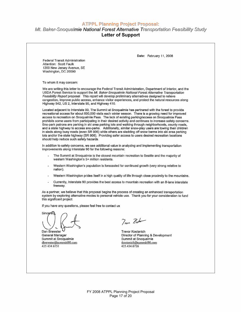
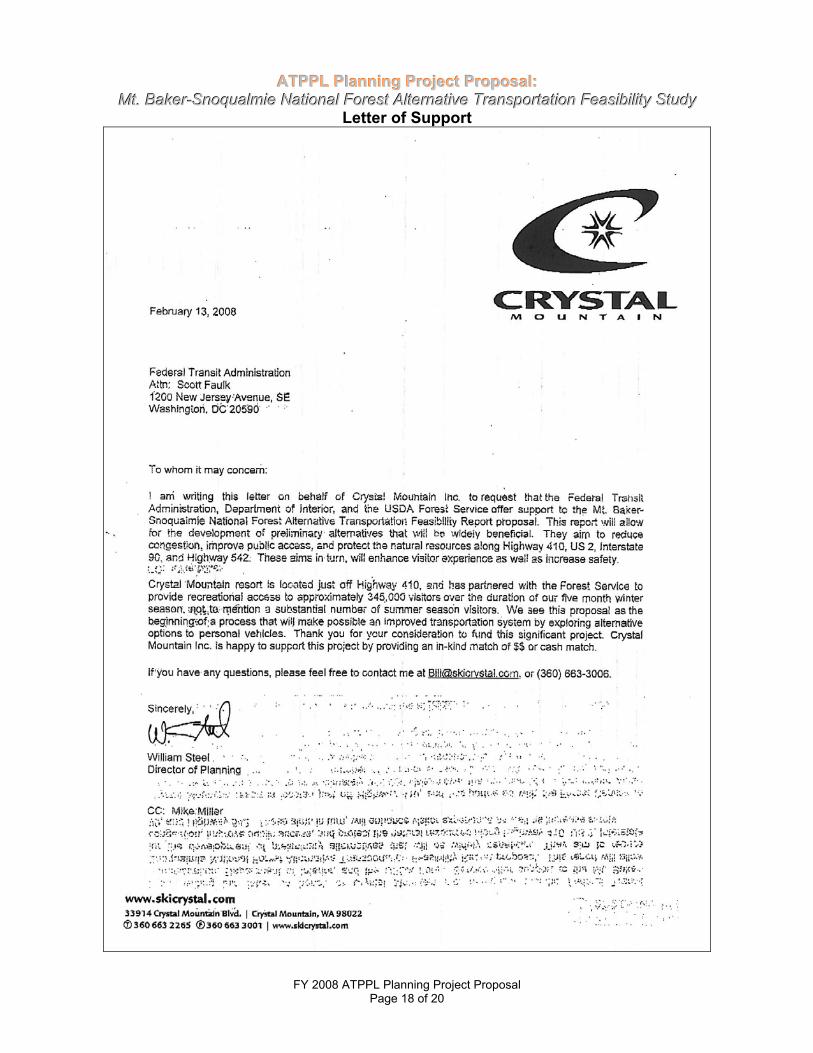
OTHER PROJECT SPONSORS (in addition to funding recipient) Listed are partners who have participated in the 2007 TAG meeting as well as other organizations that will participate in future planning. They include Washington Department of Transportation (WSDOT), National Park Service, Mountains to Sound Greenway, Community Transit (Snohomish County), King County Metro, Pierce County Transit, Enumclaw Chamber of Commerce, Whatcom Council of Governments, Stevens Pass Ski Area, Summit at Snoqualmie Ski Area, and the Crystal Mountain Ski Area
REQUIREMENTS If a State, Tribal, or local government entity is proposing the project, the applicant has contacted the
manager of the federal land unit(s) and has the consent of the Federal land management agency or agencies affected.
The project is consistent with the metropolitan and statewide planning process. The project is consistent with agency plans. The planning project will analyze all reasonable alternatives, including a non-construction option.
BASIC PROJECT DATA Number of Visitors: 5,200,000 forest-wide Daily Number of Visitors (Peak season): Winter Visitors: 1,700,000 on 4 corridors Average Winter Season on 4 corridors: 11,000 Summer Visitors: 2,300,000 on 4 corridors Average Summer Season on 4 corridors: 15,000 Average Number of Vehicles per Day at Peak Visitation: State Highway 542 Interstate 90 Average Winter Daily: 2,300 Average Winter Daily: 25,000 Average Summer Daily: 4,700 Average Summer Daily: 32,000 US Highway 2 State Highway 410 Average Winter Daily: 3,500 Average Winter Daily: 1,300 Average Summer Daily: 7,250 Average Summer Daily: 2,600 Current Road Level of Service at Peak Visitation: Fair (Please consult guidance where available on determining this variable. You may use observational accounts or pictures to provide an assessment of this datum for FY 2008 proposals). What time of the year does your land unit experience Peak Visitation?
Spring Summer Fall Winter Current Carrying Capacity of Existing Roads: Data provided by WSDOT State Highway 542: 32,000 (vehicles/day), US Highway 2: 32,000 (vehicles/day) Interstate 90: 108,000 (vehicles/day), State Highway 410: 32,000 (vehicles/day) What percent of that capacity is the site operating at during peak periods?
FY 2008 ATPPL Planning Project Proposal Page 2 of 20
FY 2008 ATPPL Planning Project Proposal Page 3 of 20
State Highway 542 Winter: 7% Summer: 15% US Highway 2 Winter: 11% Summer: 23% Interstate 90 Winter: 23% Summer: 30% State Highway 410 Winter: 4% Summer: 8% Current parking shortages during peak visitation at recreation locations throughout the four corridors Winter: 2,000 Summer: 3,000 Current Number of Persons who use the alternative transportation system (if one already exists) at peak visitation: Winter: Current use for private buses leading to ski area is very low. Stevens Pass Ski Area operates a visitor and employee transit. The visitor shuttle transported 6,680 riders in 2002-2003 winter season. Summer: No public transportation Estimated Annual Number of Persons who will use the alternative transportation system at project completion: 500,000 (anticipated number of riders or users/annually) Average number of auto collisions with wildlife in the area? The WSDOT provided collision (with deer, bear, elk, etc.) information for a 3 year period from 1/1/05 to 12/31/07. State Highwy 542: 0 wildlife collisions US Highway 2: 76 wildlife collisions Interstate 90: 145 wildlife collisions State Highway 410: 27 wildlife collisions
Executive Summary With over 1.7 million acres that extends 140 miles from the Canadian border down to Mt. Rainier National Park, the Mt. Baker-Snoqualmie National Forest (MBS) receives 5.2 million visitors annually. The MBS is one of the most heavily visited forest units in the USDA Forest Service Region 6 which encompasses the Pacific Northwest. Approximately half of the visitors come from Washington State; about 10 percent are international. Approximately 62% (3.63 million people) live in the Puget Sound region, within 70 miles from the forest. An additional 1.5 million people living in the Vancouver British Columbia Metropolitan area also are within easy reach of the northern part of the forest. With the Puget Sound population expected to reach 5.2 million by 20251, there is urgency for the Forest Service to protect the forest ecosystem while enhancing the visitor experience through high quality recreational opportunities. The MBS provides access to the rugged and scenic Cascade Mountain range, rich wildlife and fisheries, diverse plant life, and historical landmarks. Visitors can quickly escape the urban environment and immerse themselves in a multitude of year-round recreational activities including skiing/snowboarding, snowshoeing, climbing, hiking, kayaking, fishing, wildlife viewing, scenic driving, biking, hunting, and camping. The Mt. Baker-Snoqualmie National Forest Alternative Transportation Feasibility Study will analyze four east- west corridors, Mt. Baker Highway (State Highway 524), Stevens Pass Greenway (US Highway 2), Mountains to Sound Greenway (Interstate 90), and Chinook Scenic Byway (State Highway 410). Each corridor supports year-round vehicle passage and provides access to 22 campgrounds and picnic areas, 124 trails, and 4 major ski areas. The four corridors provide approximately 100 miles of access through the MBS. In addition, Hwy 410 provides entry to our heavily visited neighbor, Mt. Rainier National Park. Due to limited winter transportation and no summer options, visitors primarily use personal vehicles to access recreational opportunities on the forest. Along these corridors, traffic congestion is especially heavy during winter and summer weekends. With pressures of increased visitation, there is concern that continuing to build for increased capacity (e.g. road and parking infrastructure) will attract more vehicles without reducing congestion in the long term. The Forest Service is committed to engaging urban America by expanding opportunities to underserved communities (limited English speaking, senior citizens, individuals with disabilities, low-income groups, and the youth). Transportation alternatives can break barriers by providing affordable access to physical, recreational, and interpretive opportunities for educational institutions, youth programs, as well as other social and environmental service organizations. Automobiles can negatively impact the forest ecosystem through reduced water quality, harm to vegetation and wildlife, access to historical resources, air pollution, and noise pollution. Watershed health is crucial in supporting the Pacific Salmon, which are ecologically and economically central to the Puget Sound area. Portions of the watersheds provide drinking water to municipalities of Seattle, Tacoma, Everett, and smaller Puget Sound communities. Native vegetation can be trampled while invasive weeds can be dispersed through seeds tracked on vehicle tires. Direct mortality from collisions with motor vehicles is a major concern for wildlife vitality. As forest visitation grows, the potential for exposure of these sensitive areas also increases. A main source for greenhouse gases contributing towards global climate change can be attributed to vehicle emissions. Alternative transportation can reduce negative impacts to the ecosystem. The Mt. Baker-Snoqualmie National Forest Alternative Transportation Feasibility Study will propose innovative collaborative solutions to relieve traffic congestion, improve visitor access, enhance visitors experience, reduce pressure for increasing vehicle capacity, improve public safety, reduce contributions to global climate change and protect the forest ecosystem. A Traffic Study, Visitor Capacity Analysis, Natural Resource Condition Survey and Marketing Assessment will be completed and used to formulate potential alternatives. The Economic Analysis of each alternative will examine costs for each alternative. The alternatives will be used to initiate NEPA analysis for the next separate planning phase. The study also provides a unique opportunity to cooperate with state and local municipalities’ efforts to reduce traffic congestion, global climate change, and improve accessibility through the comprehensive planning for transit
1 Puget Sound Partnership. Accessed at www.psp.wa.gov/puget_sound/psfacts.htm#population.
FY 2008 ATPPL Planning Project Proposal Page 4 of 20
Page 5 of 20
mode alternatives. The study can identify opportunities to partner with existing transportation services. Forest Service has obtained Puget Sound regional support to explore alternative transportation on MBS.
Project Description
The goal of this project is to utilize a traffic study, visitor capacity analysis, natural resource condition survey, and marketing assessment to develop preliminary alternatives that will balance recreation and the protection of the forest ecosystem through an alternative transportation system. These alternatives will be used to initiate public involvement and conduct a NEPA analysis as a separate subsequent planning phase. The MBS presents an opportunity to serve as a model for implementing alternative transportation in a high-use urban forest. An interagency Transportation Assistance Team (TAG) conducted a preliminary study of the corridors (excluding Hwy 542) in September 2007 to provide technical assistance to the MBS and its partners. The TAG was comprised of individuals form the Federal Transit Administration, Federal Highways Administration, US Department of Transportation (Volpe National Transportation Systems Center), National Park Service, and Forest Service. The TAG team provided a final report recommending a number of additional transportation studies and planning needs for the MBS. Among their recommendations:
“..There is a need to consolidate and update all relevant information in order to produce a single, strategic vision for transportation in and around Mt. Baker-Snoqualmie National Forest, focusing on the corridors and taking account of recent data, developments, plans, partnerships, and other information. Therefore, the TAG’s primary overall recommendation is to apply to the Alternative Transportation in Park and Public Lands (ATPPL) Program for FY2008 funds for a comprehensive transportation planning study….”
Based on the TAG recommendations, the planning project will include:
1. Traffic Study: Evaluate the current transportation system along the corridors, circulation, infrastructure, seasonal variation, and physical capacity.
2. Visitor Capacity Analysis: Analyze the transportation system, visitor use levels within the four corridors,
travel patterns, demographics, and visitor preferences as they relate to critical natural resource protection.
3. Natural Resource Condition Survey: Compile existing and collect additional data and plans needed to
delineate sensitive areas and resource issues within the four corridors and relationship to the existing transportation system.
National Park, WSDOT, etc.) and develop preliminary strategies to successfully market use of alternative transportation.
5. Range of Alternatives: Utilize studies 1-4 to develop preliminary alternatives for managing
transportation and visitor use on the Mt. Baker-Snoqualmie National Forest. Alternatives, including “No Action,” could include ideas such as regulating travel on roads, changes to trail system, and utilization of alternative transportation ideas such as buses, vans, shuttles, and rail lines. These alternatives will be used to initiate a NEPA analysis for a future separate planning phase.
6. Economic Analysis: Evaluate costs for operations, capital investments, impact mitigation, monitoring,
and funding opportunities of each alternative. The analysis will also incorporate options affordable to underserved communities.
FY 2008 ATPPL Planning Project Proposal
Planning Justification
1. Demonstration of Need
a. Visitor mobility and experience: The Forest Service is challenged with sustaining high quality outdoor recreation experiences to meet public requirements while maintaining the ecological integrity of national forest and grasslands. The combination of the increasing Puget Sound population and continued decline of public access to privately owned forest land create extensive pressure on the MBS to provide more recreational opportunities. An alternative transportation system can support the USDA Forest Service Strategic Plan FY 2007-2012 Goal 4, “sustain and enhance outdoor recreation opportunities”. The condition of land, recreation facilities, and transportation infrastructure must be considered to preserve high-quality visitor experiences. The Mt. Baker, Stevens Pass, Summit at Snoqualmie, and Crystal Mountain ski areas are privately owned and operate under the terms and provisions of s Special Use Permit (SUP) issued by the USFS. Currently, there is limited winter alternative transportation (e.g. private ski buses at all four ski areas, and employee/visitor bus system to Stevens Pass Ski Area) and no summer public transportation system to access the MBS. As a result of limited transportation options and a growing Puget Sound population, must utilize private vehicles to access the forest. Unfortunately, this has limited enjoyment of the forest to individuals with access to automobiles. The Forest Service is committed to engaging urban America2 by expanding opportunities to underserved communities (limited English speaking, senior citizens, individuals with disabilities, low-income groups, and the youth). For the past two years, the USFS has emphasized connecting youth to nature, through the “More Kids in the Woods” Challenge Cost Share Program. Transportation alternatives can break barriers by providing affordable access to physical, recreational, and interpretive opportunities for educational institutions, youth programs, as well as other social and environmental service organizations.
In May 24, 2007 testimony before the US House of Representatives Committee on Natural Resources Chief Gail Kimbell explained the importance of connecting with the next generation of conservation leaders.
"...The National Forests and Grasslands are the natural backyards for many communities throughout the 46 States that have National Forest System lands. These lands and our infrastructure of trails, roads and recreation facilities provide opportunities for solace and solitude, challenge and risk, hunting and fishing opportunities, outlets for keeping physically fit, and represent an important conduit for society's connection to nature.
Yet, even with the resources that we are devoting to this issue we still see perhaps one of the biggest threats to our nation's forests and grasslands is environmental illiteracy. As our country becomes increasingly diverse and urban, most of America’s children grow up with little connection to the natural world. Research showing us the benefits of connecting our children with nature and the health benefits of outdoor activities, requires us to examine approaches that will encourage greater participation in outdoor activities.” Within a winter period of five months, a majority of the 1.7 million visitors visit the four ski areas. The combination of hazardous winter conditions, range of winter driving skills, lack of real-time traffic information, heavy traffic congestion, and pedestrians crossing highways3 can result in numerous vehicular accidents. This has especially been true for US 2, designated a Safety Corridor in 2007 by Washington State Governor Christine Gregoire. Parking at ski areas can reach full capacity when skiing
2 Goal 6. Engage Urban America with Forest Service Programs, USDA Forest Service Strategic Plan 2007-2012 3 Review Exhibit 2: Project Photos, photo of pedestrians crossing US 2
FY 2008 ATPPL Planning Project Proposal Page 6 of 20
conditions are favorable on weekends and holidays. When parking is at capacity, thousands of visitors are forced to turn around, wait for a free spot, or continually drive through parking lots. This can cause traffic delays and negatively impact the visitors’ experience. Peak summer visitation is especially high during weekends and holidays. Approximately 2.3 million visitors access the forest for a multitude of opportunities. It is not unusual for congestion to be extremely heavy along these corridors due to a combination of forest visitation and east-west passage traffic. When existing parking is at capacity at trailheads, visitors will park along roadsides (shoulder), trampling vegetation and compacting soil. These actions can negatively impact the forest ecosystem and visitor experience. In addition, safe access for other transportation modes - bicyclists riding on shoulders of highways and pedestrians crossing highways, are a concern along Hwy 542, US 2, and HWY 410. Designated as National Scenic Byway, US Highway 2, Interstate 90, and State Highway 410 (All American Road), have been recognized by the US Department of Transportation for their cultural, historical, natural, recreational, and scenic qualities. State Highway 542 is recognized as a USDA Forest Service Scenic Byway. Due to the distinctive characteristics of the corridors, millions of visitors experience the MBS by driving through the scenic highways. The development of an alternative transportation system will assist agencies and partners to protect the qualities that make each corridor unique while providing an option for visitors to enjoy the scenery outside of their cars. With pressures of increased visitation, there is concern that continuing to build for increased capacity (e.g. road and parking infrastructure) will attract more vehicles without reducing congestion in the long term.4 Alternative transportation can alleviate pressures to build capacity while improving safety, relieving congestion, improving access, and protecting the forest ecosystem. Visitor experience can increase through efficient travel times and ability to enjoy a scenic drive without the pressure of navigating the hazardous conditions. In addition, Hwy 410 provides access to Mt. Rainier National Park visitors. Recognizing collaborative opportunities, Mt. Rainier National Park and the MBS are partnering with other agencies to develop an interagency welcome center at the entry of Hwy 4105. Transportation planning provides an opportunity to expand collaborative transportation opportunities with the Park.
ronmental condition as a result of the existing transportation system: Watershed According to Objective 1.5 of the USDA Forest Service Strategic Plan FY 2007-2012, the agency will restore and maintain healthy watersheds and diverse habitats. High vehicle use can threaten MBS watersheds through the potential release of chemicals and sediment into the watershed. Watershed health is crucial in supporting all five Pacific Salmon species, which are ecologically and economically central to the Puget Sound area. Portions of the watersheds provide drinking water to municipalities of Seattle, Taco
Watersheds oSouth Fork Sprime concerGregoire, the organizations member for th
ma, Everett, and smaller Puget Sound communities.
riginating along the 4 corridors, the North Fork of the Nooksack River, Skykomish River, noqualmie River, and the White River Watersheds flow into the greater Puget Sound. Of n are the impacts to Puget Sound area. Mandated by Washington State Governor Christine Puget Sound Partnership was created in 2006 to mobilize communities, agencies and to create a comprehensive Action Agenda to restore Puget Sound by 2020. As an agency e Puget Sound Federal Caucus, the Forest Service and other agencies are coordinating
efforts in research and resource management programs. According to the 2007 Puget Sound Federal Caucus Memorandum of Understanding, agencies including the USFS will complete scientific investigations, species recovery, habitat restoration and protection, and land and resource management6. The Forest Service plays a critical role in raising public attention to the upstream benefits produced on National Forests. By beginning the process of exploring and analyzing alternative transportation systems,
b. Envi
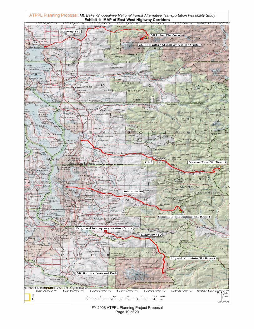
4 Anthony Downs, Still Stuck In Traffic: Coping With Peak-Hour Traffic Congestion n Traffic (Washington: Brookings Institution Press, 2004), 300-302. 5 Exhibit 1: MAP of East-West Highway Corridors, indicates locations of proposed Interagency Visitor Center location 6 Puget Sound Federal Caucus Agencies include EPA, USGS, NOAA, USFS, NPS, NRCS, USFS, and Navy Region NW
FY 2008 ATPPL Planning Project Proposal Page 7 of 20
the forest is emphasizing efforts to reduce the impacts of vehicles in watersheds that support Puget Sound. Efforts are underway to reduce urban vehicle use through the development of Light Rail7 and other enhanced transit services. Comprehensive planning of an alternative transportation system and mitigation measures can decrease these impacts. In addition, MBS watersheds are crucial in providing renewable energy for the public. The Forest Service has long-standing agreements with the City of Seattle and Puget Sound Energy to cooperatively provide hydroelectric-generated energy to millions of residents throughout the Puget Sound area. Vegetation The Chief of the USDA Forest Service has identified invasive species as one of the four critical threats to our Nation’s ecosystems. According to the 2004 USDA Forest Service National Strategy and Implementation Plan for Invasive Species Management Plan, the first program element is to prevent the introduction and spread of invasive species. Invasive species such as knapweed, hawkweed, knotweed, and thistle are abundant along roads and adjacent to campgrounds throughout the forest. Many of these weeds can be dispersed through seeds tracked on vehicle tires. USDA Forest studies such as Backcountry Road Maintenance and Weed Management8 are being conducted to analyze the correlation between veand compacinvasive speand pressur
Wildlife Loss of habimajor conceWashington:
hicles and the spread of invasive weeds. In addition, visitors can trample native vegetation t soil when vehicles overfill built parking. A transportation system can minimize the spread of cies as well as destruction of native vegetation through the reduction of personal vehicle use e to build more infrastructures to increase vehicle capacity.
tat, isolation of small populations, and direct mortality from collisions with motor vehicles are rns for wildlife. The USDA Forest Service Landscape Permeability for Large Carnivores in A Geographic Information System Weighted-Distance and Least-Cost Corridor Assessment9
indicates that highway can reduce viability of populations through decrease in movement, mortality from motor vehicles collisions, increase human disturbance, and decrease availability of food or other resources by acting as barriers. With expected forest use to increase, more vehicles will increase potential for collision with wildlife like the black tailed deer, black bear, and elk. Transportation options can decrease negative impacts to wildlife by alleviating pressure to build further infrastructure to increase vehicl
Air a
e capacity and actually reduce the number of vehicles that access the MBS.
nd Noise Pollution Air pollution from emissions is especially high during periods of heavy congestion along the corridors (high peak use days in winter and summer). Gases contributing towards global climate change can be attributed by vehicle emissions. USDA Forest Service studies such as Warming and Earlier Spring Increase Western U.S. Forest Wildfire Activity10 are being conducted to analyze the correlation between global climate change and effects to forest fires and ecosystem health. Industry and vehicle emissions can also contribute towards the development of acid rain harming vegetation and fisheries in mountain lakes and rivers. Noise pollution caused by traffic congestion and people can detract from the recreation experience and may impact wildlife. These issues also need to be addressed as part of the resource survey. impacts
Historic Resour
A transportation straditional cultural
An alternative transportation system can assist in reducing emissions may help to minimize these .
ces
ystem has the ability manage for potential impacts to historical places, sacred sites, and practices. As forest visitation grows, the potential for exposure of these sensitive areas
8 Ferguson, L.; Duncan, C.; Snodgrass, K. 2003. Backcountry Road Maintenance and Weed Management. USDA Forest Service Technology and Development Program, 1-18. 9 Singleton, P; Gains, W; and Lehmkuhl, J. 2002. Landscape Permeability for Large Carnivores in Washington: A Geographic Information System Weighted-Distance and Least-Cost Corridor Assessment. USDA Forest Service, pg. 1-4 10 Westerling, A.L.; Hidalgo, H.G.; Cayan, D.R.; Swetnam, T.W. 2006. Warming and Earlier Spring Increase Western U.S. Forest Wildfire Activity. Science, Vol. 313: 940-843.
FY 2008 ATPPL Planning Project Proposal Page 8 of 20
also increases. According to Executive Order No. 13007: Indian Sacred Sites, Federal land management agencies will avoid adversely affecting the physical integrity of sacred lands. The transportation planning process will reduce potential impacts by steering forest access away from sites.
Scope of Work and Methodology 2. Methodology for Assessing - Visitor Mobility & Experience Benefits of Project
a. Reduced traffic congestion:
The project’s scope includes a Traffic Study, Visitor Capacity Analysis, and Marketing Assessment. The Traffic Study will examine the current infrastructure of transportation system, seasonal variation and physical capacity within the corridor. The Visitor Capacity Analysis will examine current visitor demographics, use, preferences, and travel patterns. The Marketing Assessment will seek to obtain feedback from stakeholders concerning collaborative opportunities and marketing strategies. Based on information obtained, potential alternatives will be developed.
b. Enhanced visitor mobility, accessibility, and safety:
Reducing the number of vehicles on the corridors will improve safety for other drivers as well as pedestrians and bicyclists that utilize highways in midst of traffic. Year-round emergency access will be improved by reducing congestion. Due to minimal winter transit options and no summer options, access is limited to people with the economic means and knowledge of the forest. By exploring alternative transportation, the forest is committed to improving affordable accessibility to underserved populations (e.g. low-income, limited English speaking, individuals with disabilities, and youth).
Improved visitor education, recreation, and health benefits: An alternative transportation option of utilizing mass transit on the corridors to transport visitors will provide an excellent opportunity increase educational opportunities. The MBS can provide brochures and interpretive services for riders that discuss minimal recreation impact, riparian protection, trail information, wildlife, history, and invasive plant species. In addition, improved accessibility to Visitor Information Centers and Ranger Districts allow closer interaction with USFS personnel to explore recreational and interpretive services offered. Improved education can enhance the visitor experience, help protect the forest ecosystem, and add value to the transportation option. By expanding access to the public, alternative transportation allows more people the opportunity to enjoy recreational and physical activities in the MBS. The Economic Analysis will need to take into account affordable transportation opportunities that can expand use to underserved communities. The Marketing Assessment will develop effective outreach methods that will attract alternative transportation ridership.
3. Methodology for Assessing - Environmental Benefits of Project
a. Protection of sensitive natural, cultural, and historical resources:
The Natural Resource Condition Survey will compile existing resource data and research to identify ecological, historical, and cultural areas of concern. For example, an improved transportation system will route visitors away from critical wildlife habitat and sacred sites. Visitor Capacity Analysis and Condition Survey will be used to identify a level of visitation that ensures resource sustainability with consideration to current and expected use.
b. Reduced pollution: The Natural Resource Condition Survey will compare emissions between different modes of transportation based on data and research compiled. Visual quality impacts will be addressed in alternatives primarily as they relate to traffic congestion and any recommended traffic signage. Research and data produced by the Puget Sound Federal Caucus can also be used in the survey.
FY 2008 ATPPL Planning Project Proposal Page 9 of 20
4. Methodology for Assessing - Operational Efficiency and Financial Sustainability
a. Operational efficiency: The Mt. Baker-Snoqualmie National Forest Alternative Transportation Feasibility Study will develop alternatives that meet forest management objectives (e.g. watershed, wildlife, vegetation, partnerships, etc.). This will include a “No Action” alternative. In addition, alternatives must be consistent with cooperating agencies plans (e.g. Washington Department of Transportation and local municipalities). The degree to which various alternatives meet management objectives will be studied through NEPA analysis within the subsequent planning phase.
b. Financial feasibility:
The Economic Analysis component of this study will provide costs for alternatives including operations, capital purchases, implementation costs, and revenue sources.
c. Cost effectiveness: Cost effectiveness will be addressed in the Economic Analysis of the alternatives. A key component of the analysis is to propose financially sustainable transportation system alternatives.
d. Partnerships and funding from other sources: Several partners have provided letters of support for the proposed Mt. Baker-Snoqualmie National Forest Alternative Transportation Feasibility Study. The Forest Service has agreements with agencies and partners that have an invested interest on the four corridors accessing the MBS. Washington Department of Transportation and the Stevens Pass Ski Area have contributed cash and in-kind matching funds totaling $15,000. Based on intergovernmental and partner cooperation in managing the forest, the MBS expects that partners will assist with needs and support during the course of this study and subsequent planning.
FY 2008 ATPPL Planning Project Proposal Page 10 of 20
FY 2008 ATPPL Planning Project Proposal Page 11 of 20
FY 2008 ATPPL Planning Project Proposal Page 19 of 20
AATTPPPPLL PPllaannnniinngg PPrrooppoossaall:: Mt. Baker-Snoqualmie National Forest Alternative Transportation Feasibility StudyExhibit 1: MAP of East-West Highway Corridors
FY 2008 ATPPL Planning Project Proposal Page 20 of 20
Stevens Pass Highway shows minimal vehicle use in 1926 prior to the creation of US 2.
Middle photo: Stevens Pass Ski Area traffic congestion eastbound on US 2. The ski area receives over 400,000 visitors each year. Right photo: Pedestrians crossing US 2 to reach ski area or their parked vehicles. Visitation of all four ski areas total 1.5 million annually.
Mt. Baker, Mt. Shuksan, and alpine meadows attract more than 150,000 visitors to Heather Meadows each summer (located at end of Highway 542). In the winter, the Mt. Baker Ski area also attracts more than 150,000 visitors.
Eastbound traffic congestion on Interstate 90 just east of Snoqualmie Pass at the Snoqualmie Ski Area Summit. Photo courtesy of WSDOT
Mt. Baker Snoqualmie National Forest watersheds support the health of the Puget Sound. Photo courtesy of The City of Seattle
Mt. Rainier National Parkand the Crystal Mountain Ski area are both accessed by Hwy 410. Like the MBS, Mt. Rainier receives millions of visitors each summer. We will continue to develop collaborative opportunities with the park. Photo courtesy of Mt. Rainier National Park