Physical density Physical density is a numerical measure of the concentration of individuals or physical structures within a given geographical unit. It is an objective, quantitative and neutral spatial indicator. However, in practice, physical density takes on a real meaning only if it is related to a specified scale of reference. For instance, density expressed as ratio of population to land area can vary significantly with reference to different scales of geographical unit. Take Hong Kong as an example: if the land area of the whole territory is taken into account, the overall population density in Hong Kong is about 6300 persons per square kilometre. However, only about 24 per cent of the total area in Hong Kong is built up. Therefore, if the geographical reference is confined to built-up land, then the population density will be about 25,900 individuals per square kilometre, which is four times the overall density of the territory. Hence, it is important that the scales of geographical references be explicitly defined in density calculation, otherwise comparison of density measures will be difficult. Nevertheless, there is no standard measure of density; there are only measures that are more widely used than others. In town planning, measurement of physical density can be broadly divided into two categories: people density and building density. People density is expressed 1 Understanding Density and High Density Vicky Cheng The word ‘density’, although familiar at first glance, is a complex concept upon closer examination. The complexity mainly stems from the multitude of definitions of the term in different disciplines and under different contexts. This chapter attempts to untangle the intricate concepts of density according to two perspectives – namely, physical density and perceived density. A thorough comprehension of these two distinct concepts of density will serve as a basis for understanding the meaning of high density. Hopefully, this chapter will establish the ground for the discussions in later chapters on the design of high-density cities with respect to the timeliest social and environmental issues. Source: Vicky Cheng Figure 1.1 People density
Transcript
Physical density
Physical density is a numerical measure of theconcentration of individuals or physical structureswithin a given geographical unit. It is an objective,quantitative and neutral spatial indicator. However, inpractice, physical density takes on a real meaning onlyif it is related to a specified scale of reference.
For instance, density expressed as ratio ofpopulation to land area can vary significantly withreference to different scales of geographical unit. TakeHong Kong as an example: if the land area of the wholeterritory is taken into account, the overall populationdensity in Hong Kong is about 6300 persons per squarekilometre. However, only about 24 per cent of the totalarea in Hong Kong is built up. Therefore, if thegeographical reference is confined to built-up land,then the population density will be about 25,900individuals per square kilometre, which is four timesthe overall density of the territory. Hence, it isimportant that the scales of geographical references beexplicitly defined in density calculation, otherwisecomparison of density measures will be difficult.
Nevertheless, there is no standard measure of density;there are only measures that are more widely used than
others. In town planning, measurement of physicaldensity can be broadly divided into two categories: peopledensity and building density. People density is expressed
1Understanding Density and High Density
Vicky Cheng
The word ‘density’, although familiar at first glance, is a complex concept upon closer examination.The complexity mainly stems from the multitude of definitions of the term in different disciplines andunder different contexts. This chapter attempts to untangle the intricate concepts of density accordingto two perspectives – namely, physical density and perceived density. A thorough comprehension ofthese two distinct concepts of density will serve as a basis for understanding the meaning of highdensity. Hopefully, this chapter will establish the ground for the discussions in later chapters on thedesign of high-density cities with respect to the timeliest social and environmental issues.
Source: Vicky Cheng
Figure 1.1 People density
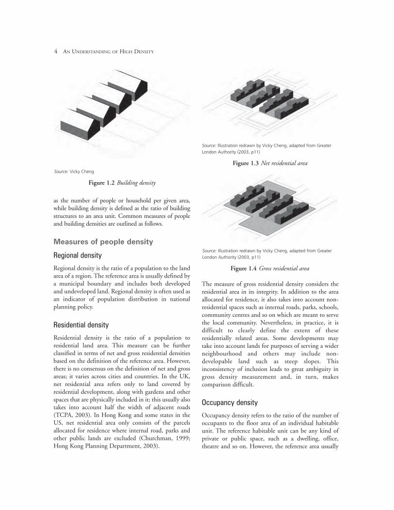
as the number of people or household per given area,while building density is defined as the ratio of buildingstructures to an area unit. Common measures of peopleand building densities are outlined as follows.
Measures of people density
Regional density
Regional density is the ratio of a population to the landarea of a region. The reference area is usually defined bya municipal boundary and includes both developedand undeveloped land. Regional density is often used asan indicator of population distribution in nationalplanning policy.
Residential density
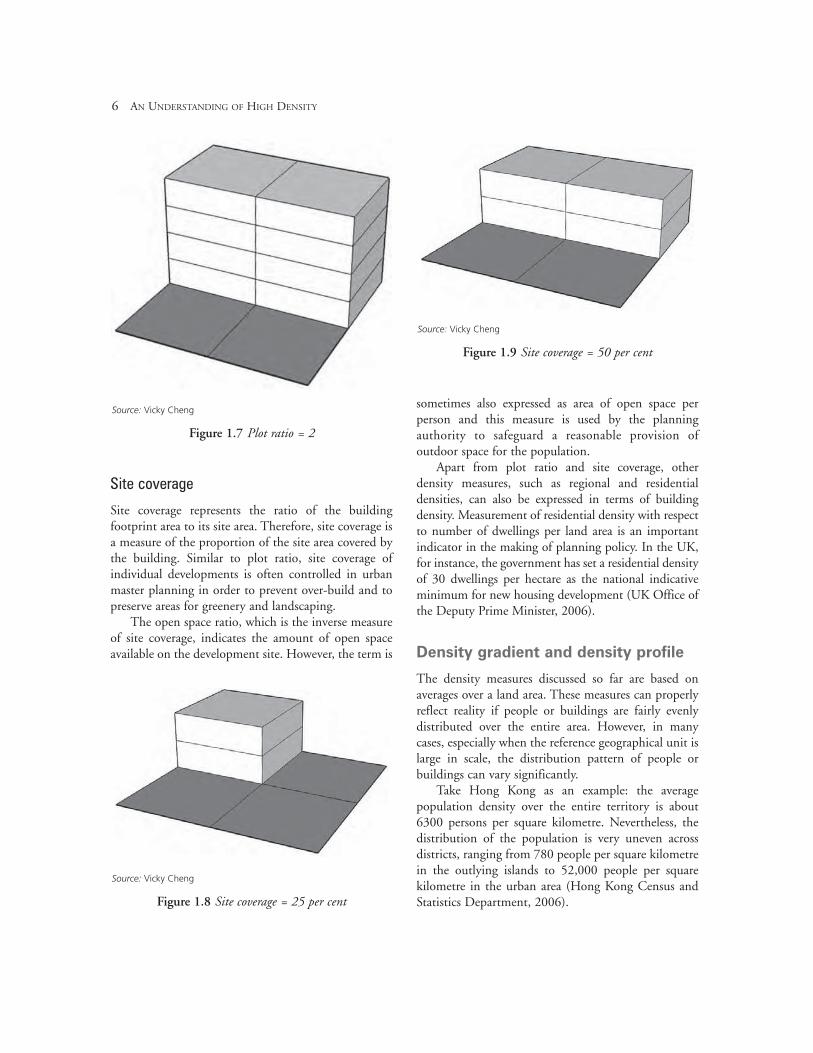
Residential density is the ratio of a population toresidential land area. This measure can be furtherclassified in terms of net and gross residential densitiesbased on the definition of the reference area. However,there is no consensus on the definition of net and grossareas; it varies across cities and countries. In the UK,net residential area refers only to land covered byresidential development, along with gardens and otherspaces that are physically included in it; this usually alsotakes into account half the width of adjacent roads(TCPA, 2003). In Hong Kong and some states in theUS, net residential area only consists of the parcelsallocated for residence where internal road, parks andother public lands are excluded (Churchman, 1999;Hong Kong Planning Department, 2003).
The measure of gross residential density considers theresidential area in its integrity. In addition to the areaallocated for residence, it also takes into account non-residential spaces such as internal roads, parks, schools,community centres and so on which are meant to servethe local community. Nevertheless, in practice, it isdifficult to clearly define the extent of theseresidentially related areas. Some developments maytake into account lands for purposes of serving a widerneighbourhood and others may include non-developable land such as steep slopes. Thisinconsistency of inclusion leads to great ambiguity ingross density measurement and, in turn, makescomparison difficult.
Occupancy density
Occupancy density refers to the ratio of the number ofoccupants to the floor area of an individual habitableunit. The reference habitable unit can be any kind ofprivate or public space, such as a dwelling, office,theatre and so on. However, the reference area usually
4 AN UNDERSTANDING OF HIGH DENSITY
Source: Vicky Cheng
Figure 1.2 Building density
Source: Illustration redrawn by Vicky Cheng, adapted from Greater
London Authority (2003, p11)
Figure 1.3 Net residential area
Source: Illustration redrawn by Vicky Cheng, adapted from Greater
London Authority (2003, p11)
Figure 1.4 Gross residential area
refers only to an enclosed area. Occupancy density is animportant measure in building services design as itprovides an indicator for estimating the servicesrequired. For instance, the electricity demand, spacecooling and heating load, provision of fire safetyfacilities, and so forth are estimated based on theoccupancy density.
Occupancy rate, which is the inverse measure ofoccupancy density (i.e. ratio of floor area of individualunit to number of occupants), is commonly used as anindicator of space available for individual occupants.Higher occupancy rate means larger habitable area forindividual occupants. Regulation of minimumoccupancy rate is often used in building design tosafeguard the health and sanitary condition of habitablespaces.
Measures of building density
Plot ratio (floor area ratio)
Plot ratio is the ratio of total gross floor area of adevelopment to its site area. The gross floor areausually takes into account the entire area within theperimeter of the exterior walls of the building, whichincludes the thickness of internal and external walls,stairs, service ducts, lift shafts, all circulation spaces,and so on.
Site area refers to the total lot area of thedevelopment, which, in most cases, is precisely definedin the planning document. Since the definitions ofboth floor and site areas are relatively clear in themeasurement, plot ratio is considered as one of themost unambiguous density measures.
In planning practice, plot ratio is extensivelyadopted as a standard indicator for the regulation ofland-use zoning and development control. Differentplot ratios for different types of land uses are oftenspecified in urban master plans as a provision ofmixed land use. Furthermore, maximum plot ratio isoften controlled in the master plan in order togovern the extent of build-up and to prevent over-development.
In building design, plot ratio is widely used indesign briefing and development budgeting as itreflects the amount of floor area to be built and,hence, can be used to estimate the quantity of
resources required for construction; consequently, itcan forecast the financial balance of investment andreturns.
UNDERSTANDING DENSITY AND HIGH DENSITY 5
Source: Vicky Cheng
Figure 1.5 Plot ratio = 1
Source: Vicky Cheng
Figure 1.6 Plot ratio = 1.5
Site coverage
Site coverage represents the ratio of the buildingfootprint area to its site area. Therefore, site coverage isa measure of the proportion of the site area covered bythe building. Similar to plot ratio, site coverage ofindividual developments is often controlled in urbanmaster planning in order to prevent over-build and topreserve areas for greenery and landscaping.
The open space ratio, which is the inverse measureof site coverage, indicates the amount of open spaceavailable on the development site. However, the term is
sometimes also expressed as area of open space perperson and this measure is used by the planningauthority to safeguard a reasonable provision ofoutdoor space for the population.
Apart from plot ratio and site coverage, otherdensity measures, such as regional and residentialdensities, can also be expressed in terms of buildingdensity. Measurement of residential density with respectto number of dwellings per land area is an importantindicator in the making of planning policy. In the UK,for instance, the government has set a residential densityof 30 dwellings per hectare as the national indicativeminimum for new housing development (UK Office ofthe Deputy Prime Minister, 2006).
Density gradient and density profile
The density measures discussed so far are based onaverages over a land area. These measures can properlyreflect reality if people or buildings are fairly evenlydistributed over the entire area. However, in manycases, especially when the reference geographical unit islarge in scale, the distribution pattern of people orbuildings can vary significantly.
Take Hong Kong as an example: the averagepopulation density over the entire territory is about6300 persons per square kilometre. Nevertheless, thedistribution of the population is very uneven acrossdistricts, ranging from 780 people per square kilometrein the outlying islands to 52,000 people per squarekilometre in the urban area (Hong Kong Census andStatistics Department, 2006).
6 AN UNDERSTANDING OF HIGH DENSITY
Source: Vicky Cheng
Figure 1.7 Plot ratio = 2
Source: Vicky Cheng
Figure 1.8 Site coverage = 25 per cent
Source: Vicky Cheng
Figure 1.9 Site coverage = 50 per cent
In order to address the spatial variation of density, othermeans of density measurements, such as densitygradient and density profiles, have been introduced.
Density gradient
Density gradient is defined as the rate at which densityfalls (according to distance) from the location of
reference; therefore, a positive density gradient denotesa decline of density away from the reference location.The density gradient is usually derived from densitiesmeasured in a series of concentric rings at a 10m or20m width, radiating out from the location of thereference (Longley and Mesev, 2002).
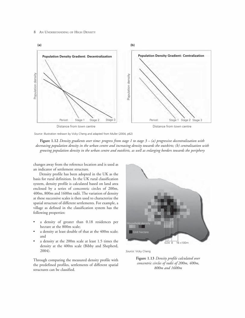
Density gradient is a composite measure of density.Comparing the changing pattern of density gradientsover time can review the process of spatial evolution.Figure 1.12 shows two changing patterns of densitygradient. Figure 1.12 (a) represents a process ofprogressive decentralization with decreasing populationdensity in the urban centre and increasing density andboarders towards the outskirts. In contrast, Figure 1.12(b) depicts a process of centralization with growingpopulation density in both the urban centre and outskirtsand, at the same time, enlarging borders towards theperiphery. Between 1800 and 1945, the North Americanmetropolis exhibited the former process ofdecentralization, while European counterparts resembledthe latter process of centralization (Muller, 2004).
Density profile
Density profile refers to a series of densitymeasurements based on a reference location butcalculated in different spatial scales. Similar to densitygradient, it is a measure of the rate at which density
UNDERSTANDING DENSITY AND HIGH DENSITY 7
Source: Vicky Cheng
Figure 1.10 Hong Kong population density map(magnitude represented in height): high density in thecentral urban area and low density in outlying islands
Source: Illustration redrawn by Vicky Cheng and adapted from Longley and Mesev (2002, p20)
Figure 1.11 Population density gradient from the town centre towards rural outskirts
Distance from reference location/km
Nu
mb
er
of
peo
ple
/sq
.km
0
10203040 m
0
1000
2000
3000
4000
5000
6000
7000
1 2 3 4 5 6 7 8 9
changes away from the reference location and is used asan indicator of settlement structure.
Density profile has been adopted in the UK as thebasis for rural definition. In the UK rural classificationsystem, density profile is calculated based on land areaenclosed by a series of concentric circles of 200m,400m, 800m and 1600m radii. The variation of densityat these successive scales is then used to characterize thespatial structure of different settlements. For example, avillage as defined in the classification system has thefollowing properties:
• a density of greater than 0.18 residences perhectare at the 800m scale;
• a density at least double of that at the 400m scale;and
• a density at the 200m scale at least 1.5 times thedensity at the 400m scale (Bibby and Shepherd,2004).
Through comparing the measured density profile withthe predefined profiles, settlements of different spatialstructures can be classified.
8 AN UNDERSTANDING OF HIGH DENSITY
Source: Illustration redrawn by Vicky Cheng and adapted from Muller (2004, p62)
Figure 1.12 Density gradients over time: progress from stage 1 to stage 3 – (a) progressive decentralization withdecreasing population density in the urban centre and increasing density towards the outskirts; (b) centralization with
growing population density in the urban centre and outskirts, as well as enlarging borders towards the periphery
Population Density Gradient: Decentralization
(a) (b)
Population Density Gradient: Centralization
Period:
Distance from town centre Distance from town centre
Figure 1.13 Density profile calculated over concentric circles of radii of 200m, 400m,
800m and 1600m
Household density
Unit hectare
024 8 16 ×100m
Building density and urban morphology
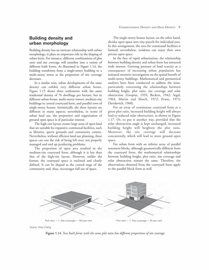
Building density has an intricate relationship with urbanmorphology; it plays an important role in the shaping ofurban form. For instance, different combinations of plotratio and site coverage will manifest into a variety ofdifferent built forms. As illustrated in Figure 1.14, thebuilding transforms from a single-storey building to amulti-storey tower as the proportion of site coveragedecreases.
In a similar vein, urban developments of the samedensity can exhibit very different urban forms. Figure 1.15 shows three settlements with the sameresidential density of 76 dwellings per hectare, but indifferent urban forms: multi-storey towers, medium-risebuildings in central courtyard form, and parallel rows ofsingle-storey houses. Intrinsically, the three layouts aredifferent in many aspects; nevertheless, in terms ofurban land use, the proportion and organization ofground open space is of particular interest.
The high-rise layout creates large areas of open landthat are suitable for expansive communal facilities, suchas libraries, sports grounds and community centres.Nevertheless, without efficient land-use planning, thesespaces can run the risk of being left over, not properlymanaged and end up producing problems.
The proportion of open area resulted in themedium-rise courtyard form, although it is less thanthat of the high-rise layout. However, unlike theformer, the courtyard space is enclosed and clearlydefined. It can be shaped as the central stage of thecommunity and, thus, encourages full use of space.
The single-storey houses layout, on the other hand,divides open space into tiny parcels for individual uses.In this arrangement, the area for communal facilities islimited; nevertheless, residents can enjoy their ownprivate open space.
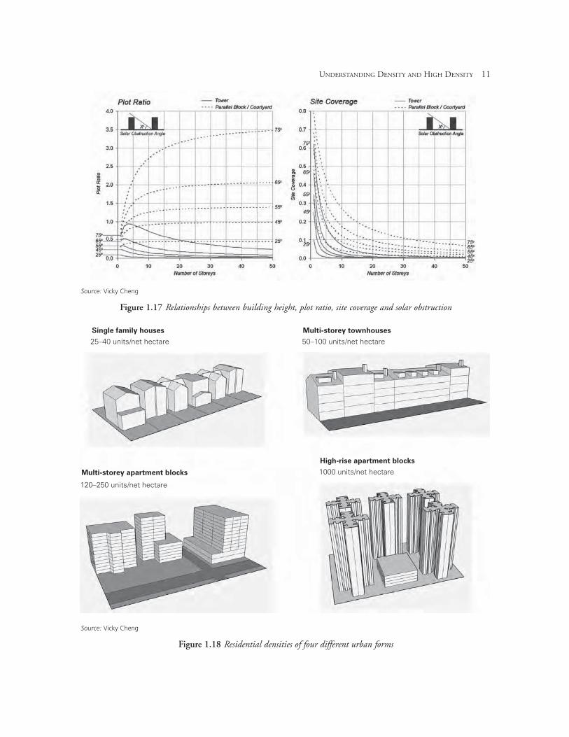
In the face of rapid urbanization, the relationshipbetween building density and urban form has attractedwide interest. Growing pressure of land scarcity as aconsequence of increasing urban population hasinitiated extensive investigation on the spatial benefit ofmulti-storey buildings. Mathematical and geometricalanalyses have been conducted to address the issue,particularly concerning the relationships betweenbuilding height, plot ratio, site coverage and solarobstruction (Gropius, 1935; Beckett, 1942; Segal,1964; Martin and March, 1972; Evans, 1973;Davidovich, 1968).
For an array of continuous courtyard form at agiven plot ratio, increased building height will alwayslead to reduced solar obstruction, as shown in Figure1.17. Or, to put it another way, provided that thesolar obstruction angle is kept unchanged, increasedbuilding height will heighten the plot ratio.Moreover, the site coverage will decreaseconcurrently, which will lead to more ground openspace.
For urban form with an infinite array of paralleltenement blocks, although geometrically different fromthe courtyard form, the mathematical relationshipsbetween building height, plot ratio, site coverage andsolar obstruction remain the same. Therefore, theobservations obtained from the courtyard form applyto the parallel block form as well.
UNDERSTANDING DENSITY AND HIGH DENSITY 9
Source: Vicky Cheng
Figure 1.14 Two built forms with the same plot ratio but different proportions of site coverage
Plot ratio = 1, Site coverage = 100 per cent Plot ratio = 1, Site coverage = 25 per cent
For urban form with an infinite array of towers at a lowsolar obstruction angle (below approximately 45°),increased building height will always lead to a reducedplot ratio. At high solar obstruction angles (aboveapproximately 55°), increased building height mayincrease the plot ratio initially, but further incrementwill result in a reduced plot ratio.
Nevertheless, increased building height will decrease thesite coverage in both cases. Finally, compared to thecourtyard and the parallel block forms, at a given solarobstruction angle and building height, the tower formwill always lead to a lower plot ratio and lower sitecoverage.
In reality, site area is usually limited and urban formis very often determined by the predefined developmentdensity. Figure 1.18 shows the residential densities of
10 AN UNDERSTANDING OF HIGH DENSITY
Source: Illustration redrawn by Vicky Cheng and adapted from Rogers
(1999, p62)
Figure 1.15 Same density in different layouts: (a) multi-storey towers; (b) medium-rise buildings in central
courtyard form; (c) parallel rows of single-storey houses
High-rise(a)
(b)
(c)
Medium-rise
Low-rise
Source: Illustration redrawn by Vicky Cheng and adapted from Martin
and March (1972, p36)
Figure 1.16 Three different urban forms: (a) courtyard;(b) parallel block; (c) tower
(a)
(b)
(c)
UNDERSTANDING DENSITY AND HIGH DENSITY 11
Source: Vicky Cheng
Figure 1.18 Residential densities of four different urban forms
Source: Vicky Cheng
Figure 1.17 Relationships between building height, plot ratio, site coverage and solar obstruction
Single family houses
25–40 units/net hectare
120–250 units/net hectare
1000 units/net hectare
50–100 units/net hectare
Multi-storey townhouses
Multi-storey apartment blocks
High-rise apartment blocks
several existing urban forms (Alexander, 1993; Ellis,2004; Campoli and MacLean, 2007).
Perceived density
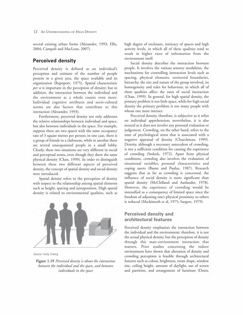
Perceived density is defined as an individual’sperception and estimate of the number of peoplepresent in a given area, the space available and itsorganization (Rapoport, 1975). Spatial characteristicper se is important in the perception of density; but inaddition, the interaction between the individual andthe environment as a whole counts even more.Individual cognitive attributes and socio-culturalnorms are also factors that contribute to thisinteraction (Alexander, 1993).
Furthermore, perceived density not only addressesthe relative relationships between individual and space,but also between individuals in the space. For example,suppose there are two spaces with the same occupancyrate of 3 square metres per person; in one case, there isa group of friends in a clubroom, while in another thereare several unacquainted people in a small lobby.Clearly, these two situations are very different in socialand perceptual terms, even though they show the samephysical density (Chan, 1999). In order to distinguishbetween these two different aspects of perceiveddensity, the concept of spatial density and social densitywere introduced.
Spatial density refers to the perception of densitywith respect to the relationship among spatial elementssuch as height, spacing and juxtaposition. High spatialdensity is related to environmental qualities, such as
high degree of enclosure, intricacy of spaces and highactivity levels, in which all of these qualities tend toresult in higher rates of information from theenvironment itself.
Social density describes the interaction betweenpeople. It involves the various sensory modalities, themechanisms for controlling interaction levels such asspacing, physical elements, territorial boundaries,hierarchy, the size and nature of the group involved, itshomogeneity and rules for behaviour, in which all ofthese qualities affect the rates of social interaction(Chan, 1999). In general, for high spatial density, theprimary problem is too little space, while for high socialdensity the primary problem is too many people withwhom one must interact.
Perceived density, therefore, is subjective as it relieson individual apprehension; nevertheless, it is alsoneutral as it does not involve any personal evaluation orjudgement. Crowding, on the other hand, refers to thestate of psychological stress that is associated with anegative appraisal of density (Churchman, 1999).Density, although a necessary antecedent of crowding,is not a sufficient condition for causing the experienceof crowding (Stokols, 1972). Apart from physicalconditions, crowding also involves the evaluation ofsituational variables, personal characteristics andcoping assets (Baum and Paulus, 1987). Researchsuggests that as far as crowding is concerned, theinfluence of social density is more significant thanspatial density (McClelland and Auslander, 1978).However, the experience of crowding would beintensified as a consequence of limited space since thefreedom of adjusting one’s physical proximity to othersis reduced (Mackintosh et al, 1975; Saegert, 1979).
Perceived density and
architectural features
Perceived density emphasizes the interaction betweenthe individual and the environment; therefore, it is notthe actual physical density, but the perception of densitythrough this man–environment interaction thatmatters. Prior studies concerning the indoorenvironment have shown that alteration of density andcrowding perception is feasible through architecturalfeatures such as colour, brightness, room shape, windowsize, ceiling height, amount of daylight, use of screenand partition, and arrangement of furniture (Desor,
12 AN UNDERSTANDING OF HIGH DENSITY
Source: Vicky Cheng
Figure 1.19 Perceived density is about the interactionbetween the individual and the space, and between
individuals in the space
1972; Baum and Davis, 1976; Schiffenbauer et al,1977; Bell et al, 2001).
In the urban environment, the perception ofdensity has been found to be associated with the builtform and certain urban features. Rapoport (1975)outlined the importance of a list of environmental cues,which are thought to have effects on perceived density;these hypothesized factors include building height-to-space ratio, building height, space openness, spacecomplexity, the number of people, the number of streetsigns, traffic, light level, naturalness of theenvironment, and the rhythm of activity.
In a guidebook for housing development authoredby Cooper-Marcus and Sarkissian (1988), designattributes such as the overall size of buildings, spacebetween buildings, variety in building façade, andvisual access to open and green space are acknowledgedas contributing factors to the perception of density. Onthe other hand, Bonnes et al (1991) pointed out thatspatial features such as street width, building height,building size, and balance between built-up and vacantspaces can affect people’s perception of density.
Flachsbart (1979) conducted an empirical study toexamine the effects of several built-form features uponperceived density. According to his findings, shorterbuilding block lengths and more street intersectionscould lower perceived density. However, surprisingly,the influence of street width was found insignificant;and other features such as street shape, slope andbuilding block diversity did not show noticeable effects.
Zacharias and Stamps (2004) proposed thatperceived density is a function of building layout.Based on the findings of their simulation experiments,building height, number of buildings, spacing and theextent of building coverage have significant effectsupon perceived density. Nevertheless, architecturaldetails and landscaping did not show significantinfluences.
By and large, research to date indicates that theperception of density is related to certainenvironmental cues; however, it is important to keep inmind that besides physical characteristics, individual-cognitive and socio-cultural factors are also prominent,especially with respect to the notion of high density.There is not an explicit definition of high density; itvaries from culture to culture and from person toperson. The next section furthers the discussion ofdensity with regard to the phenomenon of high density.
High density
Rapid urbanization since 1950 has exerted tremendouspressure on urban development in many cities and hasbeen confronted with the scarce supply of land inurban areas; densification has also become animportant agenda in planning policies around theworld. High-density development has consequentlybeen a topic of increasing interest worldwide; itrepresents different notions in different countries,across different cultures and to different people.
UNDERSTANDING DENSITY AND HIGH DENSITY 13
Source: Vicky Cheng
Figure 1.20 Architectural features that influence the perception of density
Window size Daylight Brightness
Ceiling
height
Colour
Furniture
Room shape
Screen/
partition
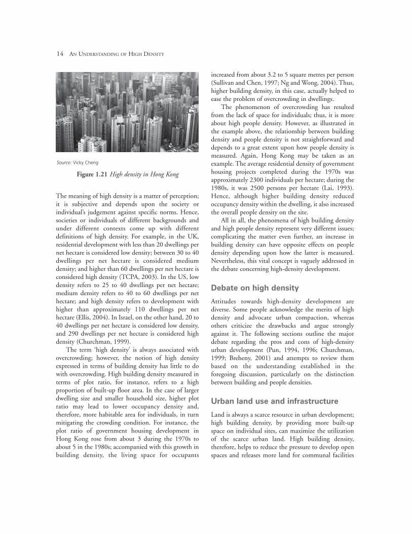
The meaning of high density is a matter of perception;it is subjective and depends upon the society orindividual’s judgement against specific norms. Hence,societies or individuals of different backgrounds andunder different contexts come up with differentdefinitions of high density. For example, in the UK,residential development with less than 20 dwellings pernet hectare is considered low density; between 30 to 40dwellings per net hectare is considered mediumdensity; and higher than 60 dwellings per net hectare isconsidered high density (TCPA, 2003). In the US, lowdensity refers to 25 to 40 dwellings per net hectare;medium density refers to 40 to 60 dwellings per nethectare; and high density refers to development withhigher than approximately 110 dwellings per nethectare (Ellis, 2004). In Israel, on the other hand, 20 to40 dwellings per net hectare is considered low density,and 290 dwellings per net hectare is considered highdensity (Churchman, 1999).
The term ‘high density’ is always associated withovercrowding; however, the notion of high densityexpressed in terms of building density has little to dowith overcrowding. High building density measured interms of plot ratio, for instance, refers to a highproportion of built-up floor area. In the case of largerdwelling size and smaller household size, higher plotratio may lead to lower occupancy density and,therefore, more habitable area for individuals, in turnmitigating the crowding condition. For instance, theplot ratio of government housing development inHong Kong rose from about 3 during the 1970s toabout 5 in the 1980s; accompanied with this growth inbuilding density, the living space for occupants
increased from about 3.2 to 5 square metres per person(Sullivan and Chen, 1997; Ng and Wong, 2004). Thus,higher building density, in this case, actually helped toease the problem of overcrowding in dwellings.
The phenomenon of overcrowding has resultedfrom the lack of space for individuals; thus, it is moreabout high people density. However, as illustrated inthe example above, the relationship between buildingdensity and people density is not straightforward anddepends to a great extent upon how people density ismeasured. Again, Hong Kong may be taken as anexample. The average residential density of governmenthousing projects completed during the 1970s wasapproximately 2300 individuals per hectare; during the1980s, it was 2500 persons per hectare (Lai, 1993).Hence, although higher building density reducedoccupancy density within the dwelling, it also increasedthe overall people density on the site.
All in all, the phenomena of high building densityand high people density represent very different issues;complicating the matter even further, an increase inbuilding density can have opposite effects on peopledensity depending upon how the latter is measured.Nevertheless, this vital concept is vaguely addressed inthe debate concerning high-density development.
Debate on high density
Attitudes towards high-density development arediverse. Some people acknowledge the merits of highdensity and advocate urban compaction, whereasothers criticize the drawbacks and argue stronglyagainst it. The following sections outline the majordebate regarding the pros and cons of high-densityurban development (Pun, 1994, 1996; Churchman,1999; Breheny, 2001) and attempts to review thembased on the understanding established in theforegoing discussion, particularly on the distinctionbetween building and people densities.
Urban land use and infrastructure
Land is always a scarce resource in urban development;high building density, by providing more built-upspace on individual sites, can maximize the utilizationof the scarce urban land. High building density,therefore, helps to reduce the pressure to develop openspaces and releases more land for communal facilities
14 AN UNDERSTANDING OF HIGH DENSITY
Source: Vicky Cheng
Figure 1.21 High density in Hong Kong
and services to improve the quality of urban living.However, some people argue that the opposite is alsotrue. In order to achieve high building density, massivehigh-rise buildings are inevitable, and these massivestructures, crammed into small sites, can converselyresult in very little open space and a congestedcityscape. This may happen when high-densitydevelopment is carried out without planning.Therefore, in order to avoid the negative impacts ofhigh density, thorough planning and appropriatedensity control are essential.
Infrastructure such as roads, drainage and sewerage,electricity, telecommunication networks and so on aresubstantial in supporting urban development. Theseinfrastructural services, however, are very costly toprovide and maintain; and in many cases, a minimumutilization threshold is required in order to operatethese systems cost effectively. High people density, byconcentrating a population in a smaller area, can makegreater use of these infrastructural services and help thesystems to run more economically. However, if thepopulation exceeds the system capacity, high peopledensity can contrarily lead to overload of the systemsand deteriorate services. Again, in order to achieve theformer outcome, it is important that the planning ofhigh density and the provision of infrastructure gohand in hand.
Transportation system
The public transport system is very costly to build andoperate; like most infrastructural services, publictransport needs a minimum utilization rate in order tobe profitable and efficient. High people density, byproviding a greater number of users, would sustain theuse of the mass transit system and thus improve itsefficiency and viability. Furthermore, high building andpeople density means that both places and people areconcentrated and close to each other. This offers moreopportunities for walking and cycling, and thereforewould reduce the number of car trips, as well as thetravel distance per trip. The increase in proximitytogether with the increased use of public transit wouldhelp to reduce traffic congestion in urban centres.However, these benefits will only be realized iftransportation systems are well planned. Otherwise,high density can lead to traffic congestion andovercrowding in mass transit facilities if the provisionof public transport is deficient.
Environment and preservation
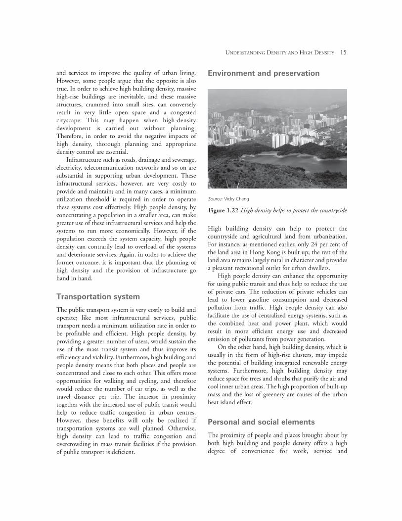
High building density can help to protect thecountryside and agricultural land from urbanization.For instance, as mentioned earlier, only 24 per cent ofthe land area in Hong Kong is built up; the rest of theland area remains largely rural in character and providesa pleasant recreational outlet for urban dwellers.
High people density can enhance the opportunityfor using public transit and thus help to reduce the useof private cars. The reduction of private vehicles canlead to lower gasoline consumption and decreasedpollution from traffic. High people density can alsofacilitate the use of centralized energy systems, such asthe combined heat and power plant, which wouldresult in more efficient energy use and decreasedemission of pollutants from power generation.
On the other hand, high building density, which isusually in the form of high-rise clusters, may impedethe potential of building integrated renewable energysystems. Furthermore, high building density mayreduce space for trees and shrubs that purify the air andcool inner urban areas. The high proportion of built-upmass and the loss of greenery are causes of the urbanheat island effect.
Personal and social elements
The proximity of people and places brought about byboth high building and people density offers a highdegree of convenience for work, service and
UNDERSTANDING DENSITY AND HIGH DENSITY 15
Source: Vicky Cheng
Figure 1.22 High density helps to protect the countryside
entertainment. However, this proximity, especiallybetween people, may force individuals to undergo someunwanted social contact and cause psychological stress.High people density may also lead to competition forthe use of facilities and space and, in turn, create socialconflicts. Moreover, high people density may result inreduced privacy and invoke the feeling of loss of controland anxiety. Nevertheless, with proper organizationand management, the proximity that arises from highpeople density can conversely facilitate socialinteraction and promote good neighbourhoodrelations.
The unpleasant experience as a result ofovercrowding is more related to high people densityand not necessarily associated with high buildingdensity. As previously illustrated, increased buildingdensity as a means of lowering occupancy rate can, infact, help to mitigate the problem of overcrowding.Furthermore, high building density, which can allowmore open space for recreation and communal uses,may also help to establish social interaction andconsolidate the sense of community.
Conclusions
This chapter has sought to explain the diversedimensions of ‘density’, from the elemental numericalmeasures to the complex notion of human perception.In terms of physical measurement, density embraces abroad range of definitions; therefore, whenever theterm is to be used, an explicit definition of the measurehas to be clearly specified in order to avoid unnecessaryconfusion. In terms of human perception, it is not thephysical density per se but the interaction betweenindividuals and the physical environment that isimportant. Nevertheless, individual cognitive attributesand socio-cultural factors are also contributing to thenotion of perceived density.
Concerning high density, this concept is a matter ofperception, is very subjective and represents differentnotions in different countries, across different culturesand to different people. It is, therefore, essential tounderstand the context before the potential of high-density development can be evaluated. In consideringthe advantages and disadvantages of high density, thedistinction between building and people density has tobe observed. For the arguments reviewed, not all butmost of the propositions are matters of planning. In
order to maximize the benefits of high density,thorough and comprehensive planning strategy isessential; otherwise, high-density development can leadto severe social and environmental problems.
Good planning is important; but as to what makesgood planning of high-density cities is anotherquestion. The rest of this book will address varioussocial and environmental issues concerning high-density development, accompanied by design strategiescorresponding to these issues. Hopefully this chapterhas set out the ground for further discussion of high-density issues in later chapters and, altogether, thisbook can provoke deeper reflection upon the potentialof high-density development.
References
Alexander, E. R. (1993) ‘Density measures: A review andanalysis’, Journal of Architectural and Planning Research,vol 10, no 3, pp181–202
Baum, A. and Davis, G. E. (1976) ‘Spatial and social aspectsof crowding perception’, Environment and Behavior, vol 8,no 4, pp527–544
Baum, A. and Paulus, P. B. (1987) ‘Crowding’, in D. Stokolsand I. Altman (eds) Handbook of EnvironmentalPsychology, vol I, John Wiley, New York, NY
Beckett, H. E. (1942) ‘Population densities and the heights ofbuildings’, Illuminating Engineering Society Transactions,vol 7, no 7, pp75–80
Bell, P. A., Greene, T. C., Fisher, J. D. and Baum, A. (2001)‘High density and crowding’, in Environmental Psychology,Wadsworth, Thomson Learning, Belmont, CA
Bibby, R. and Shepherd, J. (2004) Rural Urban MethodologyReport, Department for Environment Food and RuralAffairs, London
Bonnes, M., Bonaiuto, M. and Ercolani, A. P. (1991)‘Crowding and residential satisfaction in the urbanenvironment: A contextual approach’, Environment andBehavior, vol 23, no 5, pp531–552
Breheny, M. (2001) ‘Densities and sustainable cities: The UKexperience’, in M. Echenique and A. Saint (eds) Cities forthe New Millennium, Spon Press, London, New York
Campoli, J. and MacLean, A. S. (2007) Visualizing Density,Lincoln Institute of Land Policy, Cambridge, MA
Chan, Y. K. (1999) ‘Density, crowding and factorsintervening in their relationship: Evidence from a hyper-dense metropolis’, Social Indicators Research, vol 48,pp103–124
Churchman, A. (1999) ‘Disentangling the concept ofdensity’, Journal of Planning Literature, vol 13, no 4,pp389–411
16 AN UNDERSTANDING OF HIGH DENSITY
Cooper-Marcus, C. and Sarkissian, W. (1988) Housing as ifPeople Mattered: Site Design Guidelines for Medium-DensityFamily Housing, University of California Press, Berkeley, CA
Davidovich, V. G. (1968) ‘Interdependence between heightof buildings, density of population and size of towns andsettlements’, in Town Planning in Industrial Districts:Engineering and Economics, Israel Programme forScientific Translations, Jerusalem
Desor, J. A. (1972) ‘Toward a psychological theory ofcrowding’, Journal of Personality and Social Psychology, vol 21, pp79–83
Ellis, J. G. (2004) ‘Explaining residential density’, Places, vol 16, no 2, pp34–43
Evans, P. (1973) Housing Layout and Density, Land Use andBuilt Form Studies, Working Paper 75, University ofCambridge, Department of Architecture, Cambridge, UK
Flachsbart, P. G. (1979) ‘Residential site planning andperceived densities’, Journal of the Urban Planning andDevelopment Division, vol 105, no 2, pp103–117
Greater London Authority (2003) Housing for a CompactCity, GLA, London
Gropius, W. (1935) The New Architecture and The Bauhaus,Faber and Faber Limited, London
Hong Kong Census and Statistics Department (2006)Population By-Census: Main Report, vol 1, Hong Kong,Census and Statistics Department, Hong Kong
Hong Kong Planning Department (2003) Hong KongPlanning Standards and Guidelines, Planning Department,Hong Kong
Lai, L. W. C. (1993) ‘Density policy towards public housing:A Hong Kong theoretical and empirical review’, HabitatInternational, vol 17, no 1, pp45–67
Longley, P. A. and Mesev, C. (2002) ‘Measurement of densitygradients and space-filling in urban systems’, RegionalScience, vol 81, pp1–28
Mackintosh, E., West, S. and Saegert, S. (1975) ‘Two studiesof crowding in urban public spaces’, Environment andBehavior, vol 7, no 2, pp159–184
Martin, L. and March, L. (1972) (eds) Urban Space andStructures, Cambridge University Press, Cambridge, UK
McClelland, L. and Auslander, N. (1978) ‘Perceptions ofcrowding and pleasantness in public settings’,Environment and Behavior, vol 10, no 4, pp535–552
Muller, P. O. (2004) ‘Transportation and urban form: Stagesin the spatial evolution of the American metropolis’, in
S. Hanson and G. Giuliano (eds) The Geography of UrbanTransportation, 3rd ed. Guilford Press, New York, NY
Ng, E. and Wong, K. S. (2004) ‘Efficiency and livability:Towards sustainable habitation in Hong Kong’, inInternational Housing Conference Hong Kong, Hong Kong
Pun, P. K. S. (1994) ‘Advantages and disadvantages of high-density urban development’, in V. Fouchier and P. Merlin(eds) High Urban Densities: A Solution for Our Cities?,Consulate General of France in Hong Kong, Hong Kong
Pun, P. K. S. (1996) ‘High density development: The HongKong experience’, in Hong Kong: City of Tomorrow – AnExhibition about the Challenge of High Density Living,Hong Kong Government, City of Edinburgh Museumsand Art Galleries
Rapoport, A. (1975) ‘Toward a redefinition of density’,Environment and Behavior, vol 7, no 2, pp133–158
Rogers, R. G. (1999) Towards an Urban Renaissance: FinalReport of the Urban Task Force, Department of theEnvironment, Transport and the Regions, London
Saegert, S. (1979) ‘A systematic approach to high densitysettings: Psychological, social, and physical environmentalfactors’, in M. R. Gurkaynak and W. A. LeCompte (eds)Human Consequences of Crowding, Plenum Press, New York, NY
Schiffenbauer, A. I., Brown, J. E., Perry, P. L., Shulack, L. K.and Zanzola, A. M. (1977) ‘The relationship betweendensity and crowding: Some architectural modifiers’,Environment and Behavior, vol 9, no 1, pp3–14
Segal, W. (1964) ‘The use of land: In relation to buildingheight, coverage and housing density’, Journal of theArchitectural Association, March, pp253–258
Stokols, D. (1972) ‘On the distinction between density andcrowding: Some implications for future research’,Psychological Review, vol 79, no 3, pp275–277
Sullivan, B. and Chen, K. (1997) ‘Design for tenant fitout: Acritical review of public housing flat design in HongKong’, Habitat International, vol 21, no 3, pp291–303
TCPA (Town and Country Planning Association) (2003)TCPA Policy Statement: Residential Densities, TCPA, London
UK Office of the Deputy Prime Minister (2006) PlanningPolicy Statement 3: Housing, Department forCommunities and Local Government, London
Zacharias, J. and Stamps, A. (2004) ‘Perceived buildingdensity as a function of layout’, Perceptual and MotorSkills, vol 98, pp777–784