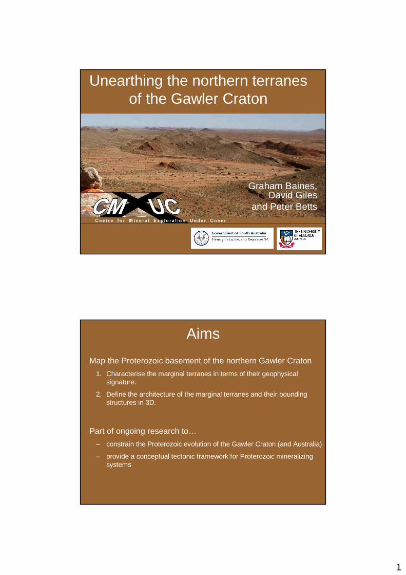
1 Unearthing the northern terranes of the Gawler Craton Graham Baines, David Giles and Peter Betts Aims Map the Proterozoic basement of the northern Gawler Craton 1. Characterise the marginal terranes in terms of their geophysical signature. 2. Define the architecture of the marginal terranes and their bounding structures in 3D. Part of ongoing research to… – constrain the Proterozoic evolution of the Gawler Craton (and Australia) – provide a conceptual tectonic framework for Proterozoic mineralizing systems
Transcript
1
Unearthing the northern terranes of the Gawler Craton
Graham Baines, David Giles
and Peter Betts
Aims
Map the Proterozoic basement of the northern Gawler Craton
1. Characterise the marginal terranes in terms of their geophysicalsignature.
2. Define the architecture of the marginal terranes and their bounding structures in 3D.
Part of ongoing research to…
– constrain the Proterozoic evolution of the Gawler Craton (and Australia)
– provide a conceptual tectonic framework for Proterozoic mineralizingsystems
2
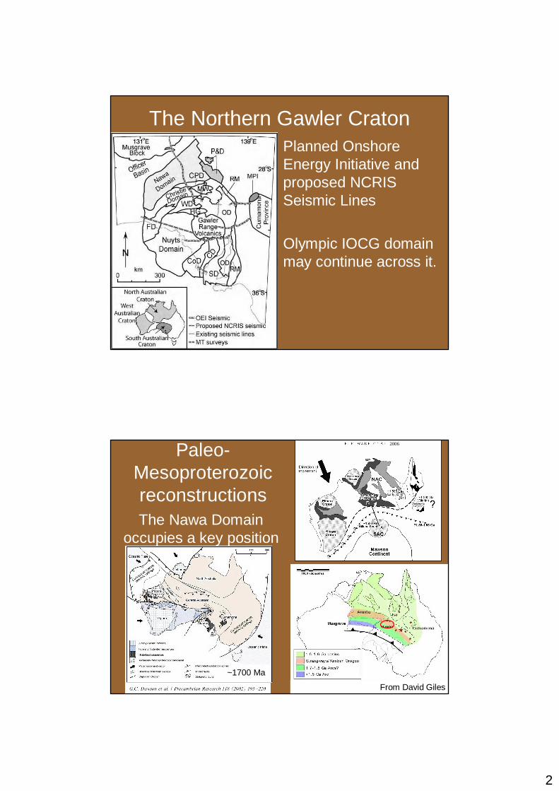
The Northern Gawler CratonPlanned Onshore Energy Initiative and proposed NCRIS Seismic Lines
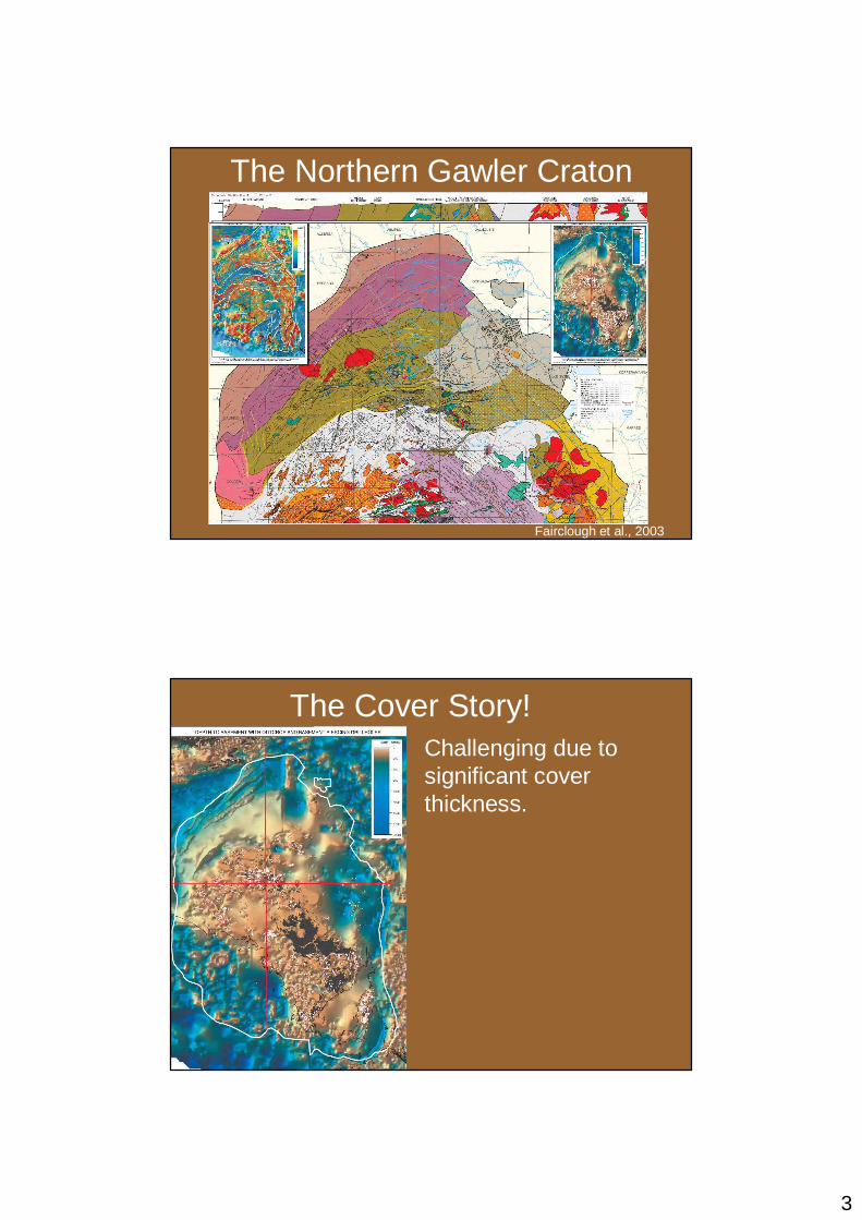
The Cover Story!Challenging due to significant cover thickness.
4
Northern Gawler Craton
• Geochronology and isotopic characterization from drill-holes (e.g. Payne et al, 2006)
• Basement domains have been mapped mainly from gravity and magnetic grids
• But what’s the geometry of these domains in depth?
– a first-order constraint for Geological models
North Dipping Terrane boundaries?
• North-dipping pre-Neoproterozoic structures imaged on seismic profiles…
• Subsequent reactivation during later orogenies
From Lindsay & Leven, 1996
5
Geophysical Techniques• Implies major terranes may have accreted by
southward directed thrusting…
• Is this really the case?
• Seismic reflection is insensitive to steeply dipping structures…
• Only provides regional cross-sections
� Analysis of regional potential field data will provide a 3D picture and can resolve steep structures
Towards the 3D architecture…
Step-wise modelling of potential field data…
1. Accurately model well-constrained 2D profiles. • analytical methods (Euler deconvolution)• [constrained] inverse models• petrophysical constraints• Other geophysical data
� forward models
2. Build regional 3D models• use constrained 2D profiles as the basis
6
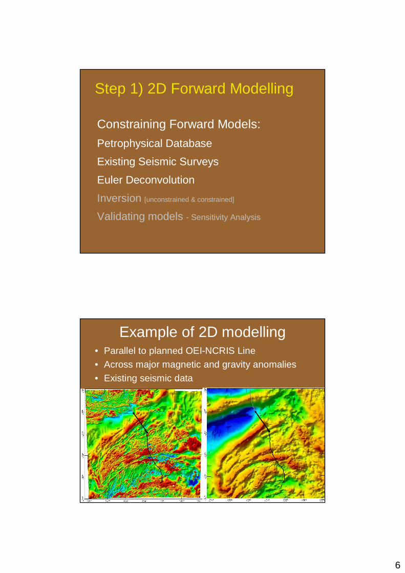
Step 1) 2D Forward Modelling
Constraining Forward Models:
Petrophysical Database
Existing Seismic Surveys
Euler Deconvolution
Inversion [unconstrained & constrained]
Validating models - Sensitivity Analysis
Example of 2D modelling• Parallel to planned OEI-NCRIS Line
• Across major magnetic and gravity anomalies
• Existing seismic data
7
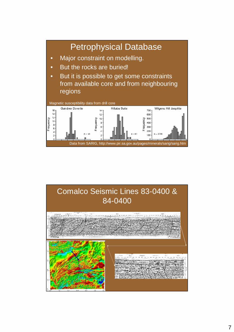
Petrophysical Database• Major constraint on modelling.• But the rocks are buried!• But it is possible to get some constraints
from available core and from neighbouring regions
Data from SARIG, http://www.pir.sa.gov.au/pages/minerals/sarig/sarig.htm
Magnetic susceptibility data from drill core
Comalco Seismic Lines 83-0400 & 84-0400
8
Seismic Constraints
5x vertical exaggeration
Euler Deconvolution• Objective/automatic assessment for the
sources of potential field anomalies• Applicable to both magnetic and gravity
data
Gravity
Magnetic
9
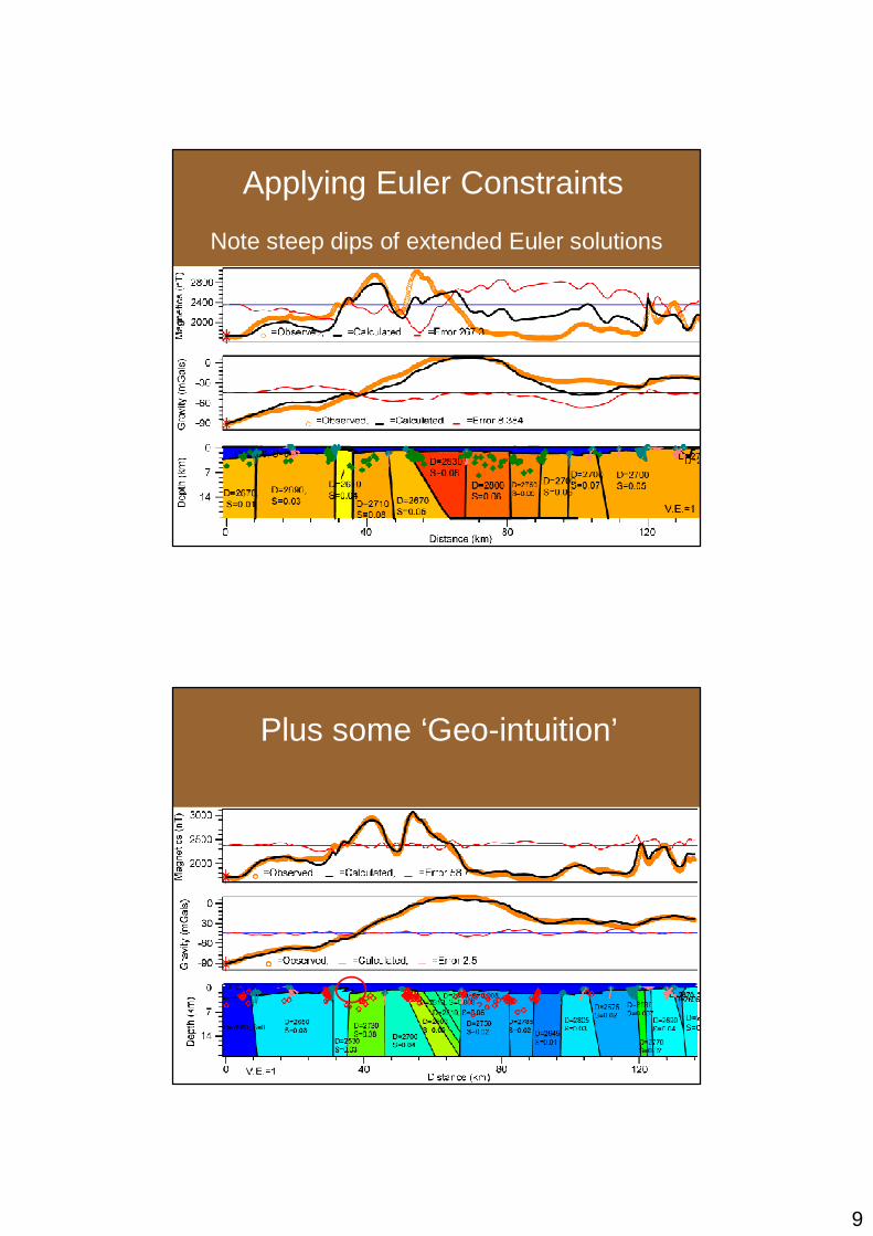
Applying Euler Constraints
Note steep dips of extended Euler solutions
1:1
Plus some ‘Geo-intuition’
10
Some remarks…
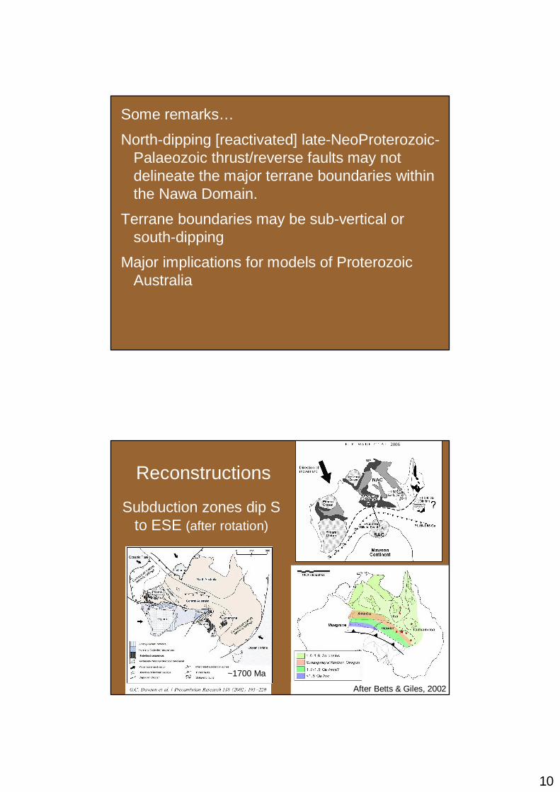
North-dipping [reactivated] late-NeoProterozoic-Palaeozoic thrust/reverse faults may not delineate the major terrane boundaries within the Nawa Domain.
Terrane boundaries may be sub-vertical or south-dipping
Major implications for models of Proterozoic Australia