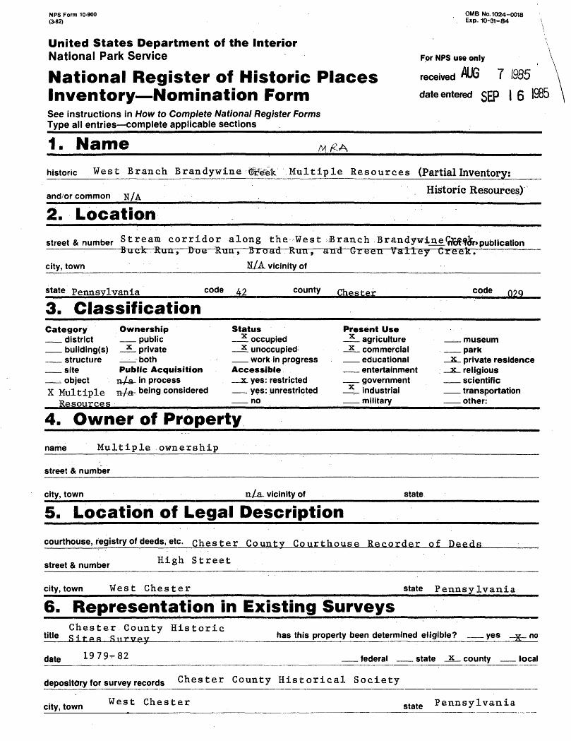
NPS Form 10-900 (3-82) OMB No. 1024-0018 Exp. 10-31-84 United States Department of the Interior National Park Service For NPS use only National Register of Historic Places received AUG 7 I9S5 Inventory Nomination Form date entered SEP I 6 1985 See instructions in How to Complete National Register Forms Type all entries complete applicable sections ______________________________ 1. Name M #A historic West Branch Brandywine Multiple Resources (Partial Inventory: and or common Historic Resources) 2. Location street & number Stream corridor along the West Branch Brandywine.^fSr, pub |i Cation ———— — — — — ~~ ——— city, town . Buck Ruu, — Doe Run, — Broad Run, — and Green Valley Creek N/A vicinity of state Pennsylvania code 42 county Chester code nog 3. Classification Category Ownership district public building(s) x private structure both site Public Acquisition object n/a in process X Multiple n/a- being considered Resources Status ^ occupied x unoccupied1 work in progress Accessible _ x. yes: restricted yes: unrestricted no Present Use x agriculture x commercial educational entertainment government x industrial military museum park x private residence x religious scientific transportation other: 4. Owner of Property name Multiple ownership street & number city, town n/a vicinity of state courthouse, registry of deeds, etc. Chester County Courthouse Recorder of Deeds street* number Hi S h Street city, town state Pennsylvania 6. Representation in Existing Surveys Chester County Historic title Sites .-Siirvp.y____________ has this property been determined eligible? yes no date 1979-82 federal state county local depository for survey records Chester County Historical Society city, town West Chester state Pennsylvania
Transcript
NPS Form 10-900 (3-82)
OMB No. 1024-0018 Exp. 10-31-84
United States Department of the InteriorNational Park Service For NPS use only
National Register of Historic Places received AUG 7 I9S5 Inventory Nomination Form date entered SEP I 6 1985See instructions in How to Complete National Register FormsType all entries complete applicable sections ______________________________
1. Name M #Ahistoric West Branch Brandywine Multiple Resources (Partial Inventory:
and or commonHistoric Resources)
2. Location
street & number Stream corridor along the West Branch Brandywine.^fSr, pub|iCation ———— — — — — ~~ ———
city, town
. Buck Ruu, — Doe Run, — Broad Run, — and Green Valley Creek
N/A vicinity of
state Pennsylvania code 42 county Chester code nog
3. ClassificationCategory Ownership
district publicbuilding(s) x privatestructure bothsite Public Acquisitionobject n/a in process
X Multiple n/a- being considered Resources
Status^ occupiedx unoccupied1
work in progressAccessible_ x. yes: restricted
yes: unrestrictedno
Present Usex agriculturex commercial
educationalentertainmentgovernment
x industrialmilitary
museumpark
x private residence x religious
scientifictransportationother:
4. Owner of Property
name Multiple ownership
street & number
city, town n/a vicinity of state
courthouse, registry of deeds, etc. Chester County Courthouse Recorder of Deeds
street* number Hi Sh Street
city, town state Pennsylvania
6. Representation in Existing SurveysChester County Historic
title Sites .-Siirvp.y____________ has this property been determined eligible? yes no
date 1979-82 federal state county local
depository for survey records Chester County Historical Society
city, town West Chester state Pennsylvania
7. Description
Condition
x fairrTjr^ n j A;-] o._ — aati! —— a ———— ̂ jf-rif ————————
deterioratedruinsunexposed
Check oneunaltered
x altered
Check onex original site
moved date N/A
Describe the present and original (iff known) physical appearance
7. Description
A. General Physical Description:
The multiple resource area is defined as the river corridor of the West Branch Brandywine dreek and its four major tributaries (See Continuation Sheet //I). The corridor includes . these bodies of water and the abutting land forming the stream valleys. The multiple resource area approximately coincides with the West Branch Brandywine Scenic River Corridor under study by the Brandywine Conservancy and the Pennsylvania Department of Environmental Resources for i-ncdiUSclon- 'in .the <stra*te Scemlc ..Rivers- S,ys,t,e;ms*. ; The West Branch Brandywine Creekntul-tiple resource area ex-tends, .for approximately 31.7 miles through eight Chester County.,. P,ennsyjkyan£^ an,d, West Bradford, Ne,wlin,, ftlghlan.?!,; ko.ndonderry,._, ̂ o&opspn,, and,, £astt, Fa.lJ.owf ield Townships. ; The. .corri^o^.^s i actually a, series, pf stream valleys tln a mat^r.e stage of jiat.ural ,develjppment;., j ,.its, topagraphy...^.^^^!!!^ from ,brfo,a4 Jrlopdplains and meadpws . to., steep,,,? w;o,p.ded .slopes,. ,_, ^ ,.__ ,,. ,..-,... .,...< . . .. ,. ;c , ,.
''• The 'corri;dor is1 a 'minor-basin 1 of t'he :-Brandywine Creek whi^fch o:ri^ginates in northern Chester County^ and fl-ows approximately 60 miles south to empty into the Christiana River in Wilmington, Delaware. The Christina, in turn, flows to the Delaware River. The Brandywine Greek is considered a sub- major basin of the Delaware River. The Brandywine f s -headwaters become the West and East Branches and join to form the Main Stem at the "Forks of the Brandywine" in East Bradford Township, near Lenape. Of the two branches, the longer and wider West Branch is considered to be the "parent" of the Main Stem.
As a center of early economic activity and colonial settlement, the Brandywine Creek became a focus of regional identity. Because of its un spoiled setting and the high integrity and full range of its historic resources, the : West] Branch today can be considered, £he : . jieart.j of Brandywine country.
The Brandywine's historic and natural landscape is least disturbed along the West Branch. Here are wide meadows, hardwood forests, rock outcroppings, and mostly stone 18th- and 19th-century buildings set well apart along its banks or nestled into the adjacent hills. Four significant historic villages and hamlets are found within this scenic corridor. A fifth historic community spans an entire stream valley. The soils of the flood plains and meadows, enriched by seasonal floodings, produce ideal vegetation for grazing cattle and horses and for crops of corn, oats, a^d barley. The area of Doe Run village, where the soils are particularly rich due to an underlying band of limestone and J ma'rble, has long been recognized as one of the premier 'grazing areas in Chester County. In contrast to the wide meadows of Doe Run, the Green Valley is narrow and fairly steep, but nevertheless found suitable for grazing* Stands of native trees abound. Hemlock, poplar, oak, and sycamore, trees
NPS Form 10-900-a (3-82)
United States Department of the InteriorNational Park Service
National Register of Historic Places Inventory Nomination FormWest Branch Bradywine Creek Multiple Resources, Chester County Continuation sheet 1 Item number 7
OMB No. 1024-0018 Exp.10-31-84
Page
The West Branch Brandywine Creek and major tributaries which form the multiple resource area.
Body of Water Course Approx, length
Municipality
West Branch Brandywine
Doe Run
Buck Run
Broad Run
Green Valley Creek
Strasburg Rd. to con- 12.2 fluence with East miles Branch BrandywineCreek
Fernwood Rd. to con- 7.1 fluence with Buck Run miles
Route 82 to confluence 5.0 with West Branch Brandy- miles wine Creek
Shadyside Road to con- 4.7 fluence with West Branch miles Brandywine Creek
Newlin/East Marlborough 1.9 Township line to conflu- miles ence with West Branch Brandywine Greek
East Bradford, West Bradford, Newlin, Pocopson, East Fallow- field Townships
Londonderry, Highland, West Marlborough, East Fallowfield Townships
East Fallowfield, WestMarlboroughTownships
West Bradford and Newlin Townships
Newlin Township
\
NPS Form 10-900-a (3^2)
OM8 No. 1024-0018 Exp.10-31-84
United States Department of the InteriorNational Park Service
National Register of Historic Places Inventory Nomination FormWest Branch Brandywine Creek Multiple Resources, Chester County
Continuation sheet 2 Item number 7 Page 2
Historic and Architectural Resources of the West Branch BrandywineCreek Multiple Resource Area
Code Municipality/Property Approximate Date
East Bradford Township (51)
(51-1) Hance House and Barn
West Bradford Township (50)
(50-1) Como Farm
(50-2) Baily Farm
(50-3) Carpenter Farm
(50-4) Temple-Webster-Stoner House**
Newlin Township (49)
(49-1) Indian Deep
(49-2) Mountain Meadow Farm
(49-3) Star Gazer Farm
(49-4) Hayes Mill House
(49-5) Jacob Hayes House
(49-6) Hayes Homestead
(49-7) Joseph Young House
(49-8) Spruce Grove Schoolhouse
(49-9) House at Lower Laurel Iron Works
(49-10) House at Upper Laurel Iron Works
1795
Construction
Stone
c .
c .
c .
c .
c .
c .
c .
c .
c .
c .
1802
1794
1755
1750
1800
1724
1780
1841
1771
1835
1839
1870
1820
Stone
Stone
Stone
Stone
Stone/ brick
Brick
Stone
Stone
Stone
Log/stone
Stone
Stone
Frame
Stone
NPS Form 10-900-a (3-82)
OMB No.1024-0018 Exp. 10-31-d4
United States Department of the InteriorNational Park Service
National Register of Historic Places Inventory Nomination FormWest Branch Brandywine Creek Multiple Resources, Chester County
Continuation sheet 3 Item number 7 Page
Pocopson (63 )
(63-1) Wilkinson House
West Marlborough
(48-1) House at Springdell
(48-2) Cyrus Hoopes House
c. 1884
c. 1750
c. 1825
Frame
Stone
Stone
Londonderry (46 )
(46-1) St. Malachi Church
(46-2) John Ferron House
(46-3) Moses Ross House
Highland (45)
(45-1) Runnymede
c. 1838
c. 1840
c. 1850
1931
** Listed in the National Register of Historic Places
Historic Districts submitted with this nomination:
Trimbleville Historic District
Northbrook Historic District
Embreeville Historic District
Doe Run Village Historic District
Stone
Stone
Brick
Stone
Green Valley Historic District
NPS Form 10-«X>-« OMB No. 1024-OO18 (3-82) Exp. 10-31-84
United States Department of the Interior ^^^-.^..•^^^•^.•^^. National Park Service
National Register of Historic Places Inventory Nomination FormWest Branch Brandywine. Greek Multiple Resources, Chester CountyContinuation sheet 4__________________Item number 7____________Page______
are particularly identified with the Brandywine corridor. Along Buck Run is the Laurels, an area prized for its significant concentration of this native shrub. Quarries in the corridor have yielded building stone, iron ore, limestone, feldspar, steatite (soapstone), and in one area a quartzitic gneiss used for whetstones.
The corridor's most dominant natural feature is its waters: the West Branch Brandywine Creek , and portions of Doe Run, Buck Run, Broad Run, and Green Valley Creek. To the Lenni-Lenape Indians who inhabited the corridor in the 17th century, the waters were a source of fish, primarily buck shad and spotted trout. To the European settlers in the 18th century, these waters, which in the course of 60 miles fall from 1000 feet to tidewater, represented power to operate their mills. To 20th-century citizens of Wilmington, Delaware, and Chester County, Pennsylvania, the high quality waters are a source of drinking water, a place for recreation, and the seat of a 300-year history.
B. Historical Description:Although in many respects the Brandywine Creek can be considered a
typical small river of the eastern seaboard, its natural beauty and wealth of historic resources have inspired unusual adulation. As early as 1872 the Brandywine had a national reputation, as evidenced by an article in William Cullen Bryants 1 Picturesque America, "Scenes on the Brandywine", which stated,
"No minor stream in our country enjoys a wider reputation than the Brandywine. Its identification with our early history renders its queer title familiar to students in all parts of the land, while it rare beauties have been delineated by painters, praised by poets, and described by tourists, until few of us have not some pleasant recollection or anticipation connected with its wooded shores."
American artists, photographers, poets, authors, and historians continue to portray its riches and sing its praises. Environmental organizations such as the Brandywine Conservancy and Brandywine Valley Association currently are devoted to the Creek corridor's wise use and preservation.
The development along the West Branch Brandywine Creek corridor that has occurred over 300 years has been relatively limited. Much of the land is, as it was in the 18th century, in agricultural use. Although many of the two- and three-hundred-acre family farms have been reduced to a fraction of their former size, historic complexes of house, barn, and outbuildings have been retained. Beginning in the 1920s, thousands of acres of farmland in the West Branch corridor and adjacent areas, along with their farmsteads, were acquired and put under single ownership. Lammot duPont of Wilmington, Delaware, who later served as President of the DuPont Company, bought scores of properties in the 1910s-30s and consolidated them, under the St. Amour Company, into a model farm known for its Hereford cattle, China hogs, and Hampshire sheep.
NFS Form 10 000-a OMB No. 1024-0018 (3-82) Exp. 10-31-84
United States Department of the InteriorNational Park Service
National Register of Historic Places Inventory Nomination FormWest Branch Brandywine Creek Multiple Resources, Chester CountyContinuation sheet 5_________ Item number 7 Page
During the same period, W. Plunkett Stewart of West Marlborough Township established a fox hunting association in the area which became known as the Cheshire Hunt. Besides the outright acquisition of rural properties, he and his associates obtained through the Cheshire Land Company deed restrictions to keep other lands open for fox hunting. Beginning in 1946, the King Ranch of Texas acquired portions of both these interests and established a major cattle fattening operation in the corridor under the name Buck and Doe Run Valley Farms. The ranch continued to acquire land through the 1950s and 1960s and at its peak controlled nearly 12,000 acres. A result of this more than 60-year large-scale grazing, farming, and foxhunting tradition has been to preserve the corridor's natural resources and agricultural heritage, by retaining stream valleys, farmland, and historic farm complexes. Many of the farm buildings were preserved because they served as housing for employees of the Buck and Doe Run Valley Farms.
The corridor's industrial heritage was not as fortunate. Nearly all of its 18th- and 19th-century water-powered grist, saw, paper, textile, and iron mills were abandoned and fell to ruin. A few mills and associated buildings do remain, however, and serve as valuable reminders of the corridor's former importance as a flourishing rural industrial center. The corridor's most active mill site was in the Laurels, where first a forge and then two rolling mills operated for nearly a century.
The corridor is home to several small villages and hamlets, four of which are nominated as historic districts: Trimbleville, Northbrook, Embreeville, and Doe Run. These areas feature clusters of from one to two dozen buildings possessing as a group historical and architectural significance. The villages originated as 18th-century mill seats to which were added modest homes, blacksmith shops, general stores, schools, small shops for cottage industry, and occasionally, churches. Doe Run, which had two stores, two mills, two blacksmith shops, a tavern, and a dozen dwellings, is the largest district to be nominated; Trimbleville, with only six principal buildings, is the smallest. Northbrook grew in the 1870s due to the advent of the Wilmington and Northern Railroad. Embreeville is a curious little village divided by the West Branch and noteworthy for its well-preserved grist mill. A fifth district is proposed for the Green Valley. This relatively long and narrow valley is dotted with farms, a school, and two mill sites. It retains a high degree of integrity, both in the architecture of its buildings and in its historic landscape.
One large country estate is included in the corridor. "Runnymede" (45-1) was established in 1931 as a "hunting box" by J. Stanley Reeve, the quintessential foxhunter, formerly a prominent member of Radnor Hunt on Philadelphia's Main Line. Unlike other dwellings in the district, his was designed by a prominent architect and dwarfs the others in size and luxury
NPS Form 10^00-a P-82)
United States Department of the InteriorNational Park Service
National Register of Historic Places Inventory Nomination FormWest Branch Brandywine Creek Multiple Resources, Chester County Continuation sheet 6 Item number 7
C. Architectural Component:Although there is a fair range of architectural style in the
corridor, on the whole it is a conservative selection from the 18th and 19th centuries. Most of the buildings are sturdy, plain, and practical, befitting the tastes and lifestyles of their mostly Quaker builders. The majority are two stories and stone with gable roofs. Several are banked into hills and feature basement cooking areas. The corridor's few brick houses are of high architectural quality and date from c. 1790 to c. 1890.The handfull of frame houses are from the second half of the 19th
century. There are only two log houses, one with Germanic and the other with English Colonial features.
The corridor's selection of 18th- and early 19th-century stone farmhouses is superb. Inspection of their basements reveals heavy stone foundations and similar types of arched or corbeled fireplace supports. Many houses feature early decorative datestones on the second floor of their facades. Chimneys on the earliest houses are of stone; on later houses they are brick. An extremely unusual feature found on three of the buildings in the corridor is a stone cornice. The three buildings -- a school, main house, and tenant house -- could have been built in the same decade (1830s) by the same mason. Brick cornices of similar appearance were readily found throughout the region beginning about 1800. Use of the stone cornice, however, has never before been documented in this general area.
Most of the buildings fall within one of the following architectural styles , or types:
1. Colonial Settlement
a) CabinsAs was common in Chester County, early settlers along the
corridor erected small, one-story cabins for immediate shelter. Most were log and eventually were replaced with substantial stone houses. In some cases, the log or stone core was incorporated into the permanent homestead. A few houses in Northbrook and Trimbleville feature these old cores.
b) English Colonial - Hall/Parlor PlanGiven the English Quaker background of most of the settlers, this plan is the most common found among the corridor's earliest permanent dwellings. This type of house is identified by its single pile construction, two rooms (i.e., hall and parlor) on the first floor, sleeping chambers on the second floor, fairly steep gable roof, and solid end walls. The Hayes Mill House (49-4) has these standard features.
A double pile version of the hall/parlor plan made its appearance in mid-century and continued to be built until c
NFS Form 10-300-a 0MB No. 1024-0018 P-82) Exp. 10-31-84
United States Department of the InteriorNational Park Service IB
National Register of Historic PlacesInventory Nomination Form WSSM,^^,West Branch Brandywine Creek Multiple Resources, Chester CountyContinuation sheet 7___________________Item number 7 ___ _____Page 7
1800. Still lacking a center hallway, the plan was more refined in its further segregation of living and cooking areas. The rather severe appearance of the earlier hall/parlor house was softened with a flatter roof pitch and the addition of windows on the gable ends. The 1795 Hance House (51-1) is a good example.
Although no documentation of German settlement in the corridor has as yet been uncovered, a house in Newlin Township shows elements of German Colonial style. Built of log, the Hayes Homestead (49-6) features a huge, stone central chimney. It uses, however, the standard English hall/parlor plan and also features a corner fireplace typical of English houses in the region.
c) Penn PlanThis two-story, double pile, two-bay plan with gable end
chimney (serving back-to-back corner fireplaces on the interior) was advocated by William Penn and was widely used in Philadelphia and outlying areas. Several houses in the corridor feature a standard Penn Plan core with a major wing of several bays. Undisturbed examples of the plan are seen in the House at Springdell (48-1) and the John Ferron House (46-2).
d) GeorgianAlthough the corridor lacks any high-style Georgian houses,
such as were built in Philadelphia, elements of the style, i.e., its center hall, external symmetry, large windows, and ample size, are reflected in several houses in Northbrook, Trimbleville and Doe Run.
e) Double-door GeorgianThis vernacular style is characterized by two doors in a
balanced four-bay facade. Usually the Colonial hall/parlor plan is retained on the interior. The corridor's best example of this type, Mountain Meadow Farm (49-2), is constructed of brick.
2. Post-Revolution 1780s - 1850s
a) Georgian/Federal TransitionalThe corridor's predominantly Quaker population was slow to
respond to changes in architectural style emanating from Philadelphia. By the time the Georgian center hall plan made its appearance in the corridor, urban tastes had changed to the lighter, more decorative Federal style. A Federal influence -- in the use of fanlights, smaller windows, and modest decoration -- is seen in several of corridor's basically Georgian
NPS Form 10 000-1 OMB No.1024-O018 (3-82) Exp. 10-31-84
United States Department of the InteriorNational Park Service
National Register of Historic Places Inventory Nomination FormWest Branch Brandywine Creek Multiple Resources, Chester County Continuation sheet 8__________________Item number 7_____
farmhouses, for example the c. 1794 Bailey Farm (50-2) "and the 1835 Joseph Young House (49-7).
b) Late Federal/Greek RevivalThe Greek Revival style is referred to in several late
Federal farmhouses in the treatment of the porch, the cornice, and the interior trim as seen in the Jacob Hayes House (49-5).
c) Greek RevivalThe Greek Revival style was never completely accepted in the
corridor. The strongest statement is seen in the c. 1850 Moses Ross House (46-3) on the banks of Doe Run. Its two-story porch with pedimented gable and dual, gable end parapeted chimneys proclaim the style. The proportions (3-story height, flattened gable roof) and dentiled cornice of the Cyrus Hoopes House (48-2) place it in the Greek Revival period.
3. Second-half of the 19th Century
a) Rural GothicThe corridor's offering of romantic styles is limited to a
few houses in the late Rural Gothic style. A good example is the E. Pusey Wilkinson House (63-1). Northbrook and Doe Run also have a few houses from this period. The exhuberant Victorian Gothic alterations made to the Jacob Hayes House (49-5) by architect H. Roney Williamson in 1885 were removed in 1952, and the house was restored to a more "acceptable" late Federal appearance.
4. The 20th Century
Although there is only one house of architectural significance from the 20th century in the corridor, a Period Revival, it is outstanding for its quality construction and unusual design. It was designed as an English country "hunting box" by George Shepard of Boston, and featured an attached stable (45-1) and luxurious quarters for stallions.
D. Archeological Component
The archeological resources of the West Branch Brandywine Greek corridor are not proposed for nomination at this time, and no sites currently are registered. With regard to the ongoing Pennsylvania archeological site survey, thirteen sites have been recorded on the Unionville Quadrangle; the findings date mostly from the Late Archaic and Late Woodland period. No sites have been as yet recorded on the Coatesville Quadrangle. Because the West Branch was occupied for so long
NPS Form 10-000-« OMB No. 1024-0018 P-S2) Exp. 10-31-84
United States Department of the InteriorNational Park Service
National Register of Historic Places Inventory Nomination FormWest Branch Brandywine Creek Multiple Resources, Chester CountyContinuation sheet 9___________________Item number 7____________Page________
by the Lenni-Lenape Indians and was considered by them to be "reserved" Indian land, the findings to date probably represent only a fraction of what exists. One Indian burial grave near Northbrook has been excavated by amateur archeologists several times and has yielded beads, pipes, shards, etc. A collection of approximately 30,000 items from the Brandywine area recently was donated to the Pennsylvania Historical and Museum Commission. In the 1890s, many items were gathered and their location sites recorded by Harry Wilson, an amateur archeologist from the local area. His notebooks are now in the Chester County Historical Society and indicate the areas around Northbrook and Doe Run were particularly rich with evidence ( i.e., points, knives, grinders, etc.) of previous Indian occupation.
E. Survey Methodology
A comprehensive survey of the historic and architectural resources of the West Branch Brandywine Creek was initiated in the course of the Chester County Historic Sites Survey (1979-1982) which was funded by the Pennsylvania Historical and Museum Commission and the Chester County Commissioners. Assisted by volunteers, the Brandywine Conservancy coordinated the survey in this area under the direction of the Chester County Historical Society. That survey identified approximately 40 individual historic resources and several potential historic districts. Prior to this survey, the corridor was the focus of some survey and research efforts. The Chester County Historical Society placed a number of historical markers in the area in the early 1900s; over the years a few houses were listed in the National Register; the Pennsylvania Historical and Museum Commission nominated two of the corridor's covered bridges to the National Register in 1980; interested groups and individuals have explored the corridor for Indian artifacts; and in 1980-81 East Fallowfield Township sponsored a multiple resource nomination of its historical and architectural resources, including several along Buck Run. That nomination was forwarded by the Bureau for Historic Preservation to the National Register and returned for revisions in 1984. It is still pending as of this writing.
Following the Chester County Historic Sites Survey, the B'randywine Conservancy continued its survey and research efforts in the corridor for several reasons. The Conservancy has worked with a number of property owners on conservation easements, some of which would impact historic resources. A controversy over a landfill adjacent to the corridor necessitated additional environmental and historical research and the preparation of position papers. In addition, in 1982-3 the Conservancy initiated two major projects in the corridor which affected its historic resources: a Scenic Rivers study and acquisition of more than 5,300 acres of Buck and Doe Run Valley Farms through a limited partnership. Beginning
NPS Form 10000-a OMB No. 1024-OO18 (3-82) Exp. 10-31-84
United States Department of the InteriorNational Park Service |%r NPS use only
National Register of Historic Places ^^^HPI/^: -^ Inventory Nomination FormWest Branch Brandywine Creek Multiple Resources, Chester County '-•--• ^-^« Continuation sheet 10___________________Item number 7____________Page 1Q___
in 1983, under a U.S. Department of the Interior Grant awarded by the Bureau for Historic Preservation of the Pennsylvania Historical and Museum Commission and a grant from the Oxford Foundation, the Conservancy reviewed its previous survey work and expanded upon it where necessary. A Data Analysis Report submitted to the Bureau for Historic Preservation in 1983 indicated there were as many as 42 individual properties and 5 potential historic districts worthy of intensive research and possible registration.
Following title searches and genealogical, tax record, and other research (which was complicated by the several municipalities in the corridor) that list was narrowed to 27 buildings and 5 districts. Letters were sent to all affected landowners informing them of the nomination effort and requesting their cooperation with site visits and photography. Most buildings were subsequently visited and inspected from attic to basement. A small number of landowners declined to cooperate and no further action was taken with regard to their potentially eligible properties. Site visits also revealed that some buildings did not possess sufficient architectural integrity for national registration and are not being nominated at this time.
With few exceptions, most of the nominated properties are of historical as well as architectural significance. Not only have they as a group borne witness to 300 years of history in the West Branch corridor; just as important, they are integral to its highly scenic quality.
8. Significance
Periodprehistoric1400-1499
1500-15991600-1699
_x_ 1700-1 799 _X- 1800-1899-x__1900-
Specific dates
Areas of Significance — Check and justify belowarcheology-prehistoric communitv olanninaarcheology-historic
x agriculture_x_ architecture
artcommercecommunications
N/A
conservationeconomics
x educationX- engineering-X_~ exploration/settlementX industry
The historic res^:u:r*c-es} ^f1 ~t%e- Wetft''Bt'a-nfcfa Wandyw'ine Creek multiple resources are& :acre^significant f^or1 ;thelr' role1 in it's his-t-o'rica'l "'development and r as high Quality- exatiiples" bF ther"corridor f s architectural heritage. The'y rep res e'nt irn^br t&nt" 'themes _' in' its s"e 11 le'mVnt ! 4hd agrl cul tur al, : ' architectural 7/'educat'l'onal, indu!strial!V and religious' nistory. ' Thfey"': are linked fto Bran'dywine' recreational 1 tradition's and' works/ o'f''literature. ~ They are united by their river-side setting^ e^han'cVd'by- its riafcurral:-' • l/ ; ]> beauty -.and. enha*iycin-g^ i^t as--evidencee^. of man-Vs^^relatlon to a ri^er- corridor over time. While the history of the WesJ:, Branc.l^ Br,an4ywine^ Creek corrl,dpr is in many ways typical of small river valleys.in eastern Pennsylvania, its high state of preservation sets it apart and justifies the strong public and private commitment to maintaining its integrity. In sum, to citizens of Chester County and ,:nearby Delaware, the Brandywine corridor is the basis of a regional heritage which is worthy of preservation.
B. Historical Development:
1. Pre-European
Prior to the arrival of Swedish, Dutch, and English settlers, the West Branch' Brandywine-Creek was inhabited by Lenni-L:enape-'Indians. The Lenapes also lived along the White Clay and Chester Creeks in southeastern Pennsylvania and in areas of New Jersey and Delaware. These Indians occupied the full length of the Brandywine, from its headwaters in Chester County to its mouth in Delaware. According to C.A. Weslager in Red Men on the Brandywine, of the two branches (the East and West which join to form the Main Stem of the river), "the principal historical Indian occupation was along the West Branch-. 11 " ' " ' '
Although there were a few Indian villages scattered along the creek, th.e,i--r populations were not fixed. The Indians moved to different campsites and villages "from season to season. Based on archeologlcal evidence, Weslager asserts there ;were villages and camps along the West Branch at Wawaset, Northbrook, Doe Run, and Embreeville, as well as near its sourae,es,.;; ;£!%€; -Indians- Lp.rimarily depended upon the creek as a source of fish; ;th-ey; -a^ftc& ^established trading trails along its length.
2. Post-European
A S-.wedish presence on the Brandywine was established in 1638 when •F,ort Christina was built in Wilmington, Delaware, near where the Brandywine empties into the Christina River. The Swedes purchased land arouni Wilmington from the Indians and established trade with them.
fe'
NPS Form 10000-a OMB No. 1024-0018 (3-82) Exp. 10-31-84
United States Department of the InteriorNational Park Service For NPS use only
National Register of Historic Places Inventory Nomination FormWest Branch Brandywine Creek Multiple Resources, Chester CountyContinuation sheet 11________________ Item number 8 Page 1
In 1755 a conflict between Swedish and Dutch (who had arrived in Lewes, Delaware in 1631) interests developed, and for a time the Dutch controlled the Swedes' former holdings.
A third European nationality made its impact on the Brandywine in the person of William Penn, an English Quaker who brought English claims of territory with him in 1682. Intending to treat the Lenni-Lenape Indians fairly, Penn initiated a policy of "repurchase" of Indian lands. In a 1685 purchase which was finalized in 1692, Penn acquired land including the entire Brandywine Creek .
As recounted by Weslager, some years later the Lenni-Lenape Indians, by then known as the "Brandywine Indians," claimed they had never sold Penn the river itself nor the lands immediately adjacent which they had reserved for settlements. The document which the Indians insisted proved this agreement could never be produced. Nevertheless, iji 1706 Penn's Commissioners of Property purchased most of the disputed land from the Indians, from the mouth of the Brandywine in Wilmington to "a certain rock by Abraham Marshall's land" (in Northbrook, West Bradford Township). From that point to the source of the West Branch in Honeybrook Township, the Indians were to retain one mile of reserved land on either side of the river. This compromise, although perhaps reasonable in theory, proved to be a failure in fact.
3. Colonial Settlement
By 1706, much of the land in the river corridor which had been included in the repurchase had already been conveyed in fairly large parcels to English Quakers. Patents for some of the parcels had been executed in England by William Penn in 1681. Actual settlement of the area began about 1700. One of the earliest settlers along the West Branch was Abraham Marshall, an English Quaker who acquired land in West Bradford Township on December 1, 1704. A few months earlier, Benjamin Chambers, also from England, had purchased more than 2,000 acres downstream. Most early grants and patents were executed by the 1730s. Some patents, however, for odd parcels were issued as late as the 1790s. Settlement along Buck and Doe Run followed a similar pattern. By 1704 the township of Marlborough was organized, indicating there had been some settlement. The boundaries of Marlborough were adjusted in 1729 to create two townships amd reflected to some degree how the initial purchases had been laid out.
A significant counterpoint to this system of settlement (which was standard in many areas of Chester County) occurred in Newlin Township, through which runs the heart of the West Branch and portions of Buck Run and Green Valley Creek. In 1688, 7100 acres were surveyed and laid out in Newlin to the Free Society of Traders, a group of speculators who in 1681 had purchased (from William Penn in England) rights to 20,000 acres of
NFS Form 10-900-a 0MB No. 1024-0018 (3*2) Exp. 10-31-84
United States Department of the InteriorNational Park Service
National Register of Historic Places Inventory Nomination FormWest Branch Brandywine Cr'eek Multiple Resources, Chester CountyContinuation sheet 12 Item number 8 Page
land in Pennsylvania as well as lots in Philadelphia. The president of the society was Benjamin Chambers, owner of 2,470 acres of land adjacent to Newlin, along the West Branch in the area of Trimbleville.
The society land began just north of the rock in Abraham Marshall's land which represented the northern limit of the 1706 repurchase. Lenni-Lenape Indians considered much of this area a part of their "reserved" land and are believed to have established a village on the outskirts of present-day Northbrook. As a result of the delay in Colonial settlement of this land held by the society and because of the Indians 1 perception of it as "reserved land," it became a focus of controversy in the 1720s when it was finally sold in one piece to Nathaniel Newlin. After Newlin began to parcel it out in 1724, the Indians complained the next year to the Provincial Assembly in Philadelphia that the new settlers were inhibiting their right to use and live along the West Branch. Although the issue was raised again by the Indians in 1726 and in 1729, and the Assembly attempted to settle the dispute, no satisfactory solution was reached. The Indians retreated, Newlin died in 1729, and the land he had not yet sold went to Newlin's heirs. They in turn sold it in smaller tracts to new settlers. Newlin was formed into a township in 1740-41.
A small portion of the corridor (along Doe Run) was settled by Irish Catholics. They formed the township of Londonderry, sometimes known as New Londonderry, in 1734. Despite Penn's policy of religious freedom, Roman Catholic settlers were not encouraged to immigrate to Chester County. By 1757 there were only 32 male and 23 female Irish Catholics in the county. The other Catholics were mostly German.
The Irish Catholics living along Doe Run in the 18th century formed a church c. 1771, thereby becoming the oldest Catholic congregation in western Chester County. In 1773 they held their first burial for a 15-year-old boy, Thomas Maguire. The present church, built in 1838, is now a mission church of Our Lady of Consolation Church in Parkesburg.
A Baptist Church became regularly established about 1810 in East Fallowfield Township. Baptists, however, had been meeting in homes in Green Valley since the mid 18th century. In 1816 a burial ground was established in Green Valley, and in 1869 the Green Valley Baptist Church was erected.
4. Industrial Development
Industrial development along the corridor, always tied to water power, flourished in the 18th and 19th centuries. The earliest mills were built along tributaries of the West Branch. Trimble's Mill, in operation since the 1740s on Broad Run, and the Harlan Mill, with a datestone of 1744 on Doe Run, are two examples of extant grist mills. By 1793, as reported by a "Pennsylvania farmer," the number and variety of mills along
NPS Form 10 000-B OMB No. 1024-0018 <M2) Exp. 10-31-84
United States Department off the InteriorNational Park Service
National Register of Historic Places Inventory Nomination FormWest Branch Brandywine Greek Multiple Resources, Chester CountyContinuation sheet 13__________________item number 8 ____page _____
the Brandywine Creek (including but not limited to the West Branch) was impressive: 50 merchant mills for wheat and corn; 1 furnace; 4 grist mills; 8 forges; 2 slitting mills; 4 paper mills; 3 oil mills; 7 fulling mills; 2 snuff mills; and 1 tilt hammer mill.
The history of these industries reflected regional trends. Following the Revolution, opportunities for export trade were greatly expanded and local mills experienced unprecedented prosperity. In 1789-90, Oliver Evans, a Welsh Quaker born in Delaware on the Christina River, perfected his automatic flour mill which increased productivity and reduced the number of individuals needed to work a mill. His design was widely implemented along the Brandywine and in other areas. With Wilmington at its mouth, a prime flour-producing and export center, the Brandywine mills enjoyed their heyday. By the 1880's another revolution in milling, the roller process, made possible the production of a fine, high quality flour. Brandywine mills which did not convert to the new system, saw their markets seriously erode. In the 1880s about a dozen grist mills were in place on Doe Run, Buck Run, Green Valley Creek, Broad Run, as well as the West Branch itself. The Embreeville Mill is an outstanding example of an 18th century mill refitted with 19th-century technology.
Buck Run and Doe Run also featured several paper and textile mills. Buck Run was particularly famous for its paper mills which in the 1860s numbered seven or eight, all in full operation. The quaint Palmer Paper Mill was located on Doe Run, just outside the village by that name. A cotton mill known as Phipp's was in place on Doe Run by the late 18th century. In 1866 it was run by James Barton who manufactured carpet yarn. The mill was converted in the 1880s to a creamery and is currently housed within the Highland Dairy building.
The corridor's most unique mill was the whetstone mill operated by the Hayes family in Newlin Township in the 18th and 19th centuries. These "Brandywine Whetstones," enjoyed a widespread reputation, particularly in the 1850s-1860s.
Not until the late 18th century did a local iron industry develop along the banks of Buck Run and Doe Run. The Laurel Forge and Iron Works was built on an oxbow of Buck Run c. 1793, about the same time the Federal Slitting, or Rokeby, Mill was built about three miles upstream. Both of these operations predated the Brandywine Iron Works in Coatesville (forerunner of the Lukens Steel Company) by nearly 20 years.
One of the early references to the Laurel Works is a 1793 petition filed by Samuel, William, and Jesse Laverty, requesting a road to laid out to a "Double Forge known by the name of Laurel Forge" which they had erected at "great expense." A second petition, dated 1797, was accompanied by a sketch mapping the relative locations of the forge, the coal house, and a saw mill. During this period Laurel was producing iron bars for the manufacture of horseshoes and nails.
NPS Form 10900-« OMB No. 1024-0018 (3-82) Exp. 10-31-84
United States Department of the Interior K r , ? National Park Service
National Register of Historic Places Inventory Nomination FormWest Branch Brandywine Creek Multiple Resources, Chester CountyContinuation sheet 14_________________item number 8 Page 4
In 1840 the iron works, then owned by Joel Pennock, was lost at Sheriff's sale to Joseph Pyle, a farmer recently returned to Chester County from Delaware. Interested only in dairying on the several hundred acres of adjacent uplands, Pyle promptly leased the iron operation (described in an advertisement as a rolling mill capable of producing boiler, sheet, and bar iron) to Hugh E. Steele and Joshua P. Edge. Three years later Steele purchased the mill with 114 acres and, with his new partner S.B. Worth, guided the business to prosperity. At its peak, the Laurel Iron Works consisted of a double forge employing approximately 75 workers. Other structures included in the industrial complex were an office and an iron master's house.
The Laurel Iron Works was very successful during the 1860s.According to legend, the government siezed the works and produced the hull of the Civil War "ironclad" vessel, the Monitor there. By the mid 1870s, however, the company was on the decline. The Iron Works ceased operation by 1890 and, in January 1891, "the old iron water mill was broken up and carried to Wilmington."
Although much of the iron ore used at the Laurel Iron Works had been brought in from northern Chester County ore fields, there is evidence of local mining. One such excavation, located less than 1.5 miles from Laurel, was recorded on an 1873 map of Newlin Township. Today the site is readily visible, appearing as a deep, tree-covered depression in an otherwise smoothly contoured, grassy hillside. There is also evidence that charcoal, used in early iron manufacturing processes, was produced nearby. The remains of one charcoaling pit have been found on a hillside above Buck Run just upstream from the mill site.
Due to a combination of factors -- the growth of Lukens Steel at Coatesville in the late 1800s, an economic panic in 1873, the failure of the Wilmington and Northern Railroad in th.e 1870s, technological changes which rendered many milling processes obsolete, and a dramatic change in the pattern of land ownership along much of the corridor beginning in the 1890s -- the industrial vitality of the corridor declined. By the 1920's it had all but vanished.
5. Transportation
Like industry, the development of transportation in the corridor was tied to water. The Brandywine, navigable only by canoe, provided a route for the Indians to trading points north and south. Footpaths paralleled and extended from the Creek , also providing early settlers access to their new purchases and eventually becoming the basis of their roads. The corridor was not significantly impacted by any early turnpike construction. Only the Strasburg Road, substantially improved in 1792-3, touched on portions of the corridor. One property in the corridor along that road, the Baily Farm (50-2), seems to have been constructed during
NFS Form 10 900-« OMB No. 1024-0018Exp. 10-31-84
United States Department of the InteriorNational Park Service
National Register of Historic Places Inventory Nomination FormWest Branch Brandywine Creek Multiple Resources, Chester CountyContinuation sheet 15 Item number 8 Page
the 1790s. It shows stylistic refinements atypical of the region, resembling instead fine houses along the 1794 Lancaster Turnpike.
The corridor was the location of several important fords and bridges. Trimble's Ford, in West Bradford and Pocopson Townships, attained the
most notoriety as the first crossing point on the Brandywine by British troops in their outflanking movement of the 1777 Battle of Brandywine. Locally it was important as the main ford across the creek in traveling from Marshallton towards Baltimore.
Hundreds of covered bridges were constructed in Chester County from the late 18th to late 19th centuries. Most were replaced in the 1920s by modern structures. Three covered bridges do remain in the corridor, two of which were listed in the National Register in 1980: Speakman No. 1 and Speakman No. 2, both crossing Buck Run in East Fallowfield Township. The third bridge, the Mary Ann Pyle Bridge, had been substantially rebuilt and was not nominated. Covered bridges no longer standing were found at Embreeville, Marshall's Mill (c. 1795), Seeds (c. 1834), Harvey's (c. 1853), and Rokeby. Some of these covered bridges were replaced in later years by iron bridges, such as at Rokeby where the Broomell Paper Mill Bridge replaced the Rokeby covered bridge in 1874. One of the corridor's few and assuredly the most significant stone bridge is found at Mortonville. Built in 1826 to carry the Strasburg Road over the West Branch, it was nominated to the National Register in 1981 as part of the East Fallowfield multiple resource nomination and as of this writing its nomination is pending.
Possibly the most significant development in transportation in the corridor was the construction of a railroad along the Brandywine Greek in the 1860s. The railroad was conceived of as a freight line extending from Wilmington to Reading. Investors saw this line as an opportunity to capture some of the market dominated since the 1830s by Philadelphia. The route, along the Brandywine's Main Stem and then along its west Branch, was determined by the presence of heavy industries like the Laurel Iron Works (49-10) and Lukens Steel in Coatesville.
Surveys for the Wilmington and Reading Railroad began in 1865. The first section of this one-track line with passing sidings to be completed was between Coatesville and Wagontown, in 1869. A few months later, the railroad was opened to Wilmington. The owner of the Laurel Iron Works, Hugh E. Steele, invested heavily in the railroad and built c. 1870 another mill and workers' housing adjacent to the tracks. Stations and flag stops were established at Wawaset, Northbrook, Glenhall, Embreeville, Laurel, Mortonville, Modena and Coatesville. A lumber and coal company and a post office opened in Northbrook. Although the train provided passenger service, overall it did not bring about significant residential development.
NPS Form 10 000-« OMB No.1024-0018 (M2) Exp. 10-31-84
United States Department of the InteriorNational Park Service
National Register of Historic Places Inventory Nomination FormWest Branch Brandywine Creek Multiple Resources, Chester CountyContinuation sheet 16___________________Item number 8 Page 6
The financial panic of 1873 had a disastrous effect on the Wilmington and Reading Railroad. Investors like Hugh E. Steele saw their bonds become worthless when they were called in 1875. The railroad was sold in 1876 and reorganized on January 1, 1877 as the Wilmington and Northern Railroad. Although the railroad continued to operate, Hugh Steele's losses were too substantial to sustain his rolling mills. The mills were leased until the 1880s by other firms, but never prospered. Follwing the sale of the iron works to Henry duPont o°f Wilmington in 1890, a colorful chapter of the West Branch's industrial history came to an end.
Despite the Wilmington and Northern Railroad's inauspicious beginnings, it still is in use, both as a freight line and also as a tourist attraction known as the Brandywine Rail Ramble. One of its most important long-term impacts was to strengthen the corridor's already strong ties to Wilmington.
Another railroad line was constructed within the corridor in the same period as the Wilmington and Northern. The Doe Run and White Clay Creek Railroad was incorporated in 1868 and ran from Pomeroy to Delaware. It passed along portions of Buck and Doe Runs. A station was established at Springdell. The Pennsylvania Railroad Company began leasing the line in 1873.
6. Agriculture
The practice of agriculture in the corridor is nearly as important today as it was in the 18th and 19th centuries. Although the tradition of family farms has been somewhat eclipsed by large-scale farming operations and despite that much of the land is now in pasture or hay for horse and cattle grazing rather than wheat production, farming remains the primary economic activity in the corridor.
A well known 18th-century agriculturist, John Beale Bordley (1727-1804), maintained a model farm in the corridor from 1792 to 1803. Bordley, a lawyer, judge, connoisseur of art and gentleman farmer, purchased several hundred acres of land along Strasburg Road in West Bradford Township between 1792-1794. He transformed the property into" "Como Farm" (50-2) where he experimented with crop rotation and maintenance of soil fertility. Bordley also kept a 1,400 acre farm on Wye Island in Maryland. Bordley's books on agriculture — Sketches on Rotation of Crops (1792) and Essays and Notes on Husbandry and Rural Affairs (T799) — were widely read and imitated. His name is in engraved with other leading agriculturalists at the entrance to the Pennsylvania Farm Show Building in Harrisburg.
An undertaking of agricultural significance was initiated by another wealthy individual, Lammot duPont, in the early 20th century. Ironically, duPont's initial purpose for acquiring land in the corridor was at odd's
NFS Form 10 WO-« OMB No. 1024-0018 (3-82) Exp. 10-31-84
United States Department of the InteriorNational Park Service
National Register of Historic Places Inventory Nomination FormWest Branch Brandywine Creek Multiple Resources, Chester CountyContinuation sheet 17__________________Item number 8 ___________Page
with the net result of his efforts, which was the preservation of 'farmland
In the early 1900s Lammot duPont had forecast that the waters of the lower Brandywine Creek would become increasingly polluted, eventually requiring the city of Wilmington to obtain water from uncontaminated upstream sources. He initiated acquisition of the Buck and Doe Run valley and adjoining lands in 1919, planning to dam Buck Run to create a reservoir from which the water could be piped. Although the reservoir project never came to fruition, duPont continued to purchase farmsteads until 1944, by which time he had accumulated approximately 8000 acres. In lieu of a reservoir, he developed a, livestock improvement program of national distinction.
Shortly after 1944, duPont decided to dispose of the farm. A neighboring landowner and avid horseman, J. Plunkett Stewart (intent on maintaining fox hunting privileges), sought and found a sympathetic buyer, Robert J. Kleberg, Jr., owner and president of King Ranch, Inc. of Kingsville, Texas. Kleberg became convinced that duPont's farm would make an ideal site for fattening his Texas plains steers for eastern markets. The purchase of the farm -- literally lock, stock, and barrel -- was completed in 1946, and for 38 years the farm, which became known as Buck and Doe Run Valley Farms, served as the eastern headquarters for the King Ranch cattle operations.
In 1984 5,367 acres of the King Ranch were acquired by a limited partnership intent on preserving these valuable farmlands. The entire tract was placed under conservation easement that year to guarantee its permanent protection. Most of the old farm complexes will revert back to individual ownership by 1985.
C. Significant Persons and Events
The West Branch Brandywine Creek multiple resource area was touched by a number of important individuals, families, and events which played a significant role in its history.
1. Indian Hannah
Acknowledged to be the last Lenni-Lenape Indian who lived in the corridor, Hannah Freeman (c. 1730-1802) touched the lives of many residents and kept the area's Indian heritage alive long past the departure of her ancestors. Born in Kennett Township, in her later years Indian Hannah settled along the banks of the West Branch across from the ancient Indian burial ground in Northbrook. These lands fell within the area "reserved" for the Lenapes by the 1706 repurchase agreement. The site of her tiny cabin was marked by the Chester County Historical Society in 1909. She was familiar to Quaker families in the area,
NPS Form 10900-a OMB No.1024-OO18 0-82) Exp. 10-31-84
United States Department of the Interior ,••,-..,,,:•--.,«,.--,.•,,-,,.,,,-- National Park Service For NPS us
*'£' • '• '' •"••-.••••#•":.--'• : - -•;-
National Register of Historic Places ll^H Inventory Nomination FormWest Branch Brandywine Creek Multiple Resources, Chester CountyContinuation sheet 18__________________Item number o_____________Page 8
providing them with baskets, brooms, and herb medicines. By 1798,' when it became obvious to her neighbors that she was incapable of caring for herself, 33 individuals drew up an agreement to provide for her maintenance. Thirteen families agreed to board her and 20 others contributed money towards her expenses. Members of the Marshall, Bally, Harlan (49-3), and Hayes (49-6) families living in the corridor were party to that agreement. Indian Hannah was boarded until 1800 in their various homes. When it became apparent she needed additional care, she was admitted to the Chester County Poorhouse in nearby Embreeville where she died on March 20, 1802. Since her death, Indian Hannah's story has been retold in family folklore and documented by scholars.
2. Mason and Dixon
Beginning in 1764, two British surveyors, Charles Mason and Jeremiah Dixon, undertook an extraordinary project in the corridor. Their task was to settle scientifically an 80-year dispute between the Penn and Calvert families concerning the boundary between their holdings.
Mason and Dixon commenced work in December of 1763 in a temporary observatory erected in Philadelphia. Within a few weeks they moved the station to a location west of Philadelphia but on the same parallel of latitude as the city's southernmost point. On January 8, 1764 the two surveyors fixed on their new point of observation. Now called the Star Gazer's Stone, it was located on John Harlan's farm in Newlin Township (49-3).
Arriving at Harlan's on January 14, 1764, Mason and Dixon erected a tent from which to make astronomical observations. The first phase of the project occupied them until March 16 of that year. The following day, Mason and Dixon left Harlan's for the location which their observations indicated would be the beginning point of the east/west boundary between Pennsylvania and Maryland. That boundary line came to be known as the Mason and Dixon Line. During the next four-and-a-half years that Mason and Dixon worked on the boundary line, the Harlan farm became their home away from home. According to their journal, Mason and Dixon returned to the farm more than a dozen times, for periods of several days to several months. Mason and Dixon also came to"know other families in the corridor. Joel Baily of Trimbleville, a clockmaker and surveyor, was employed intermittently by them. Mason and Dixon's last visit to the Harlan's (for saying farwells) occurred on June 29, 1768.
Mason and Dixon's astronomical.observations undertaken in the corridor proved to be of great significance. They resulted in the erection of an uncontested boundary between Pennsylvania and Maryland. In addition, their work provided, in the words of Charles D. Leach, "a timeless model of the application of the principles of science."
NPS Form 10-000-a P-82)
OMB No. 1024-0018 Exp. 10-31-84
United States Department of the InteriorNational Park Service
National Register of Historic Places Inventory Nomination FormWest Branch Brandywine Creek Multiple Resources, Chester CountyContinuation sheet 19 Item number 8 Page
3. Battle of Brandywine
The corridor was touched by Chester County's most significant military event - the 1777 Battle of Brandywine.
In its march in the fall of 1777 from the Head of Elk toward Philadelphia, the British army crossed nearly the entire length of southern Chester County prior to engaging in a fierce battle in Chadds Ford and Birmingham on September 11, 1777. Approximately 12,000 troops under Generals Howe and Cornwallis selected a northward course through | Pocopson Township as part of an outflanking maneuver. The troops' first fording point of the Brandywine Creek was Trimble's Ford; from there they marched through East Bradford Township crossing the Brandywine again at Jefferis Ford and preceding several miles down Birmingham Road to the point of battle. Several residents of the corridor - Joel Baily, James Marshall, and James Trimble -- submitted returns of substantial damages ag a result of this march. As Quakers generally decined to report losses of a military nature, it can be assumed there were many more families in the corridor who were impacted by the 12,000 advancing soldiers. The point of the British crossing at Trimble's Ford is identified by a Chester County Historical Society marker.
4. Quaker Families
Many large Quaker families made their home in the corridor. Their quiet lifestyles, patterns of intermarriage, distinctive architecture, agricultural and industrial pursuits, and intellectual attainments have imbued the corridor with a lasting Quaker identity. Happily, some of their descendents continue to reside along the Brandywine on lands settle by their forefathers.
a) Marshall- Northbrook Historic DistrictOne of the first families to settle along the West Branch was the
Marshall's, headed by Abraham Marshall (1697-1767). Abraham and his wife Mary, both English Quaker immigrants, established a homestead here about 1707, three years after Abraham's purchase of land in West Bradford Township. A rock in the boundary of this tract marked the northernmost point of Penn's Commissioners of Property's repurchase of Indian lands in 1706. Until the 1870's and the arrival of the Wilmington and Reading Railroad, the area was called Marshall's Mill and, for a time, Marshall's Station. The original Marshall tract occupies much of the current village of Northbrook.
At their home, "Derbydown," Abraham and Mary raised nine children. Their many descendents settled on nearby and adjacent lands and married into other large Quaker families, for example the Bailys , Peirces, Woodwards, and Pennocks. Abraham was instrumental in the formation of the Bradford Meeting from 1719-26* The first meetinghouse was erected on his
NPS Form 10-300-a OMB No. 1024-OO18 (3-82) Exp. 10-31-84
United States Department of the InteriorNational Park Service
National Register of Historic Places Inventory Nomination FormWest Branch Brandywine Creek Multiple Resources, Chester CountyContinuation sheet 20________________Item number 8__________Page
farm and prior to that meetings were held in his home. The meeting was relocated to Marshallton about 1729 with Abraham as a trustee.
Of his many children, Humphry (1722-1801) achieved the most fame. He acquired the homestead tract in 1759 and purchased other adjacent lands. A stone mason by trade, Humphry enlarged "Derbydown" in 1764, built a mill on the Brandywine, and in 1773 built a substantial house in the village which bears his name, Marshallton. At his home there, Humphry established a botanical garden and authorized important botanical works. He was elected a member of the American Philosophical Society.
Humphry was assisted in his botanical work by a nephew, Dr. Moses Marshall (1758-1813). Moses made trips to the south and west to collect specimens for his uncle and with him edited a catalogue on trees and shrubs. He also assisted with Humphry's professional correspondence. Moses Marshall was also a physician, trained in Wilmington from 1776-1779. He helped to care for the wounded at the 1777 Battle of Brandywine. Moses inherited several tracts in the Northbrook area from Humphry; his descendents are represented there today.
b) Baily- Trimbleville Historic DistrictJoel Baily (1732-1797) acquired land along the Brandywine in 1758 and
1764 from his mother's side, the Caldwells. Like Abraham Marshall, he was a member of Bradford Meeting and there he married Abraham's granddaughter, Elizabeth. A surveyor, Joel was employed at times by the English surveyors, Mason and Dixon. He also particpated in observations of the eclipse of Venus in 1769 and the next year was elected to the American Philosophical Society.
Joel Baily's 163-acre farm was in the direct line of the British march across Trimble's Ford in 1777. He filed an account of property taken by a "detachment of British army under General Cornwallis" indicating the loss of 4 horses, 300 pounds of cheese, 5 fat sheep, articles of clothing, pewter bassons and pottingers, and smith tools.
e) Trimble- Trimbleville Historic DistrictThe Trimble family dominated the area known as Trimble's Ford and
later Trimbleville from the 1740s to the 1950s. Five generations farmed and operated a grist mill there where Broad Run empties into the West Branch.
James Trimble (1707-1792), an immigrant from Ireland, bought a 1/3 interest in the mill there in 1744 and in 1751 acquired the other two shares,. He became a member of the Bradford Meeting. With his wife Ann he farmed a 121-acre tract and ran the grist mill. Like the Bailys and Marshalls, he was living on the Brandywine in 1777 when the 12,000 British troops used his ford to reach the creeks north bank. A Francis Trimble reported losses for 28 barrels of flour.
NPS Form 10 900-« OMB No. 1024-0018 P-82) Exp. 10-31-84
United States Department of the Interior , , National Park Service trorNPSuseoniy
National Register of Historic Places Inventory Nomination Form
[f'f!HiK
::I-S?l;IBIifa<
S^¥^-:|^-%^
West Branch Brandywine Creek Multiple Resources, Chester CountyContinuation sheet 21 Item number 8 Page 11
The Trimble farm, which forms the core of the Trimbleville Historic District, descended at James* death to his eldest son, James, and continued to descend in a direct line to his great-great grandson, William. William's daughter, Anna T. Woodward, disposed of the family's holdings in the corridor in the 1950s.
d) Harlan- Star Gazer Farm, Doe Run Village Historic District Members of the Harlan family were spread throughout the West Branch
corridor. Brothers George and Michael Harlan, English Quaker immigrants, settled in Chester County in 1687. Michael's son, George, was one of the first purchasers of land in Newlin Township after Nathaniel Newlin acquired the Free Society of Trader's tract in 1724. He married a daughter of Joel Baily, was a member of Bradford Meeting, and built the Star Gazer's House where Mason and Dixon began their calculations on the boundary line between Pennsylvania and Maryland.
Another branch of the Harlan family was prominent in the Doe Run area. Ezekiel Harlan acquired about 224 acres in Doe Run in 1718. His son William added 709 acres to that in 1764. On this land the Harlans erected a slitting and a grist mill. A descendent, Enoch (1801-1872), served for many years as Secretary of the Mutual Fire Insurance Company of Chester County which was founded in Doe Run.
e) HayesThe Hayes family, English Quakers who had settled in East Marlborough
Township in 1705, became established in the Brandywine corridor in 1771 when Thomas Hayes acquired 203 acres of land in Newlin Township from the son of Nathaniel Newlin. In 1774 Thomas sold the property to his brother Mordecai (1738-1824) and wife Ann. The log homestead (49-6) built by Thomas and subsequently occupied by eight generations of Hayes's, has never left the family's ownership. This extraordinary family - intelligent, artistic, socially concerned - witnessed and was a part of major themes in the corridor's history.
By 1808, Mordecai Hayes had opened a quarry on his land to furnish "stones for whetting scythes, grain cradles and sickles." These "Brandywine Whetsones," were originally produced in a small stone shop near the quarry, near where the Hayes Mill House (49-4) currently sits. A water-powered mill for grinding and dressing the stones was erected in the 1850s by Mordecai's grandson, Jacob Hayes. According to the Schedule for Manufacturing for the U.S. Census for 1860, the mill sold 6,000 stones annually at a total cost of $550.00. In the late 19th century the business declined with the advent of the "mowing machine and other farming machinery, and the consequent banishment of the scythe and cradle."
Mordecai Hayes opened his home to Indian Hannah between 1798-1800 according to an agreement worked out among neighbors to provide for her care. The family still calls a part of the large cooking fireplace "Indian Hannah's chimney corner."
NPS Form 10-900-a OMB NQ 10M.0018P"82' Exp. 10-31-64
United States Department of the Interior ,National Park Service For NPS use only, I
National Register of Historic Places Inventory Nomination Form
West Branch Brandywine Creek Multiple Resources, Chester County ^a^Mmimmmmmmmmm Continuation sheet 22____ _____ Item number 8 Page 12
Mordecai Hayes, Jr. (1780-1847) inherited the homestead from his father in 1824. He was a teamster whose account book is still in the family's possession. The book indicates he traveled to places like Wilmington, Philadelphia, Elkton, and Columbia hauling nails, lime, and various other items. On November 30, 1827, Mordecai Jr. even hauled "ten thousand cents for the Bank of Chester County" located in West Chester, for which he was paid 75 cents.
Mordecai Jr. and his second wife, Esther, were active in the anti-slavery movement. They entertained abolitionists speakers like William Lloyd Garrison in their home and, as a stop on the Underground Railway (documented in Smedley's History of the Underground Railroad in Chester County and Neighboring Counties of Pennsylvania) provided a safe haven for escaping slaves. The Hayes also sheltered homeless boys and girls, traveling ministers, and temperance lecturers. They were among the founders of the Progressive Friends. After the Quaker Separation of 1828, the Hayes became members of the Romansville Meeting.
Another house (49-5) was built on the homestead tract by Mordecai's son, Jacob (1804-1877), in 1841. Jacob's account book (also in the family's possession) gives the name of the mason and carpenter who worked on the house and the amount and cost of lumber, shingles, glass, and locks. Jacob's wife, Carolien, also kept an account book which provides details on her expenditures for the house, including a new kitchen, dormer windows, wallpaper, and a new roof. With two houses, great barn, and many outbuildings, the property became known as Greenlawn Farm. Jacob bought and sold steers and expanded the family whetstone business.
Jacob's son William M. Hayes (1840-1915) became an attorney, lived in West Chester and used the homestead as a summer home. His two sons, J. Carroll and John Russell Hayes also were trained as lawyers and returned to Greenlawn in the summers.
Although law was his profession, history was J. Carroll's (b. 1869) hobby. He served as president of the Chester County Historical Society, wrote both scholarly and entertaining accounts of local history, and compiled a detailed history of the Hayes family.
J. Carroll's brother, John Russell (1866-1945) abandoned the law profession to become a teacher and librarian at Swarthmore College. He became known as "poet of the Brandywine." Among his many published volumes of prose and verse "rich in local color and sentiment," several were devoted exclusively to the Brandywine: In a Brandywine Harvest Field (1903); Brandywine Days (1910); The Brandywine (1898) .
Currently, descendents of both J. Carroll and John Russell Hayes occupy the two dwellings on Greenlawn Farm.
NPS Form 10-900-a OMB No. 1024-0018Exp. 10-31-34
United States Department of the InteriorNational Park Service
National Register of Historic Places Inventory Nomination Form
West Branch Brandywine Creek Multiple Resources, Chester County Continuation sheet 23 Item number 8 Page 13
5. Jonathan Cause- Trimbleville Historic District
One of Chester County's most distinguished teachers resided and operated a successful boarding school along the West Branch. Jonathan Cause (1786-1873) came to the area in 1807 to teach at a Friends School in Marshallton. In 1810 he married Ann Ingram, daughter of Trimbleville f s blacksmith Robert Ingram. In 1813 he was hired to teach at the newly established West Chester Academy. After a few years, he left the academy over a salary dispute and by 1818 had opened a school in Trimbleville, said at the time to be "one of the best schools in Chester County." In 1820 he purchased a 54-acre farm through the Ingram's and continued to run the school which was attended by many youths in the area. In 1822 Cause returned to the West Chester Academy until 1829 and then opened the West Chester Boarding School for Young Men and Boys. 1832 found him back at Trimbleville as director of the Greenwood Dell Boarding School. Except for an 8-year tenure as Principal of the Unionville Academy Boarding School between 1839-1847, Cause ran Greenwood Dell until his retirement in 1865, having taught for 58 years. Greenwood Dell was an extraordinarily successful school, always filled to capacity and drawing students from distant states. The broad curriculum included various branches of mathematics (including algebra, geometry, surveying, navigation, and plane and spherical trigonometry), mechanics, optics, philosophy, chemistry, astronomy, and several languages. At his death in 1873 and for years afterward, Cause was heralded as one of Chester County's most venerable educators.
D. Areas of Significance
From the foregoing, it is apparent that the resources in the West Branch Brandywine Creek multiple resource area are significant in a number of areas:
1. Architecture
Generally, the corridor features a harmonious selection of rural vernacular architecture from the 18th and early 19th centuries. The high quality and integrity of these buildings are enhanced by the undisturbed, riparian setting. Outstanding examples of vernacular styles typical of Chester County and the Philadelphia environs are seen in:
(49-3) Star Gazer's House - Colonial, 1724;(51-1) Hance House - Colonial, 1795;(48-1) House at Springdell - Penn Plan, c. 1750;(49-2) Mountain Meadow Farm - Double-door Georgian, c. 1800;(49-7) Joseph Young House - Georgian/Federal, 1835;(50-2) Baily Farm - Georgian/Federal, 1794;(46-3) Moses Ross House - Greek Revival, c. 1850; and(63-1) Wilkinson House - Rural Gothic, 1884;
NPS Form 10-900-a (3-82)
United States Department of the InteriorNational Park Service
OMB No. 1O24-0018 Exp.10-31-84
for NPS **_receivedNational Register of Historic Places
Inventory Nomination Form Wmm,mmWest Branch Brandywine Creek Multiple Resources, Chester County s
Continuation sheet 24 Item number 8
A most unusual feature of three buildings in the corridor is their stone cornice:
(49-4) Hayes Mill House, c.1780 ;(49-7) Joseph Young House, 1835; and(49-8) Spruce Grove Schoolhouse, 1839.
The corridor is home to a number of well-preserved barns and agricultural complexes:
(51-1) Hance Barn;Trimble farm complex (Trimbleville); Marshall Barn (Northbrook); Pratt farm complex (Green Valley); and (49-1) Indian Deep Farm.
The one high-style dwelling in the corridor, Runnymede (45-1) was designed in 1931 by a prominent architect specifically for fox hunting, an activity which requires a rural setting and cooperative landowners. The corridor then had (and continues to have) both these features.
2. Settlement
Several periods of early Quaker settlement are represented in the corridor in:
Derbydown, 1707; (Northbrook) (49-3) Star Gazer's House, 1724; and (49-6) Hayes Homestead, 1771.
Rare Irish Catholic settlement is represented in Londonderry Township in St. Malachi Church (46-1).
3. Agriculture
The typical 18th-and 19th-century family farmstead is represented by many resources; outstanding among them are the Hance House and Barn (51-1) and Indian Deep Farm (49-1). Como Farm (50-1) and the Baily Farm (50-2) were the site of Judge John Beale's 18th-century scientific experiments in farming.
4. Education
Private education in the corridor is represented in the Greenwood Dell Boarding School (c. 1818-1865) in Trimbleville, run by one of the county's most notable educators.
Prior to formally adopting the "free school law" in 1841, the Directors of Common Schools of Newlin Township purchased a one-half acre lot for a public school in 1839. The Spruce Grove Schoolhouse (49-8) is a
NFS Form 10-900-a OMB NO.1O24-OO18 (3-82) Exp. 1O-31-84
For NPS use only
United States Department of the InteriorNational Park Service
National Register of Historic Places Inventory Nomination Form
West Branch Brandywine Creek Multiple Resources, Chester County Continuation sheet 25 Item number 8 Page
good example of the one-room schoolhouses erected in rural areas in the era of the "free school law."
5. Industry
Water-powered industrial resources in the corridor date from two centuries: grist mills at Embreeville, Doe Run, Green Valley, and Trimbleville; and workers' housing from the Upper (49-10) and Lower Laurel Iron Works (49-9).
6. Recreation
An outstanding Period Revival "hunting box" (45-1) illustrates the corridor's long tradition of fox hunting.
7. Engineering
The Star Gazer Farm (49-3) is significant for its association with Mason and Dixon's legendary engineering accomplishment -- erection of a boundary line between Pennsylvania and Maryland in 1764-1768.
E. Archeologically, the river corridor has yielded information on Lenni-Lenape Indians and has the potential to yield more, but this nomination does not include archeological resources.
F. The most significant recent preservation activity affecting the corridor combines the preservation of the historic landscape and historic resources. In 1984, a limited partnership purchased 5,367 acres of land in and near the corridor from Buck and Doe Run Valley Farms, a.k.a. the King Ranch, and placed a conservation easement on the entire property. The easement severely restricts the amount, location, appearance, etc. of new construction. Directly affected by this effort are Doe Run village, the Cyrus Hoopes house (48-2), and the site of the Laurel Iron Works (in its entirety). The Embreeville and Green Valley Historic Districts, as well as a number of individually significant properties, are adjacent to King Ranch* land and stand to benefit from the easement.
Prior to the King Ranch effort, the Brandywine Conservancy completed a number of conservation easements with landowners in the corridor.
Currently there is no large-scale restoration work underway in the corridor. Most buildings currently are in a good state of preservation. A major restoration of the village of Doe Run is anticipated in the next few years..
NPS Form 10-900-a OMB No. 1024-0018 (3-82) Exp. 10-31-64
United States Department of the InteriorNational Park Service
National Register of Historic PlacesInventory Nomination FormTT _ , „ , •West Branch Brandywxne Greek; Multiple Resources, Chester County -i ^ Continuation sheet 26 Item number o Page 10
G. Historic Districts
This nomination includes 5 historic districts and 20 individual properties. Four of the five districts are based on hamlets and villages situated along the river corridor since the 18th century. These proposed districts - Trimbleville, Northbrook, Embreeville, and Doe Run - have retained many historic buildings in natural settings of high integrity. One potential district - Springdell, along Doe Run in West Marlborough Township - was eliminated from consideration because of the loss of several key buildings and because those that do remain, with the exception of #48-1, do not exhibit sufficient integrity. Had industrial areas like Laurel and Rosenvick not fallen into ruin, they would have been likely candidates for historic district designation. Consideration was given to nominating the entire multiple resource area as a historic district. The amount of open space, number of intrusions between the villages, number of scattered, miscellaneous farm buildings, and practicality argued against this approach.
A scaled-down version, however, is proposed for the entire Green Valley Creek stream valley. This long narrow valley has virtually no intrusions; its buildings are evenly distributed, and a sense of community has existed here since its origins.
H. Planning Considerations
This multiple resource nomination evolved from and is complementary to the Brandywine Conservancy's primary goal to have the Brandywine Greek included in the Pennsylvania Scenic Rivers System. In a statewide inventory conducted in 1975, the West and East Branches and main stem of the Brandywine River were nominated as priority 1-A candidates for designation under the Scenic Rivers Act of 1972. Mapping and documentation of "historical sites and landmarks" is an important component of the study leading to scenic river designation. In anticipation of a phased study, the Conservancy elected to research and nominate historic resources along the West Branch initially; documentation of resources along the main stem and East Branch will begin in 1985.
Following a series of public meetings with riparian landowners, a two-pronged scenic rivers strategy has been devised by the Brandywine Conservancy, Pennsylvania Department of Environmental Resources, the Chester County Planning Commission, and the Chester County Water Resources Authority. Along with evaluating the Brandywine Creek for inclusion in the Scenic Rivers System, a planning study will be conducted to identify and analyze management issues, for example recreational abuses along the corridor and deterioration of water quality. The planning data and recommendations from this study as well as information assembled by the national registration effort will be developed for integration into municipal plans and ordinances.
9. Major Bibliographical References
See Continuation Sheets 27-28
10. Geographical DataAcreage of nominated property Approximately 9,314 acres QMfKirangie name Coatesville, Unionville, and UTMReferences Parkesburg, Pennsylvania
See Continuation Sheet 29
Quadrangle scale i 1 » 74000
A l , 1 1Zone Ea
cl , 1 1El , I 1
G , ||
1 1 1 ,sting
, l , i, l , .> l < >
> 1 < 1 > < 1Northing
1 1 1 1 1 1 1 D
, i l | 1 . | F
i 1 1 I 1 > I H
|Zone
Ld Ld L^J
Ea1
sting
|l
l
I 1
1 I
i i
i i
INorth
|
I
1
Iing
|i
i
i l
i ii ii i
iVerbal boundary description and justification The boundaries of the West Branch Brandywine Creek
Multiple Resource area principally are based on a uniform 1500-foot setback from the center- line of the bodies of water which form the river corridor, i.e., the Brandywine, and Broad, Buck, and Doe Runs. This size setback includes land adjacent to these waters as well as land
>unf^^^ for the Green arm of the corridor a boundary based on property lines or geographical contour lines was
state , , . . . , code county N/A code———————— -, , . . . , unworkable in this larger and varied corridorstate N/A county •\r /A code N/A
11. Form Prepared Byname/title Martha Leigh Wolf, Historic Preservation Specialist
organization Brandywine Conservancy date 1985
street & number P«0. Box 141 telephone 215/388-7601
city or town Chadds Ford state Pennsylvania, 19317
12. State Historic Preservation Officer CertificationThe evaluated significance of this property within the state is:
__ national __ state X local
As the designated State Historic Preservation Officer for the National Historic Preservation Act of 1966 (Public Law 89- 665), I hereby nominate this property for inclusion in the Natioptffl^egister and certify that it has been evaluated according to the criteria and procedures set forth by the Nal
State Historic Preservation Officer signature
title Dr. Larry E. Tise, State Historic Preservation Officer date
For NFS use onlyI hereby certify that this property is included in the National Register
Keeper of the National Register
Attest: dateChief of Registration
U.S. GOVERNMENT PRINTING OFFICE : 1983 0 - 419-311
NPS Form 10-900-a OMB No 1O24-OO18 £•82) Exp. 10-31-<M
United States Department of the Interior < National Park Service
National Register of Historic Places Inventory—Nomination FormWest Branch Brandywine Creek Multiple Resources, Chester County
Continuation sheet 2 7 Item number 9 Page
9. Bibliography
A Guide to Historical Markers in Chester County. August, 1966 pp. 11,12,37,38.
.Ayars, Barbara. Window on West Bradford. 1976. pp. 9-10, 11-12, 13-14, 28.
Baldwin, William C. and Rodebaugh, Paul A. Chester County Post Card Album 1900-1930. West Chester, PA 1980. pp. 54-55, 126-129.
Bryant, William Cullen, ed. "Scenes on the Brandywine." Picturesque America. Vol. 1, New York: D. Appleton & Co., 1872.
Canby, Henry Seidel. The Brandywine. Exton, PA: Schiffer Ltd., 1941. pp. 159-222.
Conway, Chris, "Bittersweet changes for a ranch's manager" Philadelphia Inquirer, May 28, 1984.
Elston, Charles A. "Along the Brandywine." Downingtown, PA
Banning, George T. A Historical Survey of the Schools in Chester County, Pennsylvania, Prior to 1834. MS Thesis, Temple University, 1937, pp.86-87.
Highland Township , PA. Bicentennial pamphlet "Roenvick" or "Joy Valley"
Jenkins, Howard M. "The Banks of the Brandywine." Harper's Magazine. Vol. 79, No. 470. pp. 208-214.
Mac Elree, Wilmer W., Along the Western Brandywine. West Chester, PA: F.S. Hickman, 1912, pp. 88-118.
McKinstry, Edwin L., The Brandywine in Legend , 1902.
McKinstry, Lorraine Stone. Laurel
Pinkowski, Edward. Chester County Place Names. Philadelphia: Sunshine Press, 1962, pp. 39,40,87,143, 162-3,178,214,233,264-6.
Pitz, Henry C. The Brandywine Tradition. New York: Weathervane Books, 1968. pp. 1-10, 13-15.
Sanderson, Christian C. "Back East on the Brandywine." Honeybrook, PA: Edwards & Andes, Inc. 1910.
NPS Form 10-900- " °"B No.1024-OO18(3-82) Exp. 1O-31-64
United States Department of the Interior ^ National Park Service lf| NPS "seNational Register of Historic Places Inventory—Nomination FormWest Branch Brandywine Creek Multiple Resources, Chester County
Continuation sheet 28 Item number 9 ___________Page 2 _____
"Sketch of Damages Sustained by Inhabitants of Chester County, Pennsylvania in the War of Independence, at and about the time of the Battle of Brandywine, September, 1777." Compiled from the record in the office of the County Commissioners, by Wm. Darlington, M.D., 1857.
Smith, Samuel S. The Battle of Brandywine. Monmouth Beach, NJ: Philip Freneau Press, 1976, pp. 12,13.
The Brandywine Story, 1777-1970. Brandywine Battlefield Park Commission, 1970, pp. 8-10.
Wallace, Paul. A.W. Indians in Pennsylvania. Harrisburg, PA: Pennsylvania Historical and Museum Commission, 1975, pp. 122,126-139.
Weslager, C.A. Red Men on the Brandywine. Wilmington, Delaware: Hambleton Co., Inc. 1953, pp. 110,115.
Zebley, Frank R. Along the Brandywine. Wilmington, Delaware 1940, pp. 60-83. (see Chapter 5 "The Western Brandywine" pictures of old mills.)
United States Department off the InteriorNational Park ServiceNational Register off Historio Plaoes Inventory—Nomination FormContinuation sheet Item number Page
Multiple Resource Area Thematic Group
Name West Branch Brandywine Creek Multiple Resource Area State Chester County, PENNSYLVANIA
Nomination/Type of Review
11 • Hoopes, Cyrus, House & Barn
E&ter.ed in._..._national legist 0» Keeper /
Date/Signature
Attest
12. House at Springdell
13. House at Upper Laurel Ironworks
14. Indian Deep Farm
Si 1**National
in B*gl«ter
JSnter.ed in tfce National
. s! 15. Mountain Meadow Farm
Leeper
Attest
deeper
Attest
16. Northbrook Historic District Ent eased im 1fS« $Ceeper
Attest f
17. ROSS, Moses, House BatwsoA in ti* /K^per ,TTfli -:-1 rtwa 1 tftaflHf mun*national 1
Attest Determined
18. Runnymede DOE/OWNER OBJECTION ^Keeper
Attest
19. St. Malachi Church
i'v20. Trimbleville Historic District
in tliaAttest
eeper
a Attest
NPS Form 10-900-a (3-82)
OMB No. 1024-0018 Exp. 10-31-84
United States Department of the InteriorNational Park ServiceNational Register of Historic Places Inventory—Nomination FormContinuation sheet Item number Page
Multiple Resource Area Thematic Group
Name West Branch BrandywiaBaCreek Multiple Resource Area State Chester County. PENNSYLVANIA