Farm No. 10-300 Rev. 10-74 UNITEDSTATES DEPARIMENTOFTI-IE INTERIOR NATIONAL PARK SERVICE NATIONAL REGISTER OF HISTORIC PLACES INVENTORY-- NOMINATION FORM FOR NPS USE ONLY un 2-. isia RECEIVEQ DATE ENTERED - flNAME SEE INSTRUCTIONS IN HOW TO COMPLETE NA TIONAL REGISTER FORMS* TYPE ALL ENTRIES--COMPLETE APPLICABLE SECTIONS HISTORIC Rice City Historic District AND/OR COMMON - Rice City flLOCATION ‘- - - - - - T - STREET&NUMBER Plainfield Pike, Barbs Hill Road, Potter Road, Vaughn Hollow Road CITY. TOWN CONGRESSIONAL DISTRICT Coventry- 2 Representative Edward Beard STATE Rhode Island CODE COUNTY Kent CODE 003 9CLASSIFICATION CATEGORY OWNERSHIP STATUS PRESENTUSE -IDISTRICT XOCCUPIED .XAGRICULTURE - LPARK XBOTH IN PROGRESS LPRIVATE RESIDENCE PUBLIC ACQUISITION ACCESSIBLE LRELIGIOUS PROCESS XYES; RESTRICTED CONSIDERED UNRESTRICTED DOWNER OF PROPERTY NAME Various STREET& NUMBER - CITY. TOWN STATE - VICINITY OF flLOCATION OF LEGAL DESCRIPTION COURTHOUSE. - REGISTRYOFDEEDaETC. Tow-n Clerk’s Office, Coventry Town House STREET& NUMBER 75 Main Street CITY. TOWN STATE Coventry Rhode Island REPRESENTATION IN EXISTING SURVEYS TITLE Preliminary Survey - Coventry DATE STATE -COUNTY DEPOSITORY FOR SURVEYRECORDS Rhode Island Historical Preservation Commission CITY. TOWN STATE Providence Rhode Island L
Transcript
Farm No. 10-300 Rev. 10-74
UNITEDSTATES DEPARIMENTOFTI-IE INTERIOR
NATIONAL PARK SERVICE
NATIONAL REGISTEROFHISTORIC PLACESINVENTORY-- NOMINATION FORM
FOR NPS USE ONLY
un 2-. isiaRECEIVEQ
DATE ENTERED -
flNAME
SEE INSTRUCTIONS IN HOW TO COMPLETE NATIONAL REGISTER FORMS*TYPE ALL ENTRIES--COMPLETE APPLICABLE SECTIONS
HISTORIC Rice City Historic District
AND/OR COMMON -
Rice City
flLOCATION ‘- - - - -- T -
STREET&NUMBER Plainfield Pike, Barbs Hill Road, Potter Road,Vaughn Hollow Road
CITY. TOWN CONGRESSIONAL DISTRICT
Coventry- 2 Representative Edward BeardSTATE Rhode Island CODE COUNTY
KentCODE
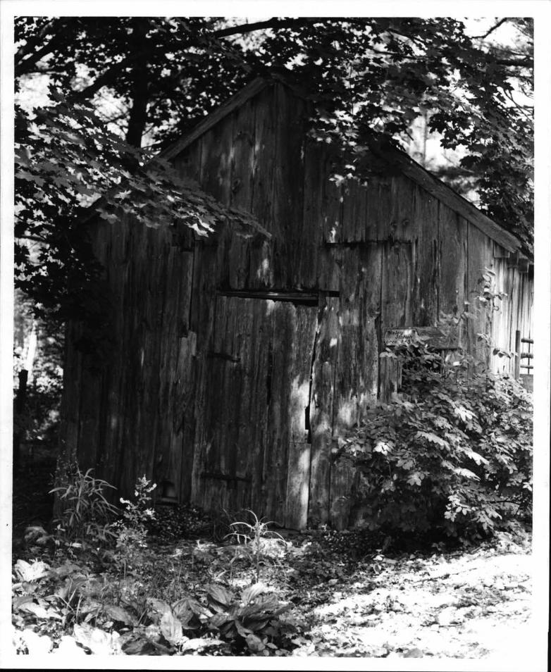
003
9CLASSIFICATION
CATEGORY OWNERSHIP STATUS PRESENTUSE-IDISTRICT XOCCUPIED .XAGRICULTURE
- LPARK
XBOTH IN PROGRESS LPRIVATE RESIDENCE
PUBLIC ACQUISITION ACCESSIBLE LRELIGIOUS
PROCESS XYES; RESTRICTED
CONSIDERED UNRESTRICTED
DOWNER OFPROPERTYNAME
VariousSTREET& NUMBER -
CITY. TOWN STATE
- VICINITY OF
flLOCATION OF LEGAL DESCRIPTIONCOURTHOUSE. -
REGISTRYOFDEEDaETC. Tow-n Clerk’s Office, Coventry Town HouseSTREET& NUMBER
SURVEYRECORDS Rhode Island Historical Preservation CommissionCITY. TOWN STATE
Providence Rhode Island
L
7. Description
Condition Check one Check one .
excellentç_ good
deterioratedruins
unalteredaltered
iL original sitemoved date
Describe the present and original if known physical appearance
Rice City is situated in the northeast corner of Coventry in ruralwestern Rhode Island. The Rice City Historic District comprises a two-mile stretch of the Plainfield Pike R.I. Route 14 with concomitanteighteenth- and nineteenth-century development along it. The districtincludes three primary nodes of activity: the village center, Rice Cityproper, located at the turnpike’s junction with Vaughn Hollow Road;Vaughn Hollow itself, an enclave of former agricultural and millingactivity, north of Rice City; and the former industrial and commerci a Icenter, Fairhank’ s Corner, located at the turnpike’s junction with FlatRiver Road R.I. Route 117.
The district includes some twenty-seven architecturally and historically important buildings, two archaeological sites, fourteen familycemeteries, one state managementpark area, and one abandonedand overgrown eighteenth-century dirt road. The main component of the district,which gives the settlement its linear aspect, is the turnpike itself, atwo-lane road now asphalt. Theambience of the district remains essentially rural, despite twentieth-century land divisions and subsequent scattered development of modestresidences. Stone walls line much of the turnpike and most of the sideroads and provide a key visual link for the entire district. Much of theland, particularly *in the western section, remains open, some of it stillin light agricultural use, as orchards and for grazing.
The district is characterized by good examples of simple vernaculararchitecture, modest frame structures, one- and two-and-a-half-storieshigh, country versions of the Federal, Greek Revival, and Victorianstyles. The beginning of the district, at the eastern end, is markedby the presence of a turnpike tollbooth number 2 on the sketch mapnow obscured by undergrowth, which, stands next to an eighteenth-centuryhouse Map Number 1 and across from an abandonedearly twentieth-centurycountry store Map Number 40. The three-quarter-mile stretch from thetollbooth to the actual village consists of woodland, mixed with sometwentieth-century residential development, set back and well-screened byvegetation from the road. The district bounds are drawn to include theroad and its right-of-way, inëluding the stone walls on both sides ofthe road, but excluding the newer houses.
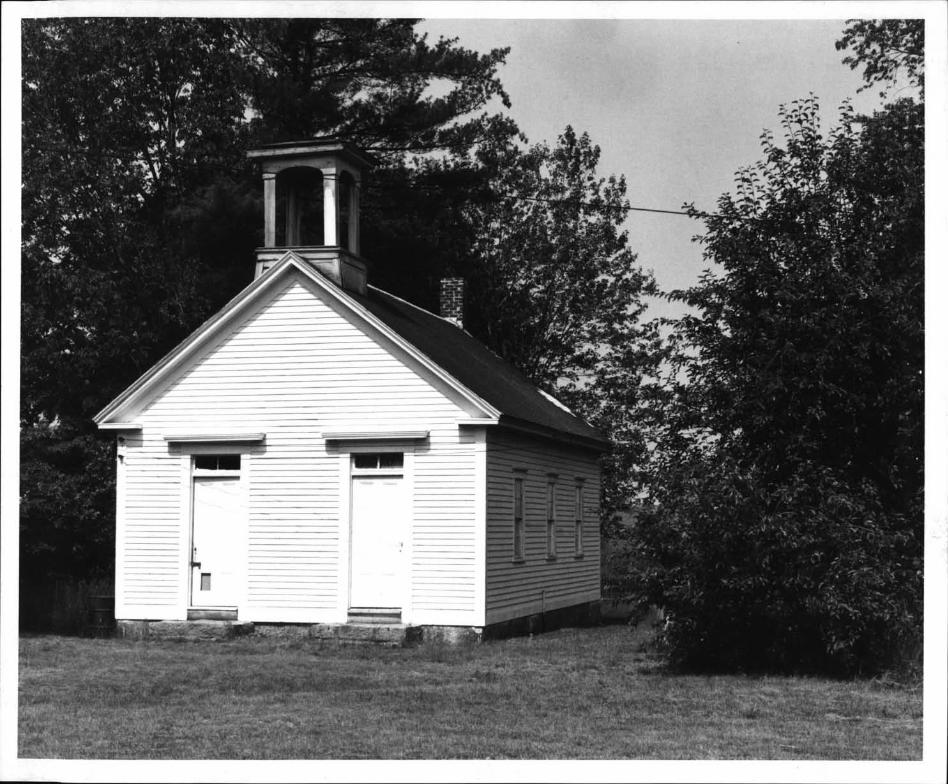
The village center is defined visually by the two-and-a-half-story,five-bay Rice Tavern, located at the junction of the turnpike with VaughnHollow Road Map Number 4, the small Democrat Schoolhouse Map Number 10--formerly located on the tavern lot opposite , the Rice City SchoolMap Number 17, the Rice City Church Map Number 15 and the OhadialiPotter house Map Number 20, a former hotel and store, the last threeall on Vaughn Hollow Road. The two last-named public buildings, school -
and church, were’ both built in 1846 in the Greek Revival style; theycomplement each other architecturally, and serve as- the civic focus ofthe village.
See Continuation Sheet #1
‘HR-8-’300A . .
11.178 - - ,
- UNITED STATES DEPARTMENT OF THE INTERIOR FOR HCRS-USE ONLY. - . -, :.. -
‘JATIONAL REGISTER OF HISTORIC PLACES :b.:: A: ;Y .::::. A
INVENTORY-- NOMINATION FORM
CONTI NUATION SHEET 1 ITEM NUMBER 7 PAGE 2
The district extends northward along the unpaved Vaughn HollowRoad into Vaughn Hollow itself, a wooded area containing six farm-houses dating from the late eighteenth to mid-nineteenth centuries, aswell as several mill sites on the Moosup River. These farms spreadeast and west along Vaughn hollow Road, Potter Road and Ban’s 11111Road, and abut the southern border of the town of Poster, which servesas the northern boundary of the district.
i iThe district continues southwest from the village center, a
quarter of a mile along the Plainfield Pike’,’ to its intersection withFlat River Road R.I. Route 117. This intersection, known as Fair-
____
bank’s Corner since the mid-nineteenth century, is the former industrialand commercial center of the village. It is marked on the north sideof the Pike by a stone Greek Revival house Map Number 25 connectedby an open-sided wooden walkway to a large, late nineteenth-centuryframe store Map Number 24; on the south side, the other enterprises ‘
located at this cornet- are indicated by a smal I ta ii orshop MapNumber 34 and a large slaughterhouse Map, Number 35 .
Beyond airhank’ s Corner, the last mile of settlement becomes
_____
increasingly rural and sparse, marked only by one eighlteemlth-ceIlturyfarmstead Map Number 33 with numerous outbuildings and stone walls, .
four small family cemeteries, and the relatively undisturbed founda-tions of two other turnpike taverns Map Numbers 26 and 31. Thesearchaeological sites have the potential to provide below-grounddocumentation, through the testing of hypotheses concerning the socialand economic interaction of these hostelries along the turnpike andthe changes brought about by this extensive transportationnetwork.
____
Near its western end, the district includes Gibson Hill Road,a now-abandonedeighteenth-century track, which runs northwest fromthe turnpike. Preliminary site survey has revealed nine foundations,several trash pits, several cemeteries and miles of walls on GibsonHill Road. There are indications of more house lots on side paths.The foundations are of eighteenth- and nineteenth-century farmsteadsthat constituted this rich agricultural hinterland oF Rice City. The 1*,
dry-laid stone foundations with half-cellars and wells represent thekind of settlement common in rural Rhode Island and southern New
_____
England during the late eighteenth century through the nineteenth
See Continuation Sheet #2
HR-8-300A11/78 -
UNITED STATES DEPARTMENT OF THE INTERIOR ro HCRS USE ONLYHERITAGE CONSERVATION AND RECREATION SERVICE
RECEIVED
NATIONAL REGISTER OF HISTORIC PLACES *: :,,,,-
INVENTORY-- NOMINATION FORM
CONTINUATION SHEET 2 ITEM NUMBER PAGE
- century. Fairly well undisturbed, the area is almost unreachable,due to heavy overgrowth, suggesting that the sites may yield rathercomplete data, which will provide supplemental information on life inRice City. There are no plans to excavate any of these archaeologicalsites at this time. -
Justification of Boundaries
The Rice City Historic District as described and mapped in thisnomination follows the historical boundaries of Rice City as anentity based on deeds, land-holdings, and early map histories.See attached 1895 map - Photo #16
See Continuation Sheet #3
:HR_8...300A - I
Inventory -
Structures contributing historically and/or architecturally to theDistrict.
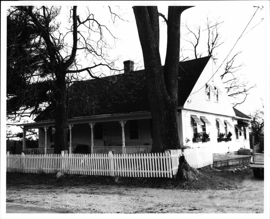
1. John Greene House 1732 and 1760. 1½-story, 5-bay house withsteeply pitched roof, shed dormersand center chimney. The 2-bay,1-story eli predates the house. Soldin-l778 to John Kelly byJohn Greene.
2. Tollbooth c. 1732. Small 1-story booth made of unfinishedvertical boards with gable roof. The entrance is at the gableend, with a small window opening to the right of the door. Usedas a tollbooth for the Plainfield Turnpike from 1794 to 1866; oneof the few remaining tollbooths in Rhode Island.
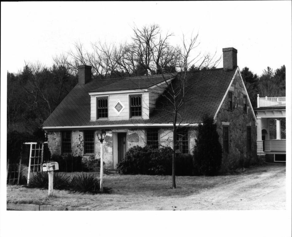
4. Rice Tavern c. 1796. Built by Samuel Rice as a tavern, itstands 2½ stories high; 5 bays with gable roof and center chimney.The tavern was an overnight stagecoach stop for the Providenceto Norwich stage.
5. House. Early nineteenth-century Ui-story, 4-bay house with gableroof and large, stone center chimney, set back in the woods.
7. Potter House 1852. 1½-story, 5-bay house with gable roof,largely altered by front projecting porch enclosure acrossfacade. On the site of the original Potter House, circa 1754.
8. "Tamarack Farm"13241 Built by John Vaughn. Uj-story farmhousewith gable roof, attached to outbuildings, with shed behind.John Vaughn ran saw and grist mills in the hollow.
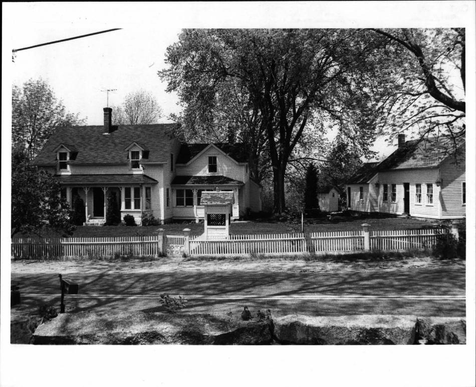
9. Caleb Vaughn House c. 1750/1840. 1½-story, 5-bay, gable-roofed,center-chimney dwelling with I - stony side add it toIl. Moved fromthe top of the knoll behind the present site in 1840. Rebuiltin 1840; its present appearance owes much to tile Greek Revival--its facade articulated by arched panelled pilasters acting ascornerboards and serving as the door enframement. Built byCaleb Vaughn, one of the incorporators of the town of Coventry.
See Continuation Sheet #4
I:,-::
s,r-.
S-
-
I 1/7B -
- UNITED STATE DEPARTMENT OF THE INTERIORHERITAGE CONSERVATION AND RECREATION SERVICE
NATIONAL REGISTER OF HISTORIC PLACES-INVENTORY-- NOMINATION FORM
CONTINUATION SHEET 3 ITEM NUMUIR 7
FOR HCRS USE ONLY
RECEIVED
DATE ENTEREa
PAGE 4
FHR-8-3d0A - -
- Nt11178 -
- UNITED STATES DEPARTMENT OF THE INTERhOR FOR I’ICRS USE ONI.YHERITAGE CONSERVATION AND RECREATION SERVICE -
- RECEIVED
NATIONAL REGISTER OF HISTORIC PLACES DATE ENTERED -:: -
INVENTORY-- NOMINATION FORM-a.
CONTI NUATION SHEET 4 ITEM NUMBER PAGE
10. - Bates House c. 1745.’ 1½-s-tory, 5-bay housewith gable roof -11and rebuilt center chimney; windows close to eaves. Rear dl. --
- Central doorway with sidelights. William and Frances Batesran a grist null - in the’ hollow. -
11. George Vaughn House. Early nineteenth-century,’ l-story,: 5-bay house,gable roof with center chimney; windows close to eaves. Centraldoorway with sidelights. Side addition 1852. Millstones fromthe Vaughn mills are located on this property.
Vcw.cVvw frh-tJ,sar to-4-- - - . -
13. C. B. Andrews’ Store 1881. Late nineteenth-century 1½-story .
building incorporating store and residence, with gable roof and - S- gable dormers. Now used as a dwelling.
:.-.
14. Nathan Corey House. Late eighteenth-century 1½-story, 5baydwelling with gable roof and gable dormers. Altered in the latenineteenth century: application of cut shingles and new pedimented :.-:.
porch entrance. Nathan Corey was a member of the first church inRice City in 1783, and subscribed to the Democrat School.
_____
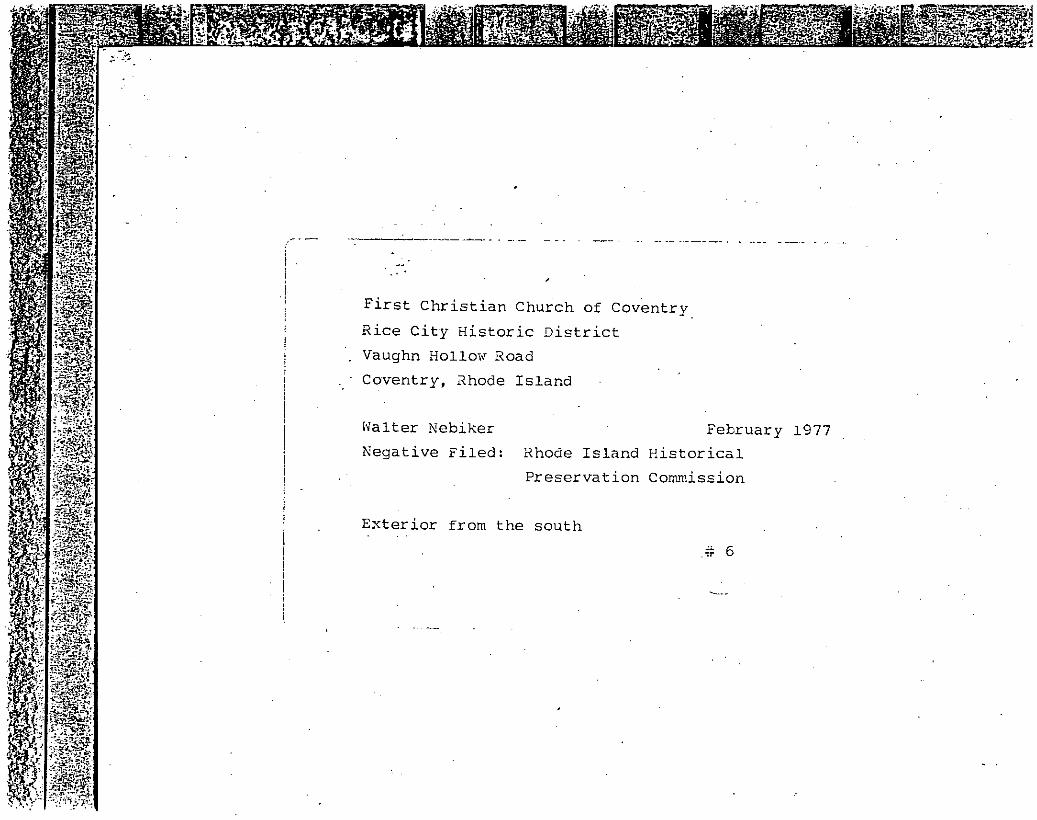
15. First Christian Church of Coventry 1846. Greek Reviv1 churchbuilding with square enclosed belfry and two front doors.Originally formed as a Baptist congregation in 1813, it-changed -
affiliation to the United Church of Christ in 1881. The most
_____
influential church in western Rhode Island in the 19th century, ...- .
it achieved prominence due to Elder James Burlingame, who presided’over the church for over 50 years. , ‘
- 17. Rice City School 1846. Greek Revival one-room public schoolwith gable roof and open belfry. The school closed in 1949.
S..A
- ‘ .--19. Democrat Schoolhouse pre 1812 . One-room schoolhouse with .
gable roof, built by public subscription as a private school.Sold to the public in 1817 for $60 by Sally and Ebenezer Rice. -
It served as a schoolhouse until 1846 when the new school wasbuilt. At this date this school was moved from the tavern lot
_____
to its present location on the west side of Vaughn Hollow Road. !
20. Obadiah Potter House 1804. 1½-story, 5-hay, frame house with -
steeply pitched roof, central chimney; windows close to eaves,’1-story side porch addition. Obadiah Potter ran a store and
-hotel here in the early 19th century.
- See Continuation Sheet #5
--
pHR..8300A :11/78 . ‘ --
- UNITED STATES DEPARTMENT OF THE INTERhORHCRS USE ONLY - -- - -
-HERITAGE CONSERVATION AND RECREATION SERVICERECEIVED
NATIONAL REGISTER OF HISTORIC PLACES DATE ENTERED
____
INVENTORY--NOMINATION FORM - :---------- - -
___
CONTINUATION SHEET 5 ITEM NUMBER 7 PAGE 6
-- 17Q..t&tfftttL 7f& ‘‘
22. - House. Greek Revival .l½-story, S-bay with gable roof and gable ‘ -
dormer,s. 1-story side ell with open norch.
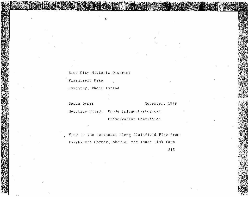
23. Isaac Fisk Farm 1890. 1½-story Late Victorian house wi th sidedl set on a foundation of white quartz; gable roof and gabledormers. The central doorway is flanked by bay windows whoseroofs support an attached open porch. To the right of the mainhouse stand 4 other structures,: -ran outhouse 1887 ; a small
-
cottage, said to he the eli c. 1742 of the first house on the- -, site; another larger cottage late nineteenth century; and a
shed-like structure which housed the blacksmith’s shop the ‘Forge -
and anvil survive - The property includes a handsometurn-of- the- ‘
century barn, situated directly across the road. Isaac Fisk was ‘.
the town blacksmith in the late nineteenth century. - --
24. Fairbank Store c. 1868. 2½-story bracketed Victorian building <with gable roof, gable dormers. The open attached porch is alater addition. The building was used as a general store until - .
1881, selling meat, groceries, clothing and furniture. An open
_____
walkway at the rear connects it with the main, house.-$25. Fairbank House 1826. Small Greek Revival cottage of cut granite -:
‘Tth2nt1c1TInneys and a tall shed dormer wi tli sash conta I ni ugGothic lights, probably added in the late nineteenth century.
26. McGregor Tavern’ Site. Built in 1783, the tavern burned in 1894. -
The foundation of the tavern, its outbuilding and unfilled welland retaining wall a,re still clearly visible and essentiallyundisturbed. It was the only tavern of the three in Rice Citythat became a TemperanceTavern in 1831. A comparative excavation of this site and that of the Gibbs Tavern would revealinteresting differences in foodways and ceramic uses.
28. "Woodpecker I-hi 11. ‘‘ Nursing home complex using Late V.1 ctor inn‘.,.farm complex and carriage house,.altered with early 20th-century
modern, low, 1-story additions in three sections, to form a -
courtyard. -"
jJ-tiL Itifl’-/-’ - -
. . - .29. McGregor District School 1812. 1-story, 1-room schoolhouse withgable roof. -Closed in 1907. Moved from its original location,on the east side of Gibson Hill Road to the west side; presentlyin use as a chicken coop.
See Continuation Sheet #6
‘HR-83QOA11/78 - -
- -
-UNITED STATES DEPARTMENT OF THE hNTERIORHERITAGE CONSERVATION AND RECREATION SERVICE
‘JATIONAL REGISTER OF HISTORIC PLACESINVENTORY-- NOMINATION FORM -
CONTI NUATION SHEET 6 ITEM NUMBER PAGE 7
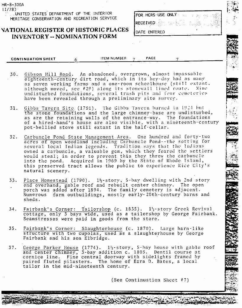
La-.30. Gibson Hill Road. An abandoned, overgrown, almost impassable’
eighteenth-century dirt road, which in its hey-day had as manyas seven working farms and a one-room schoolhouse still extant -
although moved, see #29 along its stonewaLl I med route. Nineundisturbed foundations, several trash i its anL tou i. cemet er i eshave been revealed through a preliminary site survey.
32. Carbuncle Pond State ManagementArea, One hundred and forty-two
____
acres of open woodland including Carbuncle Pond--the setting forseveral local Indian legends. Tradition says that the lnth innsowned a carbuncle, a valuable gem, which they feared the settlerswould steal; in order to prevent this they threw the carbuncleinto the pond. Acquired in 1969 by the State oF Rhode Island,this preserved tract allows the public to experience Rice City’snatural scenery.
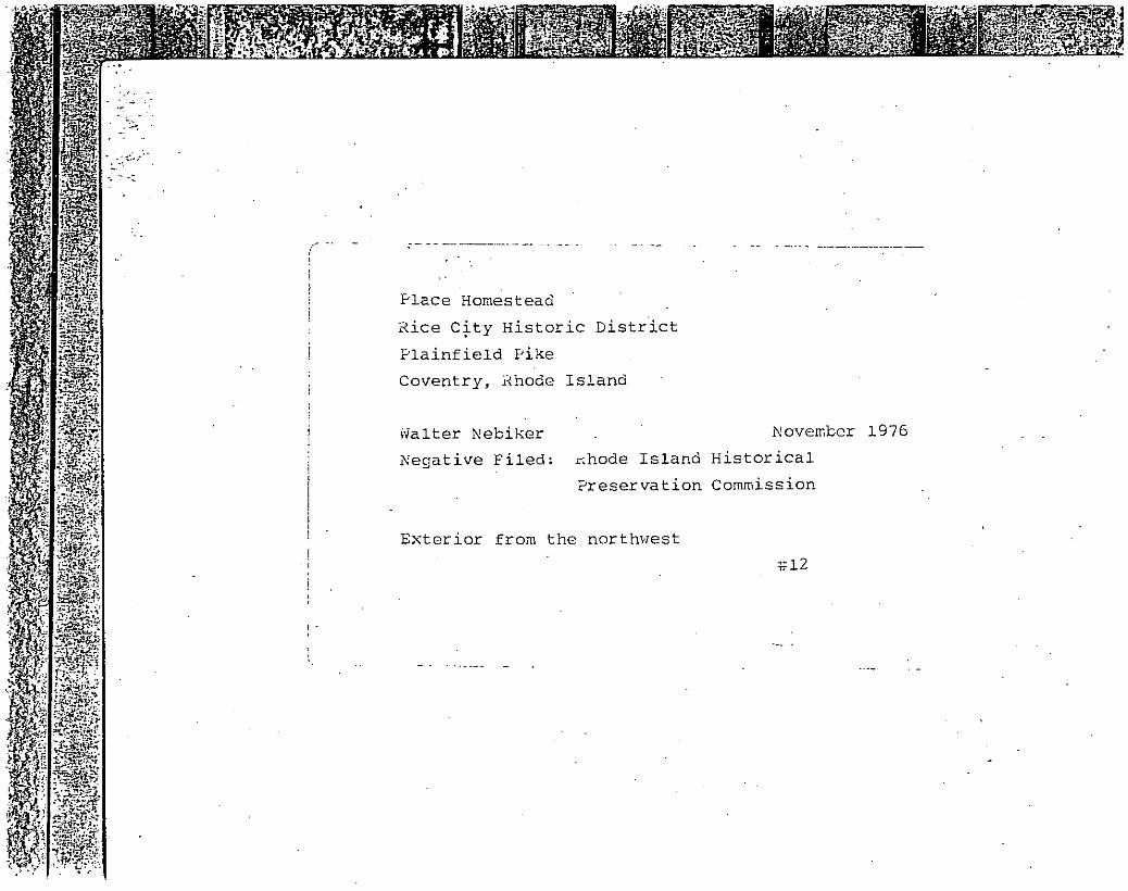
33. Place Homestead 1790. 1½-story, 5-bay dwelling with 2nd story
____
end overhand, gable roof and rebuilt center chimney. The openporch was added after 1894. The family cemetery is adjacent.Numerous farm outbuildings, mostly early- 20th-century barns andsheds.
34. Fairbank’s Corner: Tailorshop c. 1835. 1½-storyas a tailorshop byfrom the store.
GreekGeorge
RevivalFairbank.cottage, only
Seamstresses3 bays
were pawide,
Id inused
goods
35. Fairbank’s Corner: Slaughterhouse c.structure with two cupolas, used as aFairbank and his son Libridge.
37. George Parker House 1774. 1½-story,and center chimney, 3-bay addition c.cornice line. Fine central doorway wipaired fluted pilasters. The home oftailor in the mid-nineteenth century.
FOR. HCRS USE ONLY
RECEIVED
DATE ENTERED
31. Gibbs Tavern Site- 179!. Thethe stone foundations and theas are the retaining walls ofof a hired-hand’s house are alpot-bellied stove still extant
Gibbs Tavern burned in I C-1 butlarge chimney-base are undisturbed,the entrance-way. The foundationsso visible, with a nineteenth-centuryin the half-cellar.
‘A
-r
S
1
4
1870. Large barn-likeslaughterhouse by George
5-bay house1805. Dentilth sidelightsEzra D. Bates
roofwith gablecourse atframed by
a local
See Continuation Sheet #7
HR-8--300A‘11/78 - .
‘
-- UNITED STATES DEPARTMENT OF THE INTERIOR
FOR HCRS- USE ONLYHERITAGE CONSERVATION AND RECREATION SERVICE ‘ - ‘ - ‘ - -
RECEiVED ,, ‘‘‘‘‘
NATIONAL REGISTER OF HISTORIC PLACES DATE ENTEREDINVENTORY--NOMINATION FORM ‘
CoNTINUATION SHEET 7 - ITEM NUMBER 7 PAGE 8
38. Bates Tailorshop c. 1850. Long, 1-story shingled shed, part ofwhich was the 19th-century tailorshop of ‘Ezra D. Bates.
____
tt$4e40. Kettle Brothers Store. 20th-century 1-story clapboard country
store with gable roof. Presently not in use; this bui iding wasthe last of the ‘country’ stores’ to locate in Rice City.
Non-Contributing Properties
3. House. 20th-century 1-story ranch house with gable roof.
6. House. 20th-century 1½-story house with gable roof. -- - -
12. House. 20th-century 1-story house with hipped roof.
16. Parish House 1964. 1-story, 6-bay clapboarded long house withgable roof.
18. House. -20th-century, small 2-bay cottage, using vertical boardswith gable roof.
21. House. 20th-century l’-story, 3-hay shingled cottage with gableroof, built on old stone foundation.
27. House. Late 20th-century, 2½-story frame house.
39. House. 20th-century reproduction eighteenth-century house,1½-story, 3-bay with 2-bay addition, gable-roofed with large
‘.panelbrick chimney.
I
-8.. Significance - -
Period Areas of Significance-Check and justify below -
-- prehistoric archeology-prehistoric community planning landscape architecture_i religion1400-1499 _21 archeology-historic conservation - law science
- 1500-1599 _X agriculture economics - lite,nture sculpture- 1600-1699 _x architecture _ education __ military _ social?-x 1700-1799 - art _ engineering _ music humanitarian
Rice City is a relatively well-preserved typical late-eighteenth-and nineteenth-enty rural settlement. Tts component elements--villagecenter, commercial center, subsidiary farming and ml I I ing areas, mud t.Itelinear link of the turnpike itself--are significant to the study ofeighteenth- and nineteenth-century life in rural Rhode Island and provideor embody information on rural architecture, agriculture, commerce,
- religion, and transportation. The several archeological sites--althoughas yet untested--remain generally undisturbed and promise to yield additional
- data on rural life.
The village developed along the so-called "Great North Road" laterPlainfield Turnpike, an early 1711-1714 transportation link betweenProvidence and central Connecticut. The village is traditionally saidto have been founded in 173h by Adam and Gabr I e,1 love, a It Iiotmmlm no structurt’sfrom this date appear to survive. However, the road stimulated settlementand the development of community functions throughout most of the eighteenthand nineteenth centuries. Before the end of the eighteenth century threetaverns McGregor, 1783; Gibbs, 1791; and Rice, 1796 and a Baptist Church1783 were established. By this time, too, the Vaughn Family, which hadsettled north of the road in Vaughn Hollow early in the eighteenth century,had saw and grist mills in operation.
In 1794, the Great North Road was repaired and taken over by a privateturnpike- company, the Providence and Norwich Turnpike Society. The roadran to Norwich, Connecticut, via Pla infield and soon was popularly knownas the Plainfield Turnpike, the second toll road in Rhode Is I and. Locatedalong the Pike just east of the village center were a tollgate and boothwhere tolls were collected. The tollbooth which some sources indicatewas built in 1732 and used as a relay-remounting station still stands, oneof the very few remaining in the state.
Because Rice City was located halfway between Providence and Norwich,it became a convenient and popular overnight stop for stage coaches andtravellers along the pike. The opening of Rice Tavern in 1796-- theofficial state-coach stop of the Turnpike Society and the only tavern stillstanding in Rice City --reflected the impact of turnpike travel on thegrowth of the village. It was Samuel Rice, keeper of the tavern, who gavethe village its name. At midnight on opening day in 1796, he climbed to theridge pole of the tavern with a bottle which he smashedagainst the chimney,christening the building Rice Tavern and the surrounding settlement * Rico Ci t’
The village’s physical development and economic livelihood in thenineteenth century were dependent almost entirely on the turnpike and the
See Continuation Sheet 118
‘S.
NThjR-8-3QQA11/78 -
- - UNITEb STATES DEPARTMENT OF THE INTERIOR FOR HCRS USE ONLYHERITAGE CONSERVATION JAND RECREATION SERVICE
RECEIVED
NATIONAL REGISTER OF HISTORIC PLACES DATE ENTERED. LINVENTORY-- NOMINATION FORM -
CONTINUATION SHEET $ - TIM NtJMB[Fm s PAGE
trade it generated. As more families settled along its length, -
churches and schools were established. A second Baptist congregationformed here in 1813 and the church soon established built in 1815drew residents of Coventry, Foster, and, even, Cranston. The RiceCity Church, under the domination of Elder James Burlingame, becamethe religious center for much of western Rhode Island for the firsthalf of the nineteenth century. The present church building of 1846is the third structure on the site. .
- Rice City was divided into two school districts: Rice City and
_____
the McGregor district. The three schools that were built still exist t
and all three are within the district. The first school known as theDemocrat Schoolhouse, was built before 1812. A private school, built *. -.
by public subscription, it was sold to the public in 1817 and servedthe village until 1846. The Democrat Schoolhouse originally stoodon the Rice Tavern lot, but was moved in the nineteenth century to theother side of Vaughn Hollow Road. The McGregor District School wasbuilt in 1812, on Gibson Flill Road, near the Connecticut state border.It was in use until 1907; it has since been moved from its foundations, *1-to a nearby location, For use as a chicken cool. The new Rice CitySchool was built in 1846 in the Greek Revival style and served thevillage until 1949.
Vaughn Hollow, located just north of the village center, was thesite of several small and seasonal grist and sawmills, which suppliedRice City and its environs with grain and wood products. The woodedhollow is named for the Vaughn family, who settled here in the earlyeighteenth century, and ran the mills. -- - -
The most important node of commercial activity was at Fairbank’sCorner, on the ?Ioosup River. In 1811, the river was dammed and agrist and carding mill was built here. George Fairhank, for whom thecorner is named, setti Ni here in 18Th, html ld I ng a s tone Greek Rev i va Ihouse. lie built a woolen mill, which burned in l8U6 and was neverrebuilt. The mill foundation has been destroyed by the building ofthe present bridge crossing the Moosup, although the dam and snillwayare still visible. Many of the local farmers raised sheep, and it was
_____
said that they could bring the wool to Fairbank’s Mill, to have itprocessed, after which finished articles of clothing were produced byseamstresses in a small tailor shop on the premises. By 1868 the
See Continuation Sheet #9 -
S-:
:HR..sr300A -
11/78STATES DEPARTMENT OF THE INTERIOR
- FOR HCRS USE ONLYHERITAGE CONSERVATION AND RECREATION SERVICE - - - - - -H - - - - - - -
RECEIVED
NATIONAL REGISTER OF HISTORIC PLACES --: -- - -- - - - - -,
INVENTORYNOMINATIONFORM
CONTINUATION SHEET 9 ITEM NUMBER 8 PAGE 3
Fairbank- family had expanded-into the grocery business. A large store - --
was built, as well as a slaughterhouse. The Fairbank complex servedas the commercial. center not only for the village, but drew many - ‘ -,
customers from nearby Connecticut and Foster. -
Gibson Hill Road was- the- focus of outlying agricultural settlementThe road was mapped iii 1784 and was the site of several working farm-steads by the early nineteenth century. The McGregor District Schoolwas originally located along this road and could be seen clearly fromthe Plainfield Pike.
_____
Rice City began asan early eighteenth-century farming settlement -
whose development and growth were generated by the turnpike trade and ---
the stagecoach lines. When the railroad-line was built throughwestern Coventry in 1854, it totally bypassedRice City. The stationwas located to the southeast and generated a new village, Greene. Withthe change in transportation, traffic declined and the turnpike no -longer served as the primary trade route. - -
By the latter half of the nineteenth century depopulation hadbegun. The stagecoach lines discontinued service in 1866, as therailroad became more important. -Iaps reveal that many Rice City ,..-natives moved to Greene to be nearer the railroad. The post officeclosed and relocated at Greene; most of the farmsteads on Gibson HillRoad were abandonedby 1895. The Fairbank Store closed in 1831, and .4
none of the stores that were established after that time had anysimilar impact, in bringing people to Rice City. Development stopped --
and Rice City was thus reducedto a sleepy rural settlement, which itremains to this day. Despite some, mostly recent, residential development, Rice City remains relatively unchanged, reta imiing much of itsvisual, architectural, and historical integrity.
- -
- a- I - -- -
:HR_8...300A t1l/78- . . - I .
- - - UNITED STATES DEPARTMENT OF THE INTERrOR- FOR HCRS USE ONLY
HERITAGE CONSERVATION AND RECREATION SERVICE’RECEIVED
NATIONAL REGISTER OF HISTORIC PLACES DATE ENTEREDINVENTORY-- NOMINATION FORM
CONTINUATION SHEET 10 ITEM NUMBER 9 PAGE 2
Hopkins, Samuel R. A Short Account of the Reformation and
_____
Establishment of the Church of Christ or Christian Church I’of Coventry since 1812. Providence, 1821.
Place, John W. Rice City and its Suburbs. text of speech givenat Western R. I. Civic Historical Society 1949.
____
Pugh, William E. "Rice City: You can enter it, but you- can’tleave it." Providence Journal Bulletin, August 6, 1971: 1-2.
.
FHR-8-300A11/78 - --
- UN1 TED STATES DEPARTMENT OF THE INTERIOR :-- -:wHERITAGE CONSERVATION AND RECREATION SERVICE y 2 8 49
RECEIVEDNATIONAL REGISTER OF HISTORIC PLACES
INVENTORY--NOMINATIONFORM
CONTINUATION SHEET 11 ITEM NUMBER 10 PAGE 2
Beginning at the northeast corner, at and including Lot 69, Plat56, the boundary of the district runs west and south following thenorthern and western lot line of lot 69, to a point fifty feet northof the center line of Plainfield Pike. From there the boundary turnswest, following the center line of Plainfield Pike, but fifty feet tothe north, until it meets the eastern lot line of lot 13, Plat 56. Itthen runs north along the eastern lot line of lot 13 and lot 8, theneast along the southern lot line of lot 7 continuing due east to andincluding lot 4, Plat 56, and following its southern, eastern and northern bounds. From there the district boundary proceeds northwesterly,at the some angle as the northern lot line of lot 4 about 80 feet,until it meets the eastern lot line of lot 7, Plat 56. Thence northalong the east boundaries of Lots 7 and 5 to the town of Foster’ssouthern border. -
The boundary proceeds west along the town border to a point duenorth of the northeast corner of Plat 57, Lot 1, thence due south tothe northeast corner of Lot 1, then across forest land to the southwestcorner of Lot 5, then following the south bounds of Lots 5 and 7, westto meet Barbs Hill Road, southeast on the center line of the road tothe northwest corner of Lot 4, and then southwest on the west boundsof lots 4,11, 15, 26, 28, then running west on the north bound of Lot40; south on the west lot line of lot 40 to a point 50 feet north ofthe center line of Plainfield Pike. - The boundary proceeds west fromthat point, following Plainfield Pike, fifty feet north of its centerline across lots 51, 55, 56, 50, and 57, then turning to the north 20feet at lot 54 to include a cemetery, beyond that returning to fiftyfeet north of Plainfield Pike’s center line and crossing tots 53, 52,36 and 35 until it meets the eastern bound of lot 34, Plat 57. Fromthere the boundary proceeds north and west along the eastern and northem lut lines of lot 34, south on the west bound of lot 34 to meet thenortheast corner of Lot 100; west on the north bound of lot 100 to thesoutheast corner of lot 101, hence north and west on the east and northbounds of lot 101, across Gobson Hill Road, continuing west on thenorth bound of Plat 58, lot 33 to the Connecticut state border. Thedistrict boundary then runs south along the state line to the snuthwest corner of lot 33 ‘then east on the southern bound of Lot to thewestern bound of lot 4, then south on that bound to the PlainrieldPike. The boundary nuns on the southern edge of the Plainfield Pike,east to the northwest: corner of Lot 11, south and east on the westand south bounds of lot 11 to meet the western bound of Lot 10; south
C’’-’- 1-:: ‘: /
FHR-8-30OA- . 11/78 - -
- UN I TED STATES DEPARTMENT OF THE INTER I OR - drAtAs -USE’*- -H *-:V-:/ -
HERITAGE CONSERVATION AND RECREATION SERVICE 2 8 1980RECEIVED
NATIONAL REGISTER OF HISTORIC PLACES DATE ENTERED. JONINVENTORY-- NOMINATION FORM - - I
CONTINUATION SHEET 12 ITEM NUMBER 10 PAGE 3
on that bound to, and including, the railroad right-of-way of the NewYork, New Haven and Hartford Railroad which forms the southern boundsof lots 10 and 8; following east on the south bound of the right-of-wayto meet the Moosup River; following the river generally north to thesouth bound of lot 2; east on this bound across Flat River Road. Eastand north on the south and east bounds of Plat 55, Lot 20, then on thenorth line of lot 20- to a point 100 feet east of the center line ofFlat River Road; the due north to the southern bound of lot 37, Plat S.then west fifty feet, then north following the center lines of FlatRiver Road and Plainfield Pike, but fifty feet to the east across lots37 and 22 to the southern line of lot 31. From there the districtboundary follows the southern, eastern and northern bounds of lot 31east, north and west to a point 50 feet south of the center line ofPlainfield Pike. Thence the boundary turns and follows Plainfield Pike.fifty feet south of its center line, across lots 32, 33, 24, 60, 25,40, 125, 123, 122, 121, 120, 119, 117, 109, 108, 107, 106, 105 and 102.Then the boundary follows the east bound of lot 102 south to a pointopposite the southwest corner of lot 104; thence in a straight line tothat corner; east on the south bound of lot 104 to Sisson Road; northon Sisson Road to the Plainfield Pike; east on the south bound ofPlainfield Pike to the southeast corner of Plat 56, lot 69, then northalong its east bound to the point of beginning.
F
flMAJOR BIBLIOGRAPHICAL REFERENCES
Frank C. How Coventry Came to BeBicentennial Souvenir Booklet 1941.
Fowler, Gail. Rice City: An Evaluation of the Evidence.Thesis, Brown University 1976.
and-Coventry:
Master’s -
- See continuation sheet 10
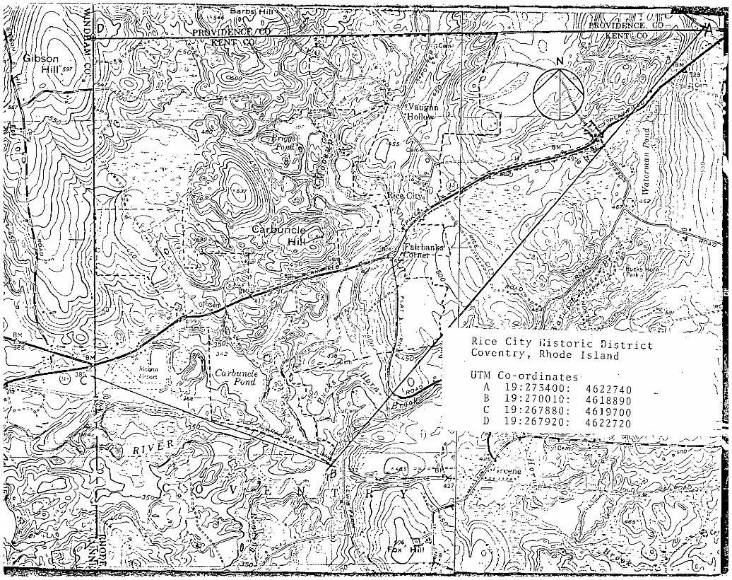
CGEOGRAPHICAL DATAACREAGEOFNOMINATEOPROPERTY about 1 , 6O acresUTM REFERENCES
ZONE EASTING NORTHING ZONE EASTING NORTHINGc11191 121710100,01 14,611,819,2,01 oll,91 l2l6616,1,0I 14161210Il18101
VERBAL BOUNDARY DESCRIPTIONE 19 269900 4622740
See attached sheet -- continuation sheet 11
LIST ALL STATES AND COUNTIES FOR PROPERTIES OVERLAPPING STATE OR COUNTY BOUNDARIES
STATE CODE COUNTY CODE
STATE CODE COUNTY CODE
mFORM PREPARED BY -
NAME! TITLEVivienne Lasky, Preservation Planner
ORGANIZATION DATE
Rhode Island Historical Preservation Commssion April, 1978STREET & NUMBER - TELEPHONE -
150 Benefit Street 401-277-2678CITY OR TOWN STATE
Providence Rhode Island -
ESTATE HISTORIC PRESERVATION OFFICER CERTIFICATIONTHE EVALUATED SIGNIFICANCE OF THIS PROPERTY WITHIN THE STATE IS: :
NATIONAL........ - STATEX LOCAL..........
As the designated State Historic Preservation Officer for the National Historic Preservation Act of 1966 Public Law 89-665. I
hereby nominate this property for inclusion in the National Register and certify that it has been evaluated according to thecriteria and procedures set forth by the Nati al rk Serv e. -
FEDERAL REPRESENTATIVE SIGNATURE - LTITLE State Historic
Barbour, Ardis F1 Bates,Our Town
PS USE ONLY
I HEREBY CERTIFY THAT THIS PRO PEW,
Preservation Officer DATE June 21, 1978
ro; n.e1 I z
ECS CITY NI/rat/C C/ITt/CT- canwrrn ta- atawo
SC47ZW /14 - - Aor IVav/t’ItIrwe gW.tpw- AtVOfl’4 -- C
Rice City Historic DistrictCoventry, Rhode is land
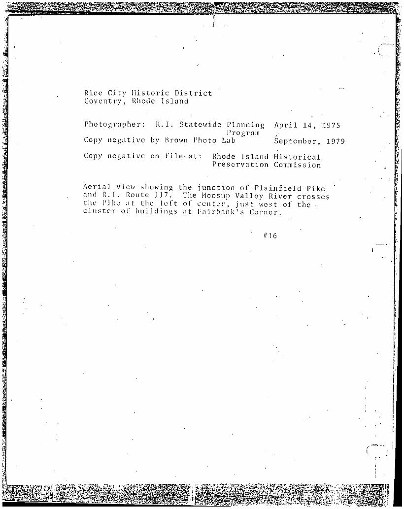
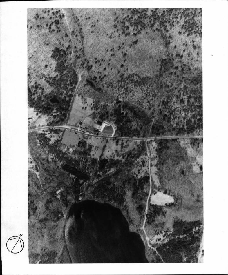
Photographer: R. I. Statewide Planning April 14, 1975rogram
Copy negative by Brown Photo Lab September, 1979
Copy negative on file at: Rhode Island HistoricalPreservation Commission
Aerial view showing the junction of Plainfield Pikeand R.T. Route 117. The I’Ioosup Valley River crossesthe Pike at the left of center, just west of thecluster of buildings at P:iirbank’ s Corner.
#16
I,
S2aNt SW JIWS
Rice City Historic DistrictCoventry, Rhode Island
Photographer: R.I.. Statewide Planning April 14, 1975Program
Copy of negative by Brown Photo Lab September, 1979
Copy of negative on file at: Rhode Island HistoricalPreservation Commission
Aerial view showing western section of district withCarbuncle Pond at center bottom and Gibson Hill Roadat left toj
#17
F 0
DkREDSwB.PTrt
LVMC rx/GZ
4DE1A/ CA -
/$AA C c/J K j
I I4NCHARD ID..V4UOffN
LE7/VARD LDI’E//
YOL//VCJ5’ >AM’4’A PRA TTy’
5;/
LED/A PECHE5. GB. CANDAZL2 /
_
R 1 C -
- /
CWETF
C I T fft15’APT C//JANf A9ftH/#S0A’fj
oci: 18T. I
5’ -
5. - - - - AD4 Tfl /A. oo
ANN8A8RP8GLENrEr
GRIEN87F /
A5AV1T1 jLO
L.D.fEN 5
- L G.NCLA/ - - - -
-, / 7*,_* - -
_
4. 1/ -
-I
_
- -
Is
t ‘- -"-
/ -
,r
-4:"
/i-
_______________
COV14L.
-
P.- ‘ ‘.‘uc#i
Mtr,./ /‘A-
L’j’-I
S
hV
*ii -
-
Rice City Historic DistrictCoventry, Rhode Island
Copy negative by Brown Photo Lab September, 1979
Negative on file at: Rhode Island HistoricalPreservation Commission
Rice City as shotcn in the 1895 Everts and RichardsAtlas of Providence County, Rhode Island.
U‘7
Rice City illstoric DistrictCoventry, Rhode Island


![UNITEDSTATES DEPARTMENT OFT}-]EINTERIOR FOR NPSUSE … · NATIONAL REGISTER OF HISTORIC PLACES INVENTORY-- NOMINATIONFORM FORNPSUSE ONLY-RECEIVED-- ---: DATE ENTERED..- --- - - ITEM](https://static.documents.pub/doc/80x56/5f0e991e7e708231d4400245/unitedstates-department-oft-einterior-for-npsuse-national-register-of-historic.jpg)


