10
Geocodin g UP206A: Introduction to GIS
Geocoding
UP206A: Introduction to GIS
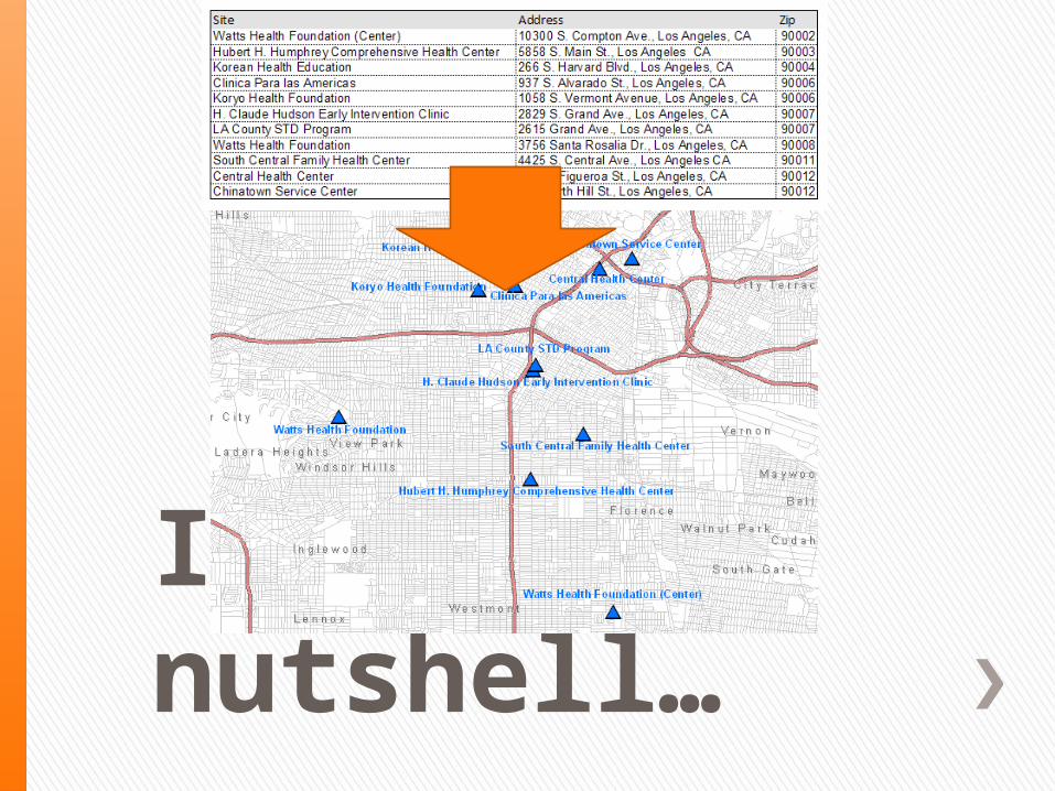
In a nutshell…
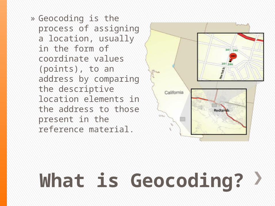
What is Geocoding?
» Geocoding is the process of assigning a location, usually in the form of coordinate values (points), to an address by comparing the descriptive location elements in the address to those present in the reference material.
Why Geocode?
» Many reasons. ˃ One is to be able to determine which boundary (e.g. school district,
census block, voting district) a particular address is contained.˃ To visually see if data is clustered or dispersed˃ To summarize data by a larger geography˃ Display points based on certain parameters
» To extract information from an address that the address does not immediately offer.

Geocoding Work Flow

The Data – What is Needed?
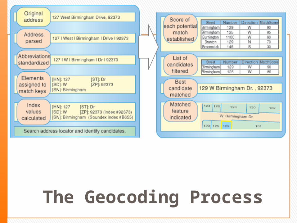
The Geocoding Process
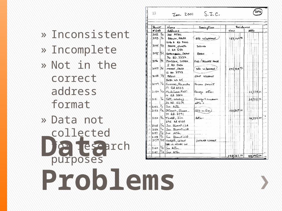
Data Problems
» Inconsistent» Incomplete» Not in the correct
address format» Data not collected
for research purposes

Incorrect Address Formats
CODE ADDRESS
1 LOMA GRANDE ESTATES LOT 48
2 CAMINO DE LOS CHAVEZ
3 CASTLE APRT
4 2 MILES WEST OF CAPITAN
5 MM 278 HWY 70
6 PO Box 862
7 UNKNOWN
8 GENERAL DELIVERY
9 T16SR13E30
10 TRACT 2 MAP 70

Accuracy of Matches
» Are the points being placed where they should be?
» Depends upon accuracy of address and road network.
» Score» Informal Checks
˃ Compare against existing data, known points. ˃ Check against Zip Code boundaries, quadrants˃ Last resort: Check against Google, Yahoo online geocoders!


