US Army Corps of Engineers e-Navigation Projects AAPA Harbors and Navigation Committee Meeting Port of Seattle 13 August 2014 Brian Tetreault US Army Corps of Engineers Research and Development Center – Coastal and Hydraulics Lab
Transcript
US Army Corps of Engineerse-Navigation Projects
AAPA Harbors and Navigation CommitteeMeeting
Port of Seattle 13 August 2014
Brian TetreaultUS Army Corps of Engineers
Research and Development Center – Coastal and Hydraulics Lab
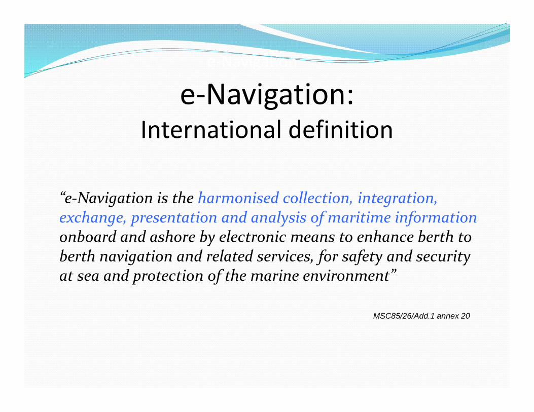
e-Navigation:International definition
“e-Navigation is the harmonised collection, integration,exchange, presentation and analysis of maritime informationonboard and ashore by electronic means to enhance berth toberth navigation and related services, for safety and securityat sea and protection of the marine environment”
MSC85/26/Add.1 annex 20
e-Navigation
“Information Paper on the Draft IALA Recommendation e-Nav 140 on e-Navigation Architecture – the shore perspective”
e-Navigation:“three sides of the coin”
e-Navigation: “Analog to Digital”
• Paper charts• Manual positioning• Voice communications• Visual aids to navigation
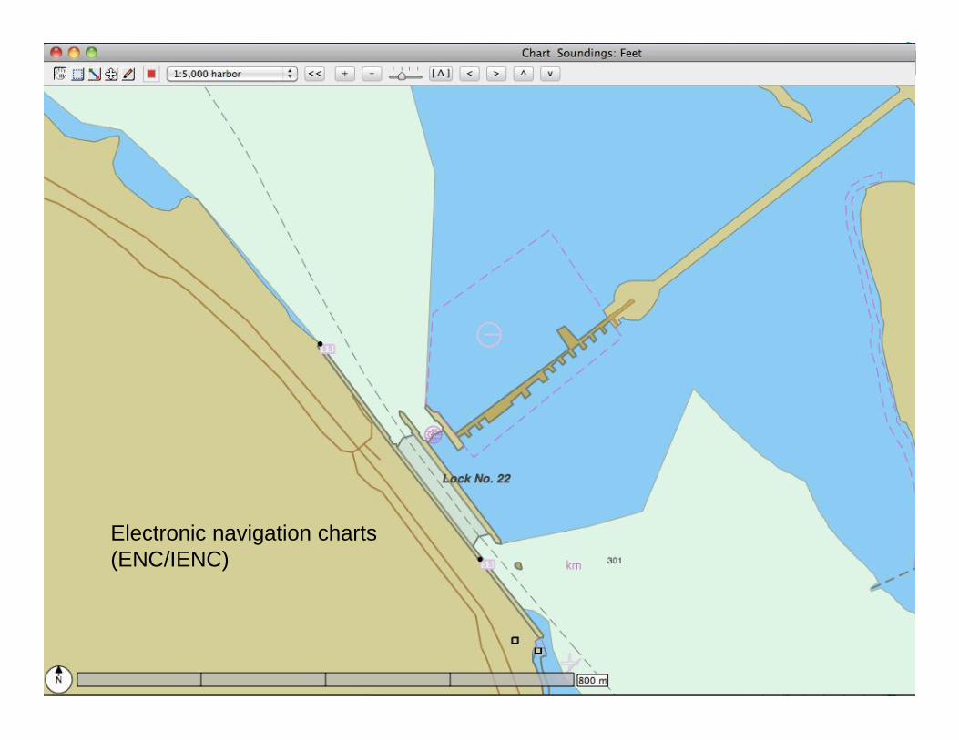
Electronic navigation charts(ENC/IENC)
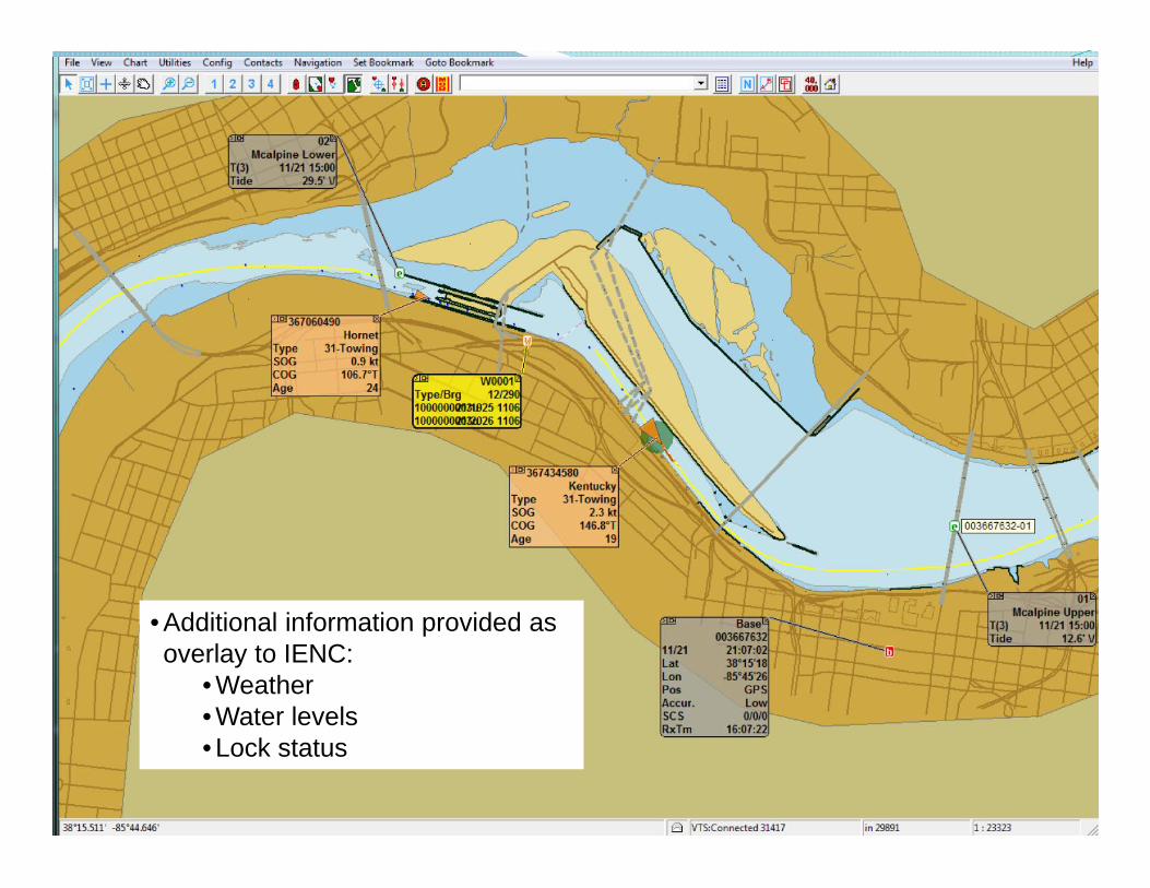
• Additional information provided asoverlay to IENC:
Application (LOMA) Lock approach current modeling Notices to Navigation Interests -“eMSI”
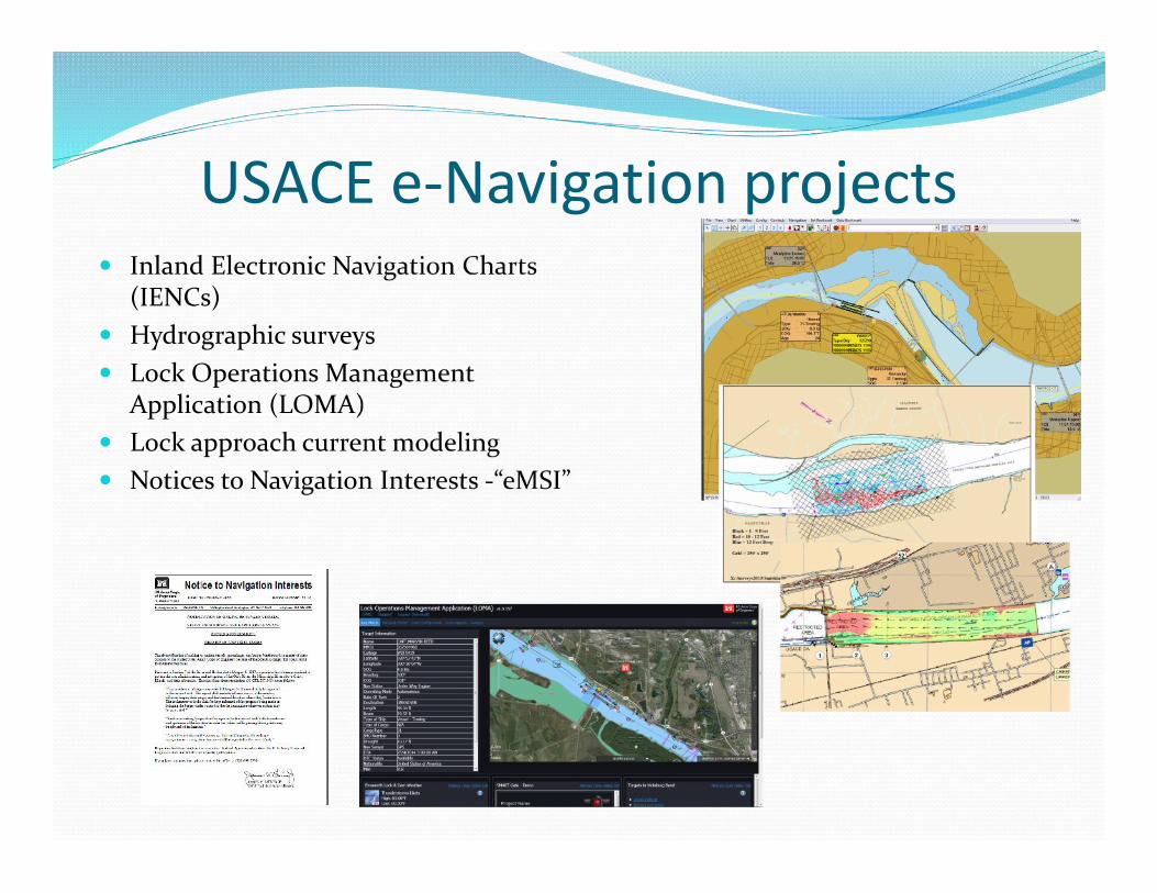
USACE Inland Electronic Navigational ChartProgram Status - 2014
• 106 charts of inland rivers available on web• ~7000 miles available in Inland Standard 2.2, shapefiles and KML• US Coast Guard buoys chart overlay available• Program managed via Army Geospatial Center & Louisville District
• Monthly Update cycle, can update weekly as needed• 100% traceable audit trail for source data• RSS and XML catalogs available for all data• IENC data on WWW (Amazon Cloud & Web Services)
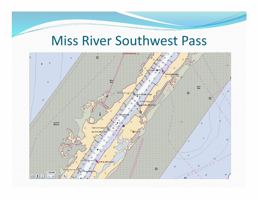
• R&D: IENC mobile apps for Android• Mississippi River SW Pass overlay near release.• 265 Miles of the White River, AR to be released in June 2014.
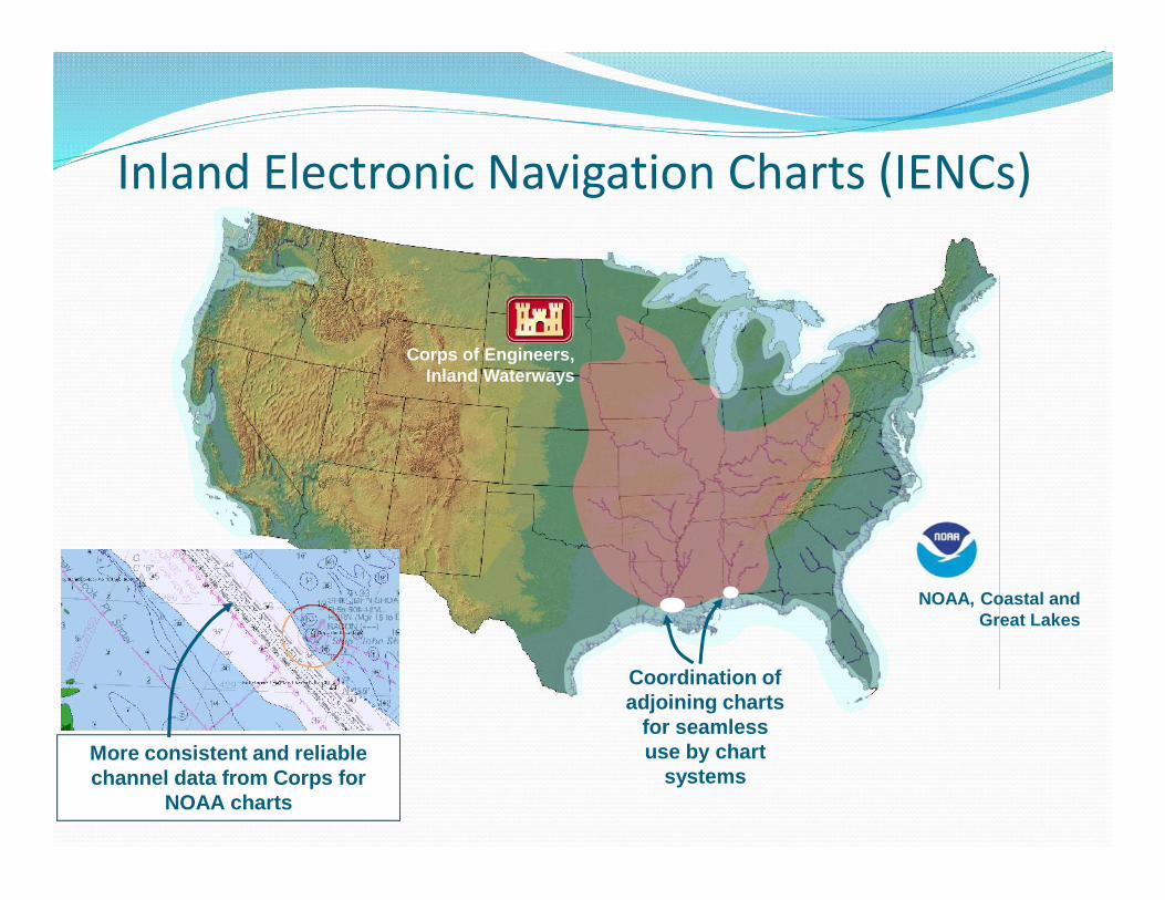
Corps of Engineers,Inland Waterways
NOAA, Coastal andGreat Lakes
More consistent and reliablechannel data from Corps for
NOAA charts
Coordination ofadjoining charts
for seamlessuse by chart
systems
Inland Electronic Navigation Charts (IENCs)
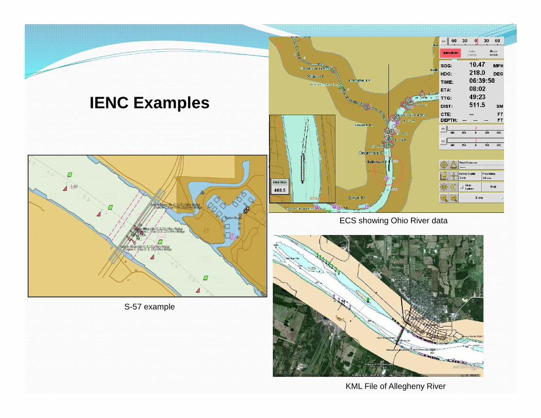
IENC Examples
ECS showing Ohio River data
KML File of Allegheny River
S-57 example
Miss River Southwest Pass
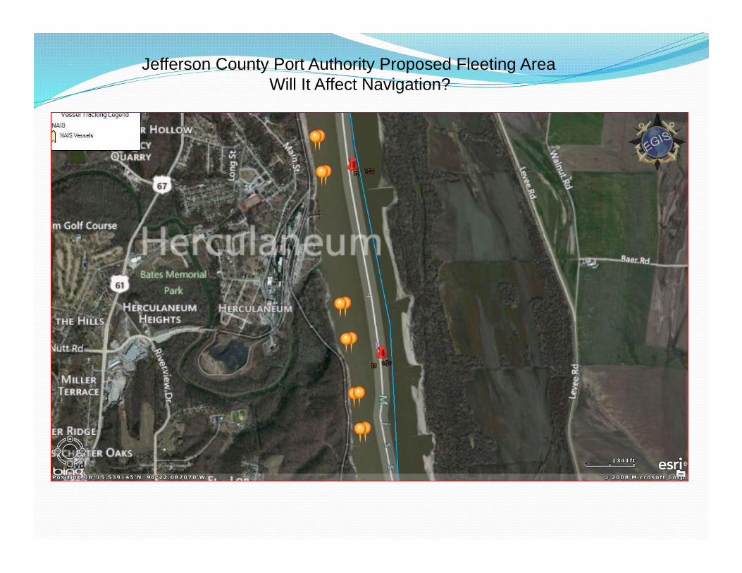
Jefferson County Port Authority Proposed Fleeting AreaWill It Affect Navigation?
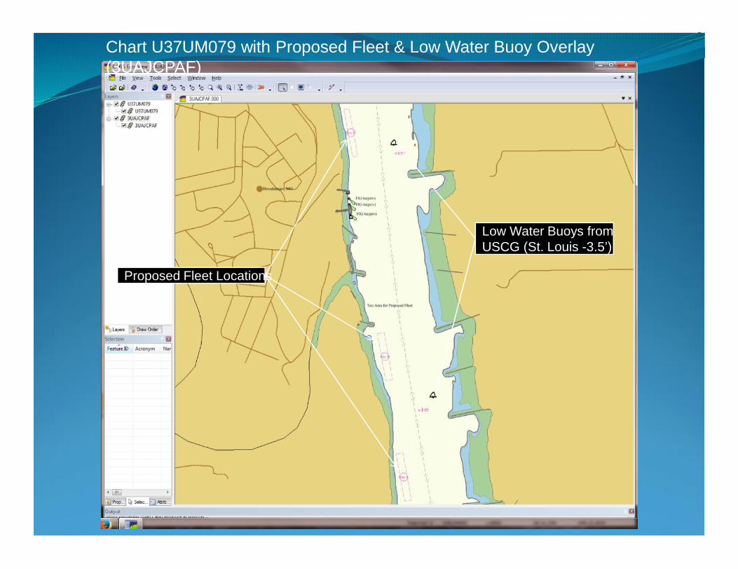
Chart U37UM079 with Proposed Fleet & Low Water Buoy Overlay(3UAJCPAF)
Proposed Fleet Locations
Low Water Buoys fromUSCG (St. Louis -3.5’)
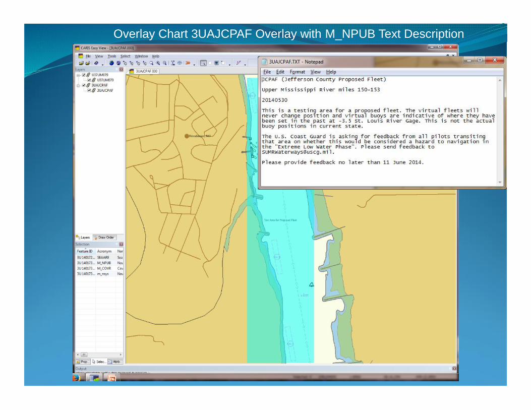
Overlay Chart 3UAJCPAF Overlay Area
Overlay Chart 3UAJCPAF Overlay with M_NPUB Text Description
USACE Development - eHydro
Channel Shoaling &Analysis Tool
HQ ChannelAvailability Report
Channel PortfolioTool
Navigation AssetManagement
eHydro GIS
Coastal DistrictChannel Surveys
Purpose: Provide end users information needed for decision support
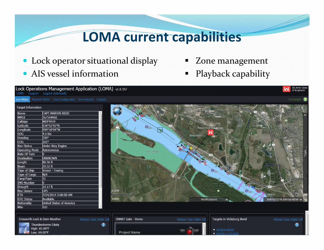
Goals: Increase lock operator situational awareness Provide vessel operators better information Provide better information to Corps management Exchange information with external users
AIS is the central LOMA technology
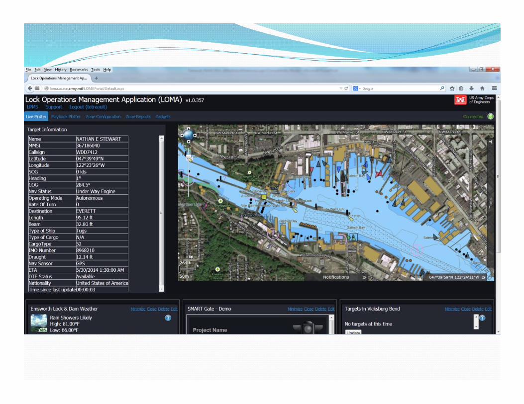
Lock Operations Management Application (LOMA)
USACE Navigation developments
Lock operator situational display AIS vessel information
Zone management Playback capability
LOMA current capabilities
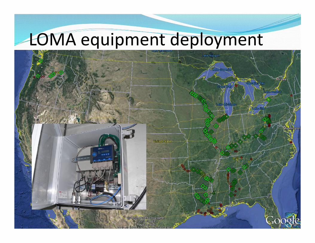
LOMA equipment deployment
• Additional information provided asoverlay to IENC:
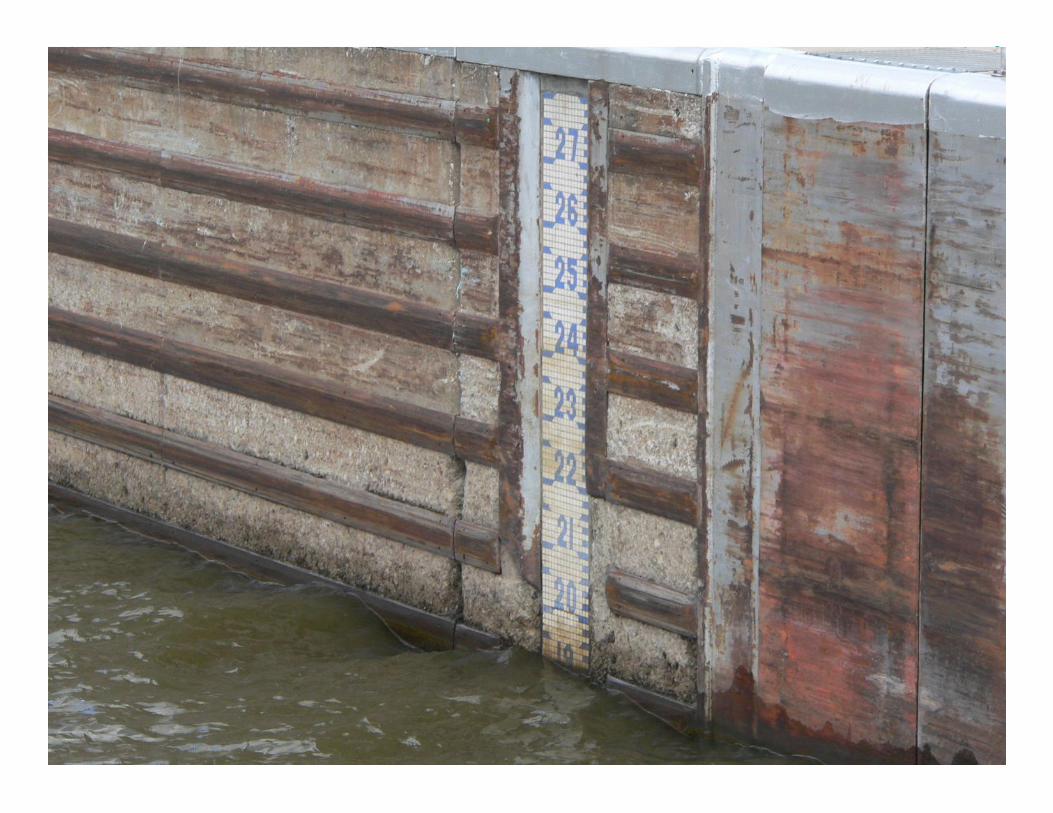
• Weather• Water levels• Lock status
Upper andlower gagereadings
Upper andlower gagereadings
Vesselsawaitinglockage
Vesselsawaitinglockage
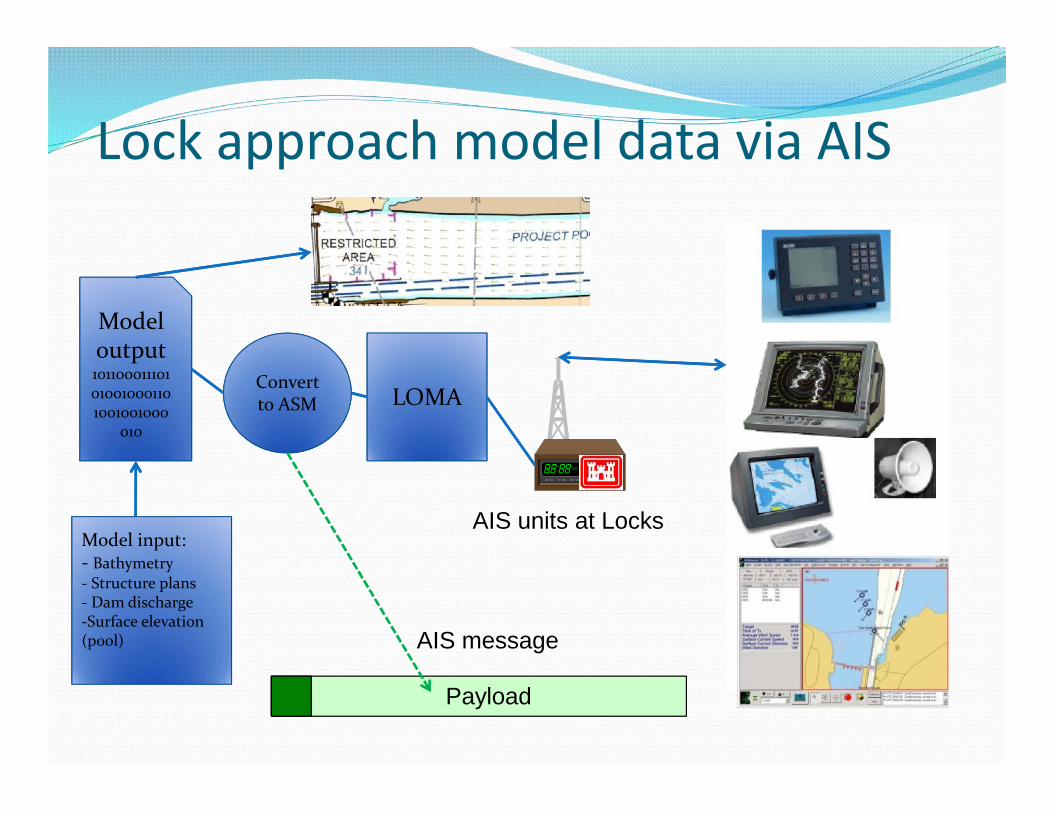
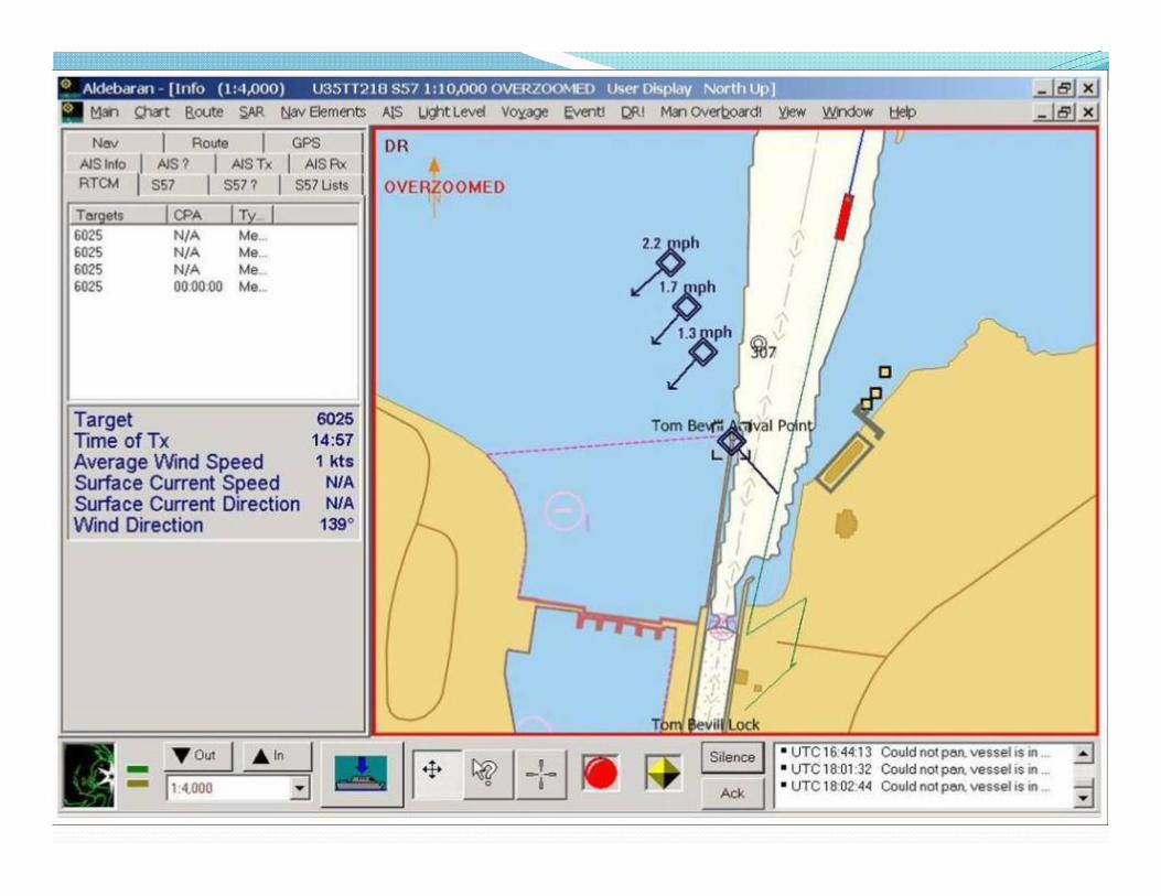
Lock approach current modelingVessel operators need river current information at critical
locations (e.g., lock approaches) Sensors are expensive to install and maintain; provide limited
information
Lock approach current modeling
Lock approach current modeling
Modeloutput101100011101010010001101001001000
010
Modeloutput101100011101010010001101001001000
010
Convertto ASMConvertto ASM LOMALOMA
AIS units at Locks
AIS message
Payload
Model input:- Bathymetry- Structure plans- Dam discharge-Surface elevation(pool)
Model input:- Bathymetry- Structure plans- Dam discharge-Surface elevation(pool)
Lock approach model data via AIS
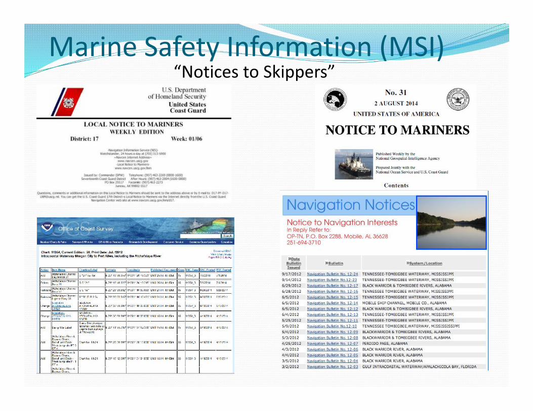
Marine Safety Information (MSI)“Notices to Skippers”
Enhanced Marine Safety Information (eMSI) Purpose: Coordinate various government-provided navigation
information services: USCG: Notices to Mariners (NTM) USACE Notices to Navigation Interest NOAA: Chart corrections/updates NGA: International NTM
Provide an “integrated navigation information bulletin” Accessed and delivered electronically Variety of formats available as web services Transmitted via AIS
Status ~Monthly interagency meetings Identifying common data fields, connectivity between agency systems Goal: Demonstration web services by 30 Sep 14
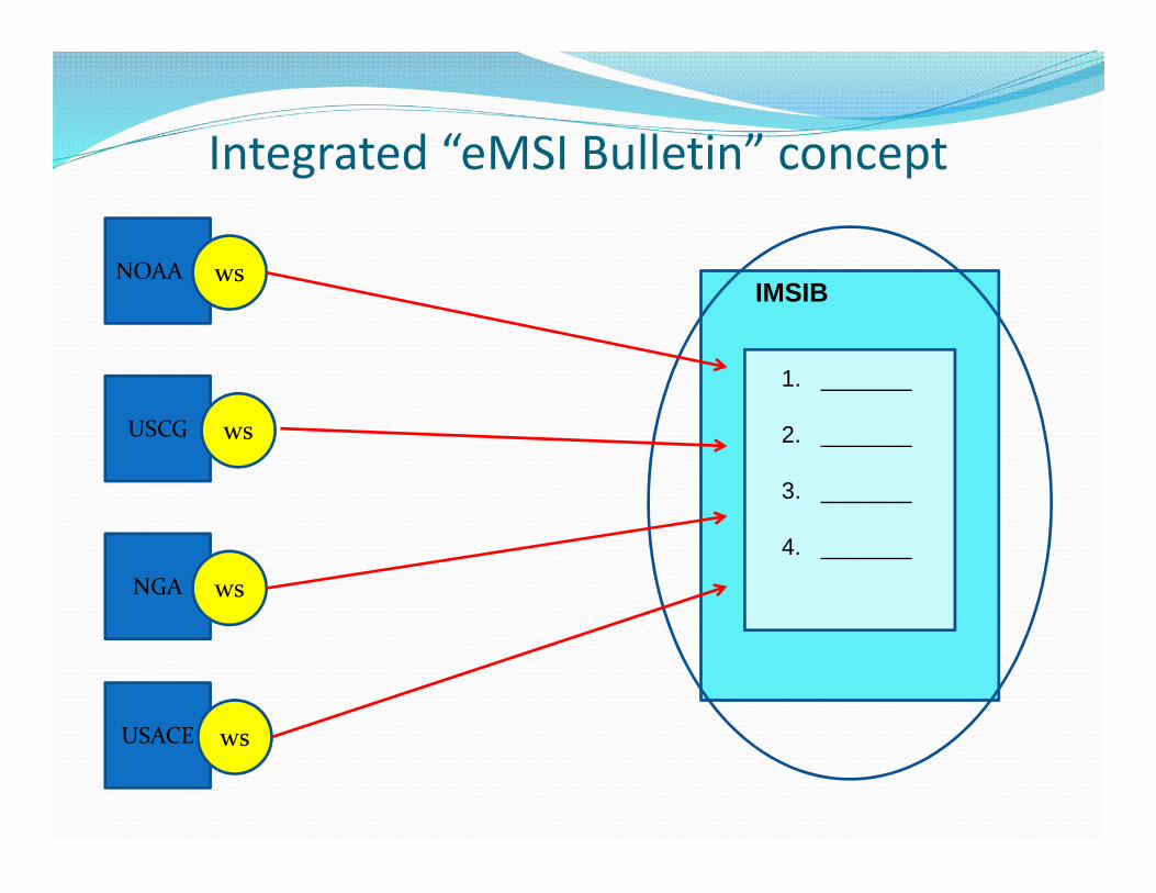
Integrated “eMSI Bulletin” concept
NOAA
USCG
NGA
USACE
ws
ws
ws
ws
IMSIB
1. _______
2. _______
3. _______
4. _______
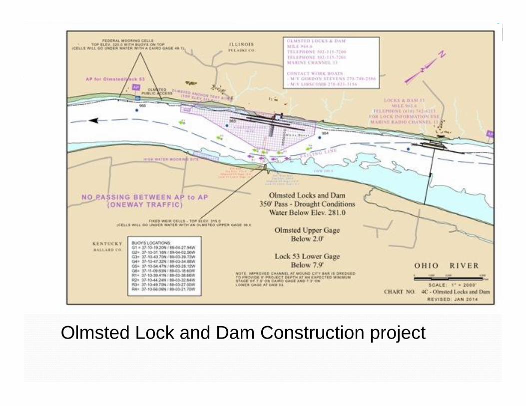
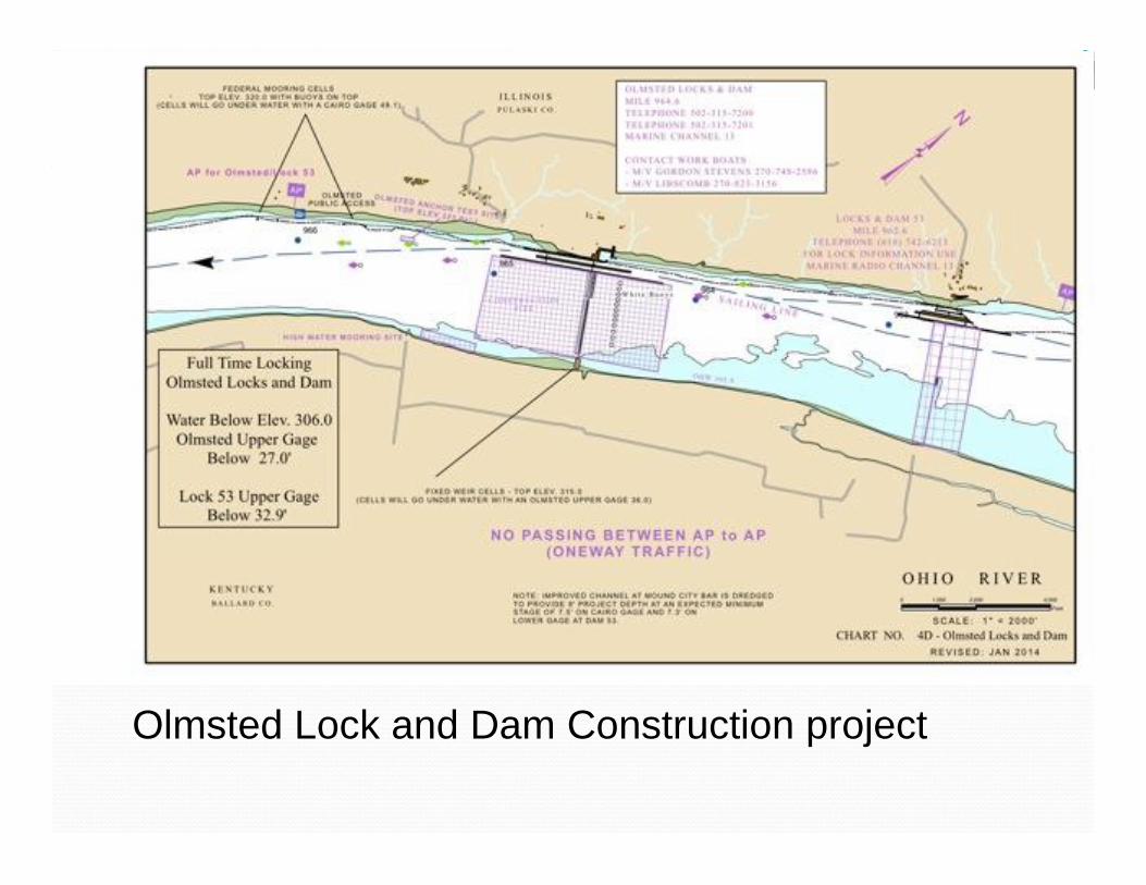
Olmsted Lock and Dam Construction project
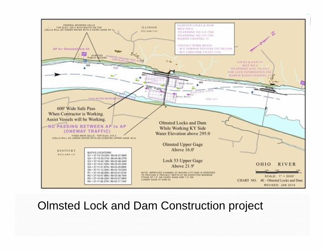
Olmsted Lock and Dam Construction project
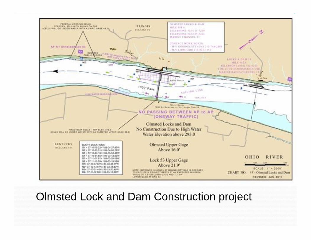
Olmsted Lock and Dam Construction project
Olmsted Lock and Dam Construction project
Olmsted Lock and Dam Construction project
Olmsted Lock and Dam Construction project
Olmsted Lock and Dam Construction project
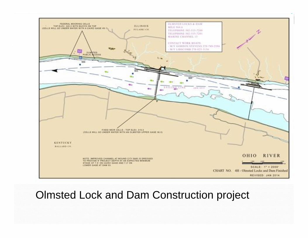
Olmsted Lock and Dam Construction project
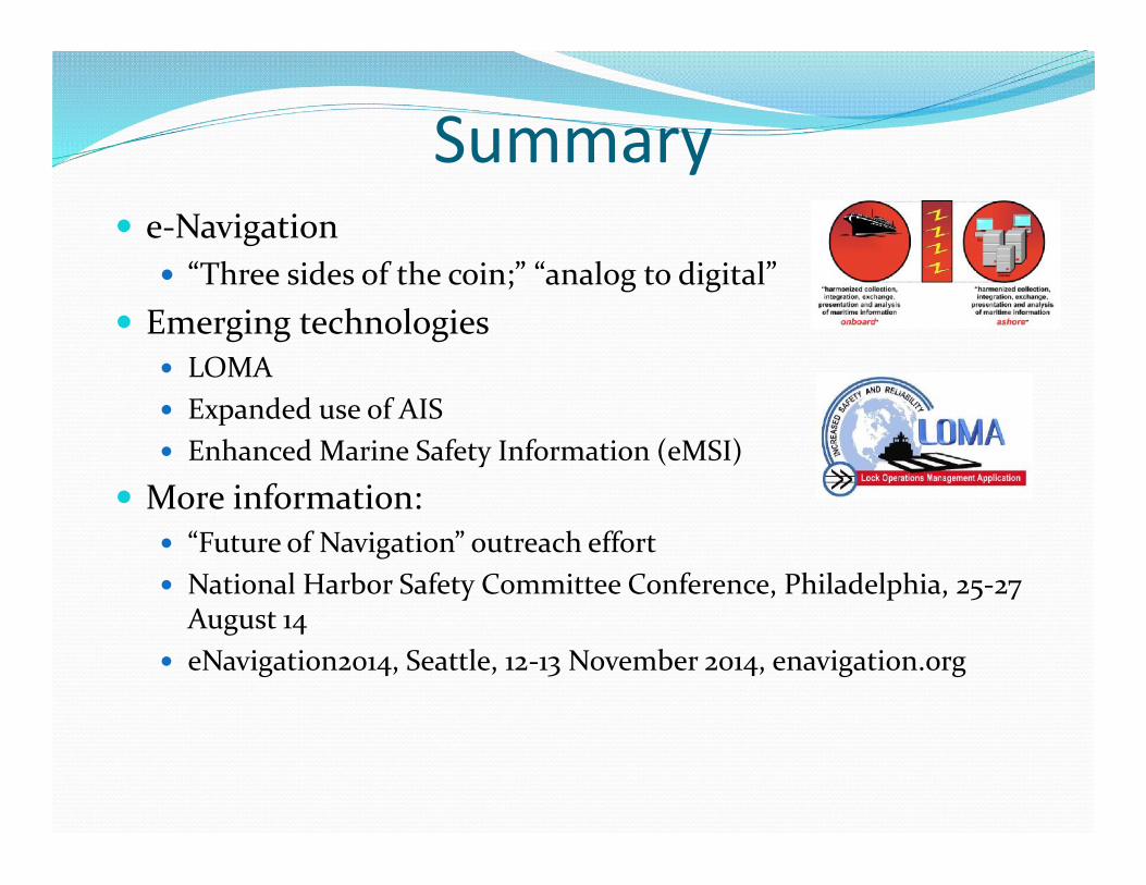
e-Navigation “Three sides of the coin;” “analog to digital”
Emerging technologies LOMA Expanded use of AIS Enhanced Marine Safety Information (eMSI)
More information: “Future of Navigation” outreach effort National Harbor Safety Committee Conference, Philadelphia, 25-27
August 14 eNavigation2014, Seattle, 12-13 November 2014, enavigation.org