44
USABILITY EVALUATION MOBILE LOCATION NETWORKING 21w.789 Spring 2012
USABILITY EVALUATION MOBILE LOCATION NETWORKING
21w.789 Spring 2012
Why Test For Usability
Often, your design and conceptual model does not match what users expect
Applications that are frustrating/difficult to use do not get used
A quick evaluation with 5-7 users will catch 80% of serious usability issues
Very easy to test with a paper prototype If large changes need to be made to your design, it just
takes minutes to fix it at this stage
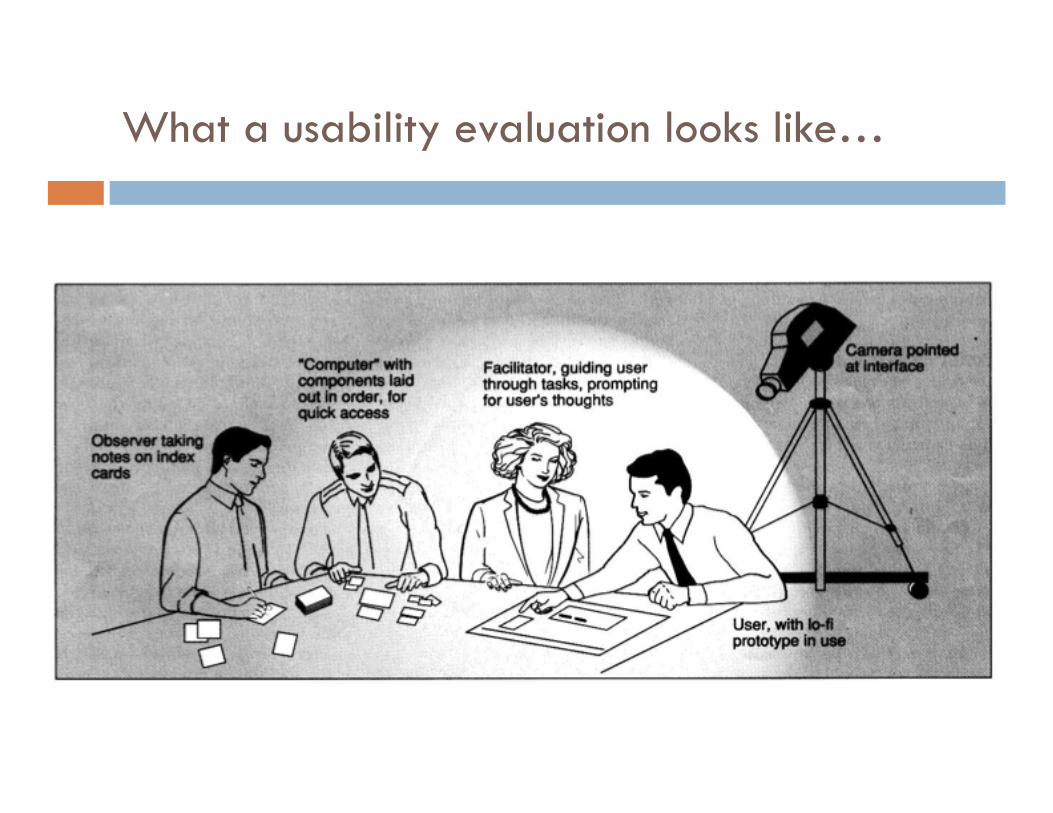
What a usability evaluation looks like…
Usability Evaluation - Tasks
Choose 3-4 tasks for users to execute on your paper prototype
Should be a mix of common use cases and areas where you have doubts about your current design
State these tasks in neutral terms e.g. NOT “Filter your contacts to show the ones
nearby” if the button is labelled “Filter” or option labelled “nearby” – try something like “Find the set of contacts that are physically close to you”
Running Your Usability Evaluation
Choose 2-3 tasks (common or troublesome use cases) One person from your team acts as “computer” changing the
screens as the “user” from a different project group points to navigate
Another team member takes notes Participant “thinks aloud” while performing tasks Do not interrupt the participant while performing the task.
Do not give away that they might be going down the wrong path.
When the user finishes all tasks, feel free to ask them questions.
Between users, debrief and if you start to see patterns, make small iterations
MOBILE LOCATION NETWORKING
21w.789 Spring 2012
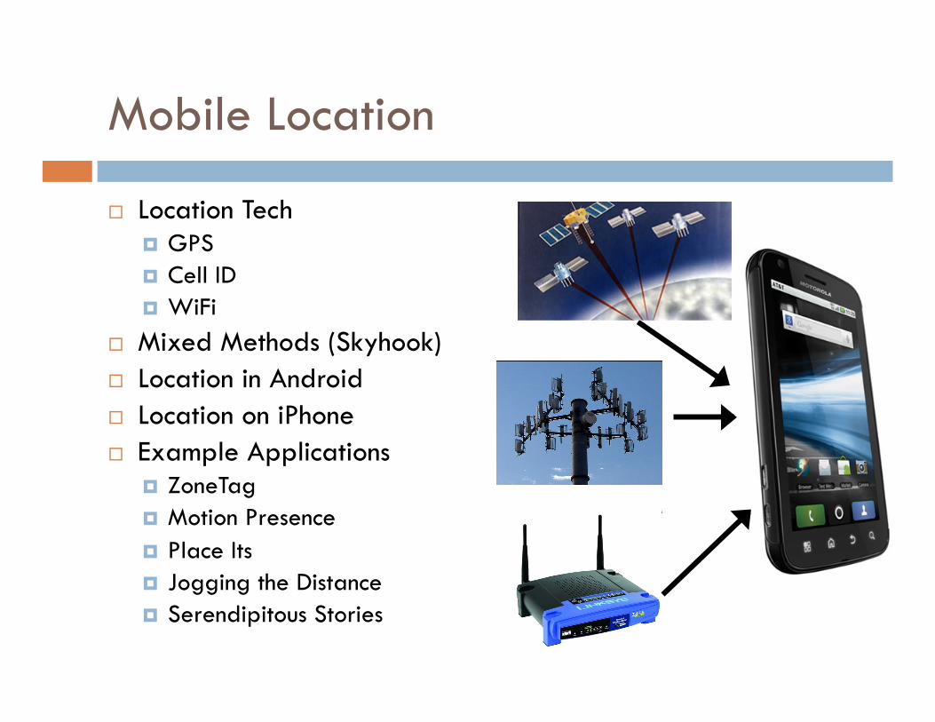
Mobile Location
Location Tech GPS Cell ID WiFi
Mixed Methods (Skyhook) Location in Android Location on iPhone Example Applications
ZoneTag Motion Presence Place Its Jogging the Distance Serendipitous Stories
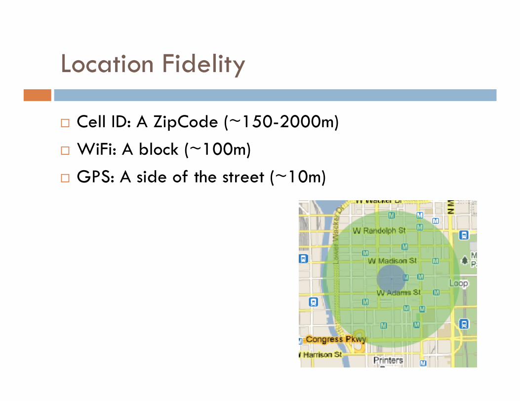
Location Fidelity
Cell ID: A ZipCode (~150-2000m) WiFi: A block (~100m) GPS: A side of the street (~10m)
Cell ID
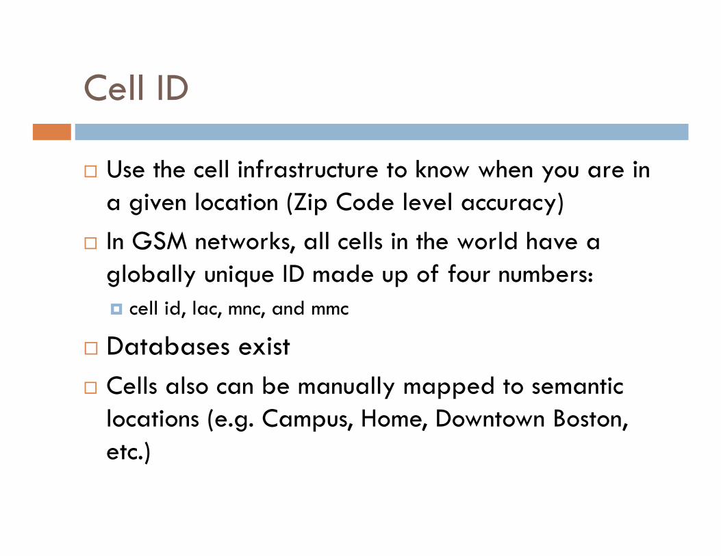
Use the cell infrastructure to know when you are in a given location (Zip Code level accuracy)
In GSM networks, all cells in the world have a globally unique ID made up of four numbers: cell id, lac, mnc, and mmc
Databases exist Cells also can be manually mapped to semantic
locations (e.g. Campus, Home, Downtown Boston, etc.)
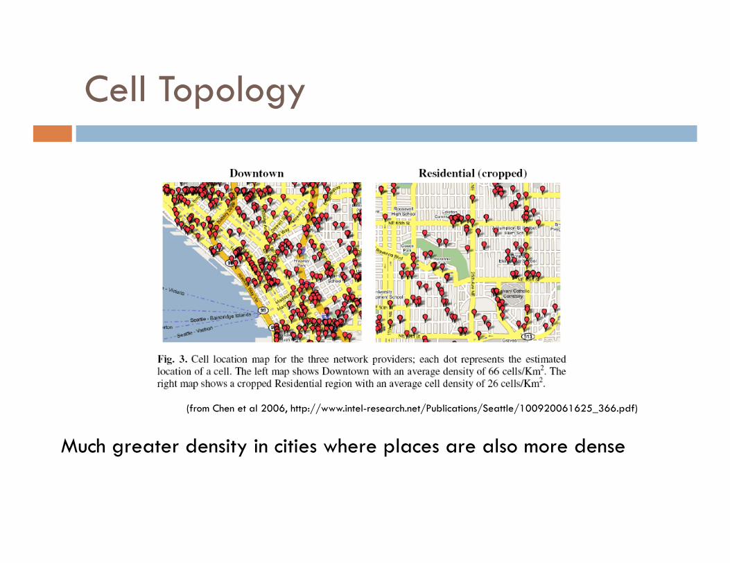
Cell Topology
Much greater density in cities where places are also more dense
(from Chen et al 2006, http://www.intel-research.net/Publications/Seattle/100920061625_366.pdf)
Cell ID -> Location
Databases exist that map a large number of Cell IDs to locations Google Yahoo
Now part of most mobile platforms…transparent to developer/user
Cell ID - Applications
People have used Cell ID to: Determine when someone was at a given place (e.g.
home) (see Sohn et al ‘05) Distinguish between walking/driving/stationary (see
Sohn et al ’06) Provide accurate positioning (e.g. Chen et al ’06)
Down to 95% error of 163m with all visible cells
Currently used to save power over GPS/when only approximate locations are needed or indoors (e.g. find nearest movie theater, etc.)
Wifi Positioning
Use available SSIDs to determine location Up to 40m accuracy in cities
Issues: Need to have sampled fairly closely to where you want
to get location Not practical until recently when combined with other
methods to bootstrap (Google trucks, apps that report Cell ID, SSID, GPS to large databases)
GPS
30 satellites in earth orbit 6 satellites always in line of site of any place on earth
Receivers must find 4 or more satellites for a fix
Receiver listens for time broadcasts from each satellite and calculates distance based on time delay
Satellites also broadcast Navigation Messages which can be used with the time delays to calculate position
Receivers often provide access to position data as a NMEA stream (National Marine Electronics Association)
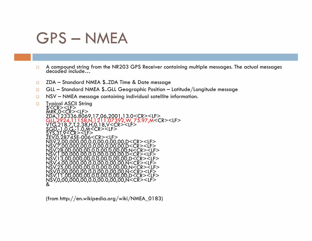
GPS – NMEA A compound string from the NR203 GPS Receiver containing multiple messages. The actual messages
decoded include…
ZDA – Standard NMEA $..ZDA Time & Date message GLL – Standard NMEA $..GLL Geographic Position – Latitude/Longitude message NSV – NMEA message containing individual satellite information. Typical ASCII String
$<CR><LF> MRK,0<CR><LF> ZDA,123336.8069,17,06,2001,13.0<CR><LF> GLL,2924.11158,N,1211.07392,W, 75.97,M<CR><LF> VTG,218.7,T,2.38,H,0.18,V<CR><LF> SGD,-1.0,G,-1.0,M<CR><LF> SYS,3T,9<CR><LF> ZEV,0.28745E-006<CR><LF> NSV,2,00,000,00,0.0,00.0,00,00,D<CR><LF> NSV,7,00,000,00,0.0,00.0,00,00,D<CR><LF> NSV,28,00,000,00,0.0,00.0,00,00,N<CR><LF> NSV,1,00,000,00,0.0,00.0,00,00,D<CR><LF> NSV,13,00,000,00,0.0,00.0,00,00,D<CR><LF> NSV,4,00,000,00,0.0,00.0,00,00,N<CR><LF> NSV,25,00,000,00,0.0,00.0,00,00,N<CR><LF> NSV,0,00,000,00,0.0,00.0,00,00,N<CR><LF> NSV,11,00,000,00,0.0,00.0,00,00,D<CR><LF> NSV,0,00,000,00,0.0,00.0,00,00,N<CR><LF> &
(from http://en.wikipedia.org/wiki/NMEA_0183)
GPS on the Phone
Most smartphones have built in GPS iPhone, Android, Blackberry, Palm
Phones that don’t have built-in GPS can use a bluetooth unit sends a NMEA stream to the phone phone can listen through a BT serial
connection Can also save power when used
with modern smartphones (bluetooth uses 22% of the power of GPS)
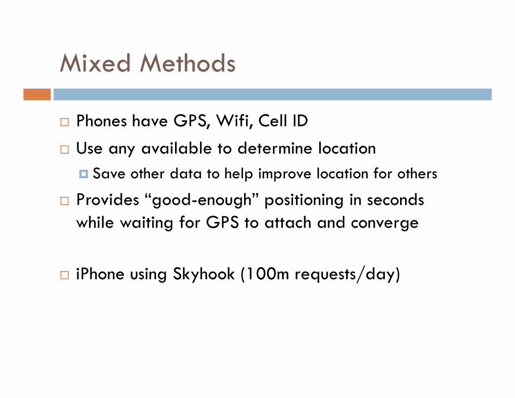
Mixed Methods
Phones have GPS, Wifi, Cell ID Use any available to determine location
Save other data to help improve location for others
Provides “good-enough” positioning in seconds while waiting for GPS to attach and converge
iPhone using Skyhook (100m requests/day)
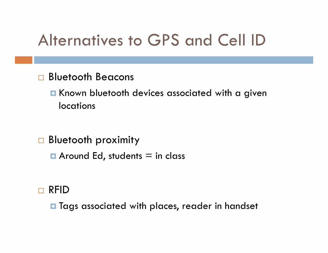
Alternatives to GPS and Cell ID
Bluetooth Beacons Known bluetooth devices associated with a given
locations
Bluetooth proximity Around Ed, students = in class
RFID Tags associated with places, reader in handset
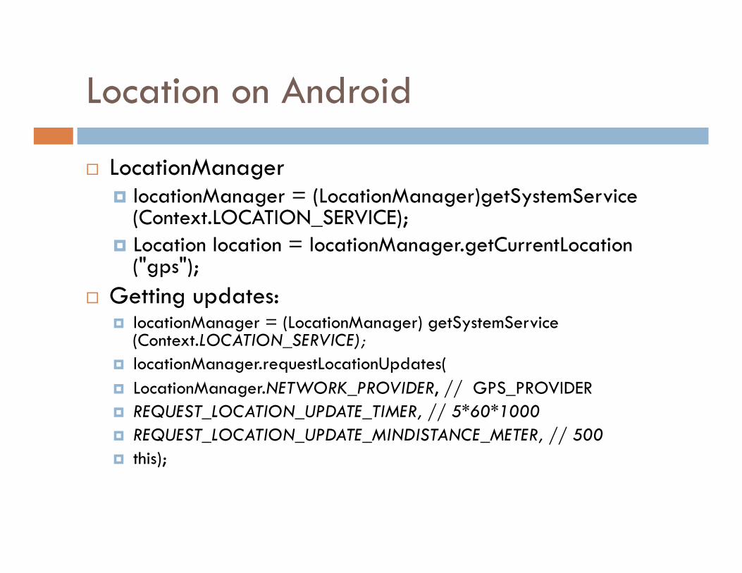
Location on Android
LocationManager locationManager = (LocationManager)getSystemService
(Context.LOCATION_SERVICE); Location location = locationManager.getCurrentLocation
("gps"); Getting updates:
locationManager = (LocationManager) getSystemService(Context.LOCATION_SERVICE);
locationManager.requestLocationUpdates( LocationManager.NETWORK_PROVIDER, // GPS_PROVIDER REQUEST_LOCATION_UPDATE_TIMER, // 5*60*1000 REQUEST_LOCATION_UPDATE_MINDISTANCE_METER, // 500 this);
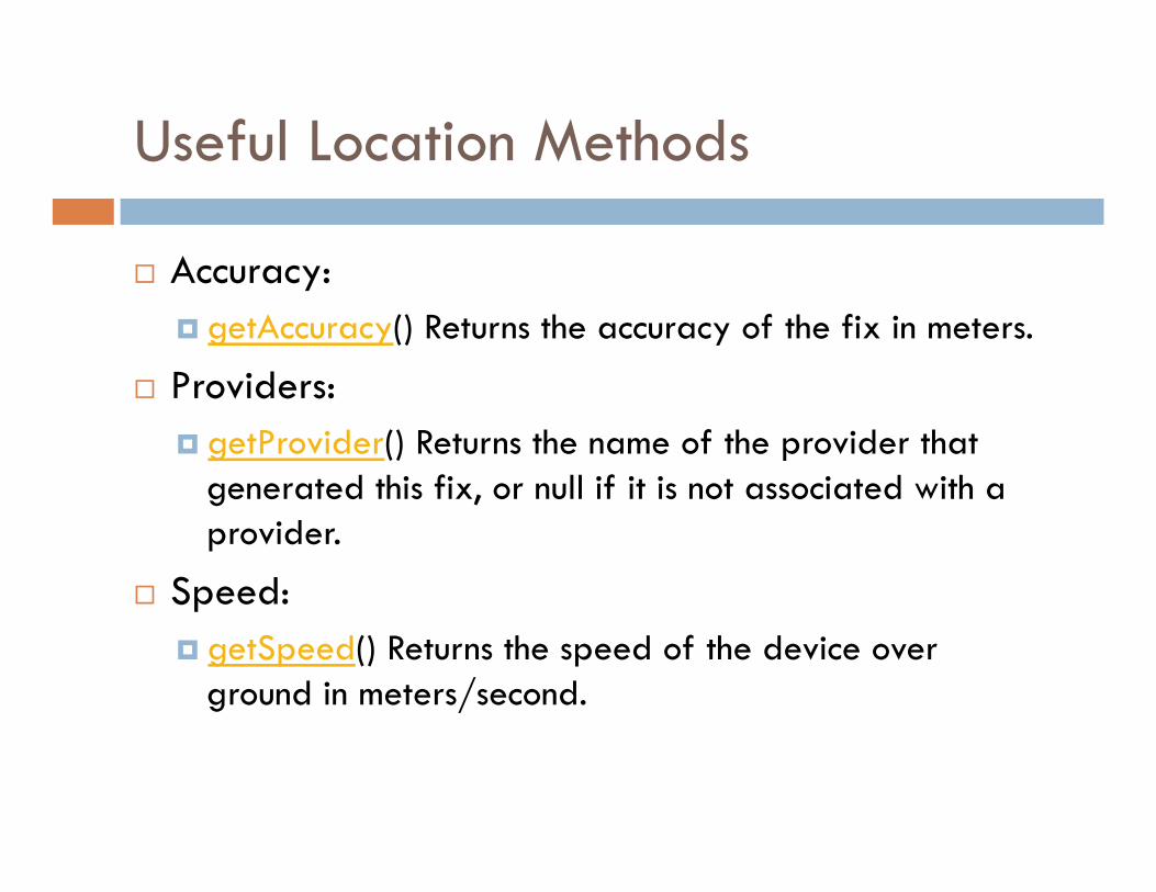
Useful Location Methods
Accuracy: getAccuracy() Returns the accuracy of the fix in meters.
Providers: getProvider() Returns the name of the provider that
generated this fix, or null if it is not associated with a provider.
Speed: getSpeed() Returns the speed of the device over
ground in meters/second.
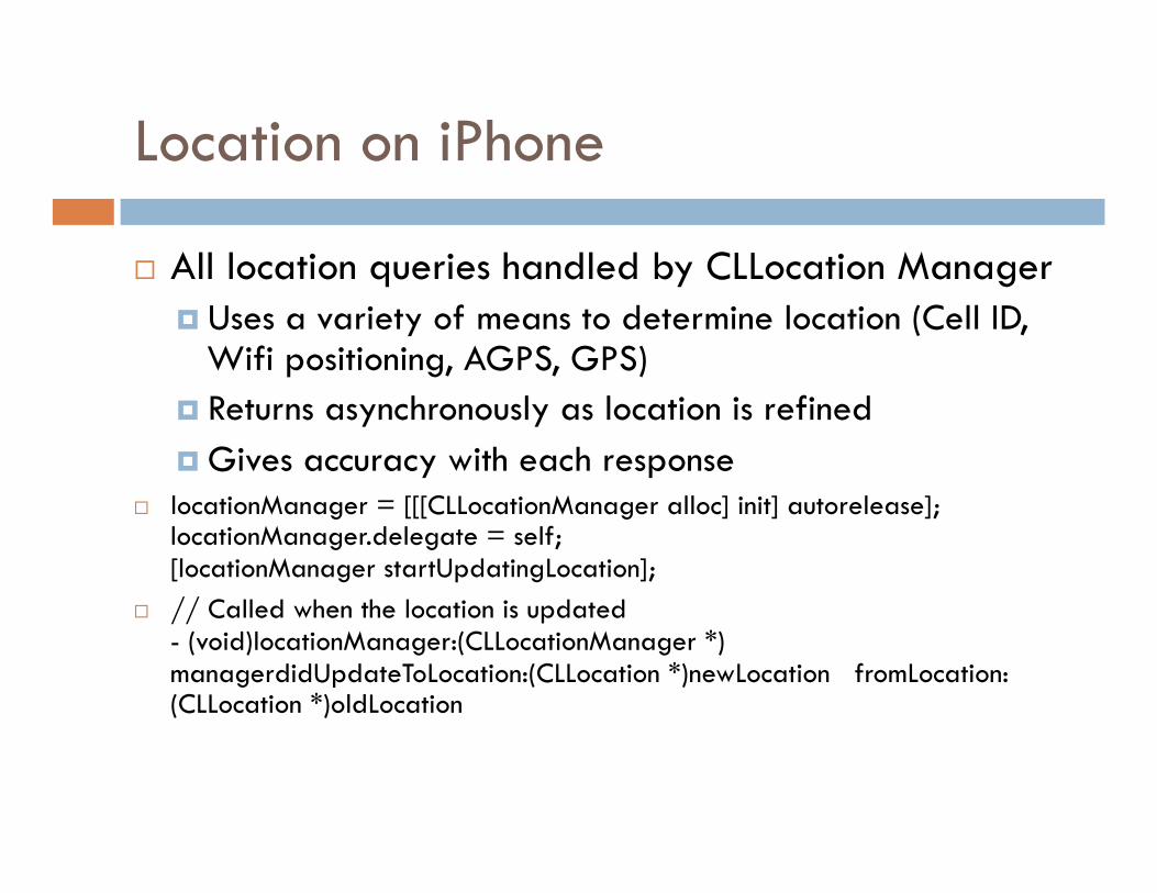
Location on iPhone
All location queries handled by CLLocation Manager Uses a variety of means to determine location (Cell ID,
Wifi positioning, AGPS, GPS) Returns asynchronously as location is refined Gives accuracy with each response
locationManager = [[[CLLocationManager alloc] init] autorelease]; locationManager.delegate = self; [locationManager startUpdatingLocation];
// Called when the location is updated - (void)locationManager:(CLLocationManager *)managerdidUpdateToLocation:(CLLocation *)newLocation fromLocation:(CLLocation *)oldLocation
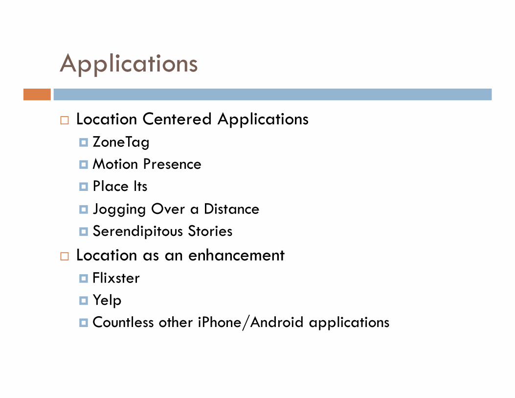
Applications
Location Centered Applications ZoneTag Motion Presence Place Its Jogging Over a Distance Serendipitous Stories
Location as an enhancement Flixster Yelp Countless other iPhone/Android applications
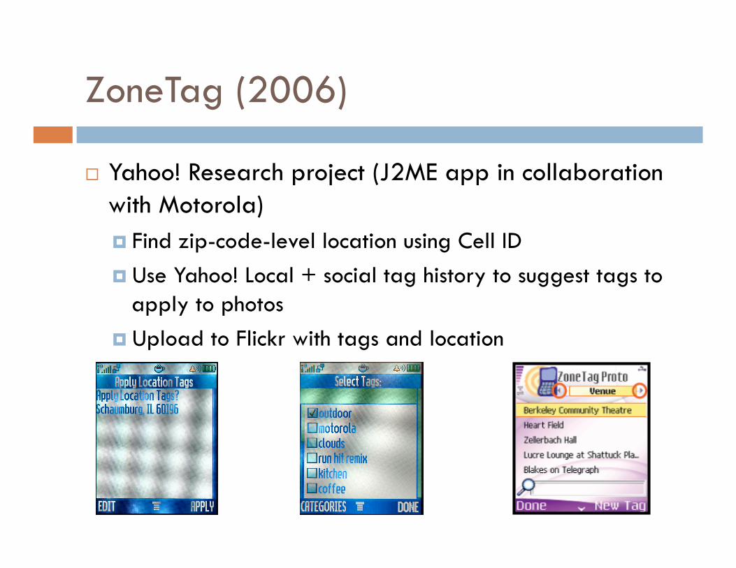
ZoneTag (2006)
Yahoo! Research project (J2ME app in collaboration with Motorola) Find zip-code-level location using Cell ID Use Yahoo! Local + social tag history to suggest tags to
apply to photos Upload to Flickr with tags and location
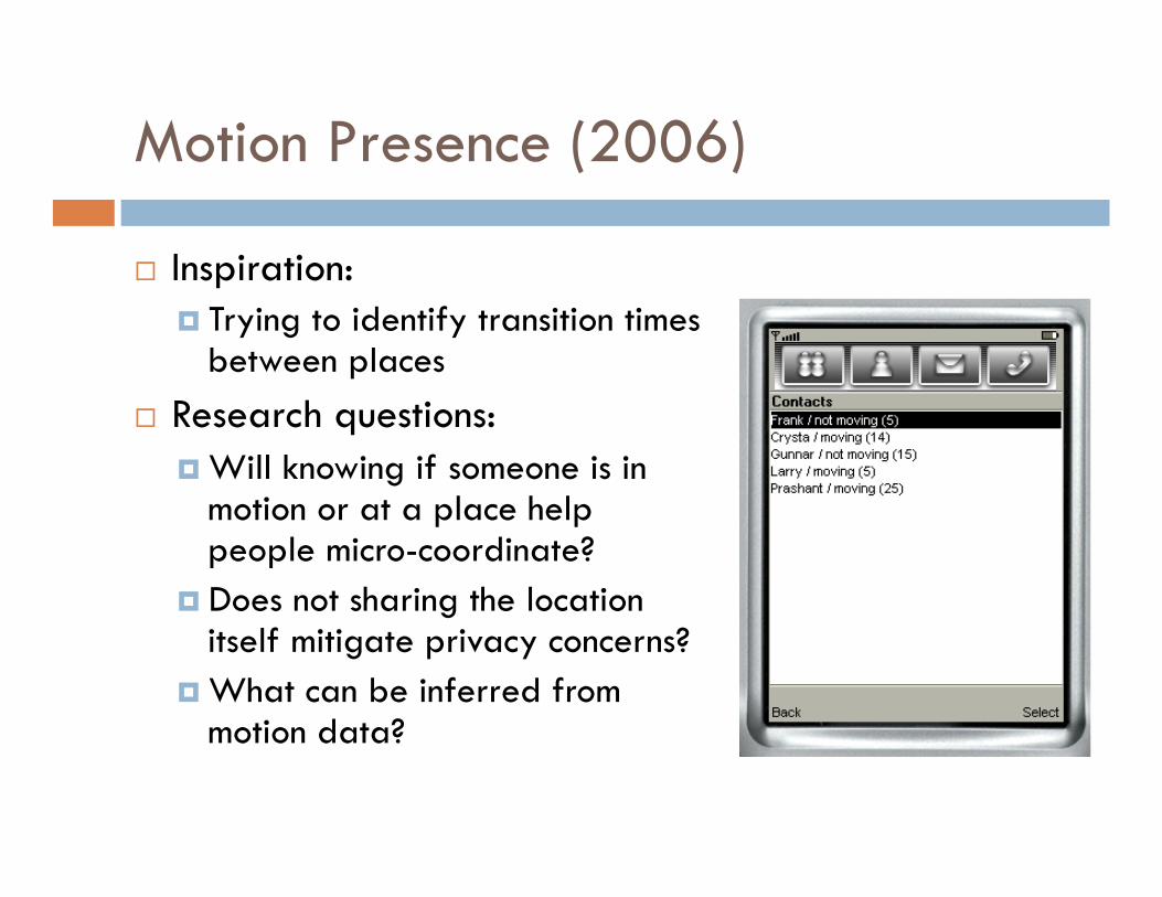
Motion Presence (2006)
Inspiration: Trying to identify transition times
between places Research questions:
Will knowing if someone is in motion or at a place help people micro-coordinate?
Does not sharing the location itself mitigate privacy concerns?
What can be inferred from motion data?
Motion Presence – Findings
Participants were able to infer: Location, Activity, Availability, Arrival Time, Destination
Participants used the application to: Moderate availability Arrive at the same time Get more time at their current activity See people were following through on commitments Check on other’s safety Social awareness – know what’s going on with others
Privacy not a major concern given plausible deniability
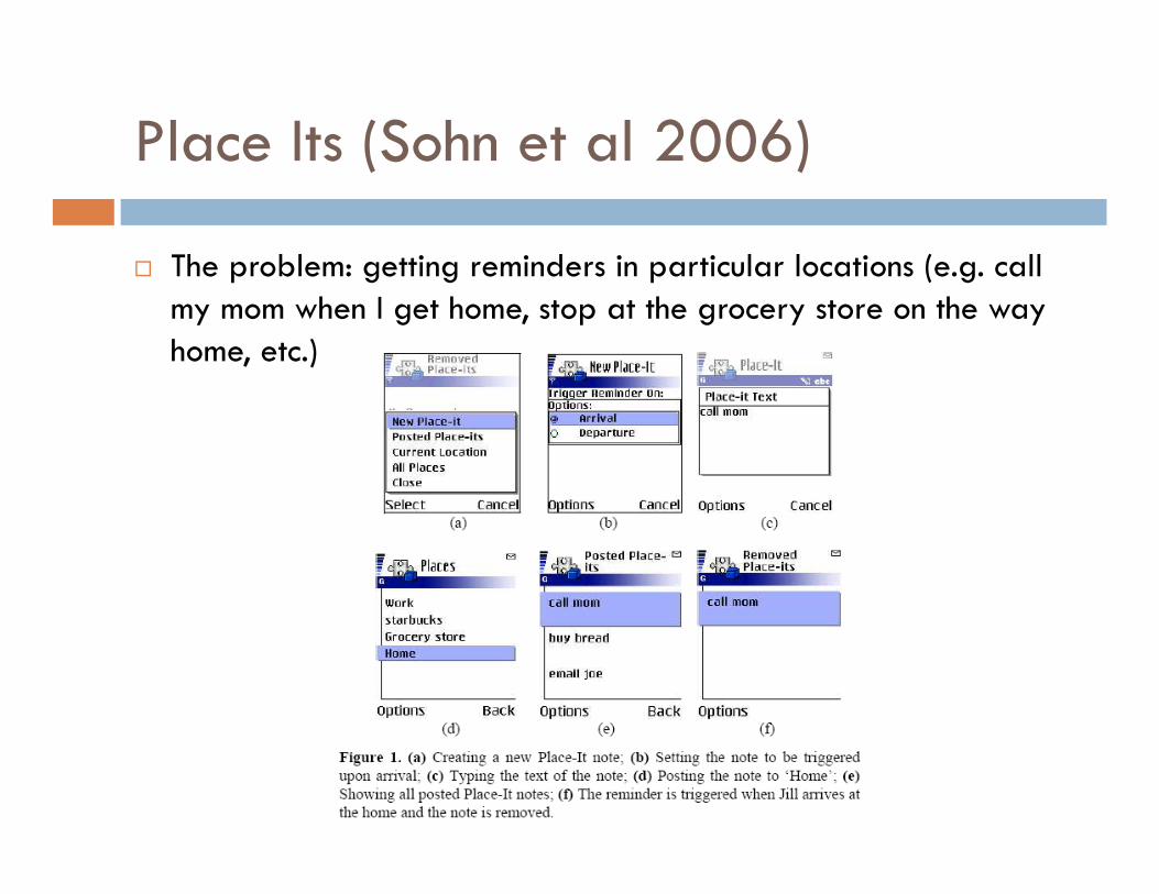
Place Its (Sohn et al 2006)
The problem: getting reminders in particular locations (e.g. call my mom when I get home, stop at the grocery store on the way home, etc.)
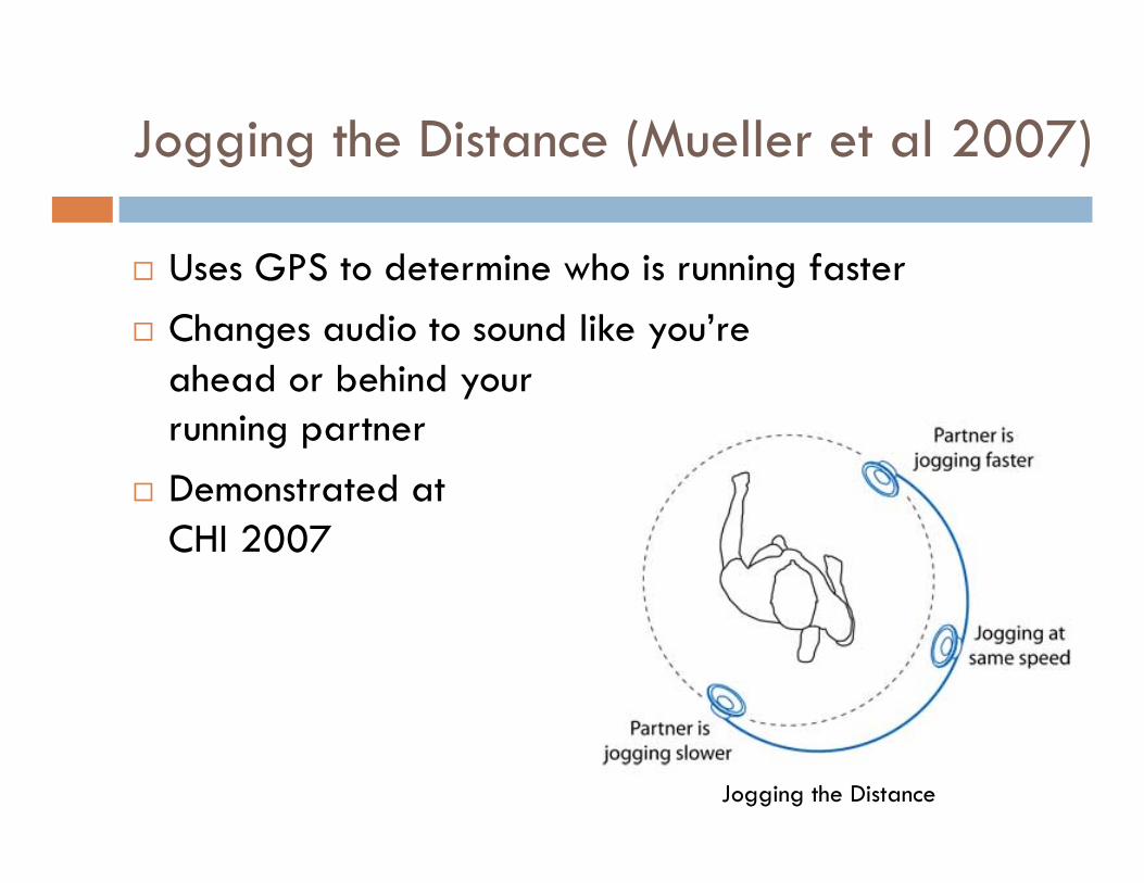
Jogging the Distance (Mueller et al 2007)
Uses GPS to determine who is running faster Changes audio to sound like you’re
ahead or behind your running partner
Demonstrated at CHI 2007
Jogging the Distance
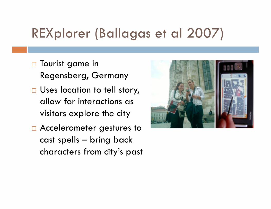
REXplorer (Ballagas et al 2007)
Tourist game in Regensberg, Germany
Uses location to tell story, allow for interactions as visitors explore the city
Accelerometer gestures to cast spells – bring back characters from city’s past
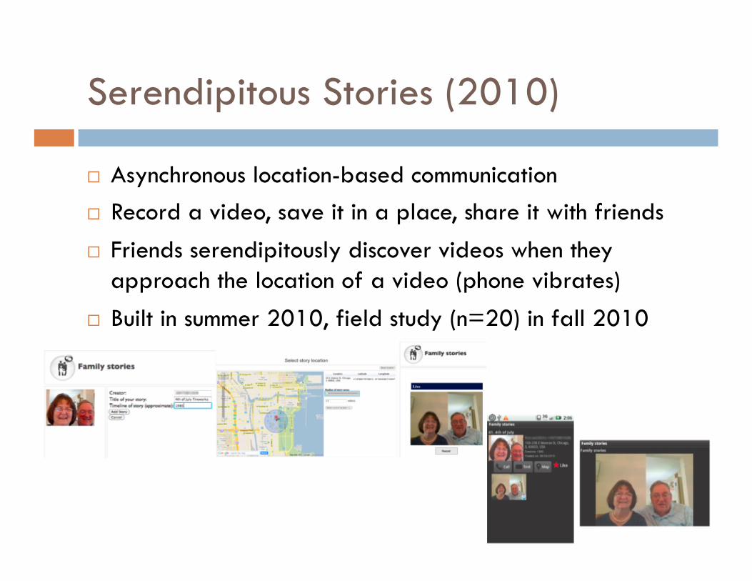
Serendipitous Stories (2010)
Asynchronous location-based communication Record a video, save it in a place, share it with friends Friends serendipitously discover videos when they
approach the location of a video (phone vibrates) Built in summer 2010, field study (n=20) in fall 2010
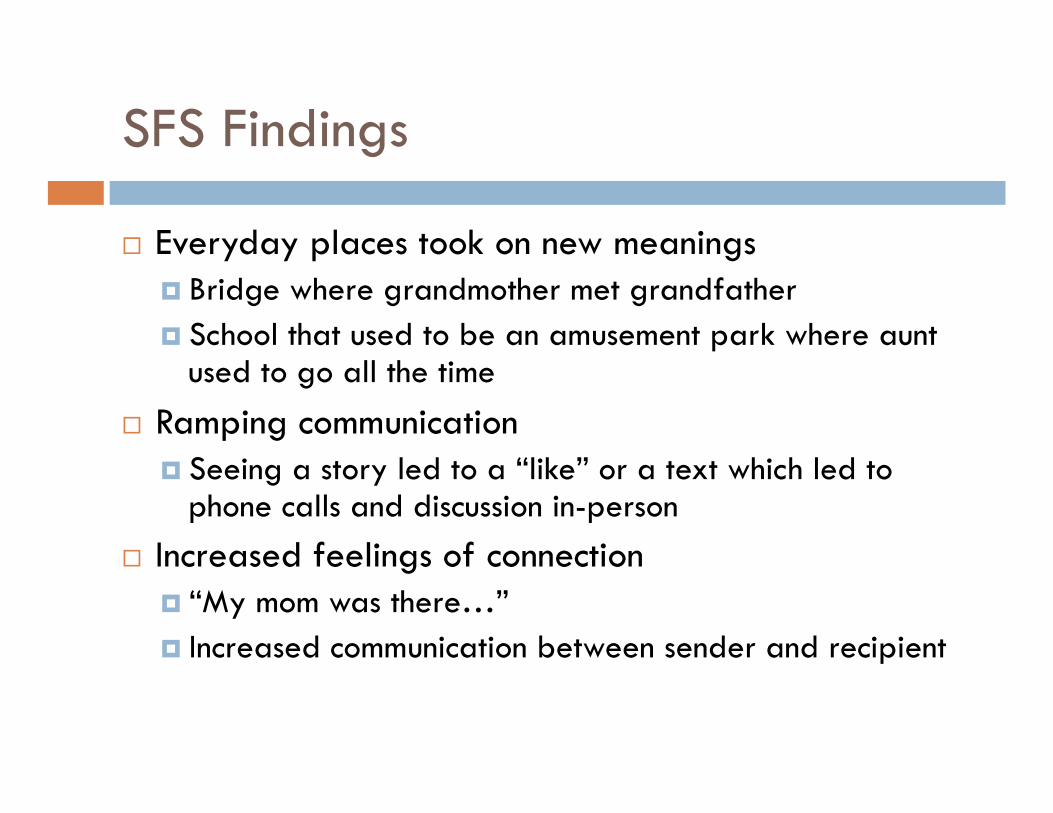
SFS Findings
Everyday places took on new meanings Bridge where grandmother met grandfather School that used to be an amusement park where aunt
used to go all the time Ramping communication
Seeing a story led to a “like” or a text which led to phone calls and discussion in-person
Increased feelings of connection “My mom was there…” Increased communication between sender and recipient
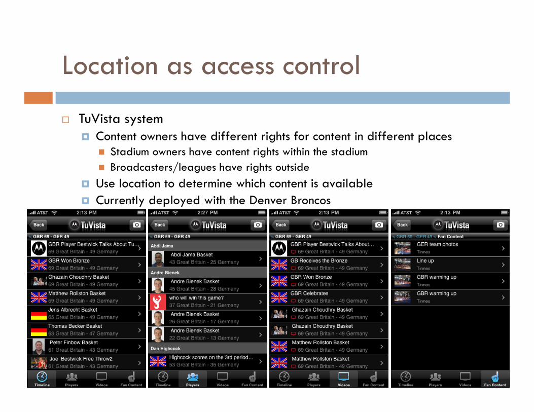
Location as access control
TuVista system Content owners have different rights for content in different places
Stadium owners have content rights within the stadium Broadcasters/leagues have rights outside
Use location to determine which content is available Currently deployed with the Denver Broncos
Location as UI Enhancement
New applications where location is meant to improve interaction, not be the central component Make search/navigation easier (Yelp/Opentable) Jump to relevant information (Flixster)
Location Assignment (due 3/20)
Location Assignment
The purpose of this assignment is to explore the properties of various location services that are available on the phone in real-world settings. You will be creating a small application and testing it and presenting the results in a short report.
You should build an application on your smartphone platform of choice that captures location (lat/lon) as well as accuracy error and logs it to a file. You should be able to run the application in three modes (wifi and GPS off, wifi on and GPS off, and wifi and GPS on). You should follow a route near your home or school in each of these conditions and save the log files. This route should include both indoor and outdoor locations.
Analyze the log files to find differences in error in each case. Try to discover why the error occurred and why it was greater in some places than others. Write 2 pages (including figures where necessary) describing your findings. Submit this text along with your log files for this assignment.
Mobile Networking
Properties of Mobile Networks Persistence of Connections Congestion Management Notifications/Push
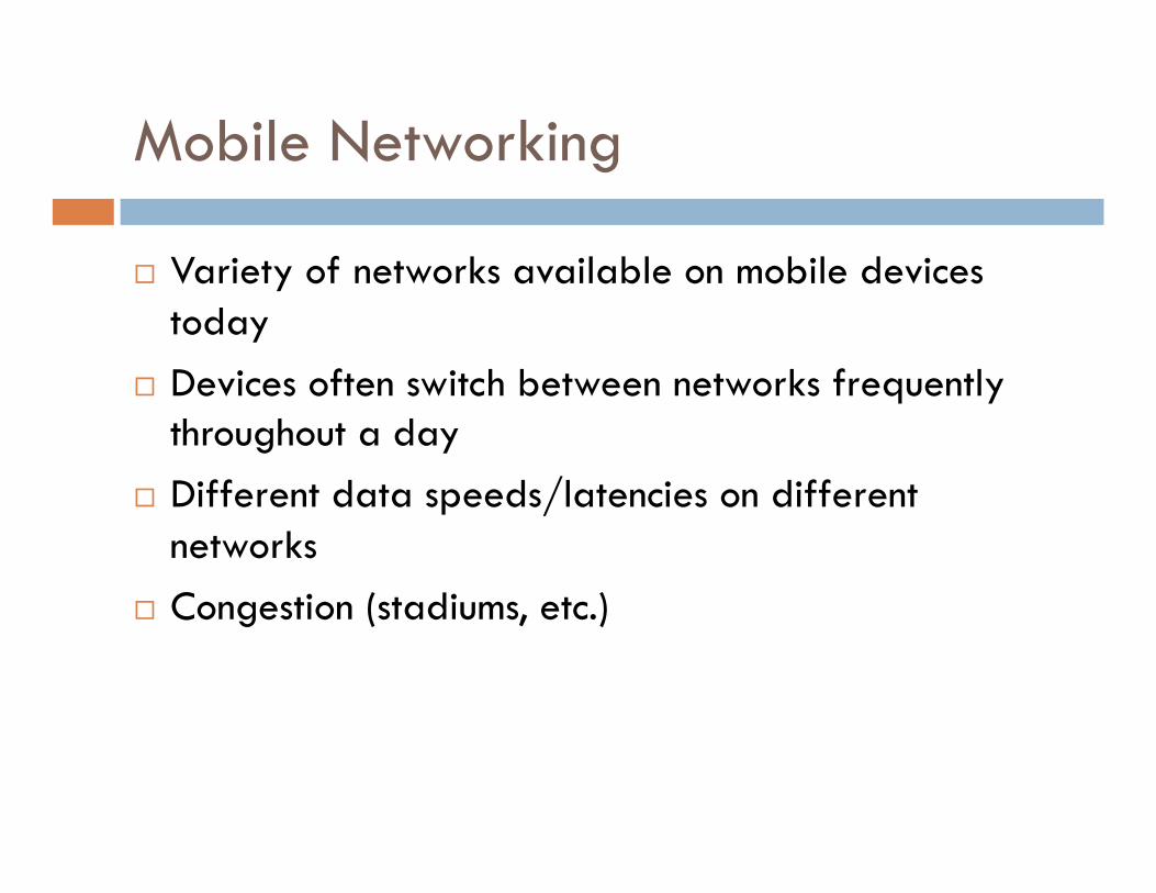
Mobile Networking
Variety of networks available on mobile devices today
Devices often switch between networks frequently throughout a day
Different data speeds/latencies on different networks
Congestion (stadiums, etc.)
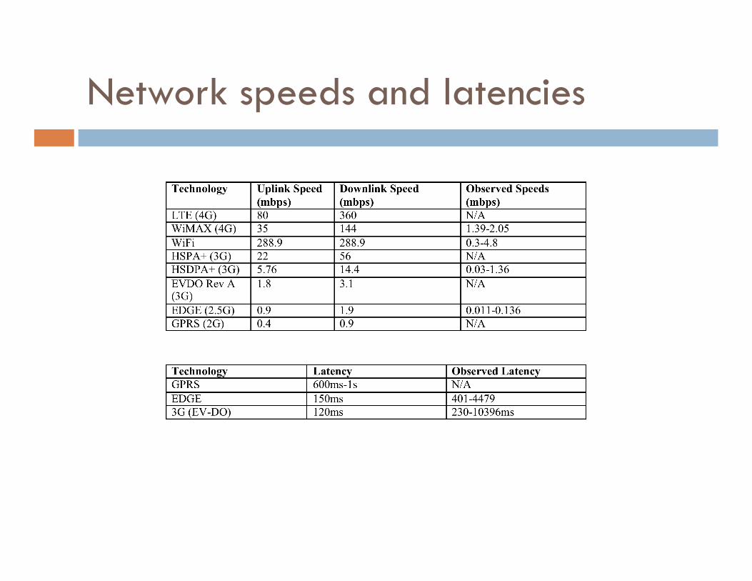
Network speeds and latencies
Common networking issues…
“Persistent” connections do not persist Phones sleep after 1-5 minutes Changing networks can change IP address of device,
drop all active connections (sometimes for minutes at a time)
Network freezes Common to have connections hang for 20 seconds
Sometimes when switching to a new tower or from 2G-3G Sometimes for totally unexplained reasons
Be patient and set long timeouts
Strategies for congestion
Cacheing Save as much data as possible App should be able to start immediately and show
something useful without a data connection App might pre-cache data that is anticipated Nice examples:
TripIt Gmail Various transit apps
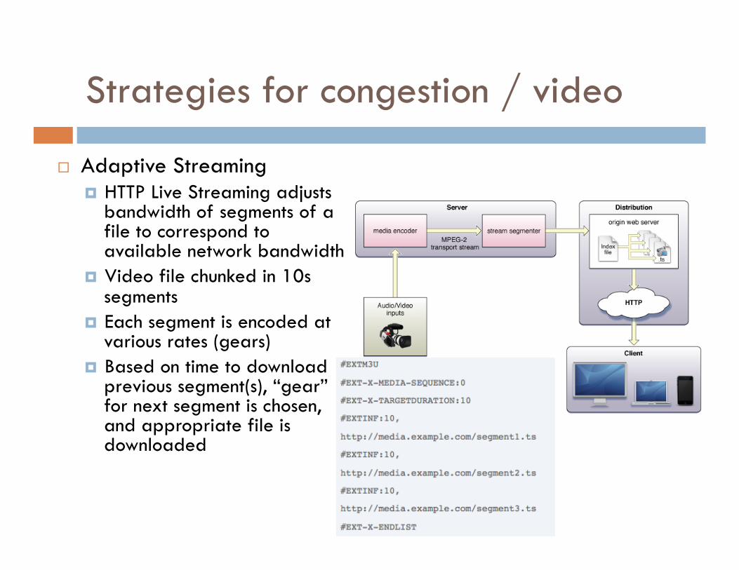
Strategies for congestion / video
Adaptive Streaming HTTP Live Streaming adjusts
bandwidth of segments of a file to correspond to available network bandwidth
Video file chunked in 10s segments
Each segment is encoded at various rates (gears)
Based on time to download previous segment(s), “gear” for next segment is chosen, and appropriate file is downloaded
HLS and iPhone
Any app that streams video over cellular connections must implement HLS to be approved in the iTunes App Store
Over wifi you can do whatever you want Apple has a tool on their website to chunk videos
(only runs on macos)
Push Channels
Way for a server to notify mobile device of item of interest Apple’s Channel
Shows a popup with custom text Can start your application Cannot start the running of arbitrary code
Android’s Push Connection (C2DM) Available in Android 2.2 and higher Uses existing GMail push connection to send intents to other applications
Rolling your own XMPP connection Maintains open connection to server Can execute any code you want at any time
SMS Sending SMS messages to a particular port that your applications listens
too Popular in J2ME Applications
Testing Network Code
Good practice when testing an application that uses networking Test what happens when network disappears in the middle
of loading a screen/video (go in a basement, etc.) Test what happens when networks change (e.g. wifi
on/off – unplug your router, walk outside) Test what happens if no network is available at all (launch
app in an area with no network, go to a different screen in an area with no network)
Ensure appropriate error messages are shown (or even better, try to cache data so no message needs to be shown)
Networking Assignment (due 3/20)
Measure the download speed and latency of downloading a file on multiple networks in multiple conditions
Write a simple program that downloads this file ( http://web.mit.edu/21w.789/www/papers/griswold2004.pdf ) and records the latency (time until first byte is received) and the throughput (bytes/sec) for each 10 second interval. The file is 650,924 bytes long.
Download the file on EDGE, 3G, WiFi, and 4G (if available on your device) networks in at least three different places. Try to pick different places (at home, inside a building on campus, outdoors, etc.). Most phones let you disable 3G in the settings in order to get 2/2.5G in the same location.
Write 2 pages on your results where you explain your methods, data observed, and any interesting findings. Submit this along with your log files.
Assignments (summary)
Next Class (3/20) Location Assignment (2 pages) Networking Assignment (2 pages) Usability Summary (1 page)
Following class (4/3) Poster and demo session (more details next class)
Must have working application on your phone by this point!


![Technical Specifications - Designlinq...1 x FLEX STRIP LED 21W 1068lm 2700K CRI90 [i] Emergency Without Voltage 48V Power 21W Battery No Supply included No Cord Length 2500 mm ...](https://static.documents.pub/doc/80x56/5e8893818ab90b23175368a1/technical-specifications-designlinq-1-x-flex-strip-led-21w-1068lm-2700k-cri90.jpg)


