2
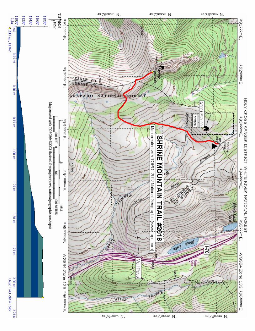
Length: 2.1 miles (one way) Trail Use: Moderate Difficulty: Easy to Moderate Open To: Hiking, Horseback Beginning Elevation: 11,089 ft. Ending Elevation: 11,747 ft. Elevation Gain: +743 ft.-98 ft. = +645 ft. USGS Map(s): Vail Pass, Redcliff Access from Vail: Travel east from Vail on I-70 to Exit 190 for Vail Pass. Exit here and turn right, heading west, onto the Shrine Pass dirt road (FSR 712). Follow this easy road 2.3 miles to just past the indistinct Shrine Pass summit and forest boundary. The trailhead is on the left near the gravel driveway for the Shrine Mountain Inn. Trail Highlights: Follow the trail southwest as it climbs through pine-studded meadows. After about 1.3 miles the trail turns west heading through pine forest before the steepest part of the climb to the saddle to the west of you. From the saddle turn right and travel northwest to Shrine Mountain where you can enjoy spectacular views. Interesting Information: Named “Shrine” for its excellent view of the Mount of the Holy Cross, the pass was originally a Ute Indian trail and later used by silver miners and settlers. Views from Shrine Mountain include: • North - Gore Range • Northwest - Uneva Peak • Southeast - Copper Mtn ski area • South - Ptarmigan Hill and Ptarmigan Pass • Southwest - Sawatch Range and Mount of the Holy Cross • West - The Flat Top Mountains PACK IT IN - PACK IT OUT!! LEAVE NO TRACE!! SHRINE MOUNTAIN TRAIL #2016 Holy Cross Ranger District 24747 US Hwy 24 P.O. Box 190 Minturn, CO 81645 (970) 827- 5715 - Voice (970) 827-9343 - Fax United States Department of Agriculture HIKING This map is intended for use as a general guide only, not for actual land navigation. The White River National Forest strongly suggests purchasing a topographic map and compass prior to your hiking trip.