22
QGIS and Remote Sensing: Using QGIS to Detect Burn Scars from Satellite Imagery Calvin McCoy, 07/06/2017
| Date post: | 30-Mar-2018 |
| Category: |
Documents |
| Upload: | hoangnguyet |
| View: | 231 times |
| Download: | 2 times |
QGIS and Remote Sensing:Using QGIS to Detect Burn Scars from
Satellite Imagery
Calvin McCoy, 07/06/2017
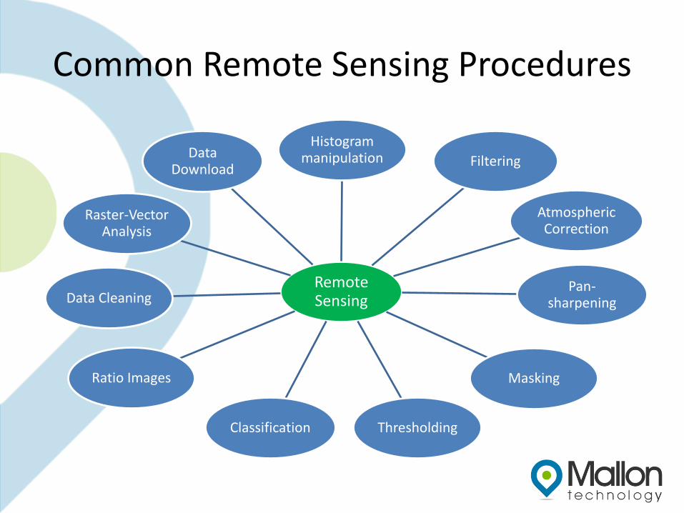
Common Remote Sensing Procedures
Remote Sensing
Histogram manipulation Filtering
Atmospheric Correction
Pan-sharpening
Masking
ThresholdingClassification
Ratio Images
Data Cleaning
Raster-Vector Analysis
Data Download
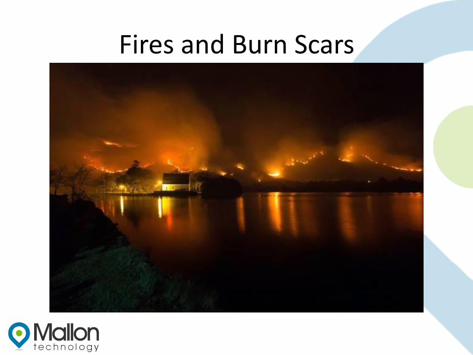
Fires and Burn Scars
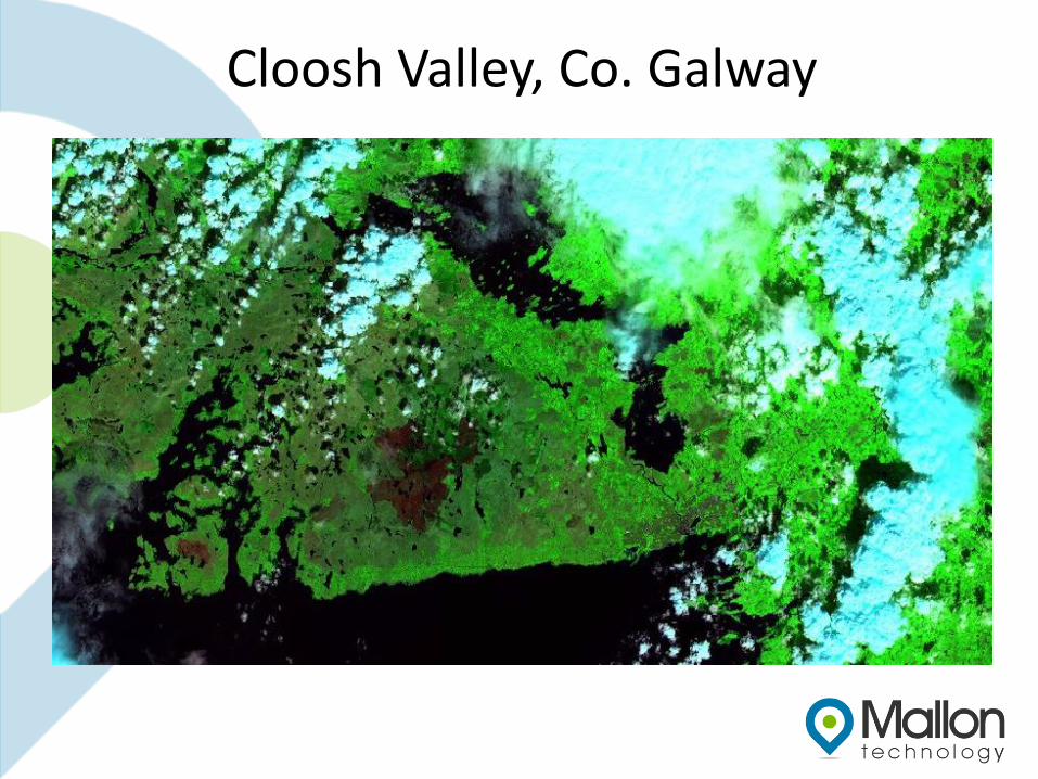
Cloosh Valley, Co. Galway
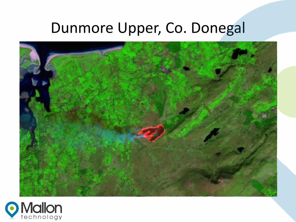
Dunmore Upper, Co. Donegal
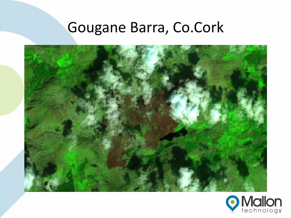
Gougane Barra, Co.Cork
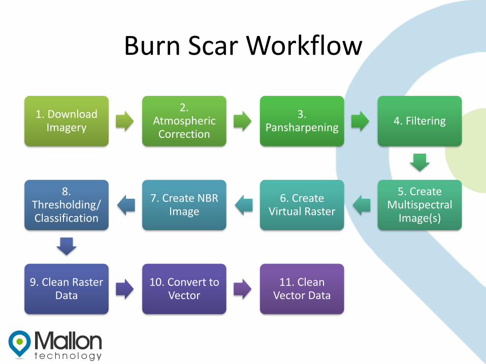
Burn Scar Workflow
1. Download Imagery
2. Atmospheric Correction
3. Pansharpening
4. Filtering
5. Create Multispectral
Image(s)
6. Create Virtual Raster
7. Create NBR Image
8. Thresholding/Classification
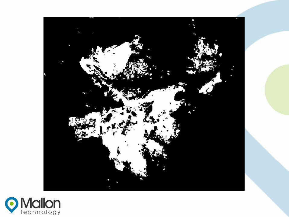
9. Clean Raster Data
10. Convert to Vector
11. Clean Vector Data
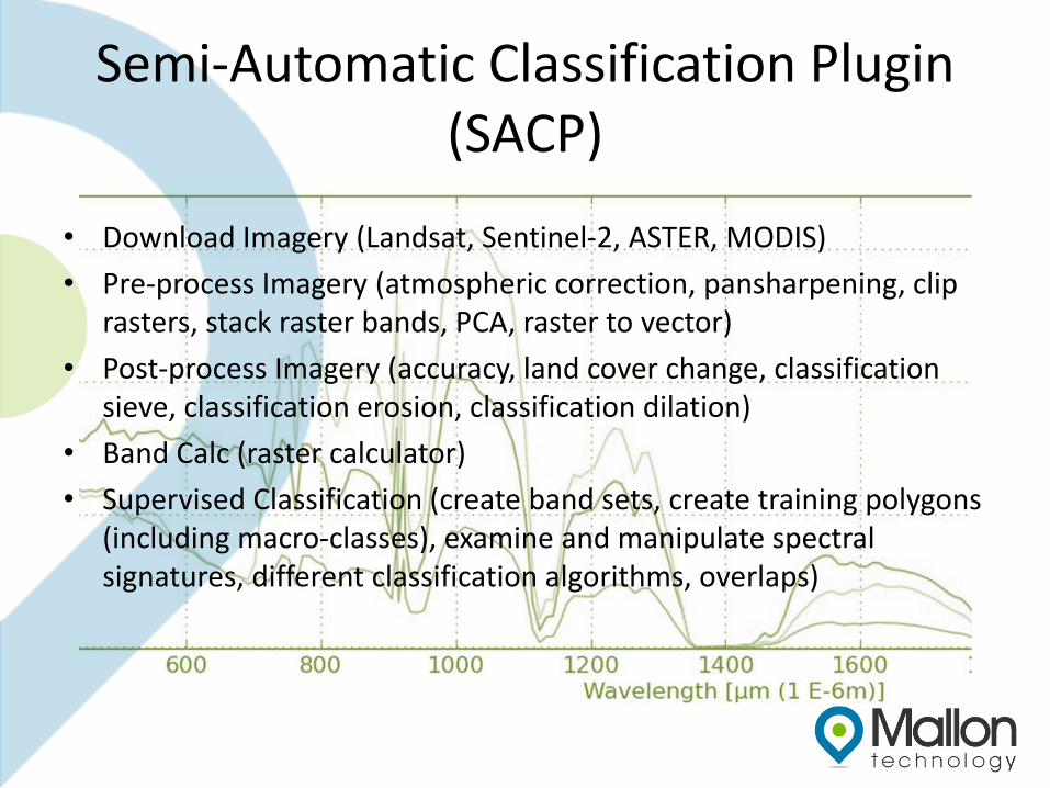
Semi-Automatic Classification Plugin (SACP)
• Download Imagery (Landsat, Sentinel-2, ASTER, MODIS)
• Pre-process Imagery (atmospheric correction, pansharpening, clip rasters, stack raster bands, PCA, raster to vector)
• Post-process Imagery (accuracy, land cover change, classification sieve, classification erosion, classification dilation)
• Band Calc (raster calculator)
• Supervised Classification (create band sets, create training polygons (including macro-classes), examine and manipulate spectral signatures, different classification algorithms, overlaps)
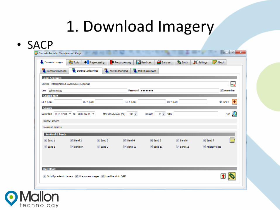
1. Download Imagery• SACP
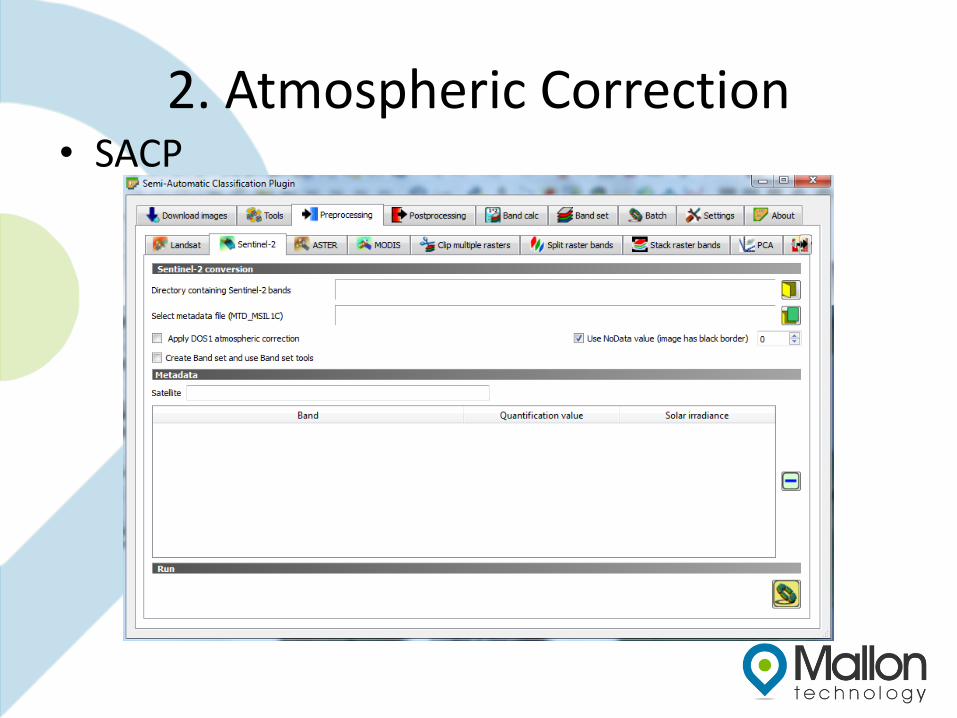
2. Atmospheric Correction • SACP
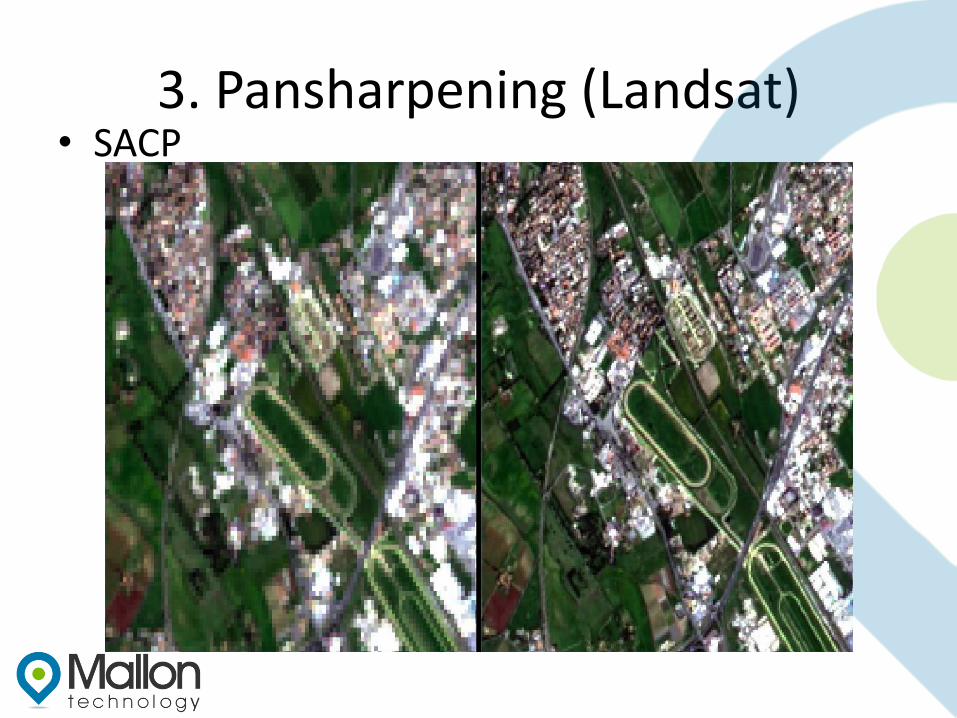
3. Pansharpening (Landsat)• SACP
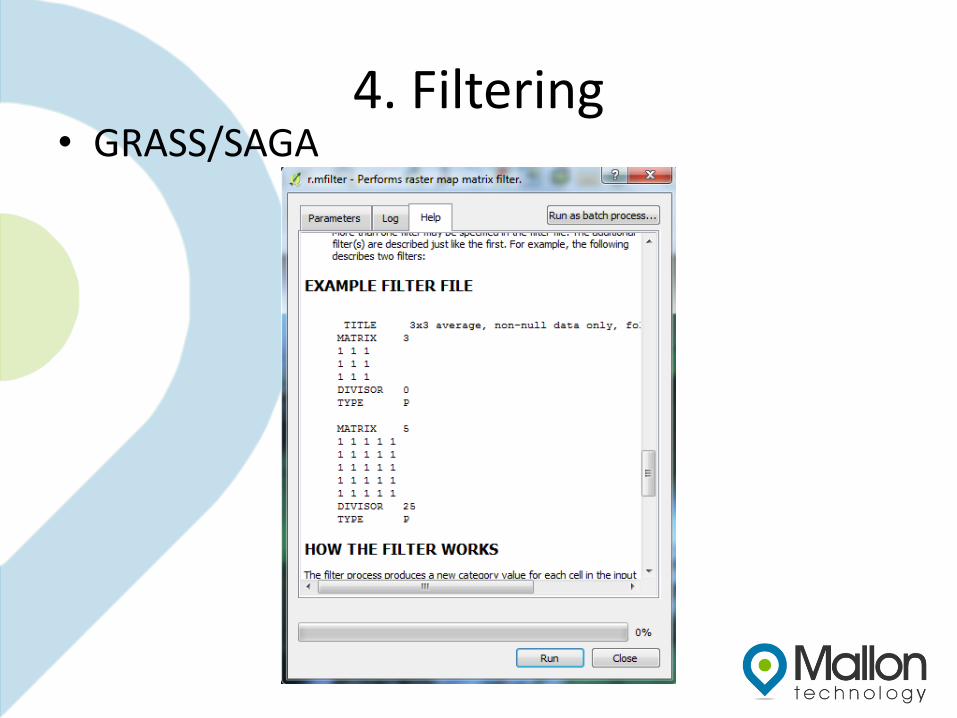
4. Filtering• GRASS/SAGA
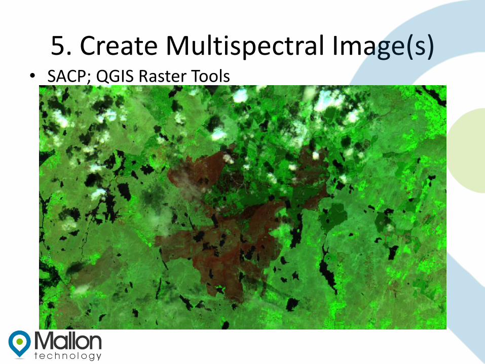
5. Create Multispectral Image(s)• SACP; QGIS Raster Tools
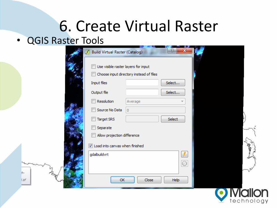
6. Create Virtual Raster• QGIS Raster Tools
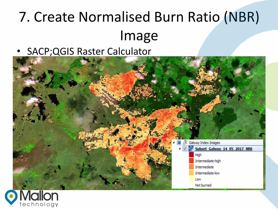
7. Create Normalised Burn Ratio (NBR) Image
• SACP;QGIS Raster Calculator
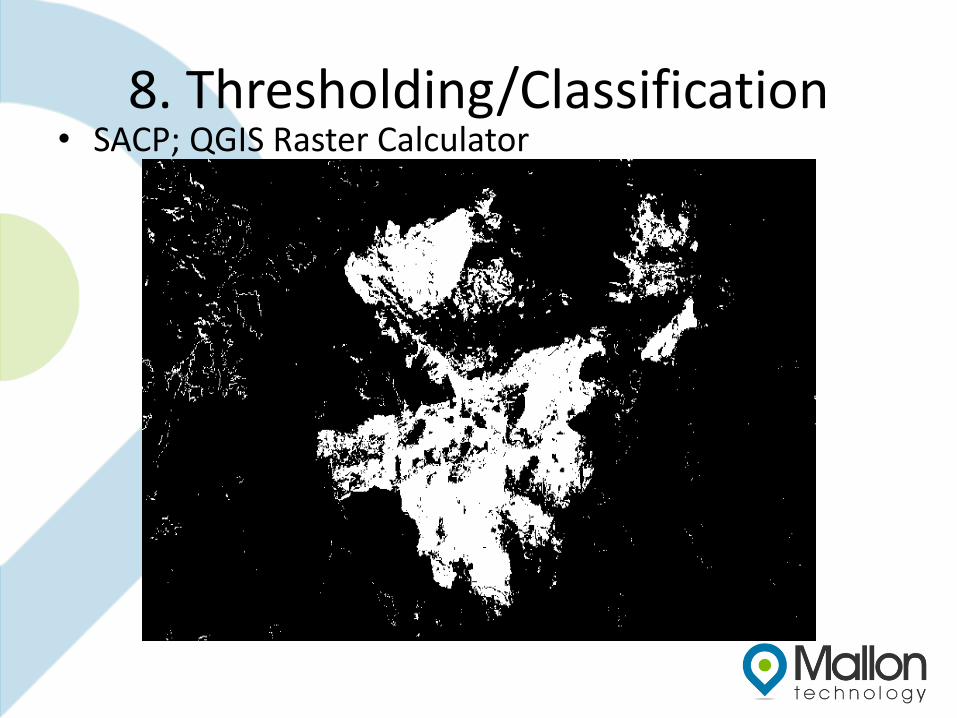
8. Thresholding/Classification• SACP; QGIS Raster Calculator
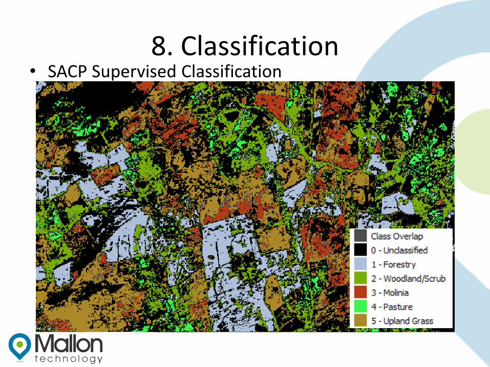
8. Classification• SACP Supervised Classification
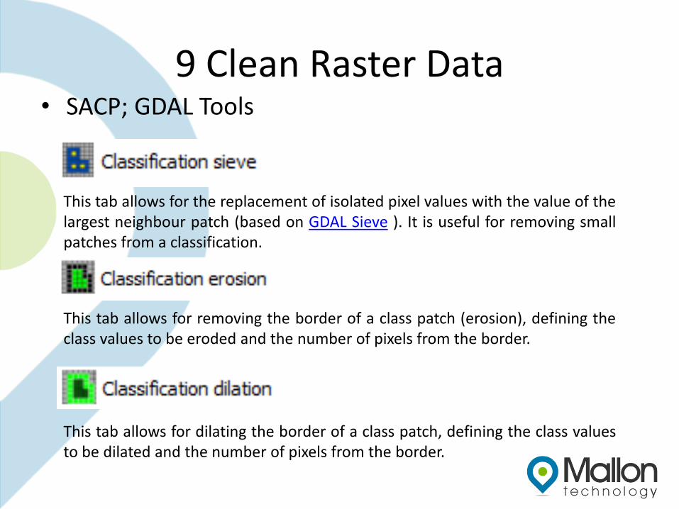
9 Clean Raster Data• SACP; GDAL Tools
This tab allows for the replacement of isolated pixel values with the value of thelargest neighbour patch (based on GDAL Sieve ). It is useful for removing smallpatches from a classification.
This tab allows for removing the border of a class patch (erosion), defining theclass values to be eroded and the number of pixels from the border.
This tab allows for dilating the border of a class patch, defining the class valuesto be dilated and the number of pixels from the border.
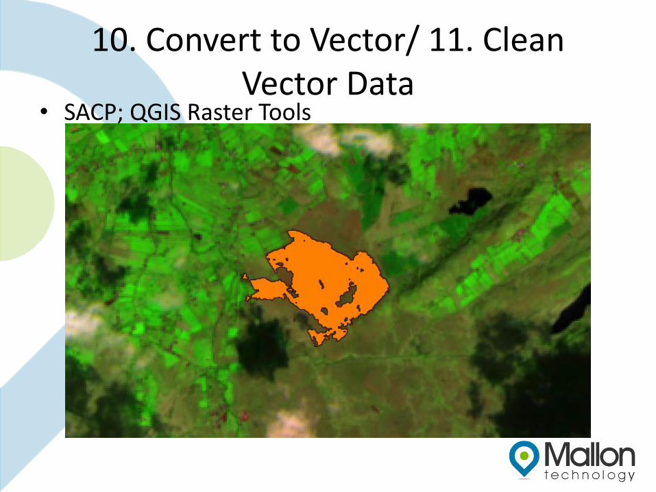
10. Convert to Vector/ 11. Clean Vector Data
• SACP; QGIS Raster Tools
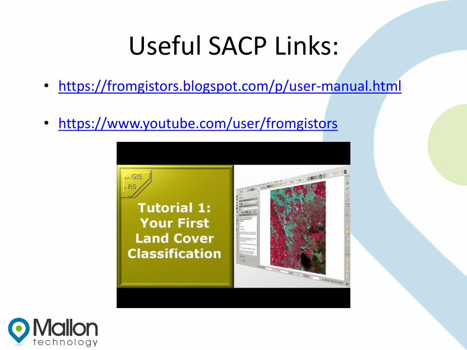
Useful SACP Links:
• https://fromgistors.blogspot.com/p/user-manual.html
• https://www.youtube.com/user/fromgistors
Thank you


