4
Value Reclamation Planning by Richard Hoehn, Principal & Lyndon Hart, Principal Hoehn Landscape Architecture, LLC
ValueReclamation
Planningby Richard Hoehn, Principal
& Lyndon Hart, PrincipalHoehn Landscape Architecture, LLC
Part 1: Value Reclamation Planning –Getting Started: The Importance of Context
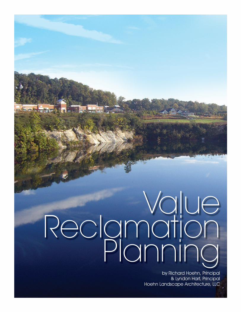
‘Quarry Lake at Greenspring’ and ‘Delight Quarry’ lo-cated in suburban Baltimore represent two case study ex-amples of Value Reclamation Planning. Both quarries,under the direction and control of Vulcan Materials Com-pany, are nearing the completion of a 15-25 year miningreclamation process that demonstrates the concept ofValue Reclamation Planning.
As with all pits and quarries, each is unique with its ownlocation, transportation network, mineral deposits,isopach, mining history, adjacent uses, relevant context,and environmental resource protection areas. Recogniz-ing the unique attributes of each reclamation site, a sim-ilar strategic process can be used to evaluate all pits andquarries in determining their highest and best use oncethe ‘life of mine’ has been obtained.
What is Value Reclamation Planning?At its most basic level, reclamation is defined as
“bringing into or returning to a suitable condition or use”or “the conversion of wasteland into land suitable forhabitation or cultivation”. However, Value ReclamationPlanning extends this definition as “the conversion ofwasteland into the highest and best uses suitable for asite’s post mining condition”. In doing so, the strategic
Photography
by HLA
Photography
by HLA
ValueReclamation
PlanningHow to Recognize and Optimize
Real Estate Value in Quarry Reclamation
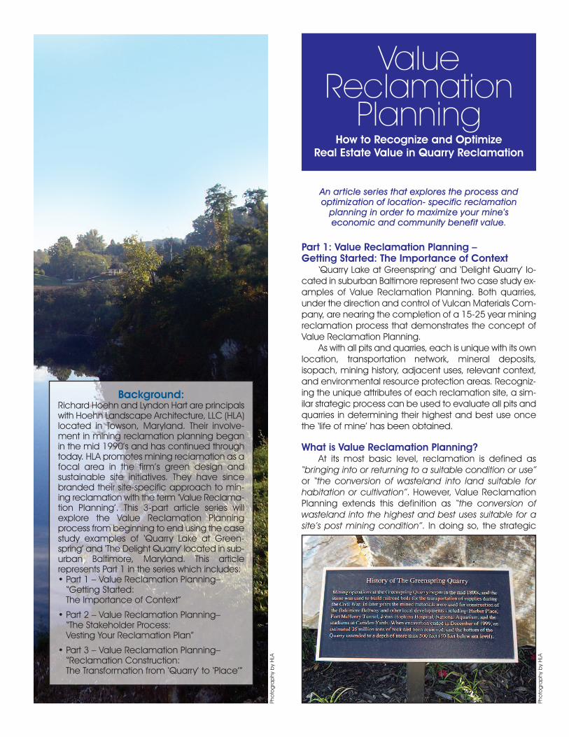
Background:Richard Hoehn and Lyndon Hart are principalswith Hoehn Landscape Architecture, LLC (HLA)located in Towson, Maryland. Their involve-ment in mining reclamation planning beganin the mid 1990’s and has continued throughtoday. HLA promotes mining reclamation as afocal area in the firm’s green design and sustainable site initiatives. They have sincebranded their site-specific approach to min-ing reclamation with the term ‘Value Reclama-tion Planning’. This 3-part article series willexplore the Value Reclamation Planningprocess from beginning to end using the casestudy examples of ‘Quarry Lake at Green-spring’ and ‘The Delight Quarry’ located in sub-urban Baltimore, Maryland. This articlerepresents Part 1 in the series which includes:• Part 1 – Value Reclamation Planning–“Getting Started: The Importance of Context”
• Part 2 – Value Reclamation Planning–“The Stakeholder Process: Vesting Your Reclamation Plan”
• Part 3 – Value Reclamation Planning–“Reclamation Construction: The Transformation from ‘Quarry’ to ‘Place’”
An article series that explores the process andoptimization of location- specific reclamation
planning in order to maximize your mine’s economic and community benefit value.

goals of the reclamation planning process have beenidentified; we are searching for the “highest and best use”for each unique quarry. Determining a site’s “highest andbest use” examines a number of contributing studies thatinclude: a site location evaluation, a site inventory andanalysis, land bay mappings of buildable and unbuild-able areas, identification of potential uses and typicalyields, cash flow projections, and risk analysis.
The Importance of LocationAs with most real estate valuations, location is a key de-
terminant of a site’s highest and best use. The location of aquarry or mine in the urban-suburban-rural-wilderness con-tinuum lends immediate direction as to the feasibility ofcertain uses. What makes the ingredients for the highestand best use at one location does not necessarily makefor the highest and best use at another. At times, thisprocess is intuitive. For example, it makes little sense to pro-pose a mid-rise apartment complex as part of your recla-mation program given the context of a rural streamside
sand and gravel pit. However, when pits and quarries arelocated in more urban environments, as is often the case,a more comprehensive location analysis is in order thattakes clues from existing land uses, legislative master plans,and zoning patterns. In the end, all reclamation efforts re-quire a realistic site location evaluation that considers ex-isting and proposed land use intensities while focusing onacceptable future uses within the site’s given context.
Site Inventory and AnalysisA site inventory and analysis should be performed by
a landscape architect who has the education, training,and experience needed to identify and analyze a broadset of site related issues. Major site issues to be examinedinclude: research of existing legislative land use masterplans, adjacent existing land uses, compatibility studies,topographic and elevation studies, existing geologic andhydro-geologic feature examinations, wetland and waterresource mappings, soil mappings, site access and sightdistance studies, transportation network analyses, utilityavailability and capacity studies, view shed and sceniccorridor analyses, etc. Completion of the site inventoryand analysis helps reveal the character of the site, its sur-roundings, its constraints, and its opportunities. In devel-oping a “highest and best use” design solution, this studyreveals how to capitalize on desirable existing site condi-tions while minimizing those that are negative.
Land Bay/Bubble PlanUsing the results and information obtained from the
site location and site analysis studies, a land bay
Single Family
Land Use Key
Retail
Office
Clubhouse
Waterfront Park
Reforestation
Quarry Lake
CondominiumMulti Family
Old Court Road
Gre
ens
prin
g A
ve.
Land Bay/Bubble Plan — Buildable areas are shown asland bays and proposed uses are identified in the LandUse Key.
Greenspring Quarry, 1961
Source: NSSGA Website
Quarry Lake at Quarry Lake at GreenspringGreenspring
Baltimore CountyBaltimore County
Baltimore
Baltimore
Beltw
ay
Beltw
ay
City of BaltimoreCity of Baltimore
Quarry Lake at Greenspring
Baltimore County
Baltimore
Beltw
ay
City of Baltimore
695I N T E R S T A T E
M A R Y L A N D
83I N T E R S T A T E
M A R Y L A N D
Location — Greenspring Quarry’s location betweenBaltimore City and Baltimore’s Beltway within anestablished urbanized neighborhood offered thepotential for a higher-end mixed-use development.

plan/bubble plan can now be prepared. The purpose ofthis plan is to clearly delineate those areas within the sitethat are available for future uses/buildable areas versusthose areas that are to be preserved, restored, or createdas natural open space areas unavailable for specific pro-gram uses. Typically, this is a simple graphic plan wherebuildable areas are outlined as closed irregular shapes(called ‘land bays’ or ‘bubbles’) and labeled with meas-ured acreage calculations. Unbuildable areas are alsoshown to delineate open space areas, lakes, ponds,streams, wetlands, forested areas, meadows, fields, etc.The land bay/bubble plan helps to understand how vari-ous potential land uses will relate to one another in an or-ganized manner for on-site and adjacent conditions.
Land Use Options/Typical Yields/Cash FlowAnalysis
Potential land uses are now evaluated as options to oc-cupy the buildable land bay areas. Potential yields can bequantified by multiplying the measured areas of buildableland bays by typical ratios associated with the suggesteduse. For example, in a rural farm location, a proposedequestrian complex might use a yield ratio of 1 horse/acre;whereas in a suburban residential location, a proposed sin-gle family home development might use a yield ratio of 2.5lots/acre. Other typical yield rates for proposed land usesmight include: small lot single family @ 4-5 units/acre, town-homes @ 8-10 units/acre, apartment/condominium @ 15-25 units/acre, retail @ 10,000 SF/acre, office @ 15,000SF/acre, and industrial/flex @ 12,000 SF/acre.
Working closely with market analysts, developers andreal estate professionals, cash flow projections can be es-timated by examining probable price points for proposeduses based on area demographics, comparable salesdata, and anticipated absorption rates. While cash flowprojections can be quantitatively weighed against eachother in terms of bottom line profit, a more subjective riskanalysis should be undertaken to assess the potential suc-
cess of the entitlement process for various land use op-tions under consideration.
Risk AnalysisRisk analysis considers such intangible factors as an-
ticipated opposition and/or support from local govern-ment officials, review agencies, and nearby propertyowners/neighborhoods. It will also consider more tangiblefactors such as impacts to the local ecological habitatand environment. Public opinion and environmental im-pacts cannot be underestimated. Proposed reclamationplans that are too aggressive, are environmentally insen-sitive, and/or propose unrealistic land uses, risk the dangerof being denied. A quality reclamation plan will proac-tively address public and neighborhood concerns, offersensitive environmental solutions, and provide the ownerwith a reasonable return on investment.
To summarize the early goals of the Value Reclama-tion Planning process, it is important that a careful analysisof the site and its surroundings be undertaken to under-stand what “highest and best uses” are available on eachunique mining site. For longer term pits and quarries, es-pecially those located near urban areas, it is preferableto begin this process 10 to 20 years in advance of the “lifeof mine”, thereby assuring all stakeholders as to the even-tual disposition of the site. Properly addressed, the resultingplan has the potential to unlock significant value andpublic support for land often only secured for public safetyand underutilized open space.
Following completion of the analysis process outlined above, a realistic and publicly responsible Reclamation Land Use Plan can then be prepared forpresentations to a variety of neighborhood, political, and environmental regulator audiences, as part of ‘TheStakeholder Process’. �
For a discussion of ‘The Stakeholder Process/VestingYour Reclamation Plan’, read Part 2 of this article series.
Community Benef itThe Value Reclamation Planningprocess for ‘Quarry Lake atGreenspring’ has transformedthe former mine into a valuedcommunity benefit.Ph
otography
by HLA


