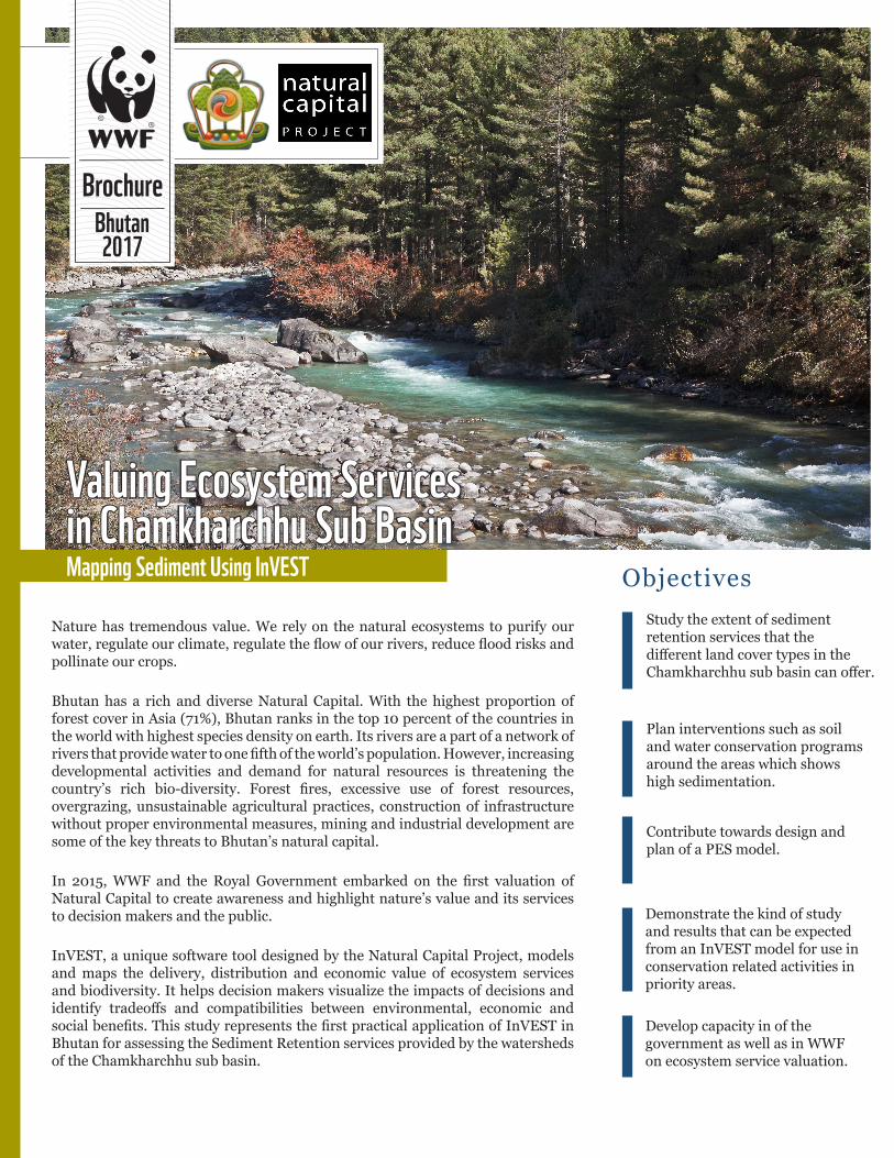
Nature has tremendous value. We rely on the natural ecosystems to purify our water, regulate our climate, regulate the flow of our rivers, reduce flood risks and pollinate our crops. Bhutan has a rich and diverse Natural Capital. With the highest proportion of forest cover in Asia (71%), Bhutan ranks in the top 10 percent of the countries in the world with highest species density on earth. Its rivers are a part of a network of rivers that provide water to one fifth of the world’s population. However, increasing developmental activities and demand for natural resources is threatening the country’s rich bio-diversity. Forest fires, excessive use of forest resources, overgrazing, unsustainable agricultural practices, construction of infrastructure without proper environmental measures, mining and industrial development are some of the key threats to Bhutan’s natural capital. In 2015, WWF and the Royal Government embarked on the first valuation of Natural Capital to create awareness and highlight nature’s value and its services to decision makers and the public. InVEST, a unique software tool designed by the Natural Capital Project, models and maps the delivery, distribution and economic value of ecosystem services and biodiversity. It helps decision makers visualize the impacts of decisions and identify tradeoffs and compatibilities between environmental, economic and social benefits. This study represents the first practical application of InVEST in Bhutan for assessing the Sediment Retention services provided by the watersheds of the Chamkharchhu sub basin. Brochure 2017 Bhutan Valuing Ecosystem Services in Chamkharchhu Sub Basin Mapping Sediment Using InVEST Study the extent of sediment retention services that the different land cover types in the Chamkharchhu sub basin can offer. Plan interventions such as soil and water conservation programs around the areas which shows high sedimentation. Contribute towards design and plan of a PES model. Demonstrate the kind of study and results that can be expected from an InVEST model for use in conservation related activities in priority areas. Develop capacity in of the government as well as in WWF on ecosystem service valuation. Objectives
Transcript
Nature has tremendous value. We rely on the natural ecosystems to purify our water, regulate our climate, regulate the flow of our rivers, reduce flood risks and pollinate our crops.
Bhutan has a rich and diverse Natural Capital. With the highest proportion of forest cover in Asia (71%), Bhutan ranks in the top 10 percent of the countries in the world with highest species density on earth. Its rivers are a part of a network of rivers that provide water to one fifth of the world’s population. However, increasing developmental activities and demand for natural resources is threatening the country’s rich bio-diversity. Forest fires, excessive use of forest resources, overgrazing, unsustainable agricultural practices, construction of infrastructure without proper environmental measures, mining and industrial development are some of the key threats to Bhutan’s natural capital.
In 2015, WWF and the Royal Government embarked on the first valuation of Natural Capital to create awareness and highlight nature’s value and its services to decision makers and the public.
InVEST, a unique software tool designed by the Natural Capital Project, models and maps the delivery, distribution and economic value of ecosystem services and biodiversity. It helps decision makers visualize the impacts of decisions and identify tradeoffs and compatibilities between environmental, economic and social benefits. This study represents the first practical application of InVEST in Bhutan for assessing the Sediment Retention services provided by the watersheds of the Chamkharchhu sub basin.
Brochure
2017Bhutan
Valuing Ecosystem Servicesin Chamkharchhu Sub Basin Mapping Sediment Using InVEST
Study the extent of sediment retention services that the different land cover types in the Chamkharchhu sub basin can offer.
Plan interventions such as soil and water conservation programs around the areas which shows high sedimentation.
Contribute towards design and plan of a PES model.
Demonstrate the kind of study and results that can be expected from an InVEST model for use in conservation related activities in priority areas.
Develop capacity in of the government as well as in WWF on ecosystem service valuation.
Objectives
Erosion and overland sediment retention are natural processes that govern the sediment concentration in streams. Sediment dynamics at the catchment scale are mainly determined by climate (in particular
What are ecosystem services?
If properly managed, ecosystems yield a flow of services that are vital to humanity, including the production of goods (e.g. food), life support processes (e.g. water purification), life-fulfilling conditions (e.g. beauty and recreational opportunities) and the conservation of options (e.g. genetic diversity for future use). Despite their importance, ecosystem services are poorly understood, scarcely monitored, and, in many cases, undergoing rapid degradation and depletion.
Ecosystem services (ES) and InVESTthe rain intensity), soil properties, topography, and vegetation; and
anthropogenic factors such as agricultural activities or infrastructure. On a landscape, the main sediment sources include overland erosion (soil particles detached and transported by rain and overland flow), gullies (channels that concentrate flow), bank erosion, and mass erosion or landslides. However, SDR only models overland erosion, which represents only a portion of the total erosion occurring in a watershed.
Study area
Chamkharchhu sub basin is located in central Bhutan, within the two districts of Bumthang and Zhemgang. It covers an area of 3,160 sq. km and stretches 130 km from the international boundary in the north, to the junction of the Chamkharchhu with the Mangdechhu to form the Manas river, which then enters India to the south. The variation in eco-regions is from alpine to sub-tropical. More than half of the basin falls within the two protected areas viz. Wangchuck Centennial National Park and Phrumsengla National Park.
Land cover types in the basin:
SDR model outputs
Methodology:
The focus of the assessment is on generating proof-of-concept for how InVEST can model changes in ecosystem services (ES) which can impact hydropower facilities in the Chamkharchhu sub basin. The upcoming Chamkharchhu-I hydropower project is taken as the case study.
Since it is known that sediment is the primary concern of these hydropower facilities, we used the InVEST Sediment Delivery Ratio (SDR) tool to model sediment production and retention in the basin. Understanding where erosion is being generated in the watershed, due to local land use, soils, climate and topography, is important for helping target restoration programs that can reduce erosion at its source. Similarly, knowing where existing vegetation is playing a role in retaining sediment in place, and keeping it from eroding, is also a key
The SDR model
Land cover types in the basin:
Top 3 sediment exporting land-cover types.
Sl. Land Cover (Code)
Total annual sediment export (tons)
% of Total annual sediment export
Area (ha)
% of High sediment export area
1 Shrubs (SH)
361,271.00
69.14 6556.59 60.226
2 Meadows (GP)
76,683.60
14.67 2276.19 20.908
3Agriculture Dryland (AK)
36,954.10
7.07 844.47 7.757
474,908.70 90.88 9,677.25 88.891
Top 3 sediment retention land-cover types.
Sl.Land Cover Code
Total annual sediment retention (tons)
% of Total annual sediment retention
Area (ha)
% of High sediment retention area
1Forest Broadleaf (FB)
242515 43.70 4365.27 45.11
2 Shrubs (SH) 88,088 15.87 1132.56 11.71
3 Meadows (GP) 62024 11.18 697.77 7.21
392,627 70.75 6,195.6 64.03
part of targeting conservation programs that can maintain the ecosystem services that are already being provided. Both of these types of programs can reduce the burden on turbines and other hydropower infrastructure. To illustrate this, we looked at relative changes in ES under various hypothetical scenarios: Restoration scenario: Improvements are made to the areas in the watershed that generate high levels of sediment which flow downstream
Degradation scenario: Areas currently providing high levels of sedimentation service upstream are allowed to degrade.
Sediment export for Dam basin 300,249.44 78,543.48 -73.84 -221,705.96 1,635,185.97 444.61 1,334,936.53
For Kurjey basin 113,072.47 33,211.40 -70.63 -79,861.07 251,893.01 122.77 138,820.54
Sediment retention index for Whole basin 82,938,210.75 83,471,276.94 0.64 533,066.19 80,113,007.17 -3.41 -2,825,203.58
Sediment retention index for Dam basin 47,774,413.49 47,999,218.32 0.47 224,804.83 46,442,575.84 -2.79 -1,331,837.65
For Kurjey basin 1,965,517.29 1,856,103.68 -5.57 -109,413.61 2,056,432.86 4.63 90,915.57
Sediment Export and Retention services
To see how land use change can impact sediment delivery, we will compare the sediment export and retention outputs from the SDR model under the baseline condition (current land cover), Restoration scenario and Degradation scenario, for both the watershed feeding Chamkharchhu-I dam, and the whole Chamkharchhu sub basin.
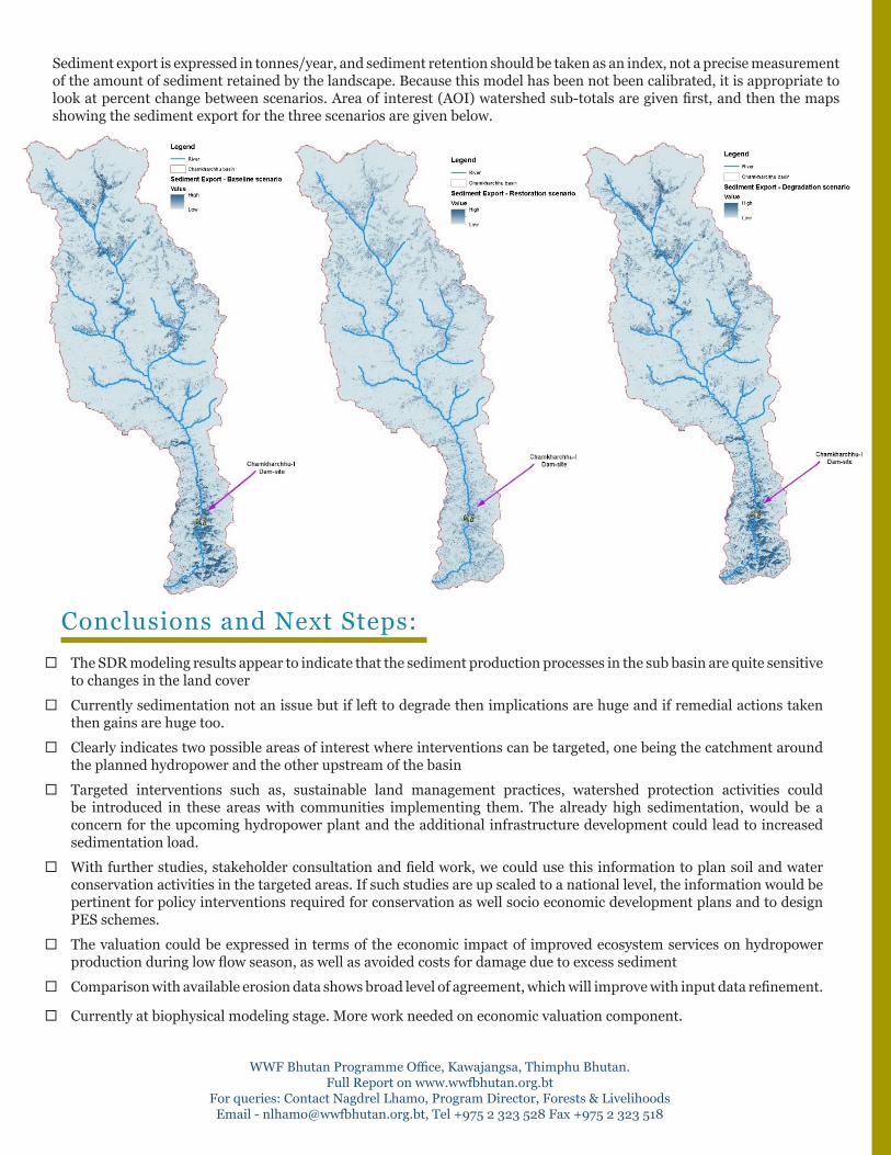
Sediment export is expressed in tonnes/year, and sediment retention should be taken as an index, not a precise measurement of the amount of sediment retained by the landscape. Because this model has been not been calibrated, it is appropriate to look at percent change between scenarios. Area of interest (AOI) watershed sub-totals are given first, and then the maps showing the sediment export for the three scenarios are given below.
Conclusions and Next Steps:¨The SDR modeling results appear to indicate that the sediment production processes in the sub basin are quite sensitive
to changes in the land cover
¨Currently sedimentation not an issue but if left to degrade then implications are huge and if remedial actions taken then gains are huge too.
¨Clearly indicates two possible areas of interest where interventions can be targeted, one being the catchment around the planned hydropower and the other upstream of the basin
¨Targeted interventions such as, sustainable land management practices, watershed protection activities could be introduced in these areas with communities implementing them. The already high sedimentation, would be a concern for the upcoming hydropower plant and the additional infrastructure development could lead to increased sedimentation load.
¨With further studies, stakeholder consultation and field work, we could use this information to plan soil and water conservation activities in the targeted areas. If such studies are up scaled to a national level, the information would be pertinent for policy interventions required for conservation as well socio economic development plans and to design PES schemes.
¨The valuation could be expressed in terms of the economic impact of improved ecosystem services on hydropower production during low flow season, as well as avoided costs for damage due to excess sediment
¨Comparison with available erosion data shows broad level of agreement, which will improve with input data refinement.
¨Currently at biophysical modeling stage. More work needed on economic valuation component.
WWF Bhutan Programme Office, Kawajangsa, Thimphu Bhutan. Full Report on www.wwfbhutan.org.bt
For queries: Contact Nagdrel Lhamo, Program Director, Forests & LivelihoodsEmail - [email protected], Tel +975 2 323 528 Fax +975 2 323 518