4 THE SCANNING OF THE PYRAMIDS PROJECT e Scanning of the Pyramids Project was invoked by the Austrian Archaeological Institute Cairo and VIAS-Vienna Institute for Archaeological Science in cooperation with the Egyptian Supreme Council of Antiquities, Dr. Zahi Hawass. e aim of the project is to apply and test latest state-of-the-art terrestrial laser scanners produced by the Austrian company RIEGL LMS for high accuracy, high resolution and long distance topographic scanning. e project was directed by Prof. Dr. Manfred Bietak, Director of the mission and Dr. Wolfgang Neubauer, Field Director and sponsored and equipped by RIEGL Laser Measurement Systems (www.riegl.com). Laser scanning has already shown its outstanding advantages in acquiring 3D information in many archaeological applications within the past few years (Doneus & Neubauer, 2004; Doneus & Neubauer, 2005). Fig. 1: RIEGL LMS-Z420i Laser Scanner with a calibrated high resolution digital camera Nikon D100 connected to a WLAN- box in front and on top of the Cheops pyramid with the scanning team Dr. Manfred Bietak, DI Nikolaus Studnicka, Dr. Wolf- gang Neubauer, Johannes Riegl jr., Karolin Kastowsky and Stefan Frenzel. W. Neubauer, N. Studnicka Vienna Institute for Archaeological Science VIA
Transcript
Interdisziplinäres Forschungsinstitut für Archäologie der Universität Wien
4
Interdisziplinäres Forschungsinstitut für Archäologie der Universität Wien
THE SCANNING OF THE PYRAMIDS PROJECT
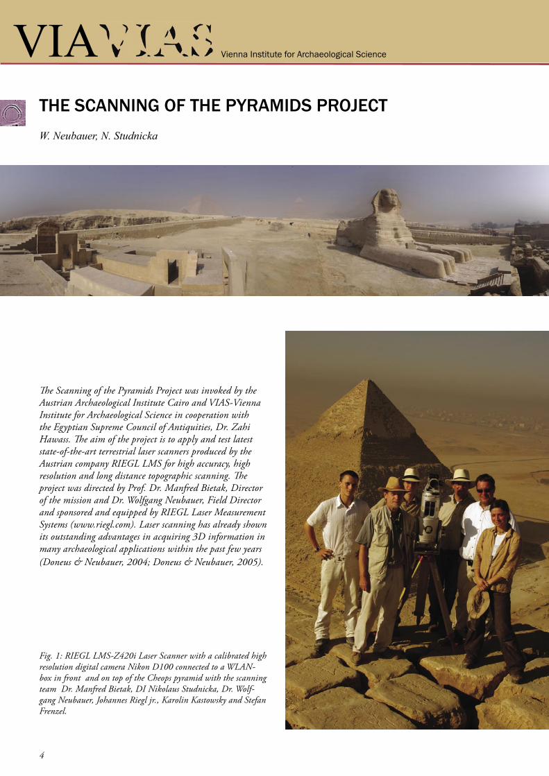
The Scanning of the Pyramids Project was invoked by the Austrian Archaeological Institute Cairo and VIAS-Vienna Institute for Archaeological Science in cooperation with the Egyptian Supreme Council of Antiquities, Dr. Zahi Hawass. The aim of the project is to apply and test latest state-of-the-art terrestrial laser scanners produced by the Austrian company RIEGL LMS for high accuracy, high resolution and long distance topographic scanning. The project was directed by Prof. Dr. Manfred Bietak, Director of the mission and Dr. Wolfgang Neubauer, Field Director and sponsored and equipped by RIEGL Laser Measurement Systems (www.riegl.com). Laser scanning has already shown its outstanding advantages in acquiring 3D information in many archaeological applications within the past few years (Doneus & Neubauer, 2004; Doneus & Neubauer, 2005).
Fig. 1: RIEGL LMS-Z420i Laser Scanner with a calibrated high resolution digital camera Nikon D100 connected to a WLAN-box in front and on top of the Cheops pyramid with the scanning team Dr. Manfred Bietak, DI Nikolaus Studnicka, Dr. Wolf-gang Neubauer, Johannes Riegl jr., Karolin Kastowsky and Stefan Frenzel.
W. Neubauer, N. Studnicka
Vienna Institute for Archaeological Science VIA
Interdisziplinäres Forschungsinstitut für Archäologie der Universität Wien VIAInterdisziplinäres Forschungsinstitut für Archäologie der Universität Wien
5
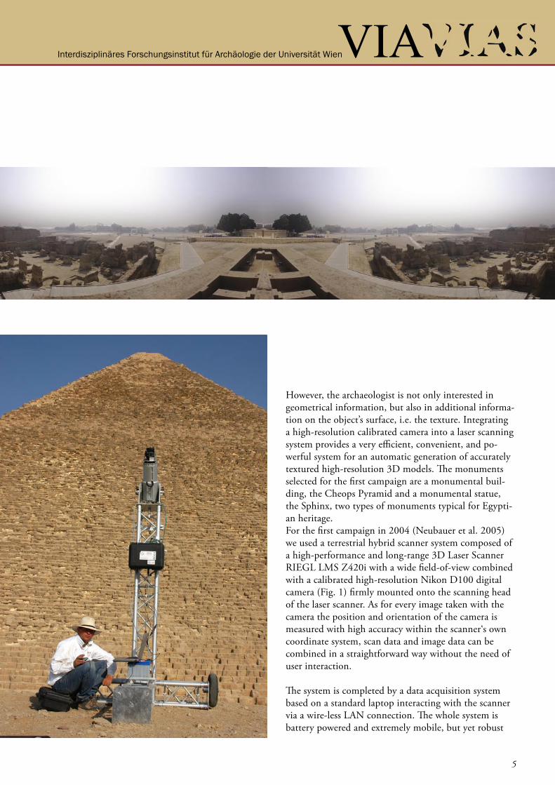
However, the archaeologist is not only interested in geometrical information, but also in additional informa-tion on the object’s surface, i.e. the texture. Integrating a high-resolution calibrated camera into a laser scanning system provides a very efficient, convenient, and po-werful system for an automatic generation of accurately textured high-resolution 3D models. The monuments selected for the first campaign are a monumental buil-ding, the Cheops Pyramid and a monumental statue, the Sphinx, two types of monuments typical for Egypti-an heritage. For the first campaign in 2004 (Neubauer et al. 2005) we used a terrestrial hybrid scanner system composed of a high-performance and long-range 3D Laser Scanner RIEGL LMS Z420i with a wide field-of-view combined with a calibrated high-resolution Nikon D100 digital camera (Fig. 1) firmly mounted onto the scanning head of the laser scanner. As for every image taken with the camera the position and orientation of the camera is measured with high accuracy within the scanner‘s own coordinate system, scan data and image data can be combined in a straightforward way without the need of user interaction.
The system is completed by a data acquisition system based on a standard laptop interacting with the scanner via a wire-less LAN connection. The whole system is battery powered and extremely mobile, but yet robust
Interdisziplinäres Forschungsinstitut für Archäologie der Universität Wien
6
Interdisziplinäres Forschungsinstitut für Archäologie der Universität Wien
and operable in a wide range of environmental condi-tions and is perfectly designed for many archaeological applications. The hybrid sensor provides geometry data from the laser scan and image data from the camera. These data can be automatically or semi-automatically processed to generate products such as textured triangulated surfaces or orthophotos with depth information.
Additionally, all the tools developed for image analysis, such as edge detection or signal detection, can be used for direct extraction of 3D content from the combined image data and scan data. The collected data therefore provides a solid and large data base for any measurements related to scientific pro-blems on the construction, the destruction and decay of the World Heritage Monuments as well as many of the structures in the surrounding
To carry out the project it was necessary to set up an ar-ray of retroreflectors to be used as control points for geo-referencing the data collected by the 3D Laser Scanner. These control points have been surveyed using a Leica TCR703 total station in a local coordinate system set up during the survey. This local system will be transformed into the coordinate system set up by the Giza Plateau Mapping Project.
The control points are used to link the single scans from several scanner positions into one single project coor-dinate system to be transformed later in a world coor-dinate system. The scanner used has a field of view of 360 x 80 degrees and collects data in a range of up to 1 km with a angular resolution of down to 0.004 degrees. This produces a point cloud of recorded points with X, Y, Z coordinates and the intensity of each reflected laser pulse.
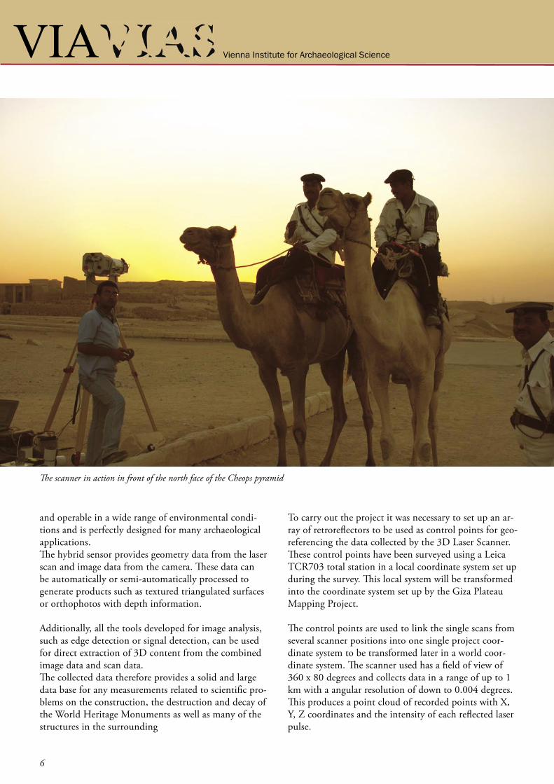
The scanner in action in front of the north face of the Cheops pyramid
Vienna Institute for Archaeological Science VIA
Interdisziplinäres Forschungsinstitut für Archäologie der Universität Wien VIAInterdisziplinäres Forschungsinstitut für Archäologie der Universität Wien
7
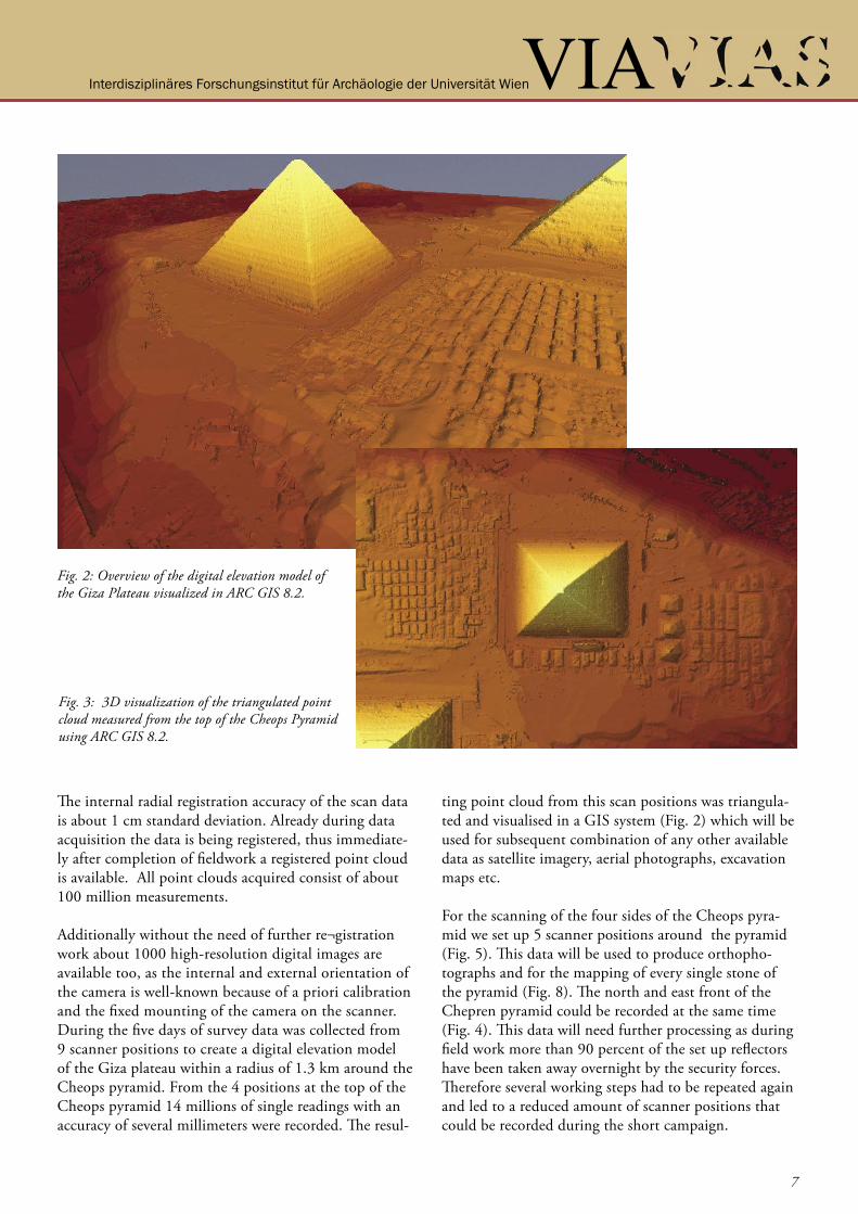
Fig. 2: Overview of the digital elevation model of the Giza Plateau visualized in ARC GIS 8.2.
Fig. 3: 3D visualization of the triangulated point cloud measured from the top of the Cheops Pyramid using ARC GIS 8.2.
The internal radial registration accuracy of the scan data is about 1 cm standard deviation. Already during data acquisition the data is being registered, thus immediate-ly after completion of fieldwork a registered point cloud is available. All point clouds acquired consist of about 100 million measurements.
Additionally without the need of further re¬gistration work about 1000 high-resolution digital images are available too, as the internal and external orientation of the camera is well-known because of a priori calibration and the fixed mounting of the camera on the scanner.During the five days of survey data was collected from 9 scanner positions to create a digital elevation model of the Giza plateau within a radius of 1.3 km around the Cheops pyramid. From the 4 positions at the top of the Cheops pyramid 14 millions of single readings with an accuracy of several millimeters were recorded. The resul-
ting point cloud from this scan positions was triangula-ted and visualised in a GIS system (Fig. 2) which will be used for subsequent combination of any other available data as satellite imagery, aerial photographs, excavation maps etc.
For the scanning of the four sides of the Cheops pyra-mid we set up 5 scanner positions around the pyramid (Fig. 5). This data will be used to produce orthopho-tographs and for the mapping of every single stone of the pyramid (Fig. 8). The north and east front of the Chepren pyramid could be recorded at the same time (Fig. 4). This data will need further processing as during field work more than 90 percent of the set up reflectors have been taken away overnight by the security forces. Therefore several working steps had to be repeated again and led to a reduced amount of scanner positions that could be recorded during the short campaign.
Interdisziplinäres Forschungsinstitut für Archäologie der Universität Wien
8
Interdisziplinäres Forschungsinstitut für Archäologie der Universität Wien
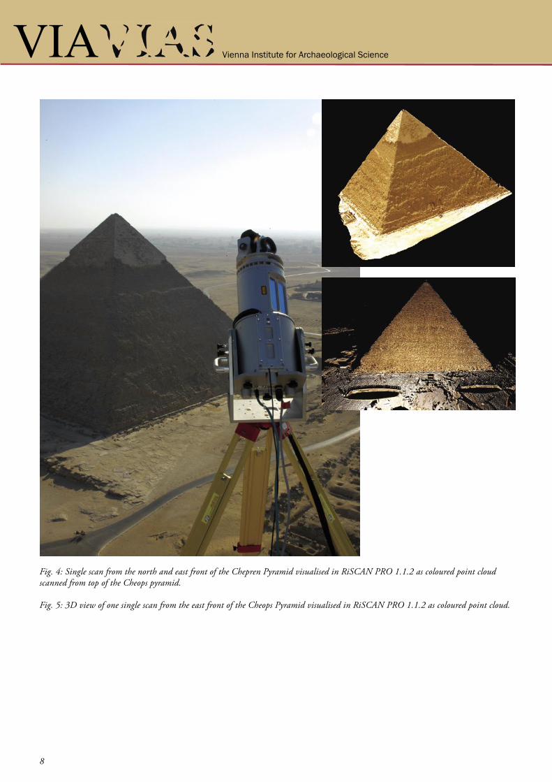
Fig. 4: Single scan from the north and east front of the Chepren Pyramid visualised in RiSCAN PRO 1.1.2 as coloured point cloud scanned from top of the Cheops pyramid.
Fig. 5: 3D view of one single scan from the east front of the Cheops Pyramid visualised in RiSCAN PRO 1.1.2 as coloured point cloud.
Vienna Institute for Archaeological Science VIA
Interdisziplinäres Forschungsinstitut für Archäologie der Universität Wien VIAInterdisziplinäres Forschungsinstitut für Archäologie der Universität Wien
9
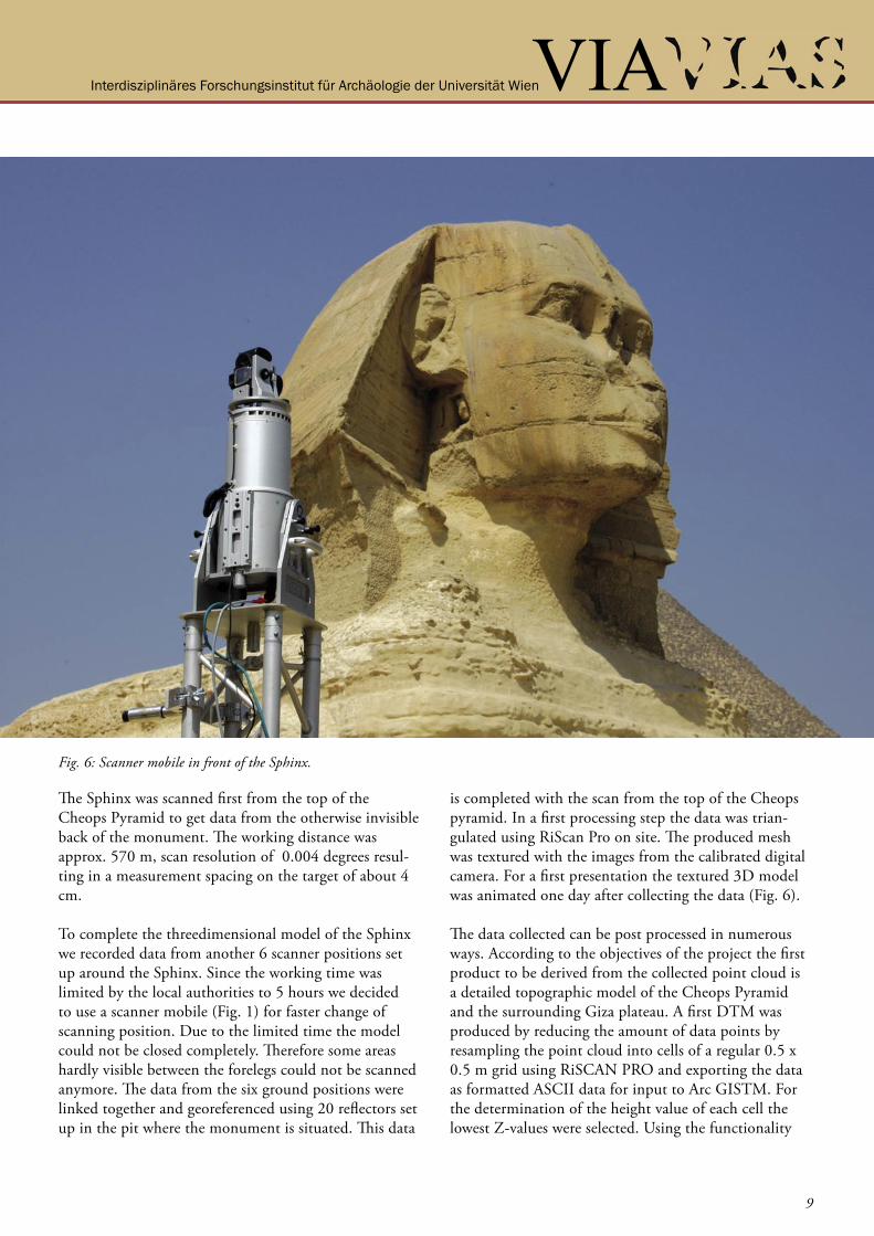
The Sphinx was scanned first from the top of the Cheops Pyramid to get data from the otherwise invisible back of the monument. The working distance was approx. 570 m, scan resolution of 0.004 degrees resul-ting in a measurement spacing on the target of about 4 cm.
To complete the threedimensional model of the Sphinx we recorded data from another 6 scanner positions set up around the Sphinx. Since the working time was limited by the local authorities to 5 hours we decided to use a scanner mobile (Fig. 1) for faster change of scanning position. Due to the limited time the model could not be closed completely. Therefore some areas hardly visible between the forelegs could not be scanned anymore. The data from the six ground positions were linked together and georeferenced using 20 reflectors set up in the pit where the monument is situated. This data
is completed with the scan from the top of the Cheops pyramid. In a first processing step the data was trian-gulated using RiScan Pro on site. The produced mesh was textured with the images from the calibrated digital camera. For a first presentation the textured 3D model was animated one day after collecting the data (Fig. 6).
The data collected can be post processed in numerous ways. According to the objectives of the project the first product to be derived from the collected point cloud is a detailed topographic model of the Cheops Pyramid and the surrounding Giza plateau. A first DTM was produced by reducing the amount of data points by resampling the point cloud into cells of a regular 0.5 x 0.5 m grid using RiSCAN PRO and exporting the data as formatted ASCII data for input to Arc GISTM. For the determination of the height value of each cell the lowest Z-values were selected. Using the functionality
Fig. 6: Scanner mobile in front of the Sphinx.
Interdisziplinäres Forschungsinstitut für Archäologie der Universität Wien
10
Interdisziplinäres Forschungsinstitut für Archäologie der Universität Wien
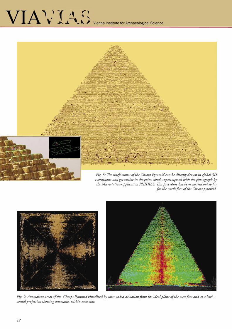
of 3D-Analyst the point cloud was triangulated into the internal TIN-format of Arc GISTM. For future processing we plan to extract breaklines from the point cloud using the photographic record to be added in the triangulation process to enhance the DTM. From the triangulated model contour maps or cross sections can be derived. The detailed DTM of the Cheops Pyramid revealed four anomalous areas in the centre of each side. These anomalies are areas starting at the top and ob-viously proceed down to the bottom where a deficiency in stones became visible. By defining idealised planes for the four sides of the Great Pyramid using the point clouds made it easy to visualise this deficiency as to be seen in Figure 9. By animating the plane stepwise up
and down its normal vector showed that a channel-like structure must have been existing in the centre of the four sides, that later was enlarged from top to bottom by corrosion. The meaning of this anomaly is still under re-search but might be seen in relation to the construction technique of the pyramid itself or has derived from the interface of a substruction for control of the limestone casing which was stripped off long ago and once covered the inner masonry of the Great Pyramid.To triangulate a model it is necessary to reduce the number of measurements from the total number of points to a lower level by means of re-sampling the data with a defined resolution. For the first processing of the Cheops Pyramid the level of detail was set to 10 cm.
Fig. 6: Triangulated point cloud of a single scan textured with the acquired digital images.
Vienna Institute for Archaeological Science VIA
Interdisziplinäres Forschungsinstitut für Archäologie der Universität Wien VIAInterdisziplinäres Forschungsinstitut für Archäologie der Universität Wien
11
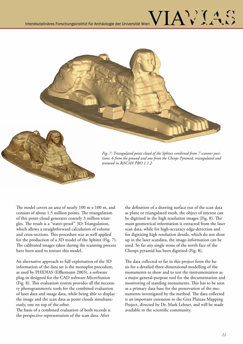
The model covers an area of nearly 100 m x 100 m, and consists of about 1.5 million points. The triangulation of this point-cloud generates coarsely 3 million trian-gles. The result is a “water-proof ” 3D-Triangulation, which allows a straightforward calculation of volume and cross-sections. This procedure was as well applied for the production of a 3D model of the Sphinx (Fig. 7). The calibrated images taken during the scanning process have been used to texture this model.
An alternative approach to full exploitation of the 3D information of the data set is the monoplot procedure, as used by PHIDIAS (Effkemann 2003), a software plug-in designed for the CAD software MicroStation (Fig. 8). This evaluation system provides all the necessa-ry photogrammetric tools for the combined evaluation of laser data and image data, while being able to display the image and the scan data as point clouds simultane-ously, one on top of the other. The basis of a combined evaluation of both records is the perspective representation of the scan data. After
the definition of a drawing surface out of the scan data as plane or triangulated mesh, the object of interest can be digitized in the high resolution images (Fig. 8). The main geometrical information is extracted from the laser scan data, while for high-accuracy edge-detection and for digitizing high resolution details, which do not show up in the laser scandata, the image-information can be used. So far any single stone of the north face of the Cheops pyramid has been digitized (Fig. 8).
The data collected so far in this project form the ba-sis for a detailed three-dimensional modelling of the monuments to show and to test the instrumentation as a major general-purpose tool for the documentation and monitoring of standing monuments. This has to be seen as a primary data base for the preservation of the mo-numents investigated by the method. The data collected is an important extension to the Giza Plateau Mapping Project, directed by Dr. Mark Lehner, and will be made available to the scientific community.
Fig. 7: Triangulated point cloud of the Sphinx combined from 7 scanner posi-tions: 6 from the ground and one from the Cheops Pyramid, triangulated and textured in RiSCAN PRO 1.1.2
Interdisziplinäres Forschungsinstitut für Archäologie der Universität Wien
12
Interdisziplinäres Forschungsinstitut für Archäologie der Universität Wien
Fig. 8: The single stones of the Cheops Pyramid can be directly drawn in global 3D coordinates and get visible in the point cloud, superimposed with the photograph by the Microstation-application PHIDIAS. This procedure has been carried out so far
for the north face of the Cheops pyramid.
Fig. 9: Anomalous areas of the Cheops Pyramid visualized by color coded deviation from the ideal plane of the west face and as a hori-zontal projection showing anomalies within each side.
Vienna Institute for Archaeological Science VIA
Interdisziplinäres Forschungsinstitut für Archäologie der Universität Wien VIAInterdisziplinäres Forschungsinstitut für Archäologie der Universität Wien
13
ZUSAMMENFASSUNG
REFERENCES
The mission was sponsored and equiped by RIEGL La-ser Measurement Systems (www.riegl.com) VIAS-Vien-na Institute for Archaeological Science, Vienna and the Austrian Archaeological Institute Cairo and was suppor-ted by the Supreme Council of Antiquities, the Austrian Embassy, Cairo and the Austrian Ministry of Education and Cultural Affairs. The authors want to express their special thanks for the support to Mrs. Hasbani, Cairo.
Doneus, M. & Neubauer, W., 2004. Digital Recor-ding of Stratigraphic Excavations. In: Ausserer, K.F. & Börner, W. & Goriany, M. & Karlhuber-Vöckl, L. (eds). Enter the Past. The E-way into the four Dimensions of Cultural Heritage. CAA 2003, Computer Applications and Quantitative Methods in Archaeology. BAR Inter-national Series 1227, Archaeopress, Oxford.
Doneus, M. & Neubauer, W., 2005. Laser scanners for 3D documentation of stratigraphic excavations. In: Baltsavias et al. (eds) Recording, Modeling and Visuali-zation of Cultural Heritage, Taylor & Francis, London, 193-203.
Neubauer W., Doneus M., Studnicka N., Riegl J., 2005. Combined High Resolution Laser Scanning and Photogrammetrical Documentation of the Pyramids at Giza. In: Dequal S. (Ed.) Proceedings of the XXth International Symposium CIPA, Torino. The Internati-onal Archives of Photogrammetry, Remote Sensing and Spatial Information Sciences, Vol. XXXVI-5/C34/1, 470-475226-231.
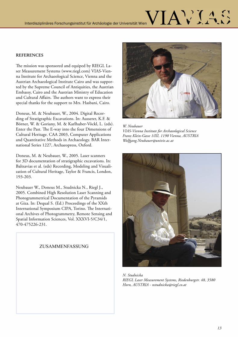
W. Neubauer VIAS-Vienna Institute for Archaeological Science Franz Klein-Gasse 1/III, 1190 Vienna, AUSTRIA [email protected]
N. StudnickaRIEGL Laser Measurement Systems, Riedenburgstr. 48, 3580 Horn, AUSTRIA - [email protected]