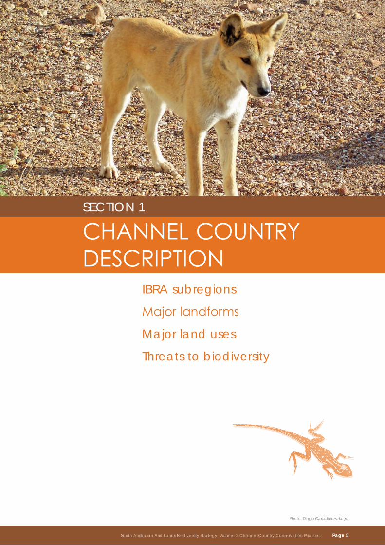
South auStralian arid landS natural reSourceS management boardSouth auStralian arid landS natural reSourceS management region
www.environment.sa.gov.au
South Australian Arid Lands Biodiversity Strategy
2 Volume
Volume 2 Channel Country Conservation Priorities
A partnership between
the department for environment and heritage and South australian arid lands natural resources management board
Contentsintroduction . . . . . . . . . . . . . . . . . . . . . . . . . . . . . . . . . . . . . . . . . . . . . . . . . . . . . . . . . . . . . . . . . . . . . . . . . . 1
Section 1 . . . . . . . . . . . . . . . . . . . . . . . . . . . . . . . . . . . . . . . . . . . . . . . . . . . . . . . . . . . . . . . . . . . . . . . . . . . . 5
channel country description . . . . . . . . . . . . . . . . . . . . . . . . . . . . . . . . . . . . . . . . . . . . . . . . . . . . . . . . . . . . 6
ibra subregions . . . . . . . . . . . . . . . . . . . . . . . . . . . . . . . . . . . . . . . . . . . . . . . . . . . . . . . . . . . . . . . . . . . . 8
major landforms . . . . . . . . . . . . . . . . . . . . . . . . . . . . . . . . . . . . . . . . . . . . . . . . . . . . . . . . . . . . . . . . . . . 10
major land uses . . . . . . . . . . . . . . . . . . . . . . . . . . . . . . . . . . . . . . . . . . . . . . . . . . . . . . . . . . . . . . . . . . . 12
threats to biodiversity . . . . . . . . . . . . . . . . . . . . . . . . . . . . . . . . . . . . . . . . . . . . . . . . . . . . . . . . . . . . . . 13
Section 2 . . . . . . . . . . . . . . . . . . . . . . . . . . . . . . . . . . . . . . . . . . . . . . . . . . . . . . . . . . . . . . . . . . . . . . . . . . . 15
conservation priorities . . . . . . . . . . . . . . . . . . . . . . . . . . . . . . . . . . . . . . . . . . . . . . . . . . . . . . . . . . . . . . . . 15
Drainagelinesandfloodplains . . . . . . . . . . . . . . . . . . . . . . . . . . . . . . . . . . . . . . . . . . . . . . . . . . . . . . 17
SignificantresponseofwaterbirdstowaterflowintheDiamantina and Cooper Creek drainage systems . . . . . . . . . . . . . . . . . . . . . . . . . . . . . . . . . . . . . . . . . . . . . . . 21
Importantpermanentandsemi-permanentwaterholesoftheDiamantina and Cooper Creek drainage systems . . . . . . . . . . . . . . . . . . . . . . . . . . . . . . . . . . . . . . . . . . . . . . . 22
Threatenedecologicalcommunitiesondrainagelines,floodplainsandswamps . . . . . . . . . . 23
GreyGrasswrenonfloodplainsandswamps . . . . . . . . . . . . . . . . . . . . . . . . . . . . . . . . . . . . . . . . . 24
Stony plains . . . . . . . . . . . . . . . . . . . . . . . . . . . . . . . . . . . . . . . . . . . . . . . . . . . . . . . . . . . . . . . . . . . . . . 26
Significantandendemicfloraandfaunaspeciesonstonyplains . . . . . . . . . . . . . . . . . . . . . . . . 29
Dunefieldsandsandplains . . . . . . . . . . . . . . . . . . . . . . . . . . . . . . . . . . . . . . . . . . . . . . . . . . . . . . . . . 31
Mulga low woodland on low dunes and sand plains. . . . . . . . . . . . . . . . . . . . . . . . . . . . . . . . . . . 33
monitoring and evaluation . . . . . . . . . . . . . . . . . . . . . . . . . . . . . . . . . . . . . . . . . . . . . . . . . . . . . . . . . . . . . 35
glossary . . . . . . . . . . . . . . . . . . . . . . . . . . . . . . . . . . . . . . . . . . . . . . . . . . . . . . . . . . . . . . . . . . . . . . . . . . . . 36
abbreviations . . . . . . . . . . . . . . . . . . . . . . . . . . . . . . . . . . . . . . . . . . . . . . . . . . . . . . . . . . . . . . . . . . . . . . . . 37
Further reading . . . . . . . . . . . . . . . . . . . . . . . . . . . . . . . . . . . . . . . . . . . . . . . . . . . . . . . . . . . . . . . . . . . . . . 37
South Australian Arid Lands Biodiversity Strategy: Volume 2 Channel Country Conservation Priorities
Cover photo: Sunset over Cooper Creek
Page ii South Australian Arid Lands Biodiversity Strategy: Volume 2 Channel Country Conservation PrioritiesSouth Australian Arid Lands Biodiversity Strategy: Volume 2 Channel Country Conservation Priorities
IntroductionThe South Australian Arid Lands Biodiversity Strategy has been developed by the South Australian Arid Lands Natural Resources Management Board (SAAL NRM Board) and the South Australian Department for Environment and Heritage (DEH).TheSouthAustralianAridLandsNaturalResourcesManagementRegioncoversover 520,000km2,almost53%oftheState.Thelandscapesandbiodiversityofthishugeareaare diverseandcomplex.Planningforbiodiversityconservationatsuchlargescalesrequiresalandscape-basedsystemofclassifyingtheland.TheclassificationsystemusedforthisstrategyistheInterimBiogeographicRegionalisationforAustralia(IBRA)regions.TheIBRAbioregionsoftheSAALNRMregionaretheStonyPlains,FlindersLoftyBlock,BrokenHillComplex,ChannelCountry,Simpson–StrzeleckiDunefields,FinkeandGawler.
TheStrategyconsistsofsixdocuments.VolumeoneistheSouthAustralianAridLandsNaturalResourcesManagementRegionBiodiversityStrategy:Region-widePriorityActions.Itidentifiestheregion-widegoalforbiodiversityconservationandsetsresourceconditiontargetsthatwillenable ustomeasureoursuccessinachievingthisgoal,anddetailsacomprehensivesuiteofmanagementactiontargetsandstrategiesthatmustbeimplementedregionallytoachievethisgoal.
Thefivebioregionaldocumentsareseparatevolumes,andidentifyconservationpriorities foreachofthebioregionsintheSouthAustralianAridLands.Theseare:
Volume 2 Channel Country Conservation Priorities•
Volume 3 Flinders and Olary Ranges Conservation Priorities•
Volume 4 Gawler Conservation Priorities•
Volume 5 Sandy Deserts Conservation Priorities•
Volume 6 Stony Plains Conservation Priorities•
Thisdocument,South Australian Arid Lands Biodiversity Strategy - Volume 2 Channel Country Conservation Prioritieshastwosections.Sectiononedescribesthebioregion’snaturalattributes, landusesandthemajorthreatstobiodiversity.Sectiontwosetsoutthepriorityactionsforbiodiversityconservationforthebioregionoverthenextfiveyears.Thisdocumentisoneoffivebioregionalbiodiversitystrategiesthat,together,contributetotheSouthAustralianAridLandsBiodiversity Strategy.
TheconservationprioritiesdescribedherehavebeenidentifiedintheSAALportionoftheChannelCountrybioregion.TheChannelCountrybioregionisinthenorth-easterncorneroftheState,extendingintoQueensland,NewSouthWalesandtheNorthernTerritory.
Photo:TableHill,InnaminckaRR
South Australian Arid Lands Biodiversity Strategy: Volume 2 Channel Country Conservation Priorities Page 1
bioregional frameworkTheInterimBiogeographicRegionalisationofAustralia(IBRA)establishesahierarchyofecosystemclassificationforwhichthephysical,climaticandbiologicalcharacteristicsaredescribed.
bioregions:arecontinentalscale(1:1,000,000)ecosystemsthatrangeinsizefromoneto20millionhectares.Theyaredistinguishedfromadjacentregionsbytheirbroadphysicalandbiologicalcharacteristics.Theymayincludemorethan30landformsand50vegetationassociations.Sevenbioregions,orpartsthereof,occurintheSAALNRM Region.
continental ecosystem: ChannelCountryIBRA–Extensivedrainagesystemoflowtopographicreliefwithextensivefloodplainsthatcrisscrossstonyplainsanddunefields,draining into Lake Eyre.
IBRA Bioregion ContinentalEcosystem 1:1,000,000
Subregions:aresub-continentalscale(1:500,000)ecosystemsthatrangeinsizefrom100,000tosevenmillionhectares. TheyoccurwithinIBRAbioregionsandmayinclude upto15landformsand30vegetationassociations.
Sub-continental ecosystem:Coongie IBRA subregion – Parallel dunesystemwithperiodicallyfloodedinterduneflatsandCooperandStrzeleckiCreeks,whichflowthroughdunefieldswithperiodicallyfloodedinterduneflats.
IBRA Subregion Sub-continentalEcosystem 1:500,000
landsystems:areregionalscale(1:250,000)ecosystemsthatrangeinsizefrom2,000tofivemillionhectares.TheyoccurwithinIBRAsubregionsandmayincludeuptofivelandforms and10vegetationassociations.
regional ecosystem: Cooperlandsystem–Watercourses,floodplains,andephemerallakeswhichflowthroughsanddunesofvarying mobility.
Landsystem RegionalEcosystem 1:250,000
Vegetation communities:arelocalscale(1:100,000)ecosystemsthatrange insizefromfiveto5,000hectaresandarebased onasinglelandformandvegetationcommunity.
local ecosystem: Localecosystem:RiverRedGumwoodlandoverchenopodsandephemeral herbs on the Cooper Creek
Vegetation Community LocalEcosystem 1:100,000
Page 2 South Australian Arid Lands Biodiversity Strategy: Volume 2 Channel Country Conservation Priorities
Who is this strategy for?Thisstrategyisdesignedtoaddresstheneedsofthreemainstakeholdergroups:
TheSAALNRMBoard,Governmentandotherinvestors•
Scientists,technicians,andNRMsupportstaff•
Land managers•
Saal nrm board, government and other investorsThefocusaudienceforthisstrategyistheSAALNRMBoard,StateandFederalGovernmentDepartmentswithresponsibilityforbiodiversityconservation,andotherorganisationscurrentlyinvesting,orwishingtoinvest,inconservingthebiodiversityoftheSouthAustralianAridLands. The20-yeartargetsrepresentclearstatementsofintentaboutbiodiversityconservationpriorities in the Channel Country and how they will be managed. Monitoring and evaluating progress againsttheidentifiedperformancecriteriawillcontributetoregionalreportingonbiodiversityconservationefforts.
The5-yearactionsprovidespecificdirectionfortargetinginvestment.Inmostinstances, theactionscanbeimplementedasnewprojects,oraspartofexistingprojectscurrentlyundertakenbytheSAALNRMBoard,GovernmentDepartmentsandotherstakeholders.
Responsibilityfordeliveringeachactionhasnotbeendetailed.Ultimately,theSAALNRMBoardandGovernmentareresponsiblefortheongoingprocessofworkingwithotherstakeholderstodelivereachaction.
Scientists, technicians and nrm support staffThestrategyalsohastwomainusesforbiologists,ecologists,NRMsupportstaffandothersinvolvedinbiodiversityconservationandNRMprojectsandprograms.
1.ItprovidesasetofprioritiesforbiodiversityconservationintheChannelCountry.Technicalstaffcanconfidentlystructureexistingornewprojectstodelivertheactionsidentifiedforeachconservationpriority.
2.Itidentifiespracticalstrategiesfordirectinvolvementbylandmanagers.Technicalstaffcanusethesestrategiestostructureanddevelopengagementandextensionprogramstobuildcapacityoflandmanagerstoachieveeffectivebiodiversityconservationgoals.
land managersForthelandmanagersoftheChannelCountry,thisdocumentclearlysetsoutthebiodiversityconservationprioritiesforthebioregion,anddescribestheactivitiesthatneedtobeundertakentoaddressthesepriorities.Thedocumentalsosuggestspracticalstrategiesandactionsthatlandmanagerscanundertakeaspartoftheirday-to-dayoperationstomaintainandimprovebiodiversity.
South Australian Arid Lands Biodiversity Strategy: Volume 2 Channel Country Conservation Priorities Page 3
South australian arid lands nrm region – ibra bioregions
Marree
Innamincka
Roxby Downs
SOUTH AUSTRALIAN ARID LANDS NRM REGIONIBRA Bioregions
South Australian Arid Lands NRM Region
South Australian Arid LandsNRM Group Boundary
Salt Lake
Major Road
State Border
Locality
0 150
Km
Northern Territory Queensland
Ne
w S
out
h W
ale
sV
icto
ria
Bioregion
Broken Hill Complex (BHC)
Channel Country (CHC)
Central Ranges (CR)
Eyre Yorke Block (EYB)
Finke (FIN)
Flinders Lofty Block (FLB)
Gawler (GAW)
Great Victoria Desert (GVD)
Murray Darling Depression (MDD)
Riverina (RIV)
Simpson-Strzelecki Dunefields (SSD)
Stony Plains (STP)
Gawler Ranges
Marla-Oodnadatta
North East
North Flinders
Marree-Innamincka
Kingoonya
GAW
STP
FIN
SSD
CHC
BHC
FLB
FLB
RIV
CR
MDD
EYB
EYB
GVD
GVD
Port Augusta
Ceduna
Page 4 South Australian Arid Lands Biodiversity Strategy: Volume 2 Channel Country Conservation Priorities
Photo:DingoCanis lupus dingo
SECtIoN 1 CHANNELCoUNTRyDESCRIPTIoN IBRA subregions
Majorlandforms
Major land uses
threats to biodiversity
South Australian Arid Lands Biodiversity Strategy: Volume 2 Channel Country Conservation Priorities Page 5
Photo: Coongie Lakes
ChannelCountrydescriptionCovering an area of 51,745 km² of South Australia, the Channel Country bioregion represents 5.3% of the State*.
TheChannelCountrybioregionformspartofthecatchmentareafortheLakeEyreBasin(LEB), theworld’slargestinternaldrainagesystem.TheLEBcoversabout1,200,000km2,almostone-sixthofAustralia.LakeEyreitself,intheadjoiningSimpson–StrzeleckiDunefieldsbioregion,isthefifthlargestterminallakeintheworld.WhilsttheChannelCountryisdominatedbyextensivedrainagesystems,itistoallintentsandpurposes,adesertexceptingoodseasons.
ThedominantlandscapefeaturesthatgivetheregionitsnamearethetwohugedrainagesystemsthatenterSouthAustraliafromthenorthandnorth-east;theGeorgina–DiamantinaandtheCoopersystems.TheircatchmentsextendhundredsofkilometresintoQueenslandandtheNorthernTerritoryandtheirflowsarelargelydependentonrainfallinthesefarawaypartsofthecountry.TheGeorgina–Diamantina’smultipleintertwiningsmallstreamchannelsandfloodcoursesspreadtoformtheephemeralGoyderLagoonbeforerecombiningintothenarrowfloodcoursesandchannelsoftheWarburtonandKallakoopahCreeksthateventuallyfeedintoLakeEyre.CooperCreekentersSouthAustraliaasanother‘braidedstream’andspreadsthroughtheshallowCoongieLakessystemandlargeflood-outsbetweenthedunesnorthoftheStrzeleckiDesert. Itformsasingle,definedchannelbelowLakeHope,andstaysthiswayformostoftheremainingdistancetoLakeEyre.Whenfloodsarelargeenough,watersspreadandfollowbroadandshallowfloodplainsthroughthegibbercountrytowardLakeEyre.TheCoongieLakeswetlandsystemistheonlymajorunpolluted,unregulatedfreshwatersysteminaridAustralia.Thewetlandschangedependingontheamountofrainwaterflowingdownfromthenorth.Inextremefloodconditionsthisnorth-eastcorneroftheStateistransformedintoahugeexpanseofinterconnectedlakes andwetlands,unimaginableafteritdriesout.
TheChannelCountryis,however,muchmorethanjustextensivefloodplainsandbraidedwatercourses,orchannelsasthenamesuggests.ThetwomajordrainagefeaturesthatgivetheChannelCountryitsnameareseparatedbytheequallyextensivegibberplains,lowhillsandmesasoftheLamamourPlateauinthenorthandSturtsStonyDesertfurthersouth.ThevastdunefieldsandsandplainsoftheStrzelecki,TirariandSimpsonDeserts,supportinglowshrubs,grassesandherbstothesouthandwestofthebioregion,alsoprovideasandsourceforthedunefieldsdottedthroughout.
*Bioregionsandsubregionsarethereportingunitforassessingthestatusofnativeecosystems,theirprotectioninthenationalreservesystemandforuseinthemonitoringandevaluationframeworkintheAustralianGovernment'scurrentNaturalResourceManagementinitiatives.TheIBRAboundariespresentedinthisreportareprovisionalandunpublishedandwillnotbeofficiallyrecogniseduntilIBRAversion7isreleasedin2009.MonitoringandevaluationoftheChannelCountrybioregionwillbeconsistentwithnationalguidelinesandfitthenationalmonitoringandevaluationframework.
Page 6 South Australian Arid Lands Biodiversity Strategy: Volume 2 Channel Country Conservation Priorities
Photo:Forrest’sMouseLeggadina forresti
Wateriscentraltothesurvivalofalllivingthingsinthisharshenvironment,andsurvivalisdeterminedbytheamount,qualityandavailabilityofwaterforbreeding.Speciesmayneedpermanentfreshwaterforallorpartoftheirlifecycle,ortheymayrelyonthevegetationthatgrowsonlyinplaceswherewaterismoreavailable.Thevariationinproductivityinthebioregion ishuge,andlargelyinfluencedbytheabilityofthesoilstoretainordispersewater.Particularlyafterrain,thegilgaisandcrackingclayareasinthestonyplainsprovideuniquehabitatsandsupportanunusuallylargenumberofendemicspecies.Adjoiningareasofdeepsand,ontheotherhand,donotretainmoistureforsolongandephemeralgrowthdiesoffveryquickly,buttheydoenableeasyburrowing,providingyetanotheruniquerangeofhabitats.
South Australian Arid Lands Biodiversity Strategy: Volume 2 Channel Country Conservation Priorities Page 7
Photo: Cooper Creek
IBRA subregionsFour IBRA subregions occur within the SAAL component of the Channel Country bioregion. Detailed descriptions of the landsystems of the Channel Country bioregion can be found in the District Plan published by the Marree Soil Conservation Board.
channel country bioregionSturt Stony desert (chc2)Gently undulating gibber plains supporting MitchellGrassandBladderSaltbush.ThereareoccasionalLignumandCane-grassswampsandscatteredlongredsand dunescoveredbySandhillWattleor Sandhill Cane-grass.
total area: 22,778km2. landsystems: Bloodwood;Eulpa;Kachumba;Ketietoonga;Koonchera;Lamamour;MerninieandSturts.
diamantina–eyre (chc4)ThefloodplainsandbraidedstreamsoftheMulligan,DiamantinaandWarburton,includingGoyderLagoon.Thereareextensivechenopodclayplainsand Lignumflood-outflatsandthemajor streamchannelsarelinedwithCoolibah.
total area: 9,446km2. landsystems:Diamantina;Ketietoonga;Koonchera;MulliganandWarburton.
coongie (ch6)TheCoolibah-linedwatercourses,waterholes,channels,floodplains,ephemerallakesoftheCooperandStrzeleckiCreeks,andthedunefields withperiodicallyfloodedinterduneflats.
total area:17,331km2. landsystems:Cooper;KachumbaandKetietoonga.
lake Pure (chc7)Small,flatareanorthofInnamincka,dominated by Lignum and Cane-grass swampsandclayplainswithnumeroussmallclaypans,lowdunesandlunettes withSandhillWattle,andsomelowsandyriseswithMulgaandDeadFinish.
total area: 2,196km2. landsystems:Marcqualpie.
Page 8 South Australian Arid Lands Biodiversity Strategy: Volume 2 Channel Country Conservation Priorities
channel country – ibra subregions
}
}
}
}
}
}
}
}} } }
}}
}}
}}
} } } } } } } }
}
}}
}
}
} } } }
}
}
}
}
}}
} } } } } } } } } }}
} }
}
} } }}
}} }
} } }}
}} }
}}
}
}
}}
}
}
}
}
}}
}}
}
}}
}}
} }
} } } } } }
}}
}
} } } }
!
!
!
!
!
CHC2
CHC4
CHC7
CHC2
Moomba
Marree
Cowarie
Dulkaninna
Innamincka
IBRA Subregions
South Australian Arid LandsNRM Region
Salt Lake
} } Dog Fence
Major Road
State Border
! Locality
0 60
Km
±
Queensland
Ne
w S
ou
th W
ale
s
SubregionSturt Stony Desert (CHC2)
Diamantina-Eyre (CHC4)
Coongie (CHC6)
Lake Pure (CHC7)
CHC6
South Australian Arid Lands Biodiversity Strategy: Volume 2 Channel Country Conservation Priorities Page 9
Photo: Emubush Eremophila sp.
MajorlandformsThere are three major landforms in the Channel Country.
Wetlands, drainage lines and floodplainsEphemeralwatercoursesdrainingtowardsLakeEyrethat,inplaces,formmajordrainagesystemsfeaturingbroadfloodplains.CharacterisedbytheCooperCreek,DiamantinaRiver,GeorginaRiverandHayRivercatchments. Subregions:CHC2;CHC4;CHC6andCHC7.
Stony plainsGentlyslopinggibberplainswithacobblesizedstonecovertogibberpavementsandsilcrete-cappedrisescharacterisedbyadensecoverofsmallpebbles. Subregion:CHC2.
Sand dunes and sand plainsDunefieldsorsandplainsofvaryingdepthsmaycompletelycoverunderlyingstonyplains orfloodplainlandforms.Wheredunespacingisfurtherapart,underlyingsoilmaybeexposed in the interdune areas. Subregions:CHC2;CHC4;CHC6andCHC7.
Conservationprioritieshavebeengroupedundereachlandform.
Page 10 South Australian Arid Lands Biodiversity Strategy: Volume 2 Channel Country Conservation Priorities
channel country – land use
Moomba
Marree
Cowarie
Dulkaninna
Innamincka
Land Use
0 60
Km
Queensland
Ne
w S
out
h W
ale
s
Land usePastoral Station
Mainly Cattle
DEH Managed Area
Gas or Oil Field
Channel Country Bioregion
South Australian Arid LandsNRM Region
Salt Lake
Dog Fence
Major Road
State Border
Locality
South Australian Arid Lands Biodiversity Strategy: Volume 2 Channel Country Conservation Priorities Page 11
Photo:Petroleumextraction,Moombarefinery
Major land usesThere are four major land uses in the Channel Country.
PastoralismThemainlandusewithintheChannelCountrybioregioniscattlegrazing,withtheextensivefloodplainareassupportingthehighestdensitiesofstockwithintheregion.Whilepastoralismadministered under the Pastoral Land Management and Conservation Act 1989coversover75% oftheregion,pastoralismalsooccursinbothInnaminckaandStrzeleckiRegionalReserves.
conservationIntheChannelCountrybioregion,landdedicatedsolelytoconservationisrestrictedtoCoongieLakesNationalParkandtheExclusionZoneatCullyamurraWaterholeinInnaminckaRegionalReserve.BothInnaminckaandStrzeleckiRegionalReservesareadministeredunderamultiple useframeworkthatenablesbothpastoralismandminingtobeundertaken.
tourismTheBirdsvilleandStrzeleckiTracksarethemajortourismroutesthroughtheregion. PopulardestinationsincludeInnamincka,CooperCreekandCoongieLakes.
mining and petroleumPetroleumactivitiesarefocusedontheoilandgasfieldsoftheCooperBasin,butthereissomeexplorationoutsidethebasin.Explorationformineralsandgeothermalalsooccursintheregion.Petroleumtenementsincludingexplorationandproductionlicencescoverasignificantportion oftheregion.
Page 12 South Australian Arid Lands Biodiversity Strategy: Volume 2 Channel Country Conservation Priorities
Photo:Duneerosion
threats to biodiversityThere are many threats to biodiversity in the Channel Country. Some are specific to particular areas, or act primarily within the Channel Country, whilst others extend across multiple bioregions or jurisdictions.
Theimpactsofthesethreatsalsovarywithtime.ThemainthreatstobiodiversityintheChannelCountryinclude:
excessive total grazing pressureThecombinedeffectsofexcessivegrazingpressurefromdomesticstock,feralandnativeherbivores.
impact:Reductioninrecruitmentofsomenativeplantspecies(decreasers);increaseinrecruitmentofsomeunpalatablenativeplantspecies(increasers);lossofnativeanimalsdue tocompetitionforresources;reductioninhabitatquality;increasedsoilerosionandincreasedspreadofweedsanddisease.
alteration to natural water flowsRestrictionstonaturalflowand/orfloodingregimesofawatercourseduetodiversionsortheconstructionofartificialflowbarriersandstorageareas,includingseismiclines,tracks,roads,borrowpits,damsandotherinfrastructure.
impact:Changeinecosystemstructure;disruptionofdispersalmechanismsofaquaticspecies; lossofrefugesandincreasedsoilerosionandsalinity.
competition for resources by pest plants and animalsIntroducedfaunaandfloraspeciescompetewithnativespeciesforresources.
impact:Reductioninrecruitmentanddensityofnativeplantsandanimals;changeinspeciescompositionofecosystemsandpotentiallossofnativeplantsandanimalspecies.
excessive predationHuntingandconsumptionofnativeanimalsbyintroducedcarnivores.
impact:Changeinspeciescompositionofecosystemsandpotentiallossofnativeanimals.
South Australian Arid Lands Biodiversity Strategy: Volume 2 Channel Country Conservation Priorities Page 13
altered fire regimesChangestointensity,seasonandfrequencyoffirefromthepreviousregimeunderwhichtheecosystemevolved.
impact:Changeinecosystemstructureandhabitatvalueandlossoflocalpopulationsofplants and animals.
FishingRemovalofnativefishfromwetlands.
impact:Changeinspeciescompositionofecosystemsandpotentiallossofnativefishspecies.
mechanical disturbanceChangestothevegetationcoverasaconsequenceofhumanactivitythatleavesthesoilexposed.
impact:Lossofhabitatandreductioninhabitatvaluefornativespecies;increasedpotentialspreadofweedsandincreasernativespeciesandincreasedsoilerosion.
PollutionReductioninqualityofgroundand/orsurfacewaterasaconsequenceofhumanactivity.
impact:Lossofnativespeciesanddeclineinhabitatvalueinandsurroundingwaterholes.
climate changeChangesinrainfallpatternsandincreaseintemperature.
impact:Reductioninthegeographicrangeofspecies;changesinthelocation,structureandcompositionofhabitatsandecosystems;increasedriskofextinctionofalreadyvulnerablespeciesandexpansionofinvasivespecies.
Page 14 South Australian Arid Lands Biodiversity Strategy: Volume 2 Channel Country Conservation Priorities
Photo:SmallMonkey-flowerMimulus prostratus
identifying conservation prioritiesBiodiversityexistsatthreelevels-genes,speciesandecosystems-andoccursatavarietyofscales,fromsquaremetrestothousandsofsquarekilometres.Ateachoftheselevels,itisnecessarytoidentifythresholdswherespecies,ecosystemsorlandscapesarerecognisedasprioritiesfortargetedinvestment.Conservationprioritiesaddressedbythisstrategyinclude:
threatened species;IdentifiedasCriticallyEndangered,EndangeredorVulnerableundertheCommonwealthEnvironmentProtectionandBiodiversityConservationAct1999.
endemic species;Identifiedasoccurringonlywithinasinglebioregion.
threatened ecological communities;IdentifiedasCriticallyEndangered,EndangeredorVulnerableundertheAustralianGovernment’sEnvironmentProtectionandBiodiversityConservationAct1999,oridentifiedinNeagle(2003)AnInventoryoftheBiologicalResourcesoftheRangelandsofSouthAustralia.
Significant ecological processes;Significantecologicalprocessesarethoseidentifiedasbeingsignificantinmaintainingtheviabilityofspecies,communities,ecosystemsorlandscapes.
other species or communities considered to be at riskbutnotcurrentlylistedundertheCommonwealthGovernment’sEnvironmentProtectionandBiodiversityConservationAct1999.
Conservationprioritieshavebeenpresentedwithinthisstrategyaseithersignificantecologicalprocessesorgroupingsofspeciesandecologicalcommunitiesthatshareacommonsetofconservationrequirementsatsimilarspatialscales.Individualconservationprioritieshavebeengroupedunderthemajorlandformsintheregion.
mapping conservation priorities at multiple scalesThisstrategyfollowsthemethodofBrandle(1998),andusesbroadlandformpatternstogroup vegetationcommunitiesandcategorisethelandscape.Vegetationcommunities,landsystems,subregionsandIBRAbioregionsareallcategorisedbythedominantlandformattheirrespectivescales.Whilstthedistributionofbiodiversitycorrelatesstronglywithlandformswithinbioregions,ecologicalprocesses,disturbanceregimesandlanduseinfluencethedistributionofbiodiversitywithinthelandscape.
Section2 CoNSERVAtIoN PRIoRItIES
South Australian Arid Lands Biodiversity Strategy: Volume 2 Channel Country Conservation Priorities Page 15
landform conservation priority
drainage lines and floodplains
SignificantresponseofwaterbirdstowaterflowintheDiamantinaandCooperCreek drainage systems
Significant ecological process
Ecologicalresponsestowater •flowsinthelandscape
Important permanent and semi-permanent waterholesoftheDiamantinaandCooperCreek drainage systems
Significant ecological process
Ecologicalresponsestowater •flowsinthelandscape
Threatenedecologicalcommunitiesondrainagelines,floodplainsand swamps
threatened ecological communities
Coolibah and River Red Gum woodland •onregularlyinundatedfloodplains
old-manSaltbushonfloodplains•
QueenslandBluebushshrublandon •crackingclaydepressionssubjecttoperiodicwaterlogging
BroughtonWillowandCoolibahwoodland•alongdrainagelinesandonfloodplains
Grey Grasswren on floodplainsandswamps
endemic fauna
GreyGrasswren(• Amytornis barbatus diamantina)
Stony plains Significantandendemicfloraandfauna speciesonstonyplains
endemic fauna
AshyDownsSkink(• Ctenotus astarte)
nationally threatened fauna
Kowari(• Dasycercus byrnei)
FawnHopping-mouse •(Notomys cervinus)(pending)
nationally threatened flora
Pickard’sWattle(• Acacia pickardii)
dunefields and sand plains
Mulga low woodland on low dunes and sand plains
threatened ecological community
Mulga low woodland on sand plains•
Page 16 South Australian Arid Lands Biodiversity Strategy: Volume 2 Channel Country Conservation Priorities
DrainagelinesandfloodplainsThedrainagesystemsoftheChannelCountryconsistofcomplexesofwaterholes,braidedstreams,channels,floodplainsandephemerallakes.TherearetwomajorsystemsthatextendfromQueenslandandtheNorthernTerritoryallthewaytoLakeEyre,theCooperandtheGeorgina–Diamantina.Water,thelifebloodofthisaridregion,iscarriedhugedistancesfromwhereitfallsbytheseextensivedrainagesystems.Whilsttheregionisdrymostofthetime,wheninflood,enormousareasarecoveredbysheetsofshallowwater.Thisimmensevolumeofwatermakesitswayslowlydownthecatchment,transformingthelandscapeasitgoes.
GoyderLagoon,whichseparatestheDiamantinafromWarburtonCreek,isanenormousarea ofshallowchannels,alluvialflatsandflood-outs.TheintermittentlakesofthelowerCooperCreekflood-outandCoongieLakesarenearlypristinewetlandsandplayacrucialroleintheecologicalandhydrologicalfunctioningoftheLakeEyreBasin.Inaverageyears,someoftheselakesreceivearegularflowofwaterfromthenorth-westbranchoftheCooper,buttheycandryoutalmostentirelyduringextendeddrought.ThepresenceofRiverRedGumsisanindicationofrelativelyfrequentflows.Thesewetlandsareahugemosaicoflakes,channelsandinterduneflood-outs, andafterfloodwatersrecede,extensivegrassandherblandsdominate.LinedwithCoolibahtrees,thelakespresentanexpanseofwaterinadesertenvironment.Complexesofhighlydiversedrainagelinesandfloodplainssurroundthewetlands.Whenwaterispresentforextendedperiods,thelakesandopenwaterareasarecoveredwithmatsofDuckweedandWaterPrimrose.
Thevariabilityofflows,rainfallandthecomplexfloodplainlandscapegiverisetoahugevariety offloodplainandriparianhabitatsthatarediverseinbothspaceandtime.CoongieLakeisseldomdry,whilstotherlakesinthesystemfillonlyduringmajorfloodsandcanremaindryformanyyears.Duringmajorfloods,Coongieandothersmallerlakestothenorthgraduallyfillandoverflow,eventuallyreachingLakeHope.AfterLakeHopefills,whichcantakeuptothreemonths,watertravelsrapidlytotheBirdsvilleTrack,thenviaastringofinterconnectedlakesandstreamstoLakeEyre.AlthoughtheCooperisthelargestoftheLakeEyreBasinwatercourses,ithasflowedasfarasLakeEyreonlyeleventimessince1890.
Significance of drainage lines and floodplainsIn1987,partoftheCooperCreeksystemwasproclaimedastheCoongieLakesWetlandofInternationalImportanceunderthe1971RamsarConvention,towhichAustraliaissignatoryandrecognisedbytheLakeEyreBasinIntergovernmentalAgreement.WhiletheCoongieLakesnamewastheonlyonegiven,thelistedareaincludesextensivedunefieldsaswellasthemorefrequentlyfloodedlakesandfloodplainsoftheCooperCreeksystem.
TheStrzeleckiCreekandDiamantinawetlandsystemsarealsolistedasnationallyimportant,theStrzeleckiprovidingextremelyimportanthabitatfor18raptorspeciesofwhich16breedlocally.WaterbirddiversityinthelowerCoopersystemisparticularlyhighwith73waterbirdspeciesandanother13wetlanddependentspeciesrecorded.Thewetlandsalsoprovideanimportantdroughtrefugeforwaterbirdpopulations.CooperCreekandCoongieLakessupportatleast12indigenousfishspeciesfromeightfamilies.onlytwoexoticfisheshavebeenrecorded:theGoldfish(Carassius auratus)andthePlagueMinnow(Gambusia holbrooki).
TheCoongieLakesareaisafeedingground,spawningground,nurseryandmigrationpathformostoftheindigenousCooperCreekfishes.Thewetlandalsocontainsamorphologicallydistinctformoffreshwaterturtle(Emydurasp.).TheRed-napedSnake(Furina diadema),WomaPython(Aspidites ramsayi)andBlack-headedGoanna(Varanus tristis)allhaveanuncertainabundanceandsmallorsparserange.Notonlyarethewetlandsanddrainageareasimportantanduniquehabitatinanaridarea,buttheyalsoprovideprotectionandbreedingareasforspeciesthat feedandforageinthelesshospitablesurroundingareas.
South Australian Arid Lands Biodiversity Strategy: Volume 2 Channel Country Conservation Priorities Page 17
Photo:BradyWaterhole
major vegetation communitiesWoodland RiverRedGum(Eucalyptus camaldulensis)woodlandover+/-ElegantWattle(Acacia victoriae) +/-BroughtonWillow(Acacia salicina)andchenopodsandephemeralherbsontheCooperCreek.
Coolibah(Eucalyptus coolabah),RiverCooba(Acacia stenophylla)+/-BroughtonWillow(Acacia salicina)lowwoodlandoverLignum(Muehlenbeckia florulenta)andchenopodsandephemeralherbs on major drainage lines.
Coolibah(Eucalyptus coolabah)lowwoodlandoverLignum(Muehlenbeckia florulenta), TangledPovertyBush(Sclerolaena intricata)andRat'sTailCouch(Sporobolus mitchellii) andSpinyFlat-sedge(Cyperus gymnocaulos)onintermittentdrainagelinesandtheirfloodplains.
Shrubland old-manSaltbush(Atriplex nummularia ssp. nummularia)andLignum(Muehlenbeckia florulenta)lowopenshrublandoverCottonBush(Maireana aphylla)andQueenslandBluebush(Chenopodium auricomum)withemergentCoolibah(Eucalyptus coolabah)andRiverCooba(Acacia stenophylla)inminordrainagelinesandnon-salineswamps.
Lignum(Muehlenbeckia florulenta)tallshrublandwithold-manSaltbush(Atriplex nummularia ssp. nummularia)orQueenslandBluebush(Chenopodium auricomum)andchenopodshrubsandephemeralherbswithemergentCoolibah(Eucalyptus coolabah)inminordrainagelinesand non-saline swamps.
Cottonbush(Maireana aphylla)+/-old-manSaltbush(Atriplex nummularia ssp. nummularia) +/-bladderSaltbush(Atriplex vesicaria)lowopenshrublandoverNeverfail(Eragrostis setifolia)andMitchellGrass(Astrebla pectinata)andBindyi(Sclerolaena spp.)onflood-outsandrun-onareas.
QueenslandBluebush(Chenopodium auricomum)andLignum(Muehlenbeckia florulenta)openshrublandoverBindyi(Sclerolaena spp.)andephemeralherbswithemergentCoolibah(Eucalyptus coolabah)inrun-onareasandshallowswamps.
Samphire(Tecticornia indica ssp. leiostachya)Rat'sTailCouch(Sporobolus mitchellii)andSpiny Flat-sedge(Cyperus gymnocaulos)verylowshrublandinsalinedepressions.
TangledPovertyBush(Sclerolaena intricata)verylowopenshrublandonfloodplains.
grassland Swamp Cane-grass(Eragrostis australasica)+/-Lignum(Muehlenbeckia florulenta)tallgrasslandoverchenopodshrubs,grassesandBindyi(Sclerolaena spp.)innon-salineswamps.
Rat'sTailCouch(Sporobolus mitchellii)lowgrasslandinshallow,slightlysalineswamps.
Page 18 South Australian Arid Lands Biodiversity Strategy: Volume 2 Channel Country Conservation Priorities
ramsar WetlandsRamsar Wetlands are internationally recognised wetlands that have been specifically designated on the List of Wetlands of International Importance under the Ramsar Convention. Wetlands achieve this status by undergoing a comprehensive evaluation process, endorsement by both the State and Federal Australian governments, and acceptance by the Ramsar Secretariat, Switzerland. Coongie Lakes Ramsar Wetland meets eight of the 13 Ramsar selection criteria.
The purpose of designating a wetland under the Ramsar Convention is often misunderstood. The goal of Ramsar is to ensure the ecological character of a wetland does not change as a function of its use. They are not ‘no-go’ zones, but allow for development that can be shown to be ecologically sustainable in the long term. They are an important opportunity to demonstrate that resource use and biodiversity conservation are complementary activities.
Coongie Lakes Ramsar Wetland provides fundamental ecosystem services, such as the regulation of water regimes and source of biodiversity at all levels – species, communities and ecosystems. It is also important for its economic, cultural and recreational values. By ensuring the ecological character of Coongie Lakes Wetland is maintained, we are preserving these values for generations to come.
South Australian Arid Lands Biodiversity Strategy: Volume 2 Channel Country Conservation Priorities Page 19
managing the biodiversity of drainage lines and floodplains – practical ways that land managers can helpThemaindriverofbiologicalactivityinthearidareasiswater.WhentheamountorintensityofrainfallovertheChannelCountryresultsinwaterrunoff,surfacewaterconvergesintodrainagelinesand,eventually,iftheflowsarelargeenough,ontofloodplains.Floodeventsmustbemanagedaccordingtotheoriginsoftherainfall.Localrainandsubsequentfloodingwillprovidegrazingpotentialdifferentfromthatoffloodeventstriggeredbyrainfallawayfromthedrainagelinesintheupperreachesofthecatchment.
Drainagelinesandfloodplainsareoftenthefocusforpestplantspecies,campingandgrazingpressurefromnativeandintroducedherbivores.Thesepressurescontributetothesuppressedrecruitmentofperennialshrubandtreespecies,andnegativeimpactsonwaterholewildlifethroughincreasedquantitiesofpollutantsandacceleratedwateruse.
Practicalstrategiesthatlandmanagerscanuseondrainagelinesandfloodplainstohelpretainbiodiversityinclude:
Grazingintensityshouldbedependentonthetypeoffloodingevent.Localfloodsresulting•fromlocalrainfallwilltriggeradifferentvegetationresponsetofloodeventsfromrainfallin theuppercatchment.
Afterheavyrainsorflooding,managetotalgrazingpressuretopromoterecruitment, •seed set and enable vegetation to establish.
Manage total grazing pressure.•
Fencingtoseparateproductivefloodplainareasfromadjacentsandiercountry.•
Maximisevegetationcovertohelpslowwaterrunoffandpromotewaterinfiltrationafterrains.•Thishasotherflow-onbenefitsincluding:
- Increasedvegetationcoverassistswaterinfiltrationandnutrientcycling,
- Greaterinfiltrationofwaterintothesoilincreasesplantgrowthandbiodiversity,
- Increasedvegetationcoverprotectsthesoilfromerosionandreduces sedimentinrunoffwaters,
- Lowerflowsalongdrainagelinesarelesslikelytoscouranderodebanks ofwatercourses.
Controlferalherbivoresandpestplants,incollaborationwithneighboursandtheSAALNRMBoard.•
Page 20 South Australian Arid Lands Biodiversity Strategy: Volume 2 Channel Country Conservation Priorities
Photo:yellow-billedSpoonbillPlatalea flavipes(J.Reid)
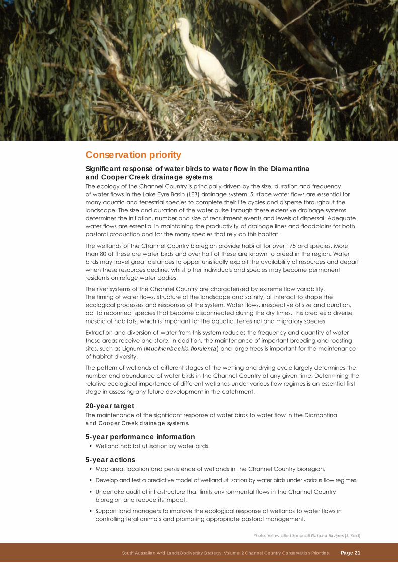
conservation priority Significant response of water birds to water flow in the diamantina and cooper creek drainage systemsTheecologyoftheChannelCountryisprincipallydrivenbythesize,durationandfrequency ofwaterflowsintheLakeEyreBasin(LEB)drainagesystem.Surfacewaterflowsareessentialformanyaquaticandterrestrialspeciestocompletetheirlifecyclesanddispersethroughoutthelandscape.Thesizeanddurationofthewaterpulsethroughtheseextensivedrainagesystemsdeterminestheinitiation,numberandsizeofrecruitmenteventsandlevelsofdispersal.Adequatewaterflowsareessentialinmaintainingtheproductivityofdrainagelinesandfloodplainsforbothpastoralproductionandforthemanyspeciesthatrelyonthishabitat.
ThewetlandsoftheChannelCountrybioregionprovidehabitatforover175birdspecies.Morethan80ofthesearewaterbirdsandoverhalfoftheseareknowntobreedintheregion.Waterbirdsmaytravelgreatdistancestoopportunisticallyexploittheavailabilityofresourcesanddepartwhentheseresourcesdecline,whilstotherindividualsandspeciesmaybecomepermanentresidentsonrefugewaterbodies.
TheriversystemsoftheChannelCountryarecharacterisedbyextremeflowvariability. Thetimingofwaterflows,structureofthelandscapeandsalinity,allinteracttoshapetheecologicalprocessesandresponsesofthesystem.Waterflows,irrespectiveofsizeandduration,acttoreconnectspeciesthatbecomedisconnectedduringthedrytimes.Thiscreatesadiversemosaicofhabitats,whichisimportantfortheaquatic,terrestrialandmigratoryspecies.
Extractionanddiversionofwaterfromthissystemreducesthefrequencyandquantityofwatertheseareasreceiveandstore.Inaddition,themaintenanceofimportantbreedingandroostingsites,suchasLignum(Muehlenbeckia florulenta)andlargetreesisimportantforthemaintenanceofhabitatdiversity.
ThepatternofwetlandsatdifferentstagesofthewettinganddryingcyclelargelydeterminesthenumberandabundanceofwaterbirdsintheChannelCountryatanygiventime.Determiningtherelativeecologicalimportanceofdifferentwetlandsundervariousflowregimesisanessentialfirststageinassessinganyfuturedevelopmentinthecatchment.
20-year targetThemaintenanceofthesignificantresponseofwaterbirdstowaterflowintheDiamantina and Cooper Creek drainage systems.
5-year performance informationWetlandhabitatutilisationbywaterbirds.•
5-year actions Maparea,locationandpersistenceofwetlandsintheChannelCountrybioregion.•
Developandtestapredictivemodelofwetlandutilisationbywaterbirdsundervariousflowregimes.•
UndertakeauditofinfrastructurethatlimitsenvironmentalflowsintheChannelCountry•bioregionandreduceitsimpact.
Supportlandmanagerstoimprovetheecologicalresponseofwetlandstowaterflowsin•controllingferalanimalsandpromotingappropriatepastoralmanagement.
South Australian Arid Lands Biodiversity Strategy: Volume 2 Channel Country Conservation Priorities Page 21
conservation priority important permanent and semi-permanent waterholes of the diamantina and cooper creek drainage systemsTherearefourmajorclustersofsemi-permanentwaterbodiesintheregion;theCullyamurraareaonCooperCreek,CoongieLakes,GoyderLagoonandseveralwaterbodiesassociatedwiththeKallakoopahCreek.Waterholesthatretainwaterforshorterperiodsmayalsofunctionasseasonalrefuges.Refugewaterbodiesarethosethatpersistforatleast19–24monthswithoutreceivingfloodwater.Generally,withtheextremeevaporationrates,thesewaterbodiesneedtobeoverthreemetresdeep.Theirrefugefunctionislargelydeterminedbysalinity,physicalstructureandtimesincethelastregionalflow.
WaterholesintheChannelCountryaregenerallyveryturbid,andmuchoftheirorganicproductivityoccursinabandofalgaethatformsontheirshallowmargins.Disturbanceofthisalgalringbyuncontrolledstockorrapidchangesinwaterlevelcanlowerproductivityformanydaysbefore itrecovers.Furtherworkisrequiredtoquantifydisturbanceimpactsontheecologicalfunction ofwaterholes.
Waterholes,withtheircomplexriparianareas,alsoprovideessentialhabitatforwaterdependentterrestrialspeciessuchasWaterRats(Hydromys chrysogaster)andCarpetPythons(Morelia spilota)thatrelyonthefoodsourcesprovidedbyriparianhabitatsandpermanentwater.
Inthedriertimes,thepermanentandsemi-permanentwaterholesbecomeincreasinglyimportant,notonlyasapastoralresourcebutalsoasrefugeareas.Introducedplantsandanimals,andmorerecentlytourismhaveresultedinarangeofthreateningprocesses,includingwaterpollution,predation,excessivetotalgrazingpressure,competitionforresourcesandmechanicaldisturbance.Theseprocessesaffectthenativespeciesthatrelyonthesehabitats.Theyenablemanyspeciestosurvivethroughextremedroughtandprovidesourcesforrecolonisationofpotentialhabitatswhenconditionsimprove.Allmajordrainagelinescontainsignificantwaterholes,butwhileourknowledgeofin-streamprocessesisimproving,littleisknownabouttheirindividualbiodiversityvalues.Furtherworkisrequiredtoidentifythesevalues,andtodevelopmanagementstrategies,inconjunction withlandmanagers,tomaintainorimprovethesevalues.
20-year target Themaintenanceandimprovementofbiodiversityvaluesofpermanentandsemi-permanentstreams and waterholes.
5-year performance information Numberofpermanentandsemi-permanentwaterholesmanagedforbiodiversityvalues.•
5-year actions Establishcriteriaforscoringconditionofpermanentandsemi-permanentwaterholes.•
Undertakebiologicalsurveysandidentifybiodiversityvalues,andprioritisepermanent •and semi-permanent waterholes along drainage lines.
Identifytheextentandintensityofthreateningprocessesreducingbiodiversityvalues •ofpermanentandsemi-permanentwaterholes.
Identifyandimplementsupportmechanismstoassistlandmanagerstomaintainandimprove•biodiversityvaluesofprioritypermanentandsemi-permanentwaterholes.
Undertaketargetedrestorationofpermanentandsemi-permanentwaterholesbased •oncondition,biodiversityvalueandlinkagerequirements.
Page 22 South Australian Arid Lands Biodiversity Strategy: Volume 2 Channel Country Conservation Priorities
conservation priority threatened ecological communities on drainage lines, floodplains and swampsFourthreatenedecologicalcommunitiesoccuronthefloodplainsoftheChannelCountrybioregion:
Coolibah(• Eucalyptus coolabah ssp. arida)andRiverRedGum(E. camaldulensis)woodlandonregularlyinundatedfloodplains.
old-manSaltbush(• Atriplex nummularia ssp. nummularia)onfloodplains.
QueenslandBluebush(• Chenopodium auricomum)shrublandoncrackingclaydepressionssubjecttoperiodicwaterlogging.
BroughtonWillow(• Acacia salicina)andCoolibah(Eucalyptus coolabah ssp. arida)±Bauhinia(Lysiphyllum gilvum)woodlandalongdrainagelinesandonfloodplains.
BroughtonWillowandCoolibahwoodlandisrestrictedprimarilytotheChannelCountrybioregionwithinSouthAustralia,whileallothercommunitiesarepresentinriverineenvironmentsacrossfarnorthSouthAustralia.Thesecommunitiesoftenco-occur,orintergrade,alonganinundationfrequencyandsoilmoisturegradient.CoolibahandRiverRedGumwoodlandoftenoccursinlineamentsalongwatercoursesorinareasthatretainwaterforalongtime.BroughtonWillowandCoolibahwoodlandtendstofringeminorriverchannelsandextendoutontoadjacentfloodplains.Bothold-manSaltbushandQueenslandBluebushshrublandsoccurasunderstoreyormayformdensestandsonfloodplainsandswamps.
Floodplainsarecriticaltotheviabilityofallpastoralenterprises.Totalgrazingpressure,particularlyhistorically,hasbeenheavierinthesemoreproductiveareasandhasresultedingreateralterationofthenaturalenvironmentthaninthesurroundinghigherground.Alterationstonaturalwaterflowshave,insomeareas,contributedtoareductioninhabitatquality,areductioninrecruitmentofnativespeciesandanalteredplantcommunity.Theprimarythreattotheseecologicalcommunitiesishabitatmodificationassociatedwithtotalgrazingpressure.Theimplementationofconservativestockingstrategiesandferalanimalcontrolprogramswillsignificantlyimprovetheresilienceofthesesystems,enablingvegetationandfaunatorespondbettertoevenminorlocalisedflows.
20-year targetThemaintenanceorimprovementoftheviabilityofthreatenedecologicalcommunitiesondrainagelines,floodplainsandswampsintheChannelCountry.
5-year performance informationPercentageofpotentialareaoccupiedbythreatenedecologicalcommunitiesondrainage•lines,floodplainsandswampswithinIBRAsubregions.
Conditionofindividualoccurrencesofthreatenedecologicalcommunitiesondrainagelines,•floodplainsandswampswithinIBRAsubregions.
5-year actionsDeterminethecurrentextentandconditionofthreatenedecologicalcommunitieson•drainagelines,floodplainsandswampswithintheChannelCountry,byIBRAsubregion.
Identifythepotentialareaofoccupancyofthreatenedecologicalcommunitiesondrainage•lines,floodplainsandswampswithintheChannelCountry,byIBRAsubregion.
Identifyandwherepossible,quantifythedisruptionandsourcesofdisruptionofkeyecological•processessupportingindividualoccurrencesofthreatenedecologicalcommunitiesondrainagelines,floodplainsandswamps.
Rankindividualoccurrencesofthreatenedecologicalcommunitiesondrainagelines,•floodplainsandswampswithinIBRAsubregionsforviability,basedonsize,conditionandlandscapecontext.
Developandimplementsupportmechanismstoassistlandmanagerstoimprovethreatened•ecologicalcommunitiesondrainagelines,floodplainsandswamps.
South Australian Arid Lands Biodiversity Strategy: Volume 2 Channel Country Conservation Priorities Page 23
conservation priority grey grasswren on floodplains and swampsTheGreyGrasswren(Amytornis barbatus)isendemictotheLakeEyreBasin.Twosubspeciesarerecognised,ofwhichonlyAmytornis barbatus ssp. diamantinaoccursinSouthAustralia.ThemajorityofsightingshavebeeninCoolibahwoodlandswithLignumunderstorey.IthasbeenfoundinarangeofothervegetationcommunitiesadjacenttodensepatchesofLignum.TherelianceoftheGreyGrasswrenonLignummeansthatalterationstothefireregimerepresentasignificantrisk.Thepoordispersalabilityofthisspeciesalsomeansthattheclearanceoflowanddensevegetationtypesfortracksmayalsosignificantlyaffectitsabilitytomovethroughthelandscape,increasingtheriskofpredation.Thisspeciesrequiresfurtherinvestigationtodetermineitsstatusintheregionandtherelationshipbetweenhabitatanddisturbance.
20-year targetThemaintenanceorimprovementoftheviabilityoftheGreyGrasswrenonfloodplainsandswamps.
5-year performance informationPercentageofpotentialhabitatoccupiedbytheGreyGrasswrenonfloodplainsandswamps•in the Channel Country bioregion.
NumberandviabilityofpopulationsoftheGreyGrasswrenonfloodplainsandswampsinthe•Channel Country bioregion.
5-year actionsDetermineareaofoccupancyandrelationshipbetweenhabitatanddistributionand•abundanceoftheGreyGrasswrenonfloodplainsandswampsintheChannelCountrybioregion.
Identifyandwherepossible,quantifythedisruptionandsourcesofdisruptionofkeyecological•processessupportingindividualpopulationsoftheGreyGrasswrenonfloodplainsandswampsin the Channel Country bioregion.
IdentifypotentialhabitatsonfloodplainsandswampswithintheChannelCountrybioregion •fortheGreyGrasswren.
RankpopulationsofGreyGrasswrenonfloodplainsandswampswithinIBRAsubregionsfor•viability,basedonsize,threatsandlandscapecontext.
SupportlandmanagerstoimprovetheviabilityoftheGreyGrasswrenonfloodplainsand•swampsbycontrollingferalanimalsandoverabundantnativeherbivoresandpromotingappropriategrazingpractices.
Photo: Cooper Creek
Page 24 South Australian Arid Lands Biodiversity Strategy: Volume 2 Channel Country Conservation Priorities
conservation priorities for drainage lines and floodplains
Moomba
Marree
Cowarie
Dulkaninna
Innamincka
Conservation Priorities for Drainage Lines and Floodplains
Channel Country Bioregion
South Australian Arid Lands NRM Region
Pastoral Station
Salt Lake
Dog Fence
Major Road
State Border
Locality
0 60
Km
Queensland
Ne
w S
out
h W
ale
s
Conservation prioritiesImportant permanent and semi-permanent waterholes of the Diamantina and Cooper Creek drainage systems
Grey Grasswren on floodplains and swamps
Threatened ecological communities on drainagelines, floodplains and swampsandSignificant response of water birds to water flowin the Diamantina and Cooper Creek drainagesystems
Mapped conservation priorities provide an indication of the potential distribution
South Australian Arid Lands Biodiversity Strategy: Volume 2 Channel Country Conservation Priorities Page 25
Photo: Stony plains
Stony plainsThestonyplains,withundulatinggibberdowns,tablelandsandmesas,separatethetwomajordrainageareasoftheChannelCountrybioregion.Theyalsoincludesmallerareasofdunes andsaltlakes,andaredissectedbyanetworkofminordrainageareaslinedwithCoolibah(Eucalyptus coolabah),RiverRedGum(E. camaldulensis)andRiverCooba(Acacia stenophylla).Thelandscapeisdominatedbygibber-coveredlowhillsandexpansiveundulatingchenopodplains and tablelands.
Inthefarnorth,theLamamourPlateauonCordilloDownssupportsMitchellGrass(Astrebla pectinata),Neverfail(Eragrostis setifolia)andCommonBottlewashers(Enneapogon avenaceus).Thestonycountryextendssouth-westtoSturtStonyDesertwithitsrollinggibberdownsandoccasionalscattereddunes.TothenorthofInnamincka,extendingintosouthernQueensland,isthesmallergibberareaoftheMerninieTableland,lowhillswithMitchellGrass,andNeverfail,andmesaswithEmu-bushes(Eremophilaspp.),Gidgee(Acacia cambagei)andMulga(Acacia aneura)overBladderSaltbush(Atriplex vesicaria).
Significance of stony plainsThesestonyplains,whilstbeinggeographicallyseparatedfromtheStonyPlainsbioregion,providemanysimilarhabitats.SomespeciessuchastheThick-billedGrasswren(Amytornis textilis modestus)arenowfoundonlyintheStonyPlainsproperandareextinctintheChannelCountry.ThevulnerableKowari(Dasycercus byrnei)hasitsSouthAustralianstrongholdinthegibberplainsontheeasternflanksofGoyderLagoon,andoneoftheinlandburrowingfrogslistedrareinSouthAustralia,theKnife-footedFrog(Cyclorana cultripes),livesinthegibberandgilgaiareasandreliesontheperiodicwettinganddryingofthecrackingclaysforsurvival.
Thestonygibberplainsarecharacterisedbyahighproportionofephemeralspecies.Thesespecieshaveshortlifecycles,enablingthemtoexploittheirregularandinfrequentrains.Mostoftheperennialvegetationisinthehighlyproductivegilgaisandminordrainagedepressions,andevenmodestrainfalleventstriggerextensiveephemeralgrowth.Itisthislocalisedandshort-livedephemeralvegetationthatprovidestheuniquehabitatsthatareabletobeexploitedonlybycertainanimalswithspecificadaptations.Thismeansthatmorespeciesarerestrictedorendemictothislandscapetypethananyotherinthebioregion.
Page 26 South Australian Arid Lands Biodiversity Strategy: Volume 2 Channel Country Conservation Priorities
Photo: Low Bluebush Maireana astrotricha
major vegetation communitiesWoodlandMulga(Acacia aneura)lowopenwoodlandoverSandhillWattle(Acacia ligulata),Narrow-leavedHopBush(Dodonaea viscosa ssp. angustissima),SpinySaltbush(Rhagodia spinescens),RubySaltbush(Enchylaena tomentosa),BlackBluebush(Maireana pyramidata)andLobedSpinifex(Triodia basedowii)andgrassesonplains.
ShrublandSandhillWattle(Acacia ligulata),ElegantWattle(Acacia victoriae),Gidgee(Acacia cambagei)+/-Mulga(Acacia aneura)tallopenshrublandoverCottonbush(Maireana aphylla),BladderSaltbush(Atriplex vesicaria)andBindyi(Sclerolaenaspp.)andgrassesonsandspreadson stony plains.
Cottonbush(Maireana aphylla)+/-old-manSaltbush(Atriplex nummularia ssp. nummularia)+/-BladderSaltbush(Atriplex vesicaria)lowopenshrublandoverNeverfail(Eragrostis setifolia);andMitchellGrass(Astrebla pectinata)andBindyi(Sclerolaena spp.)onrun-onareasandslightdepressions.
BladderSaltbush(Atriplex vesicaria),oodnadattaSaltbush(Atriplex nummularia ssp. omissa),LowBluebush(Maireana astrotricha)andBlackBluebush(Maireana pyramidata)lowopenshrublandoverBindyi(Sclerolaena spp.)andNeverfail(Eragrostis setifolia)onslightlysalineplainsandgilgais.
grasslandMitchellGrass(Astrebla pectinata)andKatoora(Sporobolus actinocladus)lowopengrasslandwithBindyi(Sclerolaenaspp.)andBonefruit(Osteocarpum acropterum)onplainsandgilgais.
South Australian Arid Lands Biodiversity Strategy: Volume 2 Channel Country Conservation Priorities Page 27
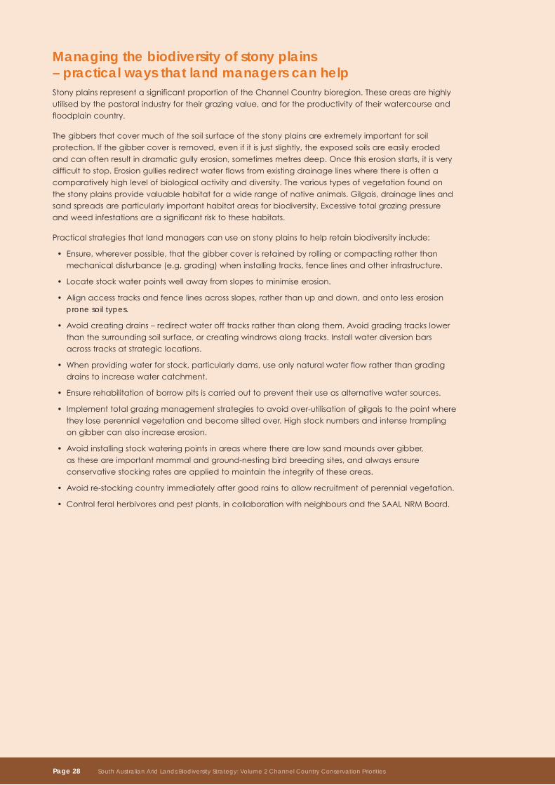
managing the biodiversity of stony plains – practical ways that land managers can helpStonyplainsrepresentasignificantproportionoftheChannelCountrybioregion.Theseareasarehighlyutilisedbythepastoralindustryfortheirgrazingvalue,andfortheproductivityoftheirwatercourseandfloodplaincountry.
Thegibbersthatcovermuchofthesoilsurfaceofthestonyplainsareextremelyimportantforsoilprotection.Ifthegibbercoverisremoved,evenifitisjustslightly,theexposedsoilsareeasilyerodedandcanoftenresultindramaticgullyerosion,sometimesmetresdeep.oncethiserosionstarts,itisverydifficulttostop.Erosiongulliesredirectwaterflowsfromexistingdrainagelineswherethereisoftenacomparativelyhighlevelofbiologicalactivityanddiversity.Thevarioustypesofvegetationfoundonthestonyplainsprovidevaluablehabitatforawiderangeofnativeanimals.Gilgais,drainagelinesandsandspreadsareparticularlyimportanthabitatareasforbiodiversity.Excessivetotalgrazingpressureandweedinfestationsareasignificantrisktothesehabitats.
Practicalstrategiesthatlandmanagerscanuseonstonyplainstohelpretainbiodiversityinclude:
Ensure,whereverpossible,thatthegibbercoverisretainedbyrollingorcompactingratherthan•mechanicaldisturbance(e.g.grading)wheninstallingtracks,fencelinesandotherinfrastructure.
Locatestockwaterpointswellawayfromslopestominimiseerosion.•
Alignaccesstracksandfencelinesacrossslopes,ratherthanupanddown,andontolesserosion•prone soil types.
Avoidcreatingdrains–redirectwaterofftracksratherthanalongthem.Avoidgradingtrackslower•thanthesurroundingsoilsurface,orcreatingwindrowsalongtracks.Installwaterdiversionbarsacrosstracksatstrategiclocations.
Whenprovidingwaterforstock,particularlydams,useonlynaturalwaterflowratherthangrading•drainstoincreasewatercatchment.
Ensurerehabilitationofborrowpitsiscarriedouttopreventtheiruseasalternativewatersources.•
Implementtotalgrazingmanagementstrategiestoavoidover-utilisationofgilgaistothepointwhere•theyloseperennialvegetationandbecomesiltedover.Highstocknumbersandintensetramplingongibbercanalsoincreaseerosion.
Avoidinstallingstockwateringpointsinareaswheretherearelowsandmoundsovergibber,•astheseareimportantmammalandground-nestingbirdbreedingsites,andalwaysensureconservativestockingratesareappliedtomaintaintheintegrityoftheseareas.
Avoidre-stockingcountryimmediatelyaftergoodrainstoallowrecruitmentofperennialvegetation.•
Controlferalherbivoresandpestplants,incollaborationwithneighboursandtheSAALNRMBoard.•
Page 28 South Australian Arid Lands Biodiversity Strategy: Volume 2 Channel Country Conservation Priorities
conservation priority Significant and endemic flora and fauna species on stony plainsFourthreatenedandendemicspecieshavebeenrecordedintheSouthAustralianportionoftheChannelCountryonstonyplains.Theseinclude:
AshyDownsSkink(• Ctenotus astarte)
FawnHopping-mouse(• Notomys cervinus)
Kowari(• Dasycercus byrnei)
Pickard’sWattle(• Acacia pickardii)
TheKowari,asmallcarnivorousmarsupial,hasexperiencedareductioninitsrangeofover90%ofitspotentialpre-EuropeandistributionandisnowrestrictedtostonyplainshabitatsintheChannelCountryandsouthernmarginsoftheMitchellGrassDownsbioregions.TheFawnHopping-mouseisthoughttohaveexperiencedasimilarrangereductionandappearstobeconfinedtothesamestonyplainshabitatastheKowari.TheAshyDownsSkinkisagrounddwellerthatlivesincrevices orshallowburrowsonthemarginsofthemajorfloodplains.
BoththeKowariandFawnHopping-mouseoccuronstonyplainswheresandmoundscoverlessthan20%ofthegibberpavement.Sandmoundssupportavariablemixtureofperennialandannualplantsandalloweasyburrowing.Threatsareunclearforeitherspecies,althoughtramplingandovergrazingofsandmoundsisthoughttobesignificantfortheKowari.InSouthAustraliatheKowarioccupiesnearly60%ofidentifiedpotentialfavouredhabitat,withonlyonepopulationbeingrecordedasbecomingextinctinthepast30years.
Pickard’sWattleoccursonresidualstonyplainsintheChannelCountrybioregionandthenorth-westernsideoftheSimpsonDesertintheSimpson–StrzeleckiDunefieldsbioregionintheNorthernTerritory.InSouthAustraliatherearetwopopulationsonGoyderLagoon(approximately250plants)andCowarieStation(approximately100plants)nearMountGasonBore.ThereareothersmallpopulationsonKoonanie,PandiePandieandKanowna.
20-year targetThemaintenanceorimprovementoftheviabilityofsignificantandendemicfloraandfaunaspeciesonstonyplains.
5-year performance informationPercentageofpotentialhabitatoccupiedbysignificantandendemicfloraandfaunaspecies•on stony plains within the Channel Country.
Numberandviabilityofpopulationsofsignificantandendemicfloraandfaunaspecieson•stony plains within the Channel Country.
5-year actionsDetermineareaofoccupancyandrelationshipbetweenhabitatanddistributionand•abundanceofsignificantandendemicfloraandfaunaspeciesonstonyplains.
Identifyandwherepossible,quantifythedisruptionandsourcesofdisruptionofkeyecological•processessupportingindividualpopulationsofsignificantandendemicfloraandfaunaspecieson stony plains.
IdentifypotentialhabitatsintheChannelCountryforsignificantandendemicfloraandfauna•speciesonstonyplains.
Rankpopulationsofsignificantandendemicfloraandfaunaspeciesonstonyplainswithin•IBRAsubregionsforviability,basedonsize,threatsandlandscapecontext.
Supportlandmanagerstoimprovetheviabilityofsignificantandendemicfloraandfaunaspecies•onstonyplainsbycontrollingferalanimalsandpromotingappropriatepastoralmanagement.
South Australian Arid Lands Biodiversity Strategy: Volume 2 Channel Country Conservation Priorities Page 29
conservation priority for stony plains
Moomba
Marree
Dulkaninna
Innamincka
Conservation Priorities for Stony Plains
Channel Country bioregion
South Australian Arid Lands NRM Region
Pastoral Station
Salt Lake
Dog Fence
Major Road
State Border
Locality
0 60
Km
Queensland
Ne
w S
out
h W
ale
s
Conservation prioritySignificant and endemic flora and fauna species on stony plains
Mapped conservation priorities provide an indication of the potential distribution
Cowarie
Page 30 South Australian Arid Lands Biodiversity Strategy: Volume 2 Channel Country Conservation Priorities
DunefieldsandsandplainsTheChannelCountrydunefieldsandsandplainstakeavarietyofforms.AssociatedwiththefloodplainsoftheCooperdrainagesystemisanextensivefieldofparallelsandridgeswithperiodicallyfloodedinterdunes.Dunesvaryfromredtowhitishsiliceoussands,andvegetationvaries.ThelargerdunesaresimilartothoseoftheStrzeleckiDesert,supportingatallshrublandofSandhillWattle(Acacia ligulata)overKeroseneGrass(Aristida holathera).Thered,semi-mobile,lineardunesrunnorth-north-westtosouth-south-east,withsomeindividualdunesbeingupto 250kmlong.Anotherform,associatedwiththeintermittentstreamsofMonteclearyandNilpieCreeksnorthofInnamincka,includeirregular,crescent-shaped,low,jumbledduneswithnumeroussmallclaypansandlakesintheswalesandsandplains.TheseduneshaveacoverofSandhillWattleandRattlepod(Crotalariaspp.)overdenseLobedSpinifex(Triodia basedowii)andgrasses.TherearealsothesmallerdunefieldsinthenorthernpartofSturtsStonyDesertonPandiePandie,westernCordilloDowns,andnorthernInnamincka,andthetallwidely-spacedsemi-mobilereddunesontheeasternextremityoftheSimpsonDesert.
Significance of dunefields and sand plainsdunefieldsandsandplainsintheChannelCountrybioregionhaveasimilarspeciescompositionfromthoseintheSimpson–StrzeleckiDunefieldsbioregion.Theysupportasmallnumberofmammalspecies,andmanygeneralistbirdsusethishabitat,althoughnoneareentirelydependentonit.Duetotheproximitytomajordrainageareas,thislandscapeprovidesimportantforaginghabitatforbirdsofprey,butfewnestingplaces.Swales,wherepondingoccursaftersignificantrainfall,canalsobehighlyproductiveareas.
major vegetation communitiesWoodlandMulga(Acacia aneura)lowopenwoodlandoverSandhillWattle(Acacia ligulata),Narrow-leavedHopBush(Dodonaea viscosa ssp. angustissima),SpinySaltbush(Rhagodia spinescens),RubySaltbush(Enchylaena tomentosa),BlackBluebush(Maireana pyramidata)andLobedSpinifex(Triodia basedowii)andgrassesonsandplains.
ShrublandSandhillWattle(Acacia ligulata)tallopenshrublandoverSandhillCane-grass(Zygochloa paradoxa),LobedSpinifex(Triodia basedowii),Rattlepod(Crotalaria spp.)andKeroseneGrass(Aristida holathera)andephemeralherbsondunes.
SandhillWattle(Acacia ligulata),ElegantWattle(Acacia victoriae)andGidgee(Acacia cambagei)+/-Mulga(Acacia aneura)tallopenshrublandoverCottonbush(Maireana aphylla)andBladderSaltbush(Atriplex vesicaria)andBindyi(Sclerolaenaspp.)andgrassesonsandplains.
LowBluebush(Maireana astrotricha)+/-BlackBluebush(Maireana pyramidata)+/-BladderSaltbush(Atriplex vesicaria)lowopenshrublandoverBindyi(Sclerolaena spp.)andBottlewashers(Enneapogon avenaceus)inswalesandonsandplains.
BladderSaltbush(Atriplex vesicaria)andLowBluebush(Maireana astrotricha)+/-BlackBluebush(Maireana pyramidata)+/-SpinySaltbush(Rhagodia spinescens)lowopenshrublandoverBindyi(Sclerolaenaspp.)andBottlewashers(Enneapogon avenaceus)inswalesandonsandplains.
grasslandSandhillCane-grass(Zygochloa paradoxa)+/-SpinySaltbush(Rhagodia spinescens)+/-LobedSpinifex(Triodia basedowii)openhummockgrasslandoverPoachedEggDaisy(Polycalymma stuartii)andsparsegrasseswithemergentSandhillWattle(Acacia ligulata)ondunes.
South Australian Arid Lands Biodiversity Strategy: Volume 2 Channel Country Conservation Priorities Page 31
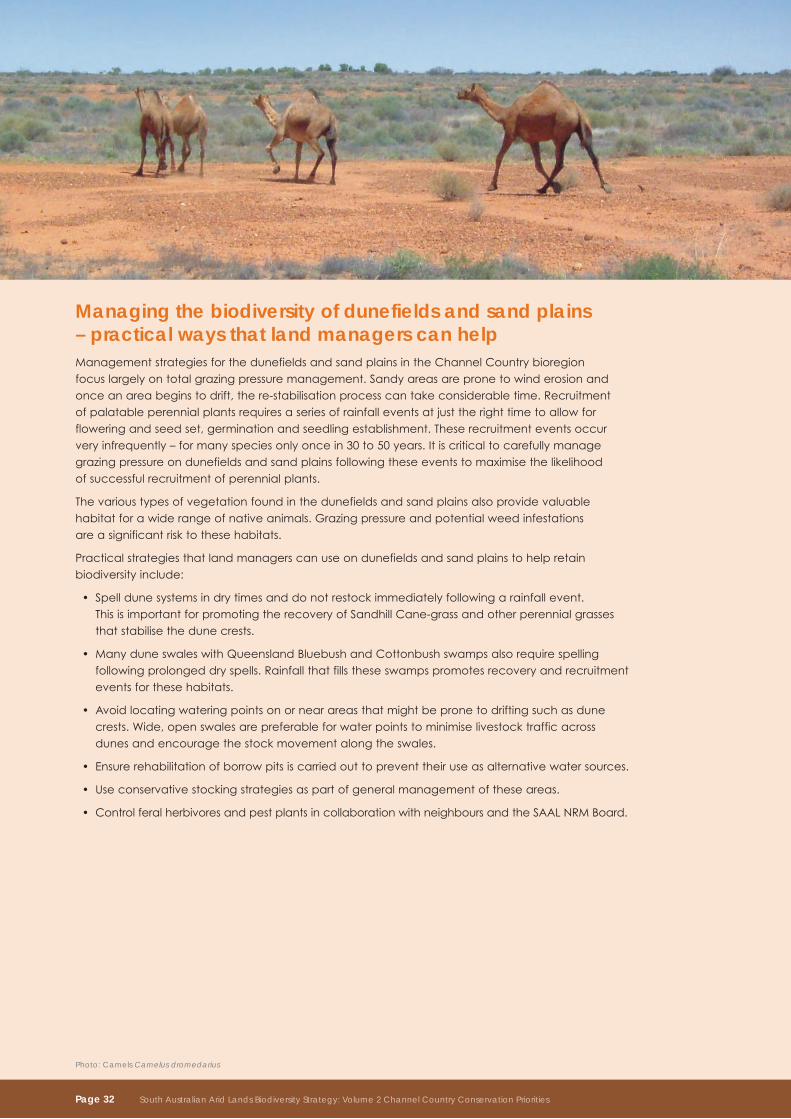
managing the biodiversity of dunefields and sand plains – practical ways that land managers can helpManagementstrategiesforthedunefieldsandsandplainsintheChannelCountrybioregionfocuslargelyontotalgrazingpressuremanagement.Sandyareasarepronetowinderosionandonceanareabeginstodrift,there-stabilisationprocesscantakeconsiderabletime.Recruitmentofpalatableperennialplantsrequiresaseriesofrainfalleventsatjusttherighttimetoallowforfloweringandseedset,germinationandseedlingestablishment.Theserecruitmenteventsoccurveryinfrequently–formanyspeciesonlyoncein30to50years.Itiscriticaltocarefullymanagegrazingpressureondunefieldsandsandplainsfollowingtheseeventstomaximisethelikelihood ofsuccessfulrecruitmentofperennialplants.
Thevarioustypesofvegetationfoundinthedunefieldsandsandplainsalsoprovidevaluablehabitatforawiderangeofnativeanimals.Grazingpressureandpotentialweedinfestations areasignificantrisktothesehabitats.
Practicalstrategiesthatlandmanagerscanuseondunefieldsandsandplainstohelpretainbiodiversityinclude:
Spelldunesystemsindrytimesanddonotrestockimmediatelyfollowingarainfallevent. •ThisisimportantforpromotingtherecoveryofSandhillCane-grassandotherperennialgrassesthatstabilisethedunecrests.
ManyduneswaleswithQueenslandBluebushandCottonbushswampsalsorequirespelling•followingprolongeddryspells.Rainfallthatfillstheseswampspromotesrecoveryandrecruitmenteventsforthesehabitats.
Avoidlocatingwateringpointsonornearareasthatmightbepronetodriftingsuchasdune•crests.Wide,openswalesarepreferableforwaterpointstominimiselivestocktrafficacrossdunesandencouragethestockmovementalongtheswales.
Ensurerehabilitationofborrowpitsiscarriedouttopreventtheiruseasalternativewatersources.•
Useconservativestockingstrategiesaspartofgeneralmanagementoftheseareas.•
ControlferalherbivoresandpestplantsincollaborationwithneighboursandtheSAALNRMBoard.•
Photo: Camels Camelus dromedarius
Page 32 South Australian Arid Lands Biodiversity Strategy: Volume 2 Channel Country Conservation Priorities
conservation priority mulga low woodland on low dunes and sand plainsMulga(Acacia aneura)lowwoodlandoccursinfrequentlyonsandplainsintheSturtStonyDesertsubregion.MulgalowwoodlandalsooccursatthenorthernandsouthernextremesoftheSimpson–StrzeleckiDesertbioregionandonthefewsandplainsintheFlindersLoftyBlock,BrokenHillComplex,StonyPlainsandFinkebioregions.IntheFinkebioregion,thiscommunityisnotconsideredtobethreatened.
Mulgalowwoodlandisprimarilythreatenedbyinhibitedregenerationfromexcessivetotalgrazingpressure.Rabbitsarethemostsignificantcomponentoftotalgrazingpressureastheyfavourthissandyhabitat.Rabbitburrowingexacerbateserosion,asdoesstocktrafficnearwateringpoints.ThereductioninrabbitnumbersfromRabbitHaemorrhagicDisease(RHD)hasresultedinanapparentimprovementintheconditionofthisecologicalcommunity.However,theextentandsignificanceofthisimprovementisunknown.TheimportanceoffireforMulgalowwoodlandisalsounknown,butfiremaybeaproblemingoodseasons,particularlyifvegetationconditionimproves.
20-year targetThemaintenanceorimprovementoftheviabilityofMulgalowwoodlandsonlowdunesandsandplains in the Channel Country.
5-year performance informationPercentageofpotentialareaoccupiedbyMulgalowwoodlandonlowdunesandsand•plains within IBRA subregions.
ConditionofindividualoccurrencesofMulgalowwoodlandonlowdunesandsandplains•within IBRA subregions.
5-year actionsDeterminetheextentandconditionofMulgalowwoodlandsonlowdunesandsandplains •in the Channel Country.
IdentifythepotentialareaofoccupancyofMulgalowwoodlandsonlowdunesandsand•plains in the Channel Country.
Identifyand,wherepossible,quantifythedisruption,andsourcesofdisruption,ofkey•ecologicalprocessessupportingindividualoccurrencesofMulgalowwoodlandonlowdunesand sand plains.
RankindividualoccurrencesofMulgalowwoodlandonlowdunesandsandplainswithinIBRA•subregionsforviability,basedonsize,conditionandlandscapecontext.
Support land managers to improve Mulga low woodland on low dunes and sand plains.•
Photo: Narrow-banded Sandswimmer Eremiascincus fasciolatus
South Australian Arid Lands Biodiversity Strategy: Volume 2 Channel Country Conservation Priorities Page 33
conservation priority for dunefields and sand plains
Moomba
Marree
Cowarie
Dulkaninna
Innamincka
Conservation Priorities for Dunefields and Sand Plains
Channel Country Bioregion
South Australian Arid Lands NRM Region
Pastoral Station
Salt Lake
Dog Fence
Major Road
State Border
Locality
0 60
Km
Queensland
Ne
w S
out
h W
ale
s
Conservation priorityMulga low woodland on low dunes and sand plains
Mapped conservation priorities provide an indication of the potential distribution
Page 34 South Australian Arid Lands Biodiversity Strategy: Volume 2 Channel Country Conservation Priorities
Monitoring and evaluationTheChannelCountryConservationPrioritiesaimistofacilitateconservationactionsacrossthebioregion.TheSAALNRMBoardandsupportpartnerswillcoordinateandsupportthedeliveryoftheseactions,guidedbystatutorymechanisms.TheSAALNRMBoardwillmonitorandreportontheimplementationoftheChannelCountryConservationPriorities.
BoththeSAALNRMBoardandtheDepartmentforEnvironmentandHeritagearejointlyresponsibleforevaluatingtheeffectivenessofthisplanwhichcontributestotheSAALNRMPlanand No Species Loss – A Nature Conservation Strategy for South Australia.
DEHwillproduceapublicreportonoverallprogresstowardstheconservationprioritiesaspartofthefiveyearreviewandevaluationoftheSouthAustralianAridLandsBiodiversityStrategyin2014.
monitoring and reporting information
landform Priority targets Performance information
drainage lines and floodplains
SignificantresponseofwaterbirdstowaterflowalongtheDiamantinaand Cooper Creek drainage systems
ThemaintenanceofthesignificantresponseofwaterbirdstowaterflowintheDiamantinaand Cooper Creek drainage systems
Wetlandhabitatutilisation •by water birds.
Important permanent and semi-permanent waterholesoftheDiamantinaandCooper Creek drainage systems
Themaintenanceandimprovementofbiodiversityvaluesofpermanent and semi-permanent streams and waterholes
Numberofpermanentand•semi-permanent waterholes managedforbiodiversityvalues.
threatened ecologicalcommunitieson drainage lines,floodplainsand swamps
Themaintenanceor improvement oftheviabilityofthreatenedecologicalcommunitiesondrainagelines,floodplainsandswamps within the Channel Country
Percentageofpotentialarea•occupiedbythreatenedecologicalcommunitiesondrainagelines,floodplainsandswamps within IBRA subregions.Conditionofindividual•occurrencesofthreatenedecologicalcommunitiesondrainagelines,floodplainsandswamps within IBRA subregions.
Grey Grasswren onfloodplainsand swamps
ThemaintenanceorimprovementoftheviabilityoftheGrey Grasswren onfloodplainsand swamps
Percentageofpotentialhabitat•occupiedbytheGreyGrasswrenonfloodplainsandswampsintheChannel Country bioregion.Numberandviabilityofpopulations•oftheGreyGrasswrenonfloodplainsandswampsintheChannel Country bioregion.
Stony plains Significantandendemicfloraandfaunaspecieson stony plains
Themaintenanceorimprovementoftheviabilityofsignificantandendemicfloraandfaunaspecieson stony plains
Percentageofpotentialhabitat•occupiedbysignificantandendemicfloraandfaunaspeciesonstonyplainswithinthe Channel Country.Numberandviabilityofpopulations•ofsignificantandendemicfloraandfaunaspeciesonstonyplainswithin the Channel Country.
dunefields and sand plains
Mulga low woodland on low dunes and sand plains
ThemaintenanceorimprovementoftheviabilityofMulgalow woodlands on low dunes and sand plains within the Channel Country
Percentageofpotentialarea•occupiedbyMulgalowwoodlandon low dunes and sand plains within IBRA subregions.Conditionofindividualoccurrences•ofMulgalowwoodlandonlow dunes and sand plains within IBRA subregions.
South Australian Arid Lands Biodiversity Strategy: Volume 2 Channel Country Conservation Priorities Page 35
Glossaryalluvial Plain: Anextensivestream-laiddepositthatmayincludegravel,sand,siltandclay;typicallyformingfloodplainsthatdevelopalluvialsoils.Thealluvialdepositofastreamgeneratedfromagorgeuponaplainorofatributarystreamatitsjunctionwiththemainstream.
arid:Referstoclimatesorregionsthatlacksufficientcropproductionorextensivesownpastures.Usuallydefinedasaclimatewithannualaveragerainfalllessthan250mm(10inches).
biodiversity:Thevarietyoflifeforms:thedifferentplants,animalsandmicro-organisms;thegenestheycontain;andtheecosystemstheyform.
bioregion:Extensive(continentalscale)regionsdistinguishedfromadjacentregionsbytheirbroadphysicalandbiologicalcharacteristics.
conservation:Theprotection,maintenance,management,sustainableuse,restorationandenhancementofthe natural environment.
decreaser Species:Aspeciesthatdecreasesinabundanceinareasofhighgrazingpressure,generallyinproximitytowater.
degradation:Degradationoflandisthedeclineinthequalityofthenaturalresourcesofthelandresultingfromhumanactivities.
dispersal:Themovementoforganismsbetweenlocations,especiallyrelatingtothemovementfrombirthsiteorbreeding sites.
ecological community:Acharacteristicsuiteofinteractingspeciesadaptedtoparticularconditionsofsoil,topography,wateravailabilityandclimate.
ecological Processes:Dynamicinteractionsthatoccuramongandbetweenbiotic(living)andabiotic(non-living)componentsoftheenvironment.
ecosystem:Adynamiccomplexofplant,animal,fungalandmicro-organismcommunitiesandtheassociatednon-livingenvironmentinteractingasanecologicalunit.
endemic:Exclusivelynativetoaspecifiedregionorsite.
Feral:Adomesticatedspeciesthathasescapedtheownership,managementandcontrolofpeopleandislivingandreproducinginthewild.
Fire regime:Theintensity,frequencyandextentoffire.
gene:Thefunctionalunitofheredity;thepartoftheDNAmoleculethatencodesasingleenzymeorstructuralprotein unit.
genetic diversity:Thevariabilityinthegeneticmakeupamongindividualsandpopulationswithinasinglespecies.
gilgai:AnaturalsoilformationoccurringextensivelyininlandAustralia,characterisedbyaanundulatingsurfacesometimeswithmoundsordepressionscausedbytheswellingandcrackingofclaysduringalternatingwet and dry seasons.
habitat diversity:Thenumberofdifferenttypesofhabitatswithinagivenarea.
habitat:Thephysicalplaceortypeofsitewhereanorganism,speciesorpopulationnaturallyoccurstogetherwiththecharacteristicsandconditions,whichrenderitsuitabletomeetthelifecycle,needsofthatorganism,speciesorpopulation.
ibra region:InterimBiogeographicRegionalisationforAustraliaregions.
ibra Subregion:Asubdivisionofabioregionbasedonbroadphysicalandbiologicalcharacteristics;asystemofrelatedandinterconnectedlandsystemswithinanIBRAregion.
increaser Species:Aspeciesthatincreasesinabundanceinareasofhighgrazingpressure,generallyinproximitytowater.
indicator:Ameasureagainstwhichsomeaspectsofperformancecanbeassessed.
invasive Species:Anyanimalpest,plantordiseasethatcanadverselyaffectnativespeciesandecosystems.
landform:Anyofthenumerousfeaturesthatmakeupthesurfaceoftheearth,suchasplain,plateauandcanyon.
landscape:Aheterogeneousareaoflandorseathatisofsufficientsizetoachievepositiveresultsintherecoveryofspeciesorecologicalcommunities,orintheprotectionandenhancementofecologicalandevolutionaryprocesses.
landsystem:Agroupoflocalecologicalcommunitiesderivedfromalandscapepatternofrelatedandinterconnectedlocalecosystemswithinasubregion.
native Species:AplantoranimalspeciesthatoccursnaturallyinSouthAustralia.
Protected area:Anareaoflandand/orseaspecificallydedicatedtotheprotectionandmaintenanceofbiologicaldiversity,andofnaturalandassociatedculturalresources,andmanagedthroughlegalorothereffectivemeans.
Page 36 South Australian Arid Lands Biodiversity Strategy: Volume 2 Channel Country Conservation Priorities
refuge:Aregion,orhabitat,whereorganismsareabletopersistduringaperiodinwhichmostoftheoriginalgeographicrangebecomesuninhabitable.
remnant:Areas(generallysmall)ofnativeplantcommunitiesthatarefoundinotherwiseclearedlandscapes.
restoration:Assistingtherecoveryofecologicalsystemstoastateinwhichtheviabilityofspeciesandecologicalcommunities,andecosystemfunction,areimproved.
riparian:on,orrelatingtothebanksofanaturalcourseofwater.
runoff:Theportionofprecipitationnotabsorbedintoordetaineduponthesoilandwhichbecomessurfaceflow.
Semi-arid:Referstoclimatesorregionswhichlacksufficientrainfallforregularcropproduction.Usuallydefinedasaclimatewithannualrainfallbetween250mmand375mm.
Species diversity:Variability(richnessandabundance)ofbiotainanarea.Anindexofcommunitydiversitythattakesintoaccountbothspeciesrichnessandtherelativeabundanceofspecies.
Species:Agroupoforganismscapableofinterbreedingwitheachotherbutnotwithmembersofotherspecies.
Subspecies:Distinctgeographicalrangesofinterbreedingnaturalpopulationsofspeciesthatarereproductivelyisolatedandpossessdistinguishingcharacteristicsfromotherpopulationsofthesamespecies.
Sustainable use:Theuseofcomponentsofbiologicaldiversityinawayandataratethatdoesnotleadtothelongtermdeclineofbiologicaldiversity,therebymaintainingitspotentialtomeettheneedsandaspirationsofpresentandfuturegenerations.
Sustainable:Theuseofresourcesorcomponentsofbiologicaldiversityinawayandataratethatdoesnotleadtothelong-termdeclineofbiologicaldiversity,therebymaintainingitspotentialtomeettheneedsandaspirationsofpresentandfuturegenerations.
tableland:Anelevatedandgenerallylevelregionofconsiderableextent.
terrestrial:Land-basedbiodiversityincludinginlandaquaticecosystemssuchasrivers,streams,lakes,wetlands,springs,groundwaterandgroundwaterdependentecosystems,andthenativeinlandaquaticspeciesintheseareas.
threat abatement:Eliminatingorreducingathreat.
threatened Species or ecological communities:Aspeciesorecologicalcommunitythatisvulnerableorendangered.
threatening Processes:Thedominantlimitingfactorsandconstraintstotheongoingconservationofbiodiversity.
Vegetation association:Astableplantcommunityofdefinitecompositionpresentingauniformappearanceandgrowinginmoreorlessuniformhabitatconditions.
Viability:Thelikelihoodoflong-termsurvivaloftheexample/populationofaparticularecosystemorspecies.
AbbreviationsDEH SouthAustralianDepartmentforEnvironmentandHeritage
DWLBC SouthAustralianDepartmentforWaterLandandBiodiversityConservation
EPBC EnvironmentProtectionandBiodiversityConservationAct1999
ESD EcologicallySustainableDevelopment
GAB Great Artesian Basin
IBRA InterimBiogeographicRegionalisationofAustralia
NPW NationalParksandWildlife
NRM NaturalResourcesManagement
PIRSA PrimaryIndustriesandResourcesSouthAustralia
SAAL South Australian Arid Lands
FurtherreadingDepartmentforEnvironmentandHeritage(2003),NatureLinks: Implementing the WildCountry Philosophy in
South Australia,DepartmentforEnvironmentandHeritage,SouthAustralia.
Ehmann,H.(2005),South Australian Rangelands and Aboriginal Lands Wildlife Management Manual: A
Resource Handbook,DepartmentforWater,LandandBiodiversityConservation,
South Australia.
Neagle,N.(2003),An Inventory of the Biological Resources of the Rangelands of South Australia,
DepartmentforEnvironmentandHeritage,SouthAustralia.
MarreeSoilConservationBoard(1997),Marree Soil Conservation District Plan,MarreeSoilConservationBoard.
South Australian Arid Lands Biodiversity Strategy: Volume 2 Channel Country Conservation Priorities Page 37
South Australian Arid Lands NaturalResourcesManagementBoard
Permissive licence ©StateofSouthAustraliathroughtheDepartmentforEnvironmentandHeritage.youmaycopy,distribute, display,downloadandotherwisefreelydealwiththispublicationforanypurposesubjecttotheconditionsthatyou (1)attributetheDepartmentasthecopyrightownerofthispublicationandthat(2)youobtainthepriorwrittenconsent oftheDepartmentforEnvironmentandHeritageifyouwishtomodifytheworkorofferthepublicationforsaleorotherwise useitoranypartofitforacommercialpurpose.Writtenrequestsforpermissionshouldbeaddressedto: DesignandProductionManager DepartmentforEnvironmentandHeritage GPoBox1047,AdelaideSA5001
disclaimer Whilereasonableeffortshavebeenmadetoensurethecontentsofthispublicationarefactuallycorrect,theDepartmentforEnvironmentandHeritagemakesnorepresentationsandacceptsnoresponsibilityfortheaccuracy,completenessorfitnessforanyparticularpurposeofthecontents,andshallnotbeliableforanylossordamagethatmaybeoccasioneddirectlyorindirectlythroughtheuseoforrelianceonthecontentsofthispublication.
Referencetoanycompany,productorserviceinthispublicationshouldnotbetakenasaDepartmentalendorsementofthecompany,productorservice.
©DepartmentforEnvironmentandHeritage DesignedandproducedbyCorporateCommunicationBranch,DEH. ISBN9781921466939 FIS90326•June2009
DepartmentforEnvironmentandHeritage(2009) South Australian Arid Lands Biodiversity Strategy - ChannelCountryConservationPriorities, SouthAustralianAridLandsNRMBoard, DepartmentforEnvironmentandHeritage.
For further information please contact:SA Arid Lands NRM Board Railway Station Building RailwayTerrace Port Augusta Telephone:(08)86485977 Website:www.saalnrm.sa.gov.au
DepartmentforEnvironmentandHeritageTelephone:(08)86485300Website:www.environment.sa.gov.au/biodiversity