40
Walla Walla Sub-Basin Groundwater Management Options Jen Woody, Hydrogeologist Ivan Gall, Field Services Division Oregon Water Resources Department
Walla Walla Sub-Basin Groundwater Management
Options
Jen Woody, Hydrogeologist
Ivan Gall, Field Services Division
Oregon Water Resources Department
Welcome
• Today’s talk:
• Review of groundwater data
• Overview of groundwater management tools
• Timelines for management actions
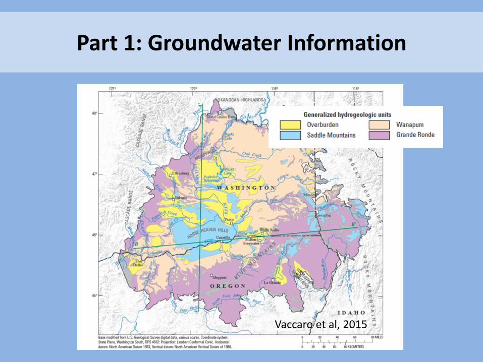
Part 1: Groundwater Information
Vaccaro et al, 2015
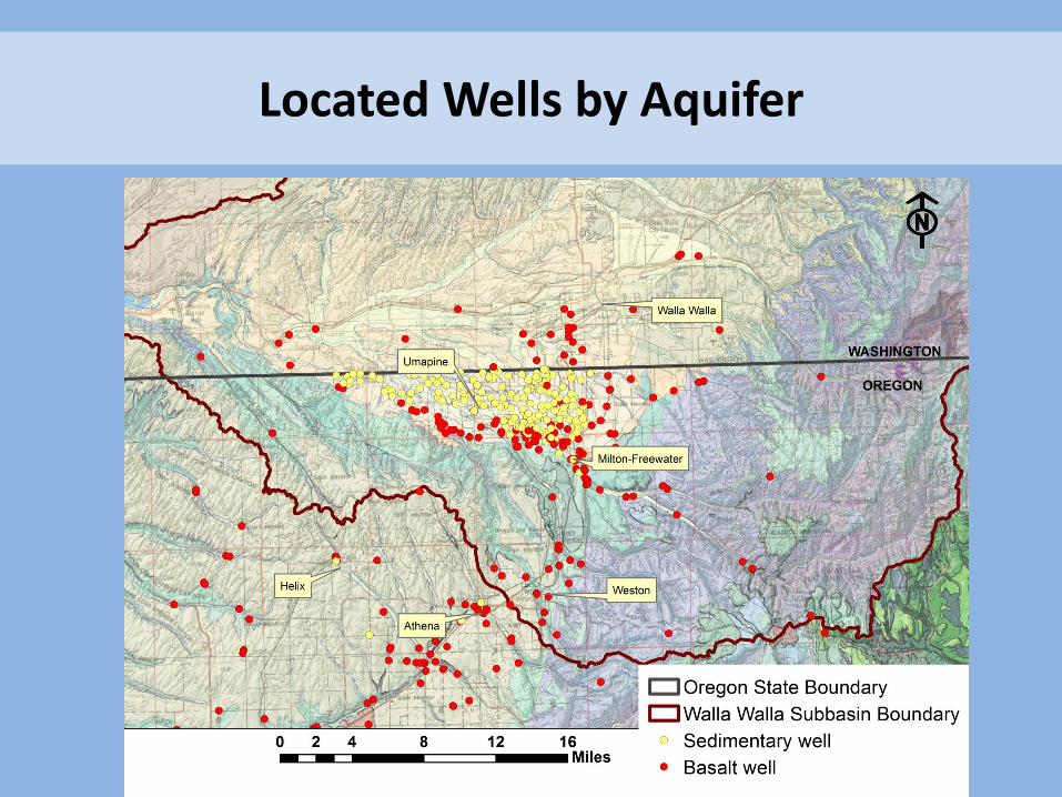
Located Wells by Aquifer

Why do we measure groundwater levels?
• Water levels are an indicator of the overall water in storage
– Rising water levels indicate recovery
– Stable water levels indicate the volume of water in storage is stable
– Declining water levels indicate water is being removed at a rate greater than is being recharged
• Stability ensures a long-term supply
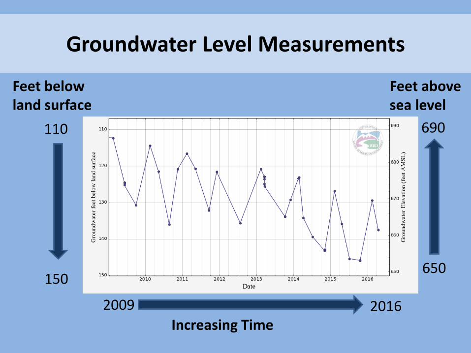
Groundwater Level Measurements
Increasing Time
2009 2016
Feet below land surface
110
150
Feet above sea level
690
650
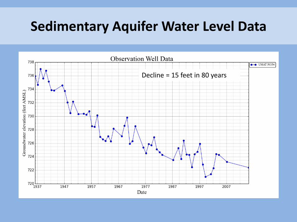
Sedimentary Aquifer Water Level Data
Decline = 15 feet in 80 years
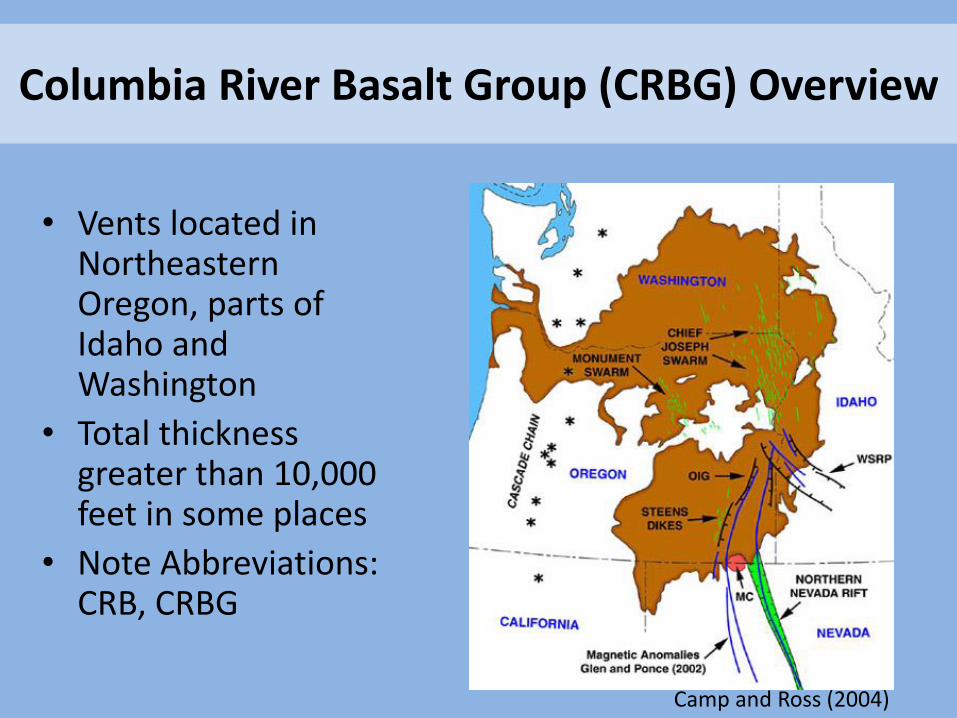
Columbia River Basalt Group (CRBG) Overview
• Vents located in Northeastern Oregon, parts of Idaho and Washington
• Total thickness greater than 10,000 feet in some places
• Note Abbreviations: CRB, CRBG
Camp and Ross (2004)
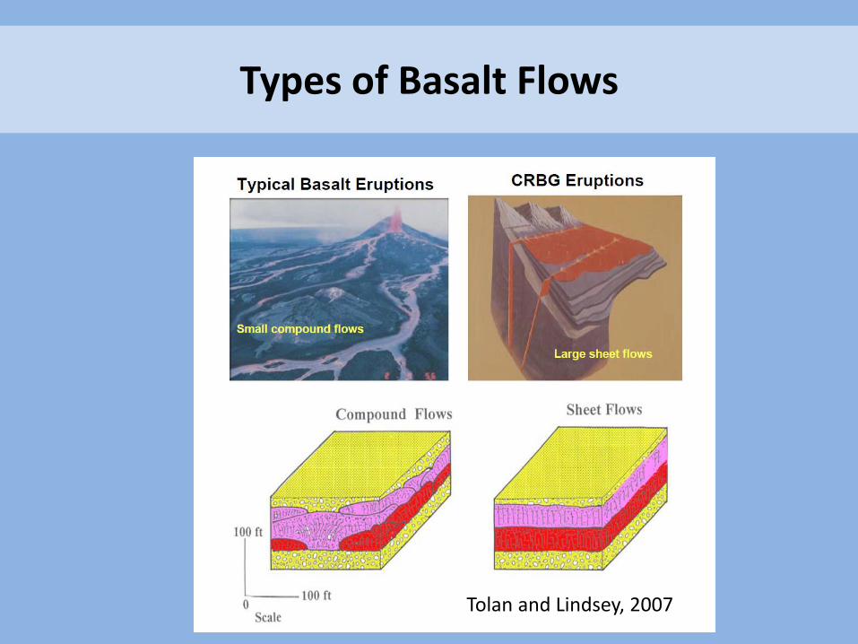
Tolan and Lindsey, 2007
Types of Basalt Flows
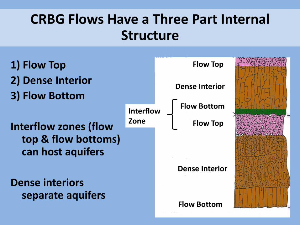
1) Flow Top
2) Dense Interior
3) Flow Bottom
Interflow zones (flow top & flow bottoms) can host aquifers
Dense interiors separate aquifers
CRBG Flows Have a Three Part Internal Structure
Flow Top
Dense Interior
Flow Bottom
Flow Top
Dense Interior
Interflow Zone
Flow Bottom
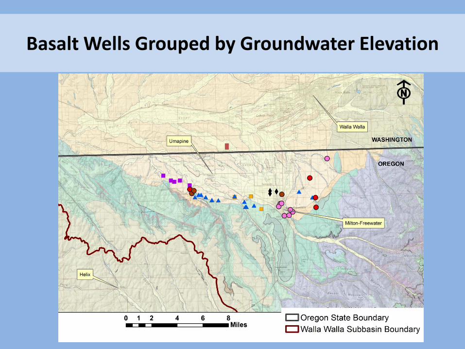
Basalt Wells Grouped by Groundwater Elevation
Decline rate = 3-4 ft/year
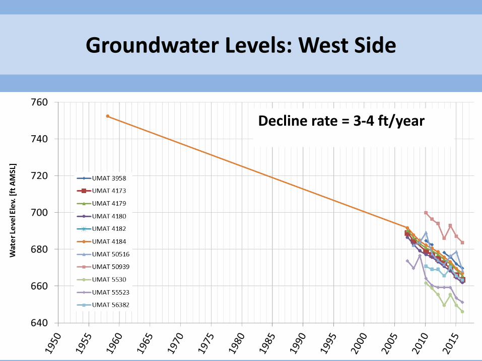
Groundwater Levels: West Side
Decline rate = 3-4 ft/year
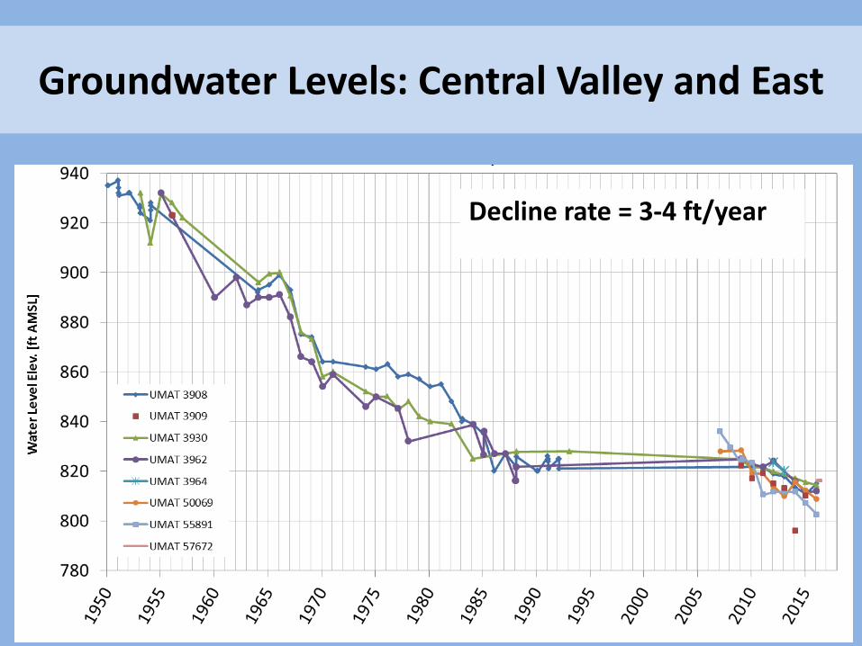
Groundwater Levels: Central Valley and East
Average decline = 3 ft/year
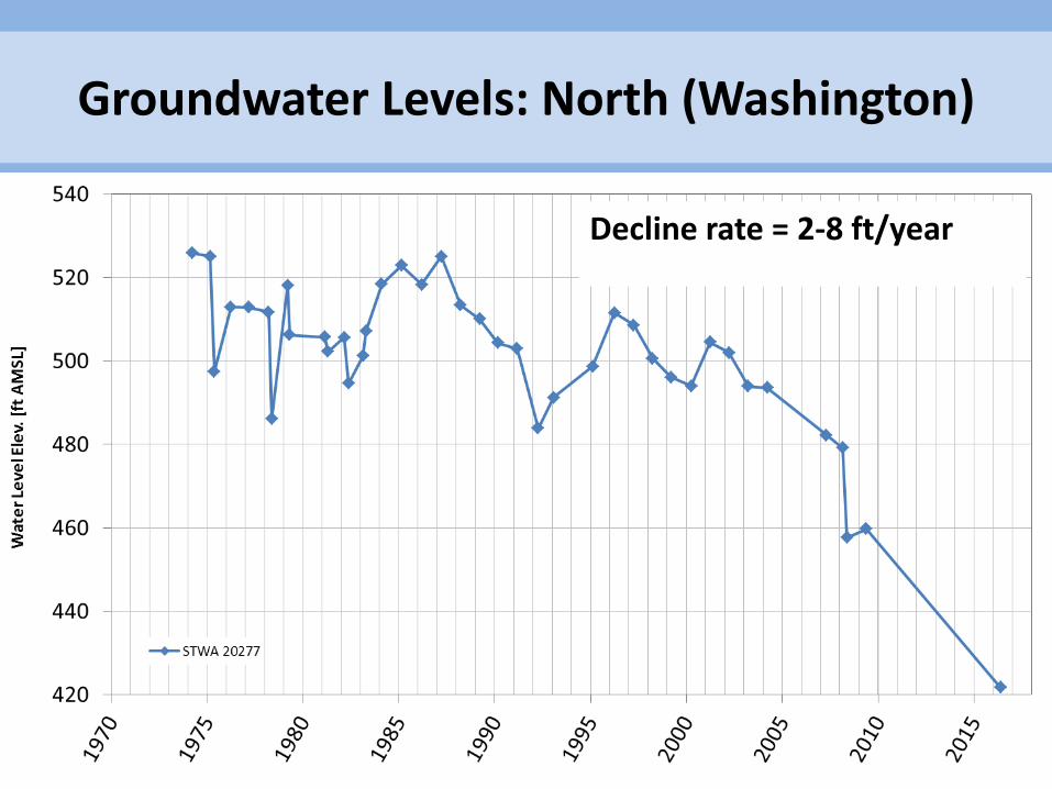
Groundwater Levels: North (Washington)
Decline rate = 2-8 ft/year
Basalt Groundwater Level Declines
• Declines are occurring in the CRBG aquifers basin-wide at rates ranging from 2 to 4 feet per year.
• Recharge is difficult to quantify; the volume pumped can be quantified if permitted wells have flowmeters.
• When total annual use is known, we can examine the relationship between changes in use and changes in water levels.
Part 2: Groundwater Management Options
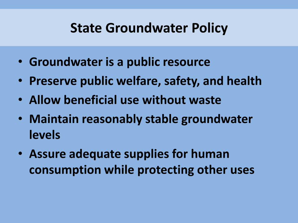
• Groundwater is a public resource
• Preserve public welfare, safety, and health
• Allow beneficial use without waste
• Maintain reasonably stable groundwater levels
• Assure adequate supplies for human consumption while protecting other uses
State Groundwater Policy
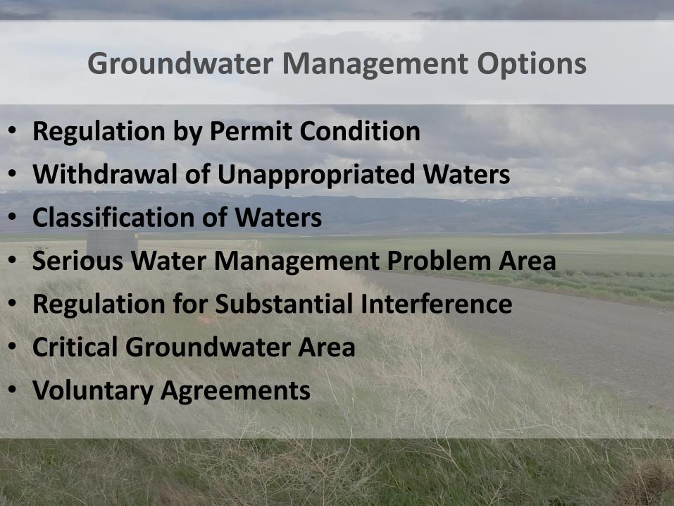
Groundwater Management Options
• Regulation by Permit Condition
• Withdrawal of Unappropriated Waters
• Classification of Waters
• Serious Water Management Problem Area
• Regulation for Substantial Interference
• Critical Groundwater Area
• Voluntary Agreements
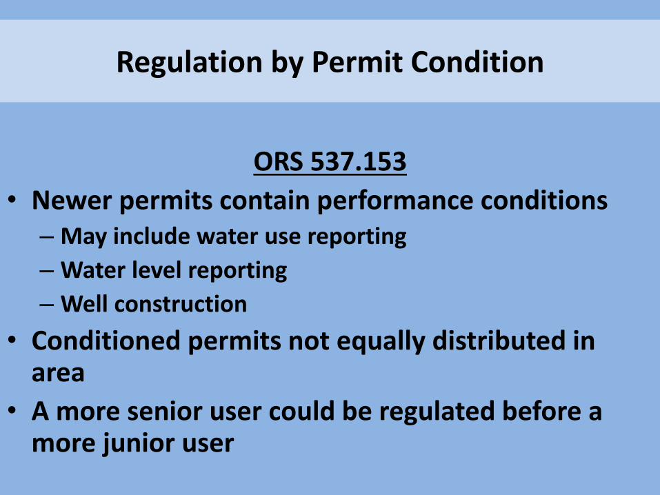
Regulation by Permit Condition
ORS 537.153
• Newer permits contain performance conditions – May include water use reporting
– Water level reporting
– Well construction
• Conditioned permits not equally distributed in area
• A more senior user could be regulated before a more junior user
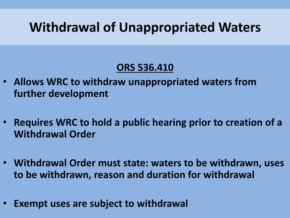
Withdrawal of Unappropriated Waters
ORS 536.410
• Allows WRC to withdraw unappropriated waters from further development
• Requires WRC to hold a public hearing prior to creation of a Withdrawal Order
• Withdrawal Order must state: waters to be withdrawn, uses to be withdrawn, reason and duration for withdrawal
• Exempt uses are subject to withdrawal
Withdrawal of Unappropriated Waters
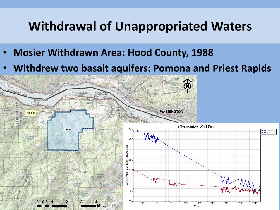
• Mosier Withdrawn Area: Hood County, 1988
• Withdrew two basalt aquifers: Pomona and Priest Rapids
Classification of Waters
ORS 536.340
• Allows WRC to restrictively classify future uses of water through a rulemaking modification of a basin program
• Requires WRC to conduct public hearing within the affected area
• Groundwater classification may restrict new exempt uses
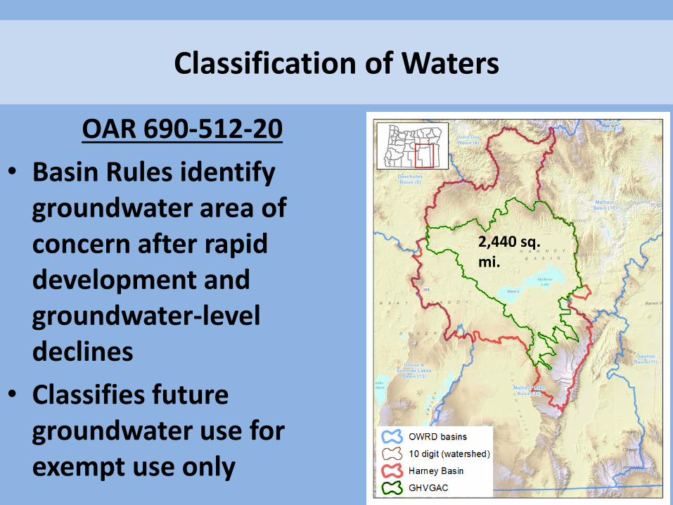
Classification of Waters
OAR 690-512-20
• Basin Rules identify groundwater area of concern after rapid development and groundwater-level declines
• Classifies future groundwater use for exempt use only
2,440 sq. mi.
Serious Water Management Problem Area
ORS 540.435 • WRC may adopt a rule when it finds groundwater declines,
significant disputes, or other problems
• Allows WRC to require the installation of metering devices and reporting of water use
• Requires WRC to conduct a public hearing within the affected area and provide opportunity for alternative solutions
• SWMPA must specify nature of the problem, area boundaries, who must meter, and reporting timelines

Serious Water Management Problem Area
• Many older groundwater permits do not require water use measurement or reporting
• Area-wide flowmeter installation is the best way to accurately quantify use from an aquifer
• Flowmeters come in a variety of styles, but should display cumulative “totalizer” in addition to instantaneous rate of flow, and be properly sized

Regulation for Substantial Interference
ORS 537.775
• WRC may order discontinuance of well use, impose conditions upon use of the well, or order permanent abandonment
• Regulation may occur to remedy substantial interference between wells or between a well and a stream
• Groundwater is distributed in the same manner as surface water: junior users are regulated in favor of senior users
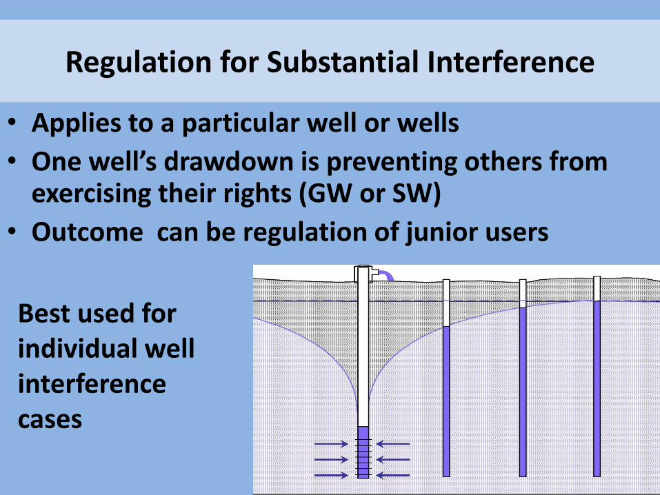
Regulation for Substantial Interference
• Applies to a particular well or wells
• One well’s drawdown is preventing others from exercising their rights (GW or SW)
• Outcome can be regulation of junior users
Best used for individual well interference cases
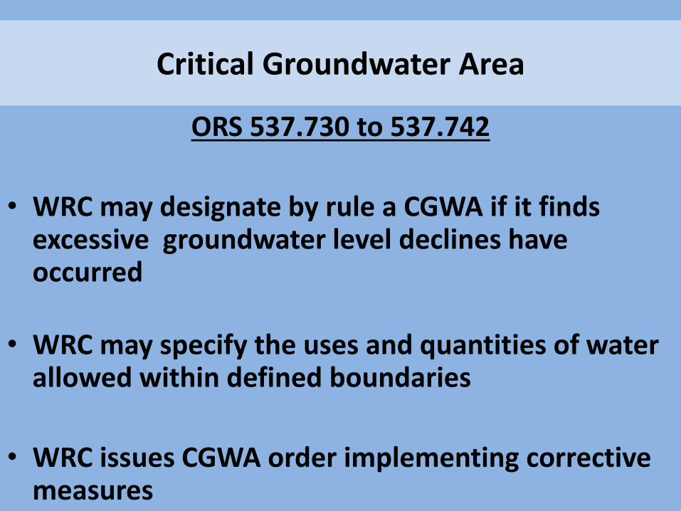
Critical Groundwater Area
ORS 537.730 to 537.742
• WRC may designate by rule a CGWA if it finds excessive groundwater level declines have occurred
• WRC may specify the uses and quantities of water allowed within defined boundaries
• WRC issues CGWA order implementing corrective measures
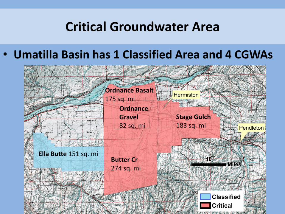
Critical Groundwater Area
• Umatilla Basin has 1 Classified Area and 4 CGWAs
Ella Butte 151 sq. mi Butter Cr 274 sq. mi
Stage Gulch 183 sq. mi
Ordnance Gravel 82 sq. mi
Ordnance Basalt 175 sq. mi

Critical Groundwater Area
Umatilla CGWAs • Rights total over 190,000 Acre-Feet • CGWA Order allocated about 63,000 Acre-Feet • Percent curtailment ranges from 0% to 91% • Average 67% curtailment • Groundwater levels are still declining at a
reduced rate
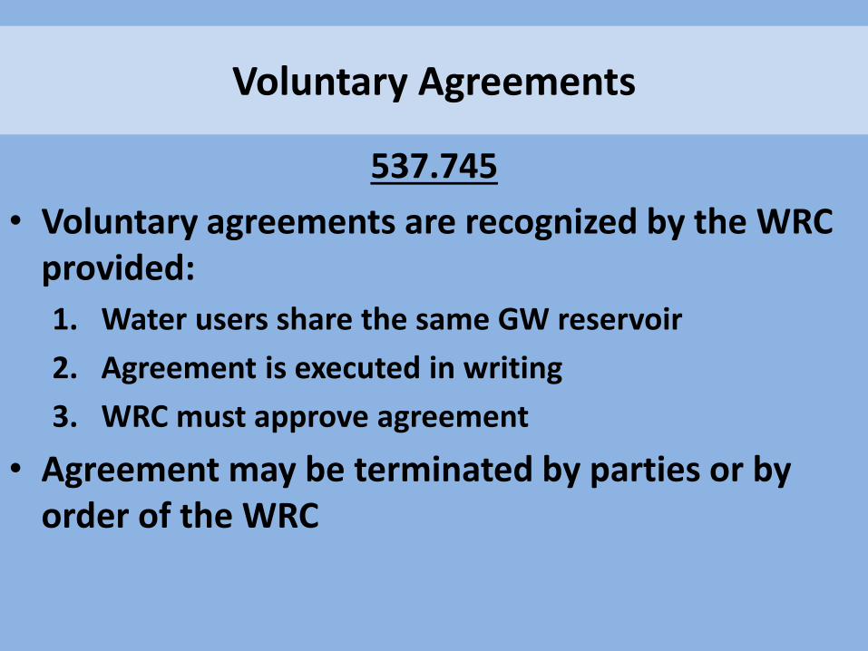
Voluntary Agreements
537.745
• Voluntary agreements are recognized by the WRC provided:
1. Water users share the same GW reservoir
2. Agreement is executed in writing
3. WRC must approve agreement
• Agreement may be terminated by parties or by order of the WRC
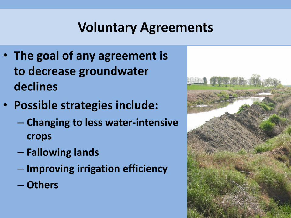
Voluntary Agreements
• The goal of any agreement is to decrease groundwater declines
• Possible strategies include:
– Changing to less water-intensive crops
– Fallowing lands
– Improving irrigation efficiency
– Others
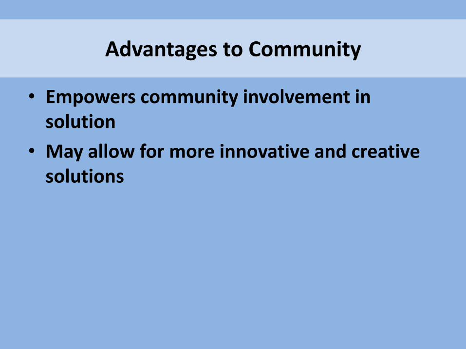
• Empowers community involvement in solution
• May allow for more innovative and creative solutions
Advantages to Community

Management Tool What it does Limitations
Withdrawal of Water Withdraws groundwater, no new rights
Does not reduce the amount of groundwater used
Classification of Water Designates approved uses of water
Does not reduce the amount of groundwater used
Serious Water Management Problem Area
Requires measuring devices and water use reporting; provides technical data
Does not reduce the amount of groundwater used
Regulation for Substantial Interference
Addresses specific cases of well-to-well interference
Does not reduce the amount of groundwater used
Management Options: No Curtailment
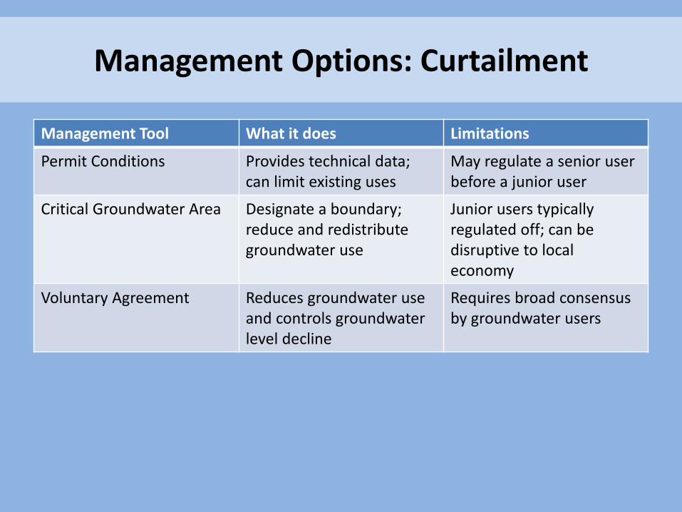
Management Tool What it does Limitations
Permit Conditions Provides technical data; can limit existing uses
May regulate a senior user before a junior user
Critical Groundwater Area Designate a boundary; reduce and redistribute groundwater use
Junior users typically regulated off; can be disruptive to local economy
Voluntary Agreement Reduces groundwater use and controls groundwater level decline
Requires broad consensus by groundwater users
Management Options: Curtailment
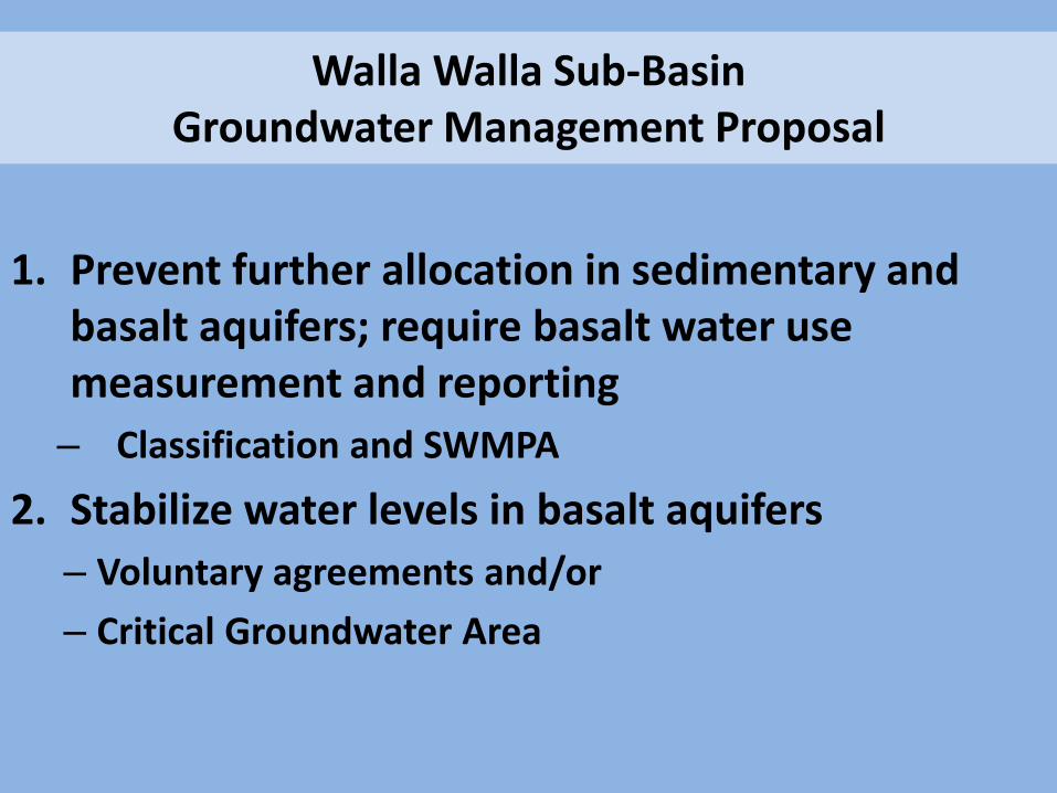
Walla Walla Sub-Basin Groundwater Management Proposal
1. Prevent further allocation in sedimentary and basalt aquifers; require basalt water use measurement and reporting
– Classification and SWMPA
2. Stabilize water levels in basalt aquifers
– Voluntary agreements and/or
– Critical Groundwater Area

Walla Walla Sub-Basin Groundwater Management Proposal
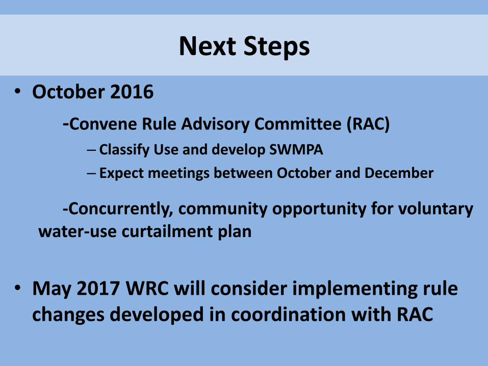
Next Steps
• October 2016
-Convene Rule Advisory Committee (RAC)
– Classify Use and develop SWMPA
– Expect meetings between October and December
-Concurrently, community opportunity for voluntary water-use curtailment plan
• May 2017 WRC will consider implementing rule changes developed in coordination with RAC
Next Meetings
• At the Milton-Freewater Community Building
October 24 at 6:30 PM and
October 25 at 9:00 AM
• Facilitated discussion, bring questions
Stay Involved and Informed
• Follow-up meeting next month
• Department contact: Justin Iverson, Groundwater Section Manager 503-986-0855 or [email protected]
• Rule Advisory Committee interest: [email protected]


