BASIC CONCEPT OF (Integrated) WATERSHED AND ITS DEVELOPMENT Er. K. P. Tripathi Secretary (AIF), Lucknow and Former-Principal Scientist, CSWRTI, Dehradun Email:[email protected]Mobile no: 9412910718 13/36, Vikasnagar, Lucknow-226 022
Transcript
BASIC CONCEPT OF (Integrated)WATERSHED AND ITS DEVELOPMENT
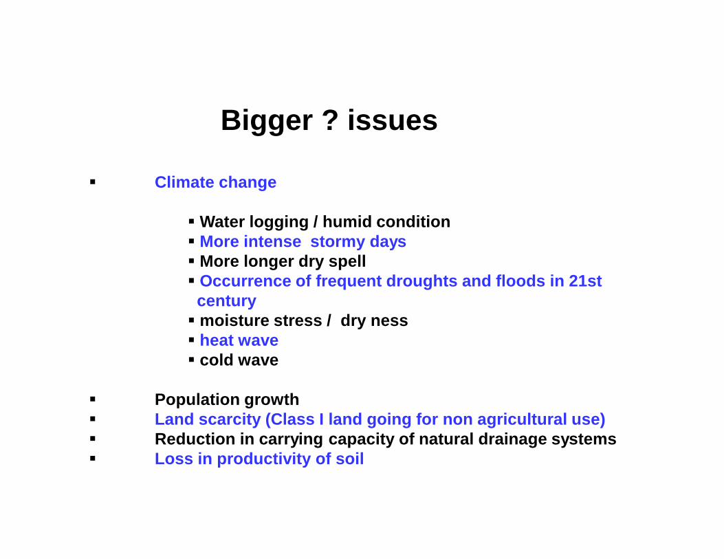
Water logging / humid condition More intense stormy days More longer dry spell Occurrence of frequent droughts and floods in 21st
century moisture stress / dry ness heat wave cold wave
Population growth Land scarcity (Class I land going for non agricultural use) Reduction in carrying capacity of natural drainage systems Loss in productivity of soil
Principal in Arable land
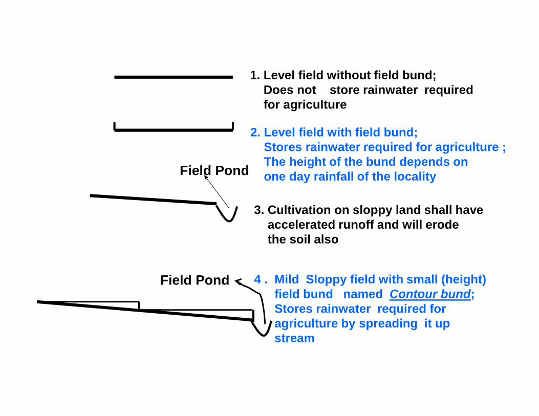
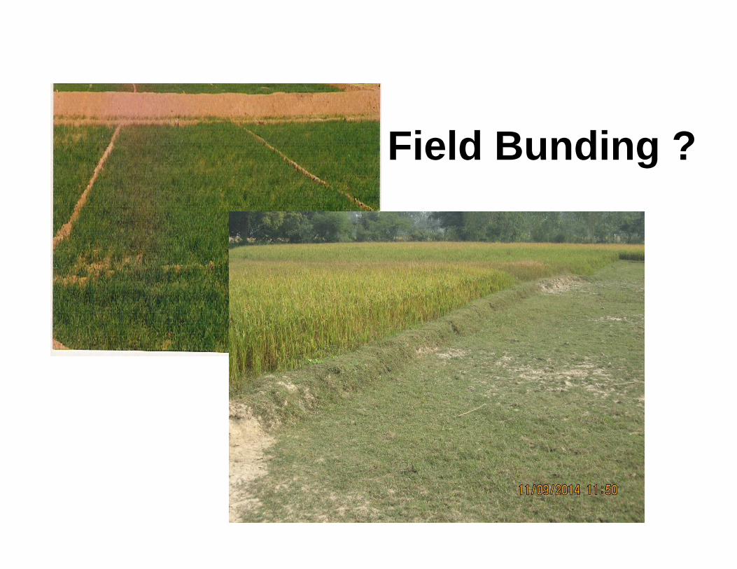
1. Level field without field bund; Does not store rainwater requiredfor agriculture
2. Level field with field bund;Stores rainwater required for agriculture ; The height of the bund depends onone day rainfall of the locality
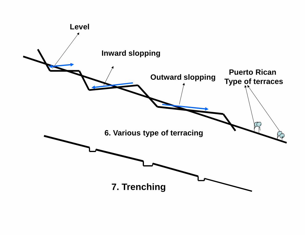
4 . Mild Sloppy field with small (height) field bund named Contour bund; Stores rainwater required for agriculture by spreading it up stream
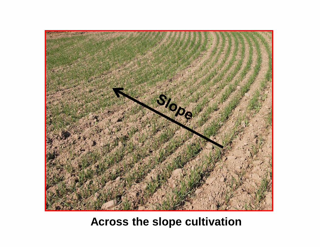
3. Cultivation on sloppy land shall have accelerated runoff and will erodethe soil also
Field Pond
Field Pond
Field Bunding ?
Across the slope cultivation
Bunding
Cost Rs. 6000.00 to Rs. 12000.00 per ha
Land developmentin shallow ravines
Vegetative barrier
Rs.2500.00 to Rs. 4500.00
5 .Steep Sloppy field with small (height) field bund namedContour bund shall not store rainwater required foragriculture by spreading it up stream on longer lengthwhile higher height bund shall spread it on longerlength but then cross section of the bund is more anduneconomical, hence contour bund is no feasible whileterracing is.
A
B
Field Pond4 . Mild Sloppy field with small (height)field bund named Contour bund;Stores rainwater required foragriculture by spreading it up stream
Level
Inward slopping
Outward slopping Puerto Rican Type of terraces
6. Various type of terracing
7. Trenching
Principal in Non - arable land
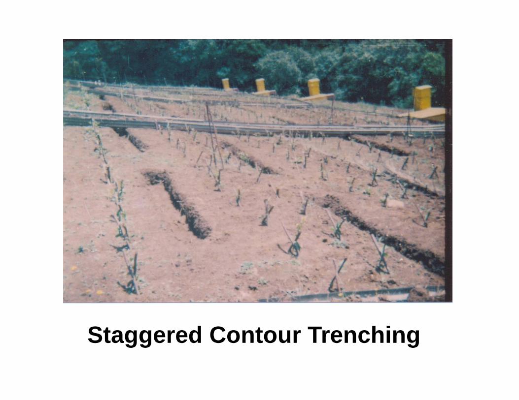
Sloppy Land
Half circular trench on upstream side
Tree
Excavated soil from trench to be used for forming bund on down ward side in half circle form linking the half circle of the trench
Trench layout for individual tree
Staggered Contour Trenching
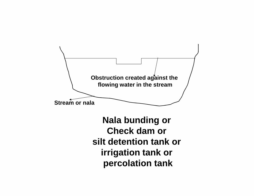
Stream or nala
Obstruction created against the flowing water in the stream
Nala bunding or Check dam or
silt detention tank or irrigation tank orpercolation tank
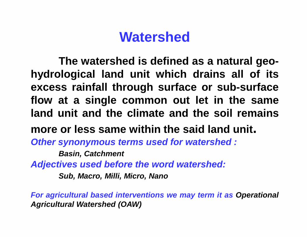
WatershedThe watershed is defined as a natural geo-
hydrological land unit which drains all of itsexcess rainfall through surface or sub-surfaceflow at a single common out let in the sameland unit and the climate and the soil remainsmore or less same within the said land unit.Other synonymous terms used for watershed :
Basin, CatchmentAdjectives used before the word watershed:
Sub, Macro, Milli, Micro, Nano
For agricultural based interventions we may term it as OperationalAgricultural Watershed (OAW)
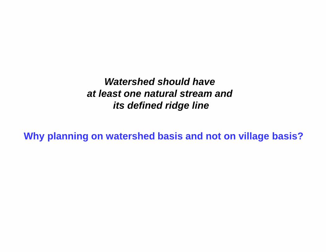
Watershed should have at least one natural stream and
its defined ridge line
Why planning on watershed basis and not on village basis?
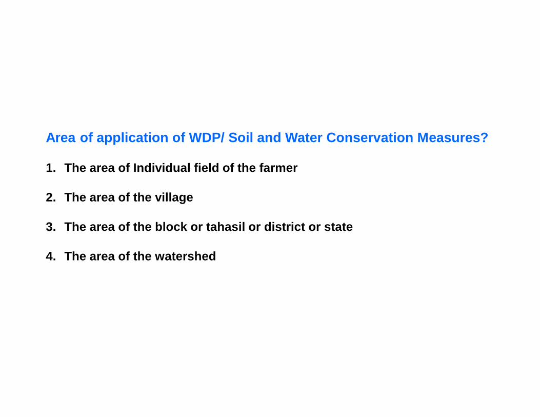
Area of application of WDP/ Soil and Water Conservation Measures?
1. The area of Individual field of the farmer
2. The area of the village
3. The area of the block or tahasil or district or state
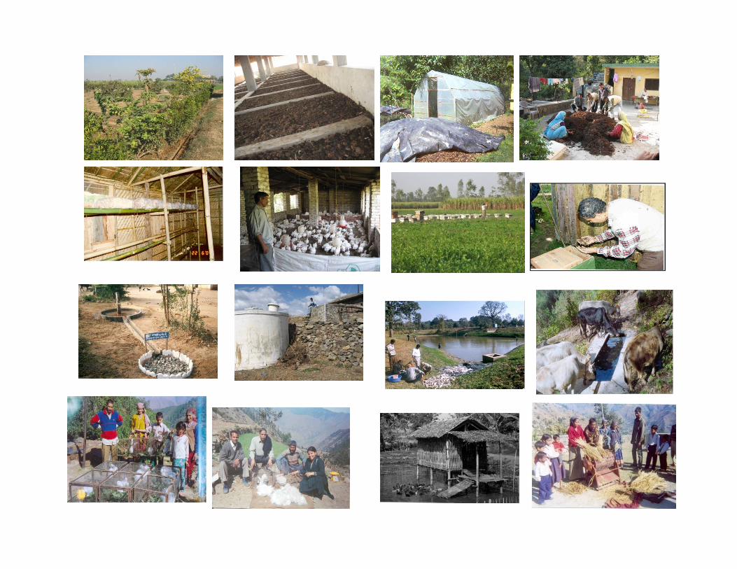
What is(Integrated) Watershed Development Programme?
Degradation Problems
What do we mean by:
• Soil degradation• Land Degradation• Degradation of stream?
Resulting in low crop and live stock production
Steep slope
Longitudinal section
Trees / Shrubs
Original
After stream bank erosion
Grass
A
A
Section at A-A
Deepening of the stream
Widening of the stream
Disturbed slope
Steep slopeafter stream Erosion , s2
Steep slopeBefore stream Erosion,s1
d
w2
w1
Degradation of Stream1. Slope of the stream is changes2. Width and depth of the stream increases
Objectives of Watershed Development Programme (WDP)
The objectives of the watershed development plan can be definedas:
I. To increase infiltration into soil.II. To control damaging excess runoff.III. To manage and utilize rainfall/runoff for useful purposes.
Useful purpose
a. Sustained production of grain, fodder, fruit, fuel, fibre,plantation and cash crops.
b. Development of industries as per potential of the watershed.c. Proper and sound health of the habitant of the watershed.d. Prolonged life of reservoirs,lakes, ponds and other water
bodies.e. Maintaining the carrying capacity of the natural drainage
network.
WDP is rainwater management programme
The most important index of evaluation of WDP
is increase in vegetational area in
a treated watershed under WDP
Issues of watershed development
Participation Equality (Gender issue, legal issues and policies, and less
and marginal farmers, economically weaker section) Equitability Common property resources Transparency Societies /association/village institutions Integrated management – all types. Industrialization of watershed Empowerment of communities Bottom – up planning and top – down development Management of hydrologic cycle as water acts as catalyst
for all activities Employment generation
continuation
After care and maintenance Responsibilities Conflicts, violence and resolution Sustainability in all spheres Single window supply system Intellectual property rights (IPR) Validation of indigenous technology Bio-diversity Human Resource Development (HRD) at all level as
watershed - an institution of learning
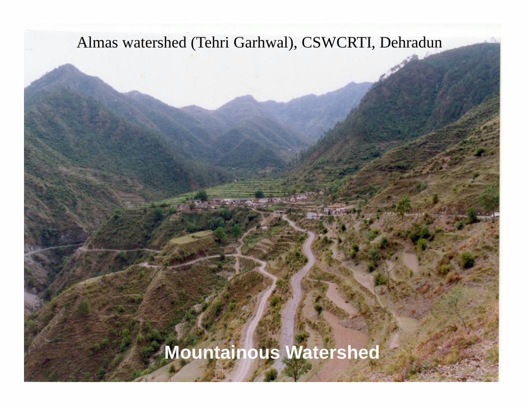
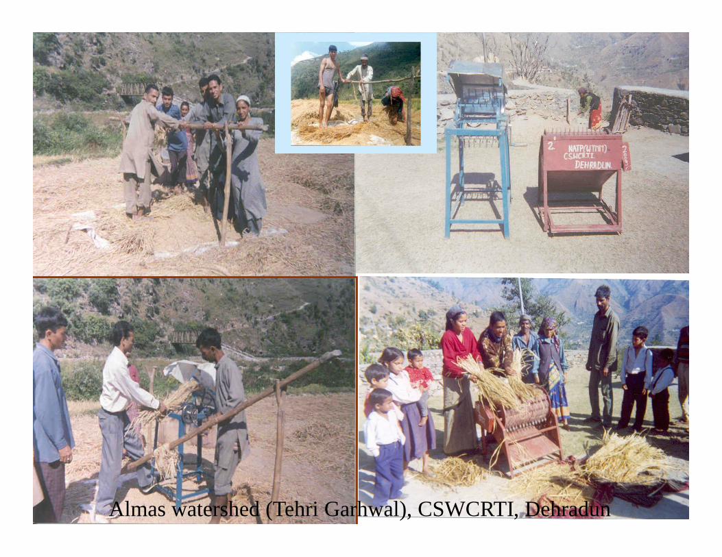
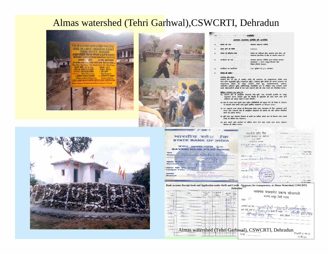
Almas watershed (Tehri Garhwal),CSWCRTI, Dehradun
Bank account, Receipt book and Application under thrift and Credit - Necessary for transparency, at Almas Watershed, CSWCRTI, Dehradun
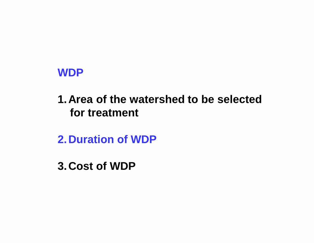
1.Area of the watershed to be selected for treatment
2.Duration of WDP
3.Cost of WDP
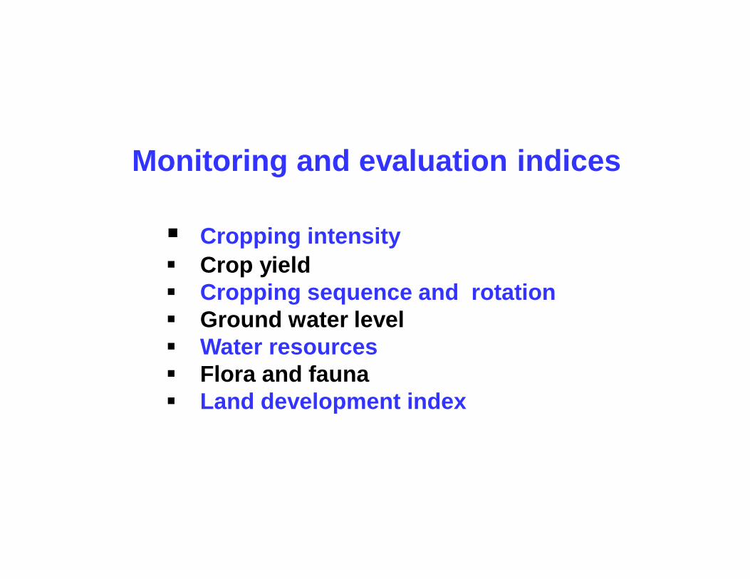
Monitoring and evaluation indices
Cropping intensity Crop yield Cropping sequence and rotation Ground water level Water resources Flora and fauna Land development index
Runo
ff/w
ater
yie
ld
Time
T4
T3
T2
T1
Qp4
Qp3Qp2
Qp1
Tp3
Tp2
Tp1
Tp4
Runo
ff/w
ater
yie
ld
Time
T4
T3
T2
T1
Qp4
Qp3Qp2
Qp1
Tp3
Tp2
Tp1
Tp4
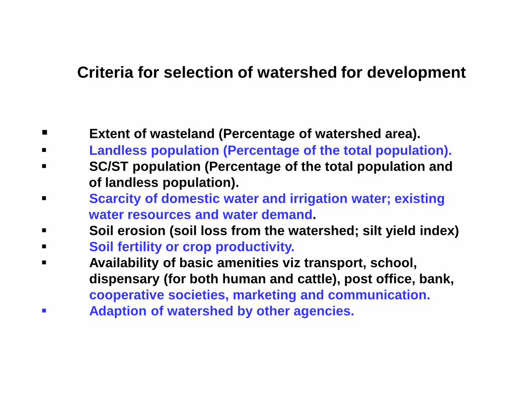
Criteria for selection of watershed for development
Extent of wasteland (Percentage of watershed area). Landless population (Percentage of the total population). SC/ST population (Percentage of the total population and
of landless population). Scarcity of domestic water and irrigation water; existing
water resources and water demand. Soil erosion (soil loss from the watershed; silt yield index) Soil fertility or crop productivity. Availability of basic amenities viz transport, school,
dispensary (for both human and cattle), post office, bank, cooperative societies, marketing and communication.
Adaption of watershed by other agencies.
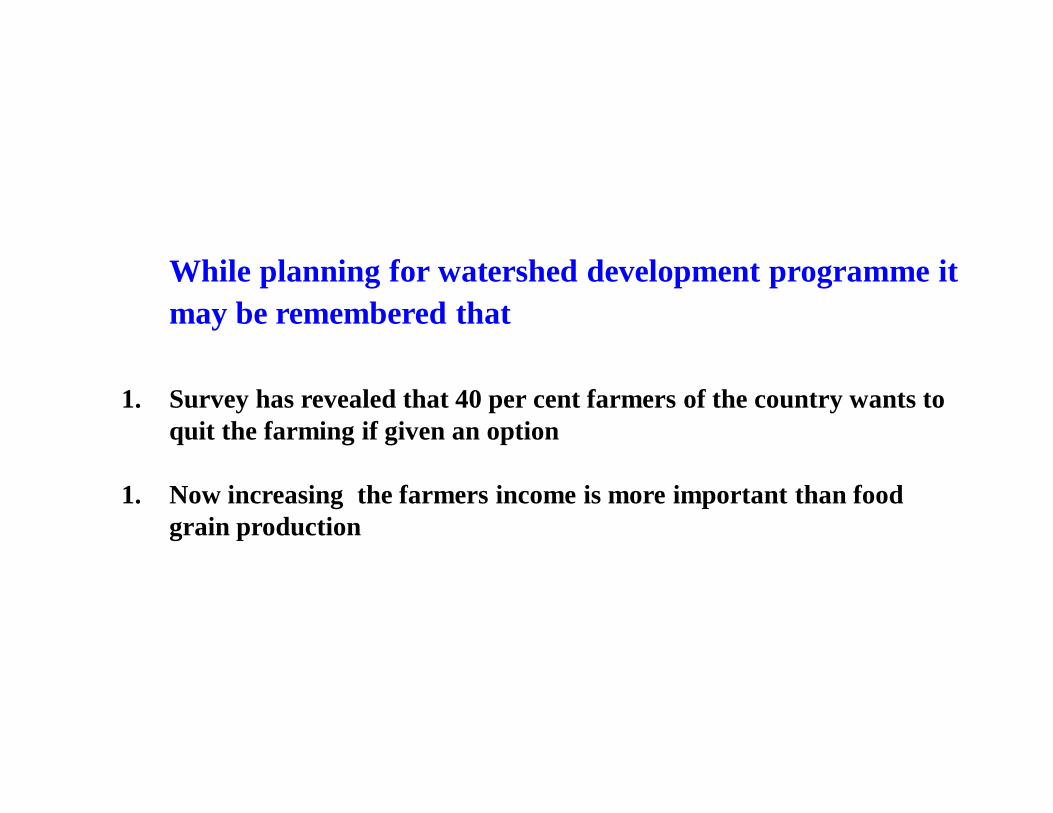
While planning for watershed development programme itmay be remembered that
1. Survey has revealed that 40 per cent farmers of the country wants to quit the farming if given an option
1. Now increasing the farmers income is more important than food grain production
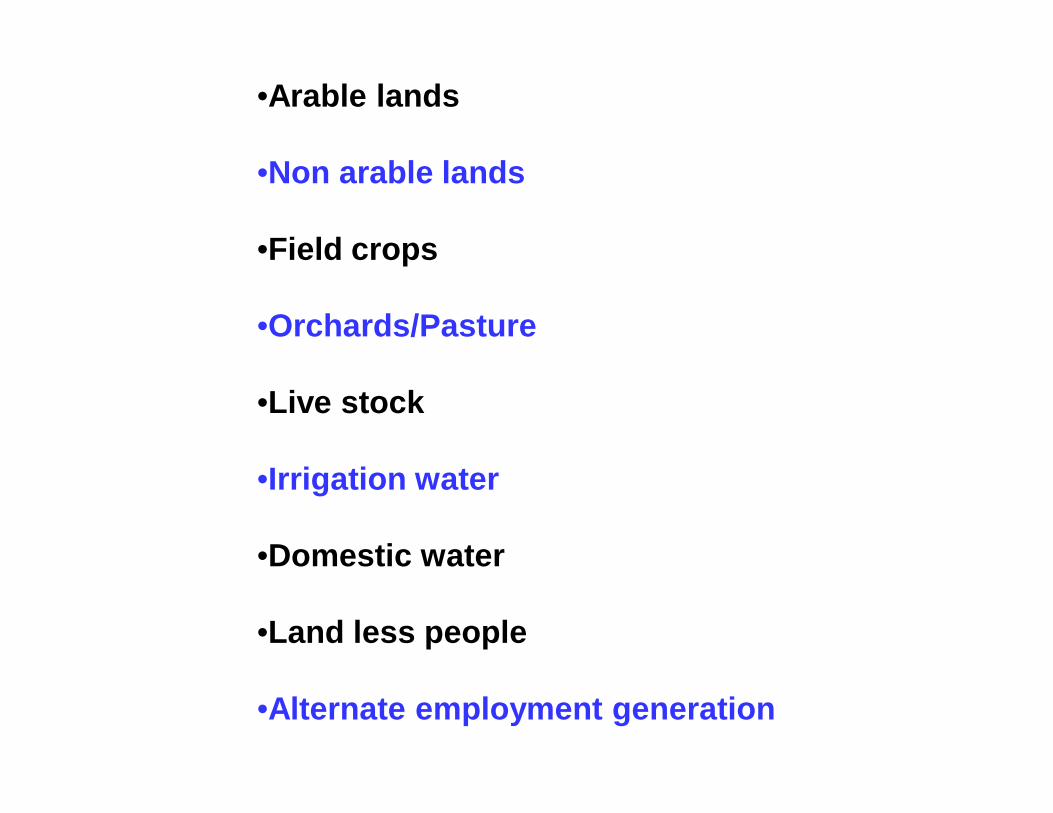
Main interventions/works/activities of WDP
1. Water resources development(Water harvesting - Soil moisture improvement, storage for irrigation,storage for augmenting ground water recharge rejuvenation of spring ,increasing flow days and discharge rate of streams and roof waterharvesting,
2. Vegetation improvement programme for sustainproduction( Field crops, orchards/plantation crops/spices/cash crops, agro-forestry)
3. Live stock based programme(water for live stock, pasture/grass land development programme, shade trees,dewarming)
4. Erosion control measures(for arable lands, non arable lands, stream bank erosion, landslide/landslips)
5. Alternative employment generation(beekeeping, mushroom, sericulture, backyard poultry, goat rearing/sheep rearing, fish cultivation, dairy, vermiculture, backyard fruit andmultipurpose tree plantation
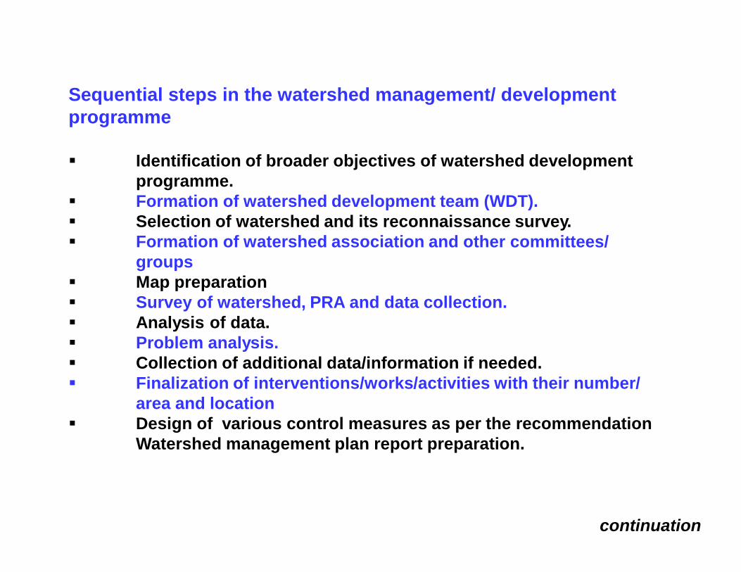
Sequential steps in the watershed management/ development programme
Identification of broader objectives of watershed developmentprogramme.
Formation of watershed development team (WDT). Selection of watershed and its reconnaissance survey. Formation of watershed association and other committees/
groups Map preparation Survey of watershed, PRA and data collection. Analysis of data. Problem analysis. Collection of additional data/information if needed. Finalization of interventions/works/activities with their number/
area and location Design of various control measures as per the recommendation
Watershed management plan report preparation.
continuation
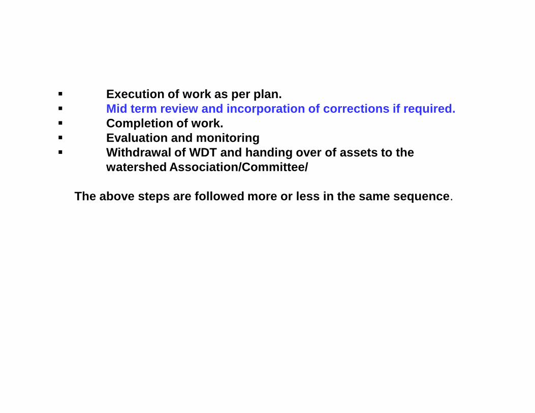
Execution of work as per plan. Mid term review and incorporation of corrections if required. Completion of work. Evaluation and monitoring Withdrawal of WDT and handing over of assets to the
watershed Association/Committee/
The above steps are followed more or less in the same sequence.
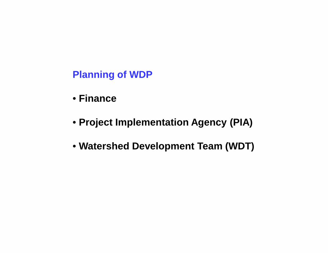
Planning of WDP
• Finance
• Project Implementation Agency (PIA)
• Watershed Development Team (WDT)
Project Formulation
The following information is needed from a watershed for developing a proper management plan:
Demographic details including Socio-economic aspect
Vegetation aspect
Soil and land resource
Engineering cum topographical details, and
Hydrological aspects
A. Static data
(i) Topographical map and Soil map
some agencies need to be entrusted with the job of providing the enlarged map of the watersheds of 1000-3000 ha on a scale of 1:5000 0r 1:10,000
(ii) Meteorological
some agencies need to be entrusted with the job of providing the enlarged map of the watersheds of 1000-3000 ha on a scale of 1:5000 0r 1:10,000
Continue
B. Dynamic data
(i) Land use
(ii) Water resources
(iii) Demographic
(iv) Existing conservation Measures
are to be collected during survey
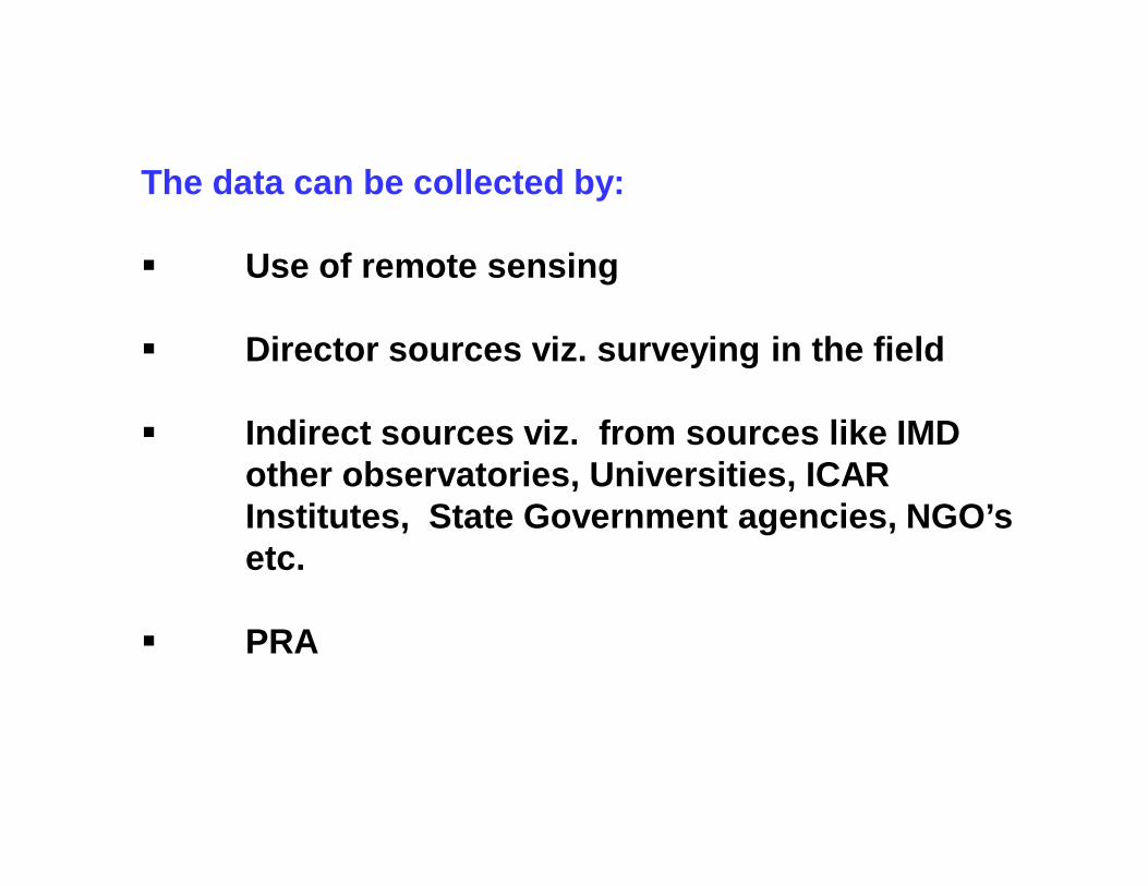
The data can be collected by:
Use of remote sensing
Director sources viz. surveying in the field
Indirect sources viz. from sources like IMD other observatories, Universities, ICAR Institutes, State Government agencies, NGO’s etc.
PRA
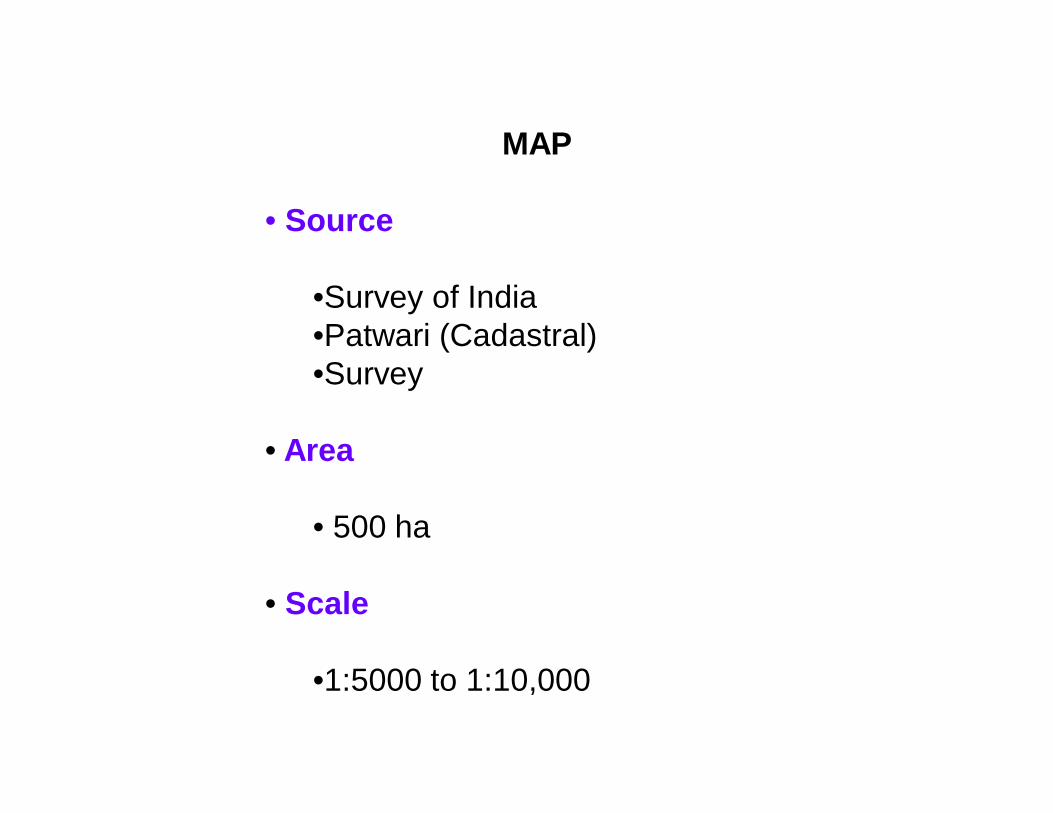
MAP
• Source
•Survey of India•Patwari (Cadastral)•Survey
• Area
• 500 ha
• Scale
•1:5000 to 1:10,000
A TOPOSHEET
The information/data collected, compiled and interpreted assuggested above are critically examined with the assistanceof following map prepared through field survey.
Land capability classification map (based on soildepth, soil texture, land slope, and erosion status)
Present land use map and
Present water resources map
1. Train the farmers in most of the activities
i. Arrange the training in the watershedii. Exposure visit
Lessons The Operational Agricultural Watersheds (OAW) of about 500 ha only
should be selected for planning and development purposes.
The scale of the map should be 1:5000 to 1:10,000.
The watershed development works should be completed in 4 to 5 years.First year should be devoted for survey, data collection, plan preparation,organization and entry point activities.
There should be in built mechanism of evaluation and monitoring,provision for post project maintenance and repair.
The Watershed Development Team (WDT) should consist of a specialistfrom
(iii) Engineering (preferably Agricultural/Civil engineering) and (iv) Social science.
At least one of the team member should be a female.Continued
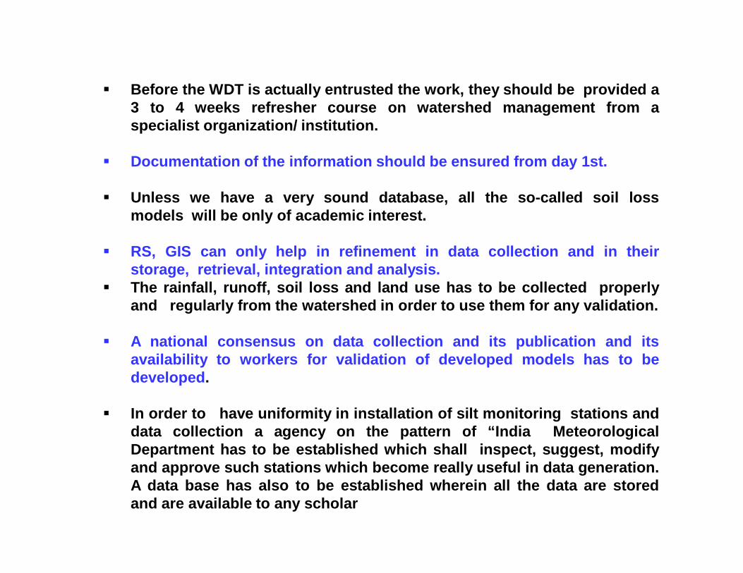
Before the WDT is actually entrusted the work, they should be provided a3 to 4 weeks refresher course on watershed management from aspecialist organization/ institution.
Documentation of the information should be ensured from day 1st.
Unless we have a very sound database, all the so-called soil lossmodels will be only of academic interest.
RS, GIS can only help in refinement in data collection and in theirstorage, retrieval, integration and analysis.
The rainfall, runoff, soil loss and land use has to be collected properlyand regularly from the watershed in order to use them for any validation.
A national consensus on data collection and its publication and itsavailability to workers for validation of developed models has to bedeveloped.
In order to have uniformity in installation of silt monitoring stations anddata collection a agency on the pattern of “India MeteorologicalDepartment has to be established which shall inspect, suggest, modifyand approve such stations which become really useful in data generation.A data base has also to be established wherein all the data are storedand are available to any scholar
Agriculture is related to :
1. Rainfall2. Soil depth3. Soil texture4. Land slope5. Market forces/need of the farmer
What is difference between Soil and Land?
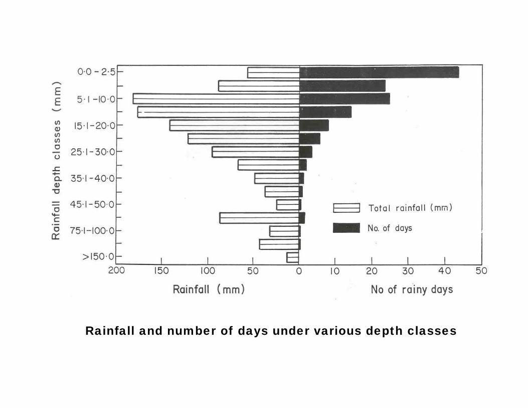
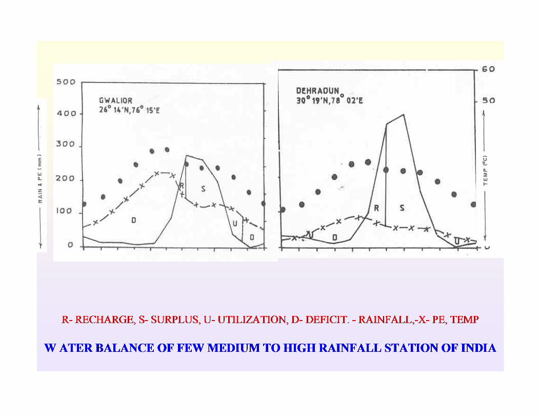
Rainfall
Rainfall and number of days under various depth classes
Soil
Which parameter of the soil are most important in agriculture ?
Soil Depth:
Why knowledge of soil depth is necessary?What is the minimum soil depth required for agriculture?
Soil texture:
Why knowledge of soil texture is necessary?Which are most common soil texture?
Slope:
How to define slope?
What is the importance of soil depth in agriculture?
Can the slope of the land be more than 100 per cent?
Slope:
1. Ratio = Horizontal (H) : Vertical (V); 1 is always Vertical
2. Per cent = V/H *100
3. Angle = tan Φ
4. 1:1 = tan 45 = 10 per cent
1
4
3
2V4
V3V2
V1
H
Φ
V
H
5
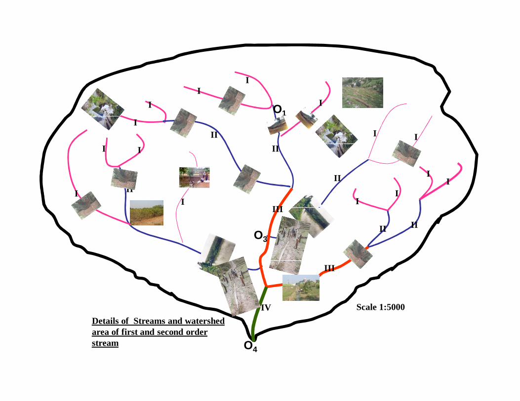
What is(Integrated ) Watershed Development Programme?
I
II
I
I
I I
II
III
I I
IIII
II
III
III
II II
II
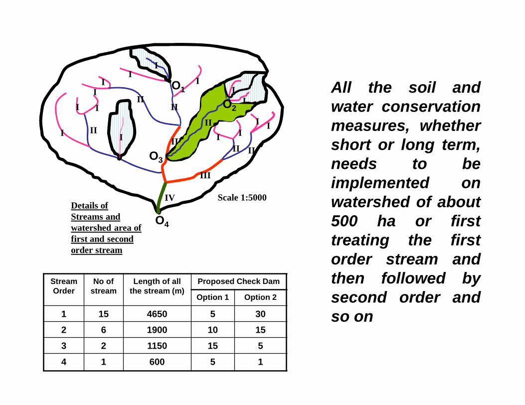
IV Scale 1:5000
O4
O1
O3
Details of Streams and watershed area of first and second order stream
All the soil andwater conservationmeasures, whethershort or long term,needs to beimplemented onwatershed of about500 ha or firsttreating the firstorder stream andthen followed bysecond order andso on
II
I II
I I
IIIII
I I
I
IIII
II
III
III
III I
IV Scale 1:5000
O4
O1
O3
Details of Streams and watershed area of first and second order stream