Watershed Connections Conexiones de la Cuenca A partnership of the Interstate Commission on the Potomac River Basin and the Patuxent River Park, Maryland-National Capital Park and Planning Commission Una colaboración entre Comisión Interestatal de la Cuenca del Río Potomac y el Parque del Río Patuxent (Miembro de la Comisión de Parques y Recreación de Maryland y la Capital Nacional) Part 1: Maryland Waterways and Watersheds Parte 1: Canales de Maryland y Cuencas Hidrográficas Interstate Commission on the Potomac River Basin Comisión Interestatal de la Cuenca del Río Potomac (301) 984-1908 │ [email protected]│ www.PotomacRiver.org
Transcript
Watershed ConnectionsConexiones de la Cuenca
A partnership of the Interstate Commission on the Potomac River Basin and the
Patuxent River Park, Maryland-National Capital Park and Planning Commission
Una colaboración entre Comisión Interestatal de la Cuenca del Río Potomac y el
Parque del Río Patuxent (Miembro de la Comisión de Parques y Recreación de
Maryland y la Capital Nacional)
Part 1: Maryland Waterways and Watersheds
Parte 1: Canales de Maryland y Cuencas Hidrográficas
Interstate Commission on the Potomac River BasinComisión Interestatal de la Cuenca del Río Potomac
Maryland’s “Other” WaterwaysLos “otros” canales de Maryland
56
7 8
Oil, toxins, and road saltAceite, toxinas, y sal de carreteras
ChannelizationCanalizaciones
Erosion and SedimentationErosión y Sedimentación
Troubled waters…Aguas en problemas…
9
46% of Maryland’s Streams are in “Poor” Condition.
46% de los ríos y arroyos de Maryland’s están en condiciones “Pobres”.
Only 12% are in “Good” Condition
Sólo el 12% están en “Buenas” condiciones
Good Health, Poor Health ― what does it mean?
Buena Salud, Mala Salud ― ¿Qué significa?
Healthy streams have…Arroyos sanos tienen…
▪ Plants and treesgrowing along bankPlantas y árboles creciendo en las riberas
▪ Diverse hábitatsDiversos hábitats
▪ Chemical and physicalproperties aceptable for aquatic lifePropiedades físicas y químicas aceptables para la vida acuática
▪ Safe water for human recreationAguas para la recreación humana
Photos: 10, 11, 12, 13, 14, 15, 16
What makes an “unhealthy” stream?¿Qué son arroyos “enfermos” o “no-saludables”?
10,17, 18
Good StreamsArroyos Saludables
Versus
Poor StreamsArroyos No-Saludables
• Plants along the bankPlantas en las riberas
• Diverse habitatsHábitas variados
• Chemical properties aceptable foraquatic lifePropiedades químicas acceptablespara la vida aquática
• Safe for human recreationSeguros para la recreación humana.
• Lack trees, plants, and shadeCarecen de árboles, plantas, y sombra
• Lack habitatsCarecen de hábitats
• Are pollutedEstán contaminados
• Unsafe for public useNo aptos para el uso público
• Filled with trash and sewageLlenos de basura y aguas negras
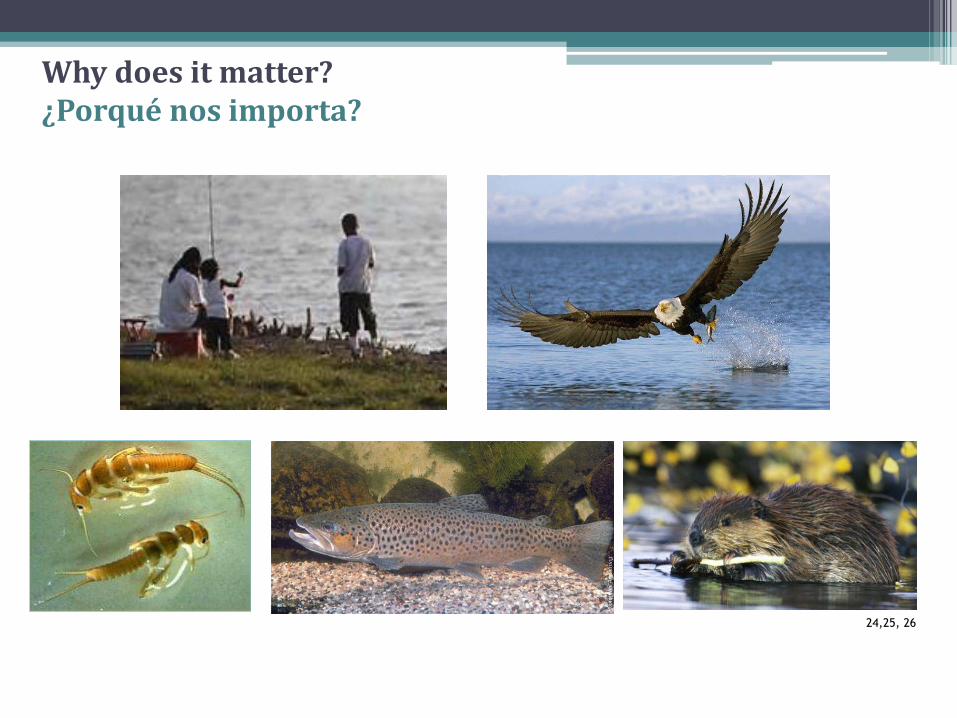
Why does it matter?¿Por qué es importante?
• Main source fordrinking waterLa fuente principal de nuestra agua de beber
19
• Lowers the beautyof a streamLe resta belleza a el arroyo
• Deters swimming, wading, boating…Prohíbe el uso recreativo como nadar, vadear, pezcar…
20
Why does it matter?¿Por qué es importante?
Why does it matter?¿Porqué nos importa?
• Pollution affects ourfood supply
La contaminación affecta nuestras fuentes de alimento
21-23
24,25, 26
Why does it matter?¿Porqué nos importa?
Protecting Our Water ResourcesProtegiendo nuestras fuentes de agua
To protect and restorewáter quality, we need a watershed perspective.
Para proteger y restaurar nuestra calidad de agua necesitamos perspectiva de cuenca.
26
What is a watershed?¿Qué es una cuenca ? Watershed: An area of
land where the water drains into a common source, such as a stream, pond, or bay.
Cuenca: Un área de tierra en dónde el agua se escurre en una fuente común como un arroyo, estanque, o bahía.
A watershed perspective looks at how our land use affects our waterways.
Una Perspectiva de cuenca explora el cómo el uso de los terrenos afecta nuestros cuerpos de agua.
Our Chesapeake Bay WatershedNuestra Cuenca de la Bahía del Chasapeake
• Maryland is nested in one of largest watersheds on the East Coast, the Chesapeake Bay drainage basin.Maryland está alojada en una de las cuencas más grandes de la costa este, la Cuenca de la Bahía del Chesapeake.
• What other states are part of the Chesapeake Bay Watershed?¿Qué otros estados son parte de la Cuenca de la Bahía del Chesapeake?
28
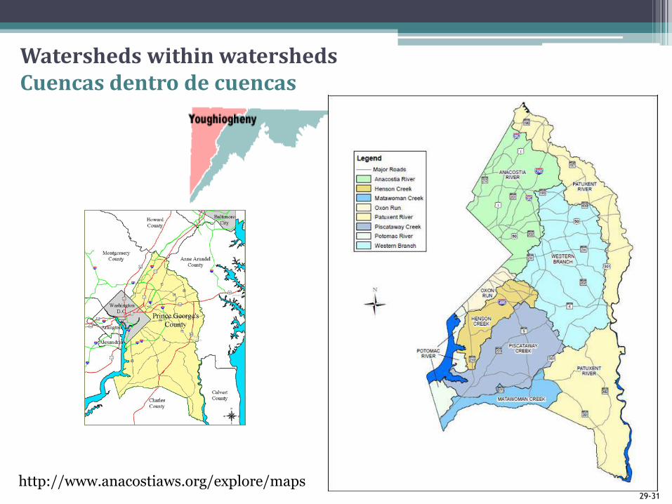
Watersheds within watershedsCuencas dentro de cuencas
1. A watershed only includes the land surface.Una cuenca sólo incluye la superficie terrestre.
2. A watershed is a building for holding run-off water after a rainstorm.Una cuenca es un edificio que sirve para almacenar escorrentía después de que llueve.
3. The way land is used in a watershed affects water quality.La manera en que usamos los terrenos afecta la calidad del agua.
4. Everyone lives in a watershed.Todo el mundo vive en una cuenca.
5. Watersheds are drawn on maps according to political jurisdictions.Las cuencas se dibujan en los mapas siguiendo jurisdicciones políticas.
6. Some watersheds are hilly; others are relatively flat.Algunas cuencas son inclinadas y otras relativamente llanas.
FALSEFALSO
FALSEFALSO
TRUECIERTO
TRUECIERTO
FALSEFALSO
TRUE` CIERTO
Picture References – IncompleteReferencias de las fotos - Parcial
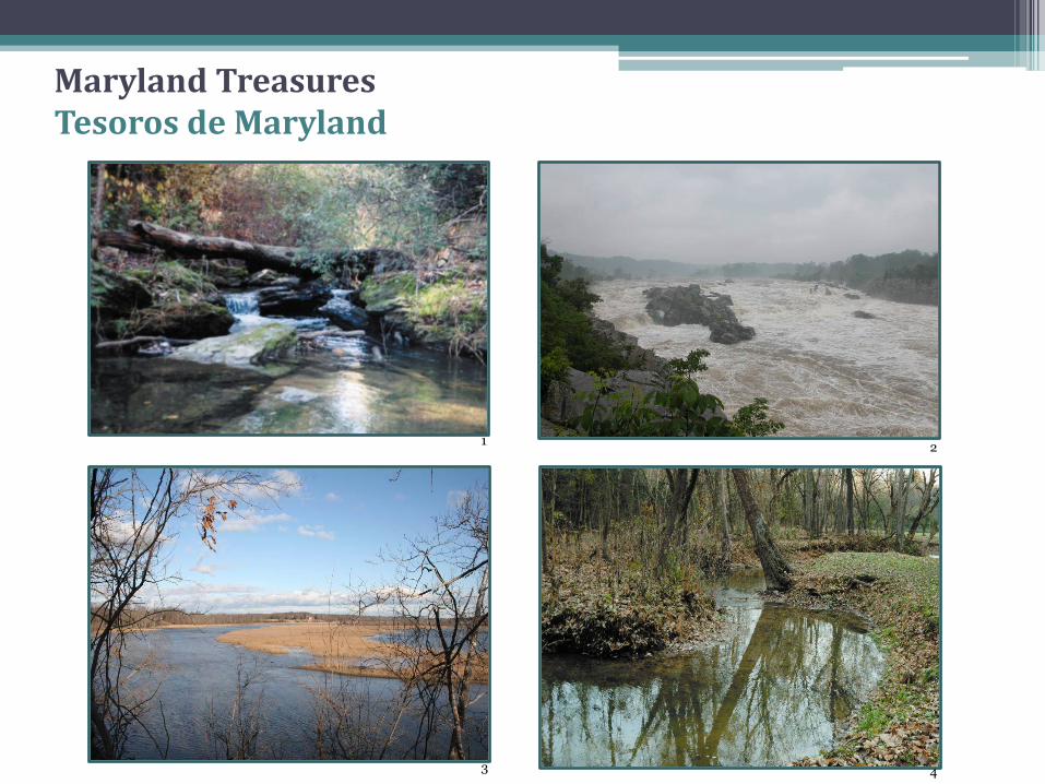
1. Northwest Branch, Montgomery County, MD, Maryland Streams Take a Closer Look, Maryland Department of Natural Resources, Photo Library, Copyright 1999.
2. Great Falls, MD, Maryland Streams Take a Closer Look, MDNR.
3. Patuxent River at Patuxent River Park Overlook, Rebecca Wolf
4. Coastal Plain stream, Maryland Streams Take a Closer Look, MDNR.
5. Maryland Streams Take a Closer Look, MDNR.
6. Maryland Streams Take a Closer Look, MDNR.
7. Maryland Streams Take a Closer Look, MDNR.
8. Alan Bull: channelized stream in Anacostia watershed, Cheverly, MD.
9. Maryland Streams Take a Closer Look, MDNR.
10. Background Photo: Maryland Streams Take a Closer Look, MDNR.
11. Gray Tree Frog, John White, Maryland DNR, <http://www.dnr.state.md.us/wildlife/Plants_Wildlife/herps/Anura/GrayTreeFrog.asp>
12. Mussels, South Carolina Department of Natural Resources <http://www.dnr.sc.gov/fish/species/shellfish/index.html>
13. Brook Trout, Ohio Department of Natural Resources <http://www.dnr.state.oh.us/Home/species_a_to_z/SpeciesGuideIndex/brooktrout/tabid/6574/Default.aspx>
14. Spotted Salamander, John White, Field Guide to Maryland’s Salamanders and Newts, http://www.dnr.state.md.us/wildlife/Plants_Wildlife/herps/Caudata/Spotted.asp