24
1 West Oxfordshire: Draft Local Plan Consultation summary leaflet October 2012 www.westoxon.gov.uk/draftlocalplan

1
West Oxfordshire:Draft Local Plan
Consultation summary leaflet October 2012
www.westoxon.gov.uk/draftlocalplan

2
ContentsIntroduction 3
The key issues 4
Our vision and objectives for the future 4
The overall strategy 8
Providing new homes 10
Transport and movement 11
Environmental and heritage assets 12
Sustainable economic growth 14
Delivering the strategy at the local level 15
3
The draft Local Plan sets out how West Oxfordshire will move forward to 2029 and address issues such as housing and economic growth and climate change.
We want to know what you think of the plan and this summary leaflet has been prepared to provide you with a brief overview including:
• The key issues that need to be addressed;• Our vision and objectives for the future;• The overall strategy;• Providing new homes;• Transport and movement; • Environment and heritage assets; • Sustainable economic growth; and• Delivering the strategy at the local level
The leaflet does not cover all elements of the plan and if you wish to read the full document, it can be viewed online:
www.westoxon.gov.uk/draftlocalplan
Paper copies of the plan are also available to view at:
• West Oxfordshire District Council Offices, Elmfield, New Yatt Road, Witney OX28 1PB
• Witney Town Centre Shop, Welch Way, Witney• Carterton Town Hall, 19 Alvescot Road, Carterton OX18 3JL• The Visitor Information Centres in Burford, Woodstock and
Chipping Norton• All local libraries.
To comment on the draft Local Plan:
www.westoxon.gov.uk/draftlocalplan
Planning Policy West Oxfordshire District Council Elmfield, New Yatt Road Witney OX28 1PB
All comments will be added to our website.
The deadline for commenting is: 5pm on the 19 December 2012
Introduction

Affordable housing, Charlbury
4
The key issuesThe draft plan identifies a range of key issues that need to be addressed in West Oxfordshire up to 2029. These have been identified through various technical studies and previous consultation and include:
• The affordability of housing• Traffic congestion and poor air quality
in some places• Reducing our dependence on travel
by car• Climate change including flood risk• Access to services in rural areas
including the roll out of high speed broadband
• Pressures from nearby centres of growth
• An ageing population• Limited primary school capacity• The need to develop greenfield land to
meet development needs
Our vision and objectives for the futureBuilding on the key issues, the plan sets out a vision of West Oxfordshire in 2029 which is supported by a number of core objectives. These have been identified and refined through extensive consultation with local communities and partner organisations and reflect the West Oxfordshire Sustainable Community Strategy (SCS) ‘Shaping Futures’.

5
To meet the needs of West Oxfordshire’s communities without significant change to the intrinsic character of the District. We want this area to continue to be one of the best places in which to live, work, play and visit.
There will be a network of safe, inclusive, vibrant, well-connected and prosperous market towns and villages within a healthy and attractive environment where new development respects and complements the distinctive character of the area whilst managing the impacts of climate change.
Witney will provide an enhanced range of services and facilities with improved transport infrastructure, whilst maintaining its character and vibrancy as a market town. The town will offer a choice of well-designed housing which meets lifetime needs and benefits from a network of green spaces linking with the surrounding countryside. There will be a diverse range of local employment opportunities to foster sustainable economic growth,
innovation and enterprise and reduce the necessity for commuting to nearby towns and cities. The town centre will be vibrant, attractive, convenient and safe for all users with a wide range of retail and leisure activities on offer and will be well served by parking facilities, frequent bus services and opportunities for walking and cycling.
Carterton will strengthen its role as a service centre meeting the daily needs of its residents and work force, including personnel at the country’s premier military transport airbase, RAF Brize Norton. A choice of well-designed housing which meets lifetime needs will be provided and benefit from a network of green spaces linking with the surrounding countryside and continuing to provide a green buffer between Carterton and nearby villages. Much of the older MOD housing will be replaced with new urban development which will complement Carterton’s enhanced role. The range of services and facilities in the town centre will expand, alongside further improvements in the quality of
the built environment. Local employment opportunities will promote greater levels of inward investment and enterprise.
Chipping Norton will strengthen its role as a centre of enterprise in the northern part of the District. It will continue to be an economically and socially strong market town serving the needs of a large rural area. Its distinctive historic character and fine setting will be conserved and enhanced at the same time as accommodating new development to meet identified needs.
Elsewhere, the distinctive qualities of the District’s other towns and villages will be protected and, where possible, enhanced. The larger towns and villages will accommodate growth of an appropriate scale and type to help ensure their future prosperity and that of the rural areas around them. New affordable housing for local families and development specifically to meet the needs of older people will be delivered to help maintain the vibrancy of rural communities.
Do you support our vision for West Oxfordshire?Our vision for the future

6
The following core objectives will help to deliver the vision:
1. Strong market towns and villages
CO1 Provide new development, services and facilities of an appropriate scale and type in locations which will help improve the quality of life of local communities and where the need to travel, particularly by car, can be minimised.
CO2 Locate new residential development where it will best help to meet local housing needs.
2. Meeting the specific housing needs of our communities
CO3 Ensure the timely delivery of new housing to meet forecast needs and support sustainable economic growth.
CO4 Plan for an appropriate mix of new residential accommodation which provides a variety of sizes, types and affordability with special emphasis on the provision of homes for local people in housing need who cannot afford to buy or rent at market prices including those wishing to self-build, as well as homes to meet the needs of older people, newly forming households and travelling communities.
Core objectives
7
3. Sustainable communities with access to services and facilities
CO5 Promote inclusive, healthy, safe and crime free communities.
CO6 Ensure that land is not released for new development until the supporting infrastructure and facilities are secured.
CO7 Maximise the opportunity for walking, cycling and use of public transport.
CO8 Achieve sustainable economic growth which improves the balance between housing and local jobs, provides a diversity of local employment opportunities, removes potential barriers to investment and provides flexibility to adapt to changing economic needs.
CO9 Achieve a prosperous and sustainable tourism economy.
CO10 Promote safe, vibrant and prosperous town centres and resist proposals that would damage their vitality and viability or adversely affect measures to improve the centres.
CO11 Maintain or improve where possible the health and wellbeing of the District’s residents through increased choice and quality of shopping, leisure, recreation, arts, cultural and community facilities.
CO12 Improve access to services and facilities without unacceptably impacting upon the character and resources of West Oxfordshire.
4. Protecting and enhancing our environment and reducing the impact from climate change
CO13 Conserve and enhance the high environmental quality of West Oxfordshire with protection and promotion of its diverse landscape, biodiversity and geological conservation interests, and its local cultural, heritage and environmental assets.
CO14 Reduce the causes and adverse impacts of climate change, especially flood risk.
CO15 Achieve improvements in water and air quality.
CO16 Minimise use of non-renewable natural resources and promote more widespread use of renewable energy solutions.
CO17 Improve the sustainable design and construction of new development, including improving energy, water efficiency and water management.
CO18 Ensure that new developments are suitably located and well designed to protect and enhance the individual form, character and identity of our towns and villages as well as contributing to the quality of life in West Oxfordshire.
Do you support our core objectives?

8
The plan sets out an overall strategy is based on five key principles:
1. A presumption in favour of sustainable development
Sustainable development is about balancing economic, social and environmental considerations so that current needs are met without putting at risk the needs of future generations. The plan is based on a ‘presumption in favour of sustainable development’ in other words development that is considered ‘sustainable’ will be allowed to go ahead.
2. Locating development in the right places
One of the main roles of the plan is to identify where new development will take place which can affect where people live, work, travel and spend their leisure time. The plan splits the District into ‘sub-areas’:
• Witney sub-area• Carterton sub-area• Chipping Norton sub-area• Eynsham - Woodstock sub-area• Burford - Charlbury sub-area
These areas are shown on the plan (right).
Having regard to previous consultation and evidence gathering, the plan seeks to focus most new development at Witney, Carterton and Chipping Norton because these towns offer the widest range of services and facilities, have suitable development sites available, are accessible by a choice of transport and offer the greatest range of job opportunities.
Growth elsewhere will be of a more modest scale.
3. Prudent use of natural resourcesAs a planet we are living beyond our means, consuming natural resources quicker than they can be replenished. We need to reduce our impact and the local plan requires all development to show efficient and prudent use of natural resources and to achieve high standards of sustainable design and construction.
4. High quality designWest Oxfordshire’s towns, villages and countryside have a distinctive character that is worthy of special protection and the plan expects all proposals to achieve a high quality of design that respects and contribute to local distinctiveness and, where possible, enhances the surroundings.
The overall strategy

© C
row
n co
pyrig
ht.
All
right
s re
serv
ed L
A 1
0002
4316
201
2
9
5. Supporting infrastructureAll new development, even a single new home puts existing services such as schools and roads under pressure. The plan therefore seeks to ensure that all new development is supported by the right level of investment in new and improved infrastructure.

10
New homes: how many and where? The plan provides for at least 5,500 new homes between 2011 and 2029 equating to just over 300 per year. Of these, around 350 have already been built, leaving just over 5,000 new homes to be provided. This level of growth strikes a balance between increasing housing supply, affordability and economic growth and the availability of suitable land, infrastructure and environmental impact. Lower and higher levels of growth have been tested and ruled out.
In accordance with the overall strategy, most new homes will be built at the three main towns with more modest growth elsewhere.
The table right shows how many homes are expected in each area.
LocationNo. of homes
Witney sub-area 1,900
Carterton sub-area 1,850
Chipping Norton sub-area 600
Eynsham - Woodstock sub-area 450
Burford - Charlbury sub-area 350
Around 1,200 of these are already in the pipeline through existing planning permissions and allocations. In the Witney sub-area, strategic housing sites are identified at West Witney (1,000 homes) and East Witney (300 homes) and in the Carterton sub-area, strategic housing sites are identified at East Carterton (700 homes) and on MOD land in the centre of the town (400 homes).
More information on the strategic sites is set out later on.
In the Chipping Norton sub-area, we will leave it for the ongoing Neighbourhood
Plan to determine the most appropriate locations for future growth at Chipping Norton.
In the two more rural sub-areas, development will be focused predominantly on the larger centres and villages.
What type of new homes? The plan aims to provide a good mix of new homes that balances the increasing trend towards smaller households with the need for family housing.
Affordable housingHouse prices in West Oxfordshire are higher than average and in some parts of the District even relatively modest properties are beyond the reach of many households. Increasing the supply of affordable housing is a key priority for West Oxfordshire and the plan requires any housing scheme of one or more dwellings (net) to make provision.
Providing new homes

11
On average, around 35% of new housing built will be affordable although the requirement varies from 35% at Carterton to 40% at Witney and 50% across the rest of the District. For very small sites of 1-5 dwellings, the Council will not insist on affordable housing being provided on site and will instead be prepared to accept a financial contribution.
Travelling communitiesThe plan aims to ensure that the housing needs of the whole community are met. Proposals for travelling communities such as gypsies, travellers and travelling showpeople will be allowed where they have good access to services and facilities, are well located for roads and public transport and of an appropriate scale and would not conflict with Green Belt objectives.
Transport is a key issue for West Oxfordshire and although there are opportunities for walking, cycling and using public transport, there is a general reliance on the car which contributes towards traffic congestion and poor air quality in some places and climate change more generally. The plan seeks to encourage more sustainable travel such as walking, cycling and public transport whilst recognising that because of the rural nature of the District, the private car will continue to play a key role.
Transport and movement
Madley Park, Witney

12
A key characteristic of West Oxfordshire is the quality and diversity of its natural and historic environment. One of the biggest challenges for the Local Plan is to protect, sustain and enhance this environment whilst accommodating necessary development.
Landscape characterWest Oxfordshire is renowned for its gentle scenic beauty, about a third of which falls within the Cotswolds AONB. Conserving and enhancing the quality of the landscape whilst supporting suitably located and designed development is a key aim of the plan.
The plan gives special attention to three areas; the Lower Windrush Valley Project Area (an area of major landscape change associated with mineral extraction); the Windrush in Witney Project Area (a fundamental component of the town’s attractive character) and the Wychwood Project Area (a project that aims to revive the landscape character and mix
of habitats found in the area during the Middle Ages).
These three areas, together with the Cotswolds AONB, will continue to be identified for special landscape protection and enhancement.
BiodiversityWest Oxfordshire contains a rich variety of habitats, not just within designated sites but across the District as a whole. The draft plan aims to protect overall biodiversity whilst actively pursuing net gains where possible.
Public realm and green infrastructureAs a predominantly rural district, it is not surprising that West Oxfordshire has a wide variety of green space, however not all of it is publicly or easily accessible. The draft plan seeks to protect and enhance the District’s assets whilst providing for new multi-functional areas of green space particularly through new development.
Decentralised, renewable and low carbon energyIn order to help tackle climate change, the draft plan encourages renewable and low-carbon energy developments in appropriate locations. New developments of 10 or more dwellings or more than 1,000m2 for non-residential schemes will be required to secure at least 10% of their energy from decentralised and renewable or low-carbon sources unless it is not feasible.
Flood riskThere are several rivers flowing through West Oxfordshire which form part of the setting of many towns and villages, are important corridors for biodiversity and provide opportunities for tourism and leisure. However they also present a flood risk, with severe flooding events affecting many communities in 2007. In line with national policy, the draft plan adopts a ‘sequential’, risk-based approach, whereby new development is steered
Environmental and heritage assets
13
towards low flood risk areas in preference to higher risk areas. Where appropriate, development proposals will need to be supported by a flood risk assessment and the use of ‘sustainable drainage’ which can reduce surface water flooding will be required in all new development.
Environmental protectionProtecting West Oxfordshire’s high environmental quality is an important objective of the draft plan. New development will be expected to be appropriate for its location and take into account the potential effects of pollution on health, the natural environment and general amenity. Regard must be had to air quality, ground contamination, soil quality, noise, water resources and light pollution.
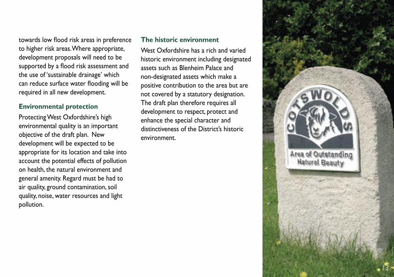
The historic environmentWest Oxfordshire has a rich and varied historic environment including designated assets such as Blenheim Palace and non-designated assets which make a positive contribution to the area but are not covered by a statutory designation. The draft plan therefore requires all development to respect, protect and enhance the special character and distinctiveness of the District’s historic environment.
13

14
West Oxfordshire has a successful local economy and is weathering the recession relatively well. However, major business growth elsewhere means we must remain competitive and the plan includes an economic vision based on providing a flexible supply of business land, tackling transport congestion, improving the availability of high-speed broadband and mobile connectivity, a skilled and ‘work-ready’ labour force, protecting our town and village centres and promoting the visitor and rural economy.
Land for businessThe plan provides for around 60 hectares of new business land, most of which will come forward at the three main towns but also through organic growth across the rest of the District. Existing employment sites will be safeguarded provided there is an ongoing prospect of continued use.
Supporting the rural economyOur rural areas are attractive places to live but we must seek to ensure that they remain attractive places to work so that rural communities remain vibrant. The draft plan adopts a positive approach towards home and flexible working, small rural businesses, diversification and the re-use of buildings in appropriate locations. The Council will also work in partnership to improve broadband and mobile telecommunications in rural areas.
TourismTourism is an important and growing sector in West Oxfordshire estimated to be worth over £250 million to the local economy each year. In the interest of reducing the need to travel and providing benefits to local communities, the plan encourages new tourist facilities within or close to existing towns and villages although proposals in open countryside may be justified where there is a link to a particular countryside attraction or diversification scheme.
Local services and community facilitiesLocal services such as village shops, post offices and pubs are vital for meeting the day to day needs of residents in rural areas such as West Oxfordshire. Many places have experienced closures in recent years and the plan aims to resist the loss of such facilities, which will only be allowed where it can be shown that they are no longer viable or needed.
Protecting and enhancing our town centresWest Oxfordshire has many vibrant town and village centres however the traditional ‘high street’ faces a number of challenges including less consumer spending and increased competition from the internet and other centres such as Oxford. The plan therefore seeks to protect our town and village centres and resist inappropriate development that might put them at risk.
Sustainable economic growth

1515
Delivering the strategy at the local levelHaving set out the overall strategy, the plan goes into more detail about what will happen in each of the five sub-areas.
Burford - Charlbury sub-areaThis area will be expected to accommodate more modest growth of around 350 new homes with the main focus being the rural service centres of Burford and Charlbury as well as the larger villages. Key elements of the strategy for this area include the protection of the Cotswolds AONB, Upper Windrush Valley and Wychwood Project Area, enhancing opportunities for public transport, walking and cycling, reducing flood risk, supporting tourism and rural diversification and protecting local services and facilities.
Chipping Norton sub-areaAround 600 new homes will be provided with most coming forward at Chipping Norton. The plan does not identify specific locations and instead leaves it for the local community to determine the most suitable locations through the Chipping Norton Neighbourhood Plan. To balance jobs with new homes, the plan aims to provide around 5 hectares of business land to the east of the town.
The plan does not identify a need for any new shops although existing shops will be protected in the primary core with a mix of shops and complimentary uses in adjoining areas.
In transport terms the plan aims to reduce the impact of through traffic especially lorries, on the town centre and in terms of the environment, the plan aims to protect Chipping Norton’s landscape setting and heritage assets including the Cotswolds Area of Outstanding Natural Beauty which covers much of the town.
Eynsham - Woodstock sub-areaThis area will be expected to accommodate more modest growth of around 450 new homes with the main focus being the rural service centres of Eynsham, Long Hanborough and Woodstock as well as the larger villages. Key elements of the strategy for this area include the protection of the natural and historic environment including the Oxford Green Belt, the Cotswolds AONB and the Blenheim World Heritage Site, enhancing opportunities for public transport, walking and cycling, protecting local services and facilities, ensuring Woodstock town centre remains vibrant and reducing flood risk whilst supporting appropriate and sensitive tourism and leisure proposals along the River Thames.

Proposed housing
Strategic development area
Employment site
Biodiversity Target Area
Landscape buffer
Scheduled Ancient Monument
New junction and other highways improvements
Land safeguarded for potential:
Park and Ride scheme
New link road
KEY:
16
Witney sub-areaIn the Witney sub-area, most future growth will be directed towards Witney itself. However, because there is limited land available within the town it will be necessary to develop greenfield land on the edge of the town. Various options have been considered including land to the east, north, west and south of the town and following a detailed assessment the plan identifies two strategic sites including West Witney (1,000 homes) and East Witney (300 homes). These sites offer a number of potential advantages not shared by the other options.
To balance the increase in housing the plan aims to increase the supply of jobs with 10 hectares of new business land to be provided as part of the strategic site at West Witney.
Transport is a key issue for Witney and there is a need to resolve the congestion problems currently experienced in some parts of the town. Previous plans have
identified the Cogges Link Road (CLR) scheme but a recent decision means this will no longer go ahead. The draft plan identifies a combination of alternative measures including a new four way junction onto the A40 at Down’s Road, west facing slip roads at Shore’s Green and improvements in the Ducklington Lane/Station Lane area.
In terms of shopping and leisure, Witney will continue to remain the key destination for West Oxfordshire and will be a focus for new development. Further town centre development will be accommodated through extension of the Woolgate shopping centre and at Welch Way, opposite Marriot’s Walk. Within the primary shopping core, shops will be protected and elsewhere, shops and other complimentary uses will be encouraged.
Delivering the strategy at the local level cont...

Land reserved for potential Park and Ride.
Land reserved for West End Link Road.
New employment and leisure development.
Mainly employment development on available land.
1,000 homes, new school facilities, open space and land for business.
Golf course
A40
Witney
Burford Rd
Woo
dsto
ck R
d
A40 Thorney Leys
Deer Park
Win
drus
h Vall
ey Cogges
Madley Park
Curbridge
Town centre
A40
300 homes, open space and landscaping.
© C
row
n co
pyrig
ht.
All
right
s re
serv
ed L
A 1
0002
4316
201
2
17

Proposed housing
Other development site
Strategic development area
Employment site
Biodiversity Target Area
Landscape buffer
New junction and other highways improvements
Land safeguarded for potential new link road
KEY:
18
Carterton sub-areaIn the Carterton sub-area, most future growth will be directed towards Carterton itself. Within Carterton, the MOD have recently stated that some of their land which was previously reserved for service families only, is now likely to be released to the open market. The redevelopment of MOD land has previously been well-supported through consultation. The draft plan therefore identifies the MOD land known as REEMA North and REEMA Central as a strategic site to deliver an additional 400 homes (over and above those already there).
To meet the overall housing requirement some development will be needed on the edge of the town and various options have been considered including land to the east, north and west of the town. Following a detailed assessment the plan identifies a strategic site at East Carterton (700). The site is considered to offer a number of advantages not shared by the other options.
Existing employment land is considered to be sufficient for Carterton although this will be kept under review.
The plan aims to deliver a stronger and more attractive town centre with land in the south west quarter identified for new shops and associated uses. The plan identifies the potential extension of the leisure centre and contributions will be sought from new development where appropriate.
The plan identifies the potential to provide ‘A-road’ access to Carterton from the A40 which Oxfordshire County Council are currently exploring and depending on the outcome of that work a new link road may be needed to the north of Brize Norton Village. Improved pedestrian and cycle links will be provided including a potential cycle link between Carterton and Witney.
Environmental considerations in this sub-area include mineral extraction, the use of the River Thames for tourism and leisure, a desire to improve the biodiversity and leisure value of the Shill Brook Valley and the need to avoid development that increases the risk of flooding.
Delivering the strategy at the local level cont...

Redevelopment of large areas of substandard MOD housing (REEMA North/Central) - 400 homes
Focus on enhancing the biodiversity and leisure value of the Shill Brook Valley.
Maintain a landscape buffer on the northern edge between Carterton and Brize Norton to form an extension to the country park.
Carterton
Alvescot Road
Brize Norton Rd
Upavon Way
Mon
ahan
Way
Carterton Rd
Mon
ahan
Way
Carterton Rd
Promote new job opportunities using available employment land.
Brize Norton Village
Alvescot Road
Improve the town centre with new shops. A site has been identifi ed and a project is underway to deliver new development.
RAF Brize Norton is an integral part of the local community. Its expansion is positive for the local economy.
MOD
Country Park
Shill
Broo
k Vall
ey
Shilton Village
Town centre
East Carterton site -700 homes, new primary school and open space.
200 new homes and new link road already planned.
Shilton Park
© C
row
n co
pyrig
ht.
All
right
s re
serv
ed L
A 1
0002
4316
201
2
19

20
www.westoxon.gov.uk/draftlocalplan
Planning Policy West Oxfordshire District Council Elmfield, New Yatt Road Witney OX28 1PB
All comments will be added to our website.
The deadline for commenting is: 5pm on the 19 December 2012
To comment on the draft Local Plan:

21
Marriotts Walk, Witney

22
Space for your notes:

23

24
www.westoxon.gov.uk/draftlocalplan
We are happy to provide this information in other formats. Please contact us if this is required.
Planning Policy West Oxfordshire District Council
Elmfield, New Yatt Road Witney OX28 1PB


