UNESCO International Hydrological Programme - World Water Forum - Marseille, 13 March 2012 Alice Aureli Chief Groundwater Resources and Aquifer Systems Section Natural Science Sector – Water Division
Transcript
UNESCO International Hydrological Programme
- World Water Forum - Marseille, 13 March 2012
Alice Aureli Chief Groundwater Resources and Aquifer Systems Section Natural Science Sector – Water Division
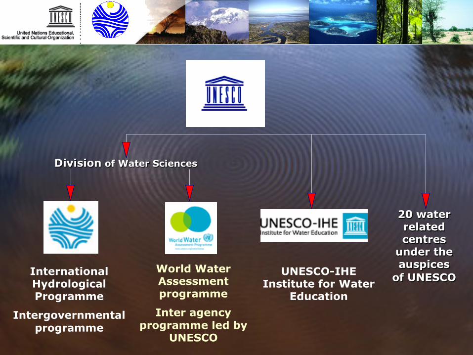
Division of Water Sciences
International Hydrological Programme
Intergovernmental programme
World Water Assessment programme
Inter agency programme led by
UNESCO
UNESCO-IHE Institute for Water
Education
20 water related centres
under the auspices
of UNESCO
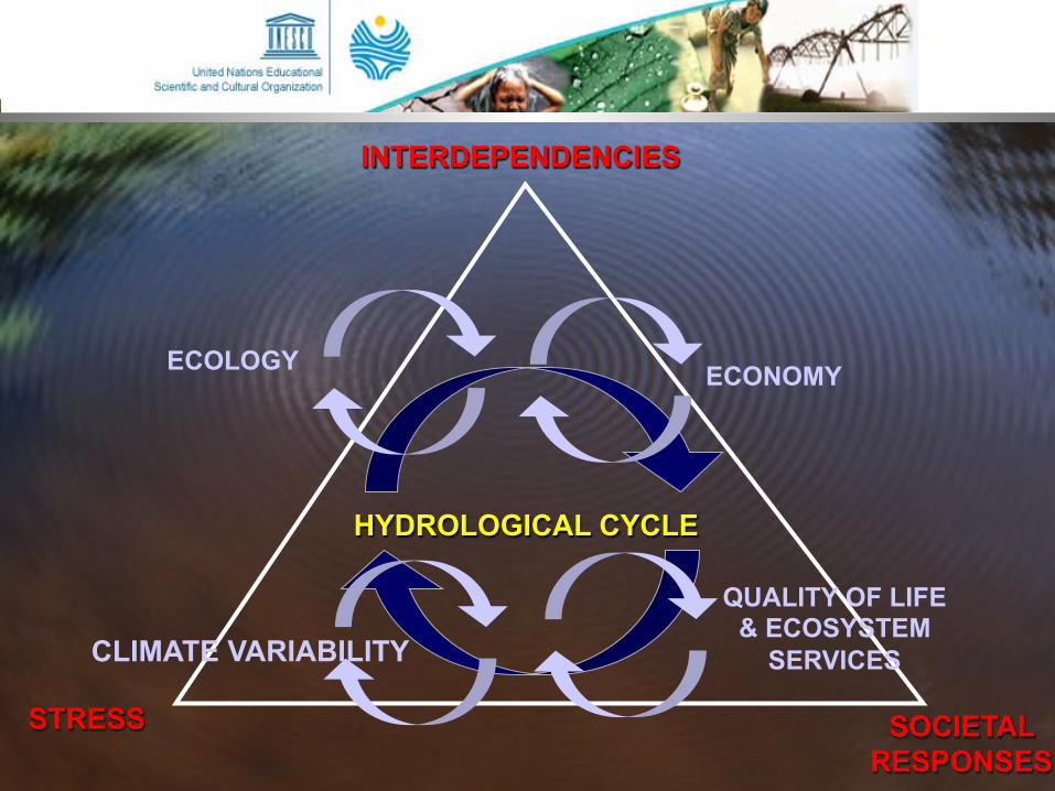
IHP-VII (2008-2013) Water Dependencies: Systems under Stress and Societal Responses
Cross - cutting Programmes
HELP / FRIEND
THEME IV: Water and Life Support Systems
THEME III: Ecohydrology for
Sustainability
THEME II: Strengthening Water
Governance for Sustainability
THEME I: Adapting to the impacts of global
changes on river basins and aquifer systems
Hydrological Research
Water Resources Management
IHP - VII
IHP VI Initiatives PC - CP
ISI IFI
ICHARM G - WADI
IAHS
THEME V: Water Education for
Sustainable Development
Education, Transfer of knowledge, Capacity building
INTERDEPENDENCIES
SOCIETAL RESPONSES
STRESS
HYDROLOGICAL CYCLE
ECONOMY ECOLOGY
CLIMATE VARIABILITY
QUALITY OF LIFE & ECOSYSTEM
SERVICES
IHP Programme Groundwater Resources - IWRM
Environmental Sustainability
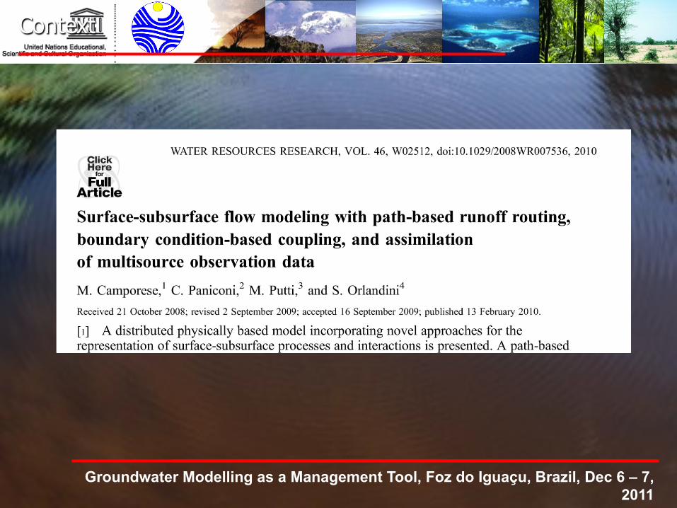
Context
Surface and subsurface waters are not isolated components of the hydrologic system, but interact in response to topographic, soil, geologic, and climatic factors.
The interaction of groundwater and surface flow is a key focus of interest for: • Hydrology (e.g., runoff generation,
groundwater recharge, evaporation) • Geomorphology (e.g., soil erosion, action of
groundwater seepage on channel initiation) • Water resources management (under the
effects of land use, demography, and climate changes)
• Water quality (e.g., role hyporheic fluxes in aquatic habitats
Groundwater Modelling as a Management Tool,
Context
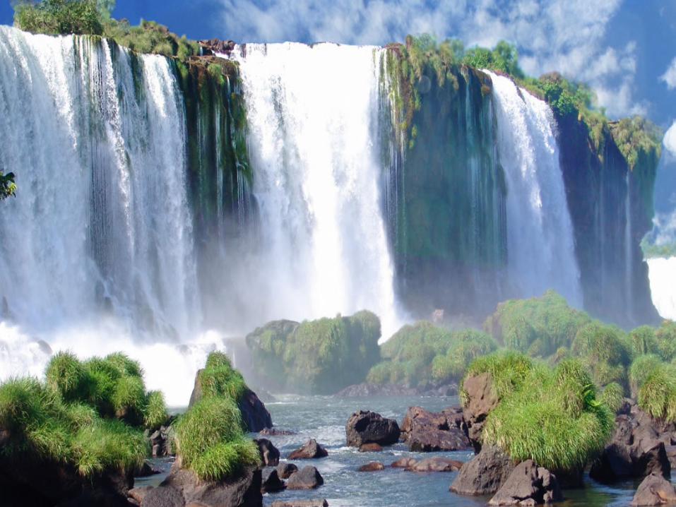
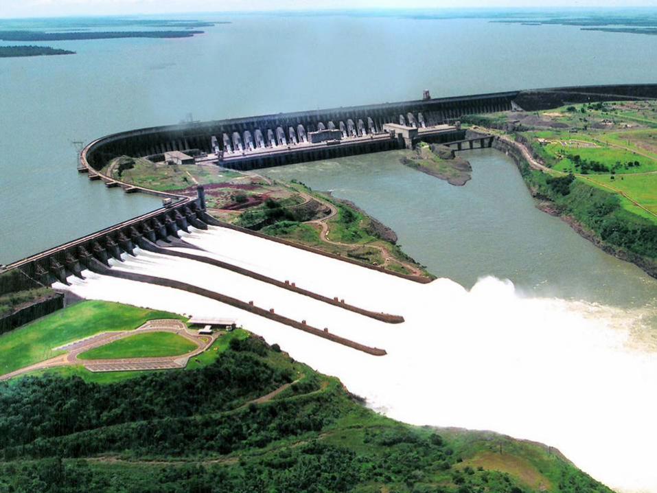
Groundwater Modelling as a Management Tool, Foz do Iguaçu, Brazil, Dec 6 – 7, 2011
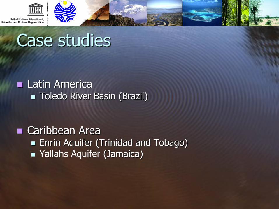
Case studies
n Latin America n Toledo River Basin (Brazil)
n Caribbean Area n Enrin Aquifer (Trinidad and Tobago) n Yallahs Aquifer (Jamaica)
Caribbean
Adoption measures to climate change impacts on Coastal aquifer systems in the Caribbean
n Modflow Model
n Caribbean Area n Enrin Aquifer (Trinidad and Tobago) n Yallahs Aquiferuifer (Jamaica) Sea Water Intrusion
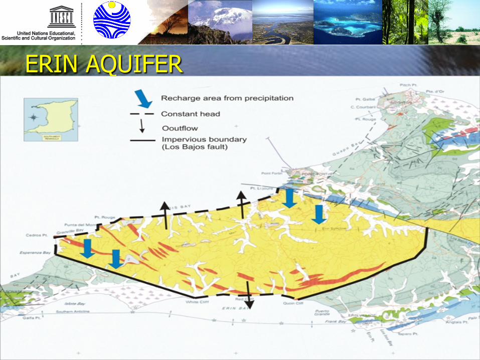
ERIN AQUIFER
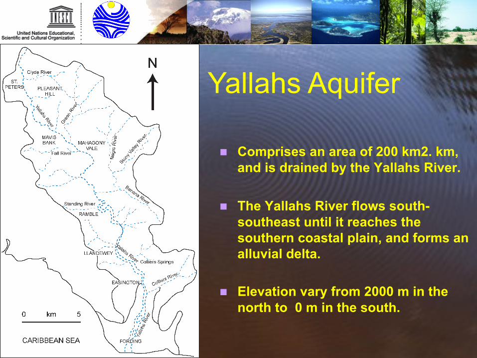
n Comprises an area of 200 km2. km,
and is drained by the Yallahs River.
n The Yallahs River flows south-southeast until it reaches the southern coastal plain, and forms an alluvial delta.
n Elevation vary from 2000 m in the north to 0 m in the south.
Yallahs Aquifer
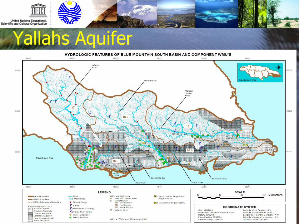
Yallahs Aquifer
Toledo River Basin
Toledo River Basin
Interaction between surface water and Groundwater facing with different
Climate change scenario.
Integrated Environmental Assessment of Agricultural and Farming Production Systems in
the Toledo River Basin (Brazil)
n Cathy Model
UNESCO Programme Specialist: Salvatore D’Angelo
Parthenope University Team:
Pier Paolo Franzese Otávio Cavalett
Tiina Häyhä
Integrated Environmental Assessment of Agricultural
and Farming Production Systems
in the Toledo River Basin (Brazil)
Conclusion
n Investing on Groundwater resources studies and aquifer systems assessment
n Multi- criteria Integrated Assessment Framework
n Win Win Win Strategy : environment, economics and social issues