WR Decision Support Activities NOAA/NWS Glasgow, MT Steven L. Apfel, MIC – 8/04/09 HIE Supercell Hail Storm – June 16, 2007 $34.2 Million in Damage in Valley County (Glasgow) HIE Heavy Snow Storm – October 10-13, 2008 15.7” Snow GGW
Transcript
WR Decision Support ActivitiesNOAA/NWS Glasgow, MT
Steven L. Apfel, MIC – 8/04/09
HIE Supercell Hail Storm – June 16, 2007 $34.2 Million in Damage in Valley County (Glasgow)
HIE Heavy Snow Storm – October 10-13, 2008 15.7” Snow GGW
• A HIGH IMPACT EVENT (HIE) is a locally significant event where the community or a local customer, or an economic sector, is substantially affected and/or mitigating actions are necessary; and the opportunity exists for the NWS to take a DECISION SUPPORT ACTION (DSA). Events covered by our advisory and warning program are a subset of all HIEs.
• A DECISION SUPPORT ACTION (DSA) occurs when the NWS takes an active role to enhance NWS products/services for use by decision makers during HIEs, such as:
- Changing priority focus - Redirecting (ramping up) operations - Initiating briefings (GoTo Meetings/Outreach) - Above and beyond daily routine (but a part of culture)
Impacts on Society – Central Montana in the News Courtesy of WFO Great Falls, MT 4/30/2009
WFO Glasgow, Mt Arctic Blizzard 12/15/08
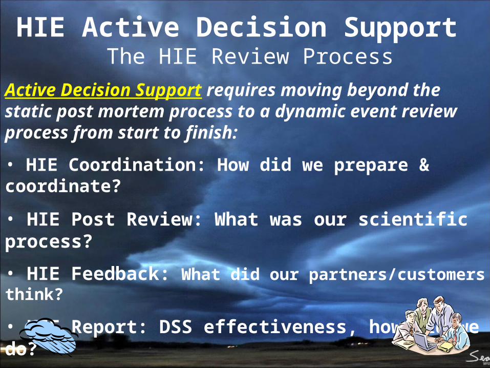
HIE Active Decision Support The HIE Review Process
Active Decision Support requires moving beyond the static post mortem process to a dynamic event review process from start to finish:
• HIE Coordination: How did we prepare & coordinate?
• HIE Post Review: What was our scientific process?
• HIE Feedback: What did our partners/customers think?
• HIE Report: DSS effectiveness, how did we do?
• HIE Collaboration: Share, Learn, Improve
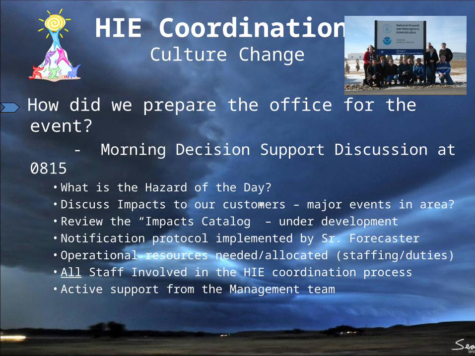
HIE Coordination Culture Change
How did we prepare the office for the event? - Morning Decision Support Discussion at 0815
• What is the Hazard of the Day?• Discuss Impacts to our customers – major events in area?• Review the “Impacts Catalog” – under development• Notification protocol implemented by Sr. Forecaster• Operational resources needed/allocated (staffing/duties)• All Staff Involved in the HIE coordination process • Active support from the Management team
HIE Coordination Impacts Catalog
• Formed Impact Catalog workgroup with 12 members• Members volunteered for one of 12 counties in the CWA• County Pre-disaster mitigation plans used for templates• Goal is to combine hazards and impacts into one database (Inter-Regional Integrated Services Database)
Examples of Current HIEs from the GGW Hazardous Weather Operatons Plan:
• Moderate Risk of Severe Weather from SPC • Major winter storm events affecting a widespread
area• Significant heat or cold event • Major Red Flag Warning Event during on-going
wildfires • Widespread flooding from heavy rains, ice jams • Others as deemed significant by forecast staff ie. or
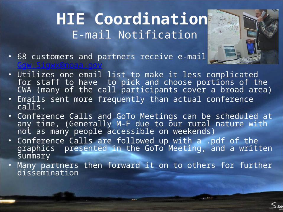
• Utilizes one email list to make it less complicated for staff to have to pick and choose portions of the CWA (many of the call participants cover a broad area)
• Emails sent more frequently than actual conference calls. • Conference Calls and GoTo Meetings can be scheduled at any
time, (Generally M-F due to our rural nature with not as many people accessible on weekends)
• Conference Calls are followed up with a .pdf of the graphics presented in the GoTo Meeting, and a written summary
• Many partners then forward it on to others for further dissemination
• Did we identify impacts? Screaming message, impacts catalog
• Did we answer questions? Yes/No If no, follow-up with our partners/customers
• TEAM effort with Management? MIC/SOO/WCM support, participation, leadership
• Timely briefing and discussion? Limit to 15 min or less
• Follow-up information provided? Provide .pdf presentation via e-mail
HIE Post ReviewThe Science
• HIE Post Review Focal Point Sr. Forecaster and SOO initiate review process, gather data, interview staff
• HIE Data Archived for WES E-shift log, dates chosen, dvd burn
• SOO Facilitates Review Focal point and ops staff meetings
• Due Date Established ~Two weeks start to finish, flexible
• HIE Review written Team effort, ops staff working the event, SOO, HIE Focal point
• HIE Review Final Edit Reviewed and edited by SOO/WCM/MIC
• HIE Post Review Published to Intranet SOO corner, easily reviewed by all staff, HIE Review library, train new staff
HIE Post Review Sharing and Learning
HIE FeedbackCustomers and Partners
• Partners: Disaster and Emergency Services (DES), BLM, USFS, USFWS, MDT, USACOE, Ag Extension Svc, FWP, Fire Depts, Local gov
• Formal Decision Support feedback started with October 10-13 HIE Heavy Snow Storm
– Pros: Finding out specific information from our partners and customers on the decisions they made and actions they took based on our information
– Cons: Don’t have a way to do this formally with the general public. NWS Duluth PSS model is something that could be done nationwide for all hazard types
• HIE Survey Questions included:– How and When did you first hear about the event?– Did you participate in the briefings and/or did you use
the email follow up with the briefing and a written summary?
– What did you do with the information when you got it?– What impacts did you experience from the event?– What did we do well? Where do we need to improve?– Other general comments or suggestions?
HIE ReportSummary Reference Document
•WCM Drafts Report
•Report completed within 5 days
•Partner Feedback Incorporated•Societal Impacts Verification Data
•Report Shared with Staff
•Mgmt Team Reviews Report
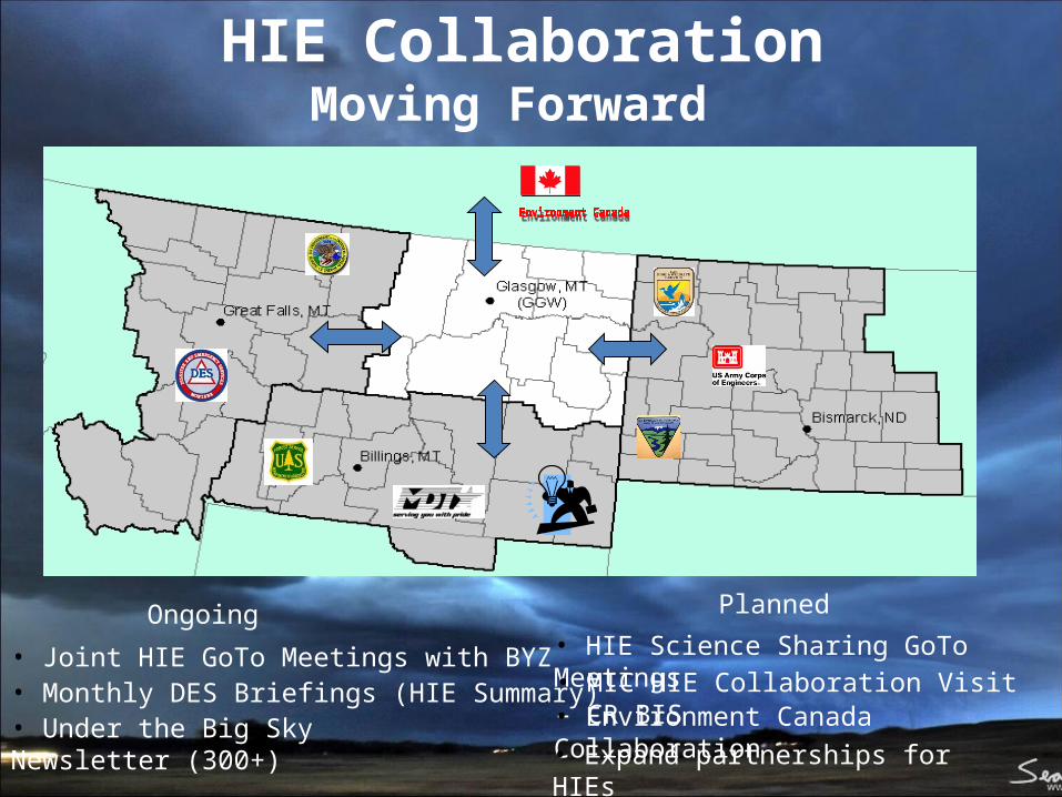
HIE CollaborationMoving Forward
• Joint HIE GoTo Meetings with BYZ• Monthly DES Briefings (HIE Summary)
Ongoing
• Under the Big Sky Newsletter (300+)
Planned
• HIE Science Sharing GoTo Meetings• MIC HIE Collaboration Visit – CR BIS• Environment Canada Collaboration• Expand partnerships for HIEs
• Published every two-three weeks• 3-5 pages in length• Short paragraphs, links to longer
information• Highlight local weather, office outreach
and happening, NOAA News Releases, US and Global Weather Stories of interest
• Includes about 400 recipients in the mailing list– Weather spotters– Partners (EM, Public Health, Hydro,
Fire, Local/State/Fed Government)– Weather enthusiasts from other parts
of the country– Some NWS personnel
Graphical Weather Story• Glasgow will implement mid-August, following one-on-one staff training.• Western Region has developed software tools to display descriptive graphical forecasts on the public internet page.• Software is generally easy to use and even fun for forecasters.
- FXC software to create images runs onAWIPS and has access toall operational data
- Here, radar data was used along with selected icons and a manually drawn front
- FXC is run from an AWIPS work station
- Graphic is created in FXC
- Graphic is sent to public web page using the “publish” button
- A headline is generated for the graphic from the WR online headline generator, which links to the image from the front page.
- Multiple images can be used
- At GGW, creation of graphics is not routine, but is event-driven
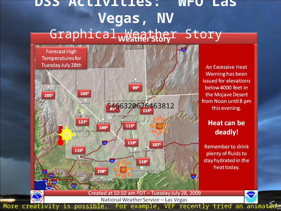
• More creativity is possible. For example, VEF recently tried an animated GIF:
5466320626463812
DSS Activities: WFO Las Vegas, NVGraphical Weather Story
DSS Activities: WFO Great Falls, MT Weather Story/Headline Generator
DSS Activities: Situational Awareness
WFO GGW Western Region Sharepoint Server web page – Sharing information with Field and WRH
Foyer display running FLARE (Fully Localized Atmospheric Research Environment)
52” LCD Situational Awareness Display in WFO Glasgow, MT Operations area
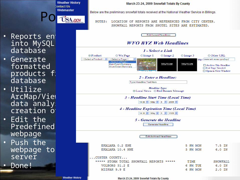
DSS Activities: WFO Billings, MTWEB Headlines
• Continue Weather Story graphic on front page of web site
• Screaming Red Banner Message– Software developed by
Randy Weatherly and Mike Seaman and WFO Salt Lake City
• Reports entered into MySQL database
• Generate formatted products from database
• Utilize ArcMap/View for data analysis & creation of map
• Edit the Predefined webpage
• Push the webpage to server
• Done!
Post Event Summaries
DSS Activities: WFO Reno, NVOnline Weather Briefings using Articulate
• Briefing no more than 5 slides/4 minutes long…we have short attention spans!
• Simple graphics: MSLP, jet stream, QPF, PW from model + GFE StormTotalQPF, StormTotalSnow, wind gust grids are used
• Screen captures → script takes AWIPS images to LAN.
• Arrows, circles, and other annotations key to getting point across; must make links from weather to impact!
• Use notes section in PowerPoint for narration text; appears in Articulate as your record.
• Ideally process should take 1 - 1.5 hours• AWIPS/Web screen captures + PowerPoint +
Articulate = Awesome Briefing• Ideally produced on the day shift with extra
staffing available.• No later than 2 pm local time; benefit to media• When? → pronounced societal impact
– Major winter storms, winter advisory situations during rush hour/holiday travel, high wind warnings
– Anticipated: significant severe thunderstorms, widespread river flooding, serious fire weather days Link to last briefing
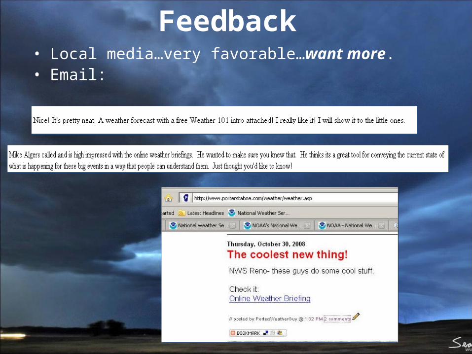
Feedback • Local media…very favorable…want more.• Email: