10
SGG 2443 PRI NCI PLES OF GEOGRAPHI C I NFORMATI ON SCI ENCE LECTURE 4 – SUBSYSTEMS I N GI S Assoc Prof Mohamad Nor Said [email protected]
| Date post: | 22-Mar-2023 |
| Category: |
Documents |
| Upload: | khangminh22 |
| View: | 0 times |
| Download: | 0 times |
SGG 2443
PRI NCI PLES OF GEOGRAPHI C I NFORMATI ON SCI ENCE
LECTURE 4 – SUBSYSTEMS I N GI S
Assoc Prof Mohamad Nor [email protected]
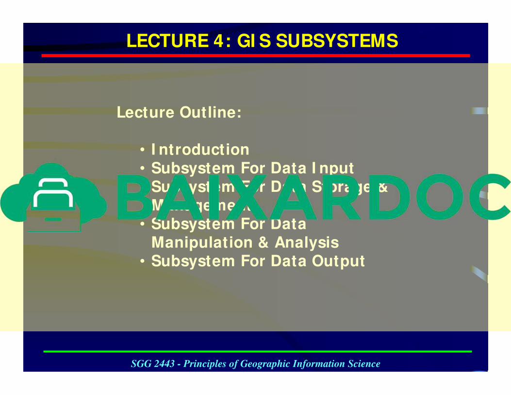
Lecture Outline:
• I ntroduction• Subsystem For Data I nput • Subsystem For Data Storage &
Management• Subsystem For Data
Manipulation & Analysis• Subsystem For Data Output
LECTURE 4: GI S SUBSYSTEMS
SGG 2443 - Principles of Geographic Information Science
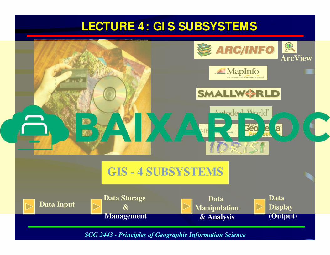
ArcView
Data InputData Storage
&
Management
Data
Display
(Output)
Data
Manipulation
& Analysis
GIS - 4 SUBSYSTEMS
LECTURE 4: GI S SUBSYSTEMS
SGG 2443 - Principles of Geographic Information Science
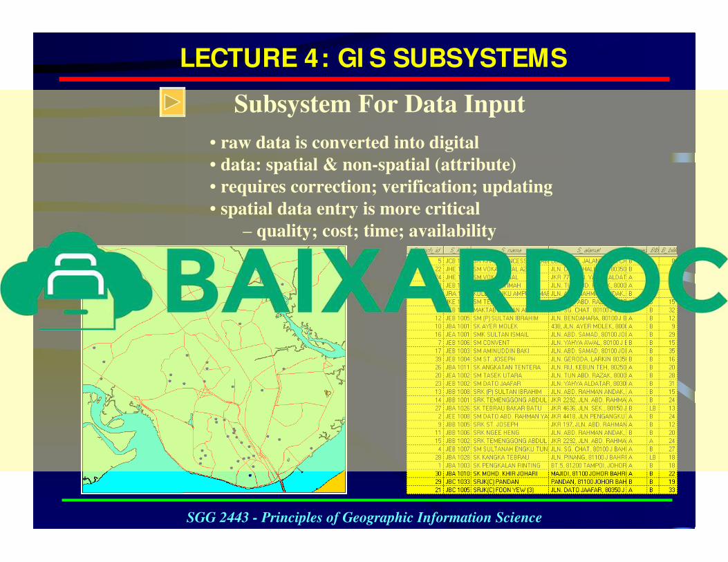
Subsystem For Data Input
• raw data is converted into digital
• data: spatial & non-spatial (attribute)
• requires correction; verification; updating
• spatial data entry is more critical
– quality; cost; time; availability
LECTURE 4: GI S SUBSYSTEMS
SGG 2443 - Principles of Geographic Information Science
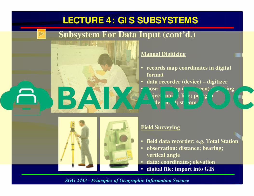
Manual Digitizing
• records map coordinates in digital
format
• data recorder (device) – digitizer
• now: head-up (on-screen) digitizing
• object: point; line; polygon
• mode: point; stream
Field Surveying
• field data recorder: e.g. Total Station
• observation: distance; bearing;
vertical angle
• data: coordinates; elevation
• digital file: import into GIS
Subsystem For Data Input (cont’d.)
LECTURE 4: GI S SUBSYSTEMS
SGG 2443 - Principles of Geographic Information Science
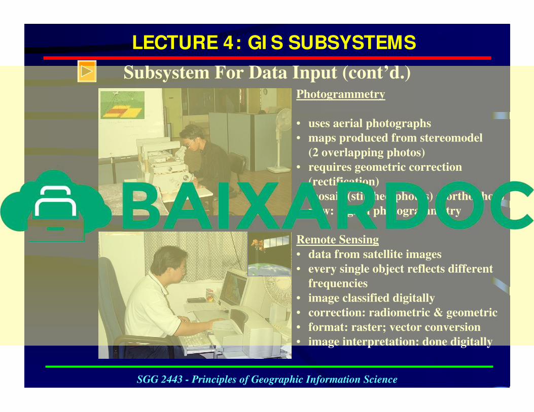
Photogrammetry
• uses aerial photographs
• maps produced from stereomodel
(2 overlapping photos)
• requires geometric correction
(rectification)
• mosaic (stitched photos) = orthophoto
• now: digital photogrammetry
Remote Sensing
• data from satellite images
• every single object reflects different
frequencies
• image classified digitally
• correction: radiometric & geometric
• format: raster; vector conversion
• image interpretation: done digitally
LECTURE 4: GI S SUBSYSTEMS
SGG 2443 - Principles of Geographic Information Science
Subsystem For Data Input (cont’d.)
LECTURE 4: GI S SUBSYSTEMS
SGG 2443 - Principles of Geographic Information Science
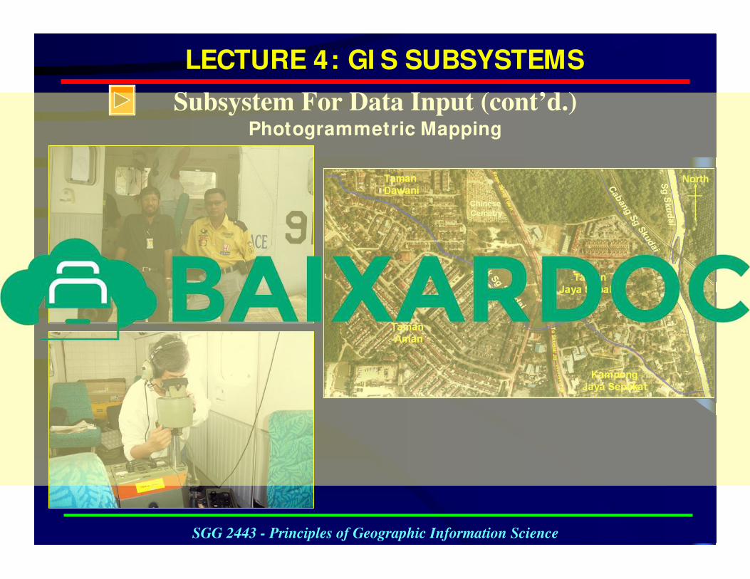
Subsystem For Data Input (cont’d.)Photogrammetric Mapping
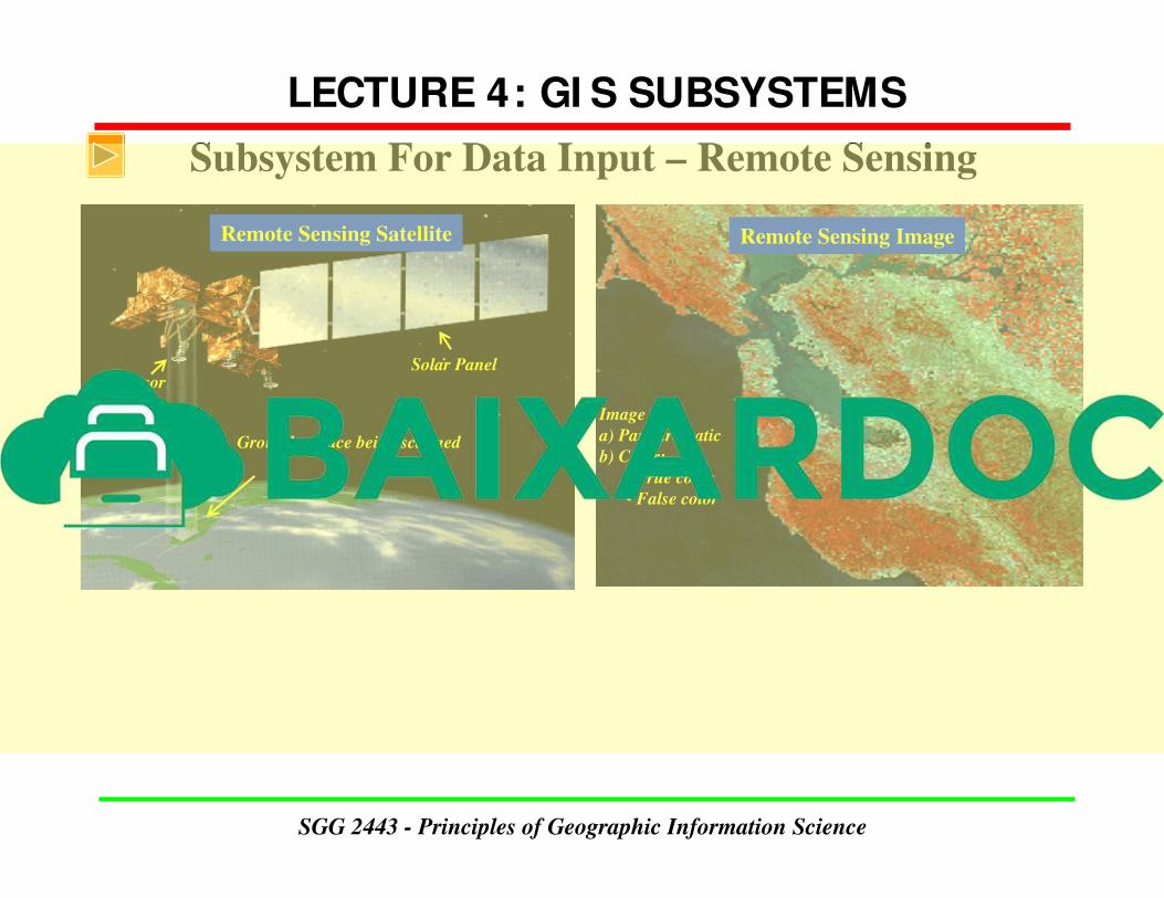
Subsystem For Data Input – Remote Sensing
Remote Sensing Satellite
Solar PanelSensor
Ground surface being scanned
Remote Sensing Image
Image :
a) Panchromatic
b) Color:
• True color
• False color
LECTURE 4: GI S SUBSYSTEMS
SGG 2443 - Principles of Geographic Information Science
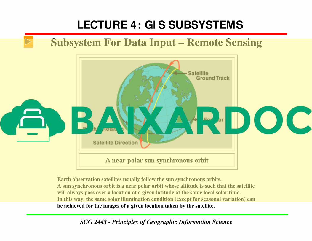
Earth observation satellites usually follow the sun synchronous orbits.
A sun synchronous orbit is a near polar orbit whose altitude is such that the satellite
will always pass over a location at a given latitude at the same local solar time.
In this way, the same solar illumination condition (except for seasonal variation) can
be achieved for the images of a given location taken by the satellite.
LECTURE 4: GI S SUBSYSTEMS
SGG 2443 - Principles of Geographic Information Science
Subsystem For Data Input – Remote Sensing
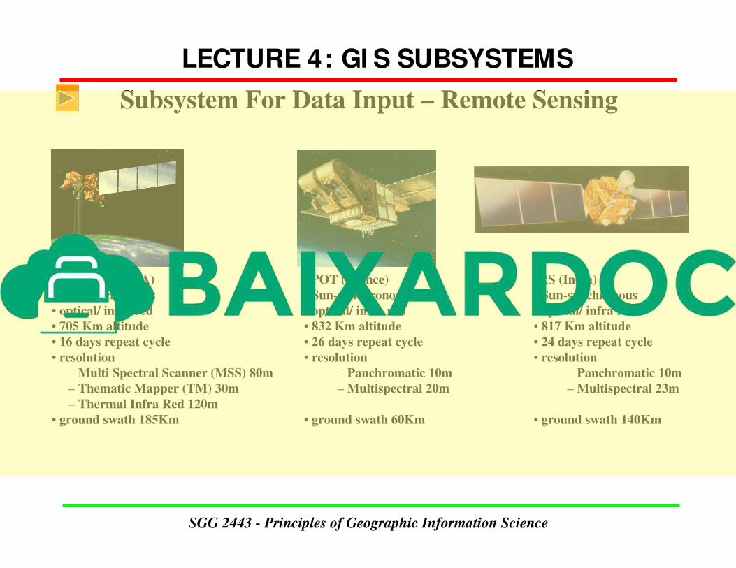
Landsat 4,5 (USA)
• Sun-synchronous
• optical/ infra red
• 705 Km altitude
• 16 days repeat cycle
• resolution
– Multi Spectral Scanner (MSS) 80m
– Thematic Mapper (TM) 30m
– Thermal Infra Red 120m
• ground swath 185Km
SPOT (France)
• Sun-synchronous
• optical/ infra red
• 832 Km altitude
• 26 days repeat cycle
• resolution
– Panchromatic 10m
– Multispectral 20m
• ground swath 60Km
IRS (India)
• Sun-synchronous
• optical/ infra red
• 817 Km altitude
• 24 days repeat cycle
• resolution
– Panchromatic 10m
– Multispectral 23m
• ground swath 140Km
LECTURE 4: GI S SUBSYSTEMS
SGG 2443 - Principles of Geographic Information Science
Subsystem For Data Input – Remote Sensing


