

Bay of Plenty Group Evacuation Plan
October 2014 Version 1.0

Bay of Plenty Group Evacuation Plan
Civil Defence Publication 2014/01
ISSN: 1175-8902 (print) ISSN: 1179-9560 (online)
Version 1.0 October 2014
Bay of Plenty Civil Defence Emergency Management Group
C/O Bay of Plenty Regional Council 5 Quay Street PO Box 364
Whakatāne 3158
New Zealand

CONTENTS
1. Introduction ........................................................................................................ 8 1.1 Objectives ................................................................................................................................ 8 1.2 Scope ...................................................................................................................................... 8 1.3 Plan Framework ...................................................................................................................... 9 1.4 Alignment with National Frameworks ...................................................................................... 9 1.5 Evacuation Scenarios ............................................................................................................. 9
2. Regional Context ............................................................................................. 11 2.1 The Hazards .......................................................................................................................... 11 2.2 The Population ...................................................................................................................... 14 2.3 The Infrastructure .................................................................................................................. 14 2.4 The Neighbouring Regions ................................................................................................... 18
3. Roles and responsibilities .............................................................................. 20 3.1 All Agencies........................................................................................................................... 20 3.2 Emergency Services ............................................................................................................. 20 3.3 Welfare Coordinating Group Agencies ................................................................................. 21 3.4 Lifelines ................................................................................................................................. 23 3.5 CDEM Group ......................................................................................................................... 23 3.6 Territorial Local Authorities ................................................................................................... 23
4. Evacuation Decision ........................................................................................ 24 4.1 Overview of the Evacuation Decision Phase ........................................................................ 24 4.2 Confirm Lead Agency ............................................................................................................ 25 4.3 Determine Declaration Level ................................................................................................. 25 4.4 Decision To Evacuate ........................................................................................................... 26
5. Evacuation Planning and Warning ................................................................. 28 5.1 Overview of the Evacuation Planning and Warning Phase .................................................. 28 5.2 Plan the Evacuation .............................................................................................................. 29 5.3 Develop Key Messages ........................................................................................................ 32 5.4 Communicated Key Messages ............................................................................................. 33
6. Evacuation Phase ............................................................................................ 35 6.1 Overview of the Evacuation Process .................................................................................... 35 6.2 Traffic Management .............................................................................................................. 35 6.3 Coordinate Public Transport Resources ............................................................................... 36 6.4 Monitor / Support Along Evacuation Routes ......................................................................... 38
7. Shelter .............................................................................................................. 40 7.1 Overview of the Shelter Phase .............................................................................................. 40 7.2 Identifying Civil Defence Centres .......................................................................................... 40 7.3 Registering Evacuees ........................................................................................................... 43
8. Monitoring and Evaluation .............................................................................. 45 8.1 Plan Review Process ............................................................................................................ 45 8.2 Monitoring Progress .............................................................................................................. 45
Appendix A: Local Evacuation Plan .................................................................... 46
Appendix B: References ....................................................................................... 49
Appendix C: Glossary of Key Terms ................................................................... 50

Bay of Plenty Group Evacuation Plan- V1.0 October 2014 Page 4
Figures
Figure 1: Summary of the Evacuation Process ................................................................................... 7 Figure 1.1: Plan Framework .................................................................................................................... 9 Figure 1.2: Plan Structure ....................................................................................................................... 9 Figure 2.1: Hazards in and around the Bay of Plenty Region ............................................................... 12 Figure 2.2: Populations in and around the Bay of Plenty Region (Stats NZ 2013)............................... 15 Figure 2.3: Mare Locations in the Bay of Plenty Region ....................................................................... 16 Figure 2.4: Community Infrastructure in the Bay of Plenty ................................................................... 17 Figure 2.5: Lifeline Utility Infrastructure in the Bay of Plenty Region .................................................... 19 Figure 4.1: Process for Decision to Evacuation .................................................................................... 24 Figure 5.1: Process for Evacuation Warning and Planning .................................................................. 28 Figure 5.2: Major Road Hazards ........................................................................................................... 30 Figure 5.3: Major Road Detour Routes and Times ............................................................................... 31 Figure 5.4: Communication Lines for Dissemination of Messaging ...................................................... 33 Figure 6.1: Evacuation Process ............................................................................................................ 35 Figure 6.2: Traffic Management Coordination ...................................................................................... 36 Figure 6.3: Communication and tasking lines - Buses .......................................................................... 37 Figure 6.4: Communication and Tasking Lines – Rail .......................................................................... 37 Figure 7.1: Shelter Phase ..................................................................................................................... 41
Tables
Table 1.1: Plan Scope ............................................................................................................................. 8 Table 1.2: Evacuation Scenarios showing Indicative numbers of Total Evacuees............................... 10 Table 2.1: Statistics relating to vulnerable populations ......................................................................... 14 Table 2.2: The Neighbouring Regions .................................................................................................. 18 Table 4.1: Agency Actions in the Decision to Evacuate ....................................................................... 24 Table 5.1: Roles and Actions During the Planning and Warning Phase .............................................. 28 Table 6.1: Traffic Management Actions and Roles ............................................................................... 35 Table 6.2: Bus Coordination Roles and Actions ................................................................................... 37 Table 6.3: Rail Coordation Roles and Actions ...................................................................................... 38 Table 6.4: Agency Roles and Actions in Providing Support along Evacuation Routes. ....................... 39 Table 7.1: Key Roles and Actions during the Shelter Phase. ............................................................... 41 Table 8.1: Operational Plan Monitoring ................................................................................................ 45

Bay of Plenty Group Evacuation Plan- V1.0 October 2014 Page 5
PRELIMINARY
ABBREVIATIONS USED IN THIS PLAN
BoP Bay of Plenty
CDEM Civil Defence Emergency Management
CDEMG Civil Defence Emergency Management Group
CDC Civil Defence Centre
CEG Coordinating Executive Group
DHB District Health Board, includes hospital, health and ambulance service
EMO Emergency Management Office
EOC Emergency Operations Centre (used in reference to a local CDEM EOC)
ES Emergency Services
GECC or ECC Group Emergency Coordination Centre
IAP Incident Action Plan
LUC Lifeline Utility Coordinator
MCDEM Ministry of Civil Defence and Emergency Management
MOU Memorandum of Understanding
MSD Ministry of Social Development
NCMC National Crisis Management Centre
NECC National Emergency Coordination Centre
PIM Public Information Manager
SOP Standard Operating Procedure
SitRep Situation Report
SPCA Royal New Zealand Society for the Prevention of Cruelty to Animals
TA or TLA Territorial Authority (includes city, district and unitary authorities)
TRG Transport Response Group (Group)
TRT Transport Response Team (National)
USAR Urban Search and Rescue
WCG Welfare Coordinating Group
A full Glossary of Terms is included in Appendix C.
Bay of Plenty Group Evacuation Plan- V1.0 October 2014 Page 6
ACKNOWLEDGEMENTS
The following people were involved in the development of this Plan.
BAY OF PLENTY CDEM
Allan Pearce (Western BoP DC)
Angela Reade (BoP CDEM)
Barbara Dempsey (ODC)
Clinton Naude (BoP CDEM)
Eric Newman (Tauranga City Council)
Jean-Paul Gaston (Rotorua District Council)
Jim Tetlow (Eastern BoP CDEM)
Matthew Harrex (BoP CDEM)
Meagan Edhouse (Eastern BoP CDEM)
Naomi Luckett (BoP CDEM)
Paul Baunton (Tauranga City Council)
Paul Bourton (BoP CDEM)
Pauline Hitchcock (Rotorua District Council)
Steven Campbell (BoP CDEM)
Tanya Amaya (BoP CDEM)
EMERGENCY SERVICES / TRANSPORT
Brent Crowe (NZ Police)
Gail Bingham (Bay of Plenty DHB)
Graham Easton (NZ Fire)
Carl Wright-St Clair (NZ Police)
Murray Binning (NZ Fire Service)
Nigel d’Ath (NZ Transport Agency)
WELFARE COORDINATING GROUP (WCG)
Angela Reade (BoP CDEM)
Ann Esler (Rotorua District Council)
Ata Jocob (TPK)
Chris Watt (Western Bay of Plenty CDEM)
Dominick Lepa (MSD)
Elaine Trembath (MSD)
Gloria Oliver (Western Bay of Plenty CDEM)
Graeme Langford (Red Cross)
Jocelyn Stowers (Bay of Plenty DHB)
Julie Bain (Kawerau Welfare Manager)
Megan Edhouse (Eastern Bay of Plenty CDEM)
Pauline Hitchcock (Rotorua CDEM)
NEIGHBOURING CDEM GROUPS
Kiri Maxwell (Auckland CDEM)
Irving Young (Waikato CDEM)
PLAN WRITER
Lisa Roberts
Infrastructure Decisions Limited
Bay of Plenty CDEMG also acknowledge the Waikato CDEM Group for allowing their Group
Evacuation Plan to be used as a template for this plan. The Group also acknowledges the use of the
MCDEM Mass Evacuation Guidelines (a full list of reference documents is included in Appendix C).

Bay of Plenty Group Evacuation Plan- V1.0 October 2014 Page 7
SUMMARY OF THE EVACUATION PROCESS
Figure 1 provides a summary of the key steps in the Evacuation Process.
Figure 1: Summary of the Evacuation Process
Activate ECC and establish contact with key agencies.
CDEM Group / ECC Other Agencies
Provide hazard info/ analysis (BoP RC, Warning Agencies).
Threat / Hazard with potential for large scale evacuation.
Activate CDEM EOC and other agency crisis management structures and establish EOC/ECC liaison (all).
Assess impact on own organisations (all).Assess impact/threat to public (Emergency Services).Assess scale of event, evacuee numbers (CDEM EOC).
Evaluate information provided, establish scope and scale and decide whether to evacuate or
shelter-in-place.
Develop Evacuation IAP - evacuation areas, staging
Local public warnings (ES supported by CDEM EOC, NZDF).
Coordinate development/issue of public messaging
Update info on evacuee no.s/types, public transport resources (CDEM EOC)
Identify evacuation routes, traffic management, deploy resources (road authorities, in liaison ES, CDEM EOC).
Prepare to evacuate facilities and client organisations and deploy resources to support shelter phase (all).
Advise key stakeholders that evacuation decision made and timing / location details
being confirmed.
Shelt
er
Evacuati
on Pla
nnin
g /
Warn
ing D
ecis
ion
Implement evacuation plans of own facilities and monitor ‘client’ facilities.
Coordinate implementation of Evacuation IAP.
Monitor agency progress, situation reporting, issues identification and
resolution.
Establish traffic management / rest areas and maintain access for priority vehicles (road authorities, supported
by Police, CDEM EOC)
Establish CDCs - registration, accommodation, recovery (local CDEM supported by WAG)
Assist vulnerable groups to evacuate (ES)
Clear and secure evacuated areas (ES)
Coordinate evacuation by rail (NCMC / Joint Crisis Mgt Group (Rail) and bus (local CDEM / bus companies)
Coordinate implementation of Welfare IAP. Monitor agency
progress, situation reporting, issues identification and resolution.
Implement plans to maintain fuel supply along evacuation routes & to CDEM Critical customers (fuel co)
On
goin
g co
ord
inat
ion
an
d in
form
atio
n e
xch
ange

Bay of Plenty Group Evacuation Plan- V1.0 October 2014 Page 8
1. INTRODUCTION
1.1 OBJECTIVES
The purpose of this Plan is to support a coordinated
response with neighbouring regions, local CDEM
EOCs and all supporting agencies when managing a
large scale evacuation. This is achieved by
confirming the:
Group arrangements for evacuation, including
the overall framework, principles and
assumptions.
Communication processes between agencies.
Roles and responsibilities of responding
agencies, to allow them to effectively plan for and
support large scale evacuations.
Framework for formalising local CDEM and
supporting agency plans and arrangements.
1.2 SCOPE
This Plan provides the framework for agencies to
coordinate a large scale evacuation. The detailed
operational plans lie with local CDEM EOCs and the
agencies supporting the evacuation.
The audience for this Plan include the key agencies
involved in the evacuation and shelter phases of an
emergency - local authorities, local and group CDEM
agencies, neighbouring region CDEM groups, emergency services, lifeline utilities and welfare
agencies.
Table 1.1: Plan Scope
Within Plan Scope Outside Plan Scope
Processes to support external and internal
regional evacuation and receipt of evacuees.
Relationships between agencies with a role in
managing a Group evacuation and provision
of welfare support.
Liaison arrangements between regions and
between EOCs.
Processes from the point at which Evacuation
may need to be considered to when the
decision has been made to evacuate until the
decision to return.
Plans, arrangements and operational
processes of neighbouring regions, local
EOCs and other agencies with a role in
evacuation.
Arrangements of government agencies to
evacuate their own and client facilities (eg:
Corrections, Health).
The recovery phase (after the decision to
return has been made).
Evacuations that are within the capabilities of
the local EOCs even if it is across TLAs or
regions.
Detailed resource lists (held in local CDEM
Evacuation Plans).
Key Terms:
Evacuation is the movement of people away from the
threat or actual occurrence of a hazard either forced or
voluntary.
The evacuation of a particular area is necessary when
a hazard, be it natural or technological, threatens and
puts at risk the safety of those within an area, or
following the impact of a hazard which has
subsequently rendered the area uninhabitable.
Evacuation becomes necessary when the benefits of
leaving significantly outweigh the risk of sheltering-in-
place.
Mass Evacuation is a large scale evacuation that is
led by a CDEM Group or National Crisis Management
Centre. Factors that may determine that an event
requires a mass evacuation include:
Declaration has or is likely to be made.
Local resources are unable to cope.
Cross regional coordination is required to manage
the movement of people.
In these guidelines we have adopted the term Group
Evacuation as it is predominantly aimed at events that
will be led by the Bay of Plenty CDEM Group
Controller or National Controller.

Bay of Plenty Group Evacuation Plan- V1.0 October 2014 Page 9
1.3 PLAN FRAMEWORK
As illustrated in Figure 1.1, this Plan is:
Guided by the National CDEM Plan and Guide, Director’s Guidelines and the Bay of Plenty Group
CDEM Plan.
Consistent with neighbouring region’s evacuation plans and other Bay of Plenty Group Plans and
Procedures.
Delivered through the operational plans of local EOCs and supporting agencies.
Figure 1.1: Plan Framework
1.4 ALIGNMENT WITH NATIONAL FRAMEWORKS
This Plan is structured to align with the process outlined in the Director’s Mass Evacuation Guidelines,
as illustrated in Figure 1.2.
Figure 1.2: Plan Structure
1.5 EVACUATION SCENARIOS
In order to understand the potential size and scale of events that may be managed under this Plan,
Table 1.2 shows hazard scenarios that may cause large numbers of evacuees into/out of or within the
region.
Bay of Plenty Group Evacuation
Plan
Director’s Guidelines (Welfare, Mass
Evacuation)
National CDEM Plan and Guide to the Plan
BoP CDEM Group Plan
Neighbouring Region’s Evacuation
Plans
Group Plans and Procedures (Welfare,
PIM, EOC, Group Controller)
Operational Evacuation Plans: Supporting Agencies
(Lifelines, welfare, govt agencies, emergency
services, NGOs)
Operational Evacuation Plans: BoP local CDEM
agencies/EOCs
Choose course of
action
Hazard threatens/ impacts
Disseminate warning message
Shelter in place
Evacuation Centre
Recovery Centre (one-
stop shop)
Self-managed accomm-odation
Return Home
Managed Evacuation
Process

Bay of Plenty Group Evacuation Plan – V1.0 October 2014 Page 10
Table 1.2: Evacuation Scenarios showing Indicative numbers of Total Evacuees
Bay of Plenty Auckland Waikato Hawkes Bay Gisborne Manawatu-
Wanganui
Taranaki
Auckland CBD volcanic
eruption
10,000 – 50,000 into region 100-300,000 evacuees,
half evacuate out of
region.
20,000 - 100,000, into
region
Up to 10,000 across these regions.
Major Central Island
volcano
5,000-10,000 into region. 5,000-10,000 into
region.
Up to 50,000 total
evacuees in near
vicinity, half supported
within region.
Will be managing their own populations impacted, unlikely to be able to
also receive evacuees from other regions (except self-managing ones).
Major volcano within BoP
region
50,000 – 100,000 total
evacuees. Half go out of
region.
Up to 20,000 Up to 20,000 Up to 20,000 across these regions.
Regional Tsunami
impacting East Coast
Each region is likely to be managing it’s own evacuees if whole north island east coast impacted. Insufficient modelling has been carried out to be able to even
roughly total evacuees, but could be total 100,000-200,000 across island?
Major Flood (eg: Opotoki,
Whakatane Rivers)
Up to 40,000 impacted –most
shelter in region (mostly short
term evac).
<5,000 <5,000 Up to 5,000 across these regions.
Major Mt Taranaki eruption <3,000 into region <5,000 into region <5,000 into region <3,000 into
region
<2,000 into
region
5,000 – 10,000 into
region
Up to 50,000
Rural Fire in Bay of Plenty Up to 10,000 evacuees, most
stay in region.
<500 into region. <500 into region Up to 2,000 across these regions.
Earthquake Up to 50,000 Up to 5,000 Up to 5,000 Up to 5,000 across these regions.
Limitations and assumptions include:
These figures are meant to be broadly indicative and are based on rough estimates at workshops with CDEM Stakeholders in May 2014. The table is therefore meant to enable regions to have
a broad understanding of the potential scale of evacuations, rather than provide guidance as to expected numbers if an event occurs. The actual numbers will depend on many factors such as
season, public messaging (eg: where people are being directed).
It is estimated that up to 30% of evacuees will need support at some stage – again, the actual number will depend on many factors.
Evacuee numbers will fluctuate. The initial numbers may drop off quite quickly once the impacted area is understood and people return to their homes (eg: people may evacuate from a
tsunami / flood threat which ends up not impacting their homes). Conversely, if conditions for those sheltering-in-place are poor, welfare numbers may increase over time.

Bay of Plenty Group Evacuation Plan – V1.0October 2014 Page 11
2. REGIONAL CONTEXT
2.1 THE HAZARDS
The Bay of Plenty region is subject to a wide range of
natural hazards. The primary natural hazards of
significance to the region include flooding,
earthquakes, volcanic eruptions and tsunami. Figure
2.1shows areas that are most vulnerable to different
hazard types.
This section provides an overview of each hazard
and how the hazard type may impact on the
evacuation process.
More detailed hazard information is available in the Bay of Plenty CDEM Plan, the Regional Policy Statement and on the Bay of Plenty Regional Council website.
FLOODING
The Bay of Plenty is typically affected by two distinct types of flooding; short intense periods of rainfall
causing small streams and stormwater flooding primarily in urban areas and long sustained rainfall
events causing flooding in larger streams and river catchments. The Bay of Plenty is crossed by
many rivers and streams, typically sourced in steep bush catchments before flowing through
productive farmland and often through densely populated urban areas. Five flood protection schemes
are managed across seven rivers in the eastern Bay of Plenty to mitigate the hazard.
The main factor relating to flooding which will impact on evacuation is that many State Highways are
vulnerable to flooding and slips which may cause road closures and isolate communities.
VOLCANIC ERUPTIONS
The Bay of Plenty is exposed to both local and distal volcanic hazards. In the Bay of Plenty Region
there are four active volcanic centres; the Okataina Volcanic Centre, Mt Edgecumbe/Putauaki, Mayor
Island/Tuhua and White Island/Whaakari. These represent four very different levels of hazard to the
region.
The Okataina Volcanic Centre is a caldera volcano and produces infrequent but large volcanic
eruptions. In a major eruption, the near vent area (within 5-10 km) could be totally destroyed and all
distal portions of the BOP region may receive significant ashfalls (0.1-1 m). The topography
impounding existing lakes could be impacted by an eruption, leading to large scale break-out floods.
Remobilisation of ashfall deposits could create erosional issues for year to decades.
Mt Edgecumbe/Pūtauaki is a young multiple vent complex near Kawerau. The most likely scenarios
for eruptions include hot pyroclastic flows, block and ash flows off the cone and light ashfalls.
Hydrothermal eruptions could also be triggered in the nearby Kawerau Geothermal system. If lava
flows are produced that flow off the cone they could extend into the Tarawera River, potentially
damming the river or diverting its direction of flow.
White Island/Whaakari represents the summit of an active volcanic pile offshore from Whakatāne,
however most of the eruptive impacts are confined to the island itself. Like Whakaari, impacts from a
Mayor Island/Tūhua eruption impacts on the mainland are likely to be limited to ashfall in the coastal
areas (1-20mm).
Key Terms:
Hazards are a source of, or situation with the
potential to cause, harm or loss within one or
more of the four environments (social, economic,
environmental, cultural).
Vulnerable Groups: At-risk groups that may
need special consideration in order to ensure that
they can be taken care of in an evacuation.
Lifeline Utilities: The essential infrastructure
and services that support communities, including
providers of energy, telecommunications,
transportation and civil/water services.

Bay of Plenty Group Evacuation Plan- V1.0 October 2014 Page 12
Figure 2.1: Hazards in and around the Bay of Plenty Region

Bay of Plenty Group Evacuation Plan- V1.0 October 2014 Page 13
Several active volcano systems exist in New Zealand outside of the Bay of Plenty. These primarily are
the Kermadec’s (Raoul Island and many submarine volcanoes), Auckland Volcanic Field, Taupo
Volcanic Centre, the Tongariro National Park volcanoes and Taranaki. These represent different
levels of hazard to the BoP region, but primarily it is an ashfall hazard, ranging from a light dusting
that creates visibility issues to thick falls that could collapse flat roofs. If sufficient ash falls there could
be remobilisation of the ash into waterways, streams and rivers.
The factors relating to volcanic events which impact on evacuation eruption include:
An eruption in the Auckland Volcanic Field could displace a large number of people into
neighboring regions including the Bay of Plenty.
There is usually some warning prior to a major eruption, between 1 day and 1 week for an
Auckland field eruption, possibly much longer for central island eruptions, enabling more
controlled evacuation.
Lifeline utility services and transport routes are likely to be impacted.
Volcanic ash can create hazardous driving conditions and increased vehicle breakdowns.
EARTHQUAKES
The Bay of Plenty is exposed to seismic hazards from three different sources. In the west is the
“extensional western North Island faults’, covering most of the region is the ‘Taupō rift faults’, while to
the east in the ‘North Island dextral’ fault belt. The Taupō rift fault is considered the most likely source
of significant ground accelerations. The North Island dextral fault belt is likely to produce the largest
events, but these are less frequent. Earthquakes from the extensional western North Island faults will
be smaller than those from the dextral fault belt to the west, but again less frequent.
The factors relating to earthquakes which impact on evacuations include:
They typically happen with little warning meaning evacuation is less able to be controlled and
managed.
Lifeline utility services and transport routes are likely to be impacted.
Aftershocks and liquefaction could continue after the initial event resulting in more damage and
uncertainty and prolonging the evacuation and shelter phase.
TSUNAMI
Tsunami can be generated from earthquakes, underwater landslides, large coastal cliff or lakeside
landslides or underwater volcanic eruptions. The Bay of Plenty eastern coastline is at risk from
tsunami.
The factors relating to tsunami which impact on evacuations include:
Locally generated tsunami are likely to have very short warning times (compared to regional and
distant tsunami which may have around 3 – 12 hours warning).
Tsunami impacts can be widespread along the coast and devastating – many neighbouring
regions may be using all their resources to manage their own issues and be unable to support
Bay of Plenty.
Some coastal towns in Bay of Plenty have constrained road network capacity to facilitate a rapid
large scale evacuation from the area. ‘Seek high ground’ may be a better strategy than trying to
move any distance.
LANDSLIDES (INCLUDING DEBRIS FLOW AND SLUMPING)
Much of the Bay of Plenty Region is vulnerable to landslide hazards triggered by both seismic and
meteorological processes. While unlikely to occur on a scale requiring mass evacuation of areas
landslides are likely to present significant barriers to evacuation by impacting on infrastructure
networks. Most of the State Highways in the region are vulnerable at multiple points to landslides and
would result in communities quickly becoming isolated. Similarly the rail network could easily become
cut off for some time from even a relatively small landslide.

Bay of Plenty Group Evacuation Plan- V1.0 October 2014 Page 14
2.2 THE POPULATION
This section provides an overview of vulnerable groups in the region – those that have particular
needs to be considered in evacuation and which may require additional time or resource to evacuate.
Specific information on location and numbers of people in these groups will be in local CDEM Evacuation plans.
The BoP CDEM Group Plan profiles the region’s population in Section 2.1 ‘Social Environment’.
Figure 2.2 shows the region’s population centres. Key factors that may impact on evacuation
processes include:
There are a number of isolated communities, such as the small permanent population of Motiti
Island, which are highly reliant on limited transport linkages.
There are many iwi in the region, and also many associations with iwi from outside the region
(particularly Aucklanders). There are over 120 marae in the Bay of Plenty and around 9 marae
are located along the coast in tsunami risk areas (refer Figure 2.3).
There are a large number of tourists and holiday homes which may be occupied by visitors
unaware of the region’s hazards. Holiday homes may also become a destination for self-
evacuation if a major disaster occurs in other population centres in the North Island.
There is a large transitional / migrant population (eg: kiwifruit pickers) that are less likely to have
support networks within the region.
The capacity of temporary accommodation (hotels, motels etc) varies significantly according to
the season.
Cultural and linguistic diversity needs to be considered in dissemination of evacuation messages
and be catered for in Civil Defence Centres (CDCs).
The large farming industry faces additional challenges in managing animals in an evacuation.
There are high levels of economic deprivation in some areas, particularly the Eastern Bay of
Plenty, though conversely those people may in some ways be more resilient and self-sufficient.
At any one time there could be up to three cruise ships in the Harbour, with up to 10,000
passengers and staff. If passengers are out on day trips they could potentially be isolated away
from their ship accommodation.
Table 2.1: Statistics relating to vulnerable populations
Area Approximate Numbers at Capacity
Eastern BoP Western BoP Rotorua
Hospital beds# Whakatane Hospital 71 beds
Opotiki Health Centre 6 beds
Tauranga Hospital 285 beds
Grace Hospital 50 beds
Rotorua Hospital Bed
Capacity of 106
Rest home beds# 306 beds 1512 beds 591 beds
Number of Schools* 52 67 47
Total Students* 9,798 28,222 13,471
Students Year 1-6* 4,758 13,289 6,399
Students Year 7-13+* 5,040 14,933 7,072
# Hospital and rest home bed numbers provided by Lakes and BOP DHBs.
* School and student numbers based on Ministry of education figures for July 2013.
2.3 THE INFRASTRUCTURE
CRITICAL COMMUNITY FACILITIES
Figure 2.4 illustrates the major community facilities in the Bay of Plenty region. Each of these facilities
is expected to have evacuation plans by the owning agency.
Figure 2.5 illustrates some key lifeline utilities in the Bay of Plenty region.

Bay of Plenty Group Evacuation Plan- V1.0 October 2014 Page 15
Figure 2.2: Populations in and around the Bay of Plenty Region (Stats NZ 2013).

Bay of Plenty Group Evacuation Plan- V1.0 October 2014 Page 16
Figure 2.3: Mare Locations in the Bay of Plenty Region

Bay of Plenty Group Evacuation Plan- V1.0 October 2014 Page 17
Figure 2.4: Community Infrastructure in the Bay of Plenty
Bay of Plenty Group Evacuation Plan- V1.0 October 2014 Page 18
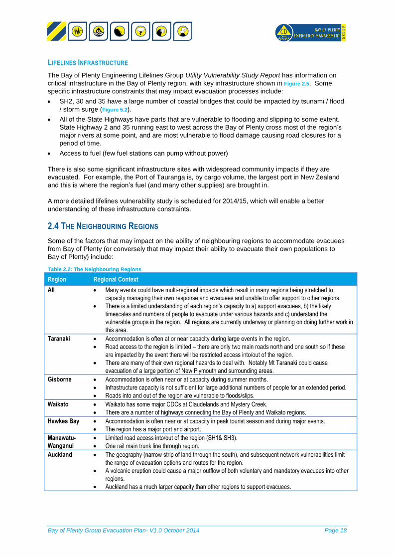
LIFELINES INFRASTRUCTURE
The Bay of Plenty Engineering Lifelines Group Utility Vulnerability Study Report has information on
critical infrastructure in the Bay of Plenty region, with key infrastructure shown in Figure 2.5. Some
specific infrastructure constraints that may impact evacuation processes include:
SH2, 30 and 35 have a large number of coastal bridges that could be impacted by tsunami / flood
/ storm surge (Figure 5.2).
All of the State Highways have parts that are vulnerable to flooding and slipping to some extent.
State Highway 2 and 35 running east to west across the Bay of Plenty cross most of the region’s
major rivers at some point, and are most vulnerable to flood damage causing road closures for a
period of time.
Access to fuel (few fuel stations can pump without power)
There is also some significant infrastructure sites with widespread community impacts if they are
evacuated. For example, the Port of Tauranga is, by cargo volume, the largest port in New Zealand
and this is where the region’s fuel (and many other supplies) are brought in.
A more detailed lifelines vulnerability study is scheduled for 2014/15, which will enable a better
understanding of these infrastructure constraints.
2.4 THE NEIGHBOURING REGIONS
Some of the factors that may impact on the ability of neighbouring regions to accommodate evacuees
from Bay of Plenty (or conversely that may impact their ability to evacuate their own populations to
Bay of Plenty) include:
Table 2.2: The Neighbouring Regions
Region Regional Context
All Many events could have multi-regional impacts which result in many regions being stretched to
capacity managing their own response and evacuees and unable to offer support to other regions.
There is a limited understanding of each region’s capacity to a) support evacuees, b) the likely
timescales and numbers of people to evacuate under various hazards and c) understand the
vulnerable groups in the region. All regions are currently underway or planning on doing further work in
this area.
Taranaki Accommodation is often at or near capacity during large events in the region.
Road access to the region is limited – there are only two main roads north and one south so if these
are impacted by the event there will be restricted access into/out of the region.
There are many of their own regional hazards to deal with. Notably Mt Taranaki could cause
evacuation of a large portion of New Plymouth and surrounding areas.
Gisborne Accommodation is often near or at capacity during summer months.
Infrastructure capacity is not sufficient for large additional numbers of people for an extended period.
Roads into and out of the region are vulnerable to floods/slips.
Waikato Waikato has some major CDCs at Claudelands and Mystery Creek.
There are a number of highways connecting the Bay of Plenty and Waikato regions.
Hawkes Bay Accommodation is often near or at capacity in peak tourist season and during major events.
The region has a major port and airport.
Manawatu-
Wanganui
Limited road access into/out of the region (SH1& SH3).
One rail main trunk line through region.
Auckland The geography (narrow strip of land through the south), and subsequent network vulnerabilities limit
the range of evacuation options and routes for the region.
A volcanic eruption could cause a major outflow of both voluntary and mandatory evacuees into other
regions.
Auckland has a much larger capacity than other regions to support evacuees.

Bay of Plenty Group Evacuation Plan- V1.0 October 2014 Page 19
Figure 2.5: Lifeline Utility Infrastructure in the Bay of Plenty Region

Bay of Plenty Group Evacuation Plan- V1.0 October 2014 Page 20
3. ROLES AND RESPONSIBILITIES
The key responsibilities listed in this section have specific reference to responsibilities during the
response phase of an evacuation. For a complete list of agency responsibilities refer to the Bay of
Plenty Civil Defence Emergency Management Group Plan, 2011-2015.
3.1 ALL AGENCIES
Key Responsibilities
Manage the response and restoration of services, while supporting and protecting the health and
safety of staff.
Coordinate with CDEM to provide information and advice relevant to their organisation / sector
and to ensure the response is consistent with overall CDEM priorities and that public messaging
is consistent.
Coordinate with CDEM and other agencies to share resources, where practicable, and where this
will improve the rate of overall community recovery.
Deploy and manage support resources from unaffected areas, where practicable.
Limitations
The type and scale of event will determine the availability of resources to manage the evacuation.
All agencies need access to resources to support their own staff (food, shelter, transport).
All agencies are dependent to some extent on other agencies and the ability to respond will be
impacted by the status of these other agencies.
3.2 EMERGENCY SERVICES
NEW ZEALAND POLICE
Key Responsibilities
Maintain law and order.
Take all measures within their power and authority to protect life and property.
Evacuate immediate disaster area (with the support of St John and Fire Service).
Coordinate movement over land to assist the movement of rescue and other essential services.
Assist with dissemination of warning messages.
Provide security of evacuated areas, including the establishment of cordons.
Trace missing persons and notify their next of kin.
Assist the Coroner.
Maintain a presence in the community to engender trust and confidence.
Work with Road Authorities (NZTA and local authorities) in support of traffic management (noting
that the first priority will be removing people from imminent danger).
Provide Disaster Victim Identification and mortuary services.
NEW ZEALAND FIRE SERVICES
Key Responsibilities
Coordinate fire and rescue response to affected areas.
Containment of releases and spillages of hazardous substances.
Command all urban search and rescue response activity.
Evacuate people away from the immediate danger of the event (in liaison with St John and NZ
Police).
Contain immediate risks resulting from the event.
Provide public fire safety messages (eg: turn off stove and gas).
Decontamination of people affected by spillages or hazardous substances.
NEW ZEALAND DEFENCE FORCE
Key Responsibilities
Provision of logistical resources that can support a disaster response including medical,
transportation, health, catering, rescue.

Bay of Plenty Group Evacuation Plan- V1.0 October 2014 Page 21
Requests for support from the NZDF beyond local levels of commitment should be made through the
National Controller in accordance with the agreement between MCDEM and the NZDF1.
MINISTRY OF HEALTH – BAY OF PLENTY AND LAKES DISTRICT HEALTH BOARDS
Key Responsibilities
Coordinate the provision of health services for patients that need medical care while maintaining a
response capability for significant incidents and emergencies.
Provide health related advice relevant to the response to the Public Information Manager (PIM).
Encourage and support hospitals and health care providers have robust evacuation plans and
access to resources to enable them to evacuate patients in danger.
Support access to medication and/medical treatment for evacuees.
Provide details of neighbouring medical services to CDCs.
Assist Police with mortuary management.
Limitations
In large scale events, elective surgery and out-patient services will be prioritised.
Ability to move large groups of dependant parties in a timely manner.
Ability to source essential resources such as food and clinical supplies.
ST JOHN AMBULANCE
Key Responsibilities
Provide ambulance services to move vulnerable evacuees from the immediate disaster area and,
if required, to other regions. Priority will be on evacuating acute care hospital patients.
Support delivery of emergency medical support along evacuation route (and at CDCs, where
practicable).
Limitations
Reliance on a large number of volunteer staff.
3.3 WELFARE COORDINATING GROUP AGENCIES
Note: This Plan is based on the welfare roles and responsibilities that will take effect from
January 2015.
The WCG is comprised of senior managers and support staff from central and local government, and
non-government organisations who deliver welfare and health services in the Bay of Plenty region.
The WCG supports the delivery of welfare/wellbeing services by Territorial Authorities prior to, and
during, an emergency event. The WCG ensures that welfare service delivery is pre-planned,
organised, integrated, coordinated and welfare agencies and bodies understand their role and
responsibilities during a civil defence event.
It is noted that many of these agencies with a welfare support role have limited resources within the
region and would be calling on national agency support in a major disaster.
CIVIL DEFENCE AND EMERGENCY MANAGEMENT GROUP
These actions are coordinated by the Welfare Coordination Group (WCG)
Register people affected by an emergency; Supported by: District Health Boards, NZ Police,
Ministry of Foreign Affairs and Trade (MFAT) and NZ Red Cross.
Coordinate Needs Assessments including: collating and analysing the welfare needs identified;
and working with support agencies to identify and deliver appropriately integrated services and
information to address welfare needs. Supported by: Ministry of Social Development (MSD),
District Health Boards, St John, Victim Support, NZ Police, NZ Red Cross and Salvation Army.
1 The Guide to the National Civil Defence Emergency Management Plan 2006, Section 6.1

Bay of Plenty Group Evacuation Plan- V1.0 October 2014 Page 22
Plan for and co-ordinate the provision of household goods and services and other essential items
to people who have been displaced or who are sheltering in place. Supported by: Local
Authorities, NZ Red Cross, The Salvation Army, Ministry of Primary Industries (MPI), NZ Defence
Force.
Coordinate the provision of shelter and emergency accommodation (short term accommodation).
Supported by: Housing New Zealand, Ministry of Education, Ministry of Social Development,
Ministry of Business, Innovation and Employment, Te Puni Kōkiri (TPK)
MINISTRY OF SOCIAL DEVELOPMENT (MSD)
Coordinate the provision of information on, and access to, the range of financial assistance
available to people affected by an emergency. Supported by: Local Authorities, Inland Revenue,
ACC, EQC, and Ministry for Primary Industries.
Plan for the delivery and coordination of statutory care and protection services to those children
and young people who have been identified (after registration) as being separated from their
parents or normal guardians during an emergency. Supported by: Ministry of Education, NZ
Police, NZ Red Cross, TPK and Victim Support.
NZ POLICE
Coordinate the provision of an inquiry system is to allow responding agencies to identify people
who have been affected by an emergency; and to assist family/whānau and friends to make
contact with each other. Supported by: CDEM Group, Ministry of Health, MFAT, NZ Red Cross,
and Ministry of Education.
MINISTRY OF BUSINESS, INNOVATION AND EMPLOYMENT (MBIE)
Coordinate the provision of temporary accommodation for those people who cannot return to their
homes for a prolonged period after an emergency event (this may be any period from weeks to
months). Supported by: Housing New Zealand, District Health Board and Public Health Units,
Local Authorities, commercial providers (eg rental companies), TPK, Ministry of Education, MSD,
NZ Defence Force and the Salvation Army.
MINISTRY OF PRIMARY INDUSTRIES (MPI)
Coordinate the provision of the animal welfare (including rescue, shelter, food, water, husbandry
and veterinary care and other essentials) for all animals, including but not limited to, companion
animals, production animals, animals in research, testing, and teaching facilities, zoo and circus
animals, and wildlife. Supported by: Federated Farmers of New Zealand, SPCA, NZ Companion
Animal Council, NZ Veterinary Association and Public Health Statutory Officers.
BAY OF PLENTY AND LAKES DISTRICT HEALTH BOARDS
Coordinate the provision of psychosocial support services. DHBs advise non-government
organisations and Primary Health Organisations on the type and nature of services needed for
on-going psychosocial support. Supported by: Primary health organisations, MSD, Victim
Support, TPK, The Salvation Army, NZ Red Cross, Ministry of Education, MPI and community
based organisations and networks.
DEPARTMENT OF CORRECTIONS – COMMUNITY CORRECTIONS BAY OF PLENTY DISTRICT
Coordinate, manage and monitor the movement of offenders within, into and out of the Bay of
Plenty Region. The Bay of Plenty does not have any residential correctional facilities but does
have a significant number of the population on electronically monitored sentences. Corrections
identify and monitor high risk offenders that are not suitable to be accommodated with the larger
population in Civil Defence Centres and work with supporting agencies to ensure their welfare
needs are met while keeping the community safe. Corrections are able to support the DHBs in
providing psychologists and experienced staff to assist in the delivery of psychosocial
support. Corrections can also offer a range of support to other agencies including labour force
and access to its fleet of vehicles.

Bay of Plenty Group Evacuation Plan- V1.0 October 2014 Page 23
3.4 LIFELINES
NEW ZEALAND TRANSPORT AGENCY (NZTA)
Key Responsibilities
Manage state highways (other roads are the responsibility of TLAs) including traffic management.
Liaise with TLAs and NZ Police over traffic management.
Advise CDEM Group on the traffic management plan.
Identify alternative routes for event in consultation with TLAs and NZ Police.
Limitations
Sufficient contractors available for traffic management (however would support with contracting
resources from other unaffected areas).
ALL LIFELINES
Key Responsibilities
Restore services as quickly as possible, with consideration of CDEM priorities for service
restoration such as emergency operating centres, critical sites of other lifelines and critical
community sites.
3.5 CDEM GROUP
Key Responsibilities (coordinated through the ECC)
Monitor events and issue regional warnings.
Provide response coordination support between local and group CDEM and MCDEM.
Support local EOCs.
Provide assistance to other CDEM Groups as required.
Coordinate agencies in support of evacuation.
Coordinate and acquire resources as requested by EOC.
Coordinate the sharing of information about the number of evacuees expected to evacuate
Coordinate the movement of evacuees within the Bay of Plenty Group and maintain an overview
of evacuees moving into or beyond the borders of the Bay of Plenty Group. (Noting that the
coordination of the movement of evacuees between CDEM Groups is likely to be managed by the
NCMC).
Assess the effect on infrastructure that could worsen the disaster or affect the evacuation process
3.6 TERRITORIAL LOCAL AUTHORITIES
Key Responsibilities – CDEM (coordinated through the EOC)
Monitor events and issue warnings to local communities.
Assess local response resources required for emergencies and activate those resources.
Provide response coordination for local emergencies within TLA boundaries.
Provide response support and assistance to the Bay of Plenty CDEMG and other CDEMGs as
required.
Welfare provision, as per Section 3.3.
Assess the effect on local infrastructure that could worsen the disaster or affect the evacuation
process.
Key Responsibilities - Road
Manage local roads, including traffic management.
Alternative route planning in consultation with NZTA, the Group LUC and NZ Police.
Advise Controller on the traffic management plan.

Bay of Plenty Group Evacuation Plan- V1.0 October 2014 Page 24
4. EVACUATION DECISION
4.1 OVERVIEW OF THE EVACUATION DECISION PHASE
The Evacuation Decision Phase runs from when an actual or potential need for evacuation is
identified through to the decision as to whether evacuation or shelter-in-place is the preferred option.
Figure 4-1 outlines the broad process in making the evacuation decision.
If a decision is made to activate the GECC to monitor or manage a potential evacuation with CDEM
Group as lead agency, agencies will take the following actions during the Evacuation Decision phase
(step 4 below).
Figure 4.1: Process for Decision to Evacuation
Table 4.1: Agency Actions in the Decision to Evacuate
Agency Actions
All key agencies Assess actual/potential impact on own organisations and advise CDEM Group.
Prepare to activate crisis management structures and deploy resources.
Establish CDEM ECC and EOC liaison in accordance with CDEM plans.
Warning
Agencies
Provision of prompt and accurate information related to the hazard.
BoP Hazards Analysis of hazard information and advice on hazard threat to the CDEM Group.
CDEM Group /
ECC
Activate ECC.
Liaise with key agencies (eg: Emergency Services, BoP Hazards, Local EOCs) to establish scale
and collate and analyse information (typically via conference call).
Notify all agencies (defined in section 3) of decision pending and to be on standby.
Decide whether to order an evacuation or advise people to shelter-in-place.
Local EOC Activate local EOC.
Gather and provide information to CDEM Group on size and scale of event, threat to life, potential
evacuee numbers and other factors effecting the decision to evacuate (refer Section 4.4).
Emergency
Services
Provide information to the CDEM Group on risk / threat assessment to the public and to
Emergency Services staff in managing an evacuation.
1. Activate GECC
when:
•Threat or hazard
with potential for
large scale
evacuation, or
•Support
requested from
Neighbouring
Region, local
Controller or
Emergency
Services, and
•Decision to
activate made by
CDEM Duty
Officer and Group
Controller
(activation level
determined as per
CDEMG Plan).
•If GECC activated
Refer Section 4-1.
2. Confirm Lead
Agency:
•Emergency
Services - small
area affected or,
danger is present
or imminent.
•Local CDEM -
larger area, needs
multiple agency
coordination.
•Group CDEM -
requested by
local CDEM or
Emergency
Services, multiple
TLA areas
impacted or
cross-regional
impacts.
•MoH - infectious
diseases
•Refer Section 4.2.
3. Determine
Declaration Level:
•No Declaration –
Emergency
Services able to
manage.
•Local Declaration
– decision in
accordance with
EOC SOP.
•Local Declaration
(Group-wide) –
decision in
accordance with
ECC SOP.
•===========
•National
Declaration –
decision in
accordance with
National CDEM
Plan.
•Refer Section 4.3.
4. Decide Whether
to Evacuate, when:
•Public safety is
more at risk if
people shelter-
in-place, and
•There is Time
Available for
people to safely
evacuate
•Transport routes
are available
•Evacuation
authorised by
agency with
authority which
determines this is
the appropriate
action.
•Refer Section 4.4.

Bay of Plenty Group Evacuation Plan- V1.0 October 2014 Page 25
4.2 CONFIRM LEAD AGENCY
The lead agency in an emergency response is the
agency that has the legislative or agreed authority for
control of the incident or emergency. Legislative
powers to lead response activities are provided as
follows: CDEM – all hazards.
New Zealand Fire Services – fires and
hazardous substances, urban search and
rescue.
Rural Fire Authorities - rural fires.
New Zealand Police – deaths, criminal activities
and to maintain public order.
Ministry of Health – controlling infectious
diseases.
If a declaration is made (as per section 4.3) the
Controller becomes responsible for coordinating the
event with the support of the original Lead Agency.
4.3 DETERMINE DECLARATION LEVEL
AUTHORITY TO DECLARE
Prior to a declaration of emergency:
NZ Police (under Common Law) have the legal authority to order an evacuation and use
reasonable force as necessary. However, this only applies when danger is imminent; People
cannot be ordered to move as a precaution if danger is expected (as per NZ Police Operating
Procedures).
The New Zealand Fire Service is similarly able to order an evacuation if life or property is in
danger.
Medical Officer of health – if required to protect public health.
Following a declaration of a state of emergency:
The Police or a CDEM Controller (CDEM Act 2002, Section 86) may authorise the evacuation and
exclusion from any premises or place. This can be affected pre- or post-event.
TYPE OF DECLARATION
No Declaration
Emergency services are the lead agency in managing local immediate evacuations where they
are within the capabilities of the local emergency services and other supporting agencies.
EOC is in support and monitoring role at the appropriate level.
Local Declaration
Event is contained within the EOC jurisdiction and support is not required from outside the area.
Emergency services are able to support EOC with the evacuation under local declaration.
Bay of Plenty ECC is in supporting and monitoring role.
Local Declaration (Group-wide)
EOC and/or capacity of local area is overwhelmed and unable to cope with evacuation.
Group coordination will improve response and evacuation is within the capabilities of the ECC.
Emergency services are able to coordinate regional supported evacuation under declaration.
NCMC is in supporting and monitoring role.
National Declaration (Needs to be requested NCMC)
Bay of Plenty GECC is overwhelmed and unable to cope with evacuation with regional resources.
Multi regional event or nationally significant event.
NCMC coordinates the support from neighbouring regions and countries.
Key Terms:
A state of emergency is a government declaration
that may suspend some normal functions of the
executive, legislative and judicial powers, alert citizens
to change their normal behaviours, or order
government agencies to implement emergency
preparedness plans. Such declarations usually come
during a time of natural or man-made disaster, during
periods of civil unrest, or following a declaration of war
or situation of international or internal armed conflict.
Mandatory-evacuation is where residents are
directed to leave because it is believed that the risk is
too great to allow them to remain where they are.
Vertical Evacuation is evacuation to a higher floor or
roof of a building.
Voluntary-evacuees are those that leave their current
location because of actual or perceived risk without
being directed to do so.

Bay of Plenty Group Evacuation Plan- V1.0 October 2014 Page 26
Emergency Services are able to coordinate NZ-wide supported evacuation under National
declaration.
Further guidance on the Declaration Decision and Lead Agency Roles are in the Bay of Plenty CDEMG Plan, Section 5.
4.4 DECISION TO EVACUATE
Mandatory evacuation places a great demand on resources and a duty of responsibility on authorities
to ensure that people who are evacuated are cared for. However people left to shelter-in-place may
be at direct risk from the hazard or longer term risk of living in unsafe or unsanitary properties.
The over-riding principle in deciding to evacuate is whether a mandatory evacuation is
considered to provide less risk to public health and safety than sheltering in place.
However there are no specific rules as to when to order a mandatory evacuation and this Plan
deliberately leaves the parameters flexible to allow the Group Controller to consider the unique
circumstances of the event and make a decision based on the best information available.
The following factors may impact the decision over whether the risk of sheltering in place outweighs
the risk of evacuation:
IMPACT ON VULNERABLE GROUPS
Some communities may be more difficult to evacuate or may be more vulnerable if sheltering-in-place.
For example, the difficulties and risks associated with evacuating a prison or intensive care hospital
may affect the decision as to whether evacuation or shelter-in-place provides the least risk to
occupants and others. Consideration also needs to be given to the mixing of the general population
with some of these special groups.
Section 2.2 outlines the vulnerable groups in the Bay of Plenty region that should be considered.
TIME AVAILABLE
The time available will determine whether immediate evacuation is required or if a staged evacuation
is a more suitable option. Consider:
Most populated areas need 1-4 hours to effect a managed evacuation from the area (depending
on size), though more prepared communities such as those with neighbourhood response plans
may be able to evacuate more quickly.
If there is less than an hour’s warning, people might be more at-risk of getting stuck in traffic
congestion if access roads are restricted.
A storm surge, flood or tsunami with very short warning times may suggest a ‘vertical evacuation’
is the safest option.
If there is more than 4 hours warning a staged evacuation (zone by zone) may prevent serious
traffic congestion impeding the evacuation. While compliance with staged evacuation directions
may not be high, they can improve the flow of traffic.
AVAILABILITY OF TRANSPORT AND TRANSPORT ROUTES
Shelter-in-place may be preferred if there has been a significant disruption to transport and/or where
driving conditions are assessed as risky. Evacuation routes may be gridlocked, damaged or unsafe
due to the hazard.

Bay of Plenty Group Evacuation Plan- V1.0 October 2014 Page 27
Planning Expectations
To enable the effective implementation of the ‘Evacuation Decision’ Phase, the following is required:
1. All agencies shall have operational plans that enable them to undertake the actions described in
Section 4.1.
2. Local CDEM Evacuation plans shall provide the detail that supports this section at a local level.
This should include:
Hazard analysis to identify the potential impacts and numbers of evacuees hazard scenarios in
each town (may be part of neighbourhood response planning).
Pre-determined evacuation triggers for the hazards that provide a risk to their areas. These may
include river or flood levels at certain locations, tsunami evacuation areas for different threat sizes
(eg: expected wave heights), evacuation areas for different volcanic hazard threat levels, etc.
Necessary warning times to evacuate areas, as this will impact on how long a decision can be left
before the expected hazard arrives.
Specific locations and types of vulnerable groups and the level of preparedness (and level of
support required to evacuate).
Identification of infrastructure constraints that may impede or direct evacuation from each town /
area.
3. Bay of Plenty Regional Council shall provide hazard information to support the above analysis.

Bay of Plenty Group Evacuation Plan- V1.0 October 2014 Page 28
5. EVACUATION PLANNING AND WARNING
5.1 OVERVIEW OF THE EVACUATION PLANNING
AND WARNING PHASE
The Planning and Warning Phase covers the period
of time from when the decision to evacuate has been
made through to the issuing of the initial public
messages to evacuate (noting that public messaging
will evolve and continue through the evacuation
phase as well).
Figure 5.1 outlines the Planning and Warning
process. Table 5.1 summarises the agency actions
to be taken (under the overall coordination of the
ECC) during this phase. This assumes that a
decision has been made to activate the ECC to
monitor or coordinate a potential evacuation with CDEM as lead agency.
Figure 5.1: Process for Evacuation Warning and Planning
Table 5.1: Roles and Actions During the Planning and Warning Phase
Agency Actions
All key
agencies
Assess impact on own infrastructure/organisations and advise Controller.
Activate crisis management structures and evacuation plans – deploy resources with consideration
of risk to personnel.
CDEM Group Activate ECC (if not already).
Advise key agencies of decision to evacuate (section 5.2).
Liaise with neighbouring Groups and NCMC about ability to receive and support evacuees and
make formal request to direct evacuees to regions (if applicable).
Coordinate the development of the initial Group Evacuation Incident Action Plan (IAP).
Activate the WCG to coordinate and support welfare resources required across the region and cross
regional evacuee support requirements.
Liaise with other key agencies to develop public messaging and coordination / disseminate public
information,
Liaise with other agencies to establish a facility to handle public inquiries.
Regional coordination of staging and assembly areas, registration centres.
Coordination of available buses and/or drivers from neighbouring TLAs and regions.
1. Plan the Evacuation
•Early advice to key
stakeholders.
•Estimate numbers /
types of evacuees
•Decide evacuation
timing and areas
•Decide preferred
evacuation routes.
•Assess Public Transport
Requirements
•Identify assembly,
staging, rest and
registration areas.
•Consider lifeline utility
constraints
•Refer Section 5.2
2. Develop Key Messages
•Why to evacuate
•What areas to evacuate
•When to evacuate
•What to do before you
leave
•What to take with you
(medicines, water, etc)
•How to evacuate
(transport modes)
•Where to evacuate
•How to get information
•What not to do
•Specific hazard
messaging
•Refer Section 5.3
3. Communicate Key
Messages
•Coordinate Public
Messages
•Communicate between
key agencies in
disseminating
messaging.
•Message dissemination
•media
•Refer Section 5.4
Key Terms:
Evacuation Assembly Areas: Pre-determined site
outside of the impacted area established as an
assembly area for evacuees en-route to a destination.
Staging Areas: Pre-determined site outside of the
impacted area established to stage and coordinate
transportation resources in support of pick-up point
operations.
Rest Areas: Areas evacuees can be diverted to if
traffic becomes overly congested.

Bay of Plenty Group Evacuation Plan- V1.0 October 2014 Page 29
Agency Actions
Local EOC Activate local EOC (if not already).
Continue to update and provide information to CDEM Group on numbers and types of evacuees,
preferred evacuation routes, public transport resources and other factors affecting the evacuation
process (refer Section 5.2).
Assist Emergency Services with local messaging, if required (eg: door knocking).
Activate the WCG to coordinate and support welfare resources within the District.
Local planning for staging and assembly areas, registration centres.
Police,
supported by
Fire
Assist people requiring support in evacuating from area.
Local messaging (door knocking, loud hailer), if time.
Prepare to secure evacuated area and procure security arrangements.
NZDF Where possible provide personnel to support with public messaging via NCMC
DHB Provide health related messages to PIM and public.
Bus / Rail Liaise with Local Controller/EOC on the availability of resources.
Neighbouring
Groups Support with public messaging in own regions.
Road
Authorities
Provide advice on suitable evacuation routes, traffic management mechanisms and requirement for
rest areas.
Deploy traffic management resources.
5.2 PLAN THE EVACUATION
Where time permits, evacuation should be undertaken in a controlled manner with designated
evacuation routes and CDCs established. This will enable tracking of numbers and registration and
receipt of evacuees to be better managed with resources placed to support evacuees.
Also, where time permits, the following planning should be undertaken before the evacuation:
Preferred evacuation routes (and alternates if these become damaged/congested).
Timing issues (warning required to safely evacuate an area, where the hazard is imminent).
Location of staging areas, assembly areas, temporary rest areas, registration centres and CDCs.
Public transport available/required to support the evacuation.
Traffic management arrangements (signage, road closures/diversions)
In making these decisions, the following factors should be considered:
1. Early Advice to Key Stakeholders: Those that need to support the evacuation and mobilise
resources (Emergency Services, Transport Agencies, Neighbouring Groups, WCG agencies) and
those that have special considerations and may take longer to evacuate (complex infrastructure
sites, hospitals, prisons). Figure 5.4 illustrates how these stakeholders will be communicated with.
2. Time of the day: Warning people during the night will be more challenging than during the day
and an initial decision to shelter-in-place under darkness and then evacuate at first light could be
an option, if time permits.
3. Preferred Evacuation routes, considering:
Ability to resupply fuel along evacuation route.
Traffic flow capacity.
Ability to recover/remove broken down vehicles and responds to accidents and emergencies.
Access to the evacuation area and collection points.
Route destination to safe areas that can cope with a large number of evacuees.
Route safety / vulnerability of the route to hazards.
Network of routes feeding into and out of evacuation routes.
The ability to provide rest areas along route.
Figure 5.2 shows the significant road hazards in the Bay of Plenty region and Figure 5.3 illustrates detour
routes for key roads that are vulnerable to closure.

Bay of Plenty Group Evacuation Plan- V1.0 October 2014 Page 30
Figure 5.2: Major Road Hazards

Bay of Plenty Group Evacuation Plan- V1.0 October 2014 Page 31
Figure 5.3: Major Road Detour Routes and Times

Bay of Plenty Group Evacuation Plan- V1.0 October 2014 Page 32
4. Evacuation Timing and Areas: Where there is uncertainty as to the impact or extent of the
hazard, and there is some warning time for this to be further assessed, CDEM agencies may
decide to wait for further information before making a decision.
5. The Number and Type of Evacuees: Consider the likely evacuation timeframes and support
requirements for vulnerable groups, seasonal populations, any major events and the extent of
self-evacuation that might be occurring (effective public management can minimise the risk of
unnecessary evacuation, however these evacuees may still need to be supported if they ignore
this advice).
6. Safety of Staff supporting the evacuation. Consider the risk to emergency workers supporting
the evacuation process.
7. Public Transport Resources: Required to support the evacuation, considering factors such as
the logistics of deploying buses to assembly areas, appropriate pick up points.
Section 6.3 details how public transport resources will be managed during the Evacuation Process.
8. Location of Staging Areas, Assembly Areas, Rest Areas and Registration Centres.
Considering numbers and types of evacuees and level of support requirements.
Section 7.2 covers in more detail the selection of Registration and CDC sites.
9. Lifeline Utility Considerations: Including:
Availability of fuel supply along the evacuation routes, particularly for emergency services,
rescue vehicles and other critical community agencies, and to minimise ‘empty tank’
breakdowns.
If power is out, traffic signals and railway crossing lights will not function and manual traffic
control would be necessary – therefore routes that still have power supply are preferred.
Traffic bottlenecks should be avoided – eg: road obstructions/closures due to
flooding/damage, dual carriageways merging, major intersections.
5.3 DEVELOP KEY MESSAGES
Consistent messaging is critical. It is important that Public Information Managers (PIMs) at
national, regional and local level work together with all supporting agencies to get messaging out to
effected people that are timely, accurate and clearly understood by all. In general, the lead agency
should determine the public information to be released and other agencies should support with the
dissemination of the agreed messages.
The public messages should cover the following, and be updated as the situation develops:
Why to evacuate (hazard and risk information – without clear, compelling reasons people may
ignore the evacuation or there may be unnecessary voluntary evacuees).
What areas to evacuate (and where it is safer to shelter-in-place).
When to evacuate (if there is plenty of warning time, a phased evacuation can help manage
traffic congestion and more effective registration of evacuees).
What to take with you (eg essential supplies, medications, documentation)
What to do before you leave (eg: turn off power, water and natural gas supplies, managing live
stock, domestic animals and pets, protect water supply/electrical equipment from ash).
How to evacuate (how to signal need for assistance, warnings about hazards, fill fuel tanks, what
to do if you break down, where to go if you have no transport, when it is safer to evacuate by foot
than by vehicle)
Where to evacuate (preferred evacuation routes, status of transport route congestion and
location of registration/evacuation/medical centres if not self-managing).
How to get information (radio channels, internet, emergency telephone numbers, etc), including
status of schools, essential services available and how you will be advised it is safe to return.
What not to do (eg: requesting people not to use phone except in emergencies, don’t use 111 for
emergency updates, hazardous areas to avoid, etc).

Bay of Plenty Group Evacuation Plan- V1.0 October 2014 Page 33
5.4 COMMUNICATED KEY MESSAGES
COORDINATION OF PUBLIC COMMUNICATION BETWEEN CDEM GROUPS
In an event where the regions need PIM support during a civil defence emergency, a Public
Information agreement is being developed for mutual support between the Bay of Plenty, Northland,
Waikato and Auckland depending on the availability of staff and the nature of the request.
(Bay of Plenty CDEM Public Information Management Plan – August 2011)
COMMUNICATION LINES
Figure 5.4 illustrates the primary lines through which key messages are disseminated to key
stakeholders and the public.
COMMUNICATION METHODS
There are a wide range of warning methods available, including:
Door to door knocking
Media (including social media such as twitter)
Helplines/ call centres
CDEM websites
Mobile loudhailer
Signage on roads - motorways.
Txt message
Of critical importance is that multiple and repeated methods are used. Further guidance on
methods and standard messaging templates are contained in Group and Local PIM Plans.
Figure 5.4: Communication Lines for Dissemination of Messaging
Note: This figure does not show all communication lines, for simplicity. For example the Group PIM
will also be liaising with other agencies such as NZTA to ensure consistent traffic management

Bay of Plenty Group Evacuation Plan- V1.0 October 2014 Page 34
messages. Many agencies such as Welfare agencies, DHB and Emergency Services will have liaison
at local, group and national level.
Planning Expectations To enable effective implementation of the Planning and Warning Phase:
1. All agencies will have evacuation plans for their own facilities / organisations, and business
continuity plans to ensure that they can continue to provide a service outside evacuated areas.
2. Road Authorities will work together to establish integrated and pre tested traffic control
management plans that identify:
- preferred and alternative evacuation routes for different scenarios
- capacity of those routes
- road closures/diversions
- areas where contra flows may be used and how these will be implemented, and
- signage requirements.
3. Local CDEM Evacuation Plans will provide detailed information on:
- which warning methods will be used in different scenarios
- pre-prepared messages for local messaging.
- evacuation zones for different hazards (eg: flood, tsunami threat levels).
4. The Group PIM will have pre-prepared messages and media release templates for Group
messages and pre-determined methods for releasing messages in different scenarios.
5. Emergency Services will have plans to support local community messaging.
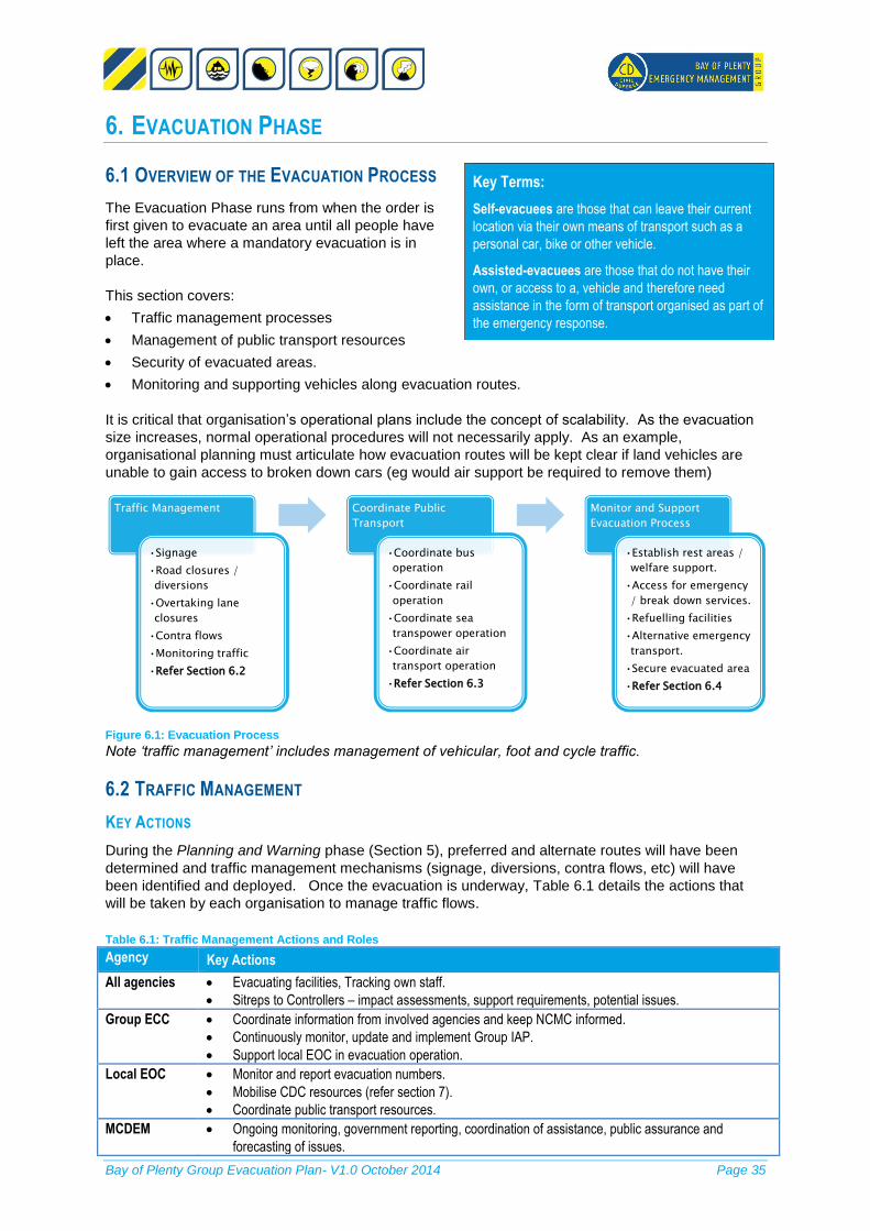
Bay of Plenty Group Evacuation Plan- V1.0 October 2014 Page 35
6. EVACUATION PHASE
6.1 OVERVIEW OF THE EVACUATION PROCESS
The Evacuation Phase runs from when the order is
first given to evacuate an area until all people have
left the area where a mandatory evacuation is in
place.
This section covers:
Traffic management processes
Management of public transport resources
Security of evacuated areas.
Monitoring and supporting vehicles along evacuation routes.
It is critical that organisation’s operational plans include the concept of scalability. As the evacuation
size increases, normal operational procedures will not necessarily apply. As an example,
organisational planning must articulate how evacuation routes will be kept clear if land vehicles are
unable to gain access to broken down cars (eg would air support be required to remove them)
Figure 6.1: Evacuation Process
Note ‘traffic management’ includes management of vehicular, foot and cycle traffic.
6.2 TRAFFIC MANAGEMENT
KEY ACTIONS
During the Planning and Warning phase (Section 5), preferred and alternate routes will have been
determined and traffic management mechanisms (signage, diversions, contra flows, etc) will have
been identified and deployed. Once the evacuation is underway, Table 6.1 details the actions that
will be taken by each organisation to manage traffic flows.
Table 6.1: Traffic Management Actions and Roles
Agency Key Actions
All agencies Evacuating facilities, Tracking own staff.
Sitreps to Controllers – impact assessments, support requirements, potential issues.
Group ECC Coordinate information from involved agencies and keep NCMC informed.
Continuously monitor, update and implement Group IAP.
Support local EOC in evacuation operation.
Local EOC Monitor and report evacuation numbers.
Mobilise CDC resources (refer section 7).
Coordinate public transport resources.
MCDEM Ongoing monitoring, government reporting, coordination of assistance, public assurance and
forecasting of issues.
Traffic Management
•Signage
•Road closures /
diversions
•Overtaking lane
closures
•Contra flows
•Monitoring traffic
•Refer Section 6.2
Coordinate Public
Transport
•Coordinate bus
operation
•Coordinate rail
operation
•Coordinate sea
transpower operation
•Coordinate air
transport operation
•Refer Section 6.3
Monitor and Support
Evacuation Process
•Establish rest areas /
welfare support.
•Access for emergency
/ break down services.
•Refuelling facilities
•Alternative emergency
transport.
•Secure evacuated area
•Refer Section 6.4
Key Terms:
Self-evacuees are those that can leave their current
location via their own means of transport such as a
personal car, bike or other vehicle.
Assisted-evacuees are those that do not have their
own, or access to a, vehicle and therefore need
assistance in the form of transport organised as part of
the emergency response.

Bay of Plenty Group Evacuation Plan- V1.0 October 2014 Page 36
Agency Key Actions
Emergency
Services
Assist evacuation of vulnerable groups.
NZ Police Immediate road closures required to ensure safety2.
Evacuation of people away from the immediate danger area.
Traffic Management in support of Road Authorities if required (where resources permit).
Advising CDEM of public transport requirements to support populations in area.
NZTA State Highway traffic management.
Advise Controllers on road conditions, alternative routes and contra flow options.
NZTAs Network Management Consultants will:
Act in advisory capacity to NZTA.
Task Maintenance Contractors on road closures and traffic management requirements.
Liaise will all Emergency Services and TLAs in managing road closures, evacuation routes and
alternative routes.
Liaise with neighbouring NZTA regions and TLAs on the use of alternative routes.
Liaise with neighbouring regions on linking of roads into the neighbouring regions.
NZTA’s Highway Maintenance Contractor will:
Provide updates to Network Consultants on road conditions.
Undertake traffic management in consultation with Network Management Consultants.
Territorial
Authority
Local road traffic management (consultants engaged by TLAs to manage local roads will coordinate
this).
BoP Regional
Council
Maintain a database of the bus company contacts 24/7 including drivers, bus capacity, bus locations
day and night, existing MOUs with health Providers to assist with evacuations and fuel capacity.
COMMUNICATION LINES
Figure 6.2 illustrates
tasking and
communication lines in
relation to traffic
management.
6.3 COORDINATE PUBLIC TRANSPORT RESOURCES
If it is determined appropriate to support the evacuation process with public transport (the decision
having been made as per Section 5.2), these public transport resources shall be managed as follows.
2 NZ Police, Fire Service and NZTA all have legislative powers to close roads. Following a state of
emergency, a CDEM Controller may authorise the exclusion of people from any place.
Group
Controller
(GECC)
Local
Controller
(EOC)
Local Road
Authorities
Local Roads
Network
Consultant
Local Roads
Maintenance
Contractor
NZ Police
(Regional)
NZ Police
(Local)
NZTA
SH Network
Consultant
SH
Maintenance
Contractor
Neighbouring
Regions GECCNotes:
•Either NZTA or NZ Police may task Network Consultant or Maintenance Contractor over State Highway Road Closures and Traffic Management.
•Either NZ Police or Local Road Authorities may task Network Consultant or Maintenance Contractor over Local Road Closures and Traffic Management.
Figure 6.2: Traffic Management Coordination

Bay of Plenty Group Evacuation Plan- V1.0 October 2014 Page 37
BUSES
Figure 6.3 illustrates tasking and communication lines
in relation to bus coordination. Table 6.2 summarises
the actions being undertaken by each organisation in
coordinating bus transport.
It is noted that in principle, buses within the area of
the Territorial Authorities are the resource of that
area. However in a large scale evacuation with cross-
boundary movement, the GECC will provide overall
coordination.
Table 6.2: Bus Coordination Roles and Actions
Agency Key Actions
Bus Companies Coordinate the availability of buses and drivers within their company.
Ensure drivers get enough rest and for their health and safety (breaks and roster systems).
Liaise with Local Controller/EOC on the continued availability of resources.
Provide buses and drivers as requested by Local Controller.
Local Controller Provide advice to bus companies as to where buses are required.
Provide advice to bus companies as to hazards impact, preferred evacuation routes.
Bay of Plenty
Regional Council
Policy and Transport provide advice on the most effective way of minimised buses and
drivers.
RAIL
Figure 6.4 illustrates tasking and
communication lines in relation to rail
coordination.
Table 6.3 summarises the key actions
being taken by each agency in the
coordination of rail. The following
principles are noted:
A six car train set with passengers
with no luggage can take up to 1000 people.
The majority of the fleet is located in Auckland, using this fleet will have a major impact on
Auckland transport (and question over whether engines can take trains over Bombay Hills).
Neighbouring
Regions
Group
Controller
(GECC)
Local
controllers
Bus
Companies
BoP (Policy
and
Transport)
National
Controller
NCMC
Group
Controller
GEOC
Local Controller
Local EOC
National
Transport
Response Group
Kiwi Rail
Network Control
Manager
Joint Crisis
Management
Group
Transport
Auckland
Suburban Fleet
Transport
Wellington
Suburban Fleet
Kiwi Rail
Vehicles
Kiwi Rail
Locomotive
Stock
Figure 6.4: Communication and Tasking Lines – Rail
Figure 6.3: Communication and tasking lines - Buses

Bay of Plenty Group Evacuation Plan- V1.0 October 2014 Page 38
Table 6.3: Rail Coordation Roles and Actions
Agency Key Actions
CDEM Group CDEM Group liaises with NCMC to request Rail Transport.
NCMC liaises with Transport Response Team (TRT).
KiwiRail Network
Control Manager
KiwiRail Network Control Manager activates the Joint Crisis Management Group.
Joint Crisis
Management Group
Establish Group in Auckland or Wellington, to implement the Rail Crisis Management Plan.
Advise NCMC on the Rail Crisis Management Plan.
Coordinate Rail Vehicles
Liaise with Rail Incident Controller on resources requested on Group or Local level.
Rail Incident
Controller
Support and advise either Group or Local Controller on the coordination of rail vehicles.
Ensure that drivers get enough rest and for their health and safety (breaks / roster system
are in place).
AIR
The main airports in the Bay of Plenty region include the following (also refer Figure 2-4):
Rotorua (capacity for Airbus A32)
Tauranga (capacity for Hercules)
Whakatane
Air transport cannot evacuate large numbers of people quickly and is generally more important for
bringing in logistical support and personnel than evacuating people. In an emergency where the
NCMC is activated, the national Transport Response Team (convened by the Ministry of Transport)
provides advice on transport related issues, recommendations for response and recovery priorities
and collates action requests. There is an Air Operations position in the ECC which would coordinate
regional air transport resources.
SEA TRANSPORT
Boats (naval and civil) and ferries could be used to transport people from Omokoroa, the Islands, to
Tauranga and from Tauranga to Auckland and Napier.
6.4 MONITOR / SUPPORT ALONG EVACUATION ROUTES
DIVERSION TO REST AREAS
Evacuation of a large number of people in a short time may cause traffic congestion and, in the worst
case, even gridlock. Diversion to rest areas is an option. Note that if people are being diverted off the
road for any length of time, they will need to be supported with water, food and shelter.
FUEL SUPPLY
As discussed in ‘lifeline utility considerations’ (section 5.2), fuel will be a critical issue. In accordance
with the National CDEM Fuel Plan and BoP Regional Fuel Contingency Plan, it is expected that:
GECC will advise fuel companies the ‘CDEM critical fuel customers’ for priority fuel supply.
Fuel companies will put in place procedures to ensure that these customers are able to access
fuel. This may include designated lanes at services stations, designated services stations, or
allowing ‘queue jumping’. (Forecourt control and security is the responsibility of the fuel station
owners, however the Police may need to support if public safety is threatened).
The GECC will advise fuel companies of any supply priorities or issues which need to be
addressed.
SECURING EVACUATED AREAS

Bay of Plenty Group Evacuation Plan- V1.0 October 2014 Page 39
Visibly securing evacuation areas should provide public assurance that they can safety leave their
homes. The NZ Police will be responsible for securing evacuated areas, supported by Fire and
possibly NZDF in a major event. The NZ Police will take any immediate steps to protect life and
property and will further liaise with the Group and Local Controllers over the extent of the area to be
secured.
ACCESS FOR EMERGENCY SERVICES AND OTHER KEY AGENCIES
Preferred evacuation routes will have traffic shoulders, which should to be kept clear for emergency
services, break down trucks and critical lifelines such as fuel trucks. It may be necessary to have
plans to forcibly remove broken down or crashed vehicles. Consider deploying loaders along
shoulders for this purpose.
Table 6.4: Agency Roles and Actions in Providing Support along Evacuation Routes.
Agency/Role Key Actions
Road
Authorities
Identify the need for, and location of, rest areas along route.
Provide traffic management support to rest areas, staging areas and evacuation assembly areas.
Group ECC Advise fuel companies of local evacuation routes.
Liaise with agencies to ensure that sufficient support is in place along route.
Provide oversight of evolving issues and communicate to local EOCs to address.
Communicate priorities for fuel supply to fuel companies.
Local EOC Liaise with Road Authorities and provide logistical / welfare support at areas where people have been
directed to rest.
MCDEM Ongoing monitoring, government reporting, coordination of assistance, public assurance and
forecasting of issues.
NZ Police Maintain law and order during evacuation.
Secure evacuated areas.
WCG Coordinate and provide support and assistance at rest areas.
Fuel
Companies
Put in place mechanisms to ensure critical customers ensure continuity of supply..
Take all practicable measures to keep fuel stations supplied with fuel.
Liaise with CDEM Controllers re: actions being taken and receive priority directives.
Advise ECC of re-supply problems.
Planning Expectations
To enable effective implementation of the Evacuation phase:
1. Road Authorities will have tested traffic control management plans that identify preferred and
alternative evacuation routes for different scenarios, road closures/diversions and signage
requirements.
2. Local CDEM Evacuation Plans will contain processes for:
- maintaining relationships and communications with public transport agencies and databases of
resources available.
- in liaison with Road Authorities, identify potential traffic bottlenecks and potential rest/shelter
areas along key routes for diversion of traffic.
3. Fuel companies will:
- have plans in place to ensure continuous supply to GECC named CDEM-critical customers and to
keep fuel stations on evacuation routes supplied as far as practicable.
- Assist the CDEM Group to review business continuity planning such as power backup at key fuel
stations.
4. NZ Police will maintain plans and procedures for:
- assisting with warnings and evacuation
- securing evacuated areas
- maintaining traffic flows along evacuation routes, including special measures for removing broken
down vehicles.

Bay of Plenty Group Evacuation Plan- V1.0 October 2014 Page 40
5. Key Agencies with vulnerable client organisations (Ministry of Education, Ministry of Health,
Department of Corrections) shall support client organisations to have detailed evacuation plans in
place and support them to do so.
7. SHELTER
7.1 OVERVIEW OF THE SHELTER PHASE
The shelter phase includes the receiving, registration
and temporary accommodation of evacuees. It
requires coordination amongst a number of
government, CDEM and welfare delivery agencies.
Welfare response at the Group level is coordinated
by the Group Welfare Manager with multi agency
advice, support and coordination of welfare activities
by the WCG. Membership is drawn from all key
welfare organisations within the group.
In smaller evacuations, people often seek shelter in second homes, hotel/motels or with family/friends
before seeking public shelter. In larger scale evacuations, these alternatives may not be available.
Therefore local CDEM Evacuation Plans need to detail how people can be accommodated in public
shelter areas (CDCs). Arrangements also need to be made to track and connect individuals and
families.
7.2 IDENTIFYING CIVIL DEFENCE CENTRES
CDC CAPACITY IN / NEAR BAY OF PLENTY
Bay of Plenty has an estimated capacity to shelter around 23,000 evacuees in CDCs within the region
(while noting there are likely to be capacity restraints in terms of staff and logistics to open all the
centres at once) as follows3:
Approximately 9,000 capacity in Western Bay of Plenty, the largest CDCs at Bay Park Stadium &
TECT Arena with capacity for around 2000 people each.
Approximately 8,800 capacity in Eastern Bay of Plenty, the largest sites having no more than 600
people capacity.
Approximately 5,300 in Rotorua, the largest site being the Energy Centre with around 1,500
person capacity.
3 This is intended to provide a broad picture of regional capacity. Seasonal variations will occur.
Details of welfare centre sites and capacity will be held in local CDEM Evacuation Plans.
Key Terms:
Welfare: Welfare response is a coordinated action
undertaken by government and non-government social
services agencies and organisations to ensure that
individuals, families and communities affected by an
emergency have information on, and easy access to,
the range of services available to or needed by them.
Civil Defence Centres: Provide temporary emergency
accommodation (for those evacuees who cannot
accommodate themselves) and registration services
(only for those who will be staying at the CDC).
At some CDCs, there may be a wider range of
welfare, support and recovery services for all
evacuees, and registration services for evacuees not
staying in accommodation provided at CDCs.

Bay of Plenty Group Evacuation Plan- V1.0 October 2014 Page 41
Figure 7.1: Shelter Phase
Table 7.1: Key Roles and Actions during the Shelter Phase.
Agency Actions
Territorial Authority Coordinate and ensure trained staff capability for EOC.
Coordinate the staffing of CDCs.
Have emergency Finance process in place to support EOC.
Local EOCs Activate appropriate CDCs
Support logistically activated CDCs.
Activate agencies to provide welfare services (eg receive and register evacuees).
Engage with agencies to provide support.
Monitor shelter locations security, food, bedding, clothing.
Coordinate emergency temporary accommodation.
Plan for return.
Local Welfare Manager Convenes the Local Welfare Committee when appropriate.
Seeks to understand the needs of the local environment/community, particularly the
vulnerable and those at risk.
Coordinates and supports CDCs.
Liaise with Group Welfare Manager.
Local Welfare
Committee
Advises Local Controller/EOC via Local Welfare Manager on the operational welfare plan
capability.
Manage issues for welfare operations.
GECC Monitor situation, identify medium / long term issues, and collate Sitreps and IAPs.
Support local EOC operations as required.
Support welfare action planning.
Welfare Manager Advise the CDEM Group Controller on welfare matters.
Liaise with and support Local Welfare Managers on the provision of welfare services within
their territorial authority and support where necessary.
Resolve issues of coordination between welfare agencies that cannot be resolved at the
local level.
Coordinate the development of emergency welfare programmes and tasks in GECC IAPs.
Welfare Coordinating
Group
Advises Group Controller/GECC via Group Welfare Manager on the Group welfare plan
capability.
Manage issues for coordination of welfare by agencies.
MCDEM/NWCG Ongoing monitoring, government reporting, coordination of assistance, public assurance
and forecasting of issues (depending on mode of activation).
Fire Service Fire safety and other personnel support at CDCs.
Assist with water for drinking / cleaning at CDCs (likely to be supported by other tanker-
owning companies such as breweries).
Assist with transportation of vulnerable populations.
St John Provide healthcare at shelter facilities (if required).
Transportation of vulnerable populations.
Police Disaster Victim Identification.
1. Identify / Establish
CDCs
•Services required
(accommodation,
needs assessment,
etc)
•Capacity in / near BoP
•Location requirements
•Logistical
requirements
including capacity to
open CDCs
•Level of support
required
•Refer Section 7-2.
2. Receive / Register
Evacuees
•Registration Points
•Registration Process
•Reception points and
other considerations
in receiving evacuees
from outside the area.
•Refer Section 7-3
3. Ongoing Management
of CDCs
•Logistical
Requirements
•Communication and
Coordination
•Needs assessments
and planning for
moving people on to
longer term
accommodation.
•Refer Section 7-4

Bay of Plenty Group Evacuation Plan- V1.0 October 2014 Page 42
Agency Actions
Reassurance patrolling around CDCs.
Presence at major CDCs during reconciliation / inquiry phase.
DHB Provide details of neighbouring medical services to CDCs.
Psychosocial support
MSD Provide emergency payments.
Provide personnel to support CDC.
NZ Red Cross Provision of CDC management services and first aid support.
Provide staff/volunteers for welfare/outreach.
National NECC established to coordinate logistics / command through a local Red Cross
EOC.
Plus other roles as defined in section 3.
Salvation Army CDC support.
Pastoral Care.
Provision and coordination of Salvation Army volunteers.
Plus other roles as defined in section 3.
MPI Establish temporary shelters for animals – racecourse, tennis courts, schools, parks, other
‘animal housing’ facilities.
Rural Support Trust Provide communication between those able to provide specialized rural support outcomes
and those requiring those outcomes.
Moral support for displaced rural people.
Education, Corrections,
Health
Liaise with ‘client’ agencies and ensuring alternative facilities available.
Prepare a controlled return plan.
Lifeline Utilities Continued capacity support in evacuation / shelter.
Neighbouring regions (with the same proviso as for Bay of Plenty – refer footnote previous page)
have an estimated capacity to shelter evacuees as follows:
Auckland – has around 130 designated facilities with capacity for up to 50,000 evacuees in terms
of physical space – however they do not currently (April 2012) have sufficient staff to run this
number of facilities concurrently and would need outside assistance. Additionally, in Auckland
there are a large number of corporate accommodation facilities.
Waikato has an estimated capacity to shelter around 50,000-60,000 evacuees in CDCs within the
region. Major sites at Claudelands and Mystery Creek could accommodate around 10,000
evacuees (with the potential to expand to 35,000 at Mystery Creek).
Taranaki. Could shelter around 5,000 in CDCs and 5,000 in corporate accommodation (unless
major event is being hosted in the region).
Gisborne. Could shelter 2,000 from outside region (if scenario does not affect the region) – this
number could increase if marae arrangements activated. Larger numbers could be
accommodated for short periods, eg: using the region as a staging area with temporary
accommodation such as camping.
Hawkes Bay. Could shelter around 7,000 in various accommodation facilities (4000 beds in
motels/hotels plus other sites such as marae, hostels).
Manawatu-Wanganui could shelter around 4,000 in CDCs and about the same amount in
corporate accommodation.
Other potential accommodation includes:
Housing NZ (generally have around 3-5% unoccupied, though some of these are unfurnished and
unsuitable for occupation). HNZ first priority will be re-housing their own tenants.
SELECTING CIVIL DEFENCE CENTRES

Bay of Plenty Group Evacuation Plan- V1.0 October 2014 Page 43
CDCs should be established in accordance with international standards4. It is recognised that many
proposed CDC sites do not currently meet these standards, and as part of local evacuation / welfare
planning, the appropriate standard will be reviewed.
The following criteria should be considered before confirming appropriate welfare sites for the event:
The numbers expected (if small, it may be cheaper and simpler to accommodate in
hotels/motels).
The ability to cater for the needs of vulnerable groups (refer Section 2.2), such as pet owners,
culturally and linguistically diverse and physically/mentally impaired. This will require provision of
resources such as disabled access, temporary animal shelters, translators, special food
requirements, etc. (It is likely that only some centres will be equipped to deal with all these issues
and people that have these special requirements may need to be moved to between Centres).
The ability to source food in the area (ie impact of the event of Fast Moving Consumer Goods to
the area).
Provision of safe sleeping and play areas for children
Safe storage for medications
The ability to separate and manage special needs evacuees such as criminals and mentally
handicapped people.
Access to sites for refueling and parking and public transport.
Designated CDC facilities as a first priority (where agreements are in place)
Availability of medical support (note that St John is unlikely to have the resource to support all
CDCs and CDCs should hold details of nearby medical centres to refer people to).
Seasonal impact – weather conditions, tourism peaks.
Separation of Evacuation and Recovery Centres (which provides better logistical coordination at
centres).
Organised billeting will not be used as an accommodation strategy, due to the complex issues around
ensuring safety of hosts and billets. Voluntary billeting (people staying with friends and family) will be
encouraged.
7.3 REGISTERING EVACUEES
The responsibility for registering evacuees lies with CDEM, the Red Cross have a mandate to assist
CDEM through the National CDEM Plan to carry out this activity.
Within the region, registration centres will be placed along key routes away from the evacuation area
(these may also be rest / support areas as described in Section 6.4). If evacuees are being directed
to other regions (in agreement with those Groups), the most likely reception points are as follows:
Hawkes Bay: Reception areas on main access points SH2 / SH5.
Taranaki: New Plymouth (preferred location) followed by Harewa or Stratford.
Waikato: Claudelands Event Centre.
Gisborne: Lawson Field Theatre.
Auckland: Reception centre would be established from a range of predetermined locations
depending on requirements specific to the event.
Registration points should:
Give priority to registering people that need assistance.
Emphasise the need for people to know their registration number to assist accessing CDCs.
Assisting with enquiries to locate family members
If a territorial authority has exhausted its efforts to locate family members, direct people to a Red
Cross helpline to find out if these people have been registered.
4 The Sphere Project: Humanitarian Charter and Minimum Standards in Humanitarian Response,
2011 Edition, P 129(247)).

Bay of Plenty Group Evacuation Plan- V1.0 October 2014 Page 44
Planning Expectations To enable effective implementation of the Shelter Phase, all agencies will have plans in place to
deliver their roles details in Table 7-1, notably:
1. Local CDEM Plans will have identified preferred CDCs and ensure they meet appropriate
standards.
2. Group CDEM will have plans to support EOAs and liaise with the National Welfare Coordination
Group.
3. WCG will develop and foster relationships amongst welfare agencies.
4. Welfare Agencies will have plans to mobilise resources to manage and support CDCs.

Bay of Plenty Group Evacuation Plan- V1.0 October 2014 Page 45
8. MONITORING AND EVALUATION
8.1 PLAN REVIEW PROCESS
The Group is responsible for maintaining arrangements to ensure that this Plan is effectively
exercised to ensure it is current and people are familiar with processes. The plan will be reviewed
every five years. Bay of Plenty Coordinating Executive Group (CEG) will lead the review and will
consult with all agencies with responsibilities or reference to the plan.
8.2 MONITORING PROGRESS
Table 8-1 illustrates the expectation in terms of plans that agencies will have in place to ensure they
are able to undertake their responsibilities outlined in this Plan. Some agencies already have these in
place.
All agencies will provide operational Evacuation Plans / procedure to BoP CEG within 12 months
following the approval of this Plan. CEG will review and provide oversight that local CDEM
evacuation plans are aligned with this Plan and with each other.
Table 8.1: Operational Plan Monitoring
Agency Plan Status
Local CDEM /
TLAs
Operational Evacuation Plans detailing:
Evacuation Plans for own facilities.
Hazard analysis/evacuation scenarios.
Evacuation triggers, areas, timing.
Vulnerable groups and how they will be supported.
Local infrastructure including details on runways and passenger numbers.
Transport constraints and responsibilities.
Supply and refueling plans.
Warning methods for different scenarios.
CDC location, facilities.
Registration processes.
CDC establishment.
Neighbouring
Regions
Procedures detailing:
Detail analysis or modeling of likely numbers and the likely social behavior following
an event.
Road
Authorities
Operational Evacuation Plans detailing:
Preferred and alternate evacuation routes for different hazard scenarios and capacity.
‘Scalable’ traffic management plans (eg: use of more extreme measures) including
consideration of contraflows.
Location of potential rest / welfare areas along route.
Evacuation Plans for own facilities.
NZ Police Operational Plans / Procedures detailing:
Evacuations.
Management of evacuated area security.
Liaison processes with Road Authorities over traffic mgt, access for priority vehicles.
BoP Regional
Council
Hazard information that facilitates evacuation planning (eg: tsunami inundation areas,
volcanic eruption zones, flood risk areas).
DHB,
Corrections,
Education
Evacuation plans / procedures for own facilities and plans to support ‘client’ facilities
(hospitals, rest homes, schools, prisons, etc).
St John Operational Plans as to how medical support can be provided along evacuation routes
and at CDCs.
Welfare
Agencies
Operational Plans for establishing / supporting CDCs.

Bay of Plenty Group Evacuation Plan- V1.0 October 2014 Page 46
Appendix A: Local Evacuation Plan
All Local CDEM sector agencies should prepare plans that outline the arrangements for contributing
to Response and Recovery from an emergency. This template is aimed at giving Territorial Local
Authorities (TLA’s) and Agencies a tool to draft local evacuation plans to support the CDEM Group
effort in evacuation. The headings give plans a minimum format to assist TLAs and Agencies in
writing their local evacuation plans.
It is important that the plan provides a way to think through the process and develop arrangements for
addressing every stage of an emergency evacuation.
To ensure the success of this plan TLA’s and Agencies need to:
Involve all partners.
Address all hazards.
Gather information, analyse and set out in logical steps.
Identify roles and responsibilities, the allocated resources and establish accountability.
Address all four R’s during planning (Possible they think about management, governance and administration).
Introduction
Purpose
o Explain the purpose of the plan and the importance to address evacuation within
TLA’s.
Scope o What is covered by the TLA/agency evacuation plan? o What is not covered by the TLA/agency evacuation plan?
Plan Framework o Ensuring that the Local and agency plans are aligned with and in support of the Bay
of Plenty CDEM Group Plan and Evacuation Plan. o Consistent with Neighbouring TLA’s, Bay of Plenty Group, supporting agency plans
and procedures
(For more detail on this refer to Section 1 of the BoP Group Evacuation Plan)
Community Demographics
Overview of hazards
Identify hazards within TLA’s that may impact on evacuation or lead to evacuations and the implication of agency plans. Hazards could include Earthquakes, Volcanic Eruptions, Tsunami, Flooding or a combination of.
Community/Vulnerability Analysis
People
Overviews of the wider population within TLA. In agency plans identify community sector agencies will be supporting.
Identify communities within the TLA of significance and the impact it will have on planning. This could include Māori Communities and Vulnerable Groups example Low socio-economic areas and homeless, people with disabilities, elderly, remote/isolated areas etc.
Infrastructure
Identify significant infrastructure specific to TLA, State highways, Hospitals, Prisons and Major rivers.

Bay of Plenty Group Evacuation Plan- V1.0 October 2014 Page 47
Incorporate infrastructure plans into TLA plan including lifelines utilities that support these infrastructures.
(For more detail on this refer to Section 2 of the BoP Group Evacuation Plan)
Roles and responsibilities
Clearly identified and agreed roles and responsibilities
TLA’s to identify agencies that are represented in TLA CDEM environment and how these agencies will support the evacuation process.
TLA’s to identify what their roles and responsibilities will be during the 4 R’s.
TLA and agencies to identify their limitations during an event and plan how to minimise the impact of these limitations.
Identify resources that agencies have access to support evacuation process.
(For more detail on this refer to Section 3 of the Plan and Section 5 of the Bay of Plenty CDEM
Group Plan)
Evacuation Decision
TLA’s and agencies to identify the triggers within each of the four steps below to decide to evacuate or to shelter-in-place. Each step has triggers to consider that might influence the decision:
o Decision to activate EOC o Confirmation who the lead agency might be in different scenarios. o Factors to consider when planning whether to evacuate or shelter-in-place this could
include time of the day, public safety, transport routes available, availability of transport and accessibility, etc.
o Effect on vulnerable population (critically ill) ability to evacuate without causing undue harm.
(For more detail on the triggers refer to Section 4 of the Plan and the Response Management
Directors Guide)
Evacuation Planning and Warning
When completing evacuation planning at TLA level consider the triggers and actions. o Consideration might include early advice to key stakeholders, numbers and types of
evacuees, timing and areas, preferred evacuation routes, public transport requirements, location of registration and CDCs and lifelines utilities constraints.
o Key messages to evacuate include why, what areas, when to evacuate, and information on what to do before you leave, what to take with, how to evacuate (transport/route), where to evacuate to, how to get evacuation messages to effected and identify specific hazard messages before the event.
o Key messages to be communicated, confirm the communication processes, and how messages will be disseminated.
o Identify and have a relationship with local media that will support the dissemination process.
(For more detail on this refer to Section 5 of the Evacuation Plan)
Evacuation Phase
The Traffic Management plan should include NZTA local TLA roading manager and cover potential road closures, over taking lanes, contra flows and details on resources required.
The public transport plan should consider planning to include bus, rail and air transport operations and they should be part of the planning process.
Bay of Plenty Group Evacuation Plan- V1.0 October 2014 Page 48
Consider how to monitor and support the evacuation process, include possible rest areas, delivering of welfare support, access for emergency services, alternative emergency transport and secured evacuate areas.
(For more detail on this refer to Section 6 of the Evacuation Plan)
Shelter
The shelter phase is the responsibility of the local welfare manager with the support of the Local Welfare Committee. The shelter phase includes the receiving, registration and temporary accommodation of evacuees.
o Local welfare committee and local agencies should be part of the planning process to identify CDCs and ongoing support, the capacity and location of possible CDCs considering hazards.
o Include how to receive/register evacuees, identify potential registration points and to confirm the registration process.
o To ensure ongoing support of CDCs, plan for logistical requirements. o It is important to liaise with agencies before an event to identify what resources are
available within the TLA and the resources that will have to be accessed from outside the area.
(For more detail on this refer to Section 7 of the Plan)
Appendixes
The Local Evacuation Plan should include appendixes with detail mapping reflecting local hazards, key evacuation routes, CDC locations, significant lifelines, vulnerability population or any other information required to support the evacuation process.
Monitoring and Evaluation
The template provided is available for TLA’s and agencies to use as a guide to draw up their own Local evacuation plans in support of the Bay of Plenty CDEM Group Evacuation Plan, as stipulated in the “Development Phase (years 1-3) of the Bay of Plenty CDEM Group Plan 2011-2015 Section 9, Figure 9.1. Local plans should be reviewed in line with TLA LTP’s.

Bay of Plenty Group Evacuation Plan- V1.0 October 2014 Page 49
Appendix B: References
1. Mass Evacuation Planning (Directors Guideline for Civil Defence Emergency Management
groups [DGL 07/08]
2. Bay of Plenty Fuel Contingency Plan, March 2013
3. Draft Bay of Plenty Civil Defence Emergency Management Welfare Plan 2013
4. Bay of Plenty Civil Defence Emergency Management Group Plan
5. Bay of Plenty Lifelines Group Vulnerability Study, April 2011
6. The Civil Defence Emergency Management Act (CDEM Act) 2002
7. The National CDEM Plan 2005
8. Guide to the National CDEM Plan
9. Statistics New Zealand

Bay of Plenty Group Evacuation Plan- V1.0 October 2014 Page 50
Appendix C: Glossary of Key Terms
Term Definition
Assisted-evacuees People that do not have their own, or access to a, vehicle and therefore need assistance in the
form of transport as part of the emergency response.
Capability The effectiveness of co-operation and co-ordination arrangements across agencies for the
delivery of resources in the event of an emergency
Civil Defence Centre
(CDC)
Provide a range of welfare, support and recovery services for evacuees including emergency
shelter, registration and social services, catering and public information management.
Civil Defence
Emergency
Management (CDEM)
Stands for Civil Defence Emergency Management and means the application of knowledge,
measures, and practices that:
are necessary or desirable for the safety of the public or property, and
are designed to guard against, prevent, reduce, or overcome any hazard or harm or loss that
may be associated with any emergency
CDEM Act Civil Defence Emergency Management Act 2002
CDEM Group Means the Civil Defence Emergency Management Group which has been established under
section 12 of the Civil Defence Emergency Management Act 2002.
Corporate
Accommodation
Hotels, motels, lodges.
Deprivation A situation in which people do not have basic things that they need to live a comfortable life
District Health Board The provider of publicly funded services for the population of a specific geographical area in
New Zealand.
Emergency Means a situation that:
is the result of any happening, whether natural or otherwise, including (without limitation)
any explosion, earthquake, eruption, tsunami, land movement, flood, storm, tornado,
cyclone, serious fire, leakage or spillage of any dangerous gas or substance,
technological failure, infestation, plague, epidemic, failure of or disruption to an
emergency service or a lifeline utility, or actual or imminent attack or warlike act; and
causes or may cause loss of life or illness or distress or in any way endangers the safety
of the public or property in New Zealand or any part of New Zealand; and
cannot be dealt with by emergency services, or otherwise requires a significant and
coordinated response under the Act (section of the Act)
Emergency Services Includes the New Zealand Police, New Zealand Fire Service, National Rural Fire Authority,
rural fire authorities, hospital and health services
Emergency
Management Office
Carries out such functions as assigned to it by the CDEM Group. The Bay of Plenty Group
EMO is currently based at Environment Bay of Plenty
Emergency Operations
Centre
A centre established by the Lead Agency where the response to an event may be managed
and supported
Evacuation The temporary relocation (either spontaneous or planned) of all or part of a particular
population or geographical region from a location that has been or is about to be affected by
an emergency, to a place considered to be safe. Evacuations can be mandatory, pre-event,
voluntary, recommended, self and assisted.
Evacuation assembly
area
Pre-determined site outside of the impacted area established as an assembly area for
evacuees en-route to a destination.
Civil Defence Centre Provides temporary emergency accommodation (for those evacuees who cannot
accommodate themselves) and registration services (only for those who will be staying at the
CDC).
Evacuation-in-place The concept of evacuating to a higher elevation within a current location. This may be
appropriate for rapid onset hazards such as near-source tsunami.
Group Controller
A person appointed by the CDEM Group as a Controller under Section 26 of the Civil Defence
Emergency Management Act 2002
Hazard Means something that may cause, or contribute substantially to the cause of, an emergency
(Section 4 of the CDEM Act) and includes all hazards (i.e. natural, technological, and

Bay of Plenty Group Evacuation Plan- V1.0 October 2014 Page 51
Term Definition
biological sources)
Lead Agency The organisation with the legislative authority; or because of its expertise, resources or formal
agreement, is primarily responsible for control of an incident
Lifeline Utilities Means an entity named or described in part A of Schedule 1, or that carries on a business
described in Part B of Schedule 1 of the CDEM Act e.g. Power companies
Local Authority Means a regional council or territorial authority (as per the Local Government Act 2002)
Local Controller
Means a person appointed by the CDEM Group as a Local Controller under Section 27 of the
Civil Defence Emergency Management Act 2002
Mandatory evacuation Mandatory evacuation is directed when it is believed that the risk to residents is too great to
allow them to remain where they are therefore placing a duty of responsibility on authorities.
Maximum Likely Event Means the largest adverse event scenario that is manageable by the Group, is the Group’s
responsibility to manage, and has a probability of occurrence high enough to merit attention.
National Controller The person who is appointed in accordance with section 10 of the CDEM Act
Pacific Tsunami
Warning Centre (PTWC)
United States National Oceanographic and Atmospheric Administration facility to alert
recipients of the probability of a tsunami and that a tsunami investigation is underway
Pick-up point This is a local site within the impacted area for picking up members of the evacuating population who require transportation and/or other assistance in evacuating an at-risk area.
Reception Centre Provide those affected by an emergency event with access to information and initial support from social service agencies. Reception Centres are involved in the provision of emergency accommodation. Auckland Welfare Coordinating Group member agencies provide appropriate staff and resource at Reception Centres.
Recommended evacuation
When the threat has a high probability of affecting people living in at-risk areas and they are encouraged to leave but the decision to do so is left to individuals.
Recovery The coordinated process of reconstruction of infrastructure and the restoration of social,
economic and physical well-being of a disaster-affected community
Response Actions taken in anticipation of, during and immediately after an emergency or disaster to
ensure that its effects are minimised and that people affected are given immediate relief and
support
Rest areas Areas evacuees can be diverted to if traffic becomes overly congested.
Risk Means the chance of something happening that will have an impact on people and property –
measured in terms of consequences (impacts) and likelihood (frequency)
Safe point Area that is deemed safe from the risk posed by the hazard.
Self-evacuees / evacuation
People leave their current location because of actual or perceived risk without being directed to do so and require no immediate assistance with accommodation.
Self evacuees People that can leave their current location via their own means of transport such as a
personal car, bike or other vehicle.
Staging area Pre-determined site outside of the impacted area established to stage and coordinate transportation resources in support of pick-up point operations.
Support Agency Any agency that assists the lead agency during an emergency. Supporting documentation
includes detailed explanations, standard operating
procedures, the Director’s guidelines, codes, and technical standards.
Transport Support
Group
Establishment of this group is recommended by the MCDEM to help develop and implement a
coordinated Traffic Control Management Plan between all agencies.
Vertical evacuation On a different floor or level of a facility/building.
Voluntary evacuation
(‘Shadow’)
Occupants of areas outside the evacuation zone that leave despite the fact they are not threatened by the hazard.
Vulnerable Communities
At-risk groups that may need special consideration in order to ensure that they can be taken care of in an evacuation.
Welfare Welfare response is a coordinated action undertaken by government and non-government
social services agencies and organisations to ensure that individuals, families and
communities affected by an emergency have information on, and easy access to, the range of
services available to or needed by them.

Bay of Plenty Group Evacuation Plan- V1.0 October 2014 Page 52


