Chapter 3

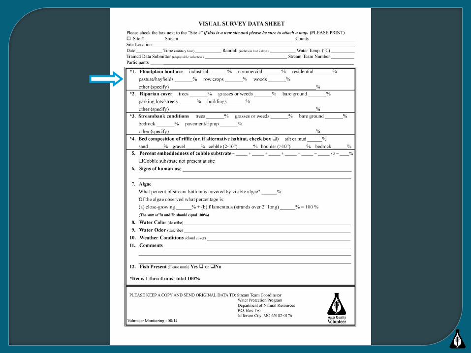
Observations of the environment through which a stream flows
Water quality is dependent on local weather conditions
Conducted twice per year• Once with foliage
present• Once with foliage absent


▪ No negative impact on water quality
▪ Stair-stepped floodplain due to normal high water
events
▪ Riparian corridor is vegetated
▪ Gently sloping banks
▪ Streambed is narrow with varying water depths
Unimpacted


Upland Floodplain and Land Use
▪ Increased possibility of nutrient (N & P) and
sediment loading
▪ Functional riparian corridor prevents erosion and
takes up access nutrients
▪ Streambank still has a gentle slope
▪ Streambed remains unaltered


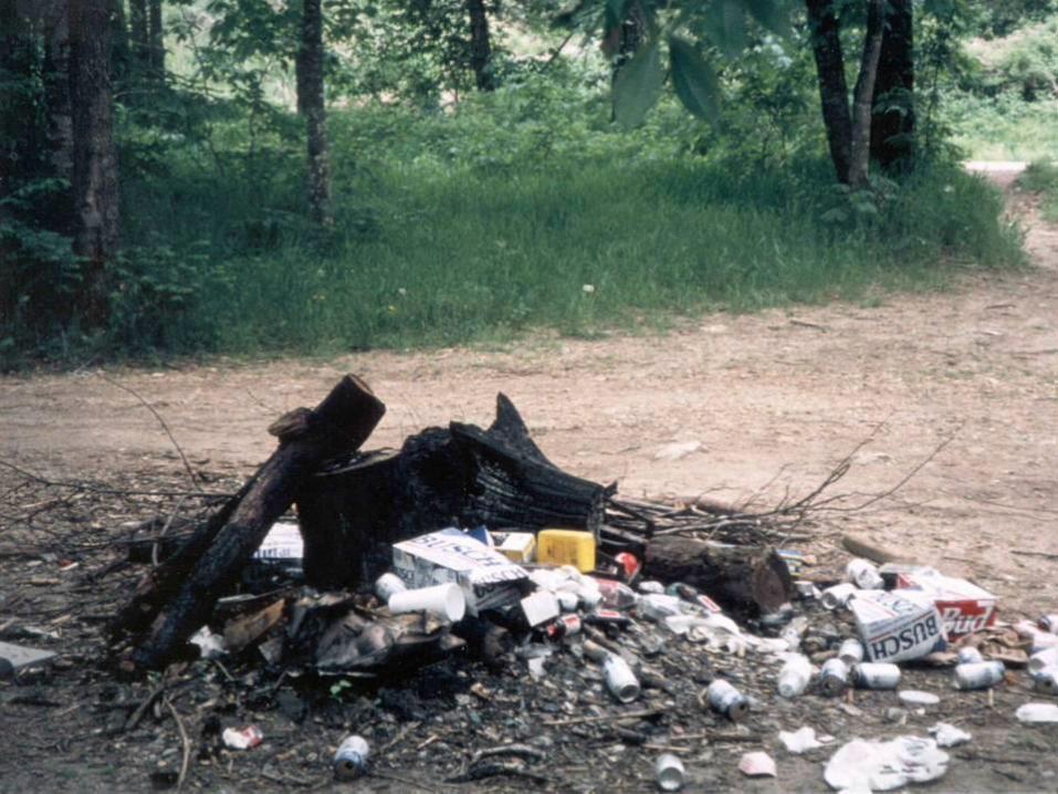
▪ Activities of economic value could be lost during a
flood event
▪ Riparian corridor is absent. Nutrients and sediment
now directly enter the stream
▪ Streambanks are now degraded
▪ Wider, shallower streambed
Floodplain Land Use


▪ Floodplain development threatened by flood events
▪ No riparian corridor
▪ Streambanks are steep and vertical
▪ Streambed is downcut and requires erosion control
Urban Land Use


Construction Sites
Sediment runoff rate of 20-150
tons/ac/yr
(Ag. Fields – 5 tons/acre)
Single largest cause of impaired
water quality in rivers
Third largest cause of impaired
water quality in lakes
Locust Creek at Grove CA