

Elgin Castle to Cathedral to
Cashmere
Historic Landscape Statement
Prepared by LUC
April 2013

Project Title: Elgin Castle to Cathedral to Cashmere, Historic Landscape Statement
Client: Moray Council
Version Date Version Details Prepared by Checked by Approved by Principal
V1 5/2/2013 Interim draft report BLD MT MT
V2 11/4/2013 Final report BLD MT MT
\\Glfp01\56 jobs and above\56\5665 Elgin Castle-Cathedral-Cashmere\B Project Working\Docs\Elgin-Castle-
Cathedral-Cashmere_Landscape Report_20130411_final.docx
Elgin Castle to Cathedral to
Cashmere
Historic Landscape Statement
Prepared by LUC
April 2013
Planning & EIA Design Landscape Planning Landscape Management Ecology Mapping & Visualisation
LUC GLASGOW 37 Otago Street Glasgow G12 8JJ Tel: 0141 334 9595 Fax: 0141 334 7789 [email protected]
Offices also in: London Bristol Edinburgh
FS 566056
EMS 566057
Land Use Consultants Ltd Registered in England Registered number: 2549296 Registered Office: 43 Chalton Street London NW1 1JD
LUC uses 100% recycled paper
Contents
1 Introduction 1
2 A History of the Landscape 3
3 Remnants of the Historic Landscape 16
4 Existing conditions 20 Existing site features 20 Existing Maintenance 29
5 Conclusions and Further Work 30 Further work 31
Appendix 1. Historical Maps 32
Appendix 2. Tree survey information 38
Tables
Table 2.1: Timeline of Events in the Landscape History 5
Figures
Figure 1: The study area 2
Figure 2: Historical analysis 1769 10
Figure 3: Historical analysis 1822 11
Figure 4: Historical analysis 1868 12
Figure 5: Historical analysis 1905 13
Figure 6: Historical analysis recent 14
Figure 7: Topographic survey 2013 15
Figure 8: Age structure of the landscape 17
Figure 9: Tree species structure 18
Figure 10: Tree age structure 19
Figure 11: Existing site issues 26
Figure 12: Views around Cooper Park 28
Photographs are taken by LUC. Historic maps are reproduced with kind
permission of the Trustees of the National Library of Scotland and Lord
Seafield.
Elgin Castle to Cathedral to Cashmere 1 11 April 2013
1 Introduction
1.1 This report is forms a Historic Landscape Statement for the landscape around Grant Lodge, within Cooper Park, Elgin. It has been prepared on
behalf of Moray Council, to inform proposals for landscape alterations around Grant Lodge. The proposals are part of the Elgin ‘Castle to Cathedral to
Cashmere’ project, an application to the Heritage Lottery Fund to support the revival of Elgin, as part of the Elgin Masterplan and Elgin of the Future
schemes.
1.2 The study area includes the immediate surroundings of Grant Lodge, extending to the A96 relief road in the south (the A96), the Elgin Library
building to the west, the Cathedral path to the north, and North College Street and King’s Street to the East. A small area to the north of the
Cathedral path, and a small area to the south of the A96 at the truncated North College Street next to Elgin Museum is also included. The study
area is shown in Figure 1. It is of note also that the study also considers the context of this area, i.e. elements within the wider Cooper Park, and in
the surrounding urban area. This has enabled the historic setting of the Lodge and its immediate (current) landscape to be considered.

Elgin Castle to Cathedral to Cashmere 2 11 April 2013
Figure 1: The study area
Elgin Castle to Cathedral to Cashmere 3 11 April 2013
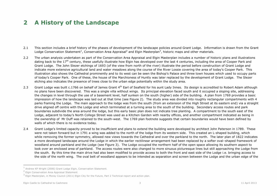
2 A History of the Landscape
2.1 This section includes a brief history of the phases of development of the landscape policies around Grant Lodge. Information is drawn from the Grant
Lodge Conservation Statement1, Conservation Area Appraisal2 and Elgin Masterplan3, historic maps and other materials.
2.2 The urban analysis undertaken as part of the Conservation Area Appraisal and Elgin Masterplan includes a number of historic plans and illustrations
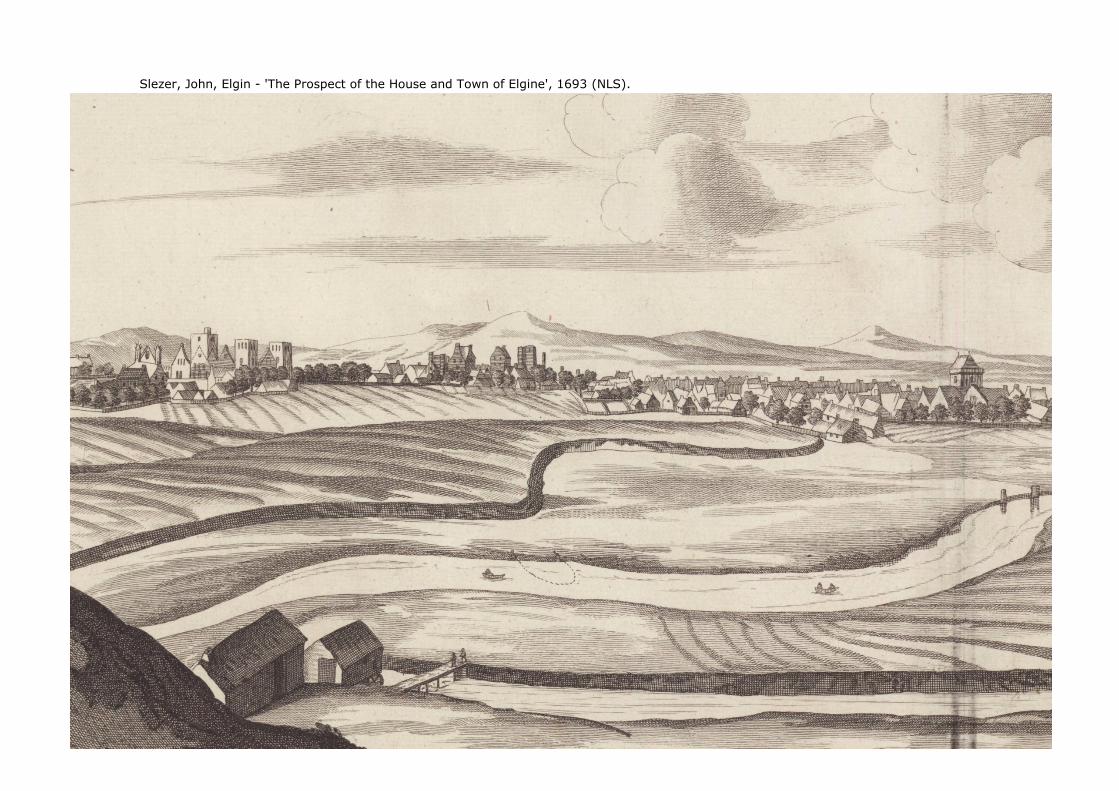
dating back to the 17th century, these usefully illustrate how Elgin has developed over the last 4 centuries, including the area of Cooper Park and
Grant Lodge. The John Slezer etchings of 1693 (of the view from north of the river) illustrate the period before construction of Grant Lodge and
indicate more extensive agricultural land and water meadows along the course of the River Lossie covering the area of today’s Cooper Park. This
illustration also shows the Cathedral prominently and to its west can be seen the Bishop’s Palace and three town houses which used to occupy parts
of today’s Cooper Park. One of these, the house of the Marchioness of Huntly was later replaced by the development of Grant Lodge. The Slezer
etching also indicates the presence of trees close to the urban edge potentially within the study area.
2.3 Grant Lodge was built c.1766 on behalf of James Grant 4th Earl of Seafield for his aunt Lady Innes. Its design is accredited to Robert Adam although
no plans have been discovered. This was a single villa without wings. Its principal elevation faced south and it occupied a sloping site, addressing
the changes in level through the use of a basement level, half sunken on the south (higher) side of the building. A plan from 1769 provides a basic
impression of how the landscape was laid out at that time (see Figure 2). The study area was divided into roughly rectangular compartments with 4
parks framing the Lodge. The main approach to the lodge was from the south (from an extension of the High Street at its eastern end) via a straight
drive aligned off centre with the Lodge and which terminated at a turning area to the south of the building. Secondary access routes and park
boundaries subdivide the area around the lodge, but this early basic plan does not indicate tree planting. A compartment to the south east of the
Lodge, adjacent to today’s North College Street was used as a Kitchen Garden with nearby offices, and another compartment indicated as being in
the ownership of Mr Duff was retained to the south-west. The 1769 plan footnote suggests that certain boundaries would have been defined by
walls of which there is no evidence today.
2.4 Grant Lodge’s limited capacity proved to be insufficient and plans to extend the building were developed by architect John Paterson in 1789. These
were not taken forward but in 1791 a wing was added to the north of the lodge from its western side. This created an L-shaped building, which
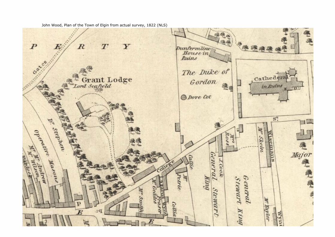
while removing the former symmetry, allowed new views towards the Cathedral and over the parkland to the north. The later plan of 1822 indicates
a more developed landscape around the Lodge in which the earlier rectilinear arrangement had been replaced by a softer oval–shaped framework of
woodland around parkland and the Lodge (see Figure 3). The Lodge occupied the northern half of the open space allowing its southern aspect to
look over an enclosed area of parkland. The access routes were also changed to more sinuous picturesque lines but still approaching the Lodge from
the south. By this time the main drive had also been modified to provide access to both the front and east side of the Lodge i.e. bringing access to
the side of the north wing. The oval belt of woodland appears to be intended as separation and screen between the Lodge and the urban edge of the
1 Andrew KP Wright (2006) Grant Lodge Elgin, Conservation Statement.
2 Elgin Conservation Area Appraisal Statement
3 Elgin Masterplan, in Moray Council (2011) Elgin City for the Future, Part 2 Technical report and action plan.

Elgin Castle to Cathedral to Cashmere 4 11 April 2013
town. It also screened the stables, offices and buildings associated with the kitchen garden from the Lodge. This plan indicates however that open
views to the east and north east were preserved i.e. towards the Cathedral, Bishop’s Palace and the older Dunkinty House.
2.5 From c.1840, the 6th Earl of Seafield progressed some substantial changes to the parkland and to the Lodge. These works were related to the Earl’s
second marriage and sought to substantially upgrade the accommodation and setting of Grant Lodge. The most significant landscape changes were
enabled by the acquisition of adjacent plots of land: the former lands of Dunkinty House to the north east, then the Duke of Gordon’s field
immediately to the east. The latter acquisition allowed the Grant Lodge parkland to be extended towards the Cathedral as shown on the 1868 OS
plan of Elgin. These mid-19th century developments included the addition of gate lodge cottages at the southern corner and the eastern end of the
(extended) parkland, and the introduction of a new sinuous drive from this eastern gate to Grant Lodge. The original drive (from the south) was
abandoned but a number of secondary paths were laid out around the parkland, mostly following or reinforcing the oval shape of the woodland
framework. This period of redevelopment also saw the removal of the old Dunkinty House and the establishment of orchard enclosures in this north
eastern corner of the park. Refinements to the landscape were undertaken in advance and in parallel with the remodelling of Grant Lodge which
took place from 1849 to the designs of local architects A & W Reid. The basic oval shaped woodland framework remained in place but more formally
defined spaces to the south and west / north-west of the Lodge were introduced. A semi-circular space framed by trees and a curved path was
introduced to enhance the outlook from the north wing of the Lodge, especially to the west and north-west. A single storey extension was built off
the east side of the north wing and this provided a coal cellar, ash pit and larder. This development determined that service access was thence
focussed on the north-east side of the Lodge and a separate service route was developed independent from the new main drive. This change was
accompanied by the extension of the woodland belt on the eastern side of the Lodge, resulting in curtailed views to the east, towards the Cathedral.
Adjacent to North College Street, walled enclosures were introduced around the stables and office buildings, thereby reinforcing screening around
these developments. The substantial remodelling of the Lodge also included the addition of a porte-cochere at the main entrance and conservatories
on the east and west sides of the original villa. The conservatories were demolished in the 1930’s but historic photographs illustrate how they
created a strong relationship with the surrounding landscape.
2.6 By 1870 the lands of Grant Lodge had been extended still further with the acquisition of fields between the Lodge and the River Lossie. However by
the end of the 19th century the Dowager Countess of Seafield was persuaded to sell the Lodge and grounds to Colonel George A Cooper, owner of the
adjacent College property, so that he could donate the Lodge and its parkland to the town council. This gift was made in 1902 and led to the Lodge
being converted to a public library and museum, and the grounds being developed as a significant public park. The latter was designed by Aberdeen
architect Dr Alexander Marshall Mackenzie and resulted in extensive alterations to the landscape particularly to the north of the Lodge where a new
axis was introduced aligned on the Cathedral, and where a pond, bowling-green, bandstand, circular tree-lined walks and parkland were developed.
To the south of the Lodge a new access route was introduced from the south-western end of North College Street to Grant Lodge, North College
Street was widened on its north side, resulting in the demolition of the former boundary walls, stables and offices. These developments retained
several key components of the extant landscape, including much of the oval woodland belts, the former drive from the east lodge and some of the
secondary footpaths. Historic photographs and postcards are available from this time and indicate that an entrance arch was located adjacent to the
museum on North College Street and that the access routes were then un-metalled i.e. gravel surfaced, giving the park a substantially less municipal
character than today.
2.7 During the 20th century, Cooper Park was little changed until the latter half. At this time losses of historic trees had started and some replacement
planting had commenced. The earlier drive from the east lodge was abandoned, and in 1981 the A96 relief road was introduced, creating severance
between the park and the city centre, and removing the southern corner of the park. The severance also affected access to Grant Lodge leading to
the development of a new access road from North College Street, a pedestrian over-bridge with associated earthworks, paths and ramps, together
Elgin Castle to Cathedral to Cashmere 5 11 April 2013
with the loss of some historic path routes. Part of the former (1902) approach to Grant Lodge was left in its severed state within the park and
remains as a tear drop shaped grass island to the south of the Lodge.
2.8 Cooper Park remains a significant asset for Elgin. It is an essential feature of the city, important for its heritage, recreation, public access,
biodiversity and as the setting for important buildings including the Cathedral, Bishop’s Palace and Grant Lodge. It has suffered some degradation
through the introduction of vehicles and the associated adaptations of the park’s infrastructure. A notable change to the parkland around Grant
Lodge has been the incremental loss of open spaces with the planting of new trees and the growth of the old. This has resulted in the loss of the
original oval planting structure as spaces have gradually been infilled. Recently, several veteran trees have been lost to disease and further
replacement planting has occurred. The result is that the entire Grant Lodge area of Cooper Park now has a wooded character with little spatial
definition. Grant Lodge is consequently obscured from the south and its outlook is no longer onto well-defined parkland spaces. Views to the
Cathedral remain curtailed by the earlier plantings to the east of the Lodge. In the wider park to the north, additional paths have been developed
and new recreational facilities introduced. Some of these developments have changed the spatial layout of the parkland and have in part
compromised the generous arcs which originally defined the main areas of parkland.
2.9 A timeline for the history of the landscape is summarised in Table 2.1 below. A map analysis of the history of the landscape is shown in Figure 2 to
Figure 8.
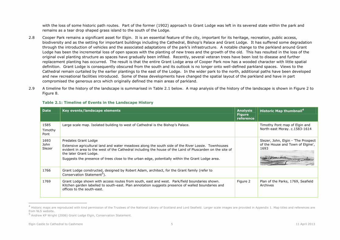
Table 2.1: Timeline of Events in the Landscape History
Date Key events/landscape elements Analysis Figure reference
Historic Map thumbnail4
1585
Timothy Pont
Large scale map. Isolated building to west of Cathedral is the Bishop’s Palace. Timothy Pont map of Elgin and North-east Moray. c.1583-1614
1693 John Slezer
Predates Grant Lodge
Extensive agricultural land and water meadows along the south side of the River Lossie. Townhouses evident in area to the west of the Cathedral including the house of the Laird of Pluscarden on the site of the later Grant Lodge.
Suggests the presence of trees close to the urban edge, potentially within the Grant Lodge area.
Slezer, John, Elgin - 'The Prospect of the House and Town of Elgine', 1693
1766 Grant Lodge constructed, designed by Robert Adam, architect, for the Grant family (refer to
Conservation Statement5).
1769 Grant Lodge shown with access routes from south, east and west. Park/field boundaries shown. Kitchen garden labelled to south-east. Plan annotation suggests presence of walled boundaries and offices to the south-east.
Figure 2 Plan of the Parks, 1769, Seafield Archives
4 Historic maps are reproduced with kind permission of the Trustees of the National Library of Scotland and Lord Seafield. Larger scale images are provided in Appendix 1. Map titles and references are
from NLS website. 5 Andrew KP Wright (2006) Grant Lodge Elgin, Conservation Statement.

Elgin Castle to Cathedral to Cashmere 6 11 April 2013
Date Key events/landscape elements Analysis Figure reference
Historic Map thumbnail4
NB. map is drawn with north to bottom of page (image here is rotated).
1776 Large scale map, Grant Lodge not shown. North College Street leading to the Cathedral is shown with buildings all along the north side.
Taylor and Skinner’s Survey, The Road from Banff to Inverness, published 1776
1791 North-west wing of Lodge built, accommodating change in levels from north to south. (refer to Conservation Statement)
1822 Significant developments to the grounds since 1769, including:
access from the south, with a curved route to east side of Grant Lodge
ring of tree planting around Grant Lodge, with open aspect to north-east, and open space around the building interrupted with possible specimen trees
north-west wing added previously to Grant Lodge
policy boundary limited at field boundary between Grant Lodge and the Cathedral. Land marked as belonging to the Duke of Gordon
buildings marked along south boundary (later labelled as stables), dovecot marked to west of field boundary, on Duke of Gordon’s land
additional land acquired to the north east allowing expansion of policies to take in areas of former Dunkinty lands
Figure 3 John Wood, Plan of the Town of Elgin from actual survey, 1822
1832 Large scale map not clearly showing Grant Lodge. John Thompson’s Atlas of Scotland, Nairn and Elgin, 1832
1838 No significant changes since 1822.
King Street is extended to the High Street.
This map predates Elgin Museum.
Figure 3 Robert Ray, Plan of the Burgh of Elgin from actual survey, 1838
1848- c1855
Grant Lodge extensively altered, using designs by A & W Reid, later known as J & W Wittet, architects (refer to Conservation Statement). Duke of Gordon’s field acquired and substantial landscape developments undertaken.
1868
OS 1st edition
Developments undertaken c. 1840-1855 illustrated on this plan including:
substantial remodelling of Grant Lodge, including new service building extension to north-east
Duke of Gordon’s field included in Grant Lodge policies
Figure 4 OS large scale Scottish Town Plans, 1847-1895. Elgin 1868, VII.12.22 and VII.16.2
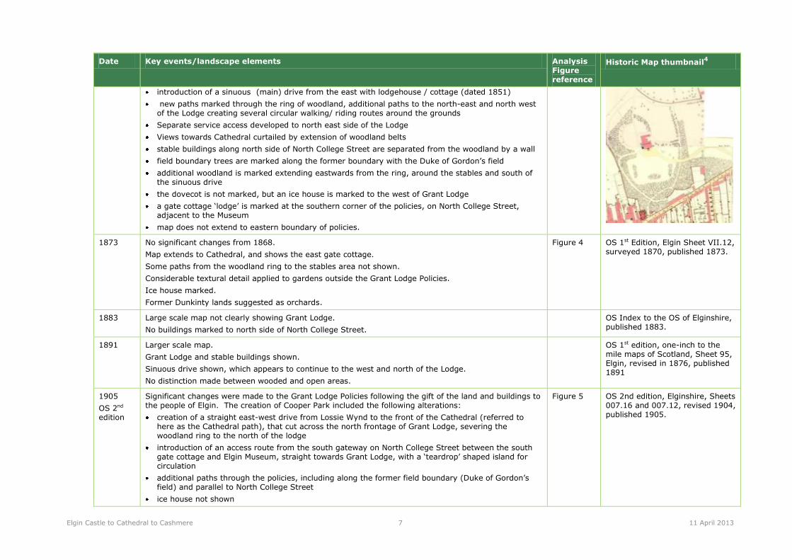
Elgin Castle to Cathedral to Cashmere 7 11 April 2013
Date Key events/landscape elements Analysis Figure reference
Historic Map thumbnail4
introduction of a sinuous (main) drive from the east with lodgehouse / cottage (dated 1851)
new paths marked through the ring of woodland, additional paths to the north-east and north west of the Lodge creating several circular walking/ riding routes around the grounds
Separate service access developed to north east side of the Lodge
Views towards Cathedral curtailed by extension of woodland belts
stable buildings along north side of North College Street are separated from the woodland by a wall
field boundary trees are marked along the former boundary with the Duke of Gordon’s field
additional woodland is marked extending eastwards from the ring, around the stables and south of the sinuous drive
the dovecot is not marked, but an ice house is marked to the west of Grant Lodge
a gate cottage ‘lodge’ is marked at the southern corner of the policies, on North College Street, adjacent to the Museum
map does not extend to eastern boundary of policies.
1873 No significant changes from 1868.
Map extends to Cathedral, and shows the east gate cottage.
Some paths from the woodland ring to the stables area not shown.
Considerable textural detail applied to gardens outside the Grant Lodge Policies.
Ice house marked.
Former Dunkinty lands suggested as orchards.
Figure 4 OS 1st Edition, Elgin Sheet VII.12, surveyed 1870, published 1873.
1883 Large scale map not clearly showing Grant Lodge.
No buildings marked to north side of North College Street.
OS Index to the OS of Elginshire, published 1883.
1891 Larger scale map.
Grant Lodge and stable buildings shown.
Sinuous drive shown, which appears to continue to the west and north of the Lodge.
No distinction made between wooded and open areas.
OS 1st edition, one-inch to the mile maps of Scotland, Sheet 95, Elgin, revised in 1876, published 1891
1905
OS 2nd edition
Significant changes were made to the Grant Lodge Policies following the gift of the land and buildings to the people of Elgin. The creation of Cooper Park included the following alterations:
creation of a straight east-west drive from Lossie Wynd to the front of the Cathedral (referred to here as the Cathedral path), that cut across the north frontage of Grant Lodge, severing the woodland ring to the north of the lodge
introduction of an access route from the south gateway on North College Street between the south gate cottage and Elgin Museum, straight towards Grant Lodge, with a ‘teardrop’ shaped island for circulation
additional paths through the policies, including along the former field boundary (Duke of Gordon’s field) and parallel to North College Street
ice house not shown
Figure 5 OS 2nd edition, Elginshire, Sheets 007.16 and 007.12, revised 1904, published 1905.

Elgin Castle to Cathedral to Cashmere 8 11 April 2013
Date Key events/landscape elements Analysis Figure reference
Historic Map thumbnail4
stable buildings removed, former wall line shown as dotted edge of woodland
additional paths and planting across Cooper Park to the north of the Cathedral path, including a bandstand
1906
OS 2nd edition
No significant change from 1905 map.
Figure 5 OS 2nd edition, Elginshire VII.SE revised 1904, published 1906.
1910
OS 3rd edition
Large scale map, Cathedral Path and south access shown.
Less detailed than the 1905 map.
OS one-inch to th e mile maps of Scotland, 3rd edition, Sheet 95, Elgin, published 1910
1912 Large scale map, Grant Lodge not shown.
North College Street shown with buildings along north side.
Bartholomew Survey Atlas of Scotland, 1912, Nairn, Elgin
1957
OS
1:25,000 scale map, showing broad outline of paths, including Cathedral path, sinuous drive, and south access route. Less detailed than the 1905 map.
OS 1:25,000 maps of Great Britain, NJ26 and NJ27, published 1957
1975 Oblique aerial photograph showing;
dense woodland cover to the south of the Cathedral path, with open areas to the southeast of Grant
Lodge and to the north-east of the east gate cottage
large specimen trees close to Grant Lodge (south-east and north-west) showing dark foliage
housing blocks to south-west of Grant Lodge, south of Elgin Library
prior to construction of A96 bypass Alexandra Road (1981)
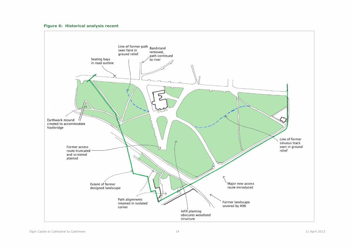
1981-recent
A96 bypass Alexandra Road constructed through southern part of policies. This cuts through the southern part of the woodland ring, and separates a triangle of land adjacent to the Museum (and the site of the former south gate cottage) from the rest of the policies. Pedestrian over-bridge and ramps introduced in western part of the study area.
Figure 6
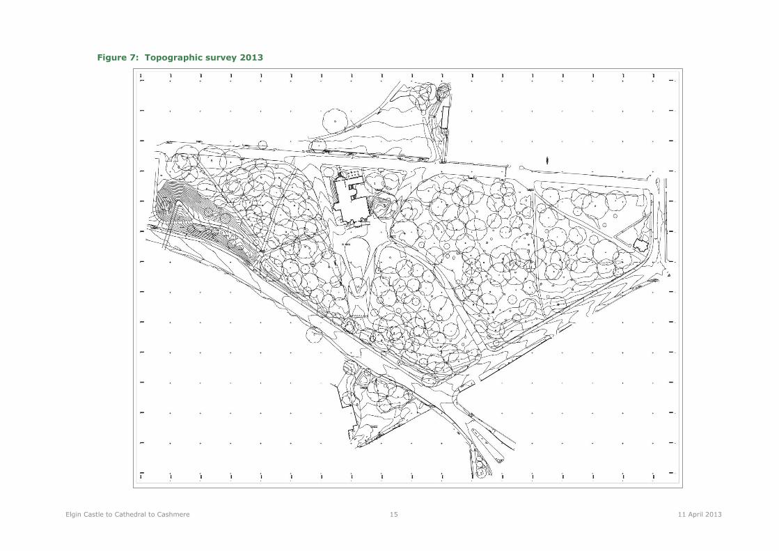
2013 topo-graphic survey
Detailed survey Figure 7

Elgin Castle to Cathedral to Cashmere 9 11 April 2013
Historical map analysis
2.10 The historical development of the Grant Lodge policies has resulted in a complex layout of features dating to different times in history. These form
layers of different ages, which can be illustrated graphically in Figure 2 to Figure 7.

Elgin Castle to Cathedral to Cashmere 10 11 April 2013
Figure 2: Historical analysis 1769

Elgin Castle to Cathedral to Cashmere 11 11 April 2013
Figure 3: Historical analysis 1822

Elgin Castle to Cathedral to Cashmere 12 11 April 2013
Figure 4: Historical analysis 1868

Elgin Castle to Cathedral to Cashmere 13 11 April 2013
Figure 5: Historical analysis 1905
Elgin Castle to Cathedral to Cashmere 14 11 April 2013
Figure 6: Historical analysis recent
Elgin Castle to Cathedral to Cashmere 15 11 April 2013
Figure 7: Topographic survey 2013

Elgin Castle to Cathedral to Cashmere 16 11 April 2013
3 Remnants of the Historic Landscape
3.1 The existing features of Cooper Park around Grant Lodge represent the legacy of different introductions to the landscape through its history. Figure
2 to Figure 7 illustrate in diagrammatic form how the landscape has changed since the 18th century. It is evident that the landscape design evolved
over this period without any wholesale re-designs but rather a series of adaptations with some new introductions. The result is that the park today
contains features dating from different periods and evidence of some features which have been removed but which can still be traced in the
landscape. Figure 8 therefore seeks to summarise the age structure of the landscape by indicating the period in the site’s history from which they
originate.
3.2 The landscape design phases generally lack complexity and there are no significant elements of landscape engineering or landscape architecture.
The main physical changes have mostly related to the access routes and planting structure, together with the increases in scale as more land was
acquired. The woodland planting and the routes of paths around the site are the key structural elements for the landscape that can be identified as
consistent with features marked on historic maps. The oldest path routes relate to 18th century field boundaries, even though they are minor paths
in the park today. The changes relating to the development of the area as Cooper Park at the beginning of the 20th century are some of the most
significant, in particular the Cathedral axis path and the now truncated drives to and along each side of the Lodge. The late 20th century introduction
of the A96 relief road and the landscape changes associated with this, significantly altered the character of the southern part of the park.
3.3 The pattern of old trees around the park (old trees of long lived species) reveals the arcs of woodland planting that date back to the early 19th
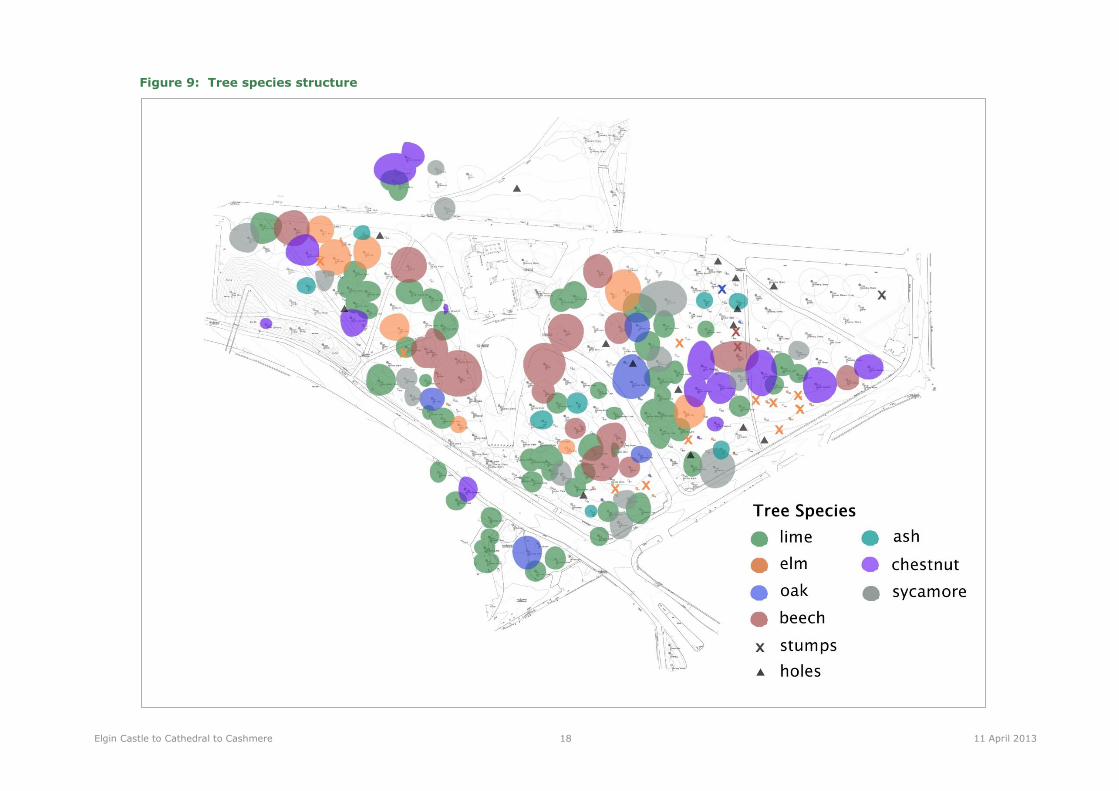
century, although some of the individual trees are younger. This pattern is illustrated in Figure 9 and Figure 10.

Elgin Castle to Cathedral to Cashmere 17 11 April 2013
Figure 8: Age structure of the landscape
Elgin Castle to Cathedral to Cashmere 18 11 April 2013
Figure 9: Tree species structure

Elgin Castle to Cathedral to Cashmere 19 11 April 2013
Figure 10: Tree age structure
Elgin Castle to Cathedral to Cashmere 20 11 April 2013
4 Existing conditions
4.1 This section describes the existing features on the site: their nature, historic value and any evident
conservation issues. This appraisal was based on a site survey undertaken in early February 2013
following production of a topographic survey of the study area. The appraisal work also included a tree
survey undertaken by Scottish Arboricultural Services; the findings of this work have informed this
report but the full results of the Tree Survey are appended to this report (Appendix 2).
Existing site features
Access routes
4.2 There is a network of roads and paths around the site, with tarmacadam surfacing, generally in good to
reasonable condition. Edged with timber 1” boards or with concrete kerbs.
4.3 Vehicular access is permitted into the park and the main trafficked routes are the recent entrance drive
from North College Street, the truncated section of the 1902 entrance drive and the Cathedral axis.
These routes are of tarmacadam with concrete kerbs, generally in good condition. Some parking areas
are defined and elsewhere double yellow lines and bollards restrict access or parking. The result of this
treatment is that the park infrastructure has a municipal character and pedestrian amenity and
potentially safety is compromised. The utilitarian roads and path surfacing is not sympathetic to a
parkland setting and does not complement the setting of Grant Lodge or the view to the Cathedral.
4.4 The area outside Elgin Library, which is part of the Cathedral path, is paved with ‘Toberloc’ blocks (or
similar), with brick kerbs. These are used to denote the pedestrian priority area outside the Library
entrance.
Desire lines
4.5 A major desire line runs from the path junction by the bowling green to the front of the Lodge. This
path partially follows a historic route (from c.1850) but is now constrained by the presence and size of
trees. The desire line path is well used and is consequently a muddy furrow through the grass.
4.6 Other minor desire lines exist in various locations across the site, showing as grass damage or footprints
in the snow. A number of path corners are cut across by foot traffic and soil has become worn.

Elgin Castle to Cathedral to Cashmere 21 11 April 2013
Drainage
4.7 The main access routes have a drainage system whereby runoff is collected in gullies along the edge of
the roads. From the absence of standing water during the site appraisal, it is assumed that the
drainage system is still functional along the roads. There is no evidence of drainage along the smaller
pedestrian paths although there may be land drainage within the parkland areas. There is some
localised ponding along the footpaths and along the lines of historic access routes, presumably where
the old sub-base is preventing percolation.
Access Conservation Issues & Opportunities
Potential traffic management and restrictions to improve pedestrian amenity and the setting of
Grant Lodge
Potential restoration of historic routes as part of the new access network for Grant Lodge
Removal of redundant truncated roads to allow landscape reinstatement and reduce scale of hard
standings
Enhancement opportunities for removal of municipal treatments to hard surfaces, kerbs, signs and
road markings
Street furniture
Benches
4.8 Three different types of seating benches are in use. These are of cast iron of different designs, with
timber slats. The benches are mostly located along the Cathedral axis path set in bays at the side of
the path. A number of benches are missing, belied by the concrete bases in empty bays.
Bins
4.9 Proprietary black plastic formed bins with galvanised steel receptacles are located strategically
throughout the park. These are secured into concrete bases.
Bollards and barriers
4.10 Bollards are used to prevent vehicular access, as in front of Elgin Library, or to denote the truncation of
a former road route, as to the south of Grant Lodge.
4.11 Concrete conical bollards are used at the south end of the south (truncated) axis, these are old, with
eroded concrete, and deep set red reflectors. Red painted post bollards are used across the Cathedral
path near library. These have a narrow circular cross-section with a faceted top.
4.12 A metal vehicular gate crosses the Cathedral path near the path junction at the bowling green, to stop
the public driving along cathedral path.
Elgin Castle to Cathedral to Cashmere 22 11 April 2013
Fences and gateways
4.13 Various styles of fencing are uses across the site, the majority is fairly recent and of no historic or
aesthetic value. Only at the main park entrances has an architectural treatment been applied. Opposite
the Cathedral on the west side of King Street is the gateway to the Cathedral axis. The original gateway
pillars date from c.1902 and are surmounted by ornamental lanterns. These are now flanked by more
recent (c. 1980) walls, railings and pillars on each side of the gateway. The wall is of sandstone
c.600mm high with half-round cope stones. Black painted steel railings are fixed onto the cope and
span between the pillars. The railings have decorative finials at intervals. The newer pillars match the
originals in style and are of masonry to approx. 2m, with pyramidal cap stones.
4.14 The ornamental wall and railing is repeated for short section from A96/North College St corner to
c.100m up North College St, including the ‘Harrison Gate’, dated 2004. This gateway was constructed
by the Elgin Trust to commemorate the centenary of the park. These walls and railings are limited in
extent leaving the adjoining boundary treatment as only post and wire fencing.
4.15 Other fences include
a high fence of wooden posts and green net wire along A96 Alexandra Rd;
a low concrete post and wire fence along North College Street.
4.16 No fences are used along Cathedral path, except for a low concrete post and wire fence contained within
the beech hedge around the east gate cottage.
4.17 Gateways vary in style and scale depending on their location, the main gateways opposite the Cathedral
and the Harrison Gate are ornamental as described above, whilst other gateways are defined by only
gaps in the hedge, or gaps in the concrete post and wire fence, framed by straining posts.
Lighting
4.18 The main access routes within Cooper Park have street lights, mostly with short (c.4.5m) grey coloured
steel columns and half globe lanterns. There are however some inconsistencies in the lantern type and
in the columns used e.g. black ‘Victoriana’ style columns are also present in a few locations as at the
Library.
Other infrastructure
4.19 There is a number of utility power and control boxes (telephone exchange or electricity transformers)
located adjacent to paths. Manhole covers are also present.
Signage
4.20 Signage across the site relates to modern use, and is predominantly aimed at controlling vehicular
movements. Signage includes pole mounted signage and painted road markings.
Elgin Castle to Cathedral to Cashmere 23 11 April 2013
Street Furniture Conservation Issues and opportunities
Opportunities to improve the park boundaries and gateways where there is currently only fencing
Requirements to replace missing furniture components
Opportunities to improve the standard of furniture and lighting and its consistency across the park
Opportunities to remove urban clutter and traffic control devices , subject to changes in traffic
management
Requirements for drainage improvements along paths
Planting
Trees
4.21 Trees have been surveyed in detail by Scottish Arboricultural Services, and the detailed tree survey
report is included in Appendix 2. Additional notes and observations made during the LUC survey of the
landscape, focussed on assessing the historical significance of the trees, are contained below and shown
in Figure 9 and Figure 10.
4.22 The belt of trees that has been shown on historical maps since 1822 is present, but obscured by more
recent planting. The belt is made up of primarily lime, elm, beech and oak trees, but there are also
some mature sycamore and horse chestnut. There is also evidence where trees from the woodland belt
have been lost, in the form of stumps of large girth trees and hollows in the ground where stumps were
or where trees fell. The pattern of stumps and hollows reinforces the pattern of the historic belt of
trees. There are specimen trees close to the house, including five large beech trees and two large
walnut trees immediately to east of house. The beech trees are badly scarred with graffiti carving, most
of it healed with scar tissue. This is mostly of illegible marks, although a few dates can be made out,
the earliest of 1930.
4.23 More recently planted trees range from mature to young trees, and many are planted in formerly open
spaces. These have introduced more ornamental and short-lived species including cherry, hornbeam,
Norway Maple and poplar. Overall there is notable scarcity of evergreens within the old and more
recent plantings resulting in an almost totally deciduous woodland. The main exceptions are the yews
to the east of Grant Lodge.
4.24 Many of the older trees are over-mature, with dead branches in their crowns. Many show signs of
internal rot, dark weeping patches on the bark or scars and exposed wood. The stumps of trees that
had similar ground level dimensions to the standing trees, which show significant internal rot prior to
felling.
4.25 Younger trees are of varying condition, with some trees in poor condition due to damage, or over-
mature due to the shorter lifespan of the species. The tree survey recommends the removal of a
number of trees in poor condition, as indicated on the tree schedule in Appendix 2.

Elgin Castle to Cathedral to Cashmere 24 11 April 2013
Other Planting
4.26 The landscape is dominated by grass, which is closely mown. Under some of the trees, i.e. those with
denser foliage in summer, the grass is weaker, with some areas of bare soil. Circles are cut in the grass
round the foot of each tree.
4.1 In some areas, particularly along the southern fringe, there are bulbs in the grass. These include
snowdrops and daffodils, and in one location to the south of the A96, crocuses. The snowdrops are
generally thin with a few small clumps, and therefore fail to create an impact on the appearance of the
grassland below the trees. Daffodils are more numerous, and will create a swathe of colour under the
trees later in spring6.
4.2 There are borders of shrubs for decorative or screening purposes in various locations:
Decorative borders include plants such as potentilla, buddleia, juniper, lonicera, cornus, cotoneaster,
viburnum and dwarf conifers (this is not an exhaustive list);
Screening borders include plants such as berberis, roses, hypericum.
4.3 The former star and crescent beds in the ‘teardrop’ shaped lawn to the south of Grant Lodge, have now
been grassed over, although they are still visible in the grass, and are picked out in light snowfall.
These formerly had bedding displays. A raised and inclined bed retained for seasonal bedding is located
to the northwest of the Lodge on the north side of the Cathedral axis.
Planting Conservation Issues and opportunities
A tree replacement strategy is required which takes into account the spatial structure of the
landscape
Veteran trees near public access routes require monitoring and tree surgery to ensure safety
Recently planted trees in inappropriate locations could be transplanted to better locations
There are opportunities to improve the horticultural content of the park generally for display, spatial
definition and to complement key activity areas
There are opportunities to improve the biodiversity of the park through management changes and
species selection
6 Note: fieldwork was carried out in early February 2013.

Elgin Castle to Cathedral to Cashmere 25 11 April 2013
Buildings
4.4 This Historic Landscape Statement does not go into detail about the buildings in the Grant Lodge
policies, but the buildings of interest around Cooper Park are listed below:
Grant Lodge (detailed information is contained in the Conservation Statement7);
East gate cottage;
Elgin Library;
a small cottage to the west of Elgin Library, which may be a western gate lodge to the Grant Lodge
policies
4.5 The south gate cottage, dovecote and ice house marked on historic maps are no longer evident in the
landscape. The site of the bandstand can be seen as undulations in the grass to the north of Grant
Lodge.
7 Andrew KP Wright (2006) Grant Lodge Elgin, Conservation Statement.

Elgin Castle to Cathedral to Cashmere 26 11 April 2013
Figure 11: Existing site issues
Elgin Castle to Cathedral to Cashmere 27 11 April 2013
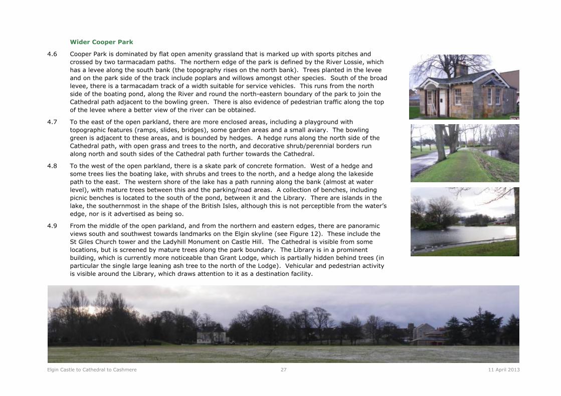
Wider Cooper Park
4.6 Cooper Park is dominated by flat open amenity grassland that is marked up with sports pitches and
crossed by two tarmacadam paths. The northern edge of the park is defined by the River Lossie, which
has a levee along the south bank (the topography rises on the north bank). Trees planted in the levee
and on the park side of the track include poplars and willows amongst other species. South of the broad
levee, there is a tarmacadam track of a width suitable for service vehicles. This runs from the north
side of the boating pond, along the River and round the north-eastern boundary of the park to join the
Cathedral path adjacent to the bowling green. There is also evidence of pedestrian traffic along the top
of the levee where a better view of the river can be obtained.
4.7 To the east of the open parkland, there are more enclosed areas, including a playground with
topographic features (ramps, slides, bridges), some garden areas and a small aviary. The bowling
green is adjacent to these areas, and is bounded by hedges. A hedge runs along the north side of the
Cathedral path, with open grass and trees to the north, and decorative shrub/perennial borders run
along north and south sides of the Cathedral path further towards the Cathedral.
4.8 To the west of the open parkland, there is a skate park of concrete formation. West of a hedge and
some trees lies the boating lake, with shrubs and trees to the north, and a hedge along the lakeside
path to the east. The western shore of the lake has a path running along the bank (almost at water
level), with mature trees between this and the parking/road areas. A collection of benches, including
picnic benches is located to the south of the pond, between it and the Library. There are islands in the
lake, the southernmost in the shape of the British Isles, although this is not perceptible from the water’s
edge, nor is it advertised as being so.
4.9 From the middle of the open parkland, and from the northern and eastern edges, there are panoramic
views south and southwest towards landmarks on the Elgin skyline (see Figure 12). These include the
St Giles Church tower and the Ladyhill Monument on Castle Hill. The Cathedral is visible from some
locations, but is screened by mature trees along the park boundary. The Library is in a prominent
building, which is currently more noticeable than Grant Lodge, which is partially hidden behind trees (in
particular the single large leaning ash tree to the north of the Lodge). Vehicular and pedestrian activity
is visible around the Library, which draws attention to it as a destination facility.

Elgin Castle to Cathedral to Cashmere 28 11 April 2013
Figure 12: Views around Cooper Park
Elgin Castle to Cathedral to Cashmere 29 11 April 2013
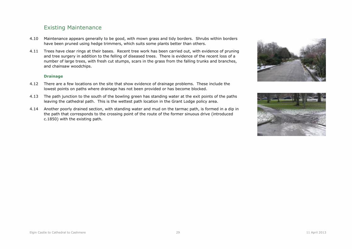
Existing Maintenance
4.10 Maintenance appears generally to be good, with mown grass and tidy borders. Shrubs within borders
have been pruned using hedge trimmers, which suits some plants better than others.
4.11 Trees have clear rings at their bases. Recent tree work has been carried out, with evidence of pruning
and tree surgery in addition to the felling of diseased trees. There is evidence of the recent loss of a
number of large trees, with fresh cut stumps, scars in the grass from the falling trunks and branches,
and chainsaw woodchips.
Drainage
4.12 There are a few locations on the site that show evidence of drainage problems. These include the
lowest points on paths where drainage has not been provided or has become blocked.
4.13 The path junction to the south of the bowling green has standing water at the exit points of the paths
leaving the cathedral path. This is the wettest path location in the Grant Lodge policy area.
4.14 Another poorly drained section, with standing water and mud on the tarmac path, is formed in a dip in
the path that corresponds to the crossing point of the route of the former sinuous drive (introduced
c.1850) with the existing path.
Elgin Castle to Cathedral to Cashmere 30 11 April 2013
5 Conclusions and Further Work
5.1 The grounds around Grant Lodge were developed through the 17th, 18th and 19th centuries with the Lodge situated in an open space surrounded by a
ring of woodland. Specimen trees were planted within the open space to frame the house from the south. Stables, outbuildings and functional space
(including kitchen gardens) were located along the south-eastern boundary of the grounds, along North College Street.
5.2 The setting of the Lodge in its ring of woodland was twice interrupted during the 20th century: at the turn of the 20th century, when the grounds and
Lodge were gifted to Elgin, and Cooper Park was created, the enclosing ring of woodland around the Lodge was cut through by the straight axial path
that focuses on the Cathedral. The stables and outbuildings were removed, and the path network was diversified. In the late 20th century, the
landscape around the Lodge was again severed by the construction of the A96 relief road, which cut across the woodland belt. Screen planting along
the road edge encroached into the open space at the front (south) of the Lodge, and further infill planting of trees has obscured the original structure
of the woodland ring.
5.3 The current uses of the Grant Lodge area of Cooper Park are mainly as a thoroughfare between the Cathedral, Elgin Library and towards the town
centre. The current disused status of Grant Lodge does not generate activity in its vicinity except for parking on the adjacent roads. The heavily
treed character of the Grant Lodge area is shaded in summer and lacks the amenity of the park to the north, this limits activities within this area
except for access.
5.4 Section 4 outlines some of the more immediate and obvious conservation issues and opportunities within the study area. These can be summarised
as follows:
Future losses of significant trees and opportunities to develop a replacement strategy, which may include adjustments to
reinstate the ring structure to the woodland and species selection to protect against future disease risks;
Opportunities to restore the spatial structure around the Lodge, bringing back clearly defined spaces and to reinforcing views to
and from the building;
Future access requirements will pose conservation issues, with potential impacts on historic trees and on the pedestrian
experience of the park. There may be opportunities to reinstate or partially re-use historic access routes within a future access
strategy;
Opportunities to increase the awareness and recognition of the heritage of the site. This may encompass the former uses and
ownerships of the Cooper Park area including the townhouses that occupied the area before Grant Lodge and later landscape
features removed during development phases;
The current boundary treatments are inconsistent in quality and represent a weak edge and poor image for the park in several
places. There would be potential benefits to redefining the poor quality boundaries and their gateways, taking into account the
future access requirements and key views into the park from the surrounding areas;

Elgin Castle to Cathedral to Cashmere 31 11 April 2013
The park’s infrastructure has a municipal character which fails to complement the architectural heritage or landscape values.
There is consequently a range of opportunities to improve the public realm in a way that provides more consistency in style and
quality, is sympathetic the to the park/less urban in character, and is complementary to the architecture and to new any
developments associated with Grant Lodge or the Cathedral.
The restoration of Grant Lodge will increase activities in this area of the park and may provide opportunities for supporting a
wider range of activities across the park, including externally based education, volunteering and training activities.
Car parking requirements can pose a threat to landscape heritage unless careful siting and design considers the history of the site
and minimises the potential damage to root zones of important or historical trees.
Further work
5.5 This study represents a preliminary historical and physical appraisal of the Grant Lodge area of Cooper Park. It is intended as supporting information
to the intended Stage 1 application to the Heritage Lottery Fund. It is recognised that there would be value in further research and site
investigations to inform the production of a Conservation Management Plan for Cooper Park, covering a greater area than this study and thus
providing wider context for the Grant Lodge developments and for other strategic initiatives related to the Castle to Cathedral to Cashmere Project.
Such additional work is recommended for the development stage of the HLF project as listed below:
A Conservation Management Plan for Cooper Park as a whole, in accordance with HLF guidance; this would ideally be undertaken as supporting
information for the Stage 2 HLF submission. The Conservation Management Plan would ideally be supported by a number specialist studies
including:
- Archaeological research and investigations in relation to the pre-17th century uses of the landscape and former town houses within the
Cooper Park area; former stables complex, office buildings, kitchen garden and associated walls;
- Statement of Significance for the landscape (as part of the CMP);
- Activity Plan for Cooper Park may be required as companion to the Conservation Management Plan or may be developed for Grant Lodge
and the park jointly;
- Landscape Masterplan which addresses the access and parking requirements for Grant Lodge and other landscape conservation and
enhancement proposals.

Appendix 1. Historical Maps
1769 ‘Plan of the Parks’ reproduced with permission from Lord Seafiled.
Other historic maps reproduced with permission from the Trustees of the National Library of Scotland.
Slezer, John, Elgin - 'The Prospect of the House and Town of Elgine', 1693 (NLS).

Plan of Parks at Elgin, 1769, Seafield Archives (Lord Seafield)
John Wood, Plan of the Town of Elgin from actual survey, 1822 (NLS)
OS large scale Scottish Town Plans, 1847-1895. Elgin 1868, VII.12.22 and VII.16.2 (NLS)

OS 2nd edition, Elginshire, Sheets 007.16 and 007.12, revised 1904, published 1905 (NLS)

Appendix 2. Tree survey information


