

Date : 12 April 2011
EO Information Services in support of
Satellite Tools for Building Flood Defence Systems in Guyana
F. N. Koudogbo and A. Arnaud Altamira InformationJ. Leen, EurosenseWorld Bank HQ, Washington DC

ALTAMIRA INFORMATION is an experienced Earth Observation company that provides ground deformation measurements with millimetric precision
and mapping solutions using satellite images.
ALTAMIRA was founded in Barcelona in 1999 and opened offices in Toulouse (France) and Calgary (Canada) – part of the CLS group since 2010
The team brings together more than 25 staff with wide InSAR technical and scientific background.
ALTAMIRA services are provided using its own PSInSAR software: the Stable Point Network processing chain (SPN).
Since 2009, ALTAMIRA has been the Coordinator of the European Space Agency’s GSE Terrafirma project.
Introduction : The EO Service ProvidersAltamira Information
Main clients in the domain of infrastructures, mining and Oil and Gas
Terrafirma Project Organisation
Activities in institutional framework for disaster managements

Introduction : The EO Service ProvidersEUROSENSE
Established in 1964, with its headquarters in Belgium and offices in many European countries
About 200 specialized staff members (engineers, geographers, topographers, hard- and software specialists)
EUROSENSE is an active player in geo-information services in the whole world for about 50 years.
EUROSENSE offers high quality geographical information (from spaceborne, airborne and seaborne data). All products meet high standards for quality,
precision and reliability.
Remote sensing applications: Land use/Land cover mapping, Flood risk monitoring, Environmental monitoring, Heightmodelling, Thermography,…
Main types of clients: International (EC, FAO, WB, UN,...), national and regional governments, cities and municipalities, public and private service corporations, consultancy firms and software providers

Background : The World Bank Project
− Project users : World Bank
− Project context : World Bank is currently preparing the Conservancy Adaptation Project (CAP) Its objective is to reduce the vulnerability of catastrophic flooding in
Guyana's low-lying coastal area that is currently threatened by sea level rise resulting from global climate change.
− Project Information requirements VHR SAR based interferometric terrain deformation mapping, Urban mapping of infrastructure & buildings, High Resolution DEM, Flood risk assessment, Accurate estimation of the effective rate of sea level rise.
− Reason / Driver for this information
Estimation of possible subsidence phenomena in the coastal lowland and to study the flood defense system based on an old
dyke system

The EO Information Products :Service 1 – Information provided
VHR SAR based interferometric terrain deformation mapping
Analysis of terrain deformation based on the processing of radar satellite data with the SPN (Stable Point Network) interferometric software (certified by DLR).
Developed by Altamira Information, SPN is capable to extract precise displacement and position information of the radar stable points.− Velocity expressed in mm/yr for each measurement point
− Time series of the displacement on the monitoring period
InSAR study based on VHR TerraSAR-X satellite data - optimal to achieve high density measurements in specific constructed areas.
In order to overcome the problem of temporal decorrelation(due to presence of vegetation), installation of 15 CornerReflectors (man-made reflectors anchored to or near the structure to be monitored e.g. the flood defense system)

TerraSAR-X
Geometric accuracy 1/10th pixel
Spatial resolution
Pixel spatial resolution Better than 3 m
Absolute location accuracy
Better than 2 m (GPS precision for CRs)
Relative X, Y accuracyMetric in both E-W and N-S direction (GPS precision for CRs)
Thematic accuracy 2 mm/yr
AOI is the coastal lowland of Guyana, including the City of
Georgetown.
Technical specifications of the displacementfor each measurement point
Technical Specifications
TerraSAR-X frame
The EO Information Products :Service 1 – Information provided

Urban Mapping of the City of Concepciòn (Chile)(scale 1/10.000)
Urban atlas product is developed and qualified in GMES projects (GSE Land, GMES Global Urban Services, geoland). The product is audited and approved by an external audit company.
Source data VHR GeoEye-1 satellite imagery + ancillary data (topographic map...)
Format GIS compatible vector / raster format (as required)
Scale / MMU 1:10.000 / 0,25 – 0,5 ha
Area produced 300 km²
Reference date 2009 - 2011
Accuracy Thematic: > 80 %, geometric: < 1m
Legend can be adapted to User requirements
ParametersRequested construction parameters per street block TBD (average building height, average building density...)
Urban mapping of infrastructure & buildings
10000 Artificial surfaces
11000 Urban fabric
11100 Continuous urban fabric
11110 Very dense urban fabric (S.L.>80%)
11200 Discontinous urban fabric
11210 Dense urban fabric (S.L.:50% - 80%)
11220 Medium density urban fabric (S.L.: 30% - 50%)
11230 Low density urban fabric (S.L.: 10% - 30%)
11300 Special urban fabric features
11310 Apartment blocks with communal open space
11320 Isolated structures
12000 Industrial, commercial and transport units
12100 Industrial, commercial, public and private units
12110 Industrial areas
12120 Commercial areas
12130 Public, military and private services
12140 Water supply infrastructure, sea walls and flood defences
12200 Road and rail networks and associated land
12210 Fast transit roads and associated land
12220 Other roads and associated land
12230 Railways and associated land
12300 Port areas
12400 Airports
13000 Mine, dump and construction site
13100 Mineral extraction & dump site
13200 Dump sites
13300 Construction sites
13400 Land without current use
14000 Artificial non-agricultural vegetated area
14100 Green urban areas
14200 Sport and leisure facilities
20000 Agricultural areas
30000 Forest and semi-natural areas
40000 Wetlands
50000 Water
The EO Information Products :Service 2 – Information provided

Due to the presence of clouds in optical data for the area of interest, VHR radar solution is suitable for DEM generation.
Digital Elevation Model (DEM) generated using 11-day interferometric pairs− Reduction of impact of temporal
decorrelation. − Better estimation of the
atmospheric artefacts
TerraSAR-X
Vertical accuracy (m) 5
Spatial resolution (m) 9
Coverage (km x km) 30 x 30
High resolution DEM based on VHR SAR data
Tunisia HR DEM generated with HighResolution SpotLigntTerraSAR-X data (4x4m)
CorrespondingSRTM DEM with
90m pixel
The EO Information Products :Additional Desirable Information 1
Flood Risk Simulation - Mapping of the stability
of the flood defense system
Simulation of a flooding- Flood extent and water depth- Resolution: approximately 9m- Input data: EO and DEM from 2009-
2011- Coverage: around 300km²- Thematic accuracy: depended on
input data flood simulation, DEM, urban map and other available data,
- Geometric accuracy: depends on DEM
Flood risk portfolio developed and qualified in GMES projects (Risk-EOS and SAFER)
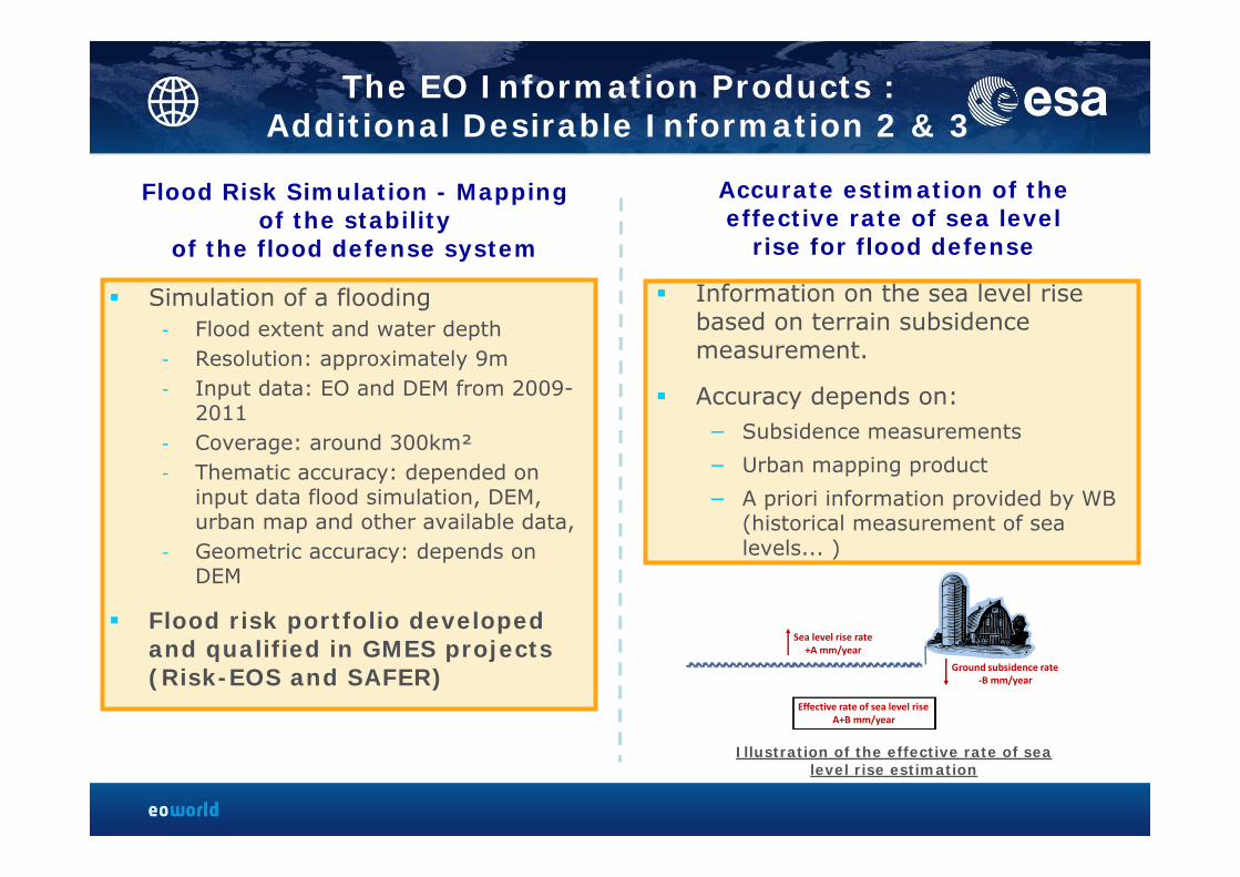
Information on the sea level rise based on terrain subsidence measurement.
Accuracy depends on: − Subsidence measurements
− Urban mapping product
− A priori information provided by WB (historical measurement of sea levels... )
Sea level rise rate+A mm/year
Ground subsidence rate‐B mm/year
Effective rate of sea level riseA+B mm/year
Accurate estimation of the effective rate of sea level
rise for flood defense
Illustration of the effective rate of sea level rise estimation
The EO Information Products :Additional Desirable Information 2 & 3
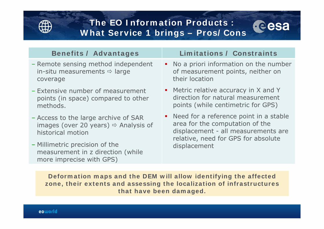
Benefits / Advantages Limitations / Constraints– Remote sensing method independent
in-situ measurements large coverage
– Extensive number of measurement points (in space) compared to other methods.
– Access to the large archive of SAR images (over 20 years) Analysis of historical motion
– Millimetric precision of the measurement in z direction (while more imprecise with GPS)
No a priori information on the numberof measurement points, neither ontheir location
Metric relative accuracy in X and Y direction for natural measurementpoints (while centimetric for GPS)
Need for a reference point in a stablearea for the computation of thedisplacement - all measurements are relative, need for GPS for absolutedisplacement
Deformation maps and the DEM will allow identifying the affectedzone, their extents and assessing the localization of infrastructures
that have been damaged.
The EO Information Products :What Service 1 brings – Pros/Cons

Benefits / Advantages Limitations / Constraints
Up-to-date digital detailed urban reference layer
Spatial view on the distribution of urban infrastructure
Derivation of statistics (e.g. Quality of life indicators)
Input for flood risk and damage assessment
Decision support system for urban planning
Easy to update
Thematic accuracy highly depended upon quality of available ancillary information.
Geometric accuracy will depend upon available reference data
All available ancillary data is needed (georeferenced digital or analogue data) to generate the product
The urban map gives a spatial view on the distribution of urban infrastructure. It will be used as input data to assess potential
flooding and in this way assess potential vulnerable areas.
The EO Information Products :What Service 2 brings – Pros/Cons

Examples of Previous Use:HURRICANE KATRINA: before and after
The project:
Mapping subsidence and uplift in New Orleans before and after Hurricane Katrina in 2005
Partners:
• Canadian Space Agency (CSA)
• Altamira Information
• United States Geological Survey (USGS)
• National Aeronautics and Space Administration (NASA)
Source: http://www.asc-csa.gc.ca/eng/programs/eoadp/article.asp
Historical movement maps provide useful information for identifying vulnerable zones and building strategies for facing natural disasters
Movement map before Katrina
1
0
-1
[cm
/yea
r]
Movement map after Katrina
1
0
-1
[cm
/yea
r]
May 2002-Jun 2005 Sep 2005-Jan 2007

Development of a set of urban land use / land cover products of Concepción (Chile)
Project: Analysis of Geographic expansion for European EO Services: Latin America and the Caribbean (JAGUAR project)
EUROSENSE has been in charge of the generation of a detailed urban map of Concepción (+ change detection). The resulting map has been used for urban planning, and used as reference for assessing the February 2010 earthquake damages
Testimony from the Users -On Urban Atlas: Igor Bacigaluppi Alvarez (Coordinador Sistema Información Territorial, Servicio de la Vivienda y Urbanización (SERVIU), Concepcón, Chile) “…Specifically I want to refer to the urban map as an extraordinary product that encouraged authoritiesand officials of the region to make the best decisions in an informed manner. This can now be done in relation to the protected natural area (Nonguen Reserve) and thus allows for better protection andconservation planning against unfriendly environmental measures. -On the use of the product as a reference layer alter the earthquake: “The produced responded well to our requirements. After the earthquake, we could add local government information like the type of damage, people affects, photographic register, etc. to the product information layer.”
Examples of Previous Use:Urban Mapping in Concepción (Chile)
Urban Atlas Map
Change Detection

Date : 12 April 2011
Thank you
Questions & Discussion


