
FGDC Facilities Working Group UpdateNancy Blyler
USACE
Mission• To serve as a multi-agency vehicle to coordinate facilities,
infrastructure, and environmental use of CADD and GIS activities within DoD and with other participating governmental (federal, state, and local) agencies, and the private sector.
• Develop CADD/GIS Standards
• Technical Support to Military Installations
• Promote the NSDI throughout Military Installations and Participating Agencies
• Originally established as the “Tri-Service CADD/GIS Technology Center” in 1992 at the Army Waterways Experiment Station, Information Technology Laboratory, Vicksburg, Mississippi . Established by the Army (including Army Corps of Engineers), Navy, and Air Force (i.e, Tri-Services).
• The FGDC Facilities Working Group was established in January 1995 to develop standards for facility management and civil engineering.
• The Tri-Service Center’s name changed to “CADD/GIS Technology Center for Facilities, Infrastructure, and Environment” in July, 1999 to reflect a broader mission.
• In October 1999, the FGDC Coordination Group approved a plan to merge the FWG with the CADD/GIS Technology Center for Facilities, Infrastructure and Environment.
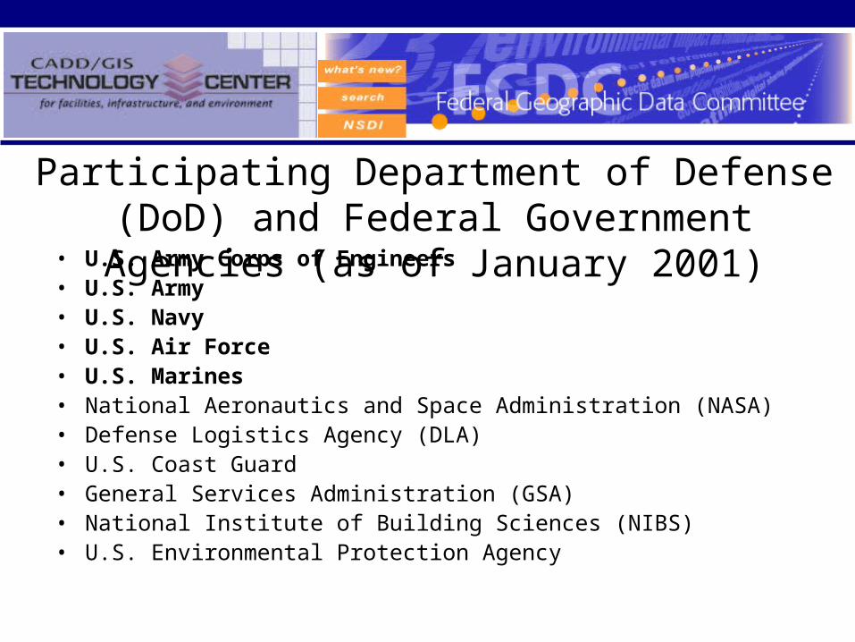
• U.S. Army Corps of Engineers• U.S. Army• U.S. Navy• U.S. Air Force• U.S. Marines• National Aeronautics and Space Administration (NASA)• Defense Logistics Agency (DLA)• U.S. Coast Guard• General Services Administration (GSA)• National Institute of Building Sciences (NIBS)• U.S. Environmental Protection Agency
Participating Department of Defense (DoD) and Federal Government Agencies (as of January 2001)
Charter and Business Plan
• Charter has been updated incorporating language concerning the FGDC Facilities Working Group (FWG) and signed by USACE, Navy, Army, National Institute for Building Science (NIBS), NASA and Coast Guard
• Updated the Business Plan incorporating language concerning the FGDC FWG
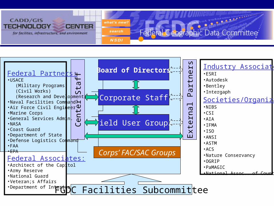
Board of Directors
Corporate Staff
Field User Groups
Cen
ter
Sta
ff
Ext
erna
l Par
tner
s
Corps’ FAC/SAC Groups
Federal Partners:•USACE (Military Programs) (Civil Works) (Research and Development)•Naval Facilities Command•Air Force Civil Engineer•Marine Corps•General Services Admin.•NASA•Coast Guard•Department of State•Defense Logistics Command•FAA•EPA
Federal Associates:•Architect of the Capitol•Army Reserve•National Guard•Veteran;s Affairs•Department of Interior
Industry Associates:•ESRI•Autodesk•Bentley•Intergaph
Societies/Organizations•NIBS•CSI•AIA•IFMA•ISO•ANSI•ASTM•ACS•Nature Conservancy•OGRIP•PaMAGIC•National Assoc.. of Counties
FGDC Facilities Subcommittee
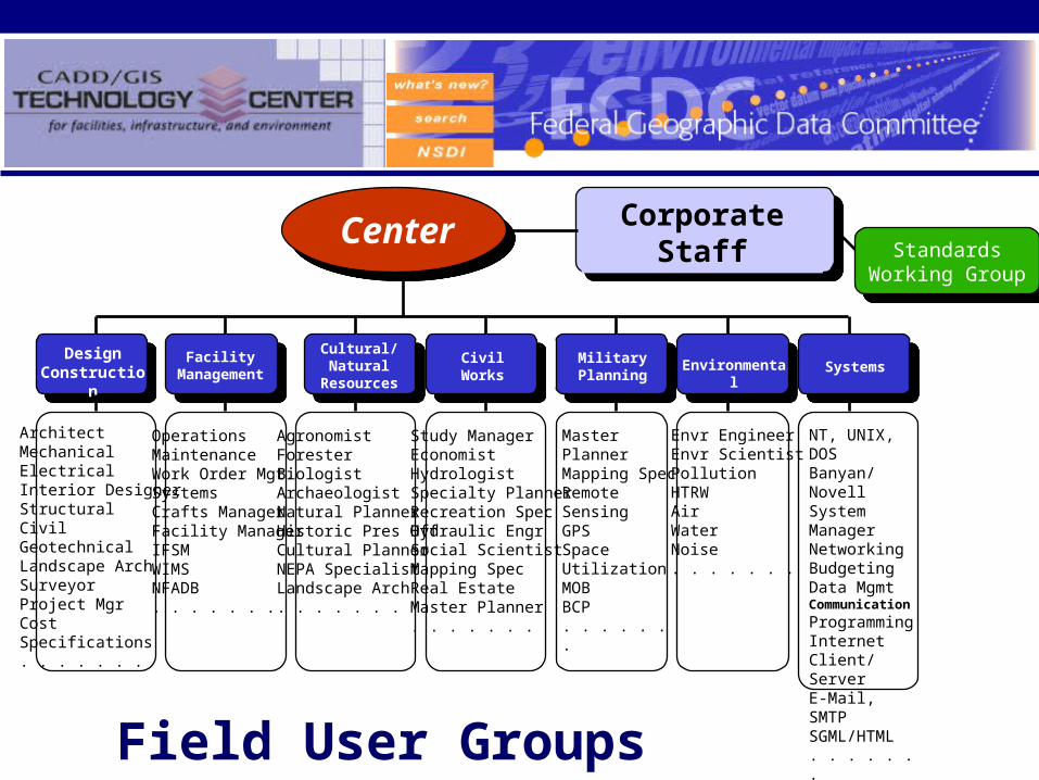
Center
Design Construction
Corporate Staff
Facility Management
Cultural/Natural
Resources
CivilWorks
MilitaryPlanning
Systems
ArchitectMechanicalElectricalInterior DesignerStructuralCivilGeotechnicalLandscape ArchSurveyorProject MgrCostSpecifications. . . . . . .
OperationsMaintenanceWork Order Mgt.SystemsCrafts ManagerFacility ManagerIFSMWIMSNFADB. . . . . . .
AgronomistForesterBiologistArchaeologistNatural PlannerHistoric Pres OffCultural PlannerNEPA SpecialistLandscape Arch. . . . . . .
Study ManagerEconomistHydrologistSpecialty PlannerRecreation SpecHydraulic EngrSocial ScientistMapping SpecReal EstateMaster Planner. . . . . . .
Master PlannerMapping SpecRemote SensingGPSSpace UtilizationMOBBCP. . . . . . .
Field User Groups
Environmental
Envr EngineerEnvr ScientistPollutionHTRWAirWaterNoise. . . . . . .
NT, UNIX, DOSBanyan/NovellSystem ManagerNetworkingBudgetingData MgmtCommunication
ProgrammingInternetClient/ServerE-Mail, SMTPSGML/HTML. . . . . . .
StandardsWorking Group
StandardsWorking Group

CADD/GIS/FM Standards Data Model(Option 1 concept for initial incorporation of FMSFIE with SDSFIE & A/E/C CADD Standards. Began with TSSDS/TSFMS Release 1.80, February 1999)
SDSFIE Entity Sets
SDSFIE Entity Classes FMSFIE Entity Classes
SDSFIE Attribute Tables
SDSFIE Entity Types
A/E/C Model File Type
SDSFIE Entities
FMSFIE Attribute Tables
A/E/C Symbol Name
A/E/C Level
Domain Tables & Domain Values
A/E/C Attribute Tables
A/E/C CADD Standards Discipline Codes
A/E/C Level/Layer Description
CADD/GIS/FM Standards Compliant Database = One Integrated Relational Database Structure
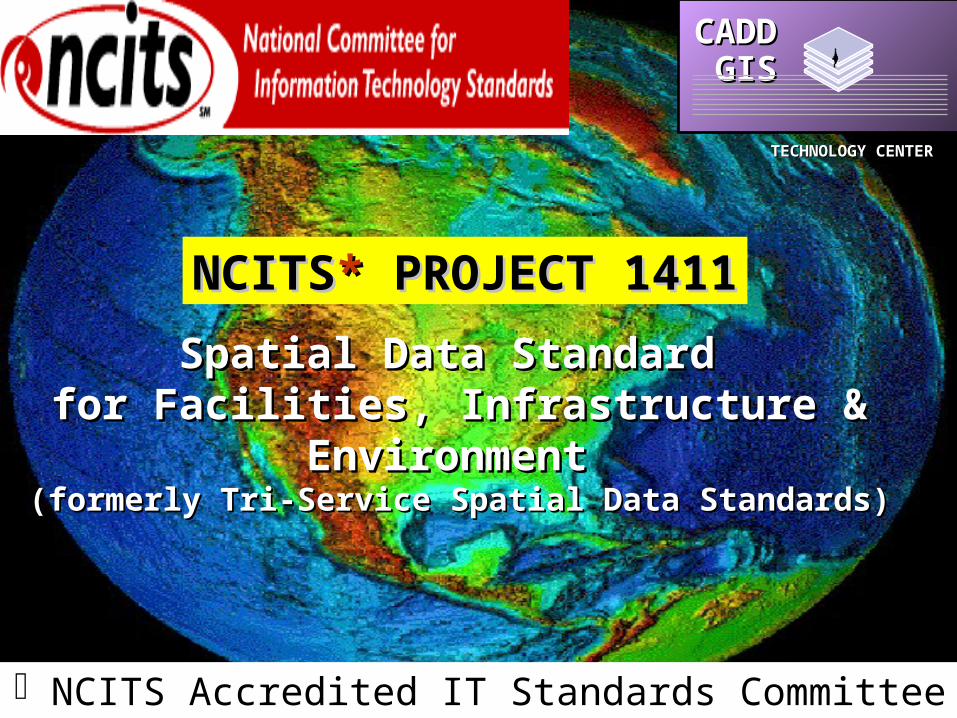
Spatial Data Standard Spatial Data Standard for Facilities, Infrastructure & Environment for Facilities, Infrastructure & Environment
(formerly Tri-Service Spatial Data Standards)(formerly Tri-Service Spatial Data Standards)
CADD GISCADD GIS
TECHNOLOGY CENTERTECHNOLOGY CENTER
NCITSNCITS** PROJECT 1411 PROJECT 1411
NCITS Accredited IT Standards Committee
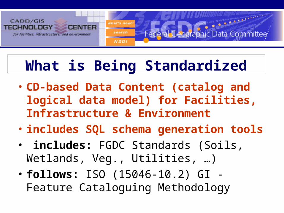
What is Being Standardized
• CD-based Data Content (catalog and logical data model) for Facilities, Infrastructure & Environment
• includes SQL schema generation tools
• includes: FGDC Standards (Soils, Wetlands, Veg., Utilities, …)
• follows: ISO (15046-10.2) GI - Feature Cataloguing Methodology

Status:• Completed 1st draft (in review by Center/FWG.)
• Submission to ANSI/NCITS L1 Mar. 01
• Review by L1 and NCITS staff
• Out for public review this spring.
"8"8"8
"8
"8 "8
"8
"8"8
"8
"8
"8
"8
"8
"8
"8 "8"8 "8"8"8"8
"8"8"8 "8"8"8 "8"8 "8 "8"8 "8 "8
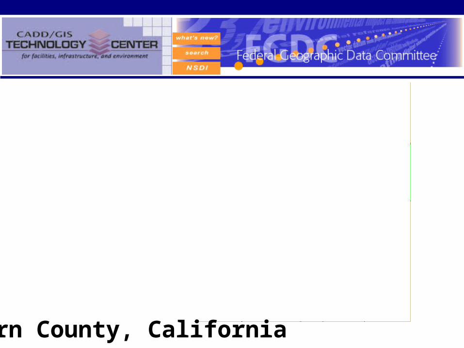
Naval Petroleum Reserve # 1
Kern CountyEdwards Air Force Base
Isabella Reservoir
China Lake Naval Weapons Center
WascoOildale
Lamont
Delano
Bakersfield
Ridgecrest
Los AngelesKern County, California

• FGDC Facilities Working Group, working with three Local Government Consortiums:– Kern Geographic Information
Network (Kern GEONET)
– San Joaquin Valley Information Association (SJV ISIS)
– California Geographic Information Association (CGIA)
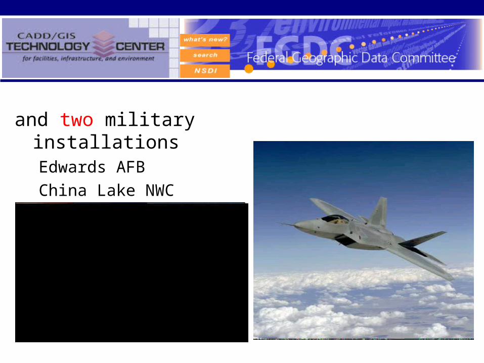
and two military installationsEdwards AFB
China Lake NWC
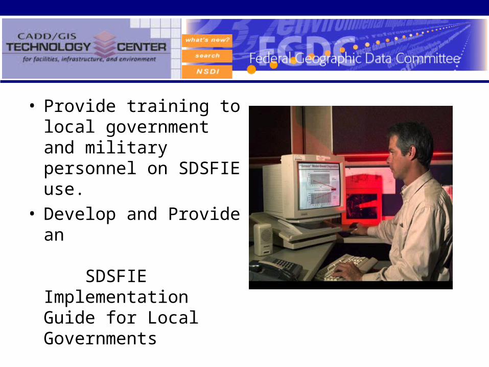
• Provide training to local government and military personnel on SDSFIE use.
• Develop and Provide an SDSFIE Implementation Guide for Local Governments
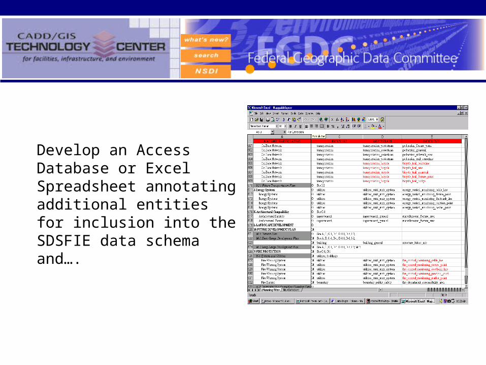
Develop an Access Database or Excel Spreadsheet annotating additional entities for inclusion into the SDSFIE data schema and….
Incorporation of USGS DLG Data into the SDSFIE
• Phase I– Detailed technical guide with workflows for automated
scripts and materials for converting USGS DLG digital map data formats into SDS.
– Draft User guide with a step-by-step conversion of digital line graph (DLG) data into SDS.
• Phase II– Bulk conversion tools– Final User guide
Questions ??


