
Groundwater in the Mekong Region – Transboundary Aquifers
Felix Seebacher, PhD Information and Knowledge Management Programme
Mekong River Commission Secretariat
International Conference on Cooperation for Water, Energy, and Food Security in Transboundary Basins under Changing Climate
2 April 2014 Ho Chi Minh City, Viet Nam
Outline Groundwater Resources in a Global Perspective
• Freshwater Resources Globally
• And Regionally in the Lower Mekong River Basin (LMB)
Effect of Groundwater Overexploitation and Possible Influences Across Borders • Quantitative and qualitative examples
Transboundary Aquifers in the LMB • Between Cambodia / Lao PDR / Thailand /Viet Nam
Example of Groundwater Resources in a LMB • Detailed investigation on 2 Cambodian Border Provinces
Arsenic in Deltaic Aquifers
• Shallow and now also deeper aquifers are affected
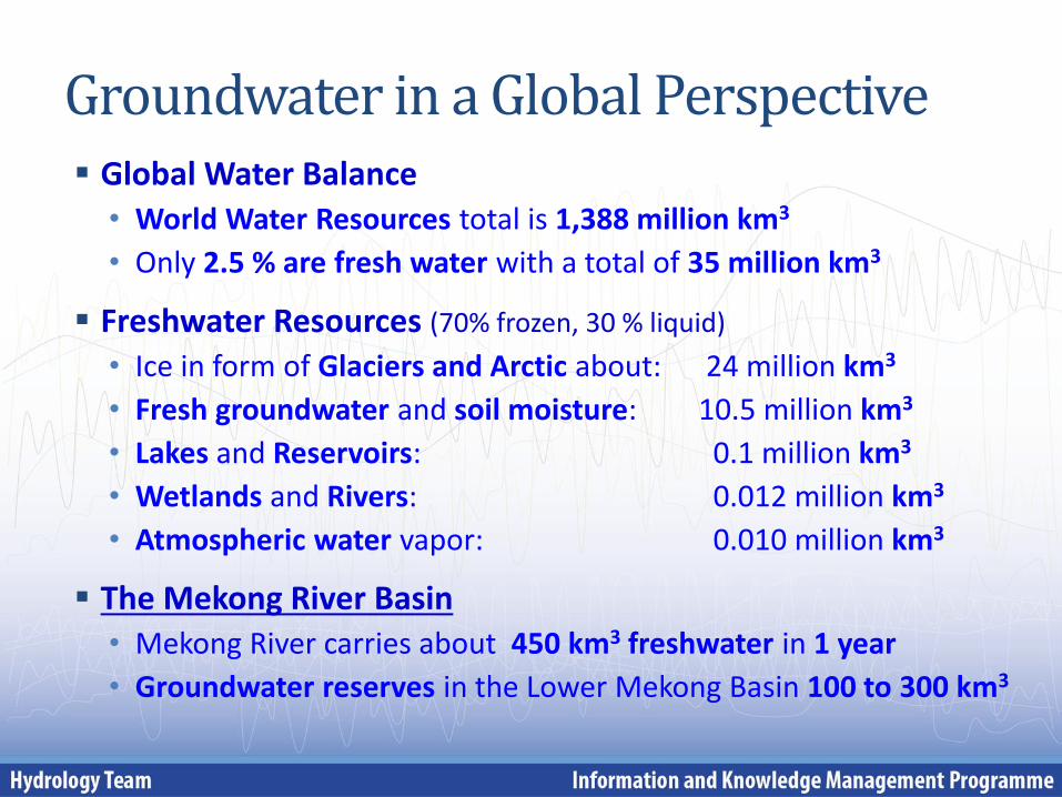
Groundwater in a Global Perspective Global Water Balance • World Water Resources total is 1,388 million km3
• Only 2.5 % are fresh water with a total of 35 million km3
Freshwater Resources (70% frozen, 30 % liquid)
• Ice in form of Glaciers and Arctic about: 24 million km3
• Fresh groundwater and soil moisture: 10.5 million km3
• Lakes and Reservoirs: 0.1 million km3
• Wetlands and Rivers: 0.012 million km3
• Atmospheric water vapor: 0.010 million km3
The Mekong River Basin • Mekong River carries about 450 km3 freshwater in 1 year
• Groundwater reserves in the Lower Mekong Basin 100 to 300 km3
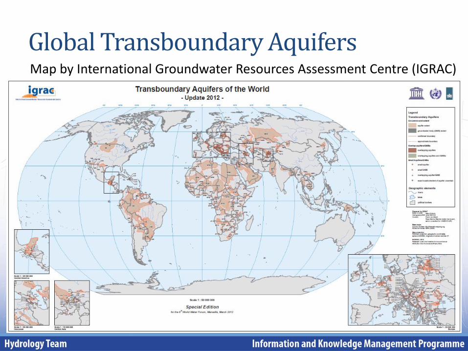
Global Transboundary Aquifers Map by International Groundwater Resources Assessment Centre (IGRAC)
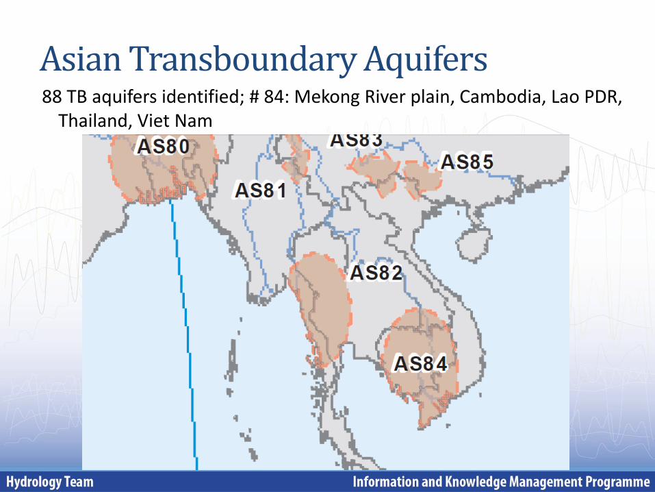
Asian Transboundary Aquifers 88 TB aquifers identified; # 84: Mekong River plain, Cambodia, Lao PDR,
Thailand, Viet Nam
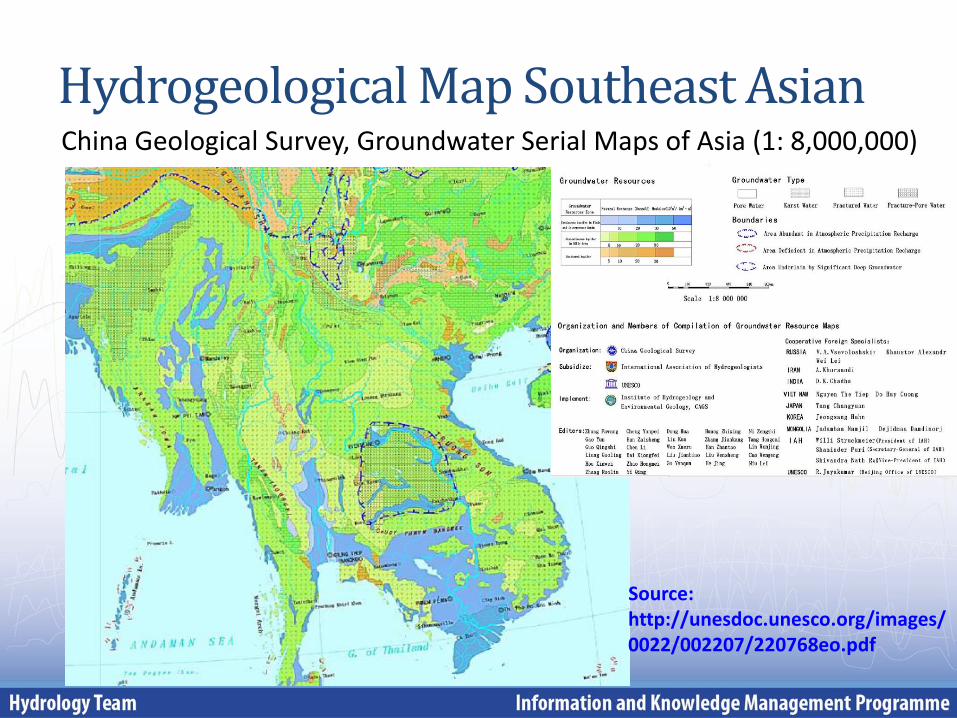
Hydrogeological Map Southeast Asian China Geological Survey, Groundwater Serial Maps of Asia (1: 8,000,000)
Source: http://unesdoc.unesco.org/images/0022/002207/220768eo.pdf
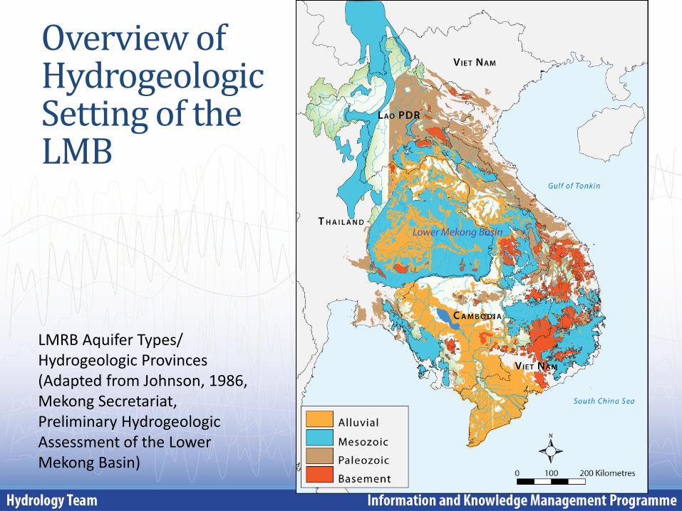
Overview of Hydrogeologic Setting of the LMB
LMRB Aquifer Types/ Hydrogeologic Provinces (Adapted from Johnson, 1986, Mekong Secretariat, Preliminary Hydrogeologic Assessment of the Lower Mekong Basin)
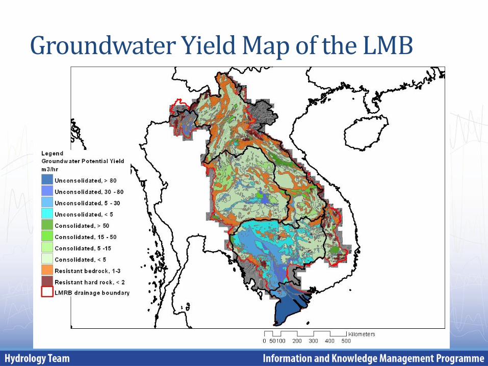
Groundwater Yield Map of the LMB
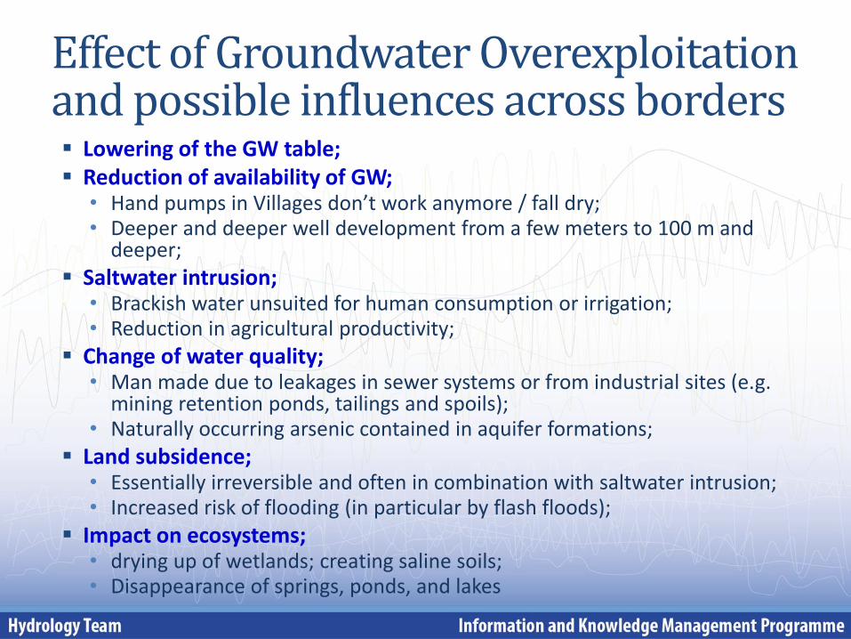
Effect of Groundwater Overexploitation and possible influences across borders
Lowering of the GW table; Reduction of availability of GW;
• Hand pumps in Villages don’t work anymore / fall dry; • Deeper and deeper well development from a few meters to 100 m and
deeper;
Saltwater intrusion; • Brackish water unsuited for human consumption or irrigation; • Reduction in agricultural productivity;
Change of water quality; • Man made due to leakages in sewer systems or from industrial sites (e.g.
mining retention ponds, tailings and spoils); • Naturally occurring arsenic contained in aquifer formations;
Land subsidence; • Essentially irreversible and often in combination with saltwater intrusion; • Increased risk of flooding (in particular by flash floods);
Impact on ecosystems; • drying up of wetlands; creating saline soils; • Disappearance of springs, ponds, and lakes
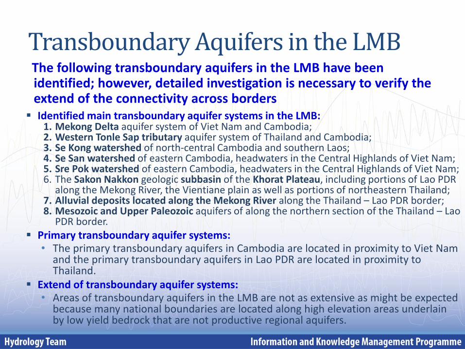
Transboundary Aquifers in the LMB The following transboundary aquifers in the LMB have been
identified; however, detailed investigation is necessary to verify the extend of the connectivity across borders
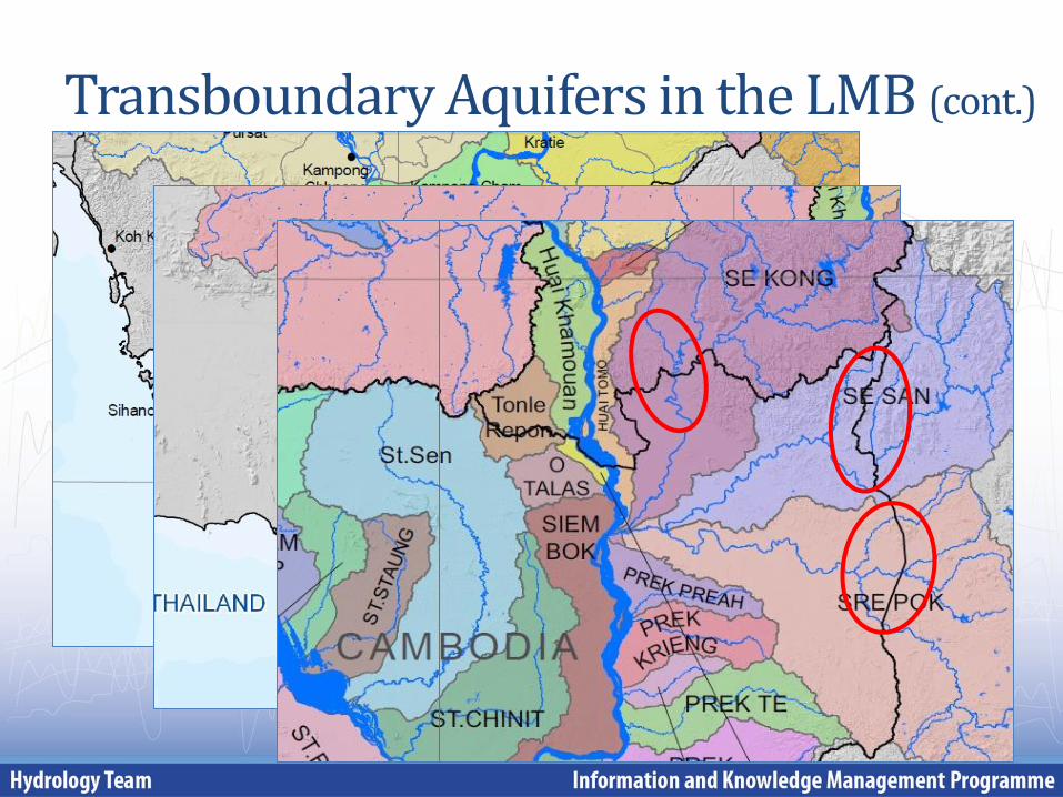
Identified main transboundary aquifer systems in the LMB: 1. Mekong Delta aquifer system of Viet Nam and Cambodia; 2. Western Tonle Sap tributary aquifer system of Thailand and Cambodia; 3. Se Kong watershed of north-central Cambodia and southern Laos; 4. Se San watershed of eastern Cambodia, headwaters in the Central Highlands of Viet Nam; 5. Sre Pok watershed of eastern Cambodia, headwaters in the Central Highlands of Viet Nam; 6. The Sakon Nakkon geologic subbasin of the Khorat Plateau, including portions of Lao PDR
along the Mekong River, the Vientiane plain as well as portions of northeastern Thailand; 7. Alluvial deposits located along the Mekong River along the Thailand – Lao PDR border; 8. Mesozoic and Upper Paleozoic aquifers of along the northern section of the Thailand – Lao
PDR border.
Primary transboundary aquifer systems: • The primary transboundary aquifers in Cambodia are located in proximity to Viet Nam
and the primary transboundary aquifers in Lao PDR are located in proximity to Thailand.
Extend of transboundary aquifer systems: • Areas of transboundary aquifers in the LMB are not as extensive as might be expected
because many national boundaries are located along high elevation areas underlain by low yield bedrock that are not productive regional aquifers.
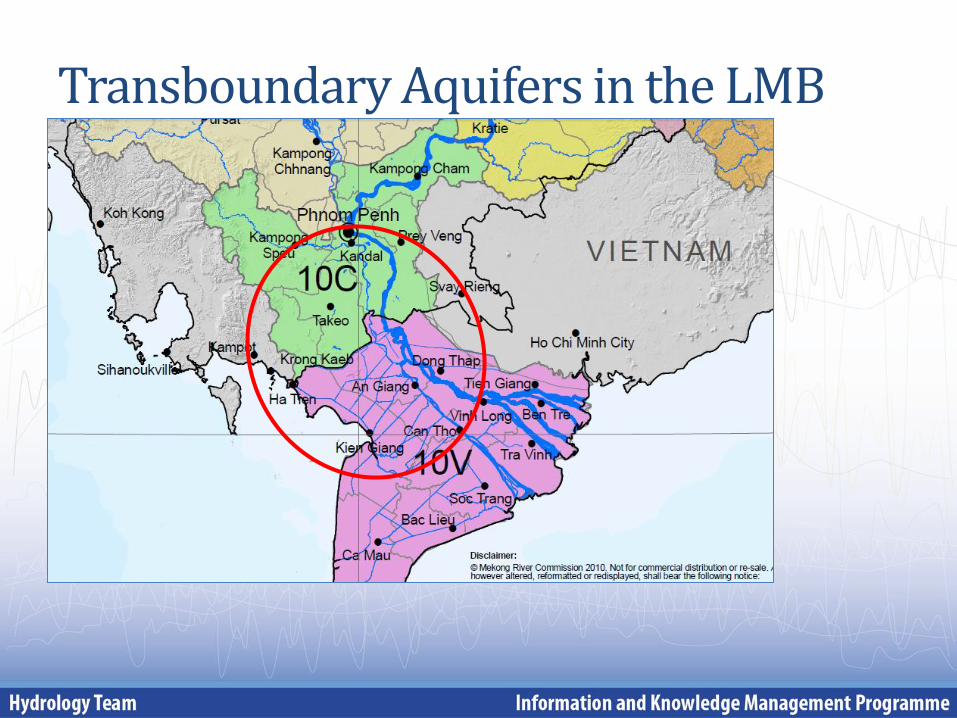
Transboundary Aquifers in the LMB
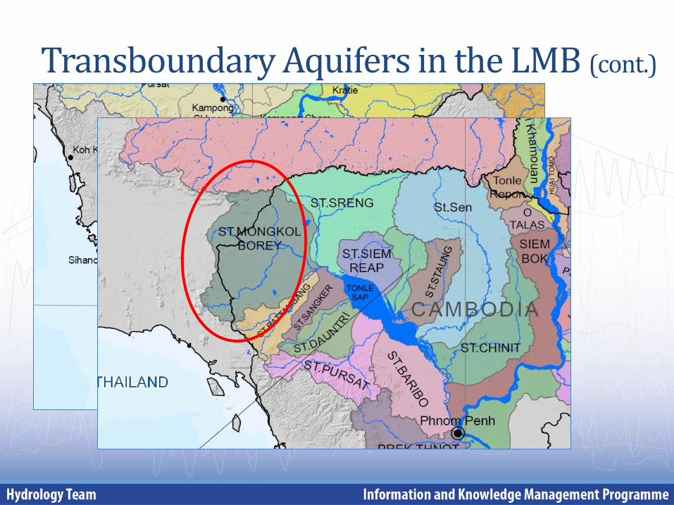
Transboundary Aquifers in the LMB (cont.)
Transboundary Aquifers in the LMB (cont.)
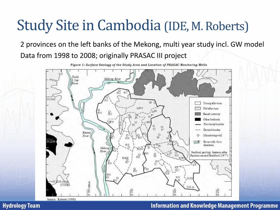
Study Site in Cambodia (IDE, M. Roberts)
2 provinces on the left banks of the Mekong, multi year study incl. GW model
Data from 1998 to 2008; originally PRASAC III project
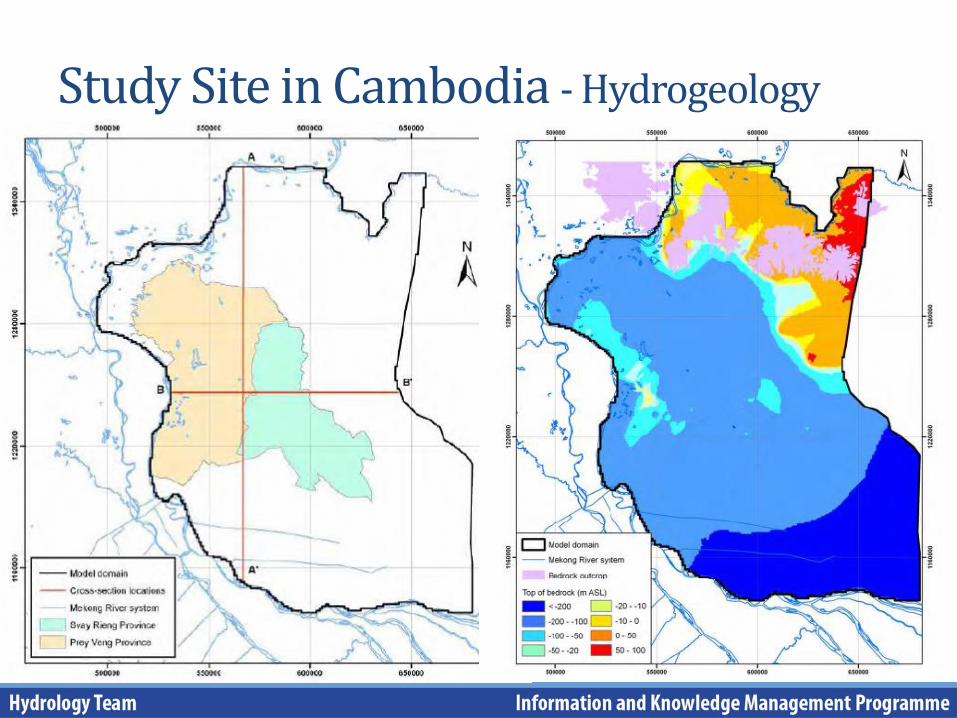
Study Site in Cambodia - Hydrogeology
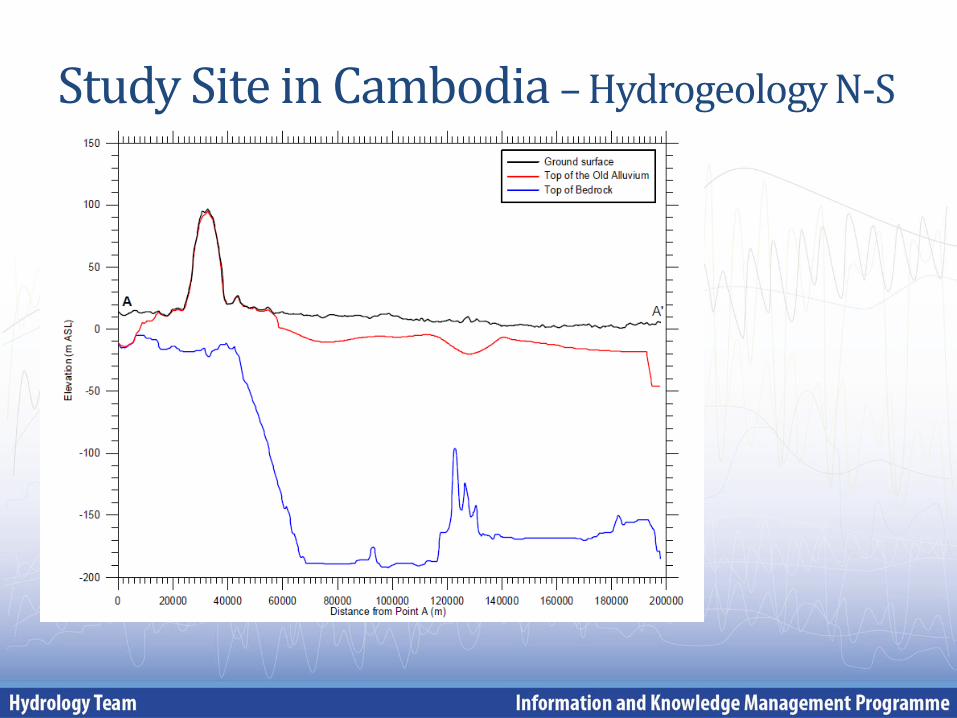
Study Site in Cambodia – Hydrogeology N-S
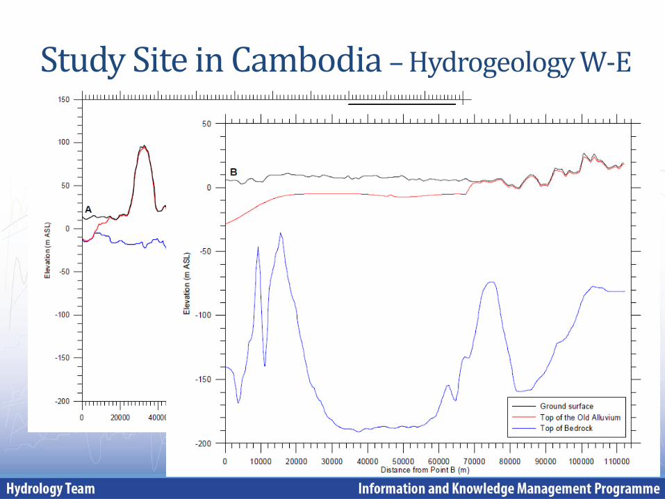
Study Site in Cambodia – Hydrogeology W-E
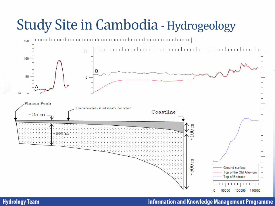
Study Site in Cambodia - Hydrogeology
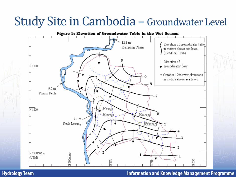
Study Site in Cambodia – Groundwater Level
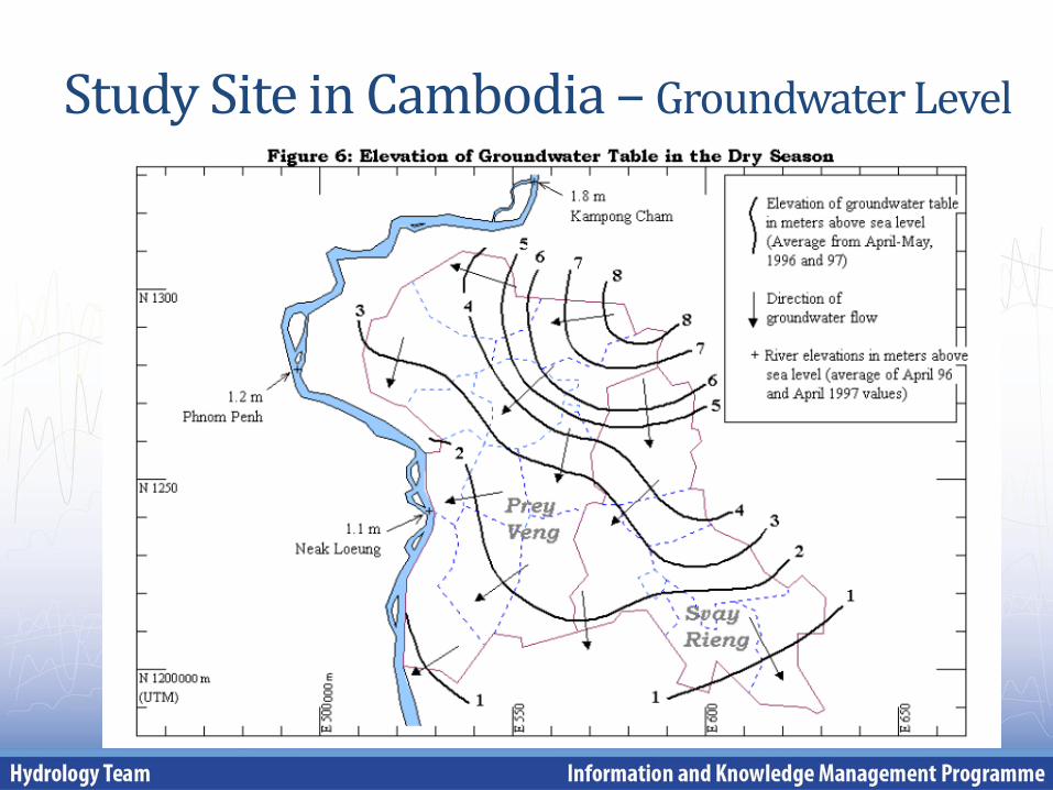
Study Site in Cambodia – Groundwater Level
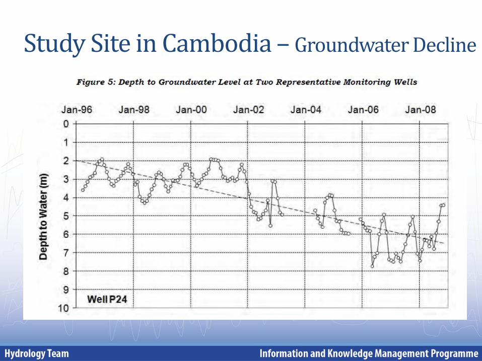
Study Site in Cambodia – Groundwater Decline
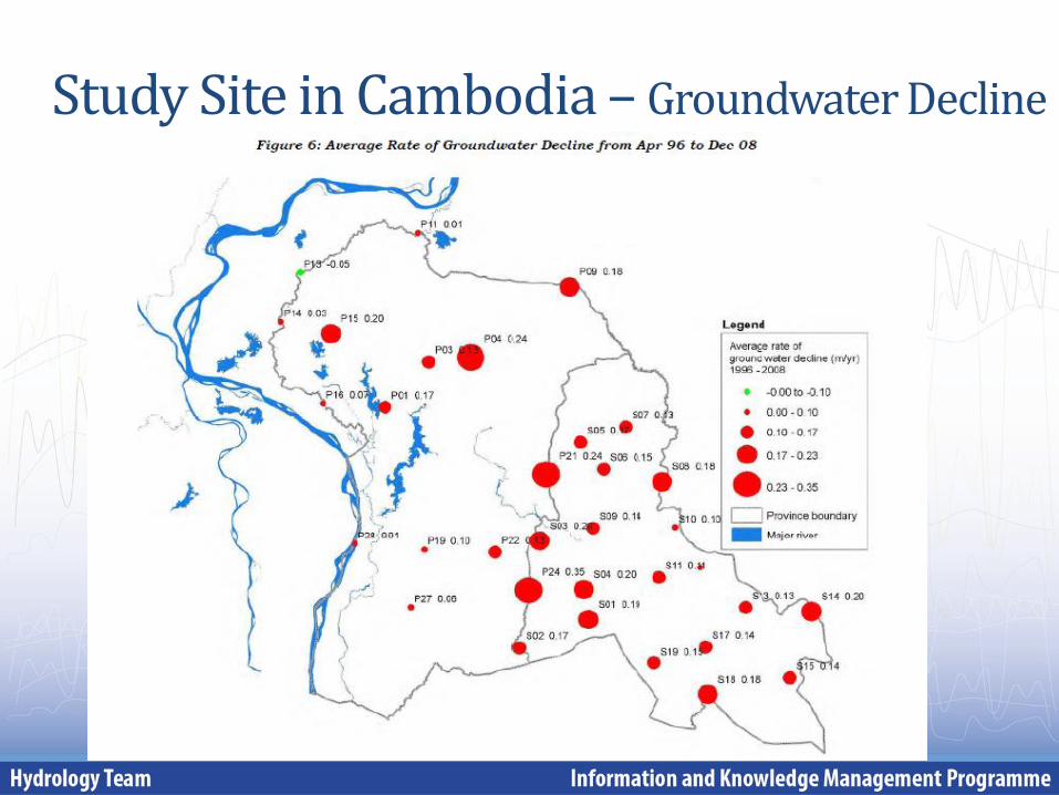
Study Site in Cambodia – Groundwater Decline
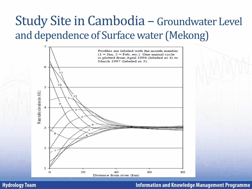
Study Site in Cambodia – Groundwater Level and dependence of Surface water (Mekong)
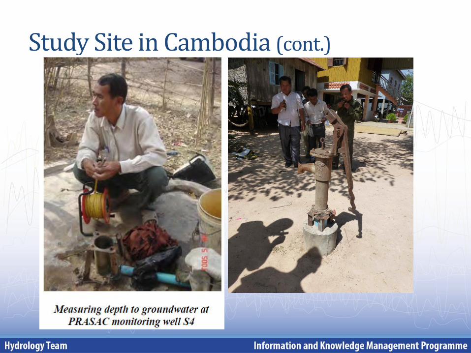
Study Site in Cambodia (cont.)
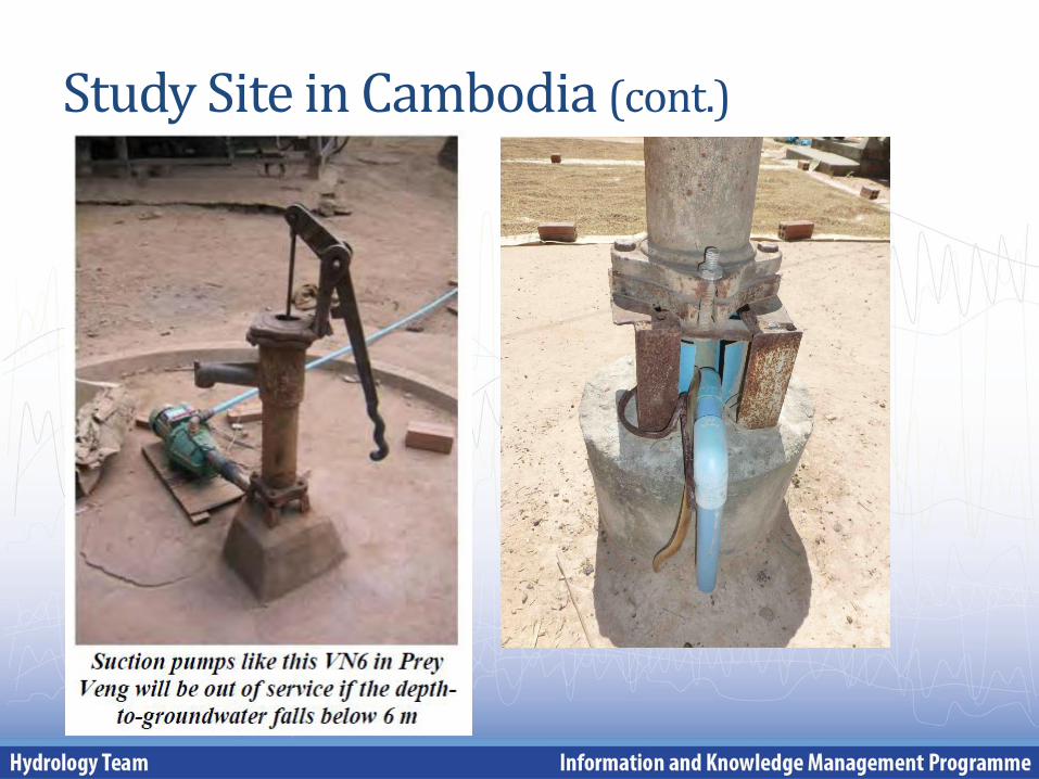
Study Site in Cambodia (cont.)
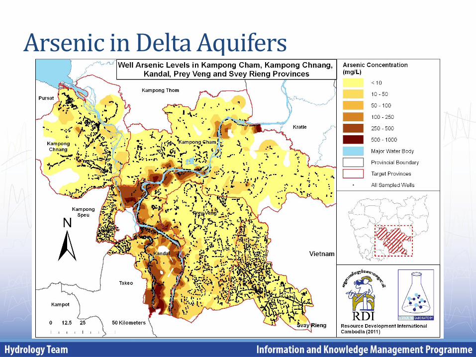
Arsenic in Delta Aquifers
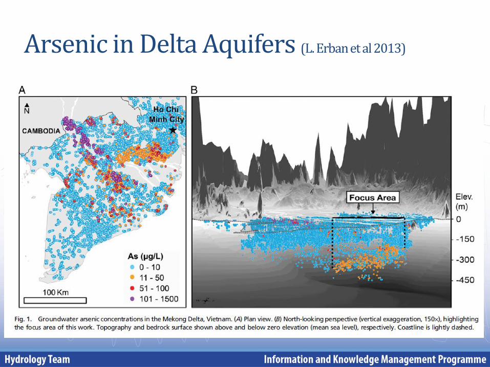
Arsenic in Delta Aquifers (L. Erban et al 2013)
Future work programme with respect to Transboundary Groundwater Systems
More detailed geological and hydrogeological investigation on the 8 identified transboundary aquifers: • Finalization of literature research;
Developing hydrogeological investigation programmes: • Detailed drilling programme adapted to the specific sites; • Team building of riparian hydrogeologists to investigate jointly;
Joint Groundwater investigation: • Simultaneous groundwater measurement campaigns across borders; • Advanced geophysical borehole methods; • Joint pumping tests;
Exchange Ground and Surface water: • Establishing groundwater wells close to major rivers (simultaneous recording
of water levels along a cross-section);
Fostering cooperation: • Exchange experience on hydrogeological investigations; • Joint transboundary aquifer investigation/research projects .
Thank you very much!
Hydrology Team Information and Knowledge Management Programme
Mekong River Commission Secretariat


