
3D Sediment Aquifer Mapping
Ontario, Canada
Abigail Burt
Ontario Geological Survey
Today’s Talk
• Introduction
• Why is the OGS doing 3-D mapping?
• Where are we working?
• What are the goals?
• How do we go about 3-D mapping
• What do we produce?
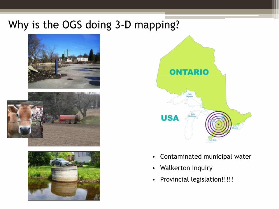
Why is the OGS doing 3-D mapping?
• Contaminated municipal water
• Walkerton Inquiry
• Provincial legislation!!!!!
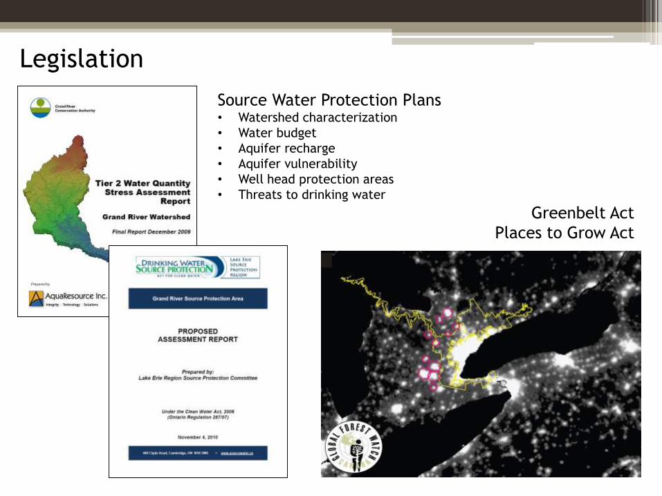
Legislation
Source Water Protection Plans• Watershed characterization
• Water budget
• Aquifer recharge
• Aquifer vulnerability
• Well head protection areas
• Threats to drinking water
Greenbelt Act
Places to Grow Act
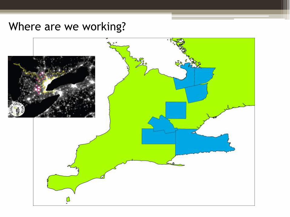
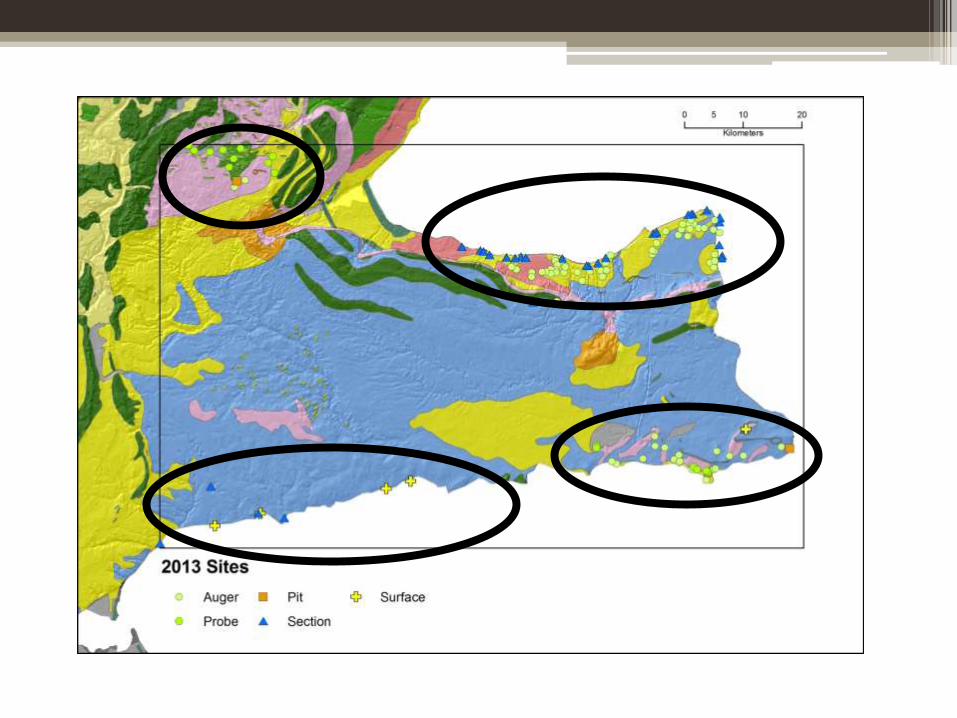
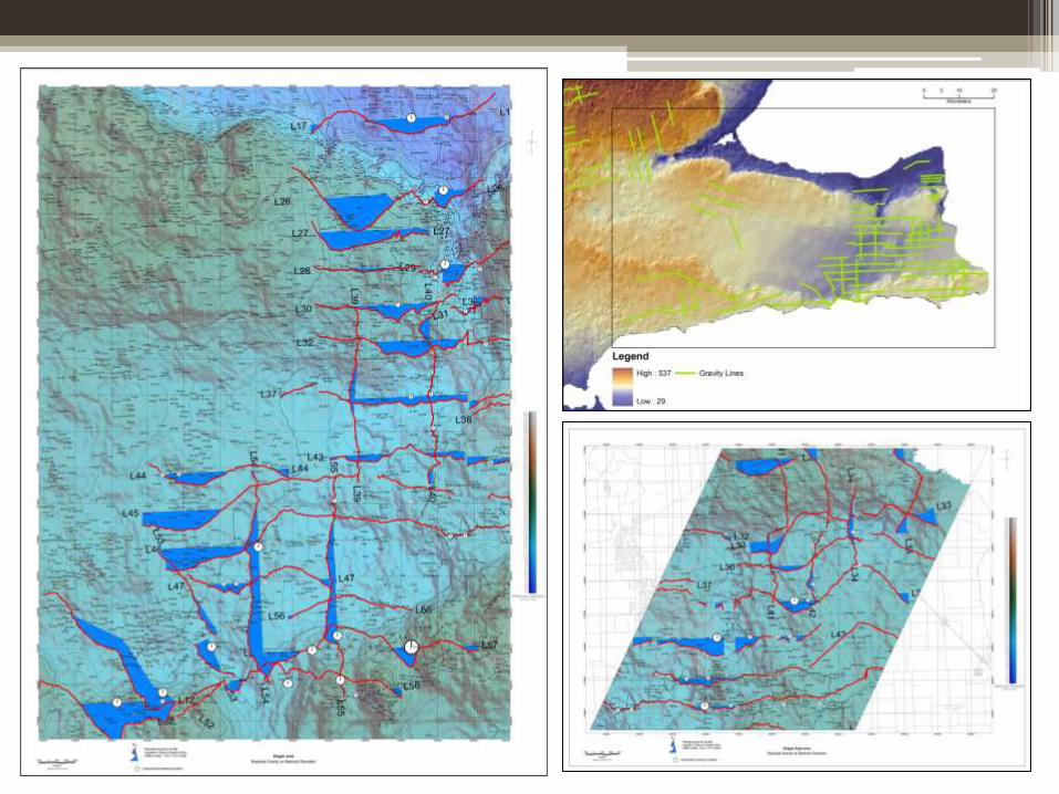
Where are we working?
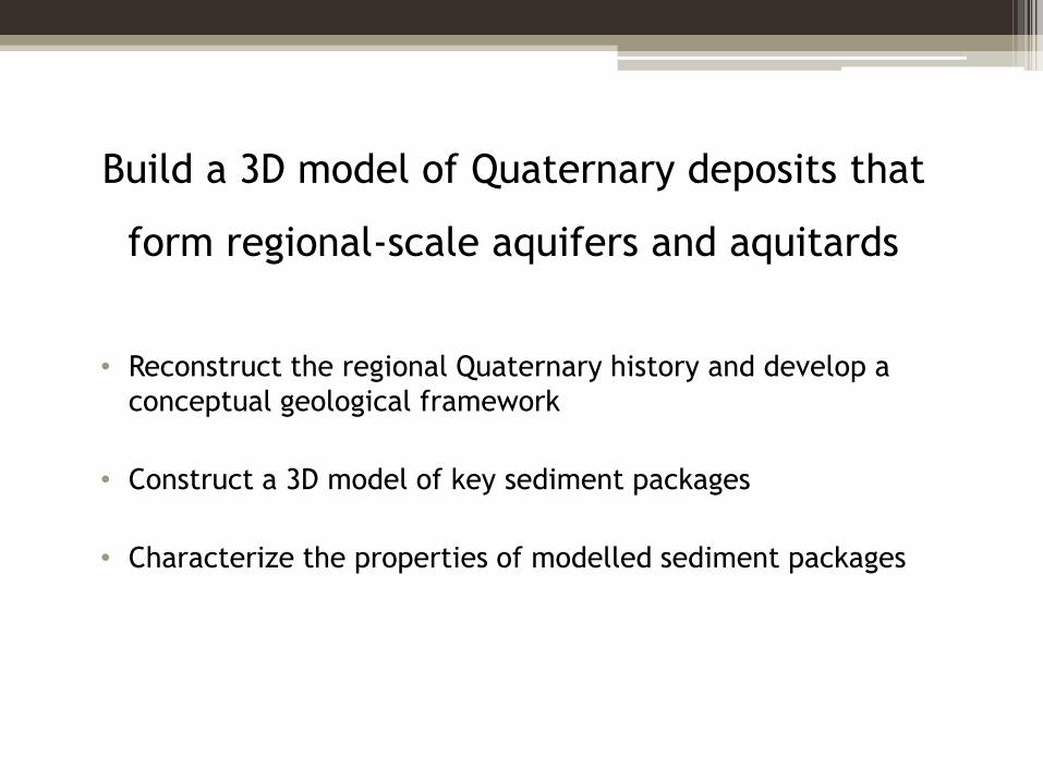
Build a 3D model of Quaternary deposits that
form regional-scale aquifers and aquitards
• Reconstruct the regional Quaternary history and develop a
conceptual geological framework
• Construct a 3D model of key sediment packages
• Characterize the properties of modelled sediment packages
How do we go about 3-D mapping?
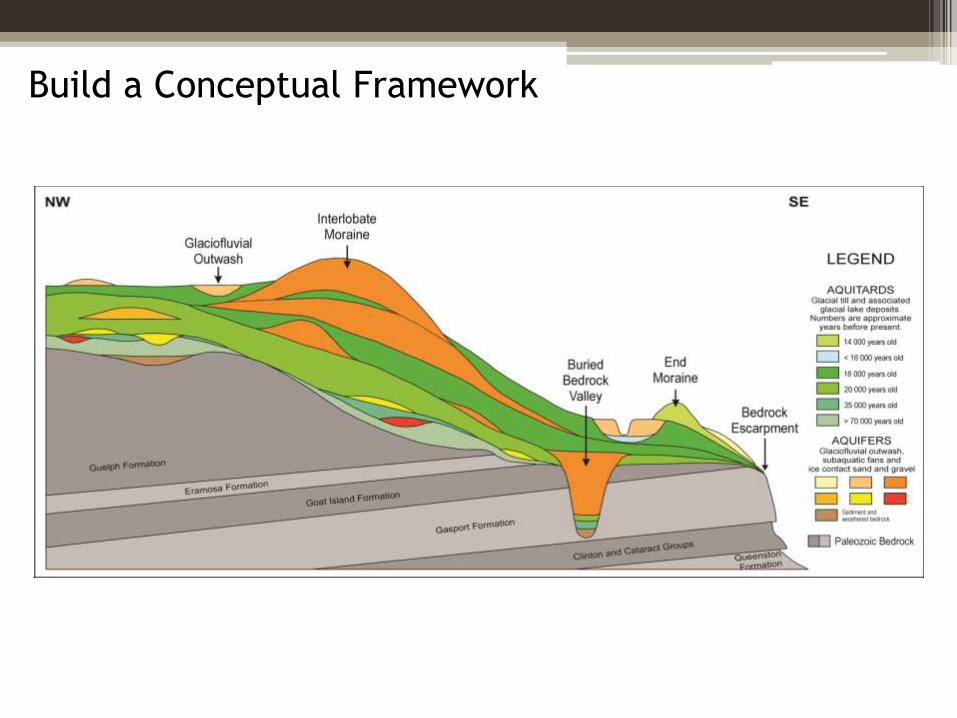
Build a Conceptual Framework
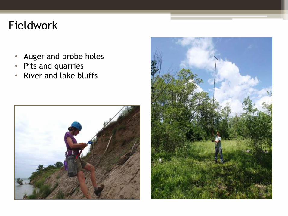
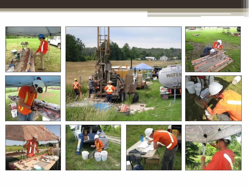
Fieldwork
• Auger and probe holes
• Pits and quarries
• River and lake bluffs
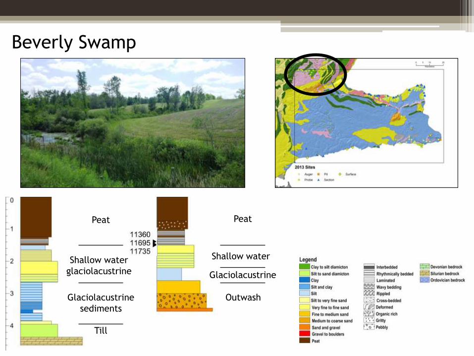
Glaciolacustrine
sediments
Till
Peat
Shallow water
glaciolacustrine Glaciolacustrine
Outwash
Peat
Shallow water
Beverly Swamp
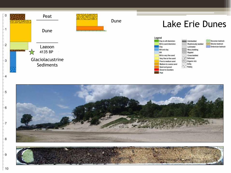
Lake Erie DunesDune
Glaciolacustrine
Sediments
DunePeat
Lagoon4135 BP
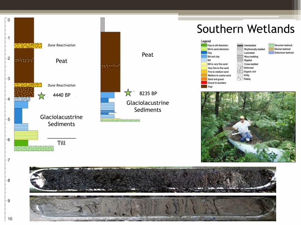
Southern WetlandsDune Reactivation
Glaciolacustrine
Sediments
Peat
Till
Dune Reactivation
Glaciolacustrine
Sediments
Peat
4440 BP 8235 BP
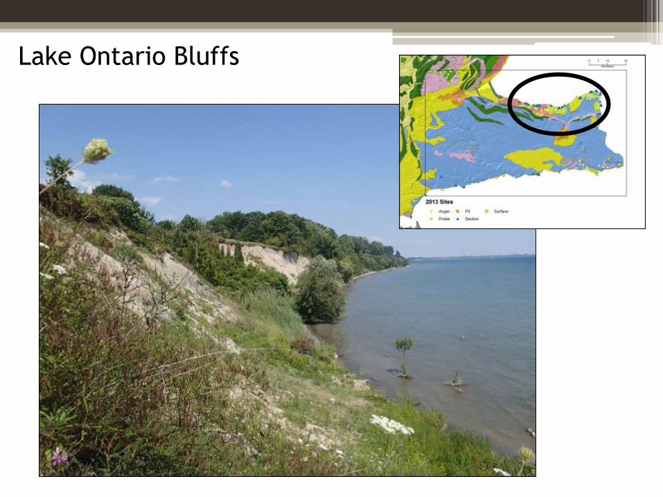
Lake Ontario Bluffs
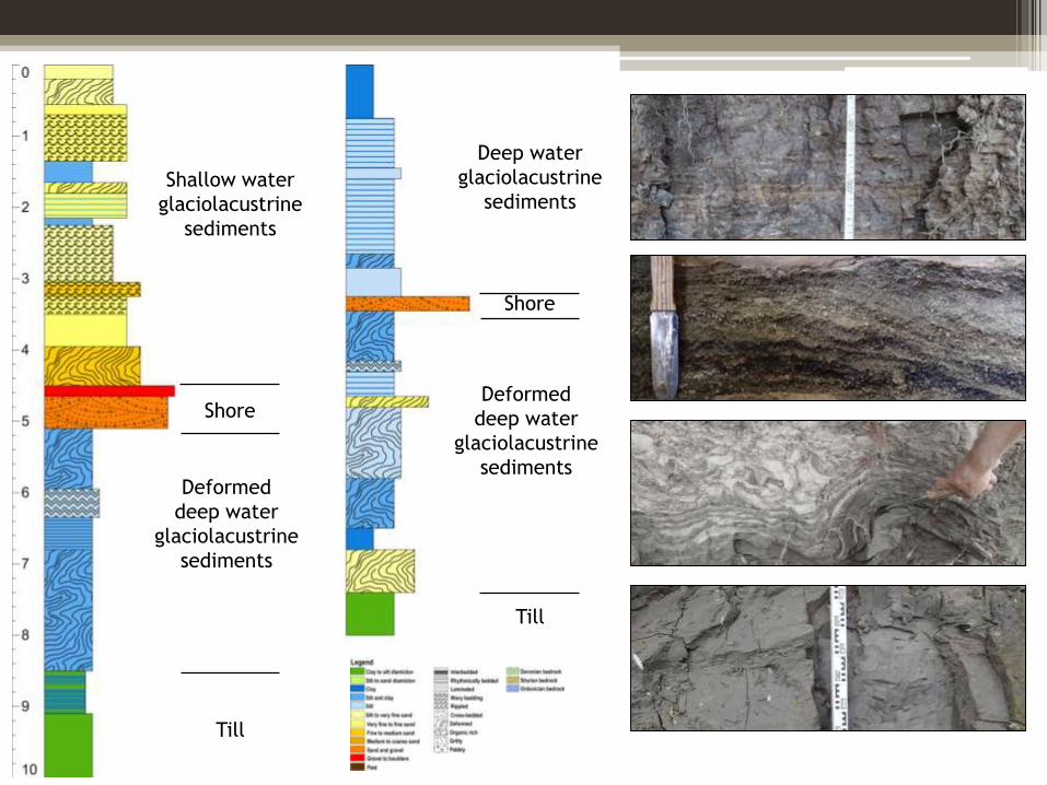
Till
Deformed
deep water
glaciolacustrine
sediments
Shallow water
glaciolacustrine
sediments
Shore
Till
Deformed
deep water
glaciolacustrine
sediments
Deep water
glaciolacustrine
sediments
Shore
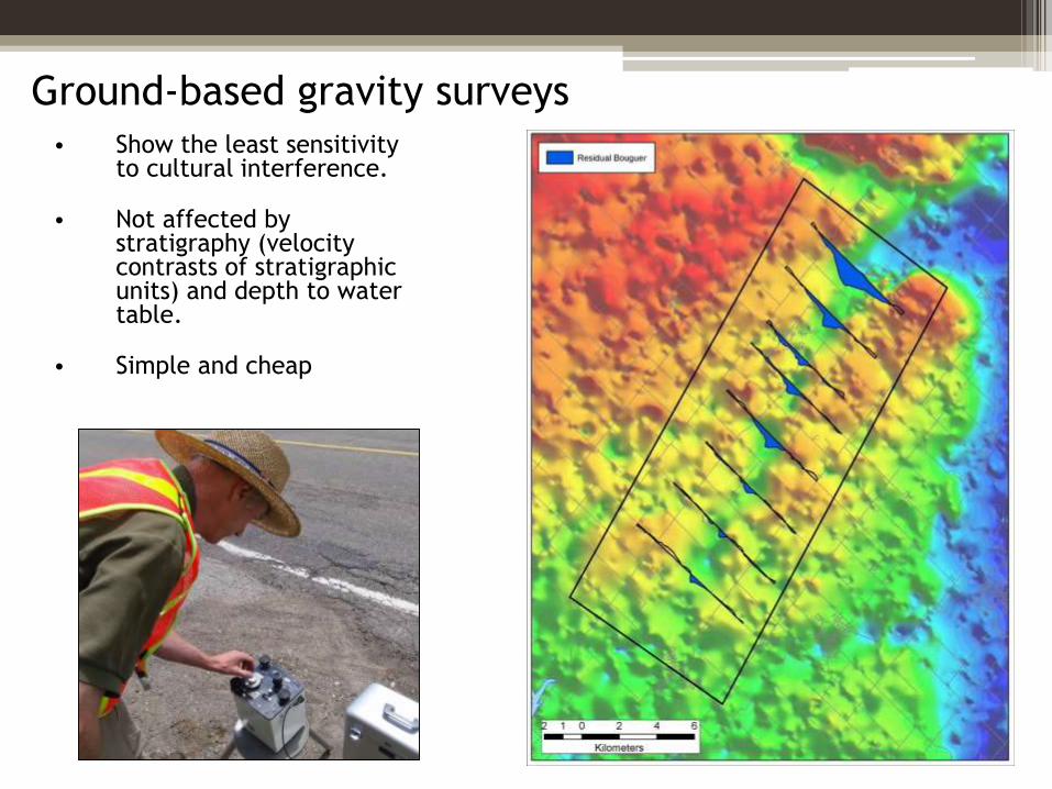
Ground-based gravity surveys• Show the least sensitivity
to cultural interference.
• Not affected by stratigraphy (velocity contrasts of stratigraphic units) and depth to water table.
• Simple and cheap
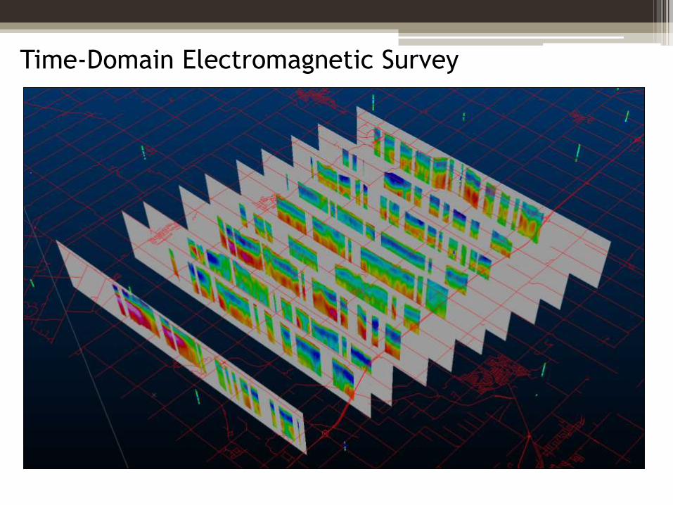
Time-Domain Electromagnetic Survey
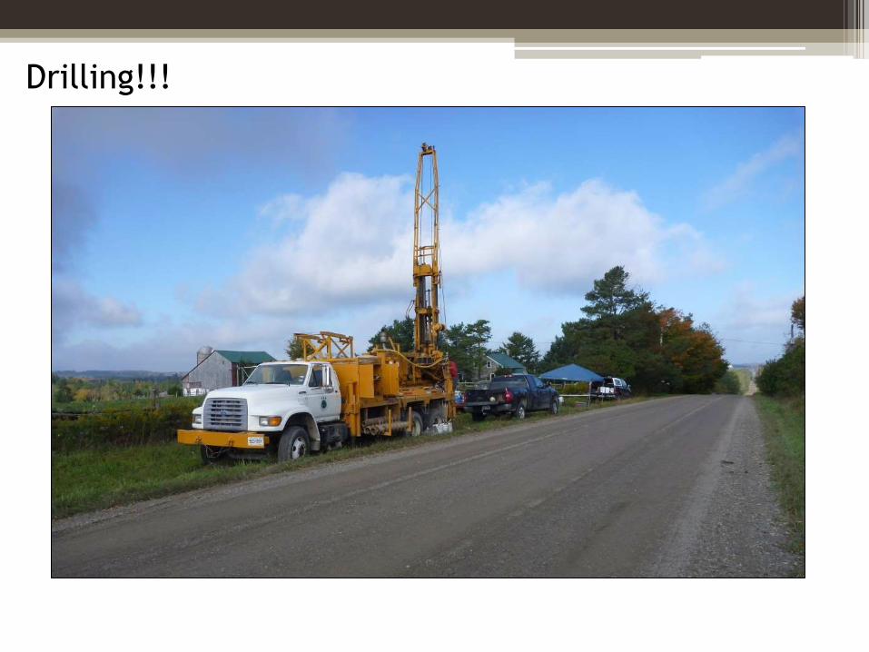
Drilling!!!
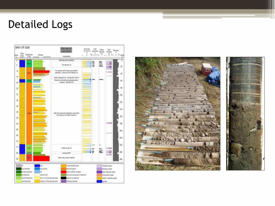
Detailed Logs
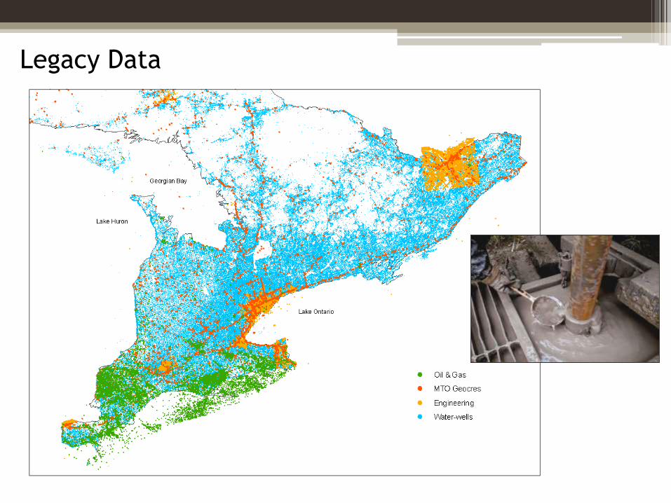
Legacy Data
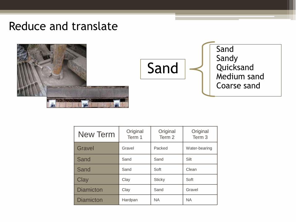
Reduce and translate
SandSandyQuicksandMedium sandCoarse sand
Sand
New TermOriginal
Term 1
Original
Term 2
Original
Term 3
Gravel Gravel Packed Water-bearing
Sand Sand Sand Silt
Sand Sand Soft Clean
Clay Clay Sticky Soft
Diamicton Clay Sand Gravel
Diamicton Hardpan NA NA
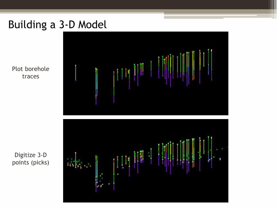
Building a 3-D Model
Plot borehole
traces
Digitize 3-D
points (picks)
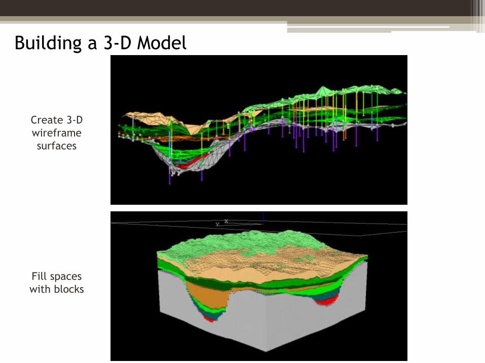
Building a 3-D Model
Fill spaces
with blocks
Create 3-D
wireframe
surfaces
What really goes on….
Tales from the Orangeville Moraine
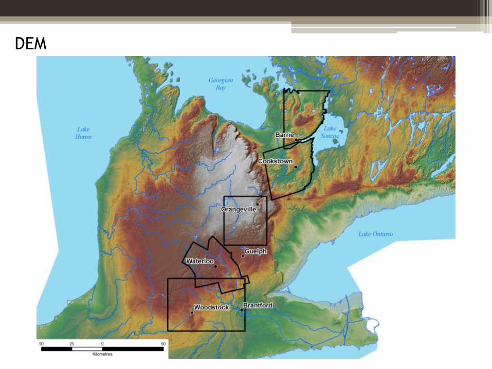
DEM
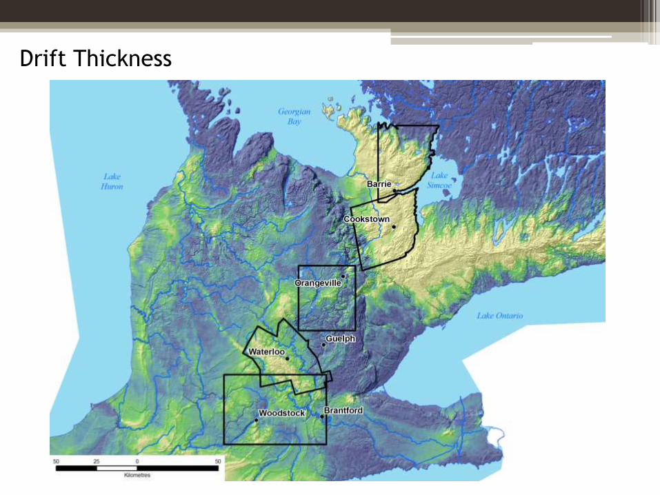
Drift Thickness
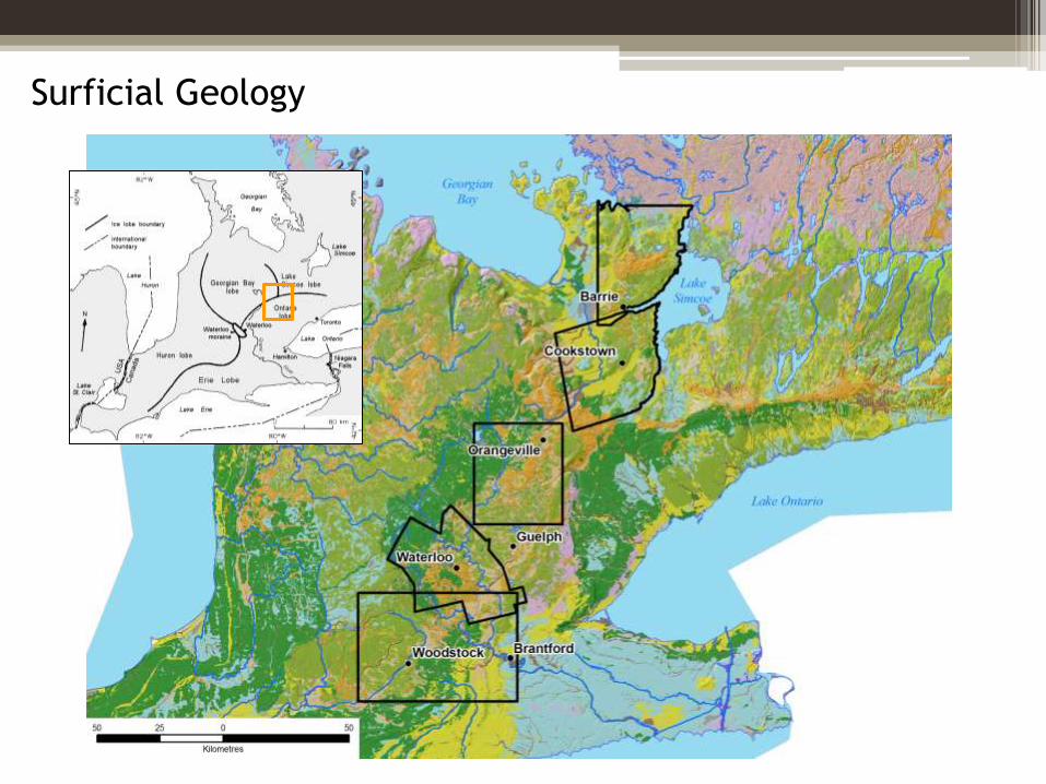
Surficial Geology
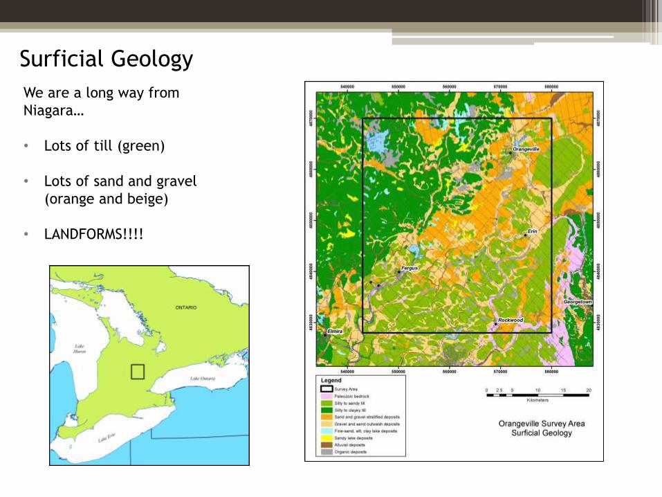
Surficial Geology
We are a long way from
Niagara…
• Lots of till (green)
• Lots of sand and gravel
(orange and beige)
• LANDFORMS!!!!
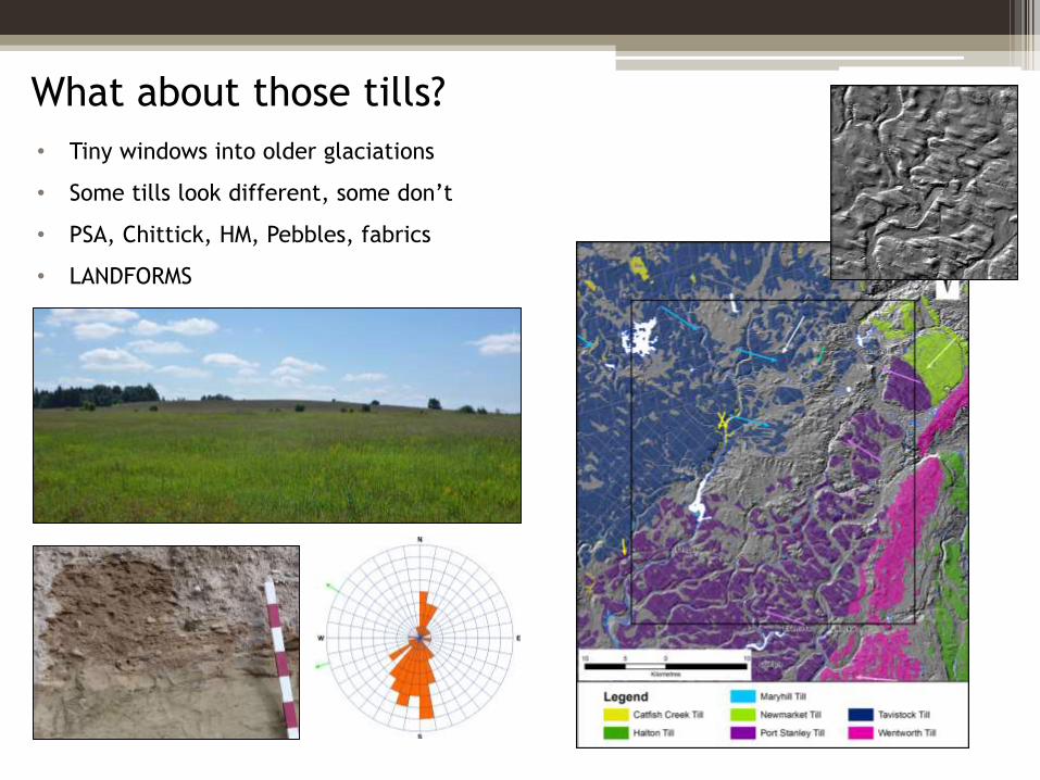
What about those tills?
• Tiny windows into older glaciations
• Some tills look different, some don’t
• PSA, Chittick, HM, Pebbles, fabrics
• LANDFORMS
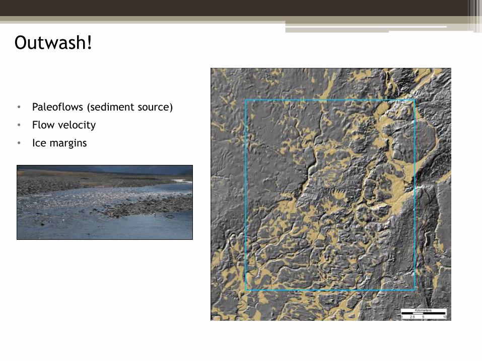
Outwash!
• Paleoflows (sediment source)
• Flow velocity
• Ice margins
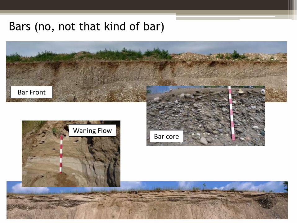
Bars (no, not that kind of bar)
Bar Front
Bar coreWaning Flow
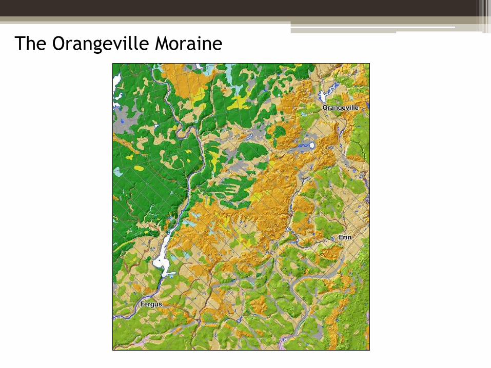
The Orangeville Moraine
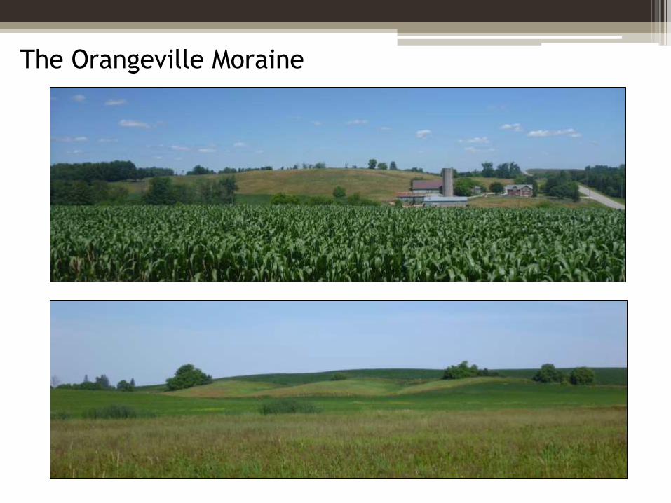
The Orangeville Moraine
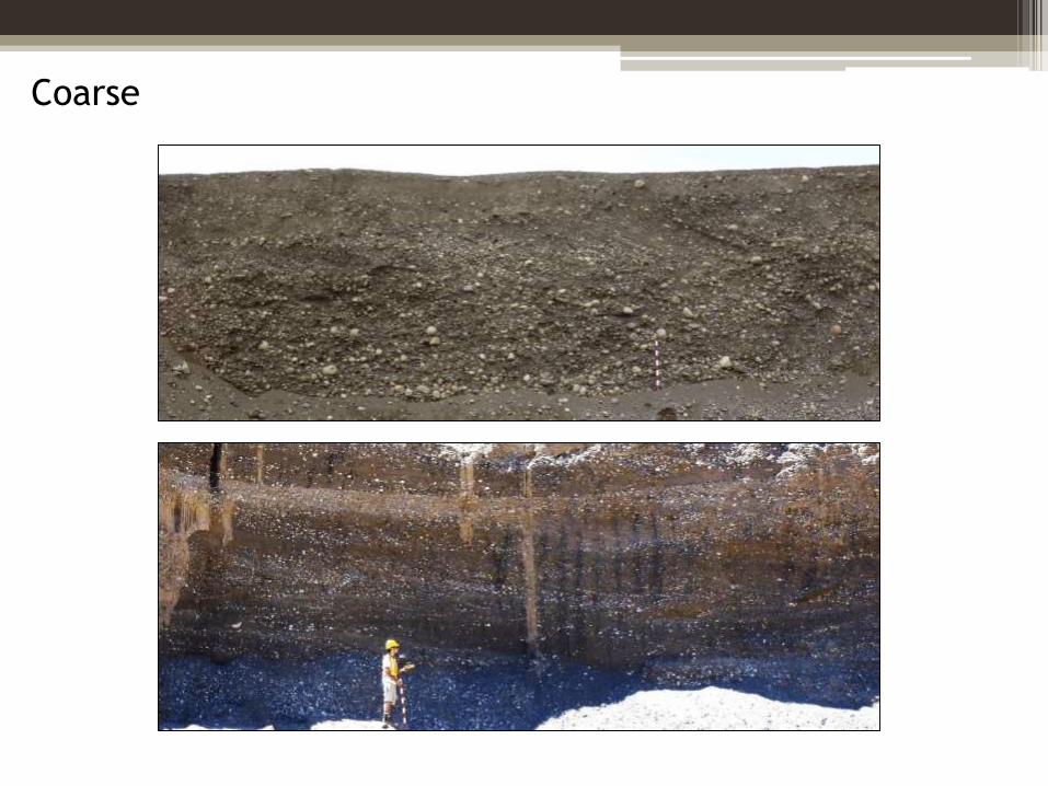
Coarse
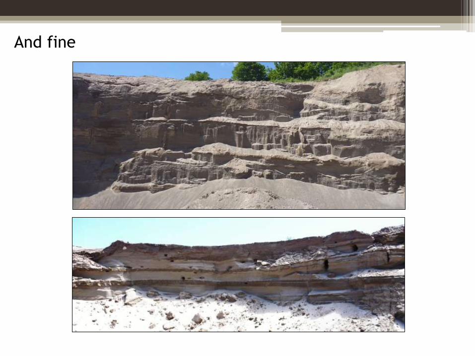
And fine
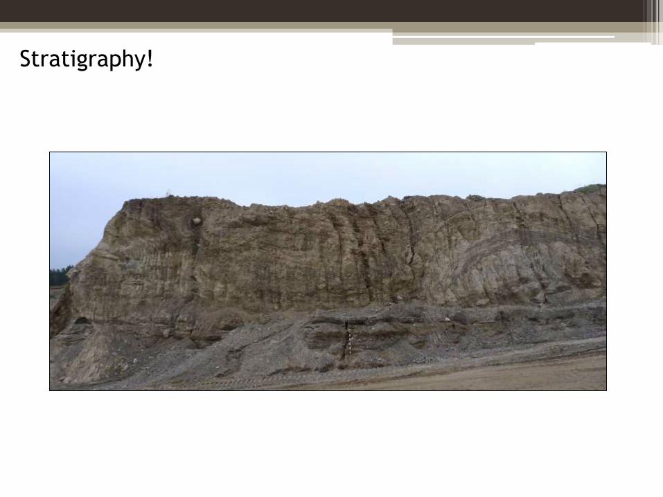
Stratigraphy!
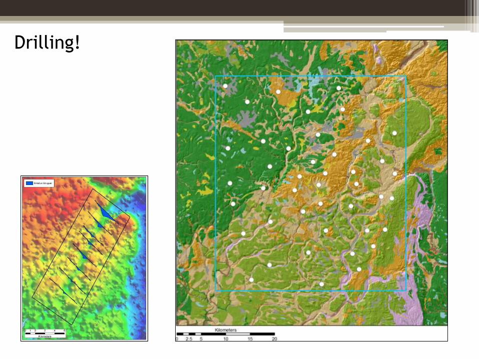
Drilling!
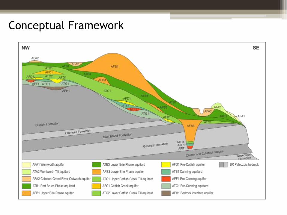
Conceptual Framework
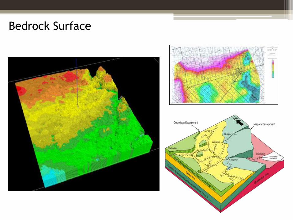
Bedrock Surface
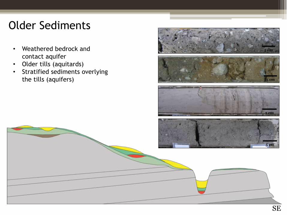
Older Sediments
• Weathered bedrock and
contact aquifer
• Older tills (aquitards)
• Stratified sediments overlying
the tills (aquifers)
N
SE
5 cm
5 cm
5 cm
5 cm
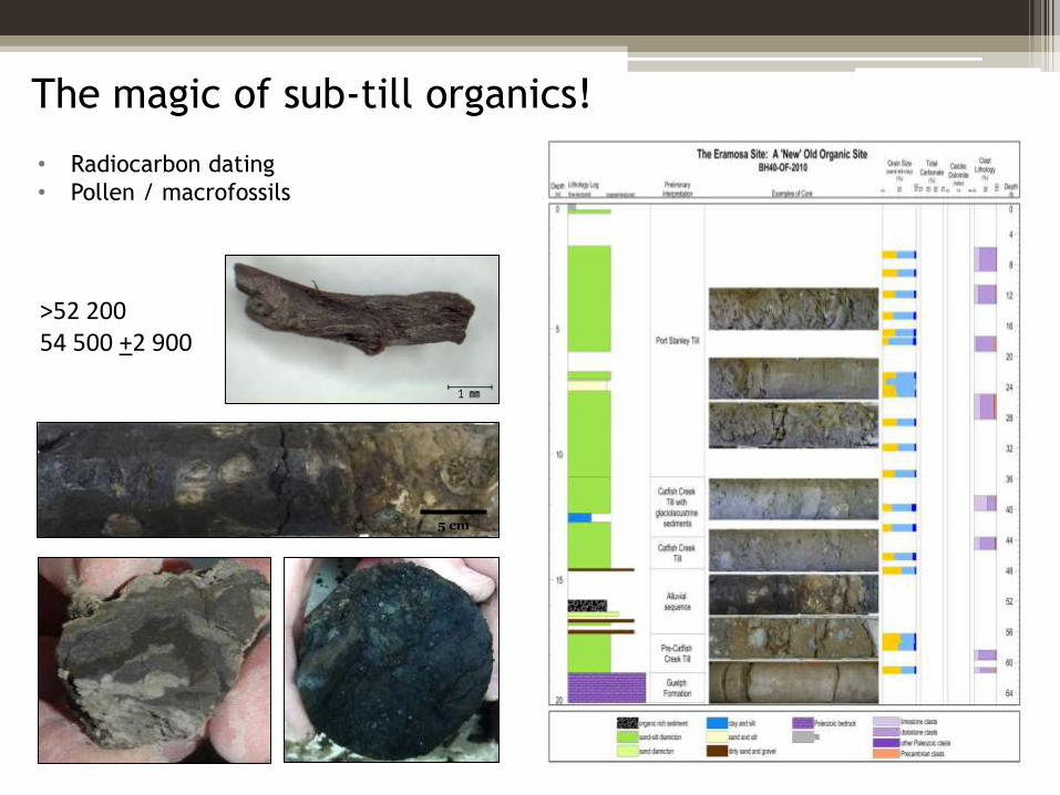
The magic of sub-till organics!
5 cm
>52 20054 500 +2 900
• Radiocarbon dating
• Pollen / macrofossils
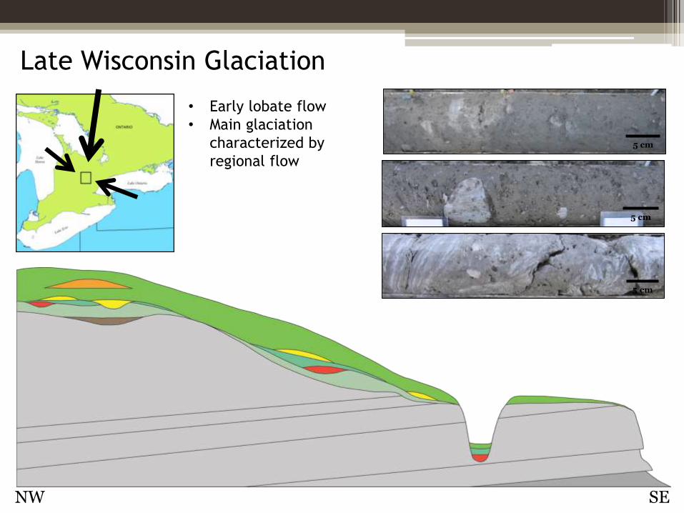
Late Wisconsin Glaciation
• Early lobate flow
• Main glaciation
characterized by
regional flow
NW SE
5 cm
5 cm
5 cm
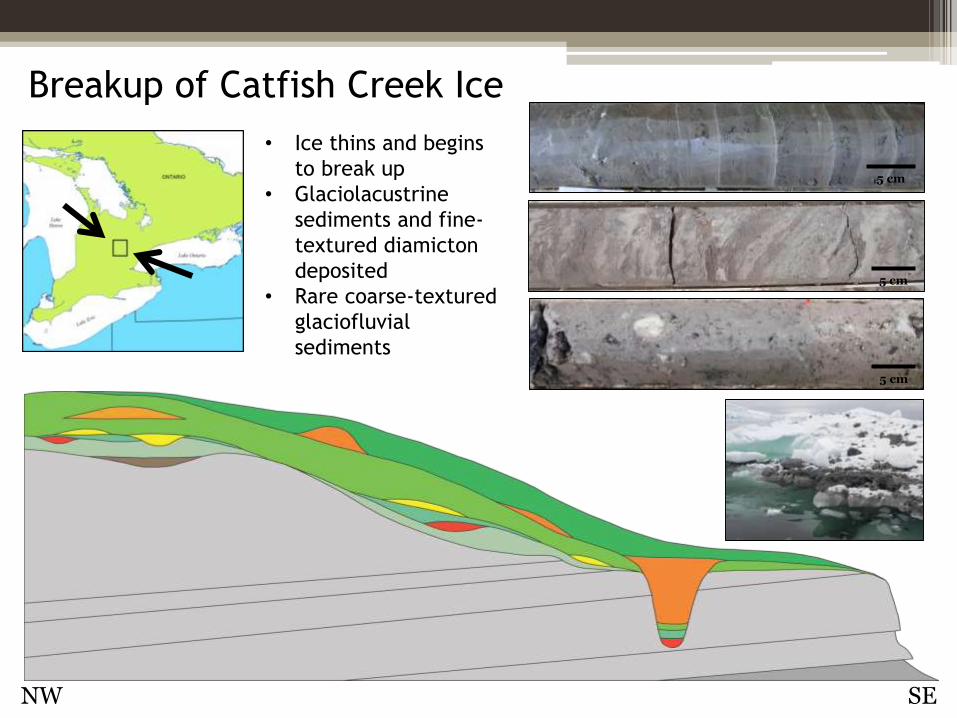
Breakup of Catfish Creek Ice
• Ice thins and begins
to break up
• Glaciolacustrine
sediments and fine-
textured diamicton
deposited
• Rare coarse-textured
glaciofluvial
sediments
NW SE
5 cm
5 cm
5 cm
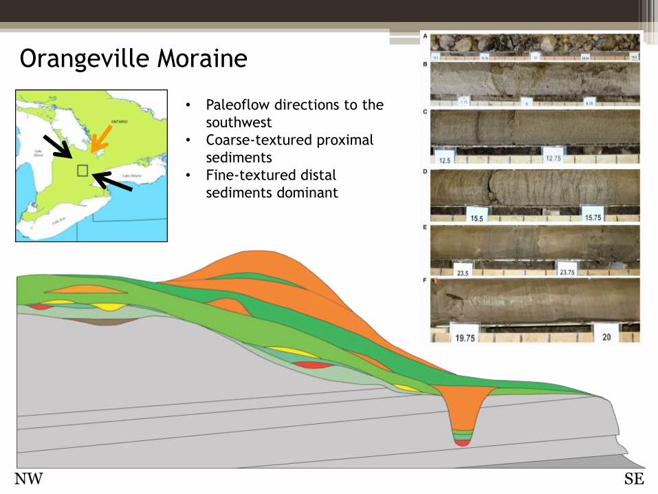
Orangeville Moraine
• Paleoflow directions to the
southwest
• Coarse-textured proximal
sediments
• Fine-textured distal
sediments dominant
NW SE
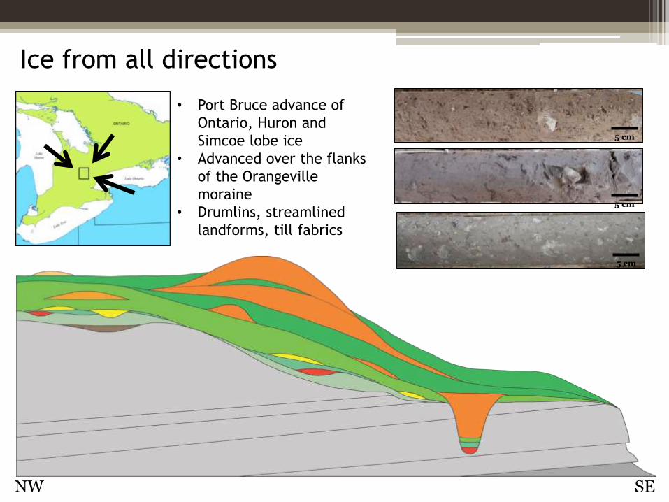
Ice from all directions
• Port Bruce advance of
Ontario, Huron and
Simcoe lobe ice
• Advanced over the flanks
of the Orangeville
moraine
• Drumlins, streamlined
landforms, till fabrics
NW SE
5 cm
5 cm
5 cm
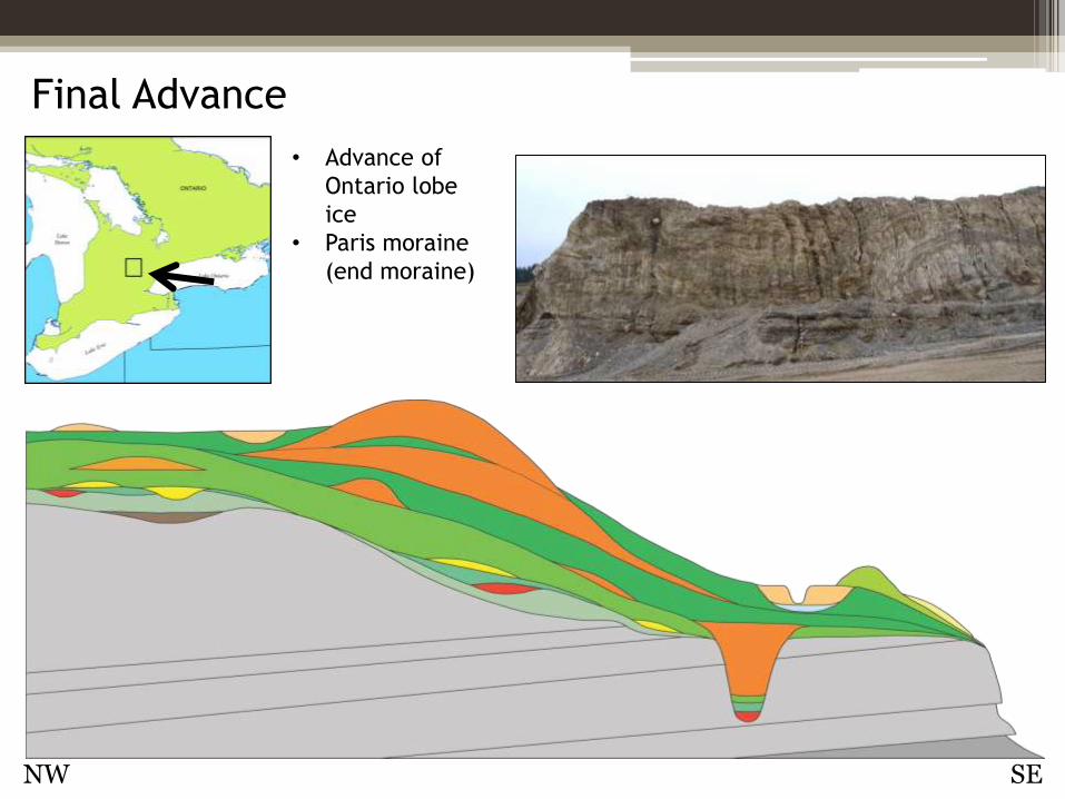
Final Advance
• Advance of
Ontario lobe
ice
• Paris moraine
(end moraine)
NW SE
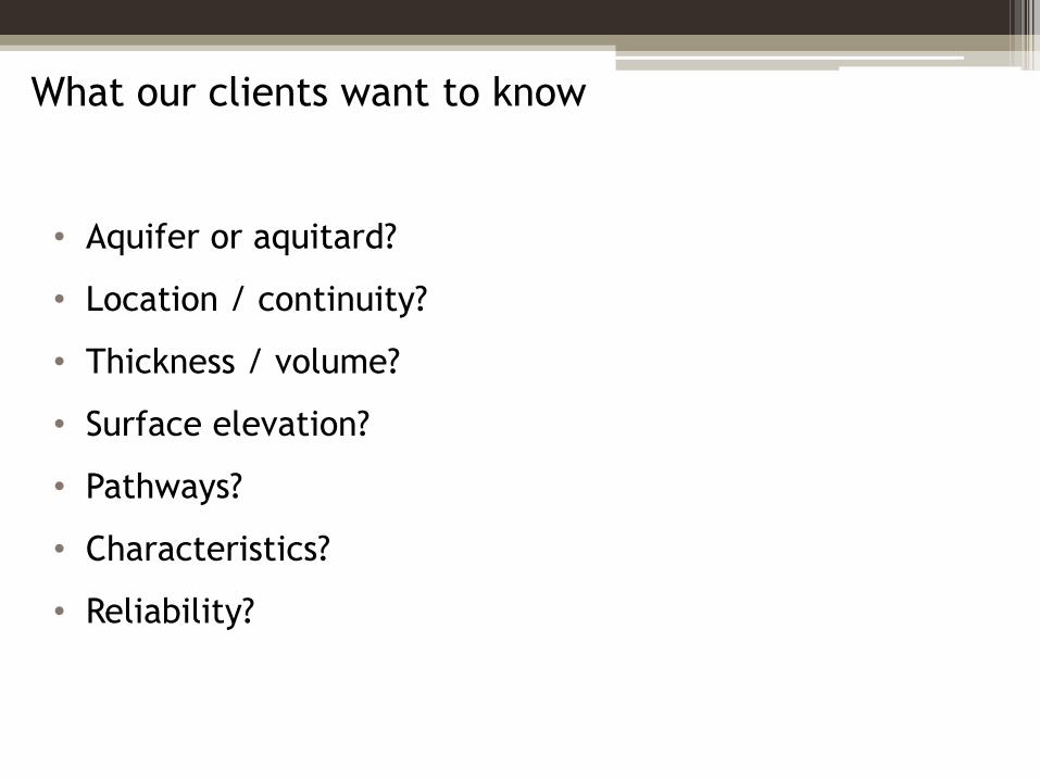
What our clients want to know
• Aquifer or aquitard?
• Location / continuity?
• Thickness / volume?
• Surface elevation?
• Pathways?
• Characteristics?
• Reliability?
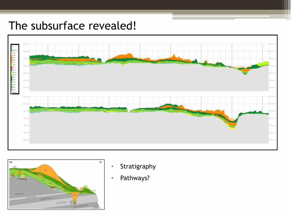
The subsurface revealed!
• Stratigraphy
• Pathways?
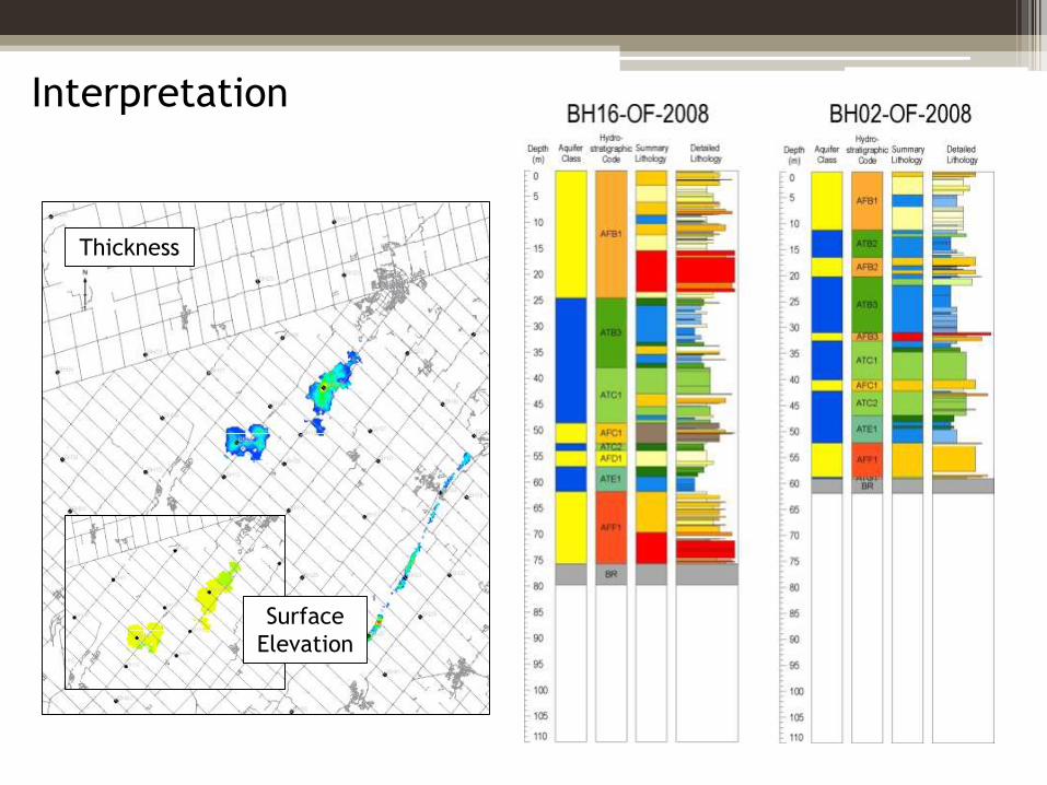
Interpretation
Thickness
Surface
Elevation
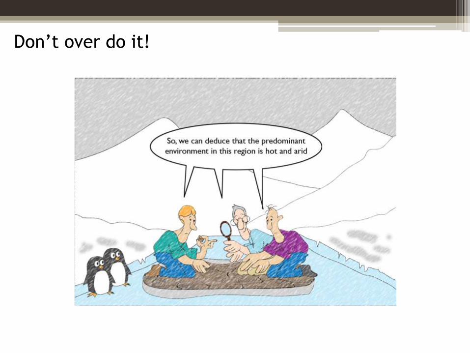
Don’t over do it!
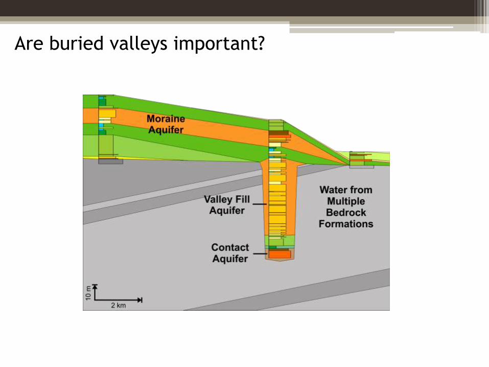
Are buried valleys important?
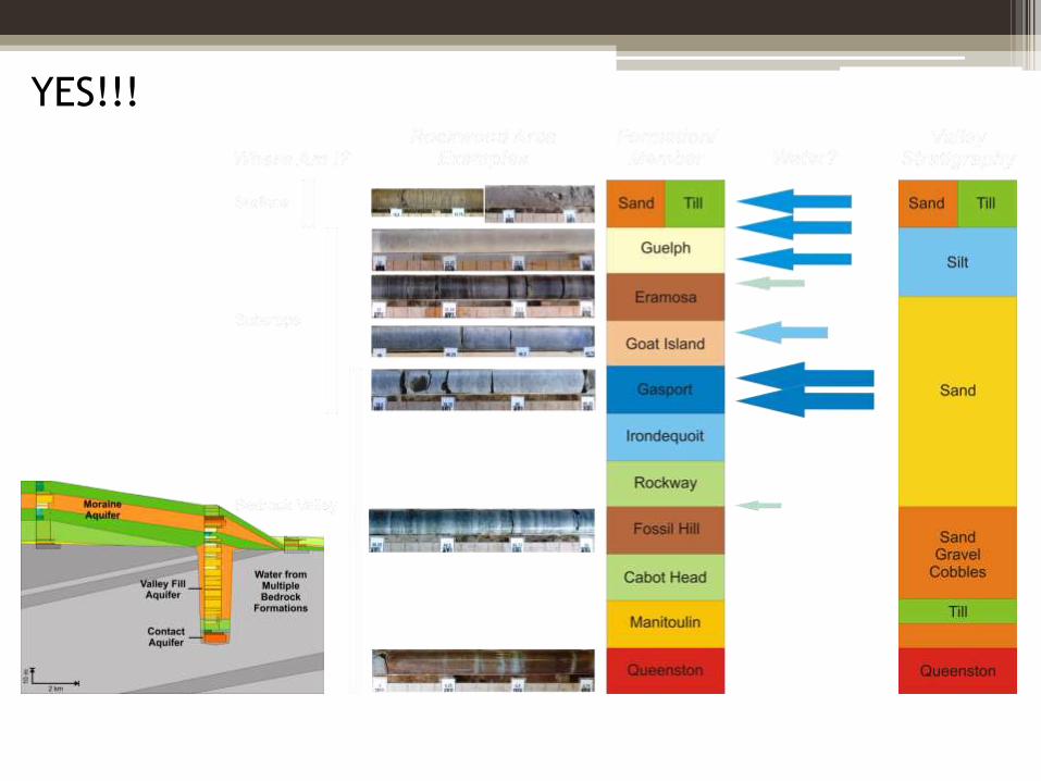
YES!!!
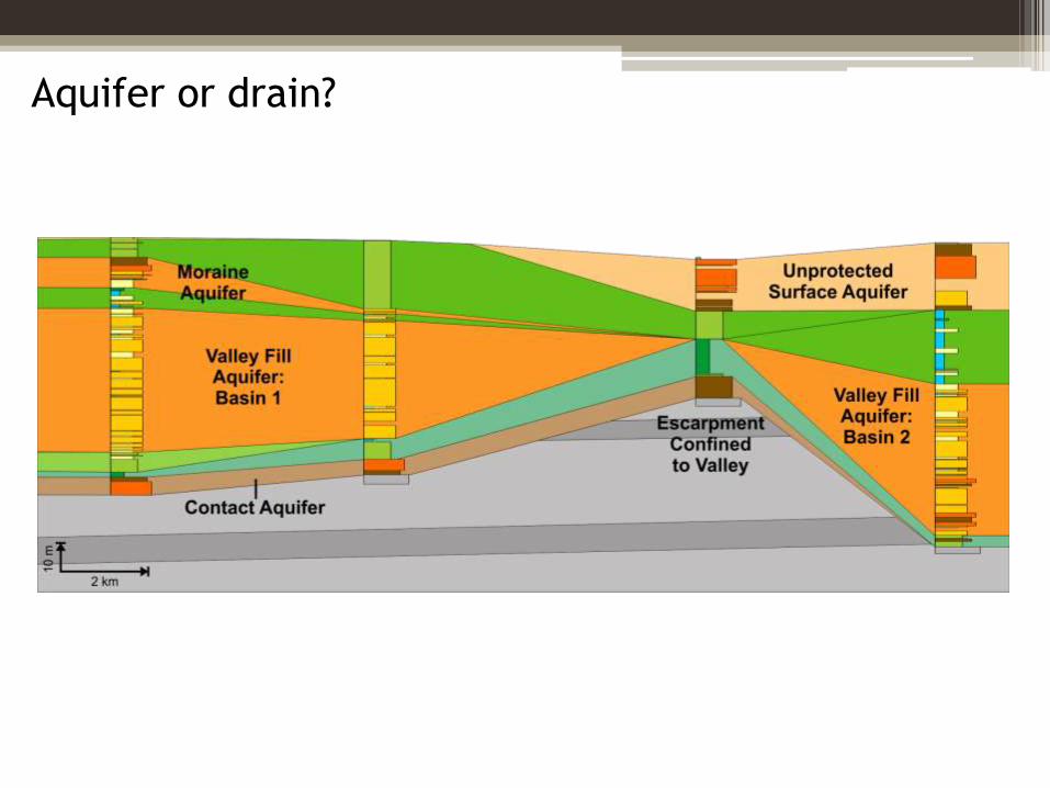
Aquifer or drain?
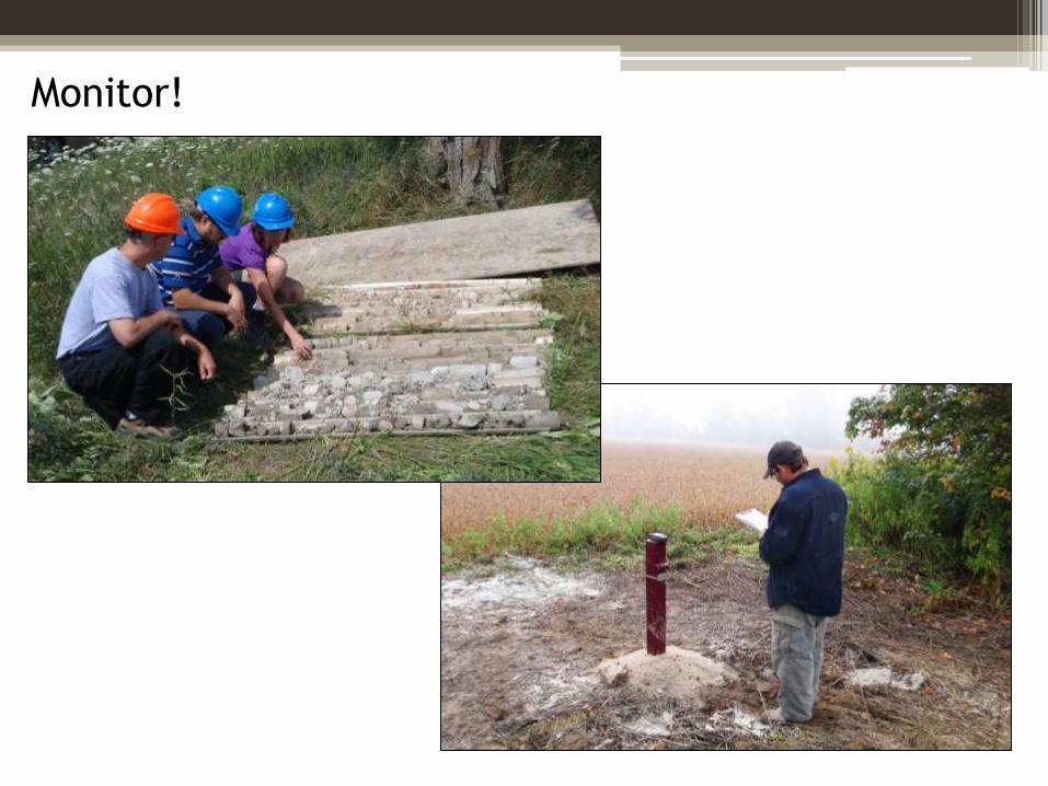
Monitor!
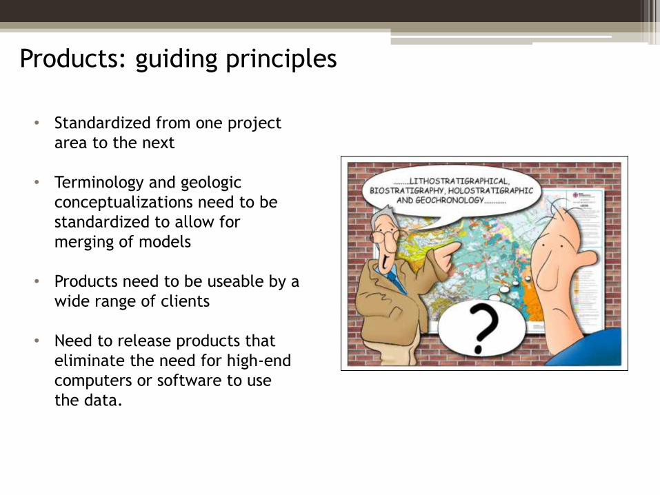
Products: guiding principles
• Standardized from one project
area to the next
• Terminology and geologic
conceptualizations need to be
standardized to allow for
merging of models
• Products need to be useable by a
wide range of clients
• Need to release products that
eliminate the need for high-end
computers or software to use
the data.
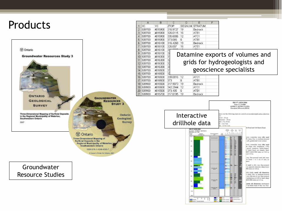
Products
Groundwater
Resource Studies
Datamine exports of volumes and
grids for hydrogeologists and
geoscience specialists
Interactive
drillhole data
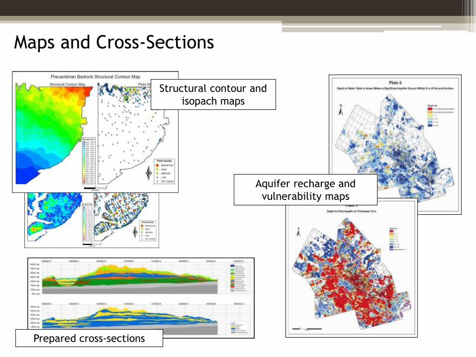
Maps and Cross-Sections
Prepared cross-sections
Aquifer recharge and
vulnerability maps
Structural contour and
isopach maps
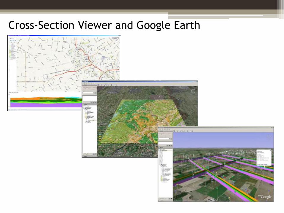
Cross-Section Viewer and Google Earth
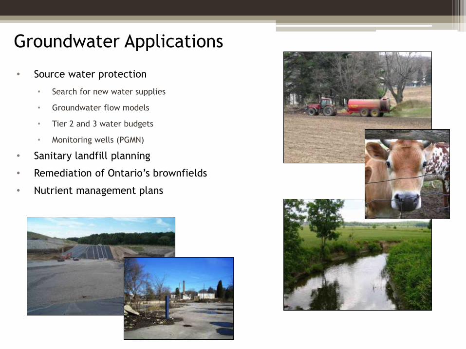
Groundwater Applications
• Source water protection
• Search for new water supplies
• Groundwater flow models
• Tier 2 and 3 water budgets
• Monitoring wells (PGMN)
• Sanitary landfill planning
• Remediation of Ontario’s brownfields
• Nutrient management plans
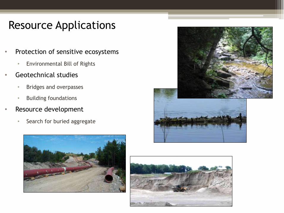
Resource Applications
• Protection of sensitive ecosystems
• Environmental Bill of Rights
• Geotechnical studies
• Bridges and overpasses
• Building foundations
• Resource development
• Search for buried aggregate
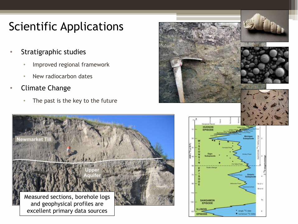
Scientific Applications
• Stratigraphic studies
• Improved regional framework
• New radiocarbon dates
• Climate Change
• The past is the key to the future
Measured sections, borehole logs
and geophysical profiles are
excellent primary data sources
Summary
• Rural and urban Ontarians rely on overburden aquifers for their water supply.
• The OGS is engaged in the effort to find, assess and protect Ontario’s
groundwater resource through regional scale and targeted 3-D surficial aquifer
mapping projects.
• Each 3-D project addresses
• Quaternary history
• Conceptual framework
• 3-D mapping
• Interpretation
• Groundwater resource reports, digital datasets, maps, cross-sections and
Google Earth applications are key products.
http://www.geologyontario.mndm.gov.on.ca/


